Mori Atlas logo
Protected areaŁukawiec

Understanding the mosaic of lowland forest, wetland habitats, and plateau terrain across the site

Łukawiec Protected Area and Regional Geography in the Podkarpackie Voivodeship of Poland

(Łukawiec (PLH180024))

Łukawiec is a significant Natura 2000 site located on the Płaskowyż Tarnogrodzki in southeastern Poland. The area encompasses a complex two part geometry that protects a rare diversity of habitats including oak hornbeam forests, ash elder floodplains, and transitional mires. By mapping these scattered natural remnants, this analysis provides insight into the fragmented landscape character and ecological structure of the region.

Natura 2000Site of Community Importancelowland forestoak-hornbeam forestfloodplain woodlandriparian forest

Łukawiec

Protected area

Park overview

Structured park overview, official facts, and landscape profile for Łukawiec Natura 2000 Site

Łukawiec Natura 2000 Site park facts, protected area profile, and essential visitor context

Review the core facts for Łukawiec Natura 2000 Site, including designation, size, terrain, visitor scale, habitats, and operating context in one park-focused overview.

About Łukawiec Natura 2000 Site

Łukawiec is a Natura 2000 habitat protection site situated on the Płaskowyż Tarnogrodzki, a relatively flat plateau in the easternmost part of Poland's southern lowlands. Its two non-contiguous parts lie to the north and south of the village of Łukawiec, and the unusually fragmented geometry of the boundary reflects the way surviving natural habitat is interspersed with farmland and settlements across this part of the country.

The site's identity centers on seven Annex I habitat types. Oak-hornbeam forest of the Tilio-Carpinetum association provides the backbone of the better-drained forest cover, while Ficario-Ulmetum ash-elder floodplain woodland occupies fresh, periodically inundated ground along the area's streams and bottomlands. More generalist riparian forests add structural complexity along waterways, and pockets of acidophilic beechwood indicate older, more acidic soils within the same landscape. Boggy coniferous woodland brings mire and bog forest elements into the mosaic, while Molinia meadows and transitional peatlands anchor the open wetland component and are particularly important for several of the site's protected species.

Łukawiec also incorporates the Moczary Nature Reserve, a long-standing Polish national reserve that predates the Natura 2000 designation and protects one of the most ecologically sensitive cores within the larger footprint. The combination of mature forest, mire systems, and protected open wetland habitat gives the site an unusually rich biodiversity profile for a lowland Polish protected area. As a Site of Community Importance under the EU Habitats Directive, Łukawiec contributes to the pan-European Natura 2000 network that links comparable habitat patches across the continent.

Quick facts and research context for Łukawiec Natura 2000 Site

Łukawiec is a Natura 2000 site with the code PLH180024, located in the Podkarpackie region of southeastern Poland and named after the village around which it is centered. It lies within the physical-geographical region known as the Płaskowyż Tarnogrodzki and administratively spans the gminas of Wielkie Oczy, Lubaczów, and Laszki.

The site's two component parts together cover roughly 2,270 hectares, and the area also contains the Moczary Nature Reserve, a pre-existing national-level protected site nested within the broader Natura 2000 boundary. Its habitats include oak-hornbeam forests, ash-elder floodplain woodland, riparian forests, acidophilic beechwoods, boggy coniferous woodland, Molinia meadows, and transitional peatlands, all of which qualify as Annex I habitat types under the EU Habitats Directive.

Protection and recognition

Examining terrestrial conservation scope and official Natura 2000 listings.

Łukawiec Protection Status and International Recognition Details

Terrestrial protection status for Łukawiec is structured alongside official Natura 2000 designation records. Documented recognition sources verify the conservation framework governing this protected landscape.

International recognition

Protection details

Protection scope
Terrestrial
Park context

Deeper park guide and search-rich context for Łukawiec Natura 2000 Site

Łukawiec Natura 2000 Site history, landscape, wildlife, and travel context

Explore Łukawiec Natura 2000 Site through its history, landscape character, ecosystems, wildlife, conservation priorities, cultural context, and seasonal travel timing in a structured park guide built for atlas discovery and search intent.

Why Łukawiec Natura 2000 Site stands out

Łukawiec is best known for its combination of lowland deciduous forest types, especially oak-hornbeam (grąd) and ash-elder floodplain woodland, paired with small-scale wetland habitats such as boggy coniferous woodland and transitional mires. These habitat fragments are increasingly rare in the intensively farmed landscapes of the Polish southeastern lowlands. The site is also distinguished by the presence of several Annex II species that depend sensitively on these very habitats, including the fire-bellied toad, the great crested newt, and a suite of specialist butterflies associated with Molinia meadows and wetland edges.

Łukawiec Natura 2000 Site history and protected-area timeline

Łukawiec was formally proposed and designated as a Natura 2000 Site of Community Importance in 2011, placing the area within the European Union's coordinated network of protected habitats. The designation built on existing national-level protection already present in the area through the Moczary Nature Reserve, which safeguards one of the most ecologically valuable cores of what would become the broader Natura 2000 footprint.

The site's present-day boundaries reflect a selection process that aimed to capture the surviving forest and wetland fragments scattered across the farmland of the Płaskowyż Tarnogrodzki, rather than creating a single continuous protected block. The site has since been catalogued by Polish conservation institutions and continues to be managed under the Polish framework for Natura 2000 implementation, with habitat conservation obligations linked to its Annex I and Annex II features.

Łukawiec Natura 2000 Site landscape and geographic character

The landscape of Łukawiec is shaped by the Płaskowyż Tarnogrodzki, a relatively level plateau region forming part of Poland's southeastern upland margins. The terrain surfaces here are not dramatic: rather than steep mountains or deep valleys, the area presents a mosaic of gently undulating ground, with shallow stream valleys and local depressions determining where wetter or drier habitats can develop.

This subtle topography is critical to the site's ecological character. Slight differences in elevation and drainage create the conditions for floodplain forests to form along streams, for boggy woodland to develop in flatter, water-retaining depressions, and for raised or transitional mires to persist on the most consistently wet substrates. The combination of plateau upland and small valley-bottom wetlands produces the fragmented, two-part geometry of the site itself, with one component sitting to the south of the village of Łukawiec and another to the north.

Łukawiec Natura 2000 Site ecosystems, habitats, and plant life

Łukawiec protects seven distinct Annex I habitat types, reflecting an unusually broad ecological range for a lowland Polish site. The forest component is built around Tilio-Carpinetum oak-hornbeam woodland, a classical Central European deciduous forest assemblage, supplemented by Ficario-Ulmetum ash-elder floodplain woodland in wetter bottomland positions and broader riparian forests along watercourses. Where soils turn acidic, acidophilic beechwood becomes established, while boggy coniferous woodland indicates the transition into mire and bog forest conditions.

The open habitats are equally important to the site's ecological identity. Molinia meadows, dominated by purple moor-grass, occupy damp, traditionally managed grasslands and are closely tied to several of the site's invertebrate species. Transitional peatlands, forming one of the seven habitat types recorded here, anchor the wettest end of the gradient and link forest, wetland, and open mire communities.

Taken together these habitats form a connected but fragmented ecological mosaic typical of the Polish lowland borderlands, where centuries of agricultural and forestry management have left surviving natural vegetation in small but high-quality patches.

Łukawiec Natura 2000 Site wildlife and species highlights

Łukawiec supports a defined set of species listed under Annex II of the EU Habitats Directive, which together signal the site's particular ecological value. Among the most ecologically indicative species is the fire-bellied toad (Bombina bombina), an amphibian strongly associated with shallow, sun-exposed wetland habitats in Polish lowlands, and the great crested newt (Triturus cristatus), another wetland-dependent amphibian that requires both breeding pools and nearby terrestrial cover.

The site is also notable for its butterfly fauna, with the marsh fritillary (Euphydryas aurinia), the large copper (Lycaena dispar), the scarce large blue (Phengaris nausithous), and the dusky large blue (Phengaris teleius) all listed among its Annex II species. These butterflies are closely tied to specific habitat conditions: Molinia meadows and wet meadows particularly support the Phengaris species, whose complex life cycles depend on particular host plants and ant species, while the marsh fritillary depends on devil's-bit scabious in similar open, damp grassland contexts.

In the plant kingdom, the site protects Eleocharis carniolica, a rare spike-rush of transitional wet habitats that adds botanical significance to the site's mire and wet-meadow communities.

Łukawiec Natura 2000 Site conservation status and protection priorities

From a conservation perspective, Łukawiec represents a carefully selected cluster of habitat fragments within an agricultural-dominated landscape, designated to preserve the ecological coherence of forest and wetland systems that are no longer continuous at the regional scale. Its inclusion in the Natura 2000 network ties it to broader EU-level conservation objectives, focusing specifically on the maintenance and restoration of Annex I habitat types and the favorable conservation status of Annex II species.

The presence of the Moczary Nature Reserve within the larger footprint adds an additional layer of national-level protection to one of the site's most sensitive areas. The site's value is enhanced by the combination of habitat types present simultaneously in one protected footprint, since many Annex II species depend on multiple habitat components across very small distances.

The specific challenges for Łukawiec include preserving the hydrology of its mire and floodplain components, maintaining traditional management of its Molinia meadows, and preventing further fragmentation of its forest patches, all of which are common pressures for lowland Natura 2000 sites in eastern Poland.

Łukawiec Natura 2000 Site cultural meaning and human context

The area around Łukawiec lies within a region of southeastern Poland that has long been shaped by mixed agricultural and forestry use, with small villages like Łukawiec itself embedded in landscapes that have been worked for centuries. The persistence of forest patches, wet meadows, and peatland fragments reflects, in part, the practical difficulty of converting certain wetter or less accessible areas into cropland, a historical circumstance that has allowed natural vegetation and traditional land uses to coexist.

The site's relationship with the Moczary Nature Reserve also reflects the Polish tradition of legally protecting particularly valuable natural sites at the national level, long before the Natura 2000 framework was established. Together, these layered human and conservation histories give Łukawiec a context in which ecological and rural cultural landscapes have remained closely linked.

Top sights and standout views in Łukawiec Natura 2000 Site

Łukawiec stands out within Poland's Natura 2000 network because of the unusually varied combination of habitat types it preserves in a single protected area. The site contains oak-hornbeam forests, ash-elder floodplain woodland, riparian forests, acidophilic beechwood, boggy coniferous woodland, Molinia meadows, and transitional peatmires, often within short distances of each other.

The site is also distinctive for the breadth of its protected species list, with both amphibians and a strong representation of wetland- and meadow-dependent butterflies among its Annex II species. The presence of rare plants such as Eleocharis carniolica and the inclusion of the Moczary Nature Reserve underscore both the botanical and the structural conservation value of the area.

Best time to visit Łukawiec Natura 2000 Site

The character of Łukawiec shifts most visibly between the active growing season and the dormant season. Late spring and early summer bring the strongest display of vegetation across its meadows, mires, and deciduous forest understory, and coincide with the adult flight periods of several of the site's protected butterflies, including the marsh fritillary and the Phengaris large blues. Summer also offers the easiest conditions for observing amphibians around the site's wetter habitats.

In autumn and winter, frog and butterfly activity declines, but the underlying forest, mire, and meadow structure becomes more visible without dense foliage, which can be an advantage for understanding the site's mosaic landscape character. Heavy precipitation or flooding can make wetter parts of the area difficult to access at any time of year.

Monthly climate preview

Long-term representative point measurements tracking monthly averages across the year

Łukawiec Climate Normals, Annual Temperature and Precipitation Rhythm

Representative coordinate records show average temperatures ranging from sub-zero winter minimums to warm summer maximums alongside measured daily precipitation totals. Examining the complete twelve-month sequence reveals detailed climate normals and broader seasonal shifts across the park.
Annual mean8 °C
-4 °C20 °C
Jan-4°
Feb-2°
Mar
Apr
May14°
Jun18°
Jul20°
Aug20°
Sep14°
Oct
Nov
Dec-2°
Warmest month
July

20 °C

Coolest month
January

-4 °C

Wettest month
July

2.8 mm/day

Driest month
January

1.3 mm/day

Park location guide

Geography guide, regional context, and park location map for Łukawiec Natura 2000 Site

Łukawiec Natura 2000 Site park geography, regions, and map view in Poland

Understand where Łukawiec Natura 2000 Site sits in Poland through a broader geographic reading of the surrounding landscape, nearby location context, and its mapped position within the national park landscape.

How Łukawiec Natura 2000 Site fits into Poland

Poland, officially the Republic of Poland, is a Central European country spanning from the Baltic Sea in the north to the Carpathian Mountains in the south. It borders Germany, Czech Republic, Slovakia, Ukraine, Belarus, Lithuania, and Kaliningrad Oblast. The country has a temperate climate, diverse landscapes, and is known for its rich history, cultural heritage, and strong economic position within the EU.

Wider geography shaping Łukawiec Natura 2000 Site in Poland

Poland occupies 312,696 km2 in Central Europe, extending from the Baltic Sea coast in the north to the Sudetes and Carpathian Mountains in the south. It borders Germany to the west, Czech Republic and Slovakia to the south, Ukraine and Belarus to the east, and Lithuania and Kaliningrad Oblast to the northeast. The landscape includes lowland plains, uplands, and mountain ranges.

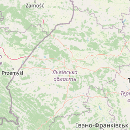
Map view of Łukawiec Natura 2000 Site

Use this park location map to pinpoint Łukawiec Natura 2000 Site in Poland, understand its exact geographic position, and read its mapped placement within the surrounding landscape more clearly.

Pigeon | © OpenStreetMap contributors

Location context for Łukawiec Natura 2000 Site

Podkarpackie Voivodeship
Park atlas

Discover related lowland reserves and connected conservation landscapes across the surrounding upland region.

Other Parks and Protected Areas Near Łukawiec for Regional Comparison

Visitors exploring the forest and wetland habitats of Łukawiec can browse adjacent protected areas to compare regional ecological conditions. Expanding the search reveals how similar lowland reserves and valley biotopes connect across the wider territorial landscape.
Nature reservePodkarpackie Voivodeship
Mapped location lies within the park boundary#1 closest

Southeast

Rezerwat przyrody Moczary: Geographic Overview and Protected Forest Reserve Mapping

Botanical sanctuary and lowland forest habitat in Podkarpackie.

Rezerwat przyrody Moczary represents a focused, twelve-hectare protected forest area known for its exceptional concentration of glacial relicts and diverse herbaceous understory. Located within the Natura 2000 Łukawiec site, this reserve offers a detailed look at lowland oak-hornbeam ecology and sub-Carpathian botanical signatures across the Płaskowyż Tarnogrodzki mesoregion.

Area
0.124 km²
Established
2004
Relief
Lowland
Scope
Terrestrial
Nature reservePodkarpackie Voivodeship
15 km away#2 closest

Southwest

Rzeka San Nature Reserve: Mapped Geographic Overview and Protected Riverine Corridor

Protected landscape geography in Podkarpackie Voivodeship

Rzeka San is a significant river-based nature reserve that defines a crucial ecological passage through southeastern Poland. By focusing on the aquatic and riparian habitats along the San River, this protected area provides vital support for diverse freshwater species. Its strategic position within the Podkarpackie Voivodeship and its integration with larger landscape parks showcase a complex, multi-layered approach to regional environmental conservation and riverine terrain management.

Area
13.75 km²
Established
2009
Scope
Terrestrial
Water
Water-dominated
Nature reservePoland
23 km away#3 closest

North

Uroczyska Puszczy Solskiej: Protected Forest and Peatland Landscape in Eastern Poland

Natura 2000 nature reserve encompassing diverse lowland forest mosaics

Uroczyska Puszczy Solskiej spans over 34,000 hectares of eastern Poland, forming a vital protected mosaic of raised bogs, transitional mires, and varied forest communities. This area provides a crucial reference for peatland and wetland ecology, supporting a wide range of forest-dependent species within a landscape shaped by glacial and fluvial processes.

Area
346.715 km²
Established
2009
Relief
Lowland
Climate
Temperate
Protected areaPodkarpackie Voivodeship
27 km away#4 closest

Northeast

Uroczyska Roztocza Wschodniego: Protected Area and Forested Ridge Geography

Extensive forest sanctuary in the Podkarpackie Voivodeship

Uroczyska Roztocza Wschodniego comprises vast, compact forest tracts on the Eastern Roztocze, defined by high-value woodland communities including beech and oak-hornbeam forests. The area functions as a critical protected landscape that supports diverse fauna and complex hydrological corridors within a significant regional conservation network.

Area
58.1 km²
Established
2011
Relief
Upland
Climate
Temperate
A horizontal watercolor illustration showing a soft, impressionistic landscape of green meadows, small clusters of trees, and pale, distant rolling hills.
Protected areaSubcarpathian Voivodeship
29 km away#5 closest

West

Starodub w Pełkiniach Protected Area: Regional Landscape and Meadow Geography Map

Protected grassland habitat in Subcarpathian Voivodeship

Starodub w Pełkiniach is a specialized protected area in Poland, renowned for its extensive, unbroken meadow complex. The site sits where the Podgórze Rzeszowskie foothills meet the fertile Lower San River valley, creating a distinct geographic mosaic. This protected landscape is fundamental for conserving Annex II botanical species, maintaining traditional agricultural management at a significant scale across the local terrain.

Area
5.748 km²
Established
2011
Relief
Lowland
Water
Minor water
A minimalist watercolor painting showing rolling green hills and distant mountain ridgelines in soft pastel tones of green and violet against a white background.
Protected areaAlbania
34 km away#6 closest

South

Primeval Beech Forests of the Carpathians and Other Regions of Europe: Protected Area and Forest Atlas

A transnational network of old growth beech forest reserves across Europe.

Examine the geographic distribution and protected boundaries of the Primeval Beech Forests of the Carpathians and Other Regions of Europe. This site highlights the continent's most intact beech forest ecosystems, illustrating essential ecological processes from the Balkans and Carpathians to the Alps and Western Europe.

Area
583.53 km²
Established
2007
Relief
Mountain
Access
Access unknown
Nature reservePoland
About 35 km away#7 closest

Northeast

Rezerwat przyrody Minokąt Nature Reserve: Geography, Forest Terrain, and Mapping

Protected Carpathian forest within the Roztocze landscape

Located in the Narol commune, Rezerwat przyrody Minokąt protects a rare, mature Carpathian fir-beech forest ecosystem. The reserve provides a critical study in regional geography, characterized by rolling upland terrain and fertile woodland soils that anchor the broader Roztocze Protected Landscape Area and regional conservation efforts.

Area
0.231 km²
Established
1996
Relief
Upland
Scope
Terrestrial
National parkLviv Oblast
About 41 km away#8 closest

East

Yavoriv National Nature Park: Protected Landscape and Regional Geography in Lviv Oblast

Mapped protected area boundaries and natural terrain context.

Yavoriv National Nature Park is a designated national park within Lviv Oblast, Ukraine. This page provides detailed geographic information, focusing on the park's protected landscape identity and its mapped terrain. Understanding its location in Western Ukraine, near the Carpathian gateway, offers valuable context for atlas-based exploration of protected areas and natural features within the region.

Area
71.08 km²
Established
1998
IUCN
II
Relief
Highland

Common questions about visiting, size, designation, and location context for Łukawiec Natura 2000 Site

Łukawiec Natura 2000 Site FAQs for park facts, access, geography, and protected area context

Find quick answers about Łukawiec Natura 2000 Site, including protected-area facts, park geography, trail and visitor context, and how the park fits into its surrounding country and regional landscape.
MoriAtlas Explorer

Continue Your Protected Areas Search Across the Global Atlas

Deepen your exploration by continuing the structured search for national parks and protected areas worldwide. Utilize the comprehensive filtering capabilities to compare different conservation landscapes and refine your understanding of global park geography. Discover more about the distribution and characteristics of protected natural areas.

Global natural geography