
Why Luneplate Nature Reserve stands out
Luneplate is best known for its role as a key resting and wintering area along the North Sea flyway, attracting large flocks of geese, swans, and waders from northern breeding grounds. The combination of tidal mudflats, saltmarsh transitions, reedbeds, and estuarine waters at the mouth of the Weser creates the conditions that make the site attractive to species such as tundra swans, white-fronted and barnacle geese, and pied avocets. The reserve is equally important for breeding populations of reed-dwelling passerines and waterbirds, giving it year-round ornithological value rather than just seasonal significance. This dual role as both a major stopover site and a productive breeding habitat defines Luneplate's ecological identity within the Bremen protected-area network.
Luneplate Nature Reserve history and protected-area timeline
The landscape of Luneplate has been shaped over centuries by human intervention along the Weser estuary, including dike construction, land reclamation, and the transformation of foreshore zones into managed polder landscapes. Industrial and harbor development in Bremerhaven further influenced the modern configuration of the area, particularly around the Fischereihafen and the mouth of the Geeste.
The decisive moment for conservation came with the formal designation as a nature reserve (Naturschutzgebiet) on 14 March 2015 under the legal framework of the Free Hanseatic City of Bremen. This step formalized and extended protection that had previously applied only to a 940-hectare core recognized as the EU Bird Protection Area Luneplate, an earlier designation rooted in the European Birds Directive and tied to the reserve's importance for migratory waterbirds.
Following designation, administrative responsibility rests with the Magistrate of the City of Bremerhaven acting as the lower nature protection authority, with oversight from the Bremen Senator for the Environment. While the formal protected-area status is relatively recent, the ecological significance of the site had long been documented through ornithological monitoring and EU-level habitat assessments, giving Luneplate a conservation history rooted in both European policy frameworks and local stewardship.
Luneplate Nature Reserve landscape and geographic character
Luneplate's landscape is defined by its position at the interface between the freshwater Weser and the tidal influence of the North Sea. The reserve is dominated by estuarine features: tidal mudflats exposed at low water, shallow brackish channels, and the broader Weser water surface up to the eastern navigation channel boundary. These open-water and intertidal zones form the physical backdrop against which the reserve's biological values are concentrated.
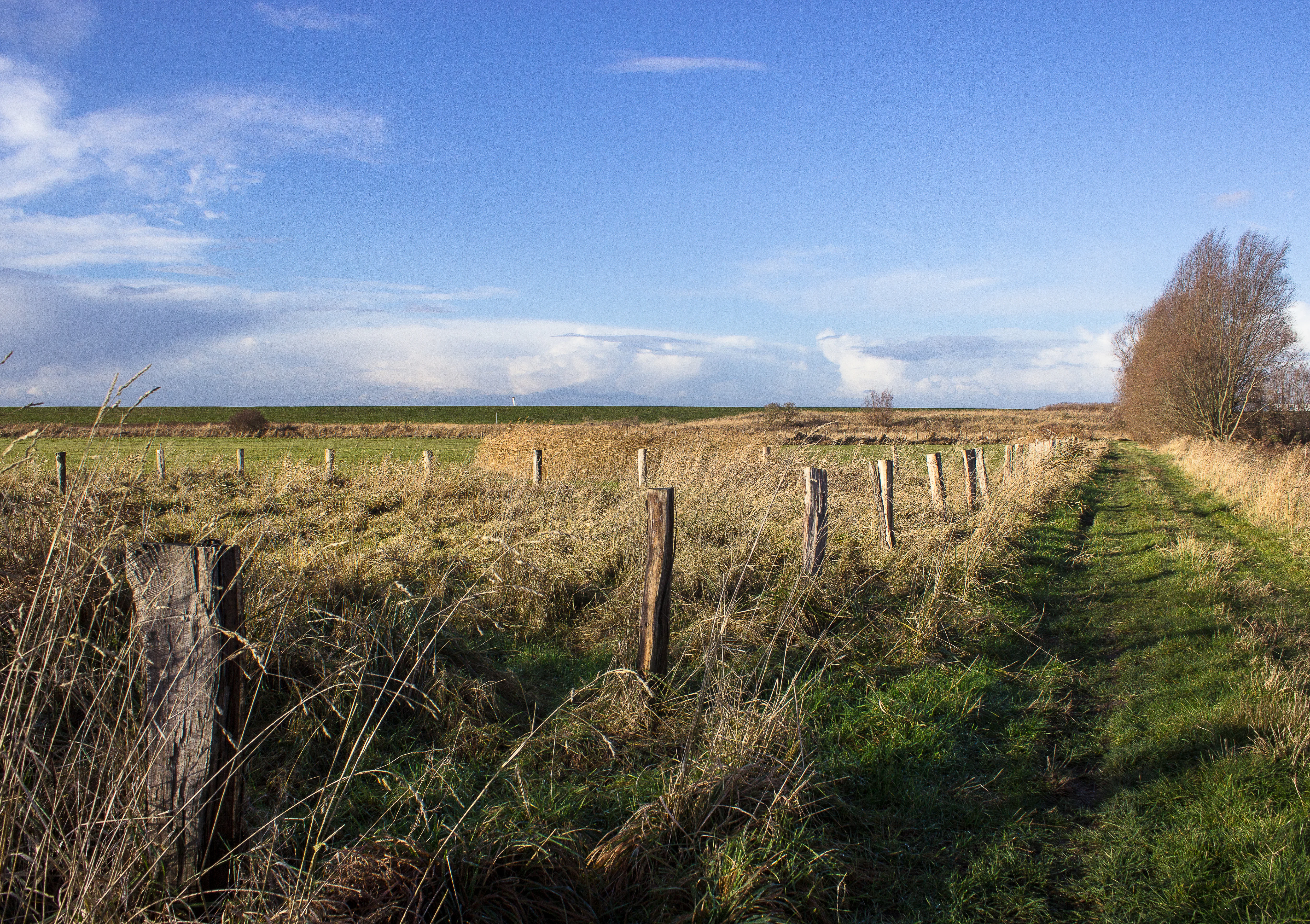
Along the shore, the Weser dike defines the inland boundary of much of the reserve. Between the dike and the water lies the foreshore (Deichvorland), a zone of saltmarsh transitions, periodically flooded grassland, and reedbed stands that grade gradually into the open estuary. In the southern portion of the reserve, around the Geeste estuary mouth near Fischereihafen, the landscape shows a stronger human-influenced character, where natural wetland processes interact with urban and harbor surroundings.
The topography is consistently low-lying, shaped by tidal deposition and centuries of coastal management. This flatness, combined with the dynamic interplay of tidal inundation, saltmarsh succession, and freshwater pulses from the Weser, gives Luneplate its characteristic coastal wetland scenery rather than any dramatic relief.
Luneplate Nature Reserve ecosystems, habitats, and plant life
The ecological character of Luneplate is built around estuarine and coastal wetland habitats. Tidal mudflats and shallow brackish waters support rich invertebrate communities that form the base of the food web for migratory shorebirds and waterfowl. Saltmarsh and foreshore grassland communities fringe the open water, providing both feeding and cover habitat. Reedbeds, particularly in the polder and sheltered foreshore areas, offer critical breeding habitat and seasonal refuge for a wide range of waterbirds and reed-specialist passerines.
The reserve's brackish-freshwater gradient, produced by the mixing of Weser discharge with North Sea tidal flow, creates habitat diversity that supports species with differing salinity tolerances. This mosaic of intertidal flats, saltmarsh, reedbed, and seasonally wet grassland is the foundation for Luneplate's ecological productivity and its significance along the East Atlantic Flyway.
Beyond the habitats themselves, the protected area functions as an ecological buffer and stepping stone within the larger Wadden Sea and lower Weser ecosystem. Its formal classification as an IUCN Category IV Habitat/Species Management Area reflects a management approach aimed at maintaining and actively shaping habitat conditions for priority bird species, rather than a strict hands-off preservation model.
Luneplate Nature Reserve wildlife and species highlights
Luneplate's wildlife significance is overwhelmingly centered on birds, with the reserve serving both as a major stopover and wintering site for migratory waterfowl and waders and as a breeding area for waterbirds and reed-associated species. The site's position along the East Atlantic Flyway brings seasonal concentrations of northern-breeding species that use the estuary for resting and refueling during long-distance movements.
Tundra swans (Zwergschwan), white-fronted geese (Blässgans), and barnacle geese (Nonnengans) are among the most characteristic wintering and passage visitors, often gathering in sizable flocks on the open flats and shallow waters. The reserve also supports important numbers of shorebirds (Limikolen), including pied avocets (Säbelschnäbler), which depend on the soft sediments and shallow water of the foreshore and mudflats for foraging.
In the breeding season, the reserve's reedbeds and sheltered waters host waterbirds and reed-dwelling songbirds that rely on the structural complexity of the vegetation. The combination of breeding and migratory functions makes Luneplate a site of year-round ornithological interest, drawing birdwatchers and contributing to long-term monitoring of estuarine waterbird populations along the southern North Sea coast.
Luneplate Nature Reserve conservation status and protection priorities
Luneplate holds substantial conservation significance at both national and European levels. The site is legally protected as a Naturschutzgebiet under Bremen state law, a designation that imposes restrictions on land use, development, and disturbance within its boundaries. Its formal classification follows the IUCN Category IV model, designating it as a Habitat/Species Management Area where active management is used to maintain favorable conditions for priority species and habitats.
At the European level, Luneplate's importance was first formalized through its designation as the EU Bird Protection Area (EU-Vogelschutzgebiet) Luneplate, covering 940 hectares within the broader reserve. This recognition under the EU Birds Directive tied the site to the Natura 2000 network and obliged ongoing monitoring and conservation planning aligned with European species and habitat objectives.
The combination of estuarine habitats, migratory waterbird concentrations, and breeding habitat for priority species means Luneplate functions as a key conservation node along the lower Weser, complementing other protected areas in Bremen and the surrounding Wadden Sea region. Its management by the Bremerhaven authorities, under oversight of the Bremen Senator for the Environment, integrates site-level habitat management with wider coastal and estuarine policy frameworks.
Luneplate Nature Reserve cultural meaning and human context
Luneplate lies within the heavily modified cultural landscape of the Weser estuary, where centuries of dike construction, polder management, and harbor development have shaped the relationship between people and the coast. The Luneplate district itself reflects this layered history, with its foreshore and reclaimed polder lands representing a long tradition of working with tidal dynamics rather than separating from them.
In the modern era, the Bremerhaven Fischereihafen, which borders the reserve, carries the cultural imprint of the city's fishing and harbor heritage. The proximity of this active industrial-urban setting to a formally protected wetland illustrates the negotiation between traditional maritime economic activity and modern ecological conservation along the southern North Sea coast.
The reserve also plays a role in local environmental awareness and education, being featured in the Bremen nature protection authority's public-facing landscape communication (Erlebnisraum Natur), which frames Luneplate within a broader narrative of accessible and engaging nature experiences within the city-state of Bremen.
Top sights and standout views in Luneplate Nature Reserve
Luneplate stands out for combining a large estuarine reserve (about 1,438 hectares) with direct connections to a pre-existing EU Bird Protection Area, giving it both legal strength and European conservation significance. The site is a defining node on the East Atlantic Flyway, gathering large seasonal concentrations of tundra swans, white-fronted geese, barnacle geese, and waders such as pied avocets, while also supporting notable breeding populations of waterbirds and reed-dwelling species.
Its integration of open Weser water, dike, foreshore, saltmarsh, reedbed, and Geeste estuary habitats creates a compact but ecologically diverse wetland system. Despite its relatively recent formal protection in 2015, Luneplate already plays an anchoring role in Bremen's protected-area network and in the broader Wadden Sea conservation landscape.
Best time to visit Luneplate Nature Reserve
The character of a visit to Luneplate shifts meaningfully with the seasons, in line with the migratory and breeding cycles of the reserve's birdlife. Autumn and winter bring the most dramatic ornithological activity, as large flocks of tundra swans, white-fronted geese, and barnacle geese arrive from northern breeding grounds to use the estuary as a major resting and feeding area. This period offers the strongest sense of the reserve's significance along the East Atlantic Flyway.
Spring and early summer are notable for breeding activity, when reedbeds and foreshore habitats host waterbirds and reed-specialist passerines. The tidal rhythm also shapes day-to-day conditions: low tide exposes mudflats rich in feeding activity, while rising water can push bird flocks closer to the dike and observation areas. These seasonal and tidal patterns, rather than any specific operational calendar, define the most rewarding windows for engaging with the reserve.