
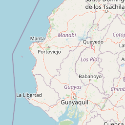
Peaks
Park geography
Detailed spatial analysis of boundary extents, terrain features, and regional geography
Comprehensive Geographic and Terrain Profile of Machalilla National Park in Manabí Province, Ecuador
Examine the structured geographic data for Machalilla National Park, a protected area encompassing 479.257 square kilometers in Manabí Province. This profile maps the perimeter and identifies natural landmarks, including Isla de La Plata, various coastal bays, and inland peaks, providing a complete spatial view of the protected landscape.
Related tags
National ParkPacific CoastCloud ForestDry ForestRamsar Site
Pacific coast protected area with cloud forests, islands, and pre-Columbian archaeological heritage
Machalilla National Park
Machalilla National Park is a coastal protected area in Ecuador's Manabí Province, established in 1979 and spanning approximately 750 square kilometers along the Pacific shoreline near the town of Puerto López. The park encompasses a remarkable diversity of ecosystems, including tropical dry forest, cloud forest, coastal beaches, mangrove wetlands, and a chain of islands that includes Salango and the famous Isla de la Plata. This ecological variety makes it one of the most biogeographically significant protected areas in mainland Ecuador, serving as a refuge for species found nowhere else outside the Galápagos Islands. In 1990, the park was designated a Ramsar Wetland of International Importance, recognizing its critical role in protecting coastal and marine habitats that support migratory species and endemic wildlife.
- Location
- Ecuador
- Park type
- National park
- Established
- 1979
- Area
- 750.6 km²
Location overview
Recorded Regional Boundaries in Ecuador and Manabí Province
Geographic Location and Regional Setting of Machalilla National Park
Machalilla National Park is situated within Ecuador, specifically positioned in Manabí Province. Regional records provide a structured view of the park's administrative borders and territorial location.
- Countries
- Ecuador
- Regions
- Manabí Province
- Primary location
- Manabí Province
Boundary and coordinates
Interactive spatial geometry and calculated area measurements
Machalilla National Park Boundary Map and Geographic Extent
Mapped park outlines provide immediate spatial context for analyzing protected territory. Accompanying boundary facts detail total surface area, coordinate limits, and geographic spans.
- Boundary area
- 479.3 km²
- Boundary perimeter
- 209.9 km
- Northernmost point
- 1.259° S
- Southernmost point
- 1.6868° S
- Easternmost point
- 80.6224° W
- Westernmost point
- 81.0847° W
- Geographic centre
- 1.515° S, 80.7271° W
- North–south span
- 47.3 km
- East–west span
- 51.5 km
Terrain and natural features
Explore recorded peaks, coastal beaches, rivers, and islands within protected boundaries
Machalilla National Park Terrain and Named Natural Features
Recorded natural features span peaks, beaches, islands, rivers, and springs located within Machalilla National Park. Linked feature cards supply names, types, measurements, and spatial relationships where recorded.
Selected named natural features
Viewpoints
Mirador Islote Sucre
Peaks
Cerro La Naranjita
Peaks
Cerro La Naranja
Viewpoints
Mirador Isla de la Plata
Peaks
Cerro La Esperanza
Environmental setting
Analysis of recorded terrain, climate zones, and ecological categories
Machalilla National Park Environmental Setting and Classification Profile
Stored classifications provide complementary perspectives on the physical geography across Machalilla National Park. Individual records connect established categories to broader protected area atlas destinations.
Park atlas
Trace the geographic spread of national parks and compare protected areas across Ecuador's Pacific region.
Explore Other National Parks and Protected Areas Near Machalilla National Park
Continue your discovery of protected areas by browsing other national parks and reserves located near Machalilla National Park in Ecuador's coastal region. Compare their unique ecological features, geographic settings, and conservation status to understand the broader protected landscape.
Marine protected areaSanta Elena
About 28 km away#1 closest
South

Reserva Marina El Pelado: Coastal Marine Protected Area and Underwater Reef Geography
Oceanic convergence zone within the Santa Elena province
Reserva Marina El Pelado features a distinct maritime landscape defined by thirteen submarine shoals, octocoral forests, and coastal mangrove systems. Located within the Santa Elena province, this protected area serves as an essential biological laboratory where tropical and temperate current systems collide, shaping a complex mosaic of rocky reefs and diverse marine habitats.
- Area
- 131.55 km²
- Established
- 2012
- IUCN
- VI
- Relief
- Lowland
Wildlife reserveManabí
About 29 km away#2 closest
North
Refugio de Vida Silvestre Marino Costera Pacoche: Geography and Protected Area Atlas
Coastal and forest protected landscapes in Manabí, Ecuador
Examine the unique geographic structure of Refugio de Vida Silvestre Marino Costera Pacoche, a protected reserve bridging the Tumbesian dry forest and the Pacific Ocean. This atlas entry focuses on the park's coastal cliffs, sediment-rich marine zones, and forest ridges, providing a clear visual and descriptive record of this ecologically significant Manabí sanctuary.
- Established
- 2008
- IUCN
- V
- Visitors
- 3.2K annual
- Relief
- Mixed relief
Wildlife reserveSanta Elena
About 66 km away#3 closest
South
Reserva de Producción de Fauna Marino Costero Puntilla Santa Elena Protected Area Map
Coastal marine geography and Pacific wildlife habitat exploration.
Investigate the marine-coastal expanse of the Reserva de Producción de Fauna Marino Costero Puntilla Santa Elena. This protected area encompasses diverse Pacific habitats, from arid shoreline vegetation to vast ocean sectors, serving as a critical environment for marine mammal migration and conservation in Santa Elena.
- Area
- 524.34 km²
- Relief
- Lowland
- Climate
- Arid
- Access
- Easy access
Protected areaGuayas
About 91 km away#4 closest
Southeast
Bosque Protector Cerro Blanco: Protected Area and Tropical Dry Forest Geography in Guayas
Mapped terrain of the Chongon-Colonche mountain range
Bosque Protector Cerro Blanco functions as a major conservation site in coastal Ecuador, protecting rare Tumbesian forest ecosystems within the Guayas province. The reserve features diverse topography of ridges and valleys, serving as a critical buffer for regional endemic species and offering a unique look at seasonally dry forest landscapes near Guayaquil.
- Area
- 60.78 km²
- Established
- 1992
- Visitors
- 12K annual
- Relief
- Upland
Nature reserveGuayas
About 93 km away#5 closest
Southeast
Bosque Protector La Prosperina Nature Reserve and Coastal Ecuador Forest Geography
Protected dry forest habitat and regional geographic terrain
Bosque Protector La Prosperina represents a critical survival of Ecuador's equatorial dry forest within the Guayas province. This nature reserve offers deep insight into seasonal ravine networks, drought-adapted vegetation, and the structural dynamics of fragmented coastal landscapes near Guayaquil.
- Area
- 2.424 km²
- Established
- 1994
- Relief
- Upland
- Climate
- Tropical
Wildlife reserveGuayas
About 102 km away#6 closest
Southeast
Reserva de producción de fauna Manglares El Salado: Coastal Geography and Protected Lands
A mangrove-dominated wildlife reserve in Guayas, Ecuador.
Analyze the protected landscape of Reserva de producción de fauna Manglares El Salado, which spans extensive mangrove forests and estuarine waters within the Guayas province. This wildlife reserve showcases a unique transition between intertidal mangrove zones, salt flats, and remnants of tropical dry forest, providing essential habitat context for the Gulf of Guayaquil coastal region.
- Area
- 53.09 km²
- Established
- 2002
- IUCN
- VI
- Relief
- Lowland
Wildlife reserveGuayas
109 km away#7 closest
Southeast
Refugio de Vida Silvestre Manglares El Morro: Protected Coastal Landscape and Map
A strategic marine and mangrove ecosystem in the Guayas Province
The landscape of Refugio de Vida Silvestre Manglares El Morro consists of continuous mangrove forests and rocky farallones, linked by a complex network of tidal channels. This wildlife refuge serves as an essential marine habitat at the threshold of the Gulf of Guayaquil, showcasing the interplay between tidal aquatic systems and coastal vegetation across the southwestern Ecuadorian region.
- Area
- 101.3 km²
- Established
- 2007
- IUCN
- Ib
- Visitors
- 23K annual
Nature reserveGuayas Province
119 km away#8 closest
Southeast
Reserva ecológica Manglares Churute: Mapping a Coastal Nature Reserve in Guayas Province
An ecological mosaic of mangrove forests, estuaries, and forested ridges.
Spanning from the inner Gulf of Guayaquil into the Churute hill range, Reserva ecológica Manglares Churute acts as an essential protected area within Ecuador. The region contains one of the country's most significant mangrove complexes, complemented by freshwater lagoons and unique fog-affected forest summits that support diverse wildlife populations and endemic vegetation.
- Area
- 471.74 km²
- Established
- 1979
- IUCN
- Ia
- Relief
- Mixed relief
MoriAtlas Explorer
Continue Exploring Machalilla National Park's Geographic and Landscape Atlas
Further your understanding of Machalilla National Park by delving into its specific geographic attributes and protected landscape context. This resource provides detailed atlas-based information to comprehend its regional placement and natural terrain, enabling a deeper appreciation of protected areas in Ecuador's Manabí Province. Examine the mapped features that define this significant national park.
Browse next
Global natural geography
Explore related park routes
Explore MoriAtlas Global ParksBrowse All MoriAtlas ParksGlobal Park Map DiscoveryMoriAtlas: Browse All CountriesBrowse All MoriAtlas ContinentsNational Park Environment AtlasGrand Canyon National Park AtlasYellowstone National Park AtlasYosemite National Park Atlas and GeographySerengeti National Park AtlasGalápagos National Park Protected LandscapeBanff National Park Geography and AtlasKruger National Park Atlas EntryUluṟu-Kata Tjuṯa National Park AtlasExplore Uluru-Kata Tjuta National Park GeographyPlitvice Lakes National Park AtlasFiordland National Park Protected LandscapeGreat Smoky Mountains National Park AtlasAfghanistan National Parks and Protected AreasAlbania National Parks and Protected AreasAlgeria National Parks and Protected AreasAmerican Samoa National Parks and Protected AreasAndorra National Parks and Protected AreasAngola National Parks and Protected AreasAntarctica National Parks and Protected AreasAntigua and Barbuda Park List