Mori Atlas logo
Protected landscapeMahndorfer Marsch

A vital riverine corridor mapping the intersection of urbanized Bremen and rural wetlands

Mahndorfer Marsch Protected Landscape and Weser River Floodplain Geography in Bremen

The Mahndorfer Marsch represents a distinct protected landscape extending along the lower Weser river valley, bridging the Bremen district of Mahndorf and the Lower Saxon town of Achim. This expansive floodplain mosaic preserves open marshy meadows, intricate drainage channels, and standing water bodies that define the area's hydrological character. Beyond its function as a green corridor within the Weser-Aller-Aue region, the landscape serves as a sensitive stopover for migratory bird species, maintaining a quiet rural transition zone in the proximity of eastern Bremen.

Weser floodplainmarshlandlandscape protection areamigratory birdswet meadowsriver landscape

Mahndorfer Marsch

Protected landscape

Park overview

Structured park overview, official facts, and landscape profile for Mahndorfer Marsch

Mahndorfer Marsch park facts, protected area profile, and essential visitor context

Review the core facts for Mahndorfer Marsch, including designation, size, terrain, visitor scale, habitats, and operating context in one park-focused overview.

About Mahndorfer Marsch

The Mahndorfer Marsch is a floodplain-protected landscape along the Weser river, located just southeast of the city of Bremen in northern Germany. It extends from the Bremen district of Mahndorf toward Achim in Lower Saxony, occupying a long stretch of the lower Weser valley. In administrative terms, the protected area spans both the city-state of Bremen and the neighboring state of Lower Saxony, making it a small but ecologically meaningful cross-border landscape.

The landscape is built from the riverine deposits of the Weser and belongs to the wider Weser-Aller-Aue natural region, a lowland floodplain system that historically dominated large parts of northwestern Germany before modern drainage and urbanization altered much of it. Within this broader context, the Mahndorfer Marsch represents one of the remaining stretches where the character of the Weser floodplain is still legible. Open meadows, marshy fields, and a network of smaller water channels define the scenery, and the river itself passes through the southern portion of the protected zone.

Beyond its landscape value, the Mahndorfer Marsch has a dual role. On one hand, it serves as a Neherholungsgebiet, a local recreation area used by residents of the Bremen district of Hemelingen and surrounding neighborhoods. Walking and cycling routes link the marshland to the wider Bremen green network. On the other hand, parts of the area are managed as a sensitive habitat for migratory birds, where entry is restricted during critical periods to avoid disturbing resting flocks.

This combination of protected floodplain ecology, recreational use, and proximity to a major urban area gives the Mahndorfer Marsch a distinctive identity. It is not a remote wilderness; instead, it is a working cultural landscape where the Weser's natural dynamics, agricultural heritage, and modern urban surroundings overlap.

Quick facts and research context for Mahndorfer Marsch

The Mahndorfer Marsch is a landscape protection area southeast of Bremen, partially designated as a Landschaftsschutzgebiet since 1968. The combined protected area covers roughly 15 square kilometers and is officially recorded in the World Database on Protected Areas under WDPA ID 378515. It is classified as an IUCN Category V Protected Landscape.

The area lies along the Weser and is part of the larger Weser-Aller-Aue natural region. It functions both as a local recreation area for the Bremen district of Hemelingen and as a protected zone for migratory bird life, with access to sensitive sections prohibited.

Protection and recognition

Examining documented conservation parameters and international database identifiers

Mahndorfer Marsch Protection Status and Official Designation Records

Mahndorfer Marsch holds registered records within international protected area databases to track conservation boundaries. Systematic evaluation of these administrative entries provides verified documentation for environmental management frameworks.

Protection details

WDPA ID
378515
Park context

Deeper park guide and search-rich context for Mahndorfer Marsch

Mahndorfer Marsch history, landscape, wildlife, and travel context

Explore Mahndorfer Marsch through its history, landscape character, ecosystems, wildlife, conservation priorities, cultural context, and seasonal travel timing in a structured park guide built for atlas discovery and search intent.

Why Mahndorfer Marsch stands out

The Mahndorfer Marsch is best known for its Weser river marshland character, a low-lying floodplain landscape of meadows, channels, and scattered water bodies southeast of Bremen. It is also recognized for its role as a resting place for migratory birds along the Weser, combining protected landscape value with local recreation. The area is additionally notable as a transitional landscape between the city-state of Bremen and the surrounding Lower Saxon countryside, where the Weser's historical flood dynamics have shaped a continuous corridor of marshland, wet meadows, and quiet rural scenery.
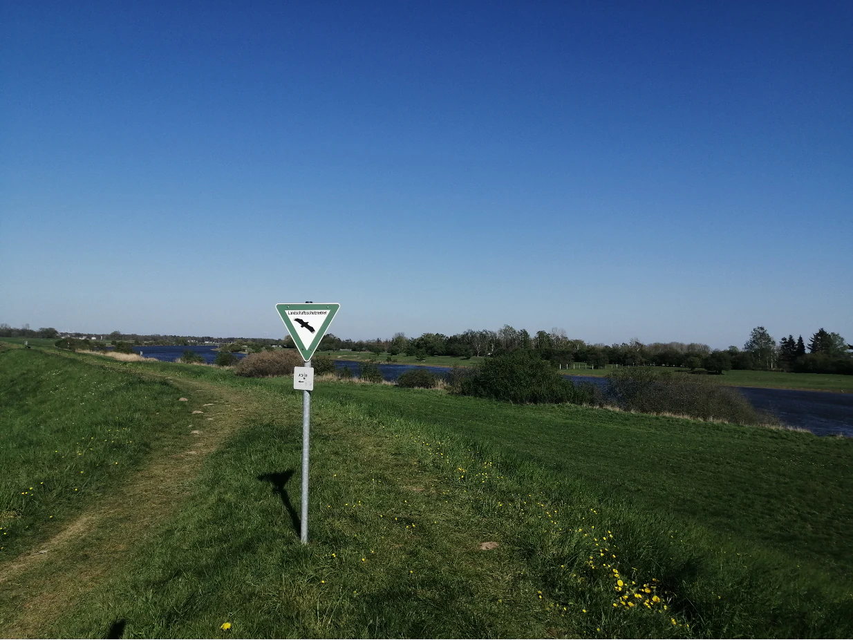
A triangular nature reserve sign on a metal post standing in a grassy meadow with the Weser river in the background under a clear blue sky.
A nature reserve sign overlooking the Weser river in the Mahndorfer Marsch area.

Mahndorfer Marsch history and protected-area timeline

The Mahndorfer Marsch has been partially protected as a Landschaftsschutzgebiet since 1968, when parts of the floodplain southeast of Bremen were first formally designated. In 2015, the broader protected area was consolidated and recognized as a single IUCN Category V Protected Landscape, aligning it with international standards for protected landscapes and seascapes.

The landscape itself is older than any formal protection regime. As a Weser river marsh, it was shaped over centuries by flooding, sediment deposition, and traditional agricultural use, with settlement and farming gradually adapting to the river's rhythms. Modern transportation infrastructure, including the A1 motorway running north of the marsh, has since framed the area between the city of Bremen and the river valley, but the core floodplain character has been preserved through landscape protection status.

The 2015 redesignation reflects a more coordinated approach to managing the area as a continuous ecological and recreational corridor, bridging the Bremen city-state boundary with Lower Saxony and integrating the Mahndorfer Marsch into broader regional conservation and outdoor recreation planning.

Mahndorfer Marsch landscape and geographic character

The Mahndorfer Marsch sits within the flat lower Weser valley, where the river's historical floodcourses and sediment layers have created a broad, low-lying floodplain. The terrain is gentle and open, with meadows, pastures, and wet depressions interrupted by a network of smaller streams, ditches, and standing water bodies that drain toward the Weser.

To the north of the marshland, the A1 motorway and the Mahndorfer See, an artificial lake, mark the boundary between the floodplain and the more urbanized part of eastern Bremen. The Weser itself flows through the southern portion of the protected area, defining the landscape's hydrological character and anchoring its identity as a river-driven marsh zone.

Individual sections of the Mahndorfer Marsch stretch from Neuenkirchen in the northwest to Bollen in the southeast, with the Bremen district of Mahndorf and the neighboring Lower Saxon town of Achim as the principal reference points. The result is a quiet, rural corridor of marshland that gradually transitions between distinctly urban and rural surroundings.

Mahndorfer Marsch ecosystems, habitats, and plant life

Ecologically, the Mahndorfer Marsch belongs to the Weser-Aller-Aue natural region, a floodplain system shaped by the Weser and its tributaries. The habitats here reflect the typical mosaic of the lower Weser valley: wet meadows, reed-fringed ditches, scattered ponds, and softer marshy soils that retain moisture from seasonal flooding.

Although the area is relatively small and lies close to the Bremen urban fringe, it retains a recognizable floodplain ecosystem. The combination of open grassland, water features, and riverside habitat makes it valuable for species that depend on quiet, periodically wet lowland environments. The protected status is tied closely to maintaining this habitat mosaic against further fragmentation.

The natural character of the Mahndorfer Marsch is also shaped by its location at the seam between Bremen and Lower Saxony, linking two administrative landscapes across a continuous ecological corridor along the Weser.

Mahndorfer Marsch wildlife and species highlights

The principal wildlife significance of the Mahndorfer Marsch lies in its function as a resting and stopover site for migratory birds along the Weser valley. The mosaic of wet meadows, channels, and marshy ground offers attractive conditions for resting flocks during migration periods, which is why sensitive sections of the area are closed to public access to minimize disturbance.

Beyond its role for migratory species, the landscape supports the broader bird and aquatic life typical of the lower Weser floodplain. Reed belts, ditches, and open water create varied microhabitats that benefit waterbirds, waders, and smaller wetland fauna. Because the area lies within a protected landscape, these habitats are managed with the goal of preserving their ecological function alongside continued traditional land use.

The result is a quiet, ecologically focused wildlife area where conservation priority is placed on protecting migratory and seasonal bird use rather than on hosting high visitor numbers.

Mahndorfer Marsch conservation status and protection priorities

The Mahndorfer Marsch has been protected since 1968 on a partial basis, with the broader area consolidated in 2015 under IUCN Category V, recognizing it as a Protected Landscape. This designation reflects the area's importance as a managed working landscape where ecological, scenic, and recreational values are balanced.

Conservation efforts in the Mahndorfer Marsch emphasize the preservation of the floodplain character of the lower Weser, including its meadows, drainage channels, and connection to the river. By maintaining open grassland and limiting further fragmentation, the protection regime aims to keep the marshland functioning both as habitat for migratory birds and as a green corridor linking Bremen with the wider Lower Saxon floodplain landscape.

The area is also connected to a wider Bremer Feuchtwiesenring, a ring of wet meadow sites around Bremen, which underlines its role in regional ecological networks rather than as an isolated reserve.

Mahndorfer Marsch cultural meaning and human context

The Mahndorfer Marsch sits at the cultural and geographical border between Bremen and Lower Saxony, where the Weser has long shaped local identity, agriculture, and settlement patterns. The landscape reflects a long tradition of living with the river, where seasonal flooding and fertile alluvial soils supported farming communities that adapted to the floodplain's rhythms.

Local communities such as Mahndorf, Hemelingen, and nearby Arbergen have a historic relationship with the marshland, and community-led publications and local initiatives continue to document the landscape's history and ecological state. Cycling and walking routes through the marsh reflect the area's integration into the everyday cultural life of eastern Bremen.

While not a site of major monuments or dramatic historical events, the Mahndorfer Marsch carries the quieter cultural significance of a continuously inhabited and traditionally used floodplain landscape on the edge of a major German city.

Top sights and standout views in Mahndorfer Marsch

The Mahndorfer Marsch combines a Weser floodplain landscape with formal protected-area status and active recreational use. It preserves an open marshland mosaic of meadows, ditches, and riverside habitat that is increasingly rare in the urbanized Bremen region.

Its strongest points of distinction include its role as a stopover site for migratory birds along the Weser, its cross-border position between Bremen and Lower Saxony, and its integration into the broader Bremer Feuchtwiesenring network of wet meadow sites.

Best time to visit Mahndorfer Marsch

The Mahndorfer Marsch is best experienced during the milder months, when the meadows, ditches, and riverside paths are most accessible on foot or by bicycle. Spring and early summer bring active birdlife and lush green floodplain scenery, while late summer and early autumn often align with migratory bird movements along the Weser, when the protected sections are more strictly closed to visitors to safeguard resting flocks.

Visitors interested in the landscape character rather than specific wildlife viewing will find the broad, open marsh scenery most pleasant when days are longer and the surrounding vegetation is in full growth, allowing the quiet rural atmosphere of the lower Weser valley to come through clearly.

Monthly climate preview

Long-term representative point measurements tracking temperature and precipitation rhythm

Mahndorfer Marsch Climate Normals and Annual Weather by Month

Mahndorfer Marsch records long-term monthly climate normals spanning average temperatures from sub-zero winter minimums to warm summer maximums alongside steady daily precipitation values. Examining the complete twelve-month record provides deep insight into the regional temperature trajectory and precipitation distribution across the protected landscape.
Annual mean9 °C
1 °C18 °C
Jan
Feb
Mar
Apr
May13°
Jun16°
Jul18°
Aug18°
Sep14°
Oct10°
Nov
Dec
Warmest month
July

18 °C

Coolest month
January

1 °C

Wettest month
July

2.5 mm/day

Driest month
April

1.4 mm/day

Park location guide

Geography guide, regional context, and park location map for Mahndorfer Marsch

Mahndorfer Marsch park geography, regions, and map view in Germany

Understand where Mahndorfer Marsch sits in Germany through a broader geographic reading of the surrounding landscape, nearby location context, and its mapped position within the national park landscape.

How Mahndorfer Marsch fits into Germany

Germany is a federal republic in Western and Central Europe with a population of over 83 million across sixteen constituent states. It is Europe's largest economy by nominal GDP and a major global exporter and importer. The capital is Berlin, and the country borders Denmark, Poland, Czech Republic, Austria, Switzerland, France, Luxembourg, Belgium, and the Netherlands.

Wider geography shaping Mahndorfer Marsch in Germany

Germany is located in Western and Central Europe, spanning 357,022 km². It borders Denmark to the north, Poland and the Czech Republic to the east, Austria and Switzerland to the south, and France, Luxembourg, Belgium, and the Netherlands to the west. The country has coastlines on the Baltic Sea and North Sea to the north, with the Alps located in the southern region.

Map view of Mahndorfer Marsch

Use this park location map to pinpoint Mahndorfer Marsch in Germany, understand its exact geographic position, and read its mapped placement within the surrounding landscape more clearly.

Pigeon | © OpenStreetMap contributors

Location context for Mahndorfer Marsch

Bremen

Visual exploration of Weser river marshland, wet meadows, and protected habitats.

Mahndorfer Marsch Photos and Landscape Scenery: Protected River Floodplain Views

Photographic records capture the flat lower Weser valley terrain, open marshland meadows, and quiet aquatic environments that define the protected landscape southeast of Bremen. Visual documentation reveals the ecological structure of seasonal wetlands and river floodplains, providing clear insight into regional conservation geography.

A triangular nature reserve sign on a metal post standing in a grassy meadow with the Weser river in the background under a clear blue sky.

Park atlas

Compare adjacent Weser floodplain reserves and surrounding river valley habitats

Parks Near Mahndorfer Marsch and Related Protected Landscapes in the Region

Browse other protected areas and lowland nature reserves located close to Mahndorfer Marsch in the Weser river valley. Continuing into adjacent regional park geography reveals broader wetland corridors and connected conservation zones across northern Germany.
Protected landscapeBremen
About 1.9 km away#1 closest

North

Mahndorfer Düne: A Protected Inland Dune Landscape in the City of Bremen

Geological remnants and ecological layering in Northwest Germany.

Mahndorfer Düne is a distinct protected landscape in Bremen, Germany, functioning as one of the final surviving inland dune relics from the Ice Age. The 2.7 hectare area maps a layered transition of sandy soil, dry heathland, and birch-oak woodland, offering an important look at regional post-glacial geology and conservation within a dense urban setting.

Area
0.027 km²
Established
1985
Relief
Lowland
Climate
Temperate
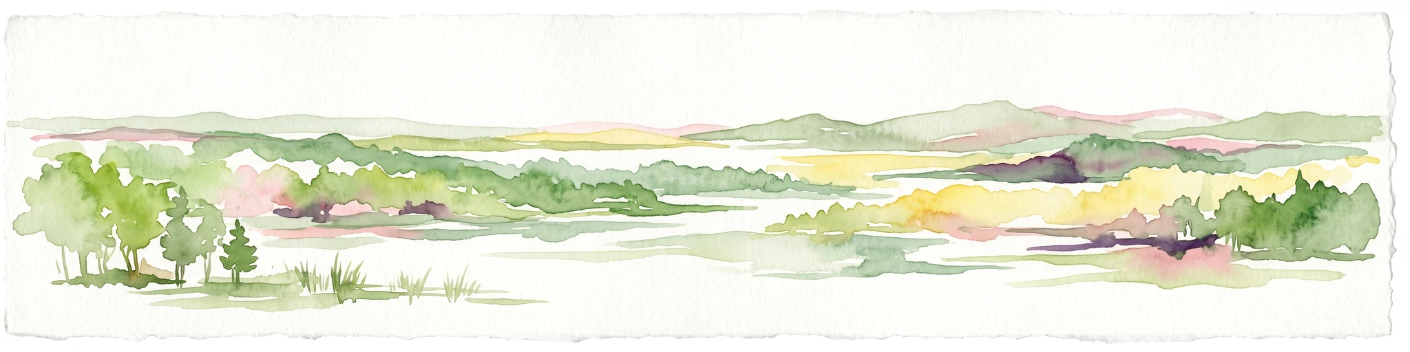
Watercolor painting of a wide, rolling landscape with green trees, golden fields, and soft hills in the background.
Protected areaGermany
About 3.8 km away#2 closest

Northeast

Krietes Wald (Im Holze) Protected Area: Landscape and Geographic Atlas Summary

A critical urban forest node in the Bremen region of Germany.

Krietes Wald (Im Holze) serves as a significant nature reserve characterized by its mature beech and oak-hornbeam woodland. Spanning a narrow, protected corridor in eastern Bremen, the site provides dense habitat value within an industrial landscape. It stands as a regional reference for saproxylic insect conservation and structural forest development within the federal republic of Germany.

Area
0.083 km²
Established
2015
Relief
Lowland
Climate
Temperate
Nature reserveBremen
About 5 km away#3 closest

Northwest

Vogelschutzgebiet Arsten-Habenhausen: Mapping the Protected Weser Floodplain Habitat

A historic urban nature reserve located in Bremen

Located in the Habenhausen district of Bremen, Vogelschutzgebiet Arsten-Habenhausen is a significant protected area focused on river floodplain maintenance. The site provides a concentrated view of floodplain woodland and reedbed vegetation, illustrating how small, long-established nature reserves contribute to the regional geography of the Weser river corridor in Germany.

Area
0.01 km²
Established
1950
IUCN
IV
Relief
Lowland
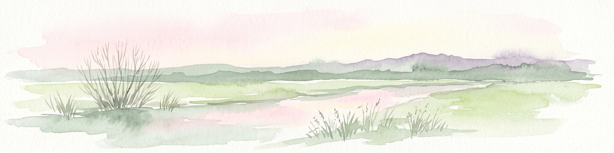
A pale, soft-toned watercolor illustration of a calm river meandering through open, green marshy meadows with distant rolling hills under a soft pink sky.
Nature reserveBremen
About 10 km away#4 closest

North

Borgfelder Wümmewiesen: Protected Wetland and Floodplain Geography in Bremen

An expansive 688-hectare nature reserve with river-fed grasslands.

Borgfelder Wümmewiesen offers a look at one of the largest protected nature reserves in the Bremen region. The landscape is characterized by its flat, open terrain and regular water dynamics that frame a rich mosaic of wet meadows, reedbeds, and ponds, providing essential habitat for breeding and migratory bird species along the Wümme river corridor.

Area
6.88 km²
Established
1987
Relief
Lowland
Climate
Temperate
Nature reserveBremen
About 10 km away#5 closest

North

Untere Wümme Nature Reserve: Riverine Biodiversity and Protected Tidal Landscapes in Bremen

Protected floodplain geography and tidal river habitats.

This nature reserve protects the meandering lower course of the Wümme river, showcasing one of northern Germany's few freshwater tidal systems. Spanning reedbeds, willow forests, and open mudflats, the reserve forms a vital corridor for migratory fish and waterfowl, reflecting a complex mosaic of protected riverine ecosystems and historic meadow landscapes.

Area
1.485 km²
Established
1991
Relief
Lowland
Climate
Temperate
A soft, painterly watercolor illustration depicting a winding river through a flat green meadow with rolling hills in the background.
Nature reserveBremen
About 10 km away#6 closest

North

Hollerland Nature Reserve: A Protected Cultural Landscape and Wetland in Bremen

Historic marshland terrain with unique saline spring ecosystems

Hollerland is a 293-hectare nature reserve in Bremen, Germany, notable for its well-preserved cultural landscape of wet grasslands and an intricate medieval ditch network. This protected area serves as a critical breeding ground for meadow birds and hosts an ecologically significant inland saline spring, providing a rare habitat for brackish-adapted plant communities deep within the regional landscape.

Area
2.93 km²
Established
1985
IUCN
IV
Relief
Lowland
Nature reserveBremen
About 12 km away#7 closest

Northwest

Kuhgrabensee Nature Reserve: Mapped Geography and Protected Areas in Bremen

An ecologically vital lake and bird sanctuary in Northwest Germany

Kuhgrabensee serves as a prime example of landscape restoration within Bremen, featuring a groundwater-fed lake with notable saline influences. This protected area supports a diverse array of pioneer plants and wildlife across its reed-lined shores and shallow-water habitats, providing a quiet corridor for ecological observation and study in the heart of the local landscape.

Area
0.296 km²
Established
1987
Relief
Lowland
Climate
Temperate
A watercolor painting showing a serene landscape with calm water, small islands of trees, and rolling hills in the background.
Nature reserveBremen
About 12 km away#8 closest

Northwest

Am Stadtwaldsee (Uni-Wildnis) Nature Reserve: Geographic Atlas and Park Map Context

Protected secondary habitat landscape in Bremen, Germany

Located in Bremen, the Am Stadtwaldsee (Uni-Wildnis) nature reserve offers a compelling study of secondary ecological succession. The area features a dense concentration of ponds and wooded ground shaped by historical sand mining. Explore the mapped boundaries of this eleven-hectare refuge to understand its role in urban biodiversity and regional landscape conservation.

Area
0.114 km²
Established
1991
IUCN
IV

Common questions about visiting, size, designation, and location context for Mahndorfer Marsch

Mahndorfer Marsch FAQs for park facts, access, geography, and protected area context

Find quick answers about Mahndorfer Marsch, including protected-area facts, park geography, trail and visitor context, and how the park fits into its surrounding country and regional landscape.
MoriAtlas Explorer

Continue Your Protected Areas Search Across the Global Atlas

Deepen your exploration by continuing the structured search for national parks and protected areas worldwide. Utilize the comprehensive filtering capabilities to compare different conservation landscapes and refine your understanding of global park geography. Discover more about the distribution and characteristics of protected natural areas.

Global natural geography