Mori Atlas logo
Protected areaMakhonjwa Mountains

Trace the ancient terrain and deep geological boundaries of the Genesis of Life region.

Makhonjwa Mountains: A Globally Significant Protected Geological Landscape in Mpumalanga South Africa

(Barberton Makhonjwa Mountains)

The Makhonjwa Mountains encompass an expansive range of rocky hills, forested valleys, and upland grasslands spanning the border of South Africa and Eswatini. Anchored in the Mpumalanga province, this protected area preserves Paleoarchean geological formations dating back over three billion years. By mapping the terrain of this Barberton Greenstone Belt remnant, visitors gain unique insight into the earliest evidence of life and the primal evolution of the Earth crust.

ancient rocksPrecambrian geologyPaleoarcheankomatiitegreenstone beltKaapvaal Craton

Makhonjwa Mountains

Protected area

Park overview

Structured park overview, official facts, and landscape profile for Makhonjwa Mountains

Makhonjwa Mountains park facts, protected area profile, and essential visitor context

Review the core facts for Makhonjwa Mountains, including designation, size, terrain, visitor scale, habitats, and operating context in one park-focused overview.

About Makhonjwa Mountains

The Makhonjwa Mountains, formally recognised as the Barberton Makhonjwa Mountains, are a range of small mountains and hills in southern Africa that together constitute the mountainous portion of the celebrated Barberton Greenstone Belt. Most of the range lies within Mpumalanga province of South Africa, with the remainder extending northward into Eswatini. Although modest in scale when compared to younger fold mountains, the range holds an outsized scientific significance because its rocks document a chapter of Earth history that is almost impossible to read anywhere else on the planet's surface.

Geologically, the mountains lie along the eastern edge of the Kaapvaal Craton, one of the oldest and most stable pieces of continental crust on Earth. The exposed rocks here have been dated to between roughly 3.2 and 3.6 billion years old, making them Paleoarchean in age and among the very oldest rocks that remain accessible to direct study. The combination of extreme age and exceptional preservation has allowed geologists to examine the conditions of an early Earth that was still cooling, still being bombarded by large impacts, and on which the first living systems were beginning to appear.

Ecologically and scenically, the Makhonjwa range is distinguished by rocky hills, moist grassy uplands, and forested valleys. It falls within the Barberton centre of endemism, a recognised region of plant distinctiveness, and supports a mosaic of habitats shaped by variable altitude and a climate of wet summers and relatively dry winters. The contemporary economy has shifted away from its gold-mining origins, with timber plantations of pine and eucalyptus and livestock grazing now forming the principal land uses around the range.

Quick facts and research context for Makhonjwa Mountains

The Makhonjwa Mountains cover an area of about 120 by 60 kilometres, spanning Mpumalanga in South Africa and a portion of Eswatini, with roughly 80% of the range located in South Africa. They constitute about 40% of the broader Barberton Greenstone Belt and sit on the eastern margin of the Kaapvaal Craton.

Elevations range from about 600 to 1,800 metres above sea level, and mean annual precipitation falls between roughly 600 and 1,150 millimetres in a pattern of wet summers and dry winters. The rocks of the range are among the oldest exposed anywhere on Earth, dating from about 3.2 to 3.6 billion years ago in the Paleoarchean. The site was inscribed as a UNESCO World Heritage Site in 2018 as a natural property under criterion (viii).

Protection and recognition

Documented terrestrial protection scope, designation year, and transboundary status.

Makhonjwa Mountains Protection Status and International Recognition Data

Makhonjwa Mountains holds documented terrestrial protection status established in 2018 alongside official UNESCO World Heritage recognition. Structured records assemble verified designation history and international recognition sources for geographic analysis.

International recognition

Protection details

Protection scope
Terrestrial
Designated year
2018
Transboundary protection
Yes
Park context

Deeper park guide and search-rich context for Makhonjwa Mountains

Makhonjwa Mountains history, landscape, wildlife, and travel context

Explore Makhonjwa Mountains through its history, landscape character, ecosystems, wildlife, conservation priorities, cultural context, and seasonal travel timing in a structured park guide built for atlas discovery and search intent.

Why Makhonjwa Mountains stands out

The Makhonjwa Mountains are best known for harbouring some of the oldest exposed rocks on Earth, with formations dated between roughly 3.2 and 3.6 billion years old. The range preserves a remarkable geological archive from the Paleoarchean era, including komatiites, an unusual type of ultramafic volcanic rock named after the Komati River that flows through the area. The mountains are equally celebrated for providing some of the oldest undisputed signs of life on the planet, earning the region the nickname "Genesis of Life." Scientific discoveries associated with the range include evidence of a massive ancient meteor impact event around 3.26 billion years ago and, in 2019, the finding of extraterrestrial organic materials preserved in 3.3-billion-year-old volcanic rocks. Together, these characteristics make the Makhonjwa Mountains a globally significant reference site for understanding early Earth and the origins of life.

Makhonjwa Mountains history and protected-area timeline

Long before European arrival, the Makhonjwa Mountains were used by Swazi and other pastoral peoples for grazing livestock, though typically not in large numbers. This pattern of light, traditional land use continued in relative isolation for many generations, allowing the range to remain largely undisturbed.

The modern history of the Makhonjwa region changed dramatically in the nineteenth century. European settlers arrived in the area in the 1860s, and gold was discovered near Kaapsehoop in 1875. The pivotal moment came in 1884, when George Barber and his cousins Fred and Harry Barber made a discovery that triggered a gold rush and led to the founding of the town of Barberton, which still carries their name. The local gold rush was eventually eclipsed by the much larger Witwatersrand Gold Rush of 1886, but the Barberton mining era left a lasting imprint on the region's identity.

By the late twentieth and early twenty-first centuries the mining economy had declined, and land use in the surrounding area shifted to commercial timber plantations of pine and eucalyptus, together with livestock grazing. The mountain range's international significance was formally recognised in 2009, when a submission was made for the region's classification as a World Heritage Site, and in 2018 the Barberton Makhonjwa Mountains were inscribed on the UNESCO World Heritage List as a natural site under criterion (viii).

Makhonjwa Mountains landscape and geographic character

The Makhonjwa Mountains form a relatively low but visually distinctive range of small mountains and hills. Elevations span roughly 600 to 1,800 metres above sea level, producing a varied topography that rises and falls in successive ridges rather than as a single dramatic massif. The scenery is shaped by ancient bedrock that has resisted erosion for billions of years, giving the range its characteristic rocky outcrops.

Within this framework the landscape divides into recognisable zones. Rocky hills dominate the upper elevations, while moist grassy uplands occupy broader mid-slope areas. Forested valleys cut through the range, often following the courses of rivers such as the Komati, which winds across the central part of the belt. Mean annual precipitation of roughly 600 to 1,150 millimetres falls mostly in wet summers, leaving the winters comparatively dry and shaping the seasonal greenness of the grasses and the density of valley vegetation.

In broader spatial terms, the mountains occupy an area about 120 by 60 kilometres in extent, with the great majority of the range lying within Mpumalanga province of South Africa and the remainder extending into Eswatini. The terrain sits on the eastern margin of the Kaapvaal Craton and forms about 40% of the larger Barberton Greenstone Belt.

Makhonjwa Mountains ecosystems, habitats, and plant life

The Makhonjwa Mountains support a varied ecological mosaic shaped by altitude, geology, and the seasonal climate of wet summers and dry winters. The combination of rocky hilltops, moist grassy uplands, and sheltered forested valleys has produced a landscape rich in habitat transitions over short distances, a pattern that contributes to the range's biological distinctiveness.

The mountains lie within the Barberton centre of endemism, a recognised biogeographic area characterised by plant species that occur here and not widely elsewhere. This endemism signal reflects both the ancient, stable substrate of the Kaapvaal Craton and the niche diversity created by the range's varied topography. Vegetation ranges from grass-dominated uplands to denser woody cover in the valleys, with moisture-loving plant communities concentrated where water collects and along river corridors.

The climatic regime, with its strongly seasonal rainfall and mild, dry winters, plays an important role in shaping plant phenology and habitat availability across the mountains. While the range is not primarily famous for charismatic large mammal populations, its ecological importance lies in the long evolutionary history of its habitats and the persistence of plant communities rooted in an exceptionally ancient landscape.

Makhonjwa Mountains wildlife and species highlights

The wildlife profile of the Makhonjwa Mountains is less defined by a single signature species than by the broader ecological character of an ancient, stable landscape that supports a recognisable plant-based centre of endemism. Within the grassy uplands, rocky hills, and forested valleys, fauna is shaped by habitat transitions that change over short distances along the elevation gradient.

The range's biological distinctiveness is tied primarily to its position within the Barberton centre of endemism, signalling that the region hosts plant and associated animal communities with restricted distributions. River corridors, including the Komati River valley, add riparian habitat patches that complement the upland grasslands and rocky slopes.

The contemporary land uses around the range, including commercial plantations of pine and eucalyptus and livestock grazing, influence the patterns of wild habitat available to native fauna. While the mountains are not widely known for a singular iconic species, their ecological value lies more in the continuity and antiquity of their habitat mosaic than in any one charismatic animal.

Makhonjwa Mountains conservation status and protection priorities

The conservation significance of the Makhonjwa Mountains rests on the extraordinary geological archive preserved in their rocks. As one of the oldest exposed rock formations on Earth, with documented ages between 3.2 and 3.6 billion years, the range offers a rare window into the early Precambrian Earth and the conditions under which the earliest life emerged.

This scientific importance has been formally recognised at the highest international level. The area was proposed as a World Heritage Site in 2009, and in 2018 it was inscribed on the UNESCO World Heritage List under the official name Barberton Makhonjwa Mountains as a natural property meeting criterion (viii). This designation reflects the site's exceptional value for understanding the history of the planet and the early evolution of life.

Alongside its global geological importance, the range falls within the Barberton centre of endemism, reinforcing its conservation value at a regional ecological scale. The combination of globally significant geology and regionally distinctive habitats gives the mountains a conservation profile that extends well beyond ordinary protected-area concerns, positioning the range as a natural reference site for Earth science and a continuing subject of scientific research.

Makhonjwa Mountains cultural meaning and human context

The cultural context of the Makhonjwa Mountains weaves together centuries of African pastoralist land use with the transformative impact of European colonial settlement. Before the arrival of outsiders, Swazi and other pastoral peoples grazed their livestock in the area, generally at modest intensities, and the landscape remained closely tied to traditional, low-intensity uses.

European settlement beginning in the 1860s brought dramatic change. The discovery of gold near Kaapsehoop in 1875, followed by the Barber cousins' find of 1884, ignited a gold rush that reshaped the regional economy and population. The town of Barberton grew up as a mining centre, although it was soon overshadowed by the enormous Witwatersrand Gold Rush that began in 1886 to the south.

In the modern era, the cultural and economic identity of the Makhonjwa region has shifted away from gold mining toward timber plantations of pine and eucalyptus and toward pastoral grazing. Today the mountains stand at the meeting point of a layered African and colonial-era heritage and a globally significant natural heritage, with the town's mining past and the landscape's deep geological history forming two complementary dimensions of the area's identity.

Top sights and standout views in Makhonjwa Mountains

Among the most distinctive features of the Makhonjwa Mountains is the preservation of 3.2 to 3.6-billion-year-old rocks within a 120 by 60 kilometre range that crosses South Africa and Eswatini, with about 80% of the area in Mpumalanga. These Paleoarchean formations, combined with the range's unusual komatiite volcanic rocks, give it global importance as a reference site for early Earth geology.

Scientific milestones tied directly to the mountains include the identification of evidence for a major ancient meteor impact near the area around 3.26 billion years ago and the 2019 discovery of extraterrestrial organic materials preserved in 3.3-billion-year-old volcanic rocks. Together with the rocks' ancient signs of life, these findings have earned the range the nickname "Genesis of Life." UNESCO inscription in 2018 recognised this exceptional natural value at the international level.

Best time to visit Makhonjwa Mountains

The climate of the Makhonjwa Mountains follows a strongly seasonal pattern of wet summers and dry winters, with mean annual precipitation of roughly 600 to 1,150 millimetres. Most of the rainfall arrives during the summer months, when the grassy uplands and valley vegetation are at their greenest and water levels in rivers like the Komati are highest, while the cooler dry winter months tend to bring clearer skies and reduced grass cover, making the underlying rocky terrain more visually prominent.

Visitors interested in the range's geology and rocky landscapes may find the drier months appealing for clearer ground visibility and easier walking conditions, while those drawn to the greener, more lush character of the landscape may prefer the wetter season. The pleasant mid-altitude climate, with elevations between roughly 600 and 1,800 metres, helps moderate conditions throughout much of the year compared with lower-lying parts of the region.

Monthly climate preview

Long-term representative point measurements tracking monthly temperature and precipitation patterns

Makhonjwa Mountains Climate Normals and Annual Weather by Month

Makhonjwa Mountains exhibits a measured annual cycle featuring winter minimums near four degrees Celsius alongside summer maximums approaching thirty-eight degrees. Exploring the complete twelve-month statistical profile reveals detailed shifts in regional precipitation and temperature averages.
Annual mean19 °C
14 °C23 °C
Jan23°
Feb23°
Mar22°
Apr19°
May17°
Jun15°
Jul14°
Aug17°
Sep20°
Oct21°
Nov22°
Dec23°
Warmest month
January

22.6 °C

Coolest month
July

14.3 °C

Wettest month
January

4.4 mm/day

Driest month
July

0.3 mm/day

Park location guide

Geography guide, regional context, and park location map for Makhonjwa Mountains

Makhonjwa Mountains park geography, regions, and map view in South Africa

Understand where Makhonjwa Mountains sits in South Africa through a broader geographic reading of the surrounding landscape, nearby location context, and its mapped position within the national park landscape.

How Makhonjwa Mountains fits into South Africa

South Africa is the southernmost country in Africa, spanning 1.22 million km² with a population of over 63 million. The country operates with three capital cities, Pretoria (executive), Cape Town (legislative), and Bloemfontein (judicial), and is renowned for its biodiversity, national parks, and multicultural society.

Wider geography shaping Makhonjwa Mountains in South Africa

South Africa occupies the southernmost region of Africa, with coastline along both the Atlantic Ocean to the west and the Indian Ocean to the east. The interior features elevated plateaus including the Highveld, with the Drakensberg escarpment marking the eastern highlands. The country shares borders with Namibia, Botswana, Zimbabwe, Mozambique, Eswatini, and Lesotho.

Map view of Makhonjwa Mountains

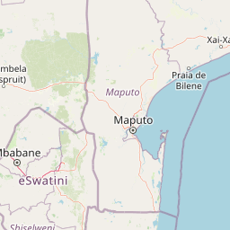
Use this park location map to pinpoint Makhonjwa Mountains in South Africa, understand its exact geographic position, and read its mapped placement within the surrounding landscape more clearly.

Pigeon | © OpenStreetMap contributors

Location context for Makhonjwa Mountains

Mpumalanga
Park atlas

Browse surrounding regional geography and connected geological reserves

Parks Near Makhonjwa Mountains and Protected Landscapes to Compare Next

Compare protected areas near Makhonjwa Mountains to examine related geological terrain and regional conservation landscapes. Expanding the park search reveals adjacent natural reserves that share similar upland geography and regional ecosystem traits.
National parkSouth Africa
About 43 km away#1 closest

North

Kruger National Park: South Africa's Iconic National Park for Geographic Discovery

Explore savanna landscapes and mapped protected area boundaries.

Kruger National Park serves as a paramount example of a protected landscape, offering a rich tapestry of savanna ecosystems and varied terrain across South Africa's Lowveld. This canonical entry details its vast geographic scope, approximately 19,623 square kilometres, and its status as the nation's first national park. Understand the park's environmental context, from the Lebombo Mountains to the Limpopo River, and its integral role within larger transfrontier conservation initiatives, providing critical insight for atlas-based geographic exploration.

Area
19,623 km²
Established
1926
IUCN
II
Visitors
1.7M annual
National parkEswatini
About 98 km away#2 closest

Southeast

Hlane Royal National Park: Eswatini's Vast Protected Savanna Woodland Landscape

Mapped geography and protected area context in northeastern Eswatini.

Delve into Hlane Royal National Park, Eswatini's most extensive protected territory, a prime example of lowland bushveld savanna. This national park is defined by its expansive woodland terrain, dotted with ancient trees and seasonal water pans, creating a dynamic landscape. It is an essential component for understanding the regional geography and the distribution of protected areas within Southern Africa, offering significant opportunities for landscape exploration.

Area
300 km²
IUCN
VI
Relief
Lowland
Climate
Subtropical
Nature reserveMpumalanga
About 104 km away#3 closest

Northwest

Verloren Valei Nature Reserve: Highveld Grassland and Wetland Protected Area Geography

Steenkampsberg plateau landscape in Mpumalanga, South Africa.

Verloren Valei Nature Reserve protects a remarkable high-altitude highland plateau ecosystem near Dullstroom. Featuring rolling grasslands and a complex network of wetlands, this region provides a critical refuge for rare bird species, indigenous flora, and distinct plateau biodiversity across a diverse mosaic of rocky ridges and marshy terrain.

Area
58.91 km²
Relief
Upland
Access
Access unknown
Scope
Terrestrial
Wildlife reserveMpumalanga
About 120 km away#4 closest

Northeast

Sabi Sand Game Reserve: Geographic Atlas and Protected Landscape Mapping in Mpumalanga

Mapping riparian corridors and savanna ecosystems in eastern South Africa

Sabi Sand Game Reserve provides a foundational study in private conservation landscapes, situated within the Lowveld of Mpumalanga. The reserve is uniquely defined by the Sand and Sabie Rivers, which sculpt the local terrain and support diverse riparian habitats. This atlas-focused entry examines the reserve as a complex, unfenced entity adjacent to Kruger National Park, highlighting its role in regional conservation geography and the spatial distribution of its renowned private concessions.

Area
650 km²
Established
1948
Relief
Lowland
Climate
Subtropical
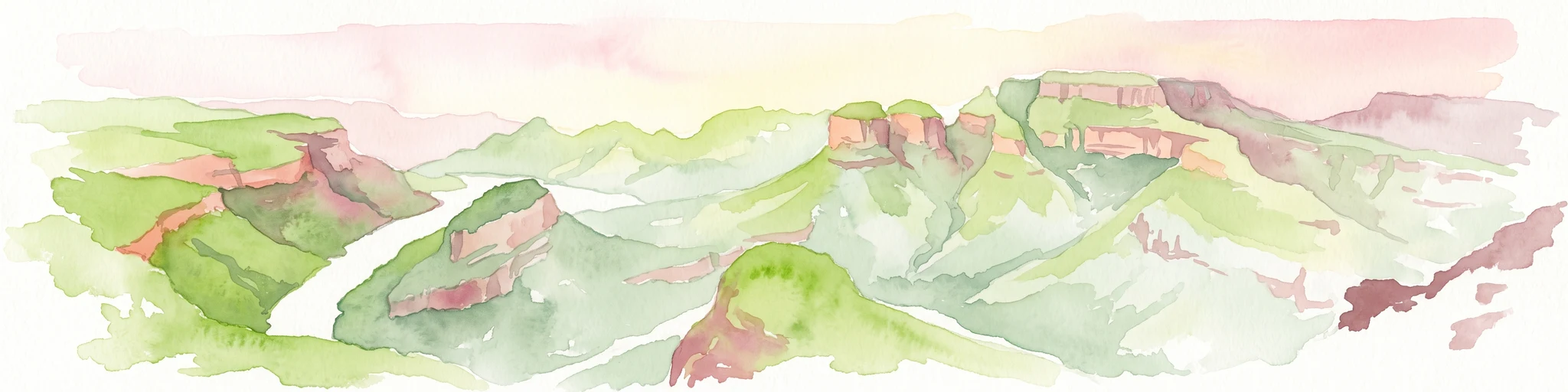
A horizontal watercolor painting depicting the Blyde River Canyon with green slopes, reddish cliff faces, and a winding river.
Nature reserveMpumalanga
About 133 km away#5 closest

North

Blyde River Canyon Nature Reserve: Escarpment Geography and Protected Landscape Map

Mapping river-carved canyons and plateau ecosystems in Mpumalanga

Blyde River Canyon Nature Reserve protects a vast stretch of the Mpumalanga Drakensberg, characterized by vertical cliffs, rocky massifs, and deep river gorges. This atlas-focused resource highlights the reserve's geological landmarks, including the Three Rondavels and Bourke's Luck Potholes, offering a clear view of the complex terrain and protected natural boundaries defining this northeastern South African landscape.

Area
290 km²
Established
1965
Relief
Mountain
Climate
Subtropical
Wildlife reserveMpumalanga
About 135 km away#6 closest

North

Manyeleti Game Reserve: Protected Area Boundaries and Lowveld Landscape Mapping

Ecological connectivity within the Mpumalanga conservation mosaic.

Manyeleti Game Reserve offers significant insights into the Lowveld landscape of Mpumalanga. Known for its unfenced connection to neighboring wildlife areas, the reserve provides a case study in contiguous protected land management and bushveld geography that sustains large mammal populations across regional boundaries.

Area
227.5 km²
Established
1967
Water
Minor water
Season
Year-round
Wildlife reserveLimpopo
About 138 km away#7 closest

North

Thornybush Game Reserve: A Protected Wildlife Landscape in Limpopo, South Africa

Mapped savanna corridors and riverine ecological zones

Located in the Limpopo province of South Africa, Thornybush Game Reserve is an essential private wildlife area known for its open savanna and rich riparian vegetation. By maintaining an unfenced boundary with the neighboring national park, it acts as a critical extension of the Greater Kruger wilderness. This entry details its geographical scope, terrain features, and its function as a managed, integrated component of the regional conservation landscape.

Area
140 km²
Water
Minor water
Wildlife reserveLimpopo
About 150 km away#8 closest

North

Kapama Game Reserve: Geographic Atlas and Protected Landscape Map of Limpopo

Explore the diverse terrain and riverine ecosystems of this South African wildlife reserve

Kapama Game Reserve sits within the Limpopo Lowveld, featuring a complex mix of open savanna, mixed bushveld, and dense riverine corridors shaped by the Blyde River. This record provides a detailed look at the reserve as a functional piece of the greater regional conservation landscape, highlighting its topography and its role in protecting South Africa's native habitat.

Area
130 km²
Established
1993
Scope
Terrestrial

Common questions about visiting, size, designation, and location context for Makhonjwa Mountains

Makhonjwa Mountains FAQs for park facts, access, geography, and protected area context

Find quick answers about Makhonjwa Mountains, including protected-area facts, park geography, trail and visitor context, and how the park fits into its surrounding country and regional landscape.
MoriAtlas Explorer

Continue Your Protected Areas Search Across the Global Atlas

Deepen your exploration by continuing the structured search for national parks and protected areas worldwide. Utilize the comprehensive filtering capabilities to compare different conservation landscapes and refine your understanding of global park geography. Discover more about the distribution and characteristics of protected natural areas.

Global natural geography