

Mori Atlas logo
Nature reserveManušické rybníky

Tracing the historic pond system and ecological boundaries of this lowland nature monument

Manušické rybníky Nature Reserve: A Protected Wetland Landscape in the Liberec Region

(Přírodní památka Manušické rybníky)

Manušické rybníky represents a compact protected complex in the Liberec Region of the Czech Republic, defined by a historic chain of seven interconnected fishponds and peatland remnants. This nature monument functions as a critical lowland habitat within the Českolipská kotlina basin, supporting populations of fire-bellied toads and rare wetland vegetation amidst a mosaic of pine-oak woodland and seasonal meadows.

fishpondswetlandsamphibiansfire-bellied toadpondscapepeatland remnants
Stylized vector illustration of a scenic valley with a waterfall in the distance, a meandering river in the foreground, and tall trees on both sides.

Manušické rybníky

Nature reserve

Park overview

Structured park overview, official facts, and landscape profile for Manušické rybníky

Manušické rybníky park facts, protected area profile, and essential visitor context

Review the core facts for Manušické rybníky, including designation, size, terrain, visitor scale, habitats, and operating context in one park-focused overview.

About Manušické rybníky

Manušické rybníky sits at the meeting point of rolling upland and lowland basin near Česká Lípa, where centuries of fish-farming have left a distinctive imprint on the landscape. The protected area brings together seven ponds, ranging in size from under a third of a hectare to nearly two hectares, joined by short channels, partially flooded meadows, and remnants of acidic peatland. The result is a small but unusually varied wetland mosaic that contrasts with the surrounding farmland.

Anchoring the site is the Velký Široký rybník, whose eighteenth- and nineteenth-century drainage under the Knights of Malta left behind a low, moist basin now recolonized by wetland vegetation. Around it lie older spawning, nursery, and growing ponds that once followed the classic three-phase carp-farming pattern of Bohemian pond systems. Today the ponds are managed by Rybářství Doksy, while the surrounding wet meadows remain in agricultural use and recreational angling is administered by the Czech Fishing Union.

Ecologically, the site’s significance lies in its combination of standing freshwater habitats, bog-edge conditions, and connective woodland: pine-oak remízky and damp meadows provide refuges, foraging grounds, and migration corridors for amphibians and waterbirds. The protected complex functions as one node in a regional amphibian network that includes nearby Sites of Community Importance such as Horní Ploučnice, Dolní Ploučnice, and Cihelenské rybníky, to which fire-bellied toad populations are strongly linked.

Quick facts and research context for Manušické rybníky

Manušické rybníky is a Czech přírodní památka (nature monument) located in the Česká Lípa district of the Liberec Region, within the Zákupská pahorkatina upland and the Českolipská kotlina basin. The protected area covers roughly 14 hectares, encompassing seven fishponds of varying size, adjacent wet meadows, peatland remnants, and fragments of pine-oak forest, all fed by the Šporka stream. It was designated by the Liberec Regional Authority in 2012 and was subsequently registered as a Site of Community Importance in 2013.

The site’s primary conservation target is the fire-bellied toad (Bombina bombina), whose metapopulation dynamics across multiple nearby pond sites make the locality part of a wider Českolipsko amphibian network. Below the ponds, the local economy blends commercial fish farming, recreational angling managed by the Czech Fishing Union, and small-scale agricultural use of the surrounding wet meadows.

Protection and recognition

Documented terrestrial protection history and Natura 2000 listings

Manušické rybníky Protection Status and International Recognition Data

Manušické rybníky holds a documented terrestrial protection status established in 2013 with verified Natura 2000 recognition records. Structured records outline the official designation history and administrative scope associated with the protected area.

International recognition

Protection details

Protection scope
Terrestrial
Designated year
2013
Transboundary protection
No
Park context

Deeper park guide and search-rich context for Manušické rybníky

Manušické rybníky history, landscape, wildlife, and travel context

Explore Manušické rybníky through its history, landscape character, ecosystems, wildlife, conservation priorities, cultural context, and seasonal travel timing in a structured park guide built for atlas discovery and search intent.

Why Manušické rybníky stands out

Manušické rybníky is best known for its role as a refuge for the fire-bellied toad (Bombina bombina), whose strong population on the two largest ponds anchors its designation as a Site of Community Importance. The site also stands out for its compact, well-documented system of small fishponds, including the historically significant Velký Široký rybník (Breite Teich), whose drained peat bottom once produced bog cranberries and survives today only as a fragmentary peatland habitat. The ponds are equally valued for their mosaic of wetland vegetation: peat-forming plants, sharp-flowered rush, whorled water-milfoil, and southern bladderwort coexist with wet meadow flora that includes May-flowering marsh orchids. This combination of historically shaped pondscape, surviving peatland fragments, and rare amphibian populations gives the locality a distinct profile among lowland protected areas in northern Bohemia.
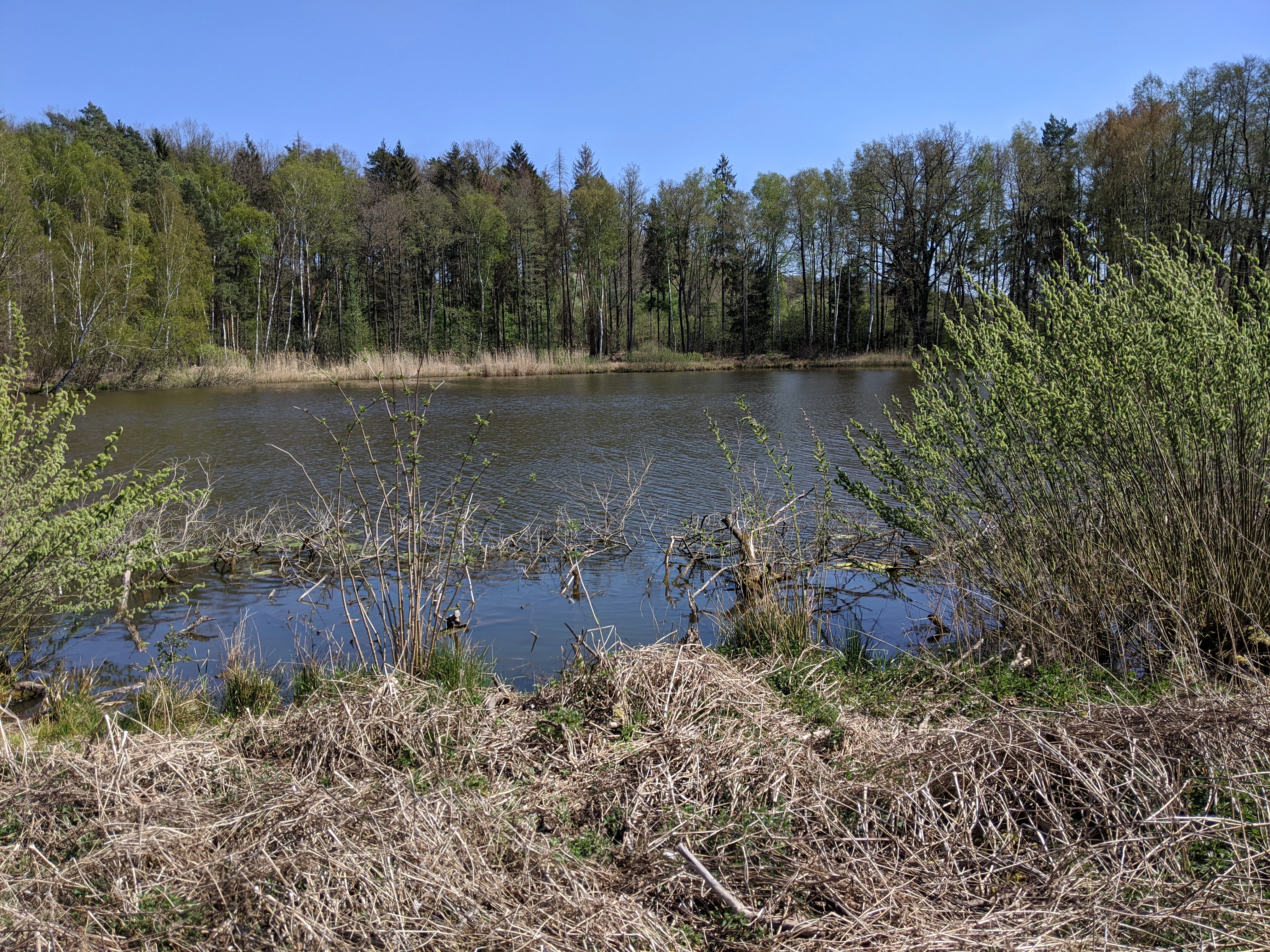
A tranquil pond surrounded by deciduous trees and shoreline vegetation under a clear blue sky.
A view of the Upper Manušice Pond at Manušické rybníky Nature Monument in spring.

Manušické rybníky history and protected-area timeline

The ponds of Manušice have been part of the Bohemian fish-farming tradition since at least 1575, when their existence is documented in the records of the Horní Libchava estate then held by the Vartenberk noble family. The site belongs to the wider pond-building boom of the sixteenth century, when the Lands of the Bohemian Crown saw the rise of interconnected pond systems engineered for the three-phase rearing of carp: small spawning ponds, larger nursery or "výtažné" ponds, and finally "vejrostní" ponds where fish grew to market size.

In the post-White Mountain period, the Bohemian pond tradition entered a long decline, and many systems were partially drained to reclaim agricultural land. The largest of the Manušice ponds, the Velký Široký rybník (then known as the Breite Teich), was dried out in 1836 under the Order of Malta, and its moist peat floor became known locally as the "Manischer Moosplan," where bog cranberries flourished each spring. Smaller ponds survived in leasehold, with the Tiefteich and Schlosserteich serving as nursery-and-growing ponds and the shallower Tränkteich and Hegerteich functioning as nursery waters for young carp.

Modern conservation history began with the formal designation of the site as a přírodní památka (nature monument) by the Liberec Regional Authority on 14 August 2012. A year later, in 2013, the Czech government included the larger 14-hectare portion of the complex in the Natura 2000 network as a Site of Community Importance, recognizing the ponds’ importance for the fire-bellied toad and the broader Česká Lípa pondscape. Subsequent debates over a planned realignment of the I/9 road between Nový Bor and Dolní Libchava, which runs close to the protected boundary, have highlighted the pond system’s continuing ecological sensitivity and its role in maintaining migration corridors between nearby amphibian populations.

Manušické rybníky landscape and geographic character

The protected complex lies in the Zákupská pahorkatina upland, specifically within the Českolipská kotlina basin, a landscape shaped by gentle relief, glacial and post-glacial deposits, and centuries of human modification. Elevations on the site range tightly between 256 and 268 meters, giving the area a lowland character dominated by small basins, shallow pond edges, and meadow margins rather than dramatic terrain.

The visual landscape is defined by a chain of small to medium-sized ponds: Velký Široký rybník and Malý Široký rybník form the larger open-water core, while the Horní, Prostřední, and Dolní Manušický rybníks together with Napajedlo create a rhythm of smaller water surfaces, channels, and seasonally flooded pools. Between the ponds lie wet meadows that hold water in spring and gradually dry through summer, interspersed with short stretches of path and the occasional patch of pine-oak scrub. To the west, the site is bordered by a road running from Libchava through Manušice toward Skalice u České Lípy, beyond which begins the territory of the České středohoří Protected Landscape Area. The northeastern edge is followed by the Cyklostezka Varhany cycle route, which frames the ponds against the surrounding countryside.
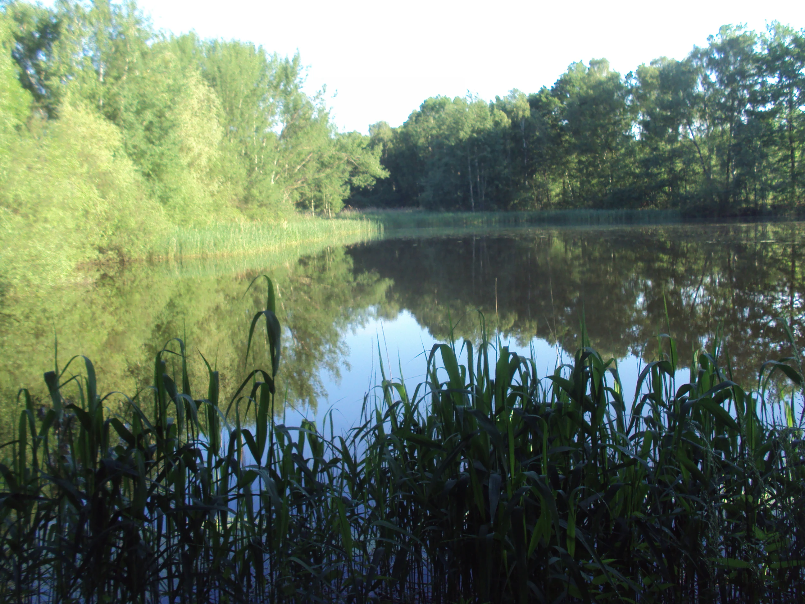
A still pond surrounded by dense green forest and reeds, reflecting the trees on the water surface.
Maly Siroky pond within the Manušické rybníky nature reserve.

Manušické rybníky ecosystems, habitats, and plant life

The ecological character of Manušické rybníky is that of a lowland Central European pondscape, with overlapping freshwater, marsh, peatland, and woodland habitats compressed into a relatively small area. Each pond has its own fringe of emergent and submerged vegetation, while the damp meadows between them support both wet-grassland species and bog-tolerant plants.

Aquatic and bog-margin flora documented at the site include the sharp-flowered rush (Juncus acutiflorus), whorled water-milfoil (Myriophyllum verticillatum), southern bladderwort (Utricularia australis), and the May-flowering marsh orchid (Dactylorhiza majalis). The drained basin of the old Velký Široký rybník retains a fragmentary peatland character, where acid-tolerant species related to those that once produced wild cranberries can still persist in patches.

Surrounding the open water, fragments of pine-oak woodland (borové doubravy) function as small habitat islands, providing cover, basking sites, and migration stepping stones for amphibians and reptiles. The combined effect is a patchy but ecologically rich mosaic in which standing water, wet meadow, peat remnants, and dry woodland coexist at a scale unusual for the intensively used farmland of the Česká Lípa region.
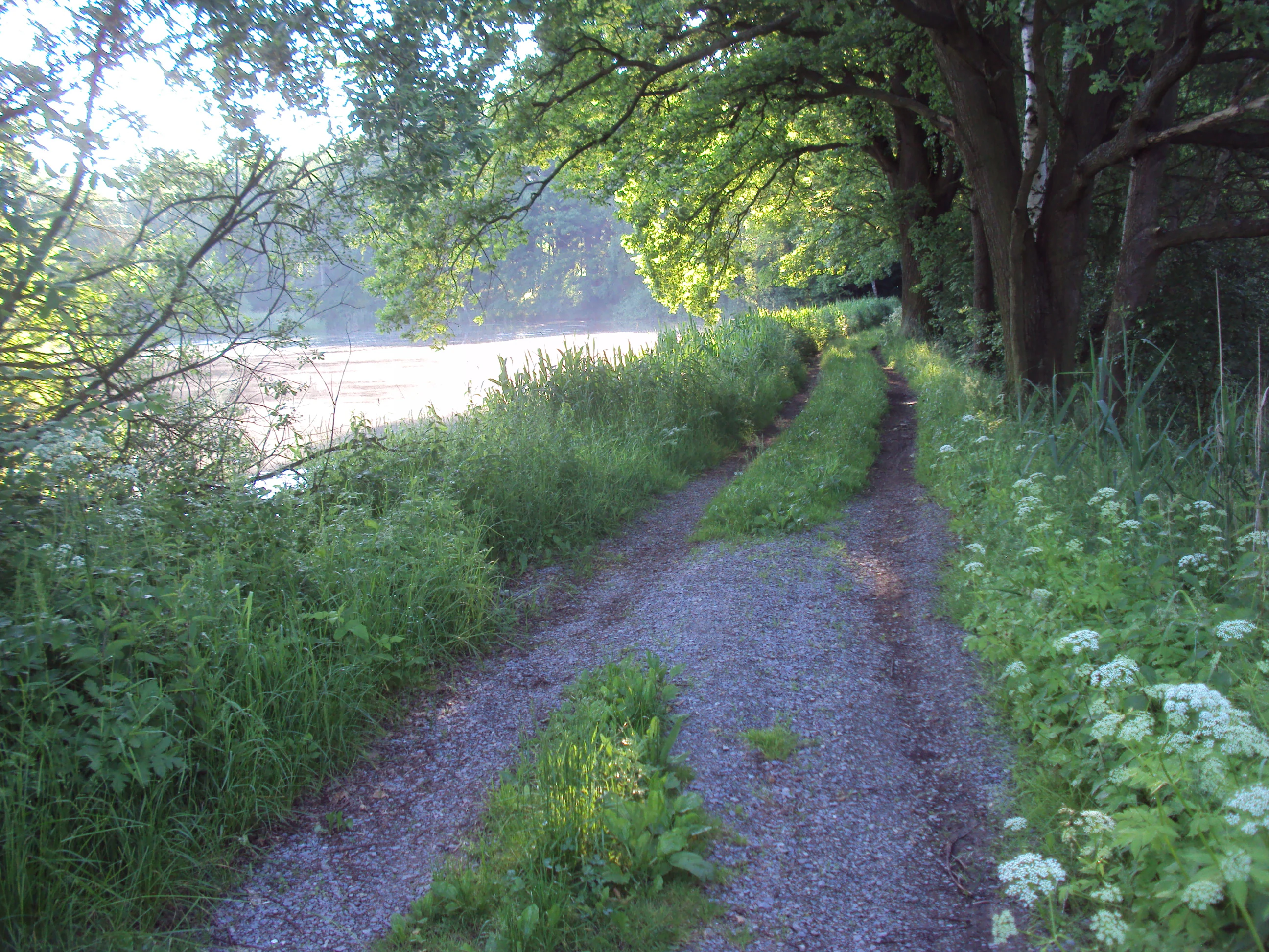
A narrow gravel and dirt path lined with green trees and wild vegetation leads alongside a pond under bright morning light.
A dirt path running alongside a pond in the Manušické rybníky nature reserve.

Manušické rybníky wildlife and species highlights

Wildlife at Manušické rybníky is dominated by amphibians, which are the primary reason for the site’s formal protection. A strong population of the fire-bellied toad (Bombina bombina) inhabits the two largest ponds, the Velký Široký and Malý Široký rybníks, and individuals or small breeding groups from this population contribute to a metapopulation that also occupies nearby Sites of Community Importance along the Ploučnice river system.

The ponds and their margins also support marsh frogs (Pelophylax ridibundus), common frogs (Rana temporaria), European tree frogs (Hyla arborea), common toads (Bufo bufo), spadefoot toads (Pelobates fuscus), and smooth newts (Lissotriton vulgaris). Reptiles include grass snakes (Natrix natrix) and slow worms (Anguis fragilis), which use the combination of damp meadows and warm woodland edges.

Birds associated with the site include breeding pairs of little grebes (Tachybaptus ruficollis), gadwalls (Anas strepera), and mute swans (Cygnus olor), as well as kingfishers (Alcedo atthis) recorded feeding along the connected streams. In the surrounding trees, golden orioles (Oriolus oriolus) nest during the breeding season, adding a layer of woodland birdlife to the pondscape.
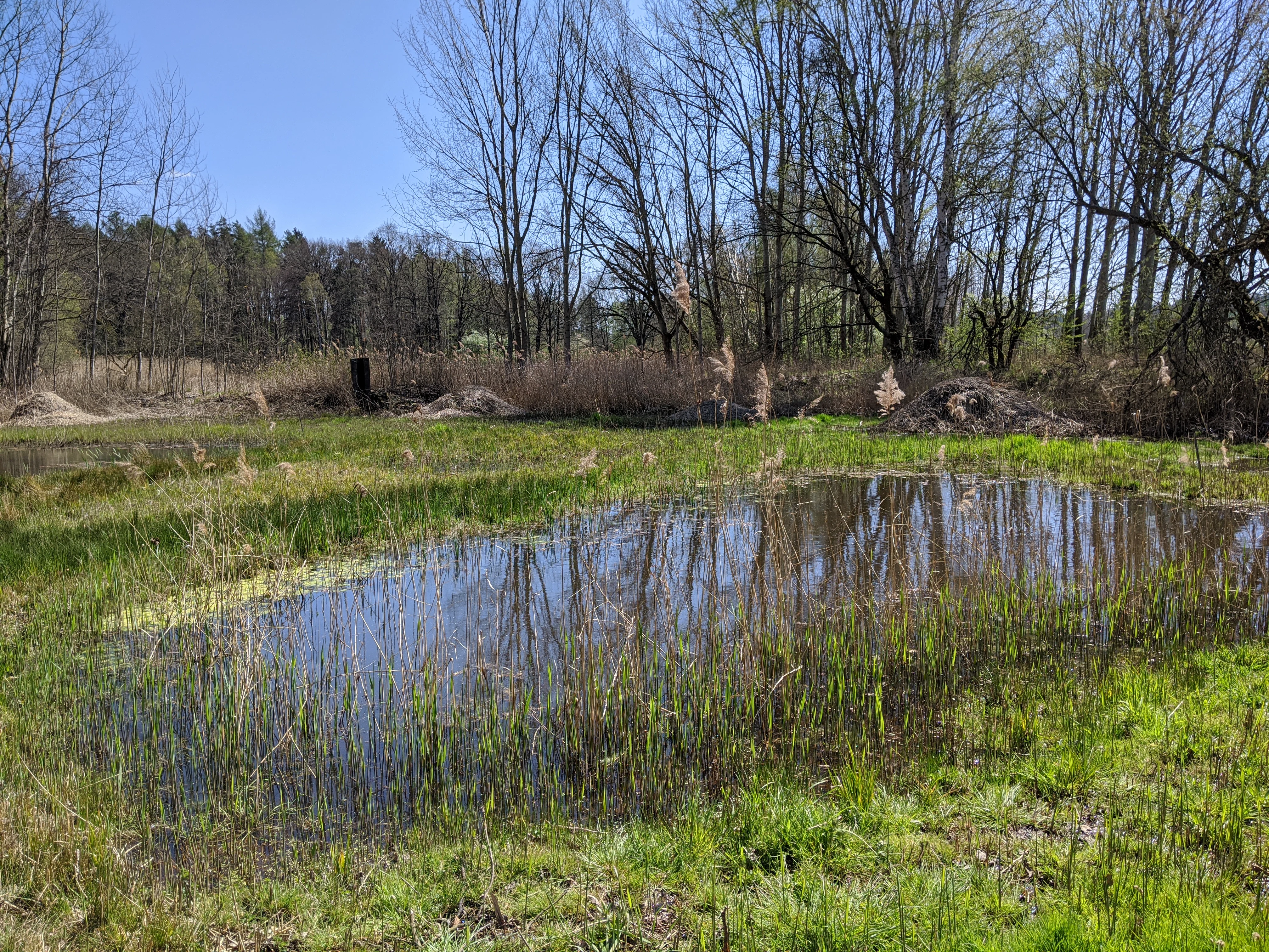
A small, still pond surrounded by grasses, reeds, and bare trees in early spring.
A small pond within the wetland ecosystem of Manušické rybníky.

Manušické rybníky conservation status and protection priorities

The conservation profile of Manušické rybníky is anchored by its designation as a Site of Community Importance within the Natura 2000 network, with the fire-bellied toad as the single formal subject of protection. The site’s importance lies less in its size than in its functional role within the regional amphibian network: its pond complex supports one of the key breeding nodes for Bombina bombina in the Česká Lípa area, and any degradation of the ponds or their connective habitats could disrupt migration between subpopulations across the Ploučnice river basin.

Management is shared between several public bodies. The Czech State Land Office owns most of the pond surfaces and the surrounding land, while Rybářství Doksy operates the ponds for fish farming. The Liberec Regional Authority, through its department of rural development, agriculture, and environment, supervises state administration and oversees fishery management, and the Czech Fishing Union runs recreational angling on defined waters. Together, they balance commercial fish production, angling use, and ecological protection.

The site has in recent years become a focus of broader conservation debate because of plans to realign the I/9 road between Nový Bor and Dolní Libchava. Environmental assessments note that the proposed route could eliminate terrestrial habitats suitable for fire-bellied toad hibernation just outside the protected boundary and may further restrict the species’ movement between nearby Sites of Community Importance. The case illustrates how a small wetland system can sit at the center of regional land-use conflicts.

Manušické rybníky cultural meaning and human context

The ponds of Manušice are embedded in several layers of central European cultural history. Their origin lies in the great Bohemian pond-building movement of the fifteenth and sixteenth centuries, when noble estates competed in engineering vast systems of fishponds to supply freshwater carp to inland markets. The 1575 documentation of Manušické rybníky under the Vartenberk lords of the Horní Libchava estate reflects this era, when technical innovation and rural estate economy were tightly intertwined.

A second cultural layer is the long tenure of the Knights of Malta on the Horní Libchava estate after the Thirty Years’ War. Under their administration, many ponds in the region were drained or reduced, including the Breite Teich, and the resulting landscape acquired a hybrid identity of former fishpond, meadow, and peatland still visible in old German names such as Tiefteich, Hegerteich, and Tränkteich or Moosplan that survive in local memory.

Today the site also plays a modest role in outdoor recreation. The Cyklostezka Varhany cycle route passes along its northeastern edge, recreational angling takes place under the Czech Fishing Union, and school groups and naturalists occasionally visit for amphibian surveys, while nearby municipalities have taken public positions on road-building proposals that would affect the broader pondscape.
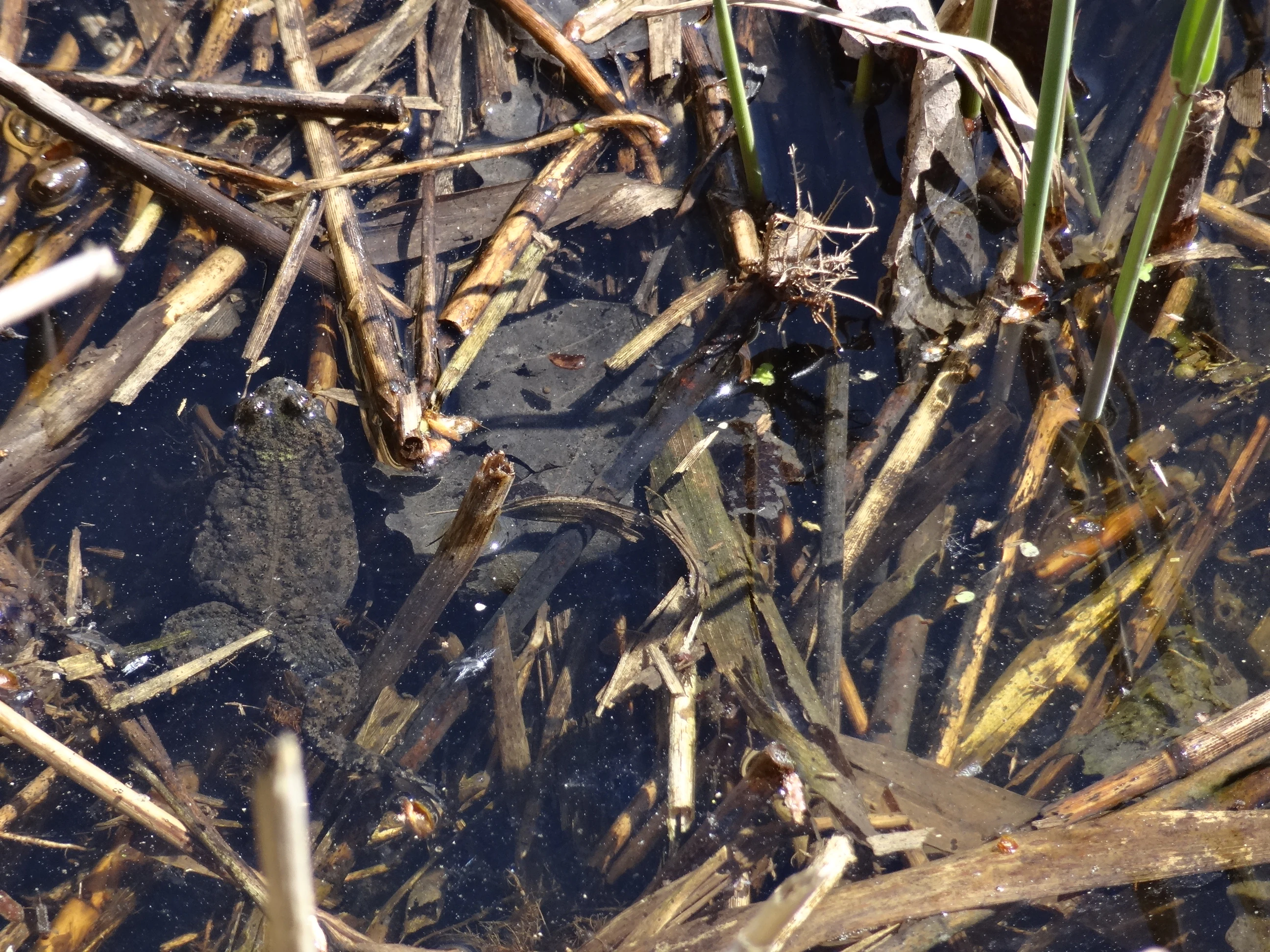
A dark, warty toad sitting in shallow water filled with submerged twigs, reeds, and organic debris.
A European fire-bellied toad resting in the marshy waters of the Manušické rybníky nature reserve.

Top sights and standout views in Manušické rybníky

A compact cluster of seven historically documented fishponds in the Česká Lípa basin, with documented origins reaching back to 1575.

Designated as a přírodní památka in 2012 and registered as a Site of Community Importance in 2013, primarily for the protection of the fire-bellied toad (Bombina bombina).

A mosaic of freshwater, marsh, peatland remnants, and pine-oak woodland supporting rare wetland plants such as southern bladderwort and the May-flowering marsh orchid.

A functioning node in the wider Českolipsko amphibian network, linked to Sites of Community Importance on the Ploučnice river system.

A focal point for ongoing regional land-use debates, particularly around a planned realignment of the I/9 road close to the protected boundary.

Best time to visit Manušické rybníky

The pond landscape of Manušické rybníky changes most visibly between spring and high summer. In late April and May, rising water levels and the greening of marginal vegetation coincide with the peak amphibian breeding season, when fire-bellied toads and other frogs become vocal around the larger ponds and the May-flowering marsh orchid blooms in adjacent meadows. The wet meadows between the ponds tend to stay flooded longest in this period, producing a strong sense of wetland character.

Late spring into early summer is generally the most rewarding window for observing the site’s birdlife, when little grebes, gadwalls, and mute swans are active on the water and woodland species such as the golden oriole can be heard from the surrounding trees. Outside the breeding season, summer brings drier margins and more open meadow vistas, while the drained basin of the former Velký Široký rybník remains a reminder of the site’s complex hydrological history. No formal visitor infrastructure is documented, so visits are best treated as low-key nature observation along the bordering cycle route and paths between the ponds.


Monthly climate preview

Review long term monthly averages and historical precipitation rhythms for Manušické rybníky

Manušické rybníky Climate Normals and Measured Annual Temperature Patterns

Representative coordinate records outline the measured annual temperature and precipitation rhythm across twelve distinct months for Manušické rybníky. Accessing the complete monthly climate profile reveals detailed temperature extremes and precipitation averages across the protected area.
Annual mean9 °C
-2 °C20 °C
Jan-2°
Feb-1°
Mar
Apr
May14°
Jun18°
Jul20°
Aug19°
Sep14°
Oct
Nov
Dec-1°
Warmest month
July

19.8 °C

Coolest month
January

-2.3 °C

Wettest month
July

2.4 mm/day

Driest month
February

1 mm/day

Park location guide

Geography guide, regional context, and park location map for Manušické rybníky

Manušické rybníky park geography, regions, and map view in Czechia

Understand where Manušické rybníky sits in Czechia through a broader geographic reading of the surrounding landscape, nearby location context, and its mapped position within the national park landscape.

How Manušické rybníky fits into Czechia

Czech Republic is a landlocked Central European country with a population of approximately 10.9 million people. The nation was established as an independent state on January 1, 1993, following the dissolution of Czechoslovakia. Its capital and largest city is Prague, with other major urban centers including Brno, Ostrava, Plzeň, and Liberec.

Wider geography shaping Manušické rybníky in Czechia

The Czech Republic is a landlocked country in Central Europe. It is bordered by Germany to the west, Austria to the south, Poland to the northeast, and Slovakia to the southeast. The landscape is predominantly hilly, with the territory covering 78,871 square kilometers.

Map view of Manušické rybníky

Use this park location map to pinpoint Manušické rybníky in Czechia, understand its exact geographic position, and read its mapped placement within the surrounding landscape more clearly.

Pigeon | © OpenStreetMap contributors

Location context for Manušické rybníky

Liberec Region
Recorded earthquake history

Explore the Recorded Earthquake History of Manušické rybníky

View the comprehensive archive of seismic events mapped to the surroundings of Manušické rybníky. This MoriAtlas collection presents historical records and data points to provide geographic context for seismic activity observed near this protected nature monument.

Manušické rybníky Earthquake History

Catalogued events

31 events

Strongest magnitude

Magnitude 3.7

Most recent event

Dec 7, 1991

This history includes earthquakes recorded inside the park or within 50 km of its borders

Visualizing the lowland fishponds, wetlands, and protected habitats of northern Bohemia

Manušické rybníky Landscape and Habitat Photography

Visual documentation captures the network of interconnected fishponds, wetland vegetation, and lowland terrain defining Manušické rybníky. Examining field photography reveals the characteristic habitats of the protected nature monument and surrounding Bohemian basin.

A tranquil pond surrounded by deciduous trees and shoreline vegetation under a clear blue sky.

A still pond reflecting birch trees and a clear blue sky, with reeds and grassy banks in the foreground.

A still pond surrounded by dense green forest and reeds, reflecting the trees on the water surface.

A narrow gravel and dirt path lined with green trees and wild vegetation leads alongside a pond under bright morning light.

A small, still pond surrounded by grasses, reeds, and bare trees in early spring.

A calm, reflective pond surrounded by dense reeds and a deciduous forest, viewed from a shaded bank with overhanging tree branches in the foreground.

A dark, warty toad sitting in shallow water filled with submerged twigs, reeds, and organic debris.

Park atlas

Discover related protected areas, wetland reserves, and lowland nature monuments nearby.

Explore Parks Near Manušické Rybníky and Surrounding Regional Landscapes

Compare Manušické rybníky with other protected areas across the surrounding northern Bohemia region. Expand your geographic exploration by browsing adjacent lowland habitats and connected wetland ecosystems.
A watercolor illustration of rolling hills and a green landscape with a soft, abstract style.
Nature reserveLiberec Region
About 12 km away#1 closest

Southwest

Ronov Nature Reserve: Protected Volcanic Geography and Scree Forest Ecosystems in Liberec Region

Volcanic landmark with basalt talus slopes and historic ruins

Ronov rises as a distinctively shaped basalt cone from the rolling terrain of the northern Czech Republic. This nature reserve offers significant insight into the geological and botanical character of the Ralská pahorkatina, featuring extensive stone seas and rare plant habitats situated around ancient castle remains.

Area
0.09 km²
Established
1995
IUCN
IV
Relief
Mountain
Natural monumentÚstecký kraj
About 13 km away#2 closest

Northwest

Sojčí rokle Natural Monument: Atlas and Geography of the Ústecký kraj Sandstone Gorge

A protected ravine sanctuary within the Bohemian Switzerland landscape region.

The Sojčí rokle natural monument features a deep, moist sandstone gorge that sustains a specialized microclimate. Located near Janská in the Ústecký kraj, the site serves as a vital ecological corridor with unique oak-hornbeam forests and rare plant life, representing the intricate rock-carved geography that defines the wider protected landscape of northern Bohemia.

Area
0.035 km²
Established
2016
IUCN
IV
Relief
Upland
Watercolor illustration of rolling green hills, forests, and distant mountains
National parkCzechia
14 km away#3 closest

Northwest

Bohemian Switzerland National Park: Czech Sandstone Protected Landscape and Map Exploration

Discover its unique terrain and protected area geography.

Bohemian Switzerland National Park is a protected area in the Czech Republic known for its exceptional sandstone geology. This national park showcases a dramatic landscape of towering rock formations, deep gorges, and striking canyons, forming a significant part of the Elbe Sandstone Mountains. Through MoriAtlas, users can explore its mapped protected boundaries, understand its regional geographic context, and appreciate its unique natural heritage.

Area
79 km²
Established
2000
IUCN
II
Relief
Mixed relief
A soft watercolor painting of a hilly landscape featuring pine trees and low-lying vegetation in shades of green, yellow, and red, with a pale background.
Natural monumentLiberec Region
About 15 km away#4 closest

South

Martinské stěny Natural Monument: Sandstone Cliff Geography and Protected Landscapes

Geomorphology and sandstone terrain in the Liberec Region

Martinské stěny features a prominent quartz sandstone cliff wall shaped by geological forces in the Bohemian Cretaceous Basin. This natural monument serves as a key protected area for heath and lichen communities, representing the unique cliff-side geography found throughout the Liberec Region in the northern Czech Republic.

Area
0.032 km²
Established
2002
IUCN
III
Relief
Upland
A watercolor landscape illustration showing a winding river flowing through a lush green valley with distant hills.
Natural monumentÚstecký kraj
About 17 km away#5 closest

Northwest

Meandry Chřibské Kamenice: Geography of a Bohemian Natural Monument

Protected river meanders and sandstone valley terrain in northern Bohemia

Meandry Chřibské Kamenice serves as a vital protected area in the Czech Republic, specifically preserving the natural river dynamics of the Chřibská Kamenice stream. Its narrow floodplain, characterized by evolving meanders, riparian woodland, and marshy habitats, offers a focused look at how watercourses shape the sandstone landscapes of the Ústecký kraj region.

Area
0.085 km²
Established
1996
IUCN
III
Relief
Lowland
A watercolor painting showing a winding river through a green landscape with soft hills in the distance and tall grasses in the foreground.
Natural monumentLiberec Region
About 18 km away#6 closest

Southeast

Meandry Ploučnice u Mimoně: Mapping the Protected River Landscapes of the Liberec Region

Unregulated Bohemian river meanders and wetland habitats

Spanning 49 hectares in the Liberec Region, Meandry Ploučnice u Mimoně preserves a naturally shifting river corridor. The monument protects complex meander lakes and active floodplain dynamics, providing a sanctuary for rare dragonfly, butterfly, and mammal populations within an otherwise developed lowland environment.

Area
0.494 km²
Established
2014
IUCN
IV
Relief
Lowland
Natural monumentLiberec Region
About 18 km away#7 closest

East

Vranovské skály Natural Monument: Protected Sandstone Towers in the Liberec Region

Geographic analysis of sandstone pillars and protected upland forest terrain.

Vranovské skály stands as a significant natural monument in the Liberec Region, preserving a cluster of bright sandstone towers that contrast with the dark forests of the Ralská pahorkatina. This protected area includes several named formations and botanical niches shaped by historical land use. Its geography offers a clear example of sandstone geomorphology and its role in maintaining regional biodiversity within the broader context of northern Bohemia.

Area
0.129 km²
Established
1991
IUCN
IV
Relief
Upland
Watercolor painting showing a landscape with green hills, trees, and a river winding through the scene
National parkGermany
22 km away#8 closest

Northwest

Saxon Switzerland National Park: Protected Area Geography and Map Exploration

Discover its mapped boundaries and regional landscape context.

Saxon Switzerland National Park, a protected national park in Germany, offers a distinct focus for geographic and atlas-based discovery. This page details the park's specific protected landscape, its mapped boundaries, and its contribution to the regional geography. MoriAtlas allows for in-depth exploration of such natural areas, providing essential context for understanding their place within broader natural systems and mapped terrains.

Area
93.5 km²
Established
1990
IUCN
II
Visitors
1.7M annual

Common questions about visiting, size, designation, and location context for Manušické rybníky

Manušické rybníky FAQs for park facts, access, geography, and protected area context

Find quick answers about Manušické rybníky, including protected-area facts, park geography, trail and visitor context, and how the park fits into its surrounding country and regional landscape.
MoriAtlas Explorer

Continue Your Protected Areas Search Across the Global Atlas

Deepen your exploration by continuing the structured search for national parks and protected areas worldwide. Utilize the comprehensive filtering capabilities to compare different conservation landscapes and refine your understanding of global park geography. Discover more about the distribution and characteristics of protected natural areas.

Global natural geography