

Mori Atlas logo
Protected areaManzano Mountain Wilderness

Analyzing the dramatic relief, forest diversity, and raptor migration corridors of this rugged wilderness.

Manzano Mountain Wilderness: A Protected Landscape in the Central New Mexico Mountains

Manzano Mountain Wilderness protects 36,875 acres of fractured, canyon-cut terrain in central New Mexico. This region exhibits a striking vertical transformation from pinyon-juniper woodlands at lower elevations to high-altitude stands of aspen and spruce-fir near Manzano Peak. The protected area serves as a critical raptor migration corridor and preserves a quiet, non-mechanized landscape that offers profound insight into the diverse ecological geography of the American Southwest.

wilderness areamountain rangecanyonsaspen forestponderosa pine forestpinyon-juniper woodland

Manzano Mountain Wilderness

Protected area

Park overview

Structured park overview, official facts, and landscape profile for Manzano Mountain Wilderness

Manzano Mountain Wilderness park facts, protected area profile, and essential visitor context

Review the core facts for Manzano Mountain Wilderness, including designation, size, terrain, visitor scale, habitats, and operating context in one park-focused overview.

About Manzano Mountain Wilderness

Manzano Mountain Wilderness is a compact but ecologically rich protected landscape in central New Mexico, set within the southern end of the Manzano Mountains. Although the range looks modest from a distance, up close the mountains are surprisingly rugged, carved by a network of deep canyons that descend on both sides of the main north-south crest. The wilderness stretches roughly 17 miles along the range and only 3 to 5 miles across, yet within that narrow footprint it captures an elevational gradient of nearly 4,000 feet.

The area lies within the Cibola National Forest and is administered by the U.S. Forest Service under the National Wilderness Preservation System. Because it is a Wilderness Area, visitors encounter a landscape with no motorized or mechanized access except for permitted uses, no roads, buildings, logging, or mining, and only trails, foot travel, and non-motorized recreation. This protected status preserves the mountains as a continuous block of relatively undisturbed habitat in a state where many landscapes show long histories of grazing, logging, or development.

Ecologically, the wilderness stands out for the way so many distinct vegetation zones are compressed into a small area. The foothills host pinyon pine and juniper woodlands with grasslands, the middle slopes are blanketed in ponderosa pine, and above roughly 8,500 feet the forests shift to cool, often misty stands of aspen and spruce-fir. Bigtooth maples, scattered through several canyons, add a seasonal flourish that draws visitors in autumn, especially near the Fourth of July Campground area at the northern end of the wilderness.

Alongside its natural values, the wilderness carries cultural depth. The name "Manzano," meaning "apple" in Spanish, was given by early Spanish settlers who found ancient apple trees planted by missionaries serving the Pueblo Indians in the 17th century. That early mission-era imprint remains part of the broader cultural landscape around the wilderness, connecting today's protected natural area to a long human story of contact, settlement, and adaptation in central New Mexico.

Quick facts and research context for Manzano Mountain Wilderness

Manzano Mountain Wilderness lies in central New Mexico within the Cibola National Forest, spanning western Torrance County and eastern Valencia County. It is roughly 50 miles south-southeast of Albuquerque and encompasses about 36,875 acres, with elevations ranging from around 6,100 feet near the base to 10,098 feet at Manzano Peak.

The area was designated a Wilderness Area in 1978 and is classified as IUCN category Ib, administered by the U.S. Forest Service. Motorsport, mechanized travel, logging, mining, and new roads are prohibited, preserving the landscape in a largely natural and undeveloped state.

Protection and recognition

Terrestrial protected area classification, management scope, and status details

Manzano Mountain Wilderness Protection Status and Recognition Records

Manzano Mountain Wilderness maintains a defined terrestrial protection status within its regional conservation framework. Documented designation records outline the management scope and official administrative context for this protected natural area.

Protection details

Protection scope
Terrestrial
Transboundary protection
No
Park context

Deeper park guide and search-rich context for Manzano Mountain Wilderness

Manzano Mountain Wilderness history, landscape, wildlife, and travel context

Explore Manzano Mountain Wilderness through its history, landscape character, ecosystems, wildlife, conservation priorities, cultural context, and seasonal travel timing in a structured park guide built for atlas discovery and search intent.

Why Manzano Mountain Wilderness stands out

The wilderness is best known for the contrast between its apparent low, distant profile and the rugged, canyon-scarred reality up close, with deeply incised canyons radiating from a north-south mountain crest. It is also recognized for its strong autumn color displays from bigtooth maples in canyons like Fourth of July, and for serving as a meaningful raptor migration corridor through central New Mexico. Its layered vegetation, from pinyon-juniper foothills through ponderosa pine to aspen and spruce-fir on the highest slopes, gives the area a compact but unusually diverse ecological profile for a single New Mexico mountain range.
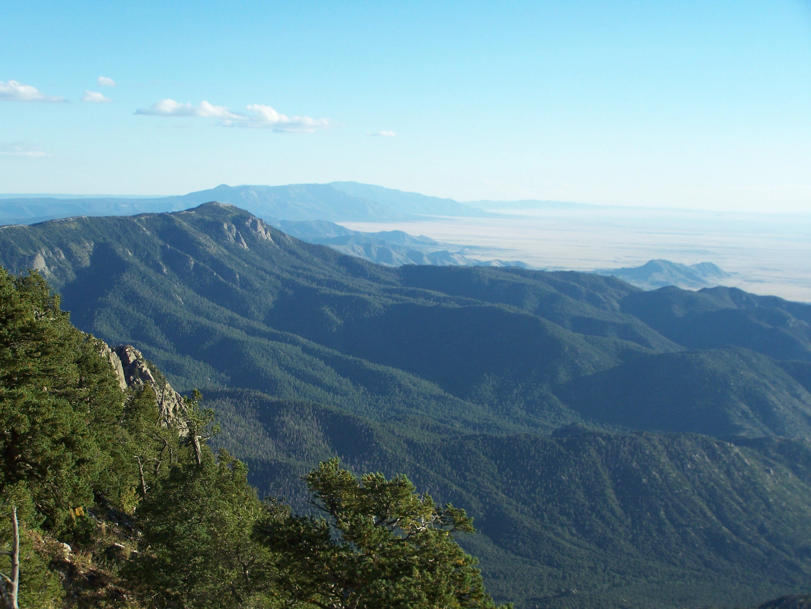
Manzano Mountains from the north
A view looking south toward the Manzano Mountains, with the Manzanita and Sandia Mountains visible to the north.

Manzano Mountain Wilderness history and protected-area timeline

The Manzano Mountain Wilderness area was formally created in 1978 as part of the National Wilderness Preservation System, which protects selected federal lands as wilderness under U.S. law. Its designation placed the rugged core of the Manzano Mountains into long-term protection and set the strict non-motorized, non-mechanized management framework that still governs the area today.

The name "Manzano" predates the federal designation by centuries. According to tradition, early Spanish settlers discovered ancient apple trees growing a few miles east of the present-day wilderness. Those trees were believed to have been planted by Spanish missionaries in the 17th century as they worked among the Pueblo Indians of the region. The resulting name, simply meaning "apple" in Spanish, became attached to the entire range and later to the wilderness that protects its center.

Under federal wilderness rules, no vehicles, bicycles, roads, new buildings, logging, or mining are permitted within the area. Camping and fishing are allowed with proper permits, and hunting in season is allowed in National Forest and BLM wilderness, in line with the broader policy framework in which the Manzano area exists.

Manzano Mountain Wilderness landscape and geographic character

The Manzano Mountains form a relatively modest, north-south range, but up close the terrain is far more dramatic than the rounded profile seen from a distance. The wilderness occupies a long, narrow band centered on the crest of the range and extends down both the eastern and western slopes. The crest itself varies in elevation from about 8,200 feet up to 10,098 feet at Manzano Peak, the highest point in the wilderness.

From that ridgeline, numerous steep canyons radiate outward, slicing deeply into the mountain mass and creating a layered, fractured topography. The result is a landscape of dramatic relief, with canyon bottoms often hundreds of feet below the surrounding ridges, scattered talus, rocky outcrops, and intermittent springs and streams. Elevation in the wilderness overall runs from roughly 6,100 feet at the base to the alpine-feeling heights near Manzano Peak, providing a strong vertical sense in a relatively small area.

Where the wild mountains meet the gentler country around them, the foothills and lower slopes soften into pinyon-juniper woodland, open grassland, and ranch country. This transition zone frames the wilderness and gives the protected area a clear boundary between the heavily used surrounding lands and the more untouched core of the mountains.

Manzano Mountain Wilderness ecosystems, habitats, and plant life

The wilderness preserves an unusually compact mosaic of vegetation zones that mirror the elevation gradient of the southern Rocky Mountains. The highest slopes, above roughly 8,500 feet, support a cool montane forest dominated by quaking aspen intermixed with spruce and fir, giving those upper reaches a distinctly different character from the warmer, drier country below.

Below this high-elevation band, between approximately 6,500 and 8,500 feet, ponderosa pine takes over as the dominant tree, forming extensive pine forests across much of the mid-elevation slopes. Further down, the lowest elevations of the wilderness transition into pinyon pine and juniper woodlands interwoven with grasslands, reflecting the semiarid character of central New Mexico and providing habitat for a different set of plant and animal communities.

A signature natural feature of the wilderness is the presence of bigtooth maple groves in several of the deeper canyons. Where they occur, especially around the Fourth of July area, these trees create dense stands that transform the canyon walls into vivid displays of yellow, orange, and red each fall. Small springs and streams add further diversity, though water becomes scarce during dry periods, and forest fire has long been a recurring natural process shaping the vegetation structure and age classes across the range.

Manzano Mountain Wilderness wildlife and species highlights

The wildlife of Manzano Mountain Wilderness is broadly typical of central New Mexico mountain environments. Mule deer range widely through the canyons and forested slopes, while elk, American black bear, pronghorn, and mountain lion also occur within or near the protected area, reflecting the diversity of habitats from foothill grasslands to high forests.

Wild turkey is among the more notable bird species present and is part of the broader upland game community in the range. The wilderness is especially significant for raptors, as its north-south orientation and location make it a recognized raptor migration corridor. During migration seasons, the area attracts birdwatchers and raptor monitors who come to observe and count birds of prey in passage through the Manzano crest.

Wildfire is also an influential ecological force in the area. Major fire events, including burns that affected more than 25,000 acres across the wilderness and adjacent lands in 2007 and 2008, have shaped habitat structure and contributed to a mosaic of successional stages that influence which species dominate different parts of the mountains in any given period.

Manzano Mountain Wilderness conservation status and protection priorities

The principal conservation importance of the Manzano Mountain Wilderness lies in its formal place within the National Wilderness Preservation System, which gives the area one of the highest levels of habitat protection available for federal lands in the United States. Within that framework, the U.S. Forest Service is required to keep the wilderness essentially untouched, with no motorized or mechanized travel, no roads, no logging, and no mining, allowing ecological processes to operate with minimal direct human interference.

This protection preserves a connected block of relatively unmodified habitat across a significant elevational gradient, including high-elevation aspen and spruce-fir stands, mid-elevation ponderosa pine forests, and lower pinyon-juniper woodlands. That continuity is ecologically significant because the linked habitats support species that range seasonally across elevation zones, such as mule deer, elk, black bear, and mountain lion.

The wilderness also plays a meaningful role as a raptor migration corridor, and its continued protection helps maintain that function in a region where migration routes can be sensitive to disturbance. Designation as IUCN category Ib further underscores the area's formal recognition as a landscape-level protected area, contributing to the broader conservation network of forests, wildernesses, and state and national monuments that together define conservation geography in central New Mexico.

Manzano Mountain Wilderness cultural meaning and human context

The Manzano Mountains carry a strong Spanish and Pueblo cultural imprint that long predates any modern conservation status. The name "Manzano" itself, meaning "apple" in Spanish, is rooted in the encounters between Spanish missionaries and Pueblo communities in the 17th century, when missionaries reportedly planted apple trees in the area around the range. Those ancient trees gave the mountains their enduring name and tied the landscape to the broader story of Spanish mission expansion among the Pueblo peoples of New Mexico.

On the eastern side of the range, the cultural connection remains visible in places like Manzano Mountains State Park and the Quarai ruins within the Salinas Pueblo Missions National Monument. Quarai was a Pueblo village and a 17th-century Franciscan mission site, and its dramatic ruins preserve both the Pueblo and Spanish mission heritage of the region. Together with the wilderness itself, these nearby cultural sites place the protected natural landscape within a larger regional story of indigenous, colonial, and modern New Mexican history.

Top sights and standout views in Manzano Mountain Wilderness

Among the wilderness's strongest points of distinction are its rugged, deeply canyoned terrain that rewards close-up exploration, and its compressed elevational range that delivers several distinct forest types within a relatively short hike. The bigtooth maple groves in canyons like Fourth of July stand out for their vivid autumn color, while the 22-mile Crest Trail and its network of feeder trails offer the area's most immersive way to experience the mountains on foot.

Equally distinctive is the wilderness's role as a recognized raptor migration corridor, drawing birdwatchers and counters during migration seasons. The nearby cultural sites, including Quarai within the Salinas Pueblo Missions National Monument and the surrounding Manzano Mountains State Park, add a layer of historical depth that complements the natural landscape and gives the broader region a uniquely combined wild and historical character.

Best time to visit Manzano Mountain Wilderness

The most popular time to visit the Manzano Mountain Wilderness is autumn, when the bigtooth maple groves in several canyons reach peak color, particularly around the Fourth of July area near the northern end of the wilderness. Cooler temperatures also make extended hiking on the Crest Trail or up to Manzano Peak more comfortable than in midsummer.

Spring and fall migration seasons are the key periods for visitors interested in raptors, when the north-south oriented range serves as a meaningful corridor for migrating birds of prey. Summer remains viable for high-country hiking among the aspens and spruce-fir stands, though afternoon thunderstorms and the higher fire risk during dry periods are part of the seasonal character. Winter can be the quietest season, with snow more likely at the higher elevations and a general sense of solitude across the canyons and ridgelines.
Monthly climate preview

Trace long term temperature averages and monthly precipitation records across representative elevations

Manzano Mountain Wilderness Climate Normals and Annual Weather Patterns

Historical climate records from representative coordinates reveal the measured annual temperature progression and monthly precipitation rhythm for Manzano Mountain Wilderness. Detailed monthly climate normals provide broader context for studying long term meteorological trends across the protected terrain.
Annual mean12 °C
0 °C24 °C
Jan
Feb
Mar
Apr11°
May17°
Jun22°
Jul24°
Aug22°
Sep19°
Oct12°
Nov
Dec
Warmest month
July

23.7 °C

Coolest month
December

0.4 °C

Wettest month
July

2.1 mm/day

Driest month
February

0.4 mm/day

Park location guide

Geography guide, regional context, and park location map for Manzano Mountain Wilderness

Manzano Mountain Wilderness park geography, regions, and map view in United States of America

Understand where Manzano Mountain Wilderness sits in United States of America through a broader geographic reading of the surrounding landscape, nearby location context, and its mapped position within the national park landscape.

How Manzano Mountain Wilderness fits into United States of America

The United States of America is a federal presidential republic and one of the world's largest countries by area and population. It consists of 50 states across a vast territory spanning multiple time zones, with its capital in Washington, D.C. and largest city in New York City. The nation has a diverse economy, influential political system, and significant cultural and military presence globally.

Wider geography shaping Manzano Mountain Wilderness in United States of America

The United States occupies a vast territory in North America, bordered by Canada to the north and Mexico to the south. The 48 contiguous states stretch from the Atlantic to the Pacific Ocean, while Alaska occupies the northwestern region and Hawaii is an archipelago in the Pacific. The country encompasses diverse terrain including the Rocky Mountains, Appalachian Mountains, Great Plains, and extensive river systems.

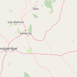
Map view of Manzano Mountain Wilderness

Use this park location map to pinpoint Manzano Mountain Wilderness in United States of America, understand its exact geographic position, and read its mapped placement within the surrounding landscape more clearly.

Pigeon | © OpenStreetMap contributors

Location context for Manzano Mountain Wilderness

New Mexico
Recorded earthquake history

Explore Historical Earthquake Records Associated with Manzano Mountain Wilderness

Review documented seismic events near the canyons and peaks of Manzano Mountain Wilderness through this structured data collection. MoriAtlas organizes historical USGS records to help users understand the seismic context of this central New Mexico landscape.

Manzano Mountain Wilderness Earthquake History

Catalogued events

43 events

Strongest magnitude

Magnitude 4.7

Most recent event

Aug 18, 2026

This history includes earthquakes recorded inside the park or within 50 km of its borders

Visual exploration of canyon-cut terrain, forest gradients, and protected landscapes

Manzano Mountain Wilderness Photos, Rugged Canyons, and Mountain Scenery

Visual records capture the steep canyons, layered pine forests, and high ridgelines that define the rugged topography of Manzano Mountain Wilderness. Studying protected area imagery reveals the compact ecological gradients and dramatic relief hidden across central New Mexico.

Manzano Mountains from the north

Fall maple in Fourth of July Canyon

Park atlas

Compare surrounding mountain ranges, canyon terrain, and connected regional conservation landscapes

Explore Other Parks Near Manzano Mountain Wilderness and Central New Mexico Protected Areas

Compare Manzano Mountain Wilderness with adjacent protected areas and regional mountain ranges across central New Mexico. Extending geographic exploration beyond the local ridge reveals broader patterns of canyon terrain and protected public lands.
Protected landscapeNew Mexico
83 km away#1 closest

North

Santa Fe National Forest: Geographic Atlas and Protected Landscape Overview

New Mexico mountain geography and wilderness mapping

Santa Fe National Forest spans more than 1.5 million acres of Northern New Mexico, featuring a dramatic transition from canyon river systems to the high elevations of the Pecos Wilderness. This protected landscape contains a complex network of forest districts across the Jemez and Sangre de Cristo Mountains, defined by volcanic plateaus, alpine basins, and seasonal aspen forests. Use this resource to understand the park boundaries, regional mountain geography, and the interconnected nature of these protected lands.

Area
6,306.83 km²
Established
1915
Relief
Mountain
Access
Easy access
Protected landscapeNew Mexico
96 km away#2 closest

South

Lincoln National Forest Protected Landscape: Mapping the New Mexico Environmental Gradient

Geography of the Sacramento, Capitan, and Guadalupe Mountains

Lincoln National Forest encompasses a remarkable vertical transition across three ranger districts in New Mexico. The area protects complex mountain landscapes including the east-west Capitan range and the ancient reef geology of the Guadalupe Mountains, serving as a critical example of ecological diversity within a single federal unit.

Area
4,467.31 km²
Established
1902
Visitors
735.2K annual
Relief
Mountain
Wildlife reserveSandoval County
99 km away#3 closest

North

Dome Wilderness: Volcanic Domes and Protected Forest Geography in Sandoval County

High-desert wilderness area in the Jemez Mountains

Dome Wilderness is a protected natural area in Sandoval County, New Mexico, defined by its exposed volcanic domes and dramatic post-fire recovery landscape. Sitting within the Santa Fe National Forest, the terrain preserves both natural geological features and significant prehistoric archaeological sites. Its unique visual character, shaped by the 1996 Dome Fire, contrasts open, fire-swept slopes with dense coniferous forest stands.

Area
21 km²
Established
1980
IUCN
Ib
Relief
Mountain
Protected landscapeSandoval County
About 110 km away#4 closest

North

Jemez National Recreation Area: Geography and Protected Land Map Overview

Exploring volcanic plateaus and river canyons in northern New Mexico

Jemez National Recreation Area represents a key protected landscape in Sandoval County, encompassing diverse forested uplands and steep volcanic canyons. The area serves as a focal point for understanding the geological legacy of the Jemez Mountains, providing a clear window into how river incision and ancient volcanic activity have shaped the regional terrain. Its proximity to national forest lands and the Valles Caldera system makes it a vital unit for geographic study and mapped landscape exploration.

Area
233.3 km²
Established
1993
Visitors
1.6M annual
Relief
Mountain
Protected landscapeNew Mexico
150 km away#5 closest

Southwest

Gila National Forest: A Geographic Overview of New Mexico's Protected Wilderness Core

Mapped terrain, forest boundaries, and regional wilderness character

Gila National Forest stands as a critical protected landscape in New Mexico, encompassing immense mountain ranges, narrow river gorges, and extensive backcountry basins. This atlas entry details the forest's topographic transition from high-altitude ponderosa stands to desert lowlands, highlighting its status as the foundational site for the global wilderness movement and a stronghold for regional ecological diversity.

Area
10,969.7 km²
Established
1905
Relief
Mountain
Climate
Temperate
National parkNew Mexico
187 km away#6 closest

South

White Sands National Park: National Park with Unique Dune Landscape in New Mexico

Explore its protected boundaries and desert geography.

White Sands National Park is a protected national park renowned for its stunning gypsum dunes, offering a unique landscape within New Mexico's geography. This page provides detailed information on its mapped protected area, serving as a valuable resource for understanding the park's specific geographic context and its identity as a significant protected natural landscape.

Area
601.3 km²
Established
2019
IUCN
V
Visitors
729.1K annual
Wildlife reserveNew Mexico
201 km away#7 closest

Southwest

Gila Wilderness: An In-Depth Look at the Protected Landscape and Geography of New Mexico

Mapped terrain, alpine peaks, and diverse forest ecosystems within the American Southwest

The Gila Wilderness stands as a primary case study in landscape conservation, protecting a massive network of unroaded river canyons and forest-covered mountains in New Mexico. This region serves as a bridge between temperate montane zones and arid desert environments, creating a unique ecological atlas defined by significant altitudinal gradients, volcanic features, and extensive watershed networks across the Mogollon range.

Area
225,820 km²
Established
1924
IUCN
Ib
Relief
Mountain
Protected landscapeNew Mexico
225 km away#8 closest

Northeast

Kiowa National Grassland: Protected Landscapes, Canyon Terrain, and Prairie Geography

Northeastern New Mexico shortgrass prairie and river canyon systems.

Kiowa National Grassland represents a distinctive protected landscape within the southwestern Great Plains, featuring a mix of rolling steppe, pinyon-juniper woodland, and the deep gorges of the Canadian River Canyon. This area offers significant insight into the regional geography of New Mexico, where historic Santa Fe Trail corridors and seasonal playa lakes define the local terrain and ecosystem.

Area
554.95 km²
Established
1960
Relief
Upland
Climate
Temperate

Common questions about visiting, size, designation, and location context for Manzano Mountain Wilderness

Manzano Mountain Wilderness FAQs for park facts, access, geography, and protected area context

Find quick answers about Manzano Mountain Wilderness, including protected-area facts, park geography, trail and visitor context, and how the park fits into its surrounding country and regional landscape.
MoriAtlas Explorer

Continue Your Protected Areas Search Across the Global Atlas

Deepen your exploration by continuing the structured search for national parks and protected areas worldwide. Utilize the comprehensive filtering capabilities to compare different conservation landscapes and refine your understanding of global park geography. Discover more about the distribution and characteristics of protected natural areas.

Global natural geography