
Mori Atlas logo
National parkParc national de la Marahoué

Tracing the river corridors and ecological transition zones of a vital West African national park

Parc national de la Marahoué: A Mapped Analysis of the Sassandra-Marahoué Protected Landscape

Parc national de la Marahoué serves as a significant ecological transition site in west-central Côte d'Ivoire, where the Sudano-Guinean savanna meets dense humid forest. This protected area, defined by the winding course of the Marahoué River or Red Bandama, encompasses a complex mosaic of riparian habitats and terrestrial ecosystems within the Sassandra-Marahoué district. Data reveals the historical and ongoing environmental shifts shaping this reserve, providing a clear perspective on its role as a botanical and mammalian refuge in the regional geography.

national parkCôte d'IvoireWest Africasavanna-forest transitionSudano-Guinean savannadense humid forest

Parc national de la Marahoué

National park

Park overview

Structured park overview, official facts, and landscape profile for Marahoué National Park

Marahoué National Park park facts, protected area profile, and essential visitor context

Review the core facts for Marahoué National Park, including designation, size, terrain, visitor scale, habitats, and operating context in one park-focused overview.

About Marahoué National Park

Marahoué National Park represents one of the eight national parks of Côte d'Ivoire and occupies an important geographic and ecological niche within the country's protected-area network. Located in west-central Ivory Coast within the Sassandra-Marahoué district, the park sits along one of the country's key road corridors, between Bouaflé and Daloa, and lies in proximity to Lake Kossou and the political capital, Yamoussoukro. With roughly 101,000 hectares of designated territory, it is among the larger national parks in the country.

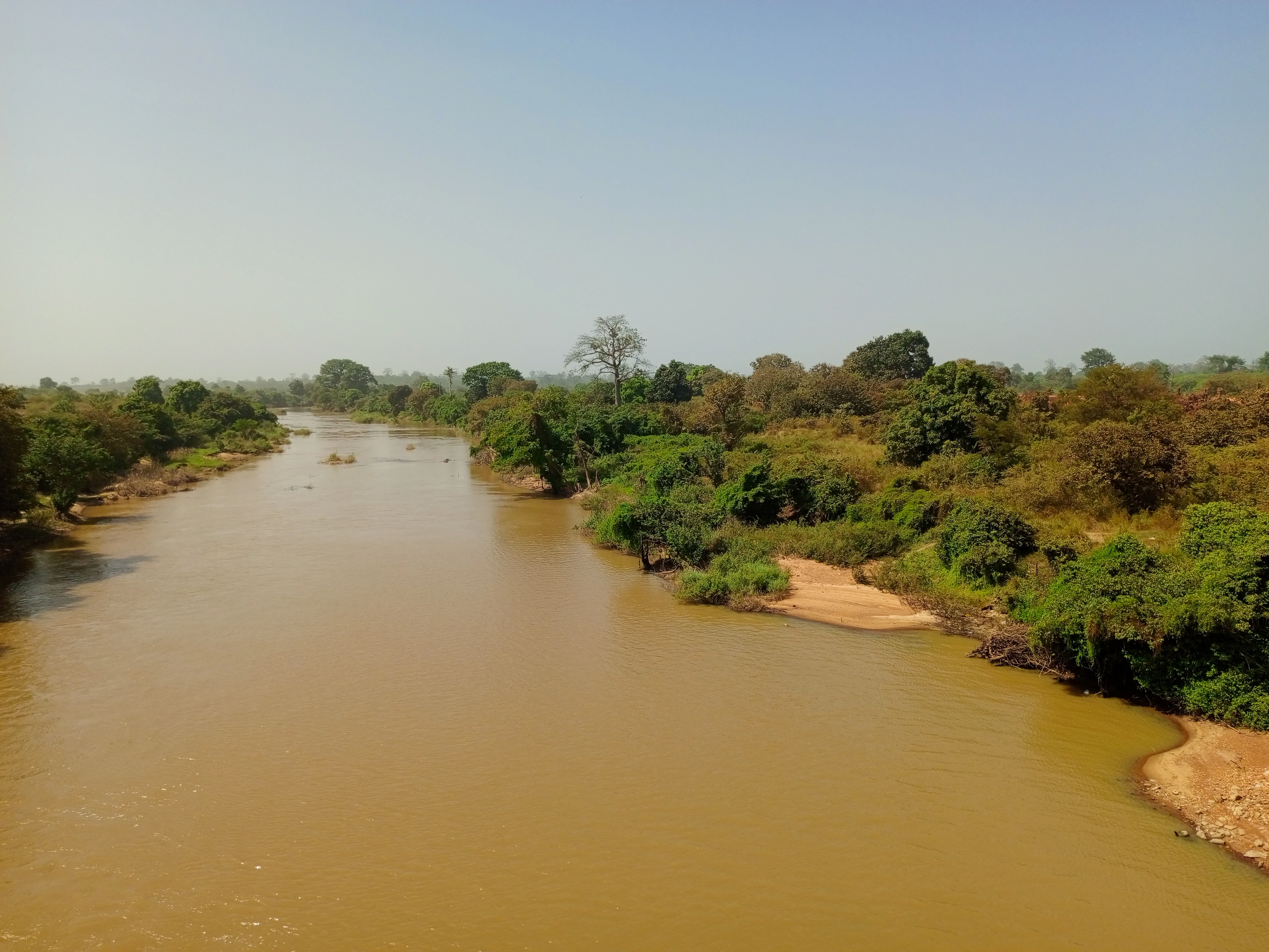
The park's identity is deeply tied to the river system that gives it its name. The Marahoué River, also referred to as the Red Bandama, traverses the protected area, providing hydrological structure, riparian habitat, and a clear geographic reference for visitors and researchers. Beyond its hydrological importance, this river corridor shaped the historical human and ecological use of the surrounding region.

What distinguishes Marahoué ecologically is its location at the junction of two major West African biomes: the Sudano-Guinean savanna to the north and the dense humid forest to the south. This transitional position made the park unusually biodiverse in the West African context, with botanical surveys recording around 600 plant species and a mammal community mixing forest-dependent and savanna-tolerant species. The coexistence of these communities was historically one of Marahoué's strongest identity markers and a key reason for its protected status.

The park's modern story is also defined by ecological challenge. Once a stronghold for species such as bongo, African buffalo, and forest elephants, Marahoué has experienced significant wildlife decline. The translocation of the remaining elephant herd to Azagny National Park in 2014, followed by the documented local extinction of African forest elephants in 2020, marks a turning point in the park's history. As a result, Marahoué stands as both a still-relevant ecological reserve and a sobering example of the pressures facing West African protected areas.

Quick facts and research context for Marahoué National Park

Marahoué National Park is located in the Sassandra-Marahoué district of Côte d'Ivoire, approximately 350 kilometers northwest of Abidjan. Established as a national park in 1968, it covers roughly 101,000 hectares along the Bouaflé to Daloa road axis. The park is named after and crossed by the Marahoué River, historically referred to as the Red Bandama. Its territory straddles the ecological boundary between Sudano-Guinean savanna and dense humid forest, making it one of the representative transition-zone reserves in the country. The protected area holds IUCN Category II designation and forms one of Côte d'Ivoire's eight national parks.

Protection and recognition

Examine official terrestrial conservation records and designated protected area metrics.

Parc National de la Marahoué Protection Status and Terrestrial Area Records

Conservation records document the terrestrial protection status and administrative framework established for Parc national de la Marahoué. Structured international databases provide baseline metrics regarding the protected area designation and management scope.

Protection details

Protection scope
Terrestrial
WDPA ID
722
Park context

Deeper park guide and search-rich context for Marahoué National Park

Marahoué National Park history, landscape, wildlife, and travel context

Explore Marahoué National Park through its history, landscape character, ecosystems, wildlife, conservation priorities, cultural context, and seasonal travel timing in a structured park guide built for atlas discovery and search intent.

Why Marahoué National Park stands out

Marahoué National Park is best known for its position at the ecological boundary between Sudano-Guinean savanna and dense humid forest, a transition zone that allowed forest and savanna species to coexist within a single protected landscape. The park was historically significant for harboring large mammals such as bongo, African buffalo, and elephant populations, as well as for its substantial botanical diversity. Its name is closely tied to the Marahoué River, also called the Red Bandama, which crosses the reserve and shapes much of its geography.
Marahoué National Park history and protected-area timeline

The history of Marahoué National Park begins with its designation as a full fauna reserve in 1956, establishing early recognition of the area's biodiversity value. This initial protection laid the foundation for a more formal conservation framework under Ivorian law, with the application of legislation passed on August 4, 1965, aimed at protecting fauna and regulating the commercialization of seeds and plants in support of scientific, educational, and recreational interests.

The key moment in the park's institutional history came in 1968, when the reserve was officially elevated to national park status through decree number 68-80 of February 9, 1968. This transformation formalized the area's role in conserving natural habitat and biodiversity while also promoting its tourism potential. From that point on, Marahoué operated as one of the eight national parks of Côte d'Ivoire, with continuous legal protection under the country's wildlife and habitat regulations.

Over subsequent decades, the park faced mounting ecological pressures, culminating in the dramatic loss of its elephant population. The translocation of the last elephants to Azagny National Park in January 2014 marked a turning point, and by 2020, the local extinction of the African forest elephant in Marahoué was confirmed. This trajectory has shaped the park's contemporary profile as a protected area whose preservation mandate is increasingly difficult to fulfill without renewed conservation investment.

Marahoué National Park landscape and geographic character

The landscape of Marahoué National Park is defined by its position at the meeting point of two of West Africa's most significant biomes. To the north, the terrain transitions into Sudano-Guinean savanna, characterized by open grasslands dotted with scattered trees and a more seasonal climate. To the south, the park gives way to dense humid forest, with closed canopy, layered vegetation, and the higher humidity typical of the West African forest zone.

The Marahoué River, also known as the Red Bandama, serves as a defining hydrological feature, threading through the protected area and shaping its microhabitats and riparian corridors. The presence of this river system, combined with the park's proximity to the Kossou lake system, contributes to a varied topography that supports both aquatic and terrestrial ecosystems. The road corridor between Bouaflé and Daloa passes near the park, positioning it within a landscape where human settlement and agricultural land use surround, but do not penetrate, the protected core.

This combination of river, savanna-edge, and forest-edge creates a physiographic mosaic that gives Marahoué its transitional character and influences everything from its vegetation patterns to its historical wildlife communities.

Marahoué National Park ecosystems, habitats, and plant life

Marahoué's ecological identity is rooted in the interface between Sudano-Guinean savanna and dense humid forest, creating a mosaic of habitats within a relatively compact protected area. This transition zone produces layered vegetation ranging from open savanna formations in the north to closed-canopy humid forest in the south, with extensive transitional woodland along the ecological gradient.

Botanical surveys have documented approximately 600 plant species across the park, reflecting its position as a meeting point for flora of two distinct biomes. While precise forest-type composition is not extensively documented in available sources, the park's structure clearly supports both savanna and forest-associated vegetation communities, suggesting a varied canopy, understory, and ground-cover profile typical of transition zones in West Africa.

The park's ecological importance is further shaped by the Marahoué River system, which provides year-round water and supports riparian vegetation corridors. These corridors likely play a crucial role in habitat connectivity, especially for species that depend on access to water and forest cover. The combination of water, varied topography, and habitat diversity gives Marahoué a distinctive ecological signature among Côte d'Ivoire's national parks.

Marahoué National Park wildlife and species highlights

Historically, Marahoué National Park supported one of the more diverse mammal communities among West African protected areas, owing to its position at the savanna-forest boundary. The park was home to forest-associated species such as the bongo, a rare antelope typically associated with dense forest, alongside savanna-tolerant species such as the African buffalo. Primate species were also present, with baboons among the documented inhabitants.

The most emblematic wildlife story of Marahoué in recent decades, however, is the decline and eventual local extinction of the African forest elephant within the park. The last elephant population was translocated to Azagny National Park in January 2014, and by 2020, the local extinction of the African forest elephant in Marahoué was officially confirmed. This loss removed one of the park's most iconic large mammals and marked a significant ecological shift.

Despite these losses, the park remains ecologically significant for the species that continue to inhabit it. The mixture of forest and savanna wildlife, including bongo, buffalo, and primates, gives Marahoué a wildlife profile unlike parks dominated by a single biome, making it an important reference site for understanding West African transitional biodiversity even as conservation challenges mount.

Marahoué National Park conservation status and protection priorities

Marahoué National Park was established with the explicit conservation mandate of preserving the natural environment and biodiversity of the area, alongside recognition of its tourism potential. From its origins as a 1956 fauna reserve through its formal designation as a national park in 1968, protection has been central to the park's identity, supported by Ivorian wildlife legislation and regulatory frameworks.

In conservation terms, the park's significance lies primarily in its transitional ecological character. By protecting a large area at the junction of Sudano-Guinean savanna and dense humid forest, Marahoué safeguards a habitat mosaic that supports biodiversity from two biomes and the species that depend on their interface. This makes it a regionally valuable reserve for ecological connectivity and biodiversity representation, particularly in the context of West African forest and savanna systems.

However, the park's recent trajectory illustrates the conservation challenges facing many African protected areas. The documented local extinction of the African forest elephant by 2020, following the 2014 translocation of the remaining population, demonstrates how even formally protected reserves can experience significant wildlife loss under sustained pressure. As a result, Marahoué today carries conservation significance both as an active protected area and as a case study in the limits of legal protection without adequate enforcement and management capacity.

Marahoué National Park cultural meaning and human context

Marahoué National Park is situated within a historically and culturally active region of Côte d'Ivoire, near the political capital of Yamoussoukro and along the major road corridor linking Bouaflé and Daloa. The park's surroundings include communities that have long interacted with the landscape, with park records noting that more than 120,000 people live in the surrounding catchment area. This proximity to population centers reflects the integration of the protected area within a broader rural and agricultural landscape of central Ivory Coast.

The naming of the park after the Marahoué River, historically referred to as the Red Bandama, also connects it to long-standing regional geographic identities. The river serves as both an ecological and cultural reference, given its prominence in the local river network. While the available source material does not detail specific traditional land uses or indigenous cultural practices within the park boundary, the surrounding communities clearly form part of the park's broader human and cultural context.

Top sights and standout views in Marahoué National Park

Marahoué National Park stands out for several defining qualities: its transitional location between Sudano-Guinean savanna and dense humid forest, its inscription within the river corridor of the Marahoué (Red Bandama), and its role as one of Côte d'Ivoire's eight national parks. Its botanical diversity, with around 600 documented plant species, complements a mammal community that mixes forest and savanna species, including bongo and African buffalo.

At the same time, Marahoué's modern profile is shaped by the documented local extinction of its African forest elephant population, a development that has transformed both its ecological status and its conservation narrative. These combined qualities make Marahoué a park of both ecological and institutional significance.

Best time to visit Marahoué National Park

Seasonal guidance for Marahoué National Park is limited in the available source material, and detailed month-by-month visitor information is not documented with confidence. The park lies at the boundary between Sudano-Guinean savanna and dense humid forest, suggesting a climate pattern with a more pronounced dry season toward the savanna side and higher humidity toward the forested sections. Visitors interested in wildlife observation would historically have found the dry season more conducive to sighting large mammals at water sources along the Marahoué River, though current wildlife populations within the park are reduced. Anyone planning a visit should rely on updated local guidance rather than assume historical conditions.
Monthly climate preview

Long-term representative monthly temperature and precipitation patterns across the coordinate profile

Parc national de la Marahoué Climate Normals and Annual Temperature Rhythm

Measured NASA POWER data records average monthly temperatures from 24.63 °C to 27.58 °C alongside varying precipitation rates from 0.46 mm to 6.83 mm per day at the reference elevation of 245.05 meters. Exploring the complete twelve-month climatology profile provides deeper analytical insight into long-term environmental trends and seasonal weather variations for Parc national de la Marahoué.
Annual mean26 °C
25 °C28 °C
Jan26°
Feb28°
Mar28°
Apr27°
May26°
Jun25°
Jul25°
Aug25°
Sep25°
Oct25°
Nov26°
Dec26°
Warmest month
March

27.6 °C

Coolest month
July

24.6 °C

Wettest month
June

6.8 mm/day

Driest month
January

0.5 mm/day

Park location guide

Geography guide, regional context, and park location map for Marahoué National Park

Marahoué National Park park geography, regions, and map view in Ivory Coast

Understand where Marahoué National Park sits in Ivory Coast through a broader geographic reading of the surrounding landscape, nearby location context, and its mapped position within the national park landscape.

How Marahoué National Park fits into Ivory Coast

Ivory Coast, officially the Republic of Côte d'Ivoire, is a West African country with a coastline on the Gulf of Guinea. It gained independence from France in 1960 and is now a presidential republic. The country is a major producer of cocoa and coffee, with Abidjan serving as its largest city and economic hub, while Yamoussoukro is the official capital.

Wider geography shaping Marahoué National Park in Ivory Coast

Ivory Coast is situated on the southern coast of West Africa along the Gulf of Guinea. It borders Guinea to the northwest, Liberia to the west, Mali to the northwest, Burkina Faso to the northeast, Ghana to the east, and the Atlantic Ocean to the south. The terrain includes coastal plains, interior highlands, and forested regions.

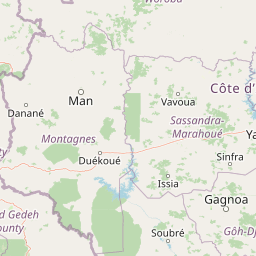
Map view of Marahoué National Park

Use this park location map to pinpoint Marahoué National Park in Ivory Coast, understand its exact geographic position, and read its mapped placement within the surrounding landscape more clearly.

Pigeon | © OpenStreetMap contributors

Location context for Marahoué National Park

Sassandra-Marahoué
Park atlas

Compare regional park geography and adjacent conservation landscapes across West Africa.

Explore Other Parks Near Parc national de la Marahoué and Surrounding Protected Areas

Browsing national parks near Parc national de la Marahoué reveals broader ecological patterns across the surrounding West African savanna and forest transition zones. Extending the geographic comparison helps trace similar protected landscapes and regional biodiversity reserves.
National parkSassandra-Marahoué District
About 0.3 km away#1 closest

North

Marahoué National Park: Geographic and Protected Landscape Analysis in Central Ivory Coast

Examining the ecological terrain within the Sassandra-Marahoué District

Marahoué National Park occupies a transitional zone where forest remnants meet savanna grasslands in the heart of Ivory Coast. This analysis explores the park's geographic boundaries along the Marahoué River and the shifting habitats that continue to sustain a notable variety of bird species within this protected district.

Area
1,000 km²
Established
1968
IUCN
II
Relief
Upland
National parkIvory Coast
About 134 km away#2 closest

West

Mont Péko National Park: Ivory Coast National Park with Mapped Boundaries

Explore its protected landscape and regional geography.

Delve into Mont Péko National Park, a designated national park within Ivory Coast, to understand its unique protected landscape. This entry facilitates detailed atlas exploration, focusing on its geographic placement, mapped boundaries, and contribution to the regional natural terrain. Discover the essence of this protected area through its mapped geography and landscape identity.

Area
340 km²
Established
1968
IUCN
II
Relief
Mountain
National parkMontagnes
About 136 km away#3 closest

West

Parc national du Mont Péko: Mountain Rainforest and Granite Inselberg Geography

Protected mountain massif and watershed within the Montagnes District

Discover the unique mountain landscape of Parc national du Mont Péko. This protected area features dense primary forests, iconic granite inselbergs, and steep terrain that rises above the surrounding Ivorian plains. Use this mapped overview to understand its role in regional conservation and the watershed dynamics of the Sassandra River.

Area
340 km²
Established
1968
IUCN
II
Nature reserveIvory Coast
About 149 km away#4 closest

Southeast

Station d'écologie de Lamto: Nature Reserve and Protected Landscape in Ivory Coast

Examining the forest and savanna transition zone along the Bandama River

Station d'écologie de Lamto is a significant nature reserve situated at a unique ecological contact point in central Ivory Coast. This 2,500 hectare protected area encompasses Borassus palm savanna and gallery forest, serving as a landmark site for West African ecological research and the study of forest and savanna mosaic landscapes.

Area
25 km²
Established
1962
IUCN
Ia
Relief
Lowland
Protected areaIvory Coast
About 155 km away#5 closest

Southeast

Forêt classée de Divo: Protected Area and Forest Geography of Southwestern Ivory Coast

A study of humid Guinean forest remnants and regional land use

Discover the mapped landscape and protected status of the Forêt classée de Divo. Situated in the Divo department, this reserve highlights the interaction between Guinean-type humid forests and agricultural expansion, providing a critical look at state-managed forest conservation in southwestern Ivory Coast.

Area
20 km²
Established
1928
Relief
Lowland
Climate
Tropical
National parkDistrict des Montagnes
About 157 km away#6 closest

Southwest

Parc national de Taï: Primary Rainforest and Protected Terrain in District des Montagnes

Mapping intact forest corridors and major drainage systems

Parc national de Taï encompasses a vast, primary evergreen rainforest landscape that anchors the Upper Guinea forest block. This protected area features a complex topography of hills, plateaus, and permanent rivers, providing a vital habitat and a major site for scientific research in Côte d'Ivoire.

Area
4,540 km²
Established
1973
IUCN
II
Relief
Lowland
National parkIvory Coast
About 157 km away#7 closest

Southwest

Taï National Park: A Primary Rainforest Protected Area in Ivory Coast

Explore mapped boundaries and critical primate habitats in West Africa.

Taï National Park in Ivory Coast stands as a monumental protected landscape, comprising the largest contiguous area of primary rainforest remaining in West Africa. Its designation as a national park highlights its critical role in preserving biodiversity and unique geographic features. Users exploring this destination can delve into its mapped terrain, understand its regional landscape context within Ivory Coast, and appreciate its significance as a vital habitat for endangered species and an integral part of the Upper Guinean forest ecosystem.

Area
3,300 km²
Established
1972
IUCN
II
Relief
Upland
Nature reserveLôh-Djiboua
About 161 km away#8 closest

Southeast

Réserve botanique de Divo: Protected Forest Landscapes and Regional Geography in Lôh-Djiboua

Nature reserve featuring extensive forest restoration projects.

Discover the complex landscape of Réserve botanique de Divo, one of the oldest nature reserves in Côte d'Ivoire. Located in the Lôh-Djiboua region, this protected area represents a transition between remaining secondary forest fragments and agricultural land, serving as a primary site for international tropical forestry restoration efforts.

Area
68.02 km²
Established
1935
Relief
Lowland
Climate
Tropical

Common questions about visiting, size, designation, and location context for Marahoué National Park

Marahoué National Park FAQs for park facts, access, geography, and protected area context

Find quick answers about Marahoué National Park, including protected-area facts, park geography, trail and visitor context, and how the park fits into its surrounding country and regional landscape.
MoriAtlas Explorer

Continue Your Protected Areas Search Across the Global Atlas

Deepen your exploration by continuing the structured search for national parks and protected areas worldwide. Utilize the comprehensive filtering capabilities to compare different conservation landscapes and refine your understanding of global park geography. Discover more about the distribution and characteristics of protected natural areas.

Global natural geography