Mori Atlas logo
Wildlife reserveMare de Lassouri

Understanding the wetland boundaries, aquatic terrain, and savanna mosaic within the Zinder Region

Mare de Lassouri Wildlife Reserve: A Mapped Geographic Overview of Sahelian Wetland Landscapes

Mare de Lassouri represents a critical freshwater ecosystem situated within the Zinder Region of southern Niger. As a designated Ramsar site, this protected wildlife reserve functions as a shallow wetland basin at the southwestern edge of the Chad Basin, sustaining diverse migratory waterbird populations and essential regional vegetation. This geographic exploration examines the interplay between the lake's open water, fringing marshland, and the surrounding woody savanna terrain that defines this Sahelian environment.

Ramsar siteSahel wetlandfreshwater lakewaterbird habitatmigratory birdsbirdwatching

Mare de Lassouri

Wildlife reserve

Park overview

Structured park overview, official facts, and landscape profile for Mare de Lassouri

Mare de Lassouri park facts, protected area profile, and essential visitor context

Review the core facts for Mare de Lassouri, including designation, size, terrain, visitor scale, habitats, and operating context in one park-focused overview.

About Mare de Lassouri

Mare de Lassouri is a shallow freshwater lake in southern Niger that stands out as one of the country's most important wetland sites. Located in the Zinder Region within the southwestern edge of the Chad Basin, the lake occupies a landscape that, by Nigerien standards, is comparatively moist, supporting both open water and surrounding bushy and woody savanna.

The lake is notable for its seasonal character, expanding and contracting its surface area in response to climatic conditions. Beyond its hydrology, Mare de Lassouri is ecologically significant as a gathering point for waterbirds. Tens of thousands of individual birds, including resident and migratory species, feed and rest at the lake, giving it regional importance for Sahelian avifauna. The wetland supports a varied plant community ranging from aquatic and marsh species to characteristic Sahelian trees that ring the shore.

From a human perspective, the lake is deeply woven into the lives of the surrounding communities of Guidimouni and Damagaram Takaya. It supplies drinking water and water for domestic tasks, brick-making, and livestock. Fishermen harvest a modest annual catch dominated by the West African lungfish. Irrigated fields along the water's edge produce cassava, tomatoes, lettuce, cabbage, and other crops, while transhumant herders use the surrounding pasture. The combination of ecological importance and heavy local use shapes both the value and the vulnerability of the site.

Recognized under the Ramsar Convention in 2005, the wetland has formal protection because of its international ecological value. This status aims to balance the lake's role as a refuge for wildlife with the needs of nearby villages that rely directly on its waters, fish, and surrounding vegetation.

Quick facts and research context for Mare de Lassouri

Mare de Lassouri is a shallow Sahelian lake in Niger's Zinder Region, spanning parts of the communes of Guidimouni and Damagaram Takaya near the village of Lassouri. The lake lies on the southwestern fringe of the Chad Basin at an elevation of roughly 350 meters and is characterized by large seasonal fluctuations in surface area. Its catchment basin extends thousands of hectares across the surrounding savanna.

Designated as a Ramsar site in 2005, the wetland covers about 34,000 hectares and is recognized for holding more than 20,000 individual birds, including significant numbers of migratory species. The lake supports fishing, irrigated agriculture, livestock watering, and household water use for the surrounding population, making it both an ecological stronghold and a key resource for local livelihoods.

Protection and recognition

Documented conservation scope, designation year, and Ramsar records for Mare de Lassouri

Mare de Lassouri Protection Status and International Recognition

Examination of the terrestrial protection status for Mare de Lassouri reveals its 2005 designation and official Ramsar wetland recognition sources. Records compile baseline designation history and formal management scope without assuming conservation outcomes.

International recognition

Protection details

Protection scope
Terrestrial
Designated year
2005
Transboundary protection
No
Park context

Deeper park guide and search-rich context for Mare de Lassouri

Mare de Lassouri history, landscape, wildlife, and travel context

Explore Mare de Lassouri through its history, landscape character, ecosystems, wildlife, conservation priorities, cultural context, and seasonal travel timing in a structured park guide built for atlas discovery and search intent.

Why Mare de Lassouri stands out

Mare de Lassouri is best known as a Ramsar-listed Sahel wetland that hosts large congregations of waterbirds, including herons, storks, ibises, ducks, and migrant waders. The lake's mix of open water, fringing marsh, and surrounding savanna creates an unusually rich habitat in a region where surface freshwater is scarce. It is also recognized for sustaining a traditional rural economy built around fishing, irrigation farming, and pastoral grazing.

Mare de Lassouri landscape and geographic character

Mare de Lassouri lies on the southwestern edge of the Chad Basin, one of the largest endorheic drainage systems in Africa. The lake sits at roughly 350 meters elevation within a relatively flat Sahelian landscape shaped by seasonal rainfall and wind action. Its catchment extends widely into the surrounding countryside, feeding the lake with runoff from savanna and farmland.

The lake itself is shallow, with average depths well under a meter and a maximum depth around two meters. Because of this shallowness and the Sahelian climate, the surface area expands and contracts noticeably with seasonal conditions. Wind and weather steadily transport sediment into the basin, gradually infilling parts of the lake and shaping its margins. Around the water, the terrain transitions into bushy and woody savanna dotted with characteristic Sahelian trees and shrubs, giving the wetland a rich mosaic of open water, fringing marsh, and dryland vegetation.

Mare de Lassouri ecosystems, habitats, and plant life

Ecologically, Mare de Lassouri is a transitional Sahelian wetland, combining open freshwater habitat with adjacent marshland and surrounding savanna. The shallow waters and fluctuating shoreline create a mosaic of microhabitats, from submerged and floating vegetation to reedbeds and seasonally flooded margins.

Fringing aquatic vegetation includes papyrus, bulrushes, water lilies, and tiger lotus, while emergent and shoreline plants such as hen's-foot grasses and khaki flower couch contribute to the wetland fringe. The surrounding bushy and woody savanna supports Sahelian tree species such as gum arabic acacias, desert date, African baobab, neem, jujube, and other drought-adapted woody plants. This mix of aquatic, marsh, and dryland plant communities creates structural diversity that supports both resident and migratory wildlife, even in an otherwise arid regional setting.

Mare de Lassouri wildlife and species highlights

The wildlife profile of Mare de Lassouri is dominated by birds. The lake and its surroundings regularly host more than twenty thousand individual birds, making it one of the more significant waterbird concentrations in this part of the Sahel. The community is diverse and includes herons, egrets, storks, ibises, ducks, geese, rails, waders, terns, and raptors.

Common species include the little grebe, grey heron, little egret, cattle egret, squacco heron, white stork, sacred ibis, African jacana, white-faced whistling duck, knob-billed duck, garganey, northern shoveler, common moorhen, black-winged stilt, spur-winged lapwing, green sandpiper, ruff, little tern, western marsh harrier, pallid harrier, and black kite. Migratory species form an important part of this mix, underscoring the wetland's importance along Sahelian flyways.

In the water itself, fish are dominated by the West African lungfish, with the eel-like catfish also present. The lake's combination of relatively stable shallow water, marshy margins, and open foraging areas supports fish populations that, while not large in commercial terms, are ecologically and nutritionally important for the surrounding communities.

Mare de Lassouri conservation status and protection priorities

Mare de Lassouri was designated a Ramsar Wetland of International Importance in September 2005, recognizing its regional ecological value and its role as habitat for large numbers of waterbirds, including migratory species. The protected designation covers the lake itself along with an extensive surrounding area, totaling roughly 34,000 hectares.

Despite this protection, the wetland faces significant pressures. Wind and weather-driven siltation gradually reduce the depth and alter the shape of the lake basin. The use of agricultural pesticides in nearby farmland threatens water quality, while overgrazing by livestock and excessive cutting of woody vegetation damage the surrounding savanna habitat. These pressures are intensified by the lake's heavy use for drinking water, irrigation, fishing, brick-making, and livestock watering, illustrating the ongoing challenge of conserving a wetland that is also a cornerstone of local livelihoods.

Mare de Lassouri cultural meaning and human context

The communities living around Mare de Lassouri have long integrated the lake into their daily life and economy. The village of Lassouri itself and a network of surrounding hamlets belong to the communes of Guidimouni and Damagaram Takaya, with livelihoods traditionally built around fishing, irrigated cropping, livestock keeping, and seasonal transhumant herding. Lake-derived resources, including water, fish, reeds, and grazing land, remain central to local identity and subsistence in this part of the Sahel.

Top sights and standout views in Mare de Lassouri

Mare de Lassouri stands out as a Sahelian wetland of international ecological significance, hosting tens of thousands of waterbirds across more than twenty recorded species. Its Ramsar designation reflects both its habitat value and its role in supporting local livelihoods through fishing, irrigation agriculture, and livestock husbandry. The lake's combination of open water, marshy margins, and surrounding savanna creates a habitat mosaic rare in this part of Niger, even as it faces ongoing environmental pressures from siltation, agricultural chemicals, and intensive local use.

Best time to visit Mare de Lassouri

As a Sahelian wetland, Mare de Lassouri is shaped strongly by seasonal rainfall patterns. The lake expands during and shortly after the rainy season, when water levels rise, aquatic vegetation flourishes, and migratory waterbirds arrive in their largest numbers. This period offers the richest birdwatching conditions and the most extensive open water. The dry season brings falling water levels, exposing muddy margins and concentrating birds in smaller areas, which can also make wildlife viewing productive but signals the season of greatest stress on the wetland itself.
Monthly climate preview

Long-term representative measurements detailing monthly temperature ranges and rainfall patterns for Mare de Lassouri

Mare de Lassouri Climate Normals, Annual Temperature and Precipitation Rhythms

Representative coordinate records for Mare de Lassouri show monthly mean temperatures ranging from 20.2 °C to 33.29 °C alongside distinct seasonal precipitation shifts. Examining the complete twelve-month climatology profile reveals precise long-term temperature averages and monthly rainfall distributions.
Annual mean27 °C
20 °C33 °C
Jan20°
Feb23°
Mar28°
Apr32°
May33°
Jun33°
Jul30°
Aug27°
Sep28°
Oct28°
Nov25°
Dec21°
Warmest month
May

33.3 °C

Coolest month
January

20.2 °C

Wettest month
August

5.2 mm/day

Driest month
January

0 mm/day

Park location guide

Geography guide, regional context, and park location map for Mare de Lassouri

Mare de Lassouri park geography, regions, and map view in Niger

Understand where Mare de Lassouri sits in Niger through a broader geographic reading of the surrounding landscape, nearby location context, and its mapped position within the national park landscape.

How Mare de Lassouri fits into Niger

Niger is a landlocked West African country spanning approximately 1.27 million km², making it the largest landlocked country in the region and the second-largest landlocked nation in Africa. Over 80% of its territory lies in the Sahara Desert, with the population concentrated in clusters in the southern and western regions. The country gained independence from France in 1960 and has experienced multiple coups, most recently in 2023.

Wider geography shaping Mare de Lassouri in Niger

Niger is located in West Africa and is landlocked, bordered by Libya (northeast), Chad (east), Nigeria (south), Benin and Burkina Faso (southwest), Mali (west), and Algeria (northwest). Over 80% of the country's land area lies in the Sahara Desert. The terrain is predominantly flat desert plains and sand dunes, with the Niger River flowing through the southwest corner near the capital Niamey.

Map view of Mare de Lassouri

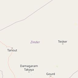
Use this park location map to pinpoint Mare de Lassouri in Niger, understand its exact geographic position, and read its mapped placement within the surrounding landscape more clearly.

Pigeon | © OpenStreetMap contributors

Location context for Mare de Lassouri

Zinder
Park atlas

Compare regional wetlands, savanna terrain, and protected landscapes

Explore Other Parks and Protected Areas Near Mare de Lassouri

Browse nearby protected areas and regional wetland reserves that share environmental traits with Mare de Lassouri. Expanding the geographic comparison reveals broader ecological patterns across the surrounding Sahel landscape.
A horizontal watercolor painting depicting a soft green landscape with rolling hills in the background and marshy vegetation in the foreground.
Protected areaZinder
About 33 km away#1 closest

South

Guidimouni Lake Protected Area: Wetland Geography and Zinder Region Landscape Atlas

A Ramsar-designated freshwater and saline wetland system in the Sahel.

Guidimouni Lake is a significant endorheic wetland situated within the Zinder Region of Niger. This protected area consists of a long, narrow depression featuring a rare coexistence of fresh and saline water basins. Beyond its ecological role, the site provides a critical framework for understanding the interplay between Sahelian sand plains, local water-lily habitats, and the regional agro-pastoral economy.

Area
0.6 km²
Established
2019
Relief
Lowland
Climate
Subtropical
Wildlife reserveYobe
About 154 km away#2 closest

Southeast

Nguru Lake Wildlife Reserve: Sahelian Wetland and Floodplain Geography

A protected freshwater ecosystem in Yobe, Nigeria

Nguru Lake serves as a vital hydrological anchor within the Hadejia-Nguru wetland system. This endorheic, shallow-water environment undergoes dramatic seasonal expansion, creating a rich mosaic of marshlands and mudflats. The site stands as a key protected area within the Chad Basin landscape, offering a unique look at Sahelian water ecology and floodplain dynamics.

Area
37 km²
Relief
Lowland
Climate
Tropical
Scope
Terrestrial
A soft, horizontal watercolor painting showing a green and tan landscape of trees and hills with a reflecting body of water in the foreground, set against a white background.
Nature reserveMaradi Region
About 264 km away#3 closest

West

Geschützter Wald von Madarounfa: Protected Woodland and Nature Reserve in the Maradi Region

Mapping the Sahel-Sudan transition landscapes of Niger.

Located in the Maradi Region, this nature reserve protects a rare mosaic of dryland vegetation, including acacia and tamarind groves on alluvial soils. The woodland functions as a critical environmental anchor within the surrounding agricultural plains, offering a window into the natural history of the Goulbi de Maradi river valley.

Area
8.3 km²
Established
1950
Relief
Lowland
Climate
Subtropical
A soft watercolor painting showing a winding river or lake flowing through a landscape with gentle green hills, clusters of trees, and a pale sky.
Nature reserveMaradi Region
About 266 km away#4 closest

West

Madarounfa Lake Nature Reserve: Geographic Overview of Niger's Premier Wetland

Seasonal wetlands and riparian habitats in Maradi Region

Madarounfa Lake functions as a pivotal natural feature in the Maradi Region, blending seasonal hydrological shifts with a distinct cultural identity. This protected area supports critical riparian woodland and waterbird populations, serving as an essential resource for the surrounding landscape. Its classification as a wetland of international importance highlights the environmental complexity of the Sahel-Sudanese transition zone.

Area
8.5 km²
Established
2019
Relief
Lowland
Scope
Terrestrial
Nature reserveNiger
343 km away#5 closest

North

Aïr and Ténéré National Nature Reserve: Protected Landscape Atlas in Niger's Sahara

Discover unique Sahelian ecosystems isolated within the desert.

Delve into the Aïr and Ténéré National Nature Reserve, a monumental protected area in northern Niger. This reserve is celebrated for its extraordinary geographic setting, acting as an island of Sahelian life within the expansive Sahara Desert. Examine its mapped boundaries, the striking contrast between its blue marble mountains and the Ténéré desert, and its critical role in preserving unique desert flora and fauna. The reserve's vast scale and ecological distinctiveness make it a key destination for understanding protected land geography and Saharan conservation.

Area
64,560 km²
Established
1988
IUCN
IV
Relief
Mountain
Protected areaTahoua Region
372 km away#6 closest

West

Mare de Tabalak Protected Area: Geography and Wetland Landscape in Tahoua, Niger

Mapping a unique Sahelian freshwater ecosystem and seasonal floodplains

Mare de Tabalak serves as one of the most ecologically significant wetlands in Niger. This protected area, characterized by its permanent freshwater lake and vast seasonal floodplains, sits at the intersection of the Ader Doutchi plateaus and the Tadrès sand dunes. The site acts as a major hub for migratory bird populations and supports essential regional pastoral and agricultural livelihoods within the Tahoua landscape.

Area
7 km²
Established
2005
Relief
Lowland
Climate
Arid
Wildlife reserveBorno
About 459 km away#7 closest

East

Lake Chad Game Reserve: A Regional Geography and Wetland Protected Area Profile

Examining the floodplain terrain and hydrological network of Borno, Nigeria.

Lake Chad Game Reserve serves as a primary example of Sahelian wetland ecology, covering vast plains in Borno, Nigeria. The area is characterized by seasonal inundation and a diverse mosaic of swamps, marshes, and river corridors. This profile details the geographic boundaries and distinctive terrain that make the reserve a vital protected landscape within the West African environmental system.

Area
6,073.54 km²
IUCN
IV
Relief
Lowland
Climate
Tropical
National parkNigeria
About 479 km away#8 closest

South

Yankari National Park: A Protected National Park within Nigeria's Geographic Atlas

Explore the mapped terrain and protected landscape of Yankari National Park.

Yankari National Park, designated as a national park within Nigeria, offers a distinct focus for atlas-driven exploration of protected landscapes. This resource provides a detailed perspective on the park's geographic identity, its mapped boundaries, and its significance within Nigeria's wider network of natural areas. Engage with structured information that highlights the park's place in the regional geography and its value as a mapped natural landscape.

Common questions about visiting, size, designation, and location context for Mare de Lassouri

Mare de Lassouri FAQs for park facts, access, geography, and protected area context

Find quick answers about Mare de Lassouri, including protected-area facts, park geography, trail and visitor context, and how the park fits into its surrounding country and regional landscape.
MoriAtlas Explorer

Continue Your Protected Areas Search Across the Global Atlas

Deepen your exploration by continuing the structured search for national parks and protected areas worldwide. Utilize the comprehensive filtering capabilities to compare different conservation landscapes and refine your understanding of global park geography. Discover more about the distribution and characteristics of protected natural areas.

Global natural geography