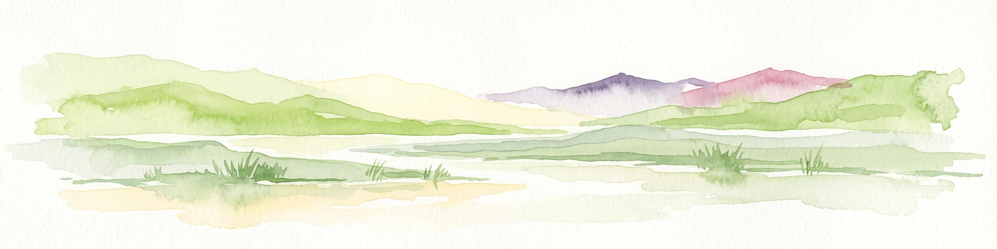
Why Mare de Tabalak stands out
Mare de Tabalak is best known as the largest and most ecologically significant Sahelian wetland in the Tahoua region of Niger, drawing tens of thousands of migratory birds each year, including crowned cranes that are otherwise rare in the country. Its combination of open water, extensive seasonal floodplains, and unusually dense vegetation in a desert-edge setting makes it a regional biodiversity hotspot. The lake is also recognized for its modern origin, having emerged only in the 1970s from a dam failure that transformed a wooded swamp into a permanent water body. Its Ramsar designation and role as a fishing, agricultural, and pastoral resource for surrounding Tuareg and Hausa communities add to its significance.
Mare de Tabalak history and protected-area timeline
Mare de Tabalak as it is known today is a relatively young landscape feature. The lake was created in the 1970s following the failure of a dam along the seasonal valley of Ibaga, which had previously held back water in a heavily wooded swamp. The dam break transformed the swamp into a permanent open water body, and the resulting lake quickly became a focal point for new settlement, attracting migrants from surrounding rural areas as well as from the departement of Birni-N'Konni and from Nigeria.
In the same decade, similar accidental lake formations occurred elsewhere in Niger, giving rise to comparable wetlands such as Mare d'Akadané and Mare de Dan Doutchi. Between 1976 and 1980, the major regional road N25 was paved along the lakeshore, reinforcing the area's importance as a regional hub. The lake's vulnerability was made clear in 1996, when reduced rainfall the previous year caused Mare de Tabalak to dry out completely for a period.
The formal recognition of the wetland's ecological importance came on 16 September 2005, when 107,100 hectares around Mare de Tabalak were designated under the Ramsar Convention as a Wetland of International Importance. This designation reflected the lake's growing value as a refuge for migratory waterbirds and as a livelihood base for surrounding communities.
Mare de Tabalak landscape and geographic character
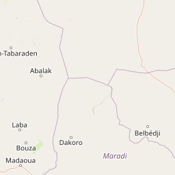
The landscape around Mare de Tabalak is defined by its position at a major ecological and geological boundary. The lake sits at approximately 270 meters above sea level, marking the northern edge of usable semi-arid land and the southern fringe of true desert. To the south and southwest of the lake rises the Ader Doutchi, a sandstone plateau that forms part of the broader Ader landscape, while to the north and northeast the terrain transitions into the sand dunes of the Tadrès region.
The lake itself is elongated and shallow, stretching 12 to 15 kilometers with an average depth of only around 3 meters. Its permanent water surface of about 700 hectares is framed by a much larger seasonal floodplain, which at peak inundation expands to more than ten times the open water area. The hydrological system is shaped by dry valleys: the Tadiss watercourse both feeds the lake and drains away from it as part of the broader Dallol Maouri system flowing toward the Niger River, while the Ibaga and Kori de Marké valleys also contribute runoff. The Kori de Marké originates at a hill known as Marké to the south.
In photographs from the early 1990s, the lake's shores show dense reed beds and trees standing in the water, illustrating how dramatically the new lake contrasted with the surrounding sparse desert and steppe vegetation.
Mare de Tabalak ecosystems, habitats, and plant life
Mare de Tabalak functions as a vital ecological island in an otherwise arid land. Its permanent water body and expansive seasonal floodplain support vegetation that is unusually lush for a Sahelian setting. Planted and naturally occurring trees, including red eucalyptus, Prosopis juliflora, gum arabic trees, and neem, have become characteristic of the lakeside, while the wetter margins are dominated by reeds and a rich assemblage of grasses and herbs.
Grass-like plants and other herbaceous species recorded in and around the lake include Cenchrus biflorus, several Aristida species, several Brachiaria species, and various Echinochloa or millet-grass relatives, as well as black nightshade and Typha australis. This dense plant cover contrasts strongly with the surrounding Tadrès dunes and dry plateaus, creating a green belt that tracks the lake's seasonal flooding.
The wetland's biodiversity value extends well beyond plants. Its mosaic of open water, flooded grasslands, and wooded shorelines supports amphibians such as toads and frogs, freshwater crustaceans, and a thriving fish community into which African catfish, Nile perch, and Nile tilapia have been introduced. The vegetation and water together create habitat conditions for large numbers of resident and migratory birds, making the lake one of the most ecologically productive wetlands in Niger's Sahelian zone.
Mare de Tabalak wildlife and species highlights
Wildlife is one of the defining features of Mare de Tabalak, especially its birdlife. The lake attracts tens of thousands of migratory birds each year and is regarded as one of the most important sites for waterbirds in central Niger. Among the species recorded here, the crowned crane, otherwise rare elsewhere in Niger, is a notable presence, underscoring the wetland's high conservation status for avifauna.
Aquatic fauna has been deliberately enriched through fish stocking. African catfish were introduced first, followed later by Nile perch and Nile tilapia, all of which now sustain a productive inland fishery. The lake also supports populations of freshwater crustaceans and amphibians, including toads and frogs, which contribute to its overall biodiversity and to the food web that supports the migratory and resident bird populations. Beyond its formal bird records, Mare de Tabalak functions as a seasonal refuge and breeding area for waterbirds in a region where surface water is scarce.
Mare de Tabalak conservation status and protection priorities
Mare de Tabalak is formally recognized as a Wetland of International Importance under the Ramsar Convention, having been designated on 16 September 2005. The protected area covers 107,100 hectares, encompassing the permanent lake, its extensive seasonal floodplain, and surrounding areas that support critical habitat for migratory and resident species.
The lake's conservation value lies in its role as a refuge for waterbirds and other wetland-dependent species at the climatic boundary between the Sahel and the Sahara. Its Ramsar status is widely cited in regional studies of Sahelian biodiversity, including long-term research on how wetlands sustain both wetland and dryland biodiversity in the face of environmental change.
The lake is also vulnerable. In 1996, reduced rainfall the previous year caused it to dry up entirely for a period, highlighting the fragility of even large Sahelian wetlands under climatic stress. Continued pressure from fishing, agricultural expansion, grazing, wood harvesting, and water use for domestic purposes means that conservation success depends not only on formal protection but also on coordinated local resource management involving traditional authorities and community organizations.
Mare de Tabalak cultural meaning and human context
Mare de Tabalak sits in a region where Tuareg and Hausa communities have long coexisted, and the lake today supports a mixed population of both groups. Several Tuareg-associated settlements such as Centre Peule, Chilélène, Ichirifan, and Manatéré line the western shore, while Hausa-linked villages including Tsaouna and Faché, along with hamlets like Saouna Chininilla and Agargar, lie to the east. To the south, Kéhéhé and Zongon Boukara extend the lakeside settlement pattern away from the open water.
The cultural landscape is recent in many respects. The village of Tabalak itself only took shape after the lake's creation in the 1970s, growing through migration from the surrounding countryside and from Birni-N'Konni and Nigeria. The lake is embedded in local governance: traditional chiefs (chefs traditionnels) retain authority over natural resources, while fishing cooperatives, agricultural committees, fish-trading associations, and women's groups organize the everyday use of the wetland. This blend of customary authority and community-based organization shapes how the lake is used and protected.
Top sights and standout views in Mare de Tabalak
Mare de Tabalak stands out as one of the largest Ramsar-listed wetlands in the Sahelian part of Niger and as one of the most important inland fisheries in the country. Its combination of permanent open water and a floodplain that expands more than tenfold seasonally creates habitat for tens of thousands of migratory birds, including crowned cranes that are otherwise scarce in Niger, and supports a rich community of fish, amphibians, and crustaceans.
Beyond its ecology, the lake defines the livelihoods of surrounding Tuareg and Hausa villages. Its floodplain soils are cultivated for cowpeas, cassava, sorghum, sweet potatoes, and onions, while its open water yields 100 to 300 tonnes of fish each year, its margins are grazed by livestock, and its trees supply fuelwood and construction timber. The site is also notable for being a man-made lake in origin, having formed after a dam failure in the 1970s.
Best time to visit Mare de Tabalak
Mare de Tabalak is a seasonal wetland, and its character varies strongly through the year. During and shortly after the wet season, when seasonal streams like Tadiss, Ibaga, and Kori de Marké bring runoff from a catchment of more than 109,000 hectares, the floodplain expands dramatically and the lake and its surroundings reach their most lush and biologically active phase. This is also when migrant waterbirds are most numerous and when vegetation along the shorelines is at its densest.
In the cooler dry season, the open water persists but floodplain areas recede, and concentrated bird populations can still be observed on the remaining water and exposed mudflats. Visitors or researchers arriving between the late rainy season and the early dry season will tend to see the lake at its fullest and most ecologically dynamic. During severe drought years, the lake can shrink dramatically or even dry out entirely, as it did in 1996, so conditions should always be considered in the context of regional rainfall.