Mori Atlas logo
National parkMark Twain National Forest

Mapping the ancient terrain, volcanic ridges, and karst river systems of southern Missouri

Mark Twain National Forest: An Atlas of Protected Landscapes and Ozark Highland Geography

Mark Twain National Forest spans a vast, disconnected patchwork of public land across the Ozark Highlands of southern Missouri. This protected area preserves a uniquely unglaciated landscape characterized by rocky glades, deep hollows, massive karst springs, and extensive old volcanic mountain ridges. By analyzing its mapped boundaries, one can trace a complex environment defined by the Eleven Point National Scenic River and over 5,000 recorded cave systems.

Ozark Highlandshardwood forestpine forestkarst springscaves and gladesnational scenic river

Mark Twain National Forest

National park

Park overview

Structured park overview, official facts, and landscape profile for Mark Twain National Forest

Mark Twain National Forest park facts, protected area profile, and essential visitor context

Review the core facts for Mark Twain National Forest, including designation, size, terrain, visitor scale, habitats, and operating context in one park-focused overview.

About Mark Twain National Forest

Mark Twain National Forest is a U.S. National Forest located in the southern half of Missouri, made up of nine disconnected tracts that together form one of the most geographically widespread forests in the National Forest system. It is the only National Forest headquartered in Missouri and spans parts of 29 counties, more than any other forest in the system. The bulk of its acreage lies within the Ozark Highlands, an ancient landscape that was never submerged beneath ancient seas and never touched by continental glaciers.

The character of the land is shaped by large permanent springs, more than 5,000 caves, rocky barren glades, old volcanic mountain remnants, and nationally recognized streams. Drainage systems like the Eleven Point River and the St. Francis River carve through the terrain, producing clear, spring-fed waterways and steep hollows. Forests of oak, hickory, and pine now cover much of the region, in contrast to the largely denuded landscape of the early 20th century.

The forest is administered by the U.S. Forest Service from its headquarters in Rolla, Missouri, and is organized into six ranger districts. Visitors can explore the 350-mile Ozark Trail system, drive the Glade Top Trail National Scenic Byway for sweeping views toward Arkansas, paddle stretches of spring-fed rivers, and travel through seven designated wilderness areas. Together with its trail, river, wilderness, and motorized recreation opportunities, the forest plays a central role in outdoor recreation and forest conservation across southern Missouri.

Quick facts and research context for Mark Twain National Forest

Mark Twain National Forest is Missouri's only National Forest and spans parts of 29 counties, more counties than any other U.S. National Forest. Roughly 1.5 million acres of land fall within its boundaries, though only a portion is publicly owned. It sits primarily within the Ozark Highlands, a landscape shaped by ancient mountains, large springs, caves, and rocky glades that was never covered by oceans or glaciers.

The forest was established in 1939 by proclamation of President Franklin D. Roosevelt, with the modern combined Mark Twain National Forest taking shape through the 1973 unification and 1976 renaming of the former Clark and Mark Twain national forests. It is administered by the U.S. Forest Service from headquarters in Rolla, Missouri, and includes seven designated wilderness areas and portions of a National Scenic River.

Protection and recognition

Explore documented conservation history and official management parameters for Mark Twain National Forest.

Mark Twain National Forest Protection Status and Terrestrial Designation

Mark Twain National Forest maintains a documented terrestrial protection status established in 1976. Conservation researchers evaluate management scope and official designation records through structured administrative data.

Protection details

Protection scope
Terrestrial
Designated year
1976
Transboundary protection
No
Park context

Deeper park guide and search-rich context for Mark Twain National Forest

Mark Twain National Forest history, landscape, wildlife, and travel context

Explore Mark Twain National Forest through its history, landscape character, ecosystems, wildlife, conservation priorities, cultural context, and seasonal travel timing in a structured park guide built for atlas discovery and search intent.

Why Mark Twain National Forest stands out

Mark Twain National Forest is best known for protecting a substantial share of the Ozark Highlands within Missouri, an unglaciated ancient landscape defined by large permanent springs, extensive cave systems, rocky glades, and old volcanic mountain terrain. The forest contains Greer Spring, the largest spring on National Forest land in the United States, with an average daily flow of hundreds of millions of gallons into the Eleven Point National Scenic River. Also distinctive is the Glade Top Trail National Scenic Byway, which offers long-range views across the rolling Ozark terrain toward the Boston Mountains of Arkansas, and the 350-mile Ozark Trail hiking system that winds through much of the forest. Together with its seven designated wilderness areas, these features give the forest a strong identity as a place of spring-fed rivers, ridge-top vistas, and extensive backcountry trail networks.
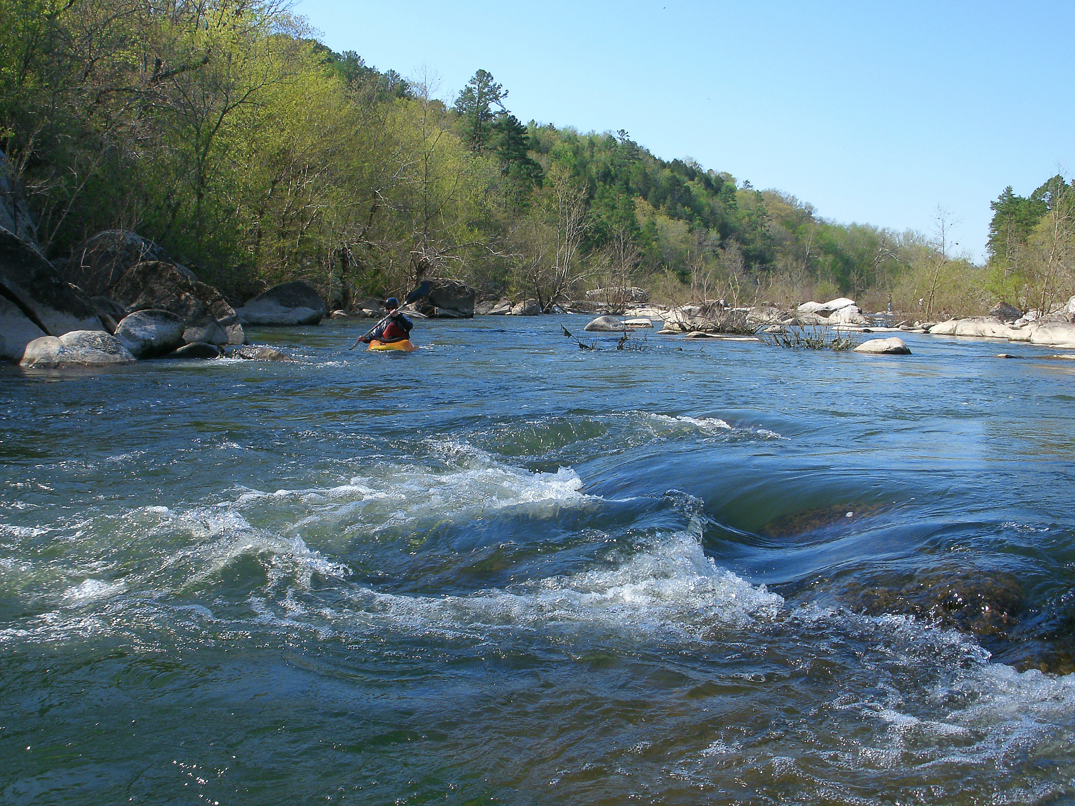
A person in a yellow kayak paddling down a river with rocky banks and a forested hillside in the background.
A kayaker navigates the St. Francis River at the Silver Mines Recreation Area in Mark Twain National Forest.

Mark Twain National Forest history and protected-area timeline

Mark Twain National Forest has an unusual institutional history because the land that today makes up the forest was once divided between two separately proclaimed national forests. Both the Clark National Forest and the Mark Twain National Forest were created by proclamation on September 11, 1939, and for many years they were administered side by side.

In June 1973, the two forests were brought under shared headquarters in Rolla and operated together as the National Forests in Missouri. On February 17, 1976, the two units were combined and renamed simply Mark Twain National Forest, creating the single forest that exists today.

The establishment of these forests was a direct response to a century of heavy logging. Beginning in the 1870s, mills throughout southern Missouri cut the region's native oak, hickory, and pine forests, and by the 1920s most of the original timber was gone. President Franklin D. Roosevelt signed the Mark Twain National Forest into existence in 1939, and through the Civilian Conservation Corps, established in 1933, hundreds of young men at more than 50 CCC sites in the region built roads and planted hundreds of acres of pine. Many of their contributions can still be visited today, including the Rolla Ranger Station Historic District and the Winona Ranger Station Historic District.

Mark Twain National Forest landscape and geographic character

The landscape of Mark Twain National Forest is defined by the Ozark Highlands, an ancient terrain of rolling hills, ridges, and hollows that extends from southern Missouri into northern Arkansas. The region was never covered by oceans and was never glaciated, leaving behind deeply weathered surface features and distinctive rock formations.

Geologically, the forest is characterized by old volcanic mountains, rocky glades where thin soil exposes bare bedrock, and large river systems such as the Eleven Point and the St. Francis. Massive springs emerge from the karst landscape, including Greer Spring, whose average daily discharge feeds the Eleven Point National Scenic River. Caves and sinkholes are common throughout the region, with more than 5,000 caves recorded in the broader Ozark area.

Above the hollows, the Glade Top Trail National Scenic Byway crosses high ridges that offer uninterrupted views for more than 30 miles, extending on clear days all the way to the Boston Mountains in Arkansas. This combination of glades, forested ridges, deep hollows, and spring-fed rivers defines the forest's visual character.

Mark Twain National Forest ecosystems, habitats, and plant life

Ecologically, Mark Twain National Forest preserves a significant portion of the Ozark Highlands ecosystem, where forests, glades, springs, and cave systems combine into a distinctive habitat mosaic. Upland forests dominated by oak and hickory cover most of the terrain, with planted and naturally regenerating stands of shortleaf and other pines on drier slopes, while bottomland forests line the streams and rivers.

A defining ecological feature is the network of large, permanent springs and spring-fed rivers that emerge from underground karst systems. These cold, clear streams support rich aquatic communities and connect surface forests to a hidden underground world of caves and aquifers. Rocky glades, where exposed bedrock and thin soils create harsh conditions, host specialized plant communities that differ sharply from the surrounding woodlands.

Together, the forest's mix of upland hardwoods, pine stands, glades, springs, and caves gives it an ecological diversity that mirrors the broader Ozark Highlands, and it functions as one of the largest protected blocks of that landscape within Missouri.

Mark Twain National Forest wildlife and species highlights

The Ozark forests, glades, springs, and caves of Mark Twain National Forest support a wide range of wildlife typical of the central Ozark Highlands. White-tailed deer and wild turkey are among the most commonly observed large animals, while black bears have reestablished a presence in parts of the region, including within or near the forest. Smaller mammals such as gray foxes, raccoons, opossums, and squirrels are widespread throughout the wooded terrain.

Songbirds and other forest birds are a major draw, using the mix of oak-hickory hardwoods, pine stands, and edge habitats along glades and streams. Raptors, woodpeckers, and migratory songbirds are present across the forest, especially along ridge corridors and river valleys. Reptiles and amphibians inhabit the rocky glades, spring branches, and cave entrances, where cool, moist conditions support salamanders and other moisture-dependent species.

The cold, spring-fed rivers such as the Eleven Point and segments of the St. Francis also host native aquatic life including smallmouth bass and other game fish, and provide habitat for species adapted to clear, oxygen-rich Ozark streams.

Mark Twain National Forest conservation status and protection priorities

Mark Twain National Forest plays an important role in forest conservation in the Ozark region, which was once largely stripped of its native timber. By protecting and reforesting large portions of southern Missouri, the forest helped restore oak, hickory, and pine woodlands that had been heavily logged in the 19th and early 20th centuries. The original CCC-era plantings of pine and the ongoing management of oak-hickory stands are among the most visible long-term conservation legacies of the forest.

The forest also contributes to conservation of the Ozark landscape at a broader scale by maintaining large, intact blocks of upland habitat, by protecting major karst spring systems such as Greer Spring, and by shielding stretches of nationally recognized rivers, including designated Wilderness and National Scenic River corridors. Seven designated wilderness areas within the forest provide added protection for the most primitive remaining landscapes.

Together, these wilderness, scenic river, and large contiguous forest holdings make Mark Twain National Forest one of the most significant protected land complexes in the Ozark Highlands and a key part of Missouri's natural heritage.

Mark Twain National Forest cultural meaning and human context

Mark Twain National Forest is named for one of Missouri's most celebrated cultural figures, the author Mark Twain, whose pen name is closely associated with the Mississippi River country. The naming reflects a long tradition of connecting Missouri's natural landmarks with the state's literary and cultural identity.

The forest also carries a strong institutional cultural layer tied to the Civilian Conservation Corps. In the late 1930s and early 1940s, CCC workers built roads, planted trees, and constructed ranger facilities throughout what would become the national forest, and many of those structures, including the Rolla Ranger Station Historic District and the Winona Ranger Station Historic District, remain standing and are part of the forest's recognized heritage.

Rural Ozark communities have long interacted with the forest through small-scale agriculture, hunting, and timber work, and the forest continues to play a cultural as well as an economic role across southern Missouri.

Top sights and standout views in Mark Twain National Forest

Mark Twain National Forest's standout qualities include its sheer geographic spread across southern Missouri, its protection of large parts of the ancient Ozark Highlands, and its seven designated wilderness areas. Greer Spring, the largest spring on National Forest land in the U.S., and the cold, clear Eleven Point National Scenic River define the forest's water resources, while the Glade Top Trail National Scenic Byway and the 350-mile Ozark Trail system offer sweeping ridge-top views and long-distance hiking.

Equally distinctive is the forest's CCC-era legacy of planted pine, historic ranger stations, and built infrastructure, much of which is still visible in the landscape. Combined, these features make the forest a defining anchor of outdoor recreation and natural heritage in the Ozarks.

Best time to visit Mark Twain National Forest

Mark Twain National Forest offers different experiences across the seasons of the Ozark Highlands. Spring brings rising temperatures, awakening vegetation, and strong flow from the springs and rivers, making it an attractive time to explore Greer Spring, the Eleven Point National Scenic River, and the St. Francis River for paddling and wildlife watching.

Summer is the warmest and busiest season, with hot weather, abundant foliage, and reliable access to swimming holes, caves, and shaded forest trails. Autumn is widely regarded for the Ozark fall colors, when the oak and hickory forests turn shades of red and gold, and cooler temperatures make hiking the Ozark Trail or driving the Glade Top Trail National Scenic Byway especially rewarding. Winters are generally mild compared with much of the United States, with occasional snow that can briefly transform the ridges and glades.

Monthly climate preview

Long-term representative averages for monthly temperature and precipitation rhythms

Mark Twain National Forest Climate Normals and Annual Weather Patterns

Representative coordinates record measured multi-year temperature ranges alongside baseline monthly precipitation rates across the landscape. Examining the full twelve-month profile provides complete historical averages for climate comparison and analysis.
Annual mean13 °C
-1 °C26 °C
Jan-1°
Feb
Mar
Apr13°
May18°
Jun23°
Jul26°
Aug25°
Sep20°
Oct14°
Nov
Dec
Warmest month
July

25.6 °C

Coolest month
January

-0.7 °C

Wettest month
May

4.4 mm/day

Driest month
January

2.2 mm/day

Park location guide

Geography guide, regional context, and park location map for Mark Twain National Forest

Mark Twain National Forest park geography, regions, and map view in United States of America

Understand where Mark Twain National Forest sits in United States of America through a broader geographic reading of the surrounding landscape, nearby location context, and its mapped position within the national park landscape.

How Mark Twain National Forest fits into United States of America

The United States of America is a federal presidential republic and one of the world's largest countries by area and population. It consists of 50 states across a vast territory spanning multiple time zones, with its capital in Washington, D.C. and largest city in New York City. The nation has a diverse economy, influential political system, and significant cultural and military presence globally.

Wider geography shaping Mark Twain National Forest in United States of America

The United States occupies a vast territory in North America, bordered by Canada to the north and Mexico to the south. The 48 contiguous states stretch from the Atlantic to the Pacific Ocean, while Alaska occupies the northwestern region and Hawaii is an archipelago in the Pacific. The country encompasses diverse terrain including the Rocky Mountains, Appalachian Mountains, Great Plains, and extensive river systems.

Map view of Mark Twain National Forest

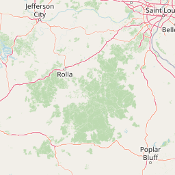
Use this park location map to pinpoint Mark Twain National Forest in United States of America, understand its exact geographic position, and read its mapped placement within the surrounding landscape more clearly.

Pigeon | © OpenStreetMap contributors

Location context for Mark Twain National Forest

Missouri
Recorded earthquake history

Explore the Historical Earthquake Catalogue for Mark Twain National Forest

Browse the documented seismic history associated with the Ozark Highlands landscape within Mark Twain National Forest. Review historical earthquake records including magnitudes and proximity data collected from USGS sources to understand the regional seismic profile.

Mark Twain National Forest Earthquake History

Catalogued events

38 events

Strongest magnitude

Magnitude 4.2

Most recent event

Sep 6, 2025

This history includes earthquakes recorded inside the park or within 50 km of its borders

Explore photographic records of rocky glades, karst springs, and forested ridges across the Ozark Highlands.

Mark Twain National Forest Photos and Scenic Landscapes Visual Exploration

Visual records capture the distinctive terrain and protected habitats found within Mark Twain National Forest. Photographic documentation reveals the underlying geography of unglaciated ridges, permanent springs, and native hardwood ecosystems.

A person in a yellow kayak paddling down a river with rocky banks and a forested hillside in the background.

Park atlas

Compare regional geography, spring-fed rivers, and connected Ozark ecosystems.

Other Parks Near Mark Twain National Forest and Surrounding Protected Landscapes

Visitors exploring Mark Twain National Forest can examine nearby protected areas to understand regional terrain patterns and geological formations. Comparing adjacent wilderness parcels reveals broader ecological contexts across the unglaciated Ozark Highlands.
A soft watercolor illustration featuring rolling green hills, a winding stream, and a forested treeline against a pale sky.
Wildlife reserveMissouri
Park boundaries overlap#1 closest

South

Irish Wilderness: Missouri Ozark Protected Area and Karst Landscape Atlas

Federally protected wilderness in the Eleven Point River landscape

Spanning the rugged terrain of the Missouri Ozarks, Irish Wilderness is a federally protected area known for its distinct karst geography. Visitors can study the network of caves, sinkholes, and springs that define the local environment, alongside historical remnants of frontier settlement. The area serves as a primary example of wilderness preservation within the Mark Twain National Forest, balancing sensitive cave ecosystems with forested ridge landscapes.

Area
65.87 km²
Established
1984
IUCN
Ib
Relief
Upland
Wildlife reserveMissouri
Park boundaries overlap#2 closest

East

Rockpile Mountain Wilderness: Mapping the Rugged Ridge Landscapes of the Southeastern Ozarks

A federally protected wilderness within Missouri's Mark Twain National Forest

Explore the distinct geography of Rockpile Mountain Wilderness, where a steep granite ridge runs from Little Grass Mountain toward the national forest boundary. This protected area features unique cultural history in the form of an Indigenous stone cairn and showcases the eroded, rocky character of the eastern Ozark highlands. Use this resource to understand the boundary and terrain of this significant wilderness tract.

Area
17.15 km²
Established
1980
IUCN
Ib
Relief
Mountain
Wildlife reserveMissouri
About 6.3 km away#3 closest

Southeast

Mingo Wilderness: Missouri Protected Wildlife Reserve and Wetland Geography

Primitive bottomland forest and swamp landscape

Mingo Wilderness encompasses 8,000 acres of protected bottomland hardwood forest and cypress-tupelo swamp in southeastern Missouri. As a federally designated wilderness area embedded within a national wildlife refuge, it provides a quiet, primitive habitat characterized by slow-moving creek corridors and varied seasonal wetlands.

Area
32 km²
Established
1976
IUCN
Ib
Relief
Lowland
Watercolor painting of a wide, rolling landscape featuring layered sandstone bluffs and green forested hills against a light background.
Protected landscapeIllinois
39 km away#4 closest

East

Shawnee National Forest: Exploring the Protected Landscapes of the Illinois Shawnee Hills

Mapped sandstone formations and glacial terrain in southern Illinois

Spanning nearly 289,000 hectares, Shawnee National Forest is the largest body of public land in Illinois. The area is defined by its dramatic sandstone bluffs, deep canyons, and seven designated wilderness areas that provide a rare rugged topography within the American Midwest. Explore the complex geography of this forest, from its glacial-sculpted river watersheds to its diverse hardwood habitats and historic reforestation sites.

Area
2,017.83 km²
Established
1933
Relief
Upland
Climate
Temperate
Wildlife reserveArkansas
55 km away#5 closest

Southwest

Leatherwood Wilderness: A Deep Dive into Arkansas Rugged Ozark Highland Geography

Protected wilderness area featuring cliff-lined hollows and streamside habitats

As the largest wilderness area in Arkansas, Leatherwood Wilderness offers a sprawling look at the rugged, broken terrain characteristic of the Ozark region. Its landscape of vertical cliffs, deep hollows, and hardwood forests serves as an essential case study for protected backcountry environments. Explore the map of this trail-less wilderness to understand the complex drainage patterns and karstic features that define its unique ecological character.

Area
68.14 km²
Established
1984
IUCN
Ib
Relief
Mountain
A soft watercolor illustration featuring a winding river flowing through a green valley with rolling hills in the background, accented by abstract pink blossoms or light reflections.
Wildlife reserveArkansas
About 67 km away#6 closest

Southwest

Richland Creek Wilderness: Mapping Protected Landscapes in the Arkansas Ozarks

A rugged wilderness area and wildlife reserve

Discover the topography and conservation value of Richland Creek Wilderness. This protected area in the Arkansas Ozarks features a complex network of forested hollows, steep sandstone bluffs, and clear creek corridors, offering an essential look at the region's preserved wilderness character and ecological landscape.

Area
48 km²
Established
1984
IUCN
Ib
Relief
Upland
National parkMissouri
93 km away#7 closest

Northeast

Gateway Arch National Park: National Park Geographic Atlas and Map Boundaries

Explore protected landscape context and regional setting.

Gateway Arch National Park represents a unique protected landscape within Missouri, contributing to the broader national park atlas. This entry focuses on its specific geographic identity and mapped boundaries, offering structured data for understanding its role. Discover the factual landscape context and regional importance of Gateway Arch National Park for informed geographic exploration.

Area
0.78 km²
Established
2018
IUCN
II
Visitors
1.2M annual
Wildlife reserveIllinois
136 km away#8 closest

East

Lusk Creek Wilderness: An Atlas of Protected Sandstone Canyons and Forests in Southern Illinois

Mapping rugged wilderness terrain and forest ecological recovery.

Lusk Creek Wilderness serves as a key protected landscape in southern Illinois, featuring extensive sandstone canyon systems and dense hardwood woodland. This area offers a unique look at the geological and forested character of the Shawnee region, documented through its boundaries, elevation changes, and natural landmarks. Use this geographic entry to examine the rugged, roadless character of the state largest wilderness designation and its place within the wider regional drainage system.

Area
25.47 km²
Established
1990
IUCN
Ib
Relief
Upland

Common questions about visiting, size, designation, and location context for Mark Twain National Forest

Mark Twain National Forest FAQs for park facts, access, geography, and protected area context

Find quick answers about Mark Twain National Forest, including protected-area facts, park geography, trail and visitor context, and how the park fits into its surrounding country and regional landscape.
MoriAtlas Explorer

Continue Your Protected Areas Search Across the Global Atlas

Deepen your exploration by continuing the structured search for national parks and protected areas worldwide. Utilize the comprehensive filtering capabilities to compare different conservation landscapes and refine your understanding of global park geography. Discover more about the distribution and characteristics of protected natural areas.

Global natural geography