
Mori Atlas logo
Wildlife reserveMatilija Wilderness

Mapping the deep canyons and riparian watersheds of this rugged Southern California landscape

Matilija Wilderness: A Protected Wildlife Reserve in the Southern Santa Ynez Mountains

Matilija Wilderness covers over 29,000 acres of steep, fractured terrain within the Los Padres National Forest. This protected area anchors the upper watershed of Matilija Creek, providing essential habitat for the California condor and diverse montane ecosystems. From the 1,600 foot canyon floors to the rocky summit of Monte Arido at 6,014 feet, the landscape exhibits dramatic vertical relief and dense alder and maple galleries. The wilderness sits as a central node in the regional network of protected lands, bordering both the Dick Smith and Sespe Wilderness areas.

wilderness areasouthern CaliforniaSanta Ynez Mountainscanyon landscaperiparian habitatCalifornia condor habitat
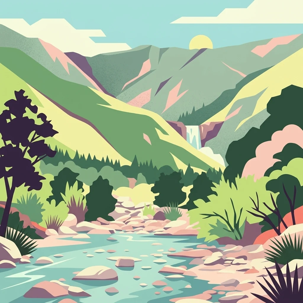
A stylized graphic illustration of a mountain canyon with a stream in the foreground, rocky banks, surrounding vegetation, a small waterfall in the distance, and a sun rising over the hills.

Matilija Wilderness

Wildlife reserve

Park overview

Structured park overview, official facts, and landscape profile for Matilija Wilderness

Matilija Wilderness park facts, protected area profile, and essential visitor context

Review the core facts for Matilija Wilderness, including designation, size, terrain, visitor scale, habitats, and operating context in one park-focused overview.

About Matilija Wilderness

Matilija Wilderness occupies a strikingly wild block of the eastern Santa Ynez Mountains, capturing most of the drainage of Matilija Creek above the Ventura River. Although smaller than neighboring wilderness areas in the Los Padres National Forest, it concentrates a remarkable range of canyon environments into its boundaries, from the brushy foothills in the south to the pine-studded ridges near Monte Arido in the west. The wilderness anchors the watershed that supplies the Ventura River and connects to a broader network of designated wild lands along the spine of the southern California ranges.

The wilderness is fundamentally a watershed reserve. Matilija Creek flows southeasterly through a deep canyon, gathering water from major tributaries such as the Upper North Fork of Matilija Creek, Old Man Canyon, and Murrieta Canyon, while a smaller northern portion of the area drains into Sespe Creek. Protecting these headwaters has long been framed as essential not only for condor conservation but also for fish, wildlife, and downstream water quality. Its establishment in 1992 was specifically tied by Congress to fire prevention, watershed protection, and the maintenance of fish and wildlife populations, including condors.

The landscape inside the wilderness remains overwhelmingly roadless and unaltered. According to U.S. Forest Service assessments, the natural appearance and integrity of the area are very much intact, and the wilderness reads as some of the most untrammeled terrain in the Los Padres. Visitors encounter a mosaic of conifers at higher elevations, dense riparian vegetation along canyon streams, and rocky slopes that limit easy travel, reinforcing the wilderness's character as a place for serious, self-reliant exploration rather than casual recreation.

Quick facts and research context for Matilija Wilderness

Protected wilderness area in the Santa Ynez Mountains of southern California, within the Los Padres National Forest. Established by Congress in 1992 as part of the Los Padres Condor Range and River Protection Act, with the explicit purpose of preserving California condor habitat and protecting watersheds. Straddles Ventura and Santa Barbara Counties along Matilija Creek, the main tributary of the Ventura River. Encompasses approximately 29,207 acres in one of the more remote and rugged corners of the Los Padres. Borders the Dick Smith Wilderness to the northwest and the Sespe Wilderness to the northeast, forming part of a large contiguous block of protected terrain in the range.

Protection and recognition

Examine the official protection scope and management framework assigned to Matilija Wilderness.

Matilija Wilderness Protection Status and Territorial Designation Records

Matilija Wilderness holds a documented terrestrial protection scope within its designated regional landscape. Structured records outline the governing management framework and established conservation status without external recognition programs.

Protection details

Protection scope
Terrestrial
Transboundary protection
No
Park context

Deeper park guide and search-rich context for Matilija Wilderness

Matilija Wilderness history, landscape, wildlife, and travel context

Explore Matilija Wilderness through its history, landscape character, ecosystems, wildlife, conservation priorities, cultural context, and seasonal travel timing in a structured park guide built for atlas discovery and search intent.

Why Matilija Wilderness stands out

Matilija Wilderness is best known for the rugged, deep canyons of the upper Matilija Creek watershed and for its importance as California condor habitat. The wilderness protects a steep, brushy landscape of crumbling slopes, rock outcrops, and riparian canyon bottoms shaded by alder and maple, culminating in the rocky heights of Monte Arido along its western edge. Its connection to the California condor recovery effort is a defining element of its identity, as the 1992 legislation establishing the area explicitly aimed to safeguard habitat for this highly endangered species. Beyond condor conservation, the wilderness is known for the Matilija poppy, which grows in the area and produces the largest flowers of any indigenous California plant. It is also recognized as a destination for experienced hikers, drawn by the multi-tiered Matilija Falls and remote trail networks along the North Fork of Matilija Creek.
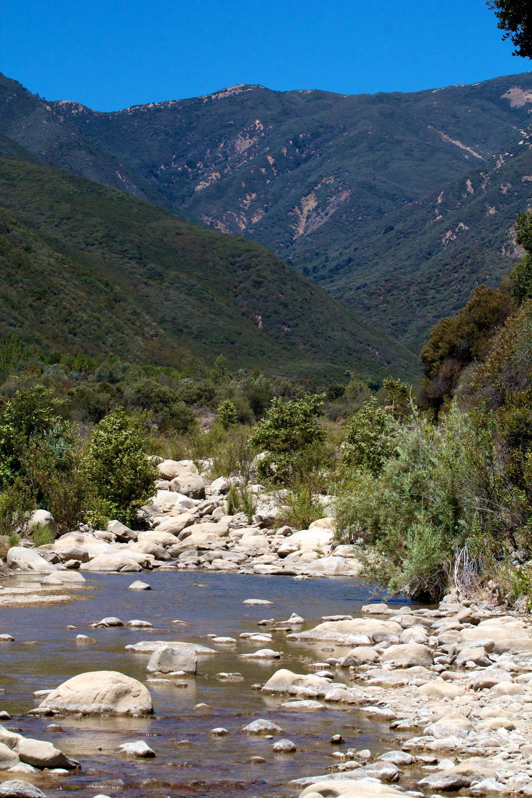
A rocky creek bed with calm water flowing between rounded stones, leading toward a steep, brush-covered mountain slope under a clear blue sky.
Matilija Creek flowing through the rugged landscape of the Matilija Wilderness.

Matilija Wilderness history and protected-area timeline

The cultural layers beneath Matilija Wilderness reach back to the Chumash people, who once lived in a village called Mat'ilha somewhere within today's wilderness. The Chumash made use of the canyon's resources in a focused and traditional way, gathering dogbane from the canyon walls for fiber and harvesting pitch and pine nuts from the conifers above.

In the nineteenth century, the canyons became part of California's broader settler history. Murrieta Canyon, named for the legendary outlaw Joaquin Murrieta, served as a trekking route for miners traveling from Santa Barbara toward gold diggings on Piru Creek during the California Gold Rush. The Upper North Fork of Matilija Creek functioned as a mail route between inland and coastal parts of Ventura County before Highway 33 was built and bypassed the canyon. Recreational use also took hold in the late 1800s, with hikers, campers, fishermen, and hunters drawn to the upper Matilija area. Matilija Hot Springs, discovered in 1873 and turned into a public resort in 1877, became a regional attraction through several ownership changes before closing in 1988.

Matilija Creek was long valued for its steelhead fishery until the construction of Matilija Dam in 1948 severed access to the upper creek. The dam, now filled with sediment, has been considered for removal. The defining moment in the area's modern history came with the Los Padres Condor Range and River Protection Act of 1992, which established Matilija Wilderness alongside the neighboring Sespe Wilderness and five other Los Padres wildernesses. Part of Matilija Creek was also identified for possible inclusion in the National Wild and Scenic Rivers System, though it was ultimately not designated. In 2010, a public access controversy arose along the Matilija Trail; the issue was resolved in 2016 when a coalition of environmental groups and hikers secured a public easement through the Bonsall ranch in exchange for rerouting part of the trail and installing signage. Major fires, including the Thomas Fire in December 2017, the 1985 Wheeler Fire, and the 1932 Matilija Fire, have repeatedly reshaped the wilderness.

Matilija Wilderness landscape and geographic character

Matilija Wilderness is defined by the deep, steep-walled canyon system of upper Matilija Creek. The creek runs from the northwest corner of the wilderness in a southeasterly direction, joined along the way by tributaries such as the Upper North Fork, Old Man Canyon, and Murrieta Canyon. The result is a landscape of rugged, brushy slopes, crumbling rock outcrops, and narrow canyon bottoms that limit easy access and give the area a strongly untrammeled character.

Elevations span from about 1,600 feet along the Upper North Fork of Matilija Creek to 6,014 feet at Monte Arido, the prominent summit on the western edge of the wilderness. A small northern portion of the area drains into Sespe Creek and ultimately toward the Santa Clara River, highlighting the wilderness's position at a hydrological crossroads in the Santa Ynez Mountains. While much of the terrain is steep and fractured, the northern part of the wilderness offers somewhat gentler ground, and conifers begin to dominate the higher slopes.

The canyon bottoms contrast sharply with the surrounding chaparral- and rock-covered slopes. Riparian galleries of alder and maple follow the creek, framing the streambed with thick, deciduous vegetation that stands out in the otherwise evergreen and shrub-dominated terrain. These canyon corridors, combined with the multi-tiered waterfalls and rocky pools along Matilija Creek and its forks, give the wilderness a strong sense of vertical relief and concentrated natural drama within a relatively compact area.

Matilija Wilderness ecosystems, habitats, and plant life

The ecological identity of Matilija Wilderness is rooted in the transition between Mediterranean-climate shrublands, riparian woodlands, and conifer forests. Chaparral and other brushy vegetation dominate the warmer, lower slopes, creating dense cover across much of the terrain. Along the canyon bottoms, the wilderness shifts into a strikingly different microclimate, with cool, shaded riparian zones where alder and maple form thick stands that follow the stream channels.

At higher elevations, the vegetation transitions toward conifers, producing a montane character on the upper slopes and ridges. The juxtaposition of these habitat types over a relatively short elevation range gives the wilderness a layered ecological structure. This layering is well known to botanists and naturalists because of the presence of the Matilija poppy, an indigenous California plant renowned for producing the largest flowers of any native California species.

The wilderness falls within the broader ecological fabric of the Santa Ynez Mountains, where fire is a defining ecological process. Repeated large fires have burned through the area, including the 1932 Matilija Fire, the 1985 Wheeler Fire, and the 2017 Thomas Fire, which scorched virtually the entire wilderness. These events shape the successional character of the vegetation and influence habitat cycles for both plants and animals.

Matilija Wilderness wildlife and species highlights

Matilija Wilderness supports a diverse community of southern California wildlife drawn to its combination of dense canyon cover and high-elevation conifer habitat. Black bears roam the canyons along with mule deer, and the area is known habitat for mountain lions, bobcats, coyotes, and foxes. Smaller mammals such as raccoons, tree squirrels, rabbits, and ground squirrels are common in the brush and along the riparian corridors. Game birds, including quail, contribute to the avian mix.

The most ecologically significant species in the wilderness is the endangered California condor. The area has long been recognized as nesting habitat for condors, and the explicit protection of condor populations was a central purpose of the legislation that established the wilderness in 1992. Management of the area continues to be framed in terms of maintaining and restoring fish and wildlife populations, with condor conservation remaining a defining priority.

Historically, Matilija Creek supported a steelhead run that drew anglers from across the region, though the construction of Matilija Dam in 1948 blocked access to the upper reaches of the creek within today's wilderness boundary. Restoration discussions around the sediment-choked dam carry potential implications for the future of anadromous fish in the watershed.

Matilija Wilderness conservation status and protection priorities

Matilija Wilderness was created in 1992 by the Los Padres Condor Range and River Protection Act, which simultaneously designated several other wilderness areas in the Los Padres National Forest. The legislation linked the wilderness's formal purpose to fire prevention, watershed protection, and the maintenance and restoration of fish and wildlife populations and their habitats. California condor conservation was specifically cited, giving the area a distinct identity within the national wilderness system.

A key aspect of the wilderness's conservation role is its preservation of the upper Matilija Creek watershed. By keeping most of the drainage in a roadless, undeveloped condition, the wilderness helps protect water quality and natural hydrology for the Ventura River system beyond its boundaries. The wilderness also safeguards habitat continuity with the adjacent Dick Smith and Sespe wildernesses, contributing to a much larger block of protected landscape in the Santa Ynez Mountains.

The wilderness continues to grapple with the long-term impacts of fire. Major fires in 1932, 1985, and again in 2017 with the Thomas Fire have burned large portions of the area, shaping both vegetation patterns and management priorities. The proposed removal of Matilija Dam, which has filled with sediment and disrupts fish migration, represents another significant conservation issue tied to the long-term ecological health of the watershed.

Matilija Wilderness cultural meaning and human context

The name Matilija comes from Mat'ilha, the Ventureño Chumash name for a village that once lay within what is now the wilderness. The Chumash tied their livelihoods closely to the canyon's resources, gathering dogbane from the canyon walls for fiber and harvesting pitch and nuts from pine trees on the slopes above.

Later generations of Californians added their own layers to the canyons. Murrieta Canyon carries a strong association with the Gold Rush era and the legendary figure of Joaquin Murrieta, having served as a travel route for miners moving between Santa Barbara and the Piru Creek gold diggings. The Upper North Fork of Matilija Creek functioned as an inland-to-coastal mail route in the era before Highway 33 redirected travel.

Recreational culture has also left a clear mark on the area. The late nineteenth century saw Matilija Hot Springs emerge as a regional resort, and the Matilija Canyon area became a destination for campers, anglers, and hunters. Although the springs closed in 1988, their history remains a defining thread in the cultural identity of the Matilija region.

Top sights and standout views in Matilija Wilderness

Matilija Wilderness concentrates some of the most rugged canyon terrain in the Los Padres National Forest into a compact and ecologically rich area. It captures nearly the entire upper watershed of Matilija Creek, supports dense alder and maple riparian zones, and climbs from canyon bottoms near 1,600 feet to the 6,014-foot summit of Monte Arido. The wilderness is a stronghold for California condors and one of the defining landscape units in the southern Santa Ynez Mountains.

Best time to visit Matilija Wilderness

The character of a Matilija Wilderness visit shifts significantly with the seasons. Late spring through early summer generally offers the most comfortable hiking conditions, when canyon trails are more reliably passable and water is flowing in the creeks that feed waterfalls and swimming holes along Matilija Creek. Spring is also prime for viewing the area's wildflowers, including the distinctive Matilija poppy.

Summer and early fall can bring extreme heat in the lower canyons, particularly in the southern approach via the Matilija Trail, while winter and spring carry the greatest risk of flash floods, post-fire debris flows, and trail washouts in canyon sections. Visitors should also be aware that the wilderness has experienced repeated large-scale fires, and burned areas can affect both scenery and navigation. Many hikers favor cooler months for the long approach to Matilija Falls and the remote North Fork trail, though conditions should be checked before any extended trip.

Monthly climate preview

Long term temperature ranges and precipitation patterns across representative coordinates

Matilija Wilderness Climate Normals and Monthly Weather Records

Representative point measurements for Matilija Wilderness record sustained shifts in mean monthly temperatures and precipitation rates from winter lows to summer maximums. Examining the complete twelve month climate profile reveals full long term averages for temperature extremes and moisture levels across the protected landscape.
Annual mean16 °C
7 °C27 °C
Jan
Feb
Mar11°
Apr13°
May17°
Jun22°
Jul27°
Aug26°
Sep23°
Oct17°
Nov11°
Dec
Warmest month
July

26.7 °C

Coolest month
December

7.5 °C

Wettest month
February

2.5 mm/day

Driest month
August

0 mm/day

Park location guide

Geography guide, regional context, and park location map for Matilija Wilderness

Matilija Wilderness park geography, regions, and map view in United States of America

Understand where Matilija Wilderness sits in United States of America through a broader geographic reading of the surrounding landscape, nearby location context, and its mapped position within the national park landscape.

How Matilija Wilderness fits into United States of America

The United States of America is a federal presidential republic and one of the world's largest countries by area and population. It consists of 50 states across a vast territory spanning multiple time zones, with its capital in Washington, D.C. and largest city in New York City. The nation has a diverse economy, influential political system, and significant cultural and military presence globally.

Wider geography shaping Matilija Wilderness in United States of America

The United States occupies a vast territory in North America, bordered by Canada to the north and Mexico to the south. The 48 contiguous states stretch from the Atlantic to the Pacific Ocean, while Alaska occupies the northwestern region and Hawaii is an archipelago in the Pacific. The country encompasses diverse terrain including the Rocky Mountains, Appalachian Mountains, Great Plains, and extensive river systems.

Map view of Matilija Wilderness

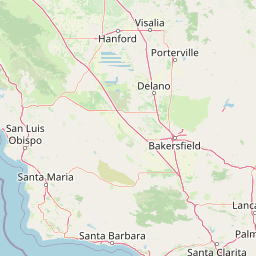
Use this park location map to pinpoint Matilija Wilderness in United States of America, understand its exact geographic position, and read its mapped placement within the surrounding landscape more clearly.

Pigeon | © OpenStreetMap contributors

Location context for Matilija Wilderness

California

Visual reference of protected watershed terrain, riparian habitats, and steep mountain relief in southern California

Matilija Wilderness Photos, Scenery, and Rugged Canyon Landscapes

Examine detailed photographs capturing the steep canyons, rocky slopes, and riparian creek corridors that define Matilija Wilderness. Visual records reveal the rugged terrain, native vegetation, and protected wildlife habitats spanning the upper watershed.

A rocky creek bed with calm water flowing between rounded stones, leading toward a steep, brush-covered mountain slope under a clear blue sky.

A black and white archival photograph looking north into a steep, rugged canyon with a rocky creek bed at the base, surrounded by scrub-covered mountain slopes.

Park atlas

Compare surrounding regional geography and connected protected landscapes

Explore Protected Areas And Other Parks Near Matilija Wilderness

Browse nearby national parks and protected areas sharing the rugged canyon terrain and watershed geography of Matilija Wilderness. Examining adjacent regional reserves provides broader context for southern California mountain ecosystems and protected landscapes.
Watercolor painting of a mountain landscape with forested foothills and a valley in the foreground.
Protected landscapeCalifornia
Mapped location lies within the park boundary#1 closest

West

Los Padres National Forest: Geography and Protected Landscape Map of Central California

Extensive wilderness corridors and high mountain ridges

Spanning from the Big Sur coastline to the interior ranges of the Santa Lucia and San Rafael mountains, Los Padres National Forest represents a significant protected area in California. The region contains deep gorges, forest-covered canyons, and high-altitude pine ridges that provide essential habitat and support major river headwaters.

Area
7,700 km²
Established
1936
Relief
Mountain
Climate
Mediterranean
A soft, painterly watercolor illustration depicting layered green mountain ridges and rolling foothills under a bright, open sky.
Protected landscapeCalifornia
About 33 km away#2 closest

Southeast

Angeles National Forest: Mapped Protected Landscapes and Geographic Terrain in California

Mountain wilderness and Mediterranean watershed geography

Spanning the San Gabriel and Sierra Pelona ranges, Angeles National Forest serves as a dramatic ecological transition zone. This analysis of its protected landscape focuses on the interaction between steep canyons, high peaks, and the distinct chaparral and conifer zones that shape California geography.

Area
2,652.26 km²
Established
1908
Relief
Mountain
Climate
Mediterranean
National parkCalifornia
About 64 km away#3 closest

South

Channel Islands National Park: A Protected Landscape within California's Geography

Explore its unique mapped terrain and protected area context.

Channel Islands National Park stands as a key protected area, providing critical insight into California's unique geographic features and natural landscapes. This entry focuses on the park's identity as a protected entity, detailing its mapped boundaries and the surrounding regional geography. It offers an atlas-level view, essential for understanding the park's contribution to the broader landscape context of the United States and its conservation importance.

Area
1,009.94 km²
Established
1980
IUCN
II
Visitors
323.2K annual
A watercolor illustration of rolling green hills, a small shoreline, and patches of grass against a white background.
Protected landscapeCalifornia
About 74 km away#4 closest

Southeast

Santa Monica Mountains National Recreation Area: Protected Landscape and Regional Geography

Exploring the ecological and cultural tapestry of Southern California's coastal mountains.

Santa Monica Mountains National Recreation Area comprises a complex array of parks and preserves that protect the unique Mediterranean climate of Southern California. The terrain showcases rugged ridgelines, deeply carved canyons, and vital coastal habitats. As a significant urban protected area, it offers an essential look at how biodiversity, human history, and regional geography coexist within one of the most populated zones in the United States.

Area
638 km²
Established
1978
IUCN
V
Visitors
795.2K annual
Watercolor painting of a panoramic mountain landscape with stylized pine trees and soft green meadows.
Protected landscapeCalifornia
About 78 km away#5 closest

Northeast

Sequoia National Forest: Protected Sierra Nevada Geography and Mountain Terrain

A vast protected landscape spanning 1.1 million acres in California

Spanning Tulare, Kern, and Fresno counties, Sequoia National Forest preserves iconic giant sequoia groves across multiple river watersheds. The terrain features vertical relief exceeding 11,000 feet, showcasing a range of ecosystems from chaparral slopes and coniferous forests to glacial cirques and granite spires located within the southern Sierra Nevada range.

Area
4,829.17 km²
Established
1908
Relief
Mountain
Climate
Mediterranean
Marine protected areaCalifornia
About 79 km away#6 closest

Southwest

Channel Islands National Marine Sanctuary Marine Protected Area Map and Atlas

Southern California marine habitat and island topography

Channel Islands National Marine Sanctuary protects 1,470 square miles of diverse marine environment near the California coast. This sanctuary guards vital kelp forests and deep seafloor ecosystems while preserving deep water archaeological sites and the biological legacy of the Northern Channel Islands.

Area
3,807 km²
Established
1980
IUCN
V
Relief
Lowland
A horizontal watercolor painting depicting a wide, winding river flowing through a coastal valley with rolling hills in the background and sparse green vegetation in the foreground.
Marine protected areaCalifornia
About 82 km away#7 closest

West

Chumash Heritage National Marine Sanctuary: California Marine Protected Area Atlas

Mapping coastal transition zones and submarine seafloor features

Spanning over 4,500 square miles off the Central Coast of California, the Chumash Heritage National Marine Sanctuary represents a critical ecological intersection between northern and southern marine species. The sanctuary includes dramatic underwater terrain like Arguello Canyon, Rodriguez Seamount, and the Santa Lucia Bank, creating a complex habitat that sustains kelp forests and diverse maritime resources.

Area
11,770 km²
Established
2024
IUCN
V
Relief
Mixed relief
Wildlife reserveSan Luis Obispo County
About 108 km away#8 closest

Northwest

Garcia Wilderness: Mapped Boundaries and Geographic Identity in San Luis Obispo County

Studying the Santa Lucia Range ridge and forest ecosystems

Located in San Luis Obispo County, Garcia Wilderness encompasses 14,100 acres of protected coastal mountains. Its topography features a prominent east-west ridge system that dictates local drainage patterns and vegetative shifts, ranging from lower-slope chaparral to dense oak forests. This area represents a vital segment of the federal conservation efforts established to protect the central California landscape.

Area
57 km²
Established
1992
IUCN
Ib
Relief
Mountain

Common questions about visiting, size, designation, and location context for Matilija Wilderness

Matilija Wilderness FAQs for park facts, access, geography, and protected area context

Find quick answers about Matilija Wilderness, including protected-area facts, park geography, trail and visitor context, and how the park fits into its surrounding country and regional landscape.
MoriAtlas Explorer

Continue Your Protected Areas Search Across the Global Atlas

Deepen your exploration by continuing the structured search for national parks and protected areas worldwide. Utilize the comprehensive filtering capabilities to compare different conservation landscapes and refine your understanding of global park geography. Discover more about the distribution and characteristics of protected natural areas.

Global natural geography