Mori Atlas logo
Nature reserveMatjiesrivier Nature Reserve

A transitional protected area defined by slate geology, San rock art, and the overlap of fynbos and karoo biomes.

Matjiesrivier Nature Reserve: Exploring the Botanical Geography and Cultural Landscapes of Western Cape

Matjiesrivier Nature Reserve serves as a vital ecological junction in the northern Western Cape, bridging the rugged Cederberg mountain landscapes with the arid interior basins. This protected area supports an exceptional botanical mosaic where rare fynbos and succulent karoo plant communities intersect, dictated by distinct slate-derived soil formations. Beyond its scientific significance as part of the Cape Floral Region, the reserve holds an extensive record of human history through hundreds of San rock art sites embedded within its sheltered valleys and ridges.

fynbossucccult karoocape floral kingdomrock artsan rock artcederberg

Matjiesrivier Nature Reserve

Nature reserve

Park overview

Structured park overview, official facts, and landscape profile for Matjiesrivier Nature Reserve

Matjiesrivier Nature Reserve park facts, protected area profile, and essential visitor context

Review the core facts for Matjiesrivier Nature Reserve, including designation, size, terrain, visitor scale, habitats, and operating context in one park-focused overview.

About Matjiesrivier Nature Reserve

Matjiesrivier Nature Reserve occupies a distinctive ecological and cultural position in the northern Western Cape of South Africa. Its geography places it on the doorstep of the Cederberg mountains, with the larger Cederberg Nature Reserve along its northwestern edge, while the reserve itself extends into lower-lying terrain where the botanically extravagant world of the Cape Floral Kingdom gradually gives way to drier, more sparsely vegetated landscapes. The result is a reserve that does not fit neatly into any single vegetation category; instead, it captures a transition zone of considerable conservation interest.

The reserve forms part of the Cape Floral Region Protected Areas, the UNESCO World Heritage Site that protects a network of fynbos-rich areas spanning the Western and Eastern Cape. This inscription links Matjiesrivier to one of the most botanically significant protected-area complexes in the world, recognized for both its species richness and the evolutionary processes that shaped its unique flora. By safeguarding a slate-dominated portion of this regional mosaic, the reserve helps maintain the ecological continuity and resilience of the broader fynbos system.

Equally important to the reserve's identity is its cultural and archaeological heritage. Scattered across the Matjiesrivier landscape are numerous rock shelters bearing paintings created by San hunter-gatherers. These rock art sites, many of them richly layered, represent an unbroken record of symbolic expression stretching back thousands of years. Together, the botanical and cultural values of Matjiesrivier give the reserve a dual significance: it is both an ecological stronghold of the Cape Floral Region and a custodian of one of the more remarkable concentrations of prehistoric rock art in southern Africa.

Quick facts and research context for Matjiesrivier Nature Reserve

Matjiesrivier Nature Reserve is situated in the northern Western Cape of South Africa, adjacent to the northwestern boundary of the Cederberg Nature Reserve. Established in 1995 after acquisition by WWF South Africa, the reserve has been managed ever since by CapeNature, the province's statutory conservation body.

The reserve covers a substantial area of rugged fynbos and karoo-influenced terrain underlain primarily by slate bedrock. It was inscribed in 2004 as part of the Cape Floral Region Protected Areas UNESCO World Heritage Site, under natural criteria recognizing both ecological processes and biodiversity significance.

Park context

Deeper park guide and search-rich context for Matjiesrivier Nature Reserve

Matjiesrivier Nature Reserve history, landscape, wildlife, and travel context

Explore Matjiesrivier Nature Reserve through its history, landscape character, ecosystems, wildlife, conservation priorities, cultural context, and seasonal travel timing in a structured park guide built for atlas discovery and search intent.

Why Matjiesrivier Nature Reserve stands out

Matjiesrivier is best known for its position at the ecological meeting point between fynbos and succulent karoo vegetation, a transition made distinctive by the area's slate-derived soils. This blend of Cape Floral Kingdom plant communities with drier, semi-desert flora creates a botanical landscape of unusual variety within a relatively compact area. The reserve is also widely recognized for its exceptional concentration of San rock art. Hundreds of painted rock-shelter sites have been documented, and ongoing discoveries continue to add to the count, making Matjiesrivier one of the more archaeologically important nature reserves in the Western Cape.

Matjiesrivier Nature Reserve history and protected-area timeline

Matjiesrivier Nature Reserve was purchased in 1995 by WWF South Africa, marking the beginning of formal state-aligned conservation protection for the area. From that point onward, the reserve has been managed by CapeNature, the public conservation agency responsible for protected areas across the Western Cape province.

The reserve's broader recognition expanded significantly in 2004, when it was inscribed as part of the Cape Floral Region Protected Areas UNESCO World Heritage Site. This listing acknowledged the reserve's contribution to one of the world's most botanically distinctive regions. The World Heritage inscription was later extended in 2015, strengthening the integrated protection status of the wider Cape floral landscape network of which Matjiesrivier forms a part.

Long before any modern conservation designation, the Matjiesrivier valley was inhabited and traversed by San peoples, whose layered rock paintings record continuous human presence across several millennia. These sites, ranging in estimated age from roughly 300 to 6,000 years, are now formally protected as National Monuments under South Africa's National Heritage Resources Act of 1999, giving the reserve both an ecological and a deep-time cultural history.

Matjiesrivier Nature Reserve landscape and geographic character

The landscape of Matjiesrivier Nature Reserve is shaped by the meeting of two very different environmental worlds: the mountain country of the nearby Cederberg and the drier interior basin that lies beyond. The result is a terrain of folded ridges, rocky slopes, sheltered valleys, and open flats, all carved into a substrate in which slate predominates. This underlying geology plays a defining role in determining what grows where, and it is one of the main reasons why so many vegetation types coexist within the reserve.

Slate bedrock weathers into relatively fine, mineral-rich soils that retain little moisture, encouraging plant communities adapted to lean, well-drained ground. Where the terrain rises and rocks break through the surface, the land becomes even harsher, and vegetation thins to scattered shrubs and hardy succulents. In wetter hollows, denser fynbos thickets take hold, while lower, hotter parts of the reserve take on a distinctly karoo-like character, with sparse, spaced-out shrubs and a generally arid feel. Across the reserve, the eye moves constantly between these modes, giving the landscape a layered, transitional quality rather than a single dominant character.

Matjiesrivier Nature Reserve ecosystems, habitats, and plant life

Matjiesrivier sits within the Cape Floral Kingdom, the smallest of the world's six floral kingdoms but one of the most botanically diverse per unit area. The reserve is essentially built around the contrast and contact between two major plant formations. On the more mesic, moisture-retaining ground, fynbos vegetation dominates, with its characteristic mix of fine-leaved shrubs, restios, bulbous plants, and proteas typical of the Cape region. On drier, sun-exposed slopes and flats, the flora shifts toward succulent karoo and karoo-influenced communities, where small-leaved shrubs, succulents, and drought-adapted plants become more prominent.

The underlying slate is significant because it favors a particular kind of landscape mosaic: not the classic Cape sandstone fynbos of the wetter coastal mountains, but a hybrid environment where fynbos and karoo communities overlap. This makes Matjiesrivier ecologically valuable as a transition zone and contributes directly to its inclusion in the Cape Floral Region Protected Areas World Heritage Site, which celebrates both the region's botanical richness and the evolutionary processes that produced it.

Matjiesrivier Nature Reserve wildlife and species highlights

The wildlife profile of Matjiesrivier is shaped as much by its landscapes as by its location within a regional conservation network that spans much of the Western Cape. Mammals typical of the Cederberg and surrounding dry mountain environments are present, including small to medium-sized species adapted to fynbos and karoo habitat, such as various antelope suited to shrubland and rocky terrain. The reserve's mosaic of slopes, valleys, and flats provides a range of microhabitats that support these populations alongside smaller carnivores, reptiles, and a wide diversity of birdlife.

Avifauna is a particular strength of the area, with raptors, rock-dwelling species, and fynbos endemics common in reserves of this type. The reserve also benefits from its proximity to the larger Cederberg Nature Reserve, allowing wildlife movements and ecological processes to extend across the combined protected landscape. While the reserve is not primarily marketed as a wildlife-viewing destination on the scale of larger South African parks, its biodiversity remains a meaningful part of its conservation value.

Matjiesrivier Nature Reserve conservation status and protection priorities

Matjiesrivier Nature Reserve holds conservation significance well beyond its area because of its role within the Cape Floral Region Protected Areas. Inscribed in 2004 and later extended in 2015 under UNESCO natural criteria recognizing both ecological processes and outstanding biodiversity, the reserve contributes to a transnational effort to protect the extraordinary plant diversity of the Cape Floral Kingdom, the world's smallest floral kingdom and one of its most botanically rich.

At a regional level, the reserve is managed by CapeNature as part of an integrated network of Western Cape protected areas. Its position adjacent to the Cederberg Nature Reserve strengthens the conservation value of both areas by creating a larger contiguous landscape in which ecological processes can operate. The reserve also protects an unusually high density of San rock art sites, formally designated as National Monuments, which adds a heritage-conservation dimension to its ecological role and reinforces the integrated natural-cultural value of the area.

Matjiesrivier Nature Reserve cultural meaning and human context

The cultural dimension of Matjiesrivier is anchored in its remarkable San rock art heritage. Rock shelters throughout the reserve carry paintings attributed to Khoi-San (Khoi) peoples, and the sheer quantity of these sites has made the reserve an important reference point for understanding late Stone Age symbolic life in southern Africa. Individual paintings have been dated to ages ranging from roughly 300 to 6,000 years, offering a long, continuous record of how hunter-gatherer communities engaged with the landscape, socially and spiritually.

These rock paintings are protected as National Monuments under South Africa's National Heritage Resources Act of 1999. Their significance extends beyond archaeology: they connect the reserve's ecological story with the deep human story of the Western Cape interior. The combined natural and cultural value of the area is a central part of why the landscape has been protected in the first place and why it continues to attract both conservation and research interest.

Top sights and standout views in Matjiesrivier Nature Reserve

Matjiesrivier Nature Reserve stands out for the unusual overlap of fynbos and succulent karoo vegetation, made possible by its underlying slate geology and its position between the Cederberg mountains and the drier interior. This botanical mosaic places it firmly within the Cape Floral Region Protected Areas UNESCO World Heritage Site.

Equally striking is the reserve's extraordinary rock art record. Hundreds of San rock shelter paintings, ranging across several millennia, have been documented and continue to be discovered, making Matjiesrivier one of the most significant rock art landscapes within a formally protected area in the Western Cape.

Best time to visit Matjiesrivier Nature Reserve

Because the reserve falls within a Mediterranean-climate region of the Western Cape, the cooler and wetter winter months tend to bring the fynbos and karoo vegetation into a greener, more floriferous condition. This is generally the most rewarding period for appreciating the reserve's botanical character, when wildflower displays in fynbos communities can be at their most expressive.

Spring, bridging the wet and dry seasons, often combines lingering moisture with warming temperatures and is widely regarded as a favorable window for visiting floral-rich reserves of this kind. The drier summer months bring hotter conditions and more subdued vegetation, but also clearer skies and easier access to remote rock art sites, for visitors whose primary interest is landscape and archaeological scenery rather than botany.
Monthly climate preview

Long-term representative monthly temperature and precipitation measurements

Matjiesrivier Nature Reserve Climate Normals and Annual Temperature Rhythm

Representative coordinates record distinct annual temperature and precipitation shifts across twelve recorded intervals at Matjiesrivier Nature Reserve. Comprehensive monthly climate normals provide deeper analytical context for long-term regional patterns.
Annual mean16 °C
9 °C24 °C
Jan24°
Feb24°
Mar22°
Apr17°
May13°
Jun
Jul
Aug
Sep12°
Oct16°
Nov18°
Dec22°
Warmest month
January

23.7 °C

Coolest month
July

8.7 °C

Wettest month
June

3.6 mm/day

Driest month
January

0.4 mm/day

Park location guide

Geography guide, regional context, and park location map for Matjiesrivier Nature Reserve

Matjiesrivier Nature Reserve park geography, regions, and map view in South Africa

Understand where Matjiesrivier Nature Reserve sits in South Africa through a broader geographic reading of the surrounding landscape, nearby location context, and its mapped position within the national park landscape.

How Matjiesrivier Nature Reserve fits into South Africa

South Africa is the southernmost country in Africa, spanning 1.22 million km² with a population of over 63 million. The country operates with three capital cities, Pretoria (executive), Cape Town (legislative), and Bloemfontein (judicial), and is renowned for its biodiversity, national parks, and multicultural society.

Wider geography shaping Matjiesrivier Nature Reserve in South Africa

South Africa occupies the southernmost region of Africa, with coastline along both the Atlantic Ocean to the west and the Indian Ocean to the east. The interior features elevated plateaus including the Highveld, with the Drakensberg escarpment marking the eastern highlands. The country shares borders with Namibia, Botswana, Zimbabwe, Mozambique, Eswatini, and Lesotho.

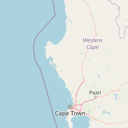
Map view of Matjiesrivier Nature Reserve

Use this park location map to pinpoint Matjiesrivier Nature Reserve in South Africa, understand its exact geographic position, and read its mapped placement within the surrounding landscape more clearly.

Pigeon | © OpenStreetMap contributors

Location context for Matjiesrivier Nature Reserve

Western Cape
Park atlas

Compare adjacent mountain reserves and regional botanical conservation areas

Parks Near Matjiesrivier Nature Reserve and Surrounding Protected Landscapes

Browse other parks near Matjiesrivier Nature Reserve to examine connected conservation terrain across the Western Cape. Comparing adjacent protected areas reveals broader regional plant distributions and transitional mountain landscapes.
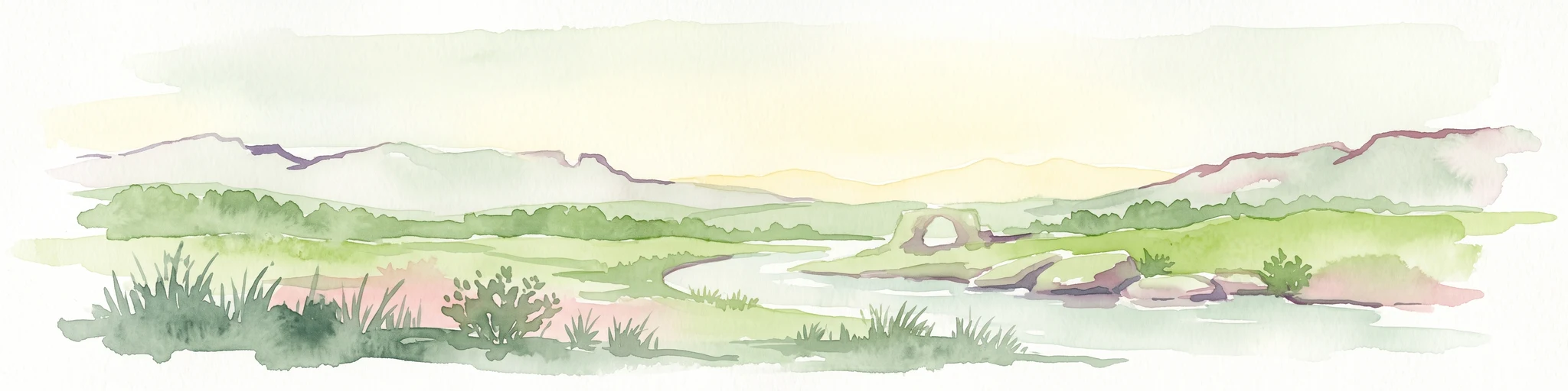
A watercolor illustration of a scenic wilderness landscape with rolling hills, a winding stream, foreground grasses, and a distinct rock arch formation in the background.
Wildlife reserveWestern Cape
About 35 km away#1 closest

Northwest

Cederberg Wilderness Area: Geographic Overview of Western Cape Protected Landscapes

Mapped sandstone peaks and diverse fynbos wilderness.

The Cederberg Wilderness Area represents a rugged mountain range defined by its resistant Peninsula Formation sandstone and complex geological history. Encompassing dramatic rock formations, ancient caves, and unique botanical endemics, the area offers a study in the intersection of mountainous terrain and the Cape Floral Region. Understand the regional context and physical geography that shape this protected sanctuary.

Area
710 km²
Established
1973
Relief
Mountain
Climate
Mediterranean
Watercolor illustration showing a mountain range with green hills and pink flowers
National parkNorthern Cape
About 37 km away#2 closest

Northeast

Tankwa Karoo National Park National Park: Mapped Protected Landscape in Northern Cape

Explore regional geography and protected area boundaries.

Tankwa Karoo National Park is a key protected area situated in the vast Northern Cape region of South Africa. This entry provides a detailed atlas perspective, focusing on the park's mapped geography and its significance as a national park. Understand the park's landscape context and its position within the broader regional geography for informed exploration and geographic discovery.

Area
1,436 km²
Established
1986
Relief
Upland
Climate
Arid
A horizontal watercolor painting showing a soft, stylized mountain landscape with green hills, purple shadows, and grassy foreground.
Wildlife reserveWestern Cape
About 63 km away#3 closest

Southwest

Groot Winterhoek Wilderness Area: Protected Mountain Reserve in the Western Cape

Mapping sandstone ridges, fynbos plateaus, and mountain river systems

Spanning 30,000 hectares, Groot Winterhoek Wilderness Area represents a core mountain wilderness in South Africa. Its dissected landscape of Table Mountain sandstone features high peaks, sheltered kloofs, and seasonal rockpools, forming a critical ecological corridor and water catchment within the Cape Fold Belt mountain system.

Area
306.08 km²
Relief
Mountain
Climate
Mediterranean
Access
Moderate access
Nature reserveWestern Cape
About 102 km away#4 closest

West

Rocherpan Nature Reserve: Mapping Coastal Wetlands and Strandveld Landscapes in the Western Cape

Protected coastal reserve on the South African West Coast.

Located along the Atlantic shore between Velddrif and Elands Bay, Rocherpan Nature Reserve encompasses a rare, seasonal wetland system. The reserve protects a complex of dune cordons, sandy beaches, and low-lying coastal veld that transforms dramatically with the winter rains. This map-focused entry highlights the ecological layering and geographic significance of this South African protected area.

Area
18 km²
Established
1976
Relief
Lowland
Climate
Mediterranean
Nature reserveWestern Cape
About 112 km away#5 closest

Northwest

Bird Island Nature Reserve: Mapped Coastal Protected Areas and Seabird Habitats

Geography and protected island landscapes in Western Cape, South Africa

Bird Island Nature Reserve represents a key protected coastal landform off the West Coast of South Africa. This three hectare reserve functions as a critical nesting ground, characterized by flat rocky shelves and sun-bleached outcrops. Browse the mapped boundaries and geographic features of this marine sanctuary, which plays a major role in regional seabird conservation and coastal ecological study.

Area
0.03 km²
Established
1988
Relief
Lowland
Climate
Mediterranean
National parkWestern Cape
About 113 km away#6 closest

Southwest

West Coast National Park: A National Park's Mapped Boundaries and Geographic Identity

Explore its protected landscape within the Western Cape region.

West Coast National Park is a protected national park situated in the Western Cape province of South Africa. This dedicated page provides a structured view of its geographic scope, emphasizing its mapped boundaries and its significance as a protected landscape within the region's broader atlas context. Gain insight into the park's distinct natural terrain and regional geography.

Area
362.59 km²
Established
1985
Climate
Mediterranean
Access
Easy access
A stylized digital illustration of a deep gorge with steep rocky cliffs, a flowing river, a waterfall, and trees in the foreground.
Nature reserveNorthern Cape
About 118 km away#7 closest

North

Oorlogskloof Nature Reserve; Protected Mountain Landscapes and River Gorges of Northern Cape

A diverse protected area featuring Karoo-fynbos biome transitions.

Oorlogskloof Nature Reserve presents a dramatic study in regional geography, characterized by deep river canyons, exposed rock shelves, and vast semi-desert plateaus. Located near the edge of the Knersvlakte, the reserve creates a refuge where seasonal waterfalls and rocky basins provide essential freshwater habitats. This atlas entry focuses on the interplay between its steep cliff formations and the surrounding Northern Cape plains, offering a comprehensive view of the terrain and ecological diversity.

Area
47.76 km²
Established
1971
Relief
Mountain
Scope
Terrestrial
Biosphere reserveWestern Cape
About 141 km away#8 closest

South

Cape Winelands Biosphere Reserve: Geographic Overview and Protected Area Mapping

Western Cape mountain terrain and sustainable landscape integration

The Cape Winelands Biosphere Reserve serves as a model for integrated landscape management in South Africa. Situated along the Cape Fold Belt, this reserve protects crucial water catchments and endemic floral habitats while encompassing a globally recognized wine-producing region. Access detailed mapping of its core, buffer, and transition zones to see how conservation persists within a working agricultural environment.

Area
1,243.4 km²
Established
2007
Relief
Mountain
Climate
Mediterranean

Common questions about visiting, size, designation, and location context for Matjiesrivier Nature Reserve

Matjiesrivier Nature Reserve FAQs for park facts, access, geography, and protected area context

Find quick answers about Matjiesrivier Nature Reserve, including protected-area facts, park geography, trail and visitor context, and how the park fits into its surrounding country and regional landscape.
MoriAtlas Explorer

Continue Your Protected Areas Search Across the Global Atlas

Deepen your exploration by continuing the structured search for national parks and protected areas worldwide. Utilize the comprehensive filtering capabilities to compare different conservation landscapes and refine your understanding of global park geography. Discover more about the distribution and characteristics of protected natural areas.

Global natural geography