
Why Mausbachtal Nature Reserve stands out
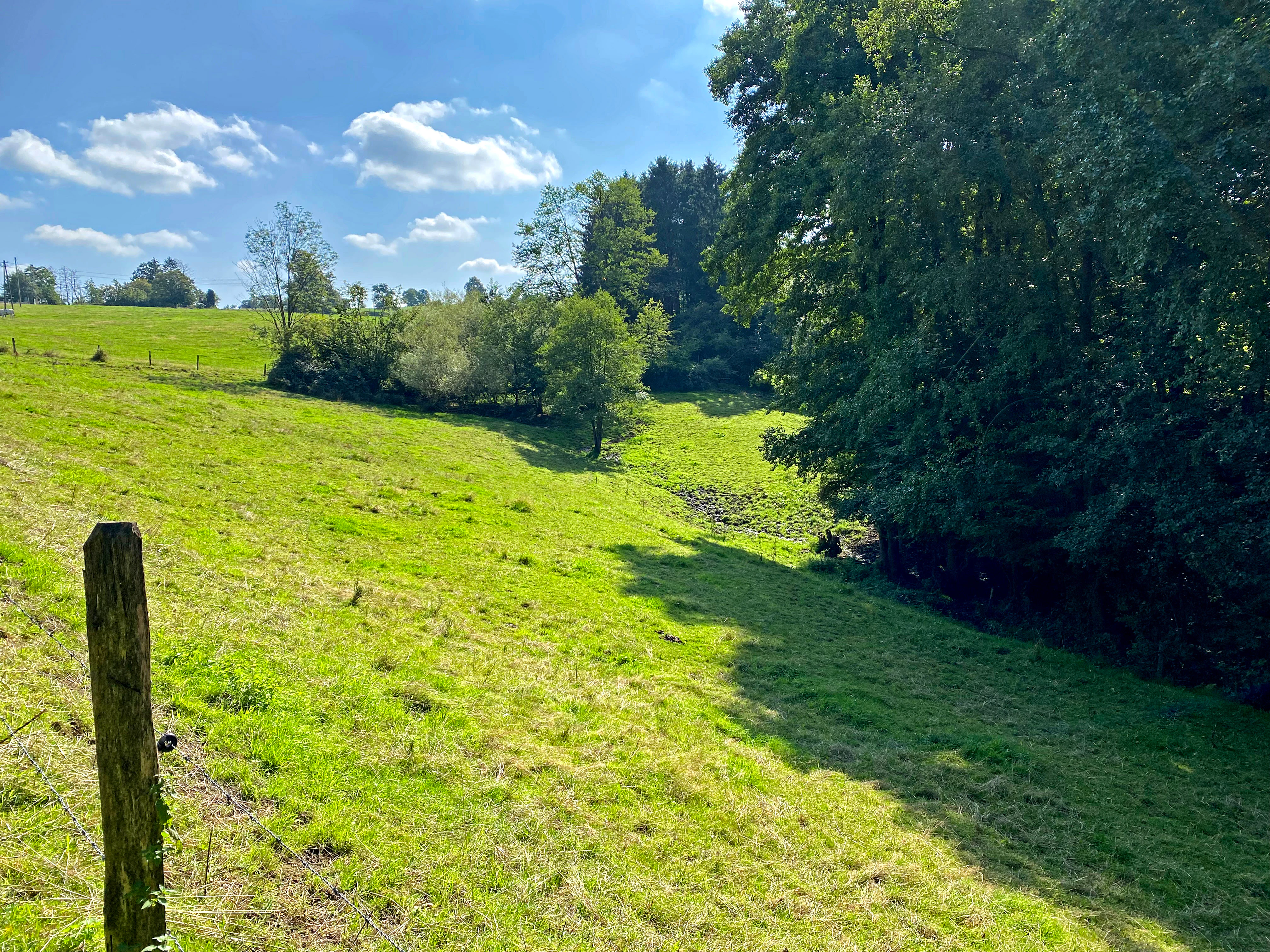
Mausbachtal is best known for its structurally rich, near-natural stream valley landscape typical of the Bergische Hochflächen, mixing incised stream channels, young mixed deciduous floodplain woods, beech forest on the upper slopes, and patches of species-rich wet meadow in the valley floor. The reserve is also notable for its role within the regional stream corridor network that connects the Mausbach to the larger Große Dhünn, and for the way it combines formerly open floodplain, now reafforested with alder and ash, with open wet grassland and tall herb fringes further upstream.
Mausbachtal Nature Reserve history and protected-area timeline
The formal history of Mausbachtal as a protected area is recent and tightly bound to the regional planning process in North Rhine-Westphalia. The site was officially designated as a nature reserve in 2013, giving it the protected-area code GM-103 and placing it under the administration of the Untere Landschaftsbehörde des Oberbergischen Kreises, the lower landscape authority of the district.
Its legal foundation is the local landscape plan (Landschaftsplan), which is the planning instrument through which North Rhine-Westphalia's districts zone areas for habitat and species management, landscape protection, or natural development. By incorporating Mausbachtal into the landscape plan, the district authorities recognized both the ecological representativeness of its stream valleys and their importance as part of the wider network of stream corridors across the Bergische Hochflächen.
Beyond this designation, the valley itself has a longer ecological history. In the lower reaches, the originally open floodplain of the Mausbach was reafforested with a young mixed deciduous stand, while parts of the upper and middle valley have shifted between mowing, grazing and abandonment over time, leaving a patchwork of intensive pastures, abandoned land, and fragments of flower-rich meadow that the present management seeks to restore.
Mausbachtal Nature Reserve landscape and geographic character
The topography of Mausbachtal reflects the broader character of the Bergische Hochflächen: a gently rolling to moderately incised upland plateau shaped by long-running stream erosion. The reserve's elevation runs from roughly 190 meters near its outlet into the Große Dhünn to about 270 meters along the upper slopes, with an average height close to 230 meters above sea level.
The defining landforms are the incised stream valleys themselves. The main Mausbach cuts an east-west oriented course through the plateau, transitioning from a Sohlenkerbtal in its middle reaches to a tighter Kerbsohlental below, while the Liethsiefen and the Hirschfelder Bachtal add narrower, branching valley channels that funnel down to the main stream. The valley floors alternate between forested narrow corridors, open wet meadow strips, and broader sections of intensively used grassland.
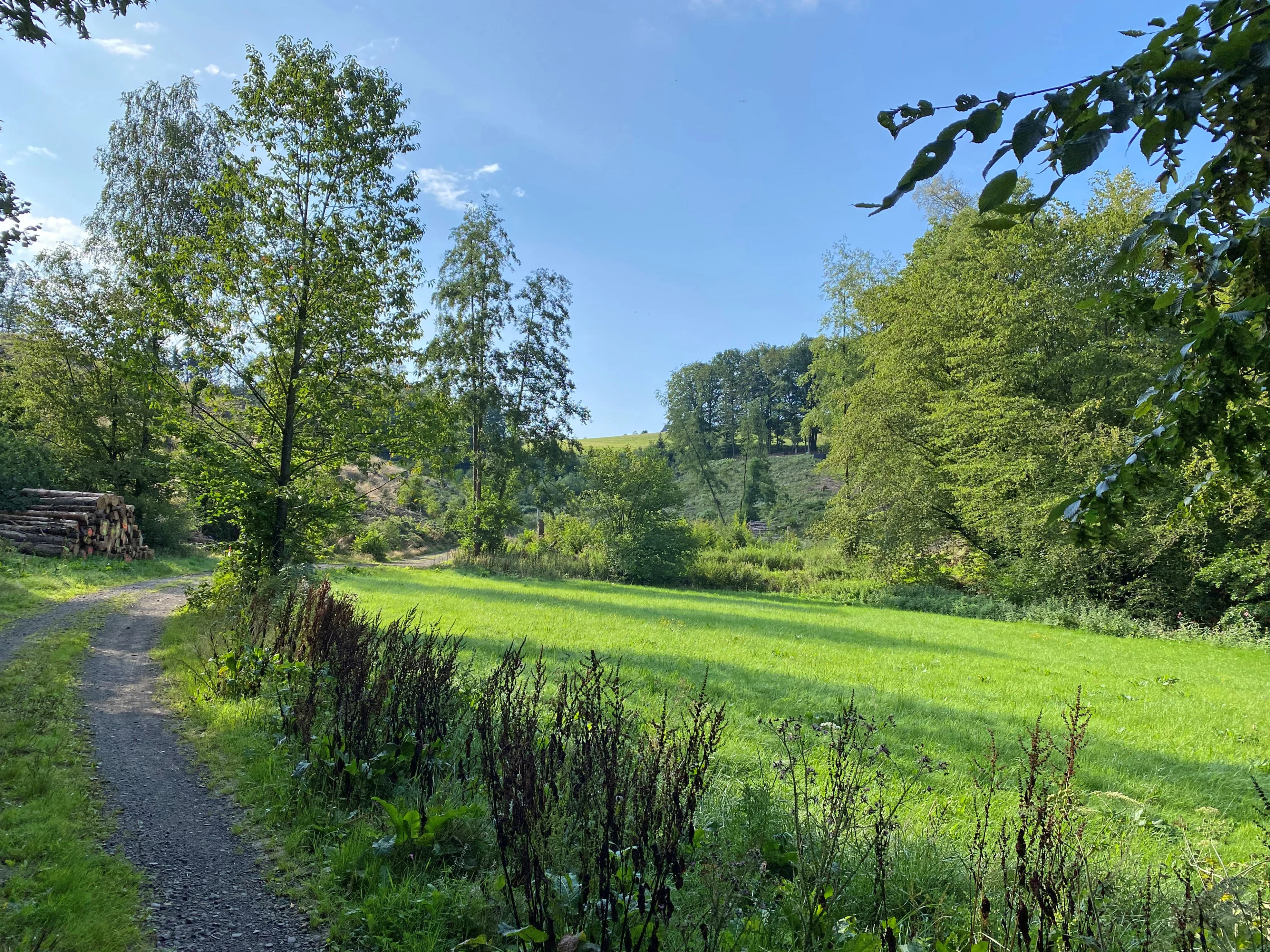
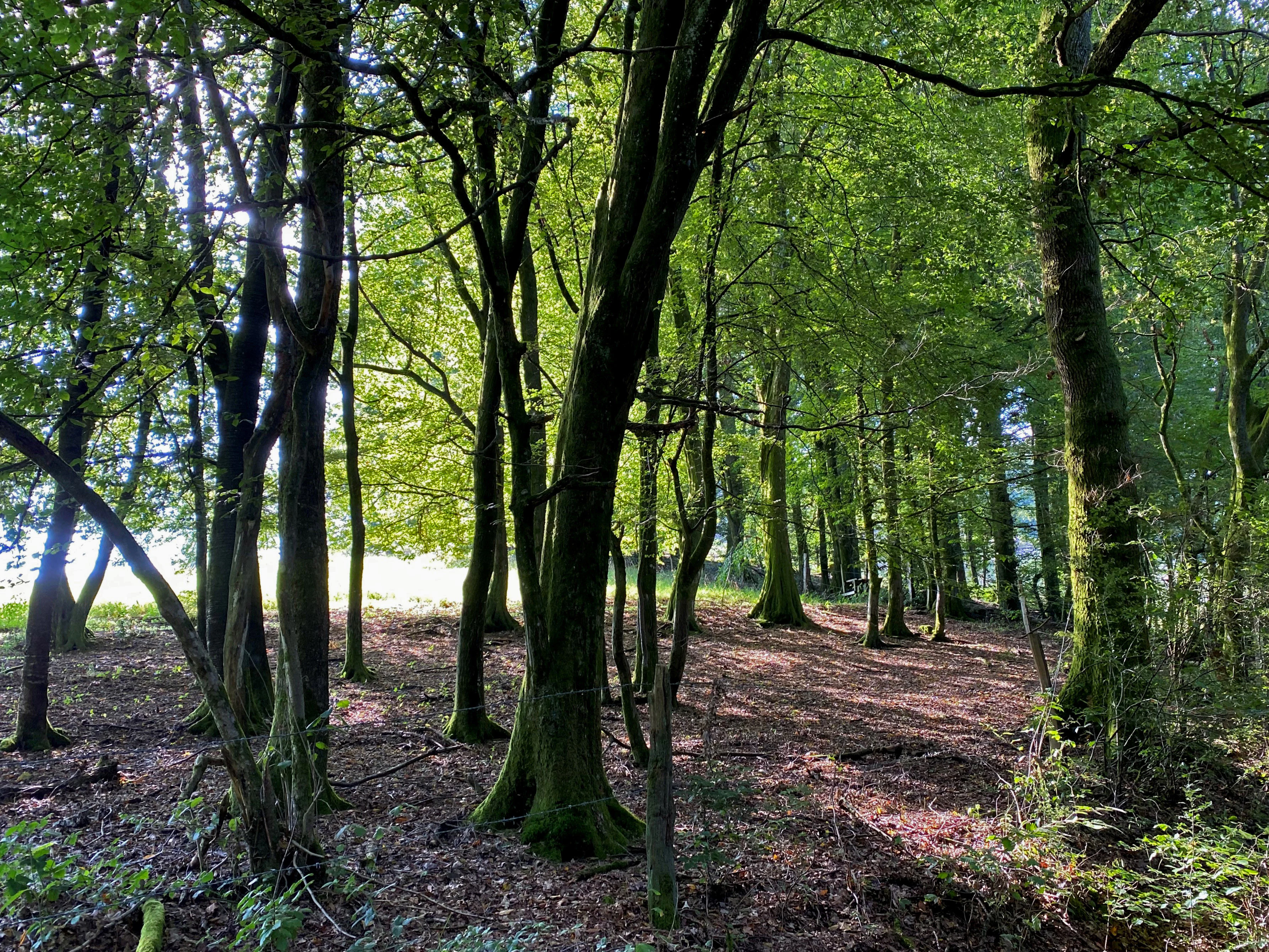
Above the stream channels the slopes carry a mix of mature beech forest on the upper reaches and younger mixed deciduous woodland lower down. Heath vegetation, fern and purple moor grass appear along sections of the walking trails that cross the reserve, hinting at the more open, acidic ground conditions that occur where the plateau surface dominates. The overall impression is of a small, tightly structured valley system rather than a wide, sweeping landscape, with the streams themselves acting as the connective spine of the reserve.
Mausbachtal Nature Reserve ecosystems, habitats, and plant life
Ecologically, Mausbachtal sits within the stream and meadow habitats of the Bergische Hochflächen, a nature region characterized by a transition between the more acidic, beech-dominated uplands and the wetter floodplain corridors that trace the larger streams. The reserve captures this transition unusually clearly because it contains both forested and open stretches along the same valley system.
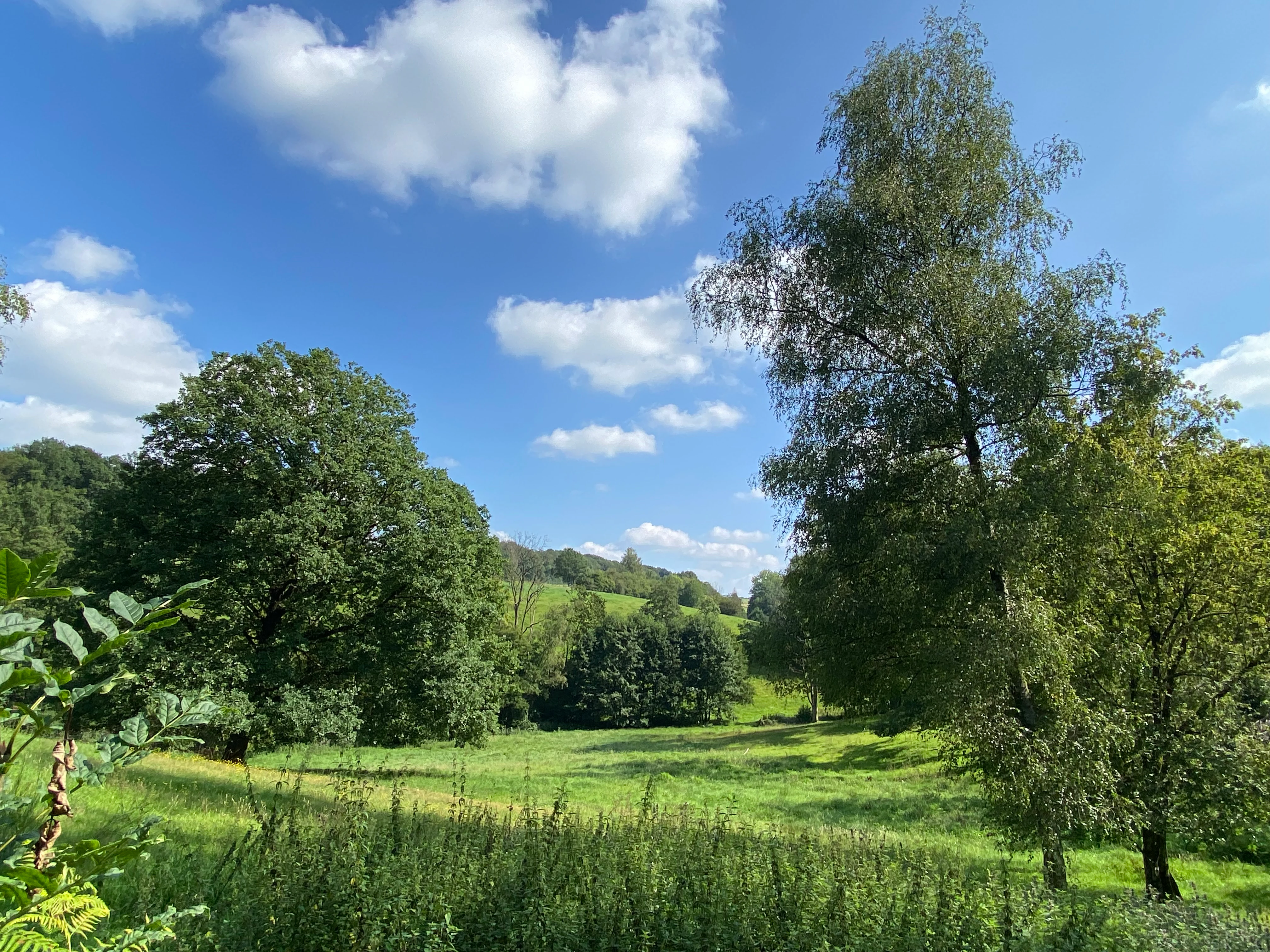
In the lower Mausbachtal, the former open floodplain of the Mausbach has been reafforested with a young mixed deciduous stand of sycamore maple, hornbeam, ash and alder. With continued development, this stand has clear potential to evolve into a more typical alder-ash floodplain woodland, providing the moist, species-rich woodland habitat typical of small upland stream corridors.
Along the upper and middle Mausbachtal and the Liethsiefen, the valley floor is more open. Species-rich wet meadows, tall herb fringes, and fragments of nutrient-poor meadow coexist with intensively used meadows and pastures, and with abandoned land now in the process of being restored. Notable plant species recorded in the reserve include meadowsweet, aconite-leaved buttercup, yellow flag iris, butterbur, salad burnet, ragged robin, marsh skullcap and sneezewort.
The reserve is also recognized as an important station in a regional network of stream habitats. The Mausbach connects northward to its own headwaters and southward and westward to the Große Dhünn, linking Mausbachtal into the larger hydrological and ecological context of the Dhünn catchment.
Mausbachtal Nature Reserve wildlife and species highlights
Although the source material does not catalog a full species list, the habitats present in Mausbachtal support a characteristic stream-valley fauna typical of the Bergische Hochflächen. The reserve's mix of moist deciduous woodland, wet grassland and tall herb fringes provides habitat for butterflies and other pollinators, including species documented in photographs from the site such as a blue butterfly resting on hemp agrimony and a large pearl-bordered fritillary observed within the reserve.
The streams themselves, their banks and the wet meadow and tall herb communities along them are typical habitat for amphibians, dragonflies, stream invertebrates and a range of farmland-edge and woodland birds associated with traditional, lightly managed valley landscapes. The presence of invasive Himalayan balsam along parts of the corridor indicates active ecological management aimed at protecting native plant and insect communities from displacement.
Mausbachtal Nature Reserve conservation status and protection priorities
Mausbachtal's conservation significance comes from its combination of structural diversity and representativeness for the Bergische Hochflächen. The reserve is highlighted in its own official description as representative of the broader stream valley landscape of the region, both because of its mosaic of forest, wet meadow and intensively used grassland and because of the comparatively well-preserved condition of some sections of floodplain habitat.
The young deciduous floodplain stands along the lower Mausbach are seen as having high development potential toward more natural alder-ash floodplain woodland, while the open upper valley, despite its mix of intensive use and abandoned land, still holds fragments of flower-rich meadow and wet grassland that justify protection and active restoration. The official conservation goal is to maintain and improve a near-natural stream valley through extensive mowing, bringing fallow land back into use, reducing nutrient inputs, and managing invasive species such as Himalayan balsam.
In the larger landscape, the reserve functions as a connective element. The Mausbach links it northward to the upper reaches of the same stream and southward and westward to the Große Dhünn, integrating Mausbachtal into the river network that runs through the western Oberbergischer Kreis and connecting it with adjacent protected areas such as the Oberlauf der Großen Dhünn.
Top sights and standout views in Mausbachtal Nature Reserve
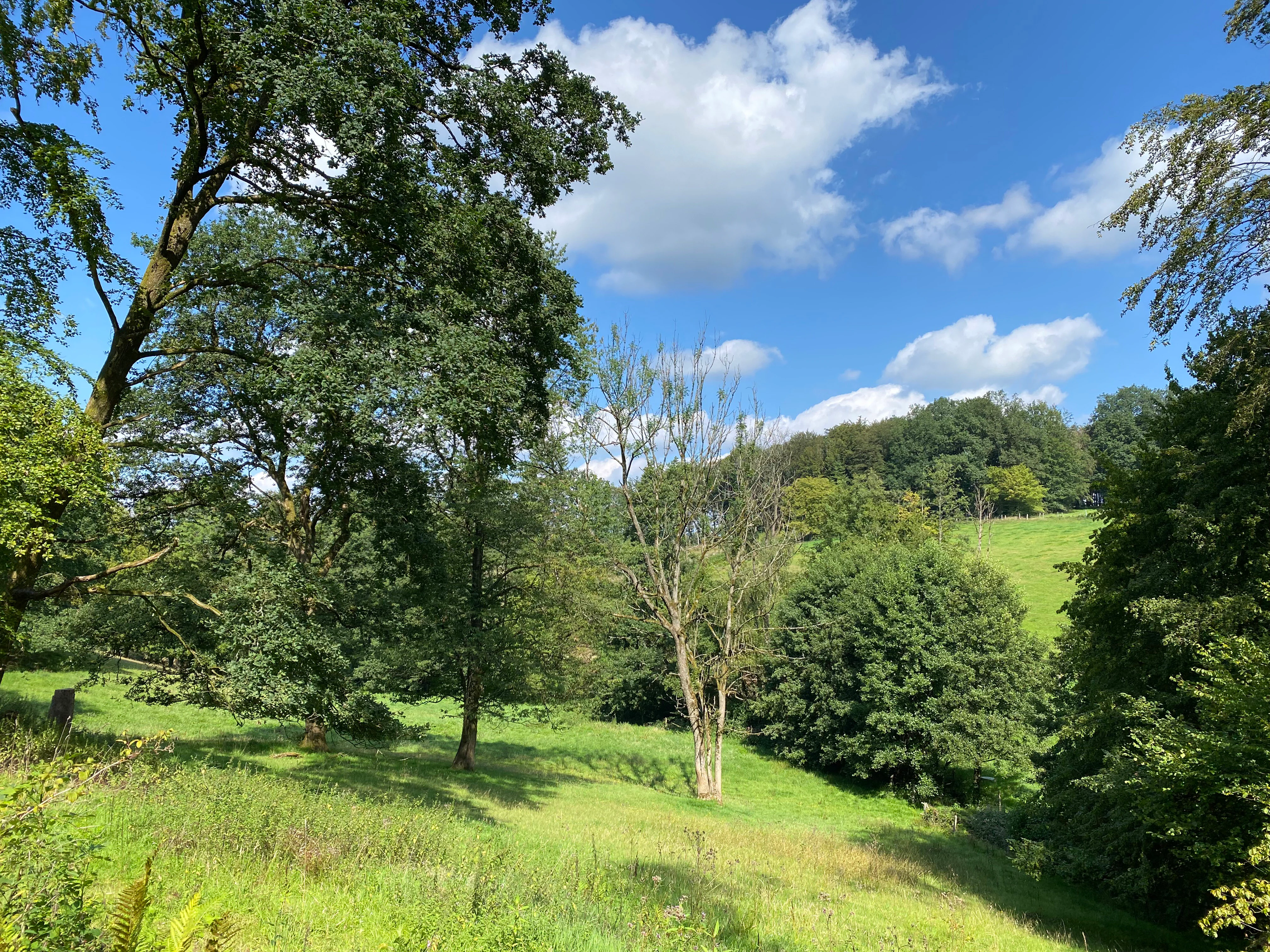
Mausbachtal is a compact but ecologically layered stream valley reserve on the Bergische Hochflächen. Its strongest features are the near-natural beech forest along the upper slopes, the young mixed deciduous floodplain stands developing along the lower Mausbach, and the mosaic of wet meadow, tall herb fringe and intensively used grassland in the upper and middle reaches.
The reserve is also notable for its role as a structural link in the regional stream corridor system. Through the Mausbach and the Große Dhünn it ties into a wider network of protected stream valleys in the Oberbergischer Kreis, including the Oberlauf der Großen Dhünn and other valley reserves nearby. Walking trails such as the route A3 cross the area, offering a ground-level view of the valley's mix of forest, meadow and wetland.
Best time to visit Mausbachtal Nature Reserve
Seasonal character at Mausbachtal follows the temperate, humid climate of the Bergisches Land. Late spring is typically the most colorful period, when the wet meadows and tall herb fringes along the open sections of the valley come into flower with species such as meadowsweet, ragged robin and sneezewort. Early summer brings dense, fresh green growth in the young floodplain forests, while autumn tends to highlight the mixed deciduous character of the lower valley with sycamore maple, hornbeam, ash and alder turning color together.
The reserve is largely a lowland valley landscape rather than an alpine or coastal setting, so weather and ground conditions matter more than altitude-driven seasonality. Wet, boggy sections along the valley floor are most easily appreciated in drier weather, while the streams themselves carry more water in winter and early spring, when the structural contrast between active channel, meadow and forested slope is at its strongest.