

Mori Atlas logo
State or regional parkMaxhamish Lake Provincial Park and Protected Area

A cohesive boreal lake basin, cultural landscape, and vital northern habitat refuge within the northeastern forests.

Maxhamish Lake Provincial Park and Protected Area: Mapping a Remote Boreal Wilderness in Northern British Columbia

(Tłu Tue - Maxhamish Lake Provincial Park and Protected Area)

Maxhamish Lake Provincial Park and Protected Area represents a significant northern wilderness reserve in northeastern British Columbia. Encompassing roughly 27,500 hectares of boreal lake, wetland, and coniferous forest, the park functions as a core refuge for moose, deer, and diverse cold-water fish populations. This protected landscape preserves the long-standing cultural heritage of the Fort Nelson First Nation and Acho Dene Koe, reflecting a deep, continuous connection between traditional Dene land use and the surrounding lake-basin terrain.

Boreal forestLake ecosystemNorthern wildernessIndigenous heritageDene territoryCold-water fish habitat

Maxhamish Lake Provincial Park and Protected Area

State or regional park

Park overview

Structured park overview, official facts, and landscape profile for Maxhamish Lake Provincial Park and Protected Area

Maxhamish Lake Provincial Park and Protected Area park facts, protected area profile, and essential visitor context

Review the core facts for Maxhamish Lake Provincial Park and Protected Area, including designation, size, terrain, visitor scale, habitats, and operating context in one park-focused overview.

About Maxhamish Lake Provincial Park and Protected Area

Maxhamish Lake Provincial Park and Protected Area sits in the far northeastern corner of British Columbia, positioned roughly 125 kilometres north of Fort Nelson and within reach of the Northwest Territories border. Despite its remote location, the park represents one of the larger lake-centric protected areas in the province, encircling the entire shoreline of Maxhamish Lake along with its surrounding boreal forest catchment. The combination of open water, wetland margins, and northern woodland gives the area a classic subarctic feel that is unusual within British Columbia's park system.

What sets Maxhamish Lake apart from many other northern parks is the depth of its cultural history. The lake, known to the Dene as Tłu Tue, has been part of the seasonal and year-round life of the Fort Nelson First Nation and Acho Dene Koe for countless generations. Dene families moved between places such as Nelson Forks, Dídah tthe, Tłigo ché, and Tłu Tue as part of a traditional seasonal round that combined hunting, trapping, fishing, and the gathering of medicinal plants. Burial sites, gathering places, and old village locations remain distributed around the lake, and four reserve parcels still protect gravesites under First Nations stewardship. Many community members continue to visit cabins around the lake year-round, and visitors are asked to approach the area with respect, travelling lightly and offering small acknowledgements before hunting, fishing, or trapping.

Ecologically, Maxhamish Lake functions as both a fish nursery and a northern wildlife refuge. The waters support species such as arctic cisco, least cisco, lake whitefish, northern pike, slimy sculpin, spottail shiner, trout-perch, walleye, and white sucker, while the surrounding forests and shoreline host moose and deer in considerable numbers. This ecological value is increasingly important because the region has also become a hub for British Columbia's oil and gas sector, with industrial operations and heavy traffic along Highway 77 placing the park at the edge of an actively developed landscape. The park's combined ecological, cultural, and geographic character makes it a distinctive northern entry in British Columbia's protected-area network.

Quick facts and research context for Maxhamish Lake Provincial Park and Protected Area

Maxhamish Lake Provincial Park and Protected Area spans approximately 27,516 hectares in northeastern British Columbia, about 125 kilometres north of Fort Nelson and close to the Northwest Territories boundary. It is classified as an IUCN Category II park and is administered by BC Parks, with the protected area fully encircling Maxhamish Lake. The park carries the institutional name Tłu Tue, the Dene name for the lake, reflecting its importance to the Fort Nelson First Nation and Acho Dene Koe. Its character combines boreal lake ecology, northern wildlife habitat, and a layered Indigenous cultural landscape.

Park context

Deeper park guide and search-rich context for Maxhamish Lake Provincial Park and Protected Area

Maxhamish Lake Provincial Park and Protected Area history, landscape, wildlife, and travel context

Explore Maxhamish Lake Provincial Park and Protected Area through its history, landscape character, ecosystems, wildlife, conservation priorities, cultural context, and seasonal travel timing in a structured park guide built for atlas discovery and search intent.

Why Maxhamish Lake Provincial Park and Protected Area stands out

The park is best known for being a Dene-named boreal lake reserve, with the protected area wrapping entirely around Maxhamish Lake and acting as a refuge for moose, deer, and a suite of cold-water fish including arctic cisco, lake whitefish, northern pike, walleye, and white sucker. It is also notable for the cultural continuity of the Fort Nelson First Nation and Acho Dene Koe, whose members still maintain cabins, reserve parcels, and seasonal activities around the lake.

Maxhamish Lake Provincial Park and Protected Area history and protected-area timeline

Maxhamish Lake's history stretches far beyond its formal designation as a provincial park. The Dene peoples of the Fort Nelson First Nation and Acho Dene Koe have used the lake and its shores since time immemorial, living there year-round or rotating seasonally between Nelson Forks, Dídah tthe (Pretty Hill), Tłigo ché (François), and Tłu Tue. Elders describe a traditional journey that began by boat from Dídah tthe to Tłigo ché, continued on foot to Tłu Tue for hunting, trapping, fishing, and gathering medicinal plants, and returned overland to Dídah tthe via trail. The main village site lay on the southeastern shore, but gathering places and burial locations are scattered around the lake.

The modern reserve system has added structure to this longstanding presence. The Fort Nelson First Nation holds four reserve parcels around Maxhamish Lake to protect gravesites, and many members of both nations continue to maintain cabins on or near the lake, visiting them throughout the year. The park's establishment as a protected area formalised conservation around this culturally significant waterbody. More recently, the surrounding region has been shaped by the expansion of British Columbia's oil and gas industry, which has brought major operations and heavy industrial traffic along Highway 77 to the area around the park.

Maxhamish Lake Provincial Park and Protected Area landscape and geographic character

Maxhamish Lake Provincial Park and Protected Area is situated in the northeastern lowland forests of British Columbia, near the transition zone toward the Northwest Territories. The terrain is dominated by the lake itself, a sizeable body of water that the protected area encircles completely, along with its forested shoreline, gentle uplands, and wetland margins typical of the boreal plains.

The surrounding country is shaped by long winters, cool summers, and a generally flat to rolling topography that supports continuous coniferous cover. Water, forest, and wet shoreline habitats blend across the park, with the lake acting as the central feature around which every other landscape element is organised. This gives the park a cohesive lake-basin character rather than a mountainous or steep-walled profile, distinguishing it from many other provincial parks farther south in British Columbia.

Maxhamish Lake Provincial Park and Protected Area ecosystems, habitats, and plant life

Ecologically, Maxhamish Lake sits within the broader network of boreal and sub-boreal ecosystems that characterise northeastern British Columbia. The park's mosaic is built around the lake itself, fringing wetlands and aquatic margins, and the surrounding coniferous forest that extends across the rolling lowlands. The combination of open water and forest creates transitional habitats that are biologically productive in this northern climate.

The forest around the park supports the ungulate populations and the smaller fauna typical of the region, while the lake itself sustains a cold-water fish community that depends on the lake's particular chemistry and seasonal temperature regime. Because the protected area surrounds the entire lake, its habitat coverage is unusually complete for a park in this region, providing a continuous buffer around the aquatic ecosystem and the shorelines where wildlife concentrates.

Maxhamish Lake Provincial Park and Protected Area wildlife and species highlights

Wildlife at Maxhamish Lake is defined primarily by northern ungulates and a diverse cold-water fish community. Moose and deer are described as abundant within and around the park, taking advantage of the forest and shoreline habitats that the protected area preserves. The lake supports a varied fish fauna that includes arctic cisco, least cisco, lake whitefish, northern pike, slimy sculpin, spottail shiner, trout-perch, walleye, and white sucker, with the park's management aiming specifically to protect this assemblage.

The combination of lake and boreal forest also supports typical northern birdlife and smaller mammals associated with wetland margins and coniferous woodland, even though the park's documentation emphasises fish and ungulates as its standout wildlife values. The fully encircling protected area is an important factor, since it allows wildlife to move around the lake without crossing unprotected, more intensively developed land.

Maxhamish Lake Provincial Park and Protected Area conservation status and protection priorities

Maxhamish Lake Provincial Park and Protected Area is classified as an IUCN Category II protected area and is managed by BC Parks. Its conservation value lies in the fact that the protected status extends around the entirety of Maxhamish Lake, securing both the aquatic habitat and its immediate shoreline from development. The park's fish community, in particular, has been identified as a focus for protection, with management emphasising species such as arctic cisco, lake whitefish, least cisco, northern pike, walleye, and white sucker.

The conservation picture is complicated by the surrounding industrial context. Over the past fifteen years, British Columbia's oil and gas sector has expanded operations in the area around the park, accompanied by heavy industrial traffic on Highway 77. Maintaining ecological integrity, while also recognising the cultural significance of the lake for the Fort Nelson First Nation and Acho Dene Koe, is therefore a central challenge for the park's long-term management.

Maxhamish Lake Provincial Park and Protected Area cultural meaning and human context

Maxhamish Lake, called Tłu Tue in the Dene language, carries a deep and continuous cultural significance for the Fort Nelson First Nation and Acho Dene Koe. Before the creation of Indian Reserves, Dene people lived on or near the lake year-round or as part of a seasonal round that connected Nelson Forks, Dídah tthe, Tłigo ché, and Tłu Tue. The southeastern shore hosted the main village site, while gathering places and burial locations are spread around the lake.

Today, the Fort Nelson First Nation protects gravesites through four reserve parcels around the lake, and members of both nations continue to keep cabins they visit throughout the year. Visitors are asked to tread lightly, respect the lake and surrounding land, and make small offerings before hunting, fishing, or trapping, recognising that the protected area overlays a still-active cultural landscape rather than an empty wilderness.

Top sights and standout views in Maxhamish Lake Provincial Park and Protected Area

Maxhamish Lake Provincial Park and Protected Area stands out for the way it combines a complete encircling protected boundary around a sizeable northern lake, a continuing Dene cultural presence, and rich boreal wildlife habitat. Among its strongest points of distinction are the traditional Dene name Tłu Tue, the abundant moose and deer populations, the diverse cold-water fish community, and the cultural continuity of the Fort Nelson First Nation and Acho Dene Koe around the lake's shores.

Best time to visit Maxhamish Lake Provincial Park and Protected Area

Because Maxhamish Lake lies deep in northeastern British Columbia's boreal climate, visits are shaped by long winters and a narrow warmer season. Summer is the natural window for most park activities, when backcountry camping, hiking, canoeing, kayaking, and fishing are viable and the boreal forest and lake margins are fully accessible. Cooler shoulder periods can extend opportunities for wildlife viewing, while the deep cold of winter limits most non-industrial travel. Visitors should plan around weather variability and keep in mind that the region is remote and lightly serviced outside of summer conditions.
Monthly climate preview

Long-term representative monthly temperature and precipitation data patterns for British Columbia

Maxhamish Lake Provincial Park and Protected Area Climate Normals and Annual Temperature Rhythm

Historical data records multi-year average temperatures and precipitation rates measured across twelve distinct monthly intervals at a representative park coordinate. Reviewing the complete monthly climate profile reveals specific shifts in long-term temperature ranges and precipitation amounts.
Annual mean-2 °C
-21 °C16 °C
Jan-21°
Feb-17°
Mar-12°
Apr-1°
May
Jun14°
Jul16°
Aug14°
Sep
Oct-1°
Nov-13°
Dec-20°
Warmest month
July

16 °C

Coolest month
January

-21.3 °C

Wettest month
July

3.5 mm/day

Driest month
February

0.9 mm/day

Park location guide

Geography guide, regional context, and park location map for Maxhamish Lake Provincial Park and Protected Area

Maxhamish Lake Provincial Park and Protected Area park geography, regions, and map view in Canada

Understand where Maxhamish Lake Provincial Park and Protected Area sits in Canada through a broader geographic reading of the surrounding landscape, nearby location context, and its mapped position within the national park landscape.

How Maxhamish Lake Provincial Park and Protected Area fits into Canada

Canada is a federal parliamentary constitutional monarchy spanning North America from the Atlantic to the Pacific and Arctic Oceans. With a population of over 41 million, it is officially bilingual in English and French at the federal level. The country gained independence from the United Kingdom through a gradual process culminating in 1982.

Wider geography shaping Maxhamish Lake Provincial Park and Protected Area in Canada

Canada occupies the northern portion of North America, sharing its longest international border with the United States. The country extends from the Atlantic Ocean to the Pacific Ocean and northward into the Arctic Ocean, giving it the longest coastline of any nation.

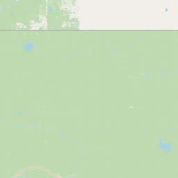
Map view of Maxhamish Lake Provincial Park and Protected Area

Use this park location map to pinpoint Maxhamish Lake Provincial Park and Protected Area in Canada, understand its exact geographic position, and read its mapped placement within the surrounding landscape more clearly.

Pigeon | © OpenStreetMap contributors

Location context for Maxhamish Lake Provincial Park and Protected Area

British Columbia
Park atlas

Compare adjacent protected areas and surrounding boreal wilderness landscapes.

Other Parks Near Maxhamish Lake Provincial Park and Protected Area for Regional Discovery

Browse protected areas near Maxhamish Lake Provincial Park and Protected Area to examine regional biodiversity and connected northern habitats. Comparing adjacent reserves expands geographical context across the boreal plains and surrounding provincial landscapes.
State or regional parkBritish Columbia
About 66 km away#1 closest

South

Jackpine Remnant Provincial Park: Protected Boreal Landscape and Regional Map Context

Conservation and terrain data for the Fort Nelson region

Jackpine Remnant Provincial Park provides a critical study in northern conservation geography. Located in the Fort Nelson area of British Columbia, this 148-hectare site protects a rare stand of jack pine trees. Its mapped boundaries and boreal forest terrain offer a focused look at small-scale protected landscapes and their significance within the broader regional ecosystem of the Canadian north.

Area
1.48 km²
Established
2001
IUCN
II
Relief
Lowland
National parkNorthwest Territories
About 125 km away#2 closest

Northwest

Nahanni National Park Reserve National Park: Protected Landscape and Geographic Mapping

Explore the mapped terrain and protected area boundaries in Northwest Territories.

Navigate the protected landscape of Nahanni National Park Reserve, a designated national park within the Northwest Territories. This entry provides detailed insight into the park's mapped geographic boundaries and its role as a significant protected area. Understanding its place within the regional atlas allows for a deeper appreciation of its natural terrain and conservation significance, offering factual context for geographic exploration.

Area
30,050 km²
Established
1972
IUCN
II
Visitors
1.1K annual
A pale, minimalist watercolor painting of a river landscape with distant rolling hills, marshy grasses, and light tree clusters under a bright sky.
State or regional parkBritish Columbia
About 165 km away#3 closest

West

Liard River Hot Springs Provincial Park: Boreal Geothermal Mapping and Regional Geography

Protected northern wilderness, thermal water systems, and muskeg wetland terrain

Liard River Hot Springs Provincial Park serves as a protected geographic nexus where thermal water discharge creates a unique biological oasis. The park landscape combines expansive boreal forest with sensitive muskeg wetlands, centered around a natural hot spring system that supports orchid populations and regular wildlife sightings. This atlas entry provides essential context on the physical boundaries and ecological features that define this significant regional park in northern British Columbia.

Area
10.82 km²
Established
1957
IUCN
III
Relief
Lowland
State or regional parkBritish Columbia
About 225 km away#4 closest

Southwest

Kwadacha Wilderness Provincial Park: Geographic Boundaries and Regional Protected Area Context

Untouched mountain wilderness in northern British Columbia

Kwadacha Wilderness Provincial Park provides a rare, roadless mountain experience within the northeastern interior of British Columbia. Characterized by high-relief alpine ridges, dense boreal forests, and challenging river systems, the park represents an essential wilderness corridor that remains free from human infrastructure and standard road access, prioritizing ecological integrity over recreation.

Area
1,302.79 km²
Established
1973
IUCN
Ib
Relief
Mountain
State or regional parkBritish Columbia
About 235 km away#5 closest

Southwest

Dune Za Keyih Provincial Park and Protected Area: Watershed and Terrain Geography

Remote wilderness landscape in northern British Columbia

Dune Za Keyih Provincial Park and Protected Area protects the largest unlogged watershed in British Columbia. Situated within the Muskwa-Kechika Management Area, this remote wilderness is defined by the geological structures of the Rocky Mountain Trench, providing a continuous corridor of undisturbed mountain forest, riparian zones, and highland terrain.

Area
3,468.33 km²
Established
2001
IUCN
Ib
Relief
Mountain
State or regional parkBritish Columbia
About 245 km away#6 closest

Southwest

Denetiah Provincial Park and Protected Area: Regional Geography and Wilderness Mapping

An undisturbed boreal reserve in the Stikine Region

Discover the geographic structure of Denetiah Provincial Park and Protected Area, a vast roadless landscape in northern British Columbia. This park protects pristine boreal forests, elongated glacial lake basins, and critical river headwaters that serve as a benchmark for northern conservation within the Muskwa-Kechika Management Area.

Area
1,053.49 km²
Established
1999
IUCN
II
Relief
Upland
State or regional parkBritish Columbia
About 246 km away#7 closest

West

Horneline Creek Provincial Park: Protected Canyon Landscapes and Rocky Mountain Trench Geography

Remote glacial-terrace wilderness in northern British Columbia

Located deep in the Rocky Mountain Trench, Horneline Creek Provincial Park is defined by its deep-cut canyon and ancient glacial terraces. This protected area offers an intimate view of sub-boreal terrain where mineral-stained walls and aspen-dotted grasslands create a concentrated, ecologically significant landscape within a remote corner of northern British Columbia.

Area
2.98 km²
Established
1999
IUCN
II
Relief
Upland
State or regional parkBritish Columbia
About 246 km away#8 closest

South

Prophet River Hot Springs Provincial Park: Protected Landscape and Geothermal Geography

Remote backcountry wilderness in northeastern British Columbia

Prophet River Hot Springs Provincial Park is a specialized protected area known for its unique tufa mounds and geothermal features. Set against the mountainous backdrop of the Muskwa Ranges, this backcountry destination offers a compelling study of boreal and subalpine geography, accessible only by hiking or horseback through undisturbed wilderness corridors.

Area
1.84 km²
Established
1999
IUCN
II
Relief
Mountain

Common questions about visiting, size, designation, and location context for Maxhamish Lake Provincial Park and Protected Area

Maxhamish Lake Provincial Park and Protected Area FAQs for park facts, access, geography, and protected area context

Find quick answers about Maxhamish Lake Provincial Park and Protected Area, including protected-area facts, park geography, trail and visitor context, and how the park fits into its surrounding country and regional landscape.
MoriAtlas Explorer

Continue Your Protected Areas Search Across the Global Atlas

Deepen your exploration by continuing the structured search for national parks and protected areas worldwide. Utilize the comprehensive filtering capabilities to compare different conservation landscapes and refine your understanding of global park geography. Discover more about the distribution and characteristics of protected natural areas.

Global natural geography