
Mori Atlas logo
Protected areaMayener Grubenfeld

Trace the remnants of prehistoric basalt extraction and expansive underground cave networks in the Vulkaneifel.

Mayener Grubenfeld Protected Area: Exploring Volcanic Landscapes and Industrial Geography

(Naturschutzgebiet Mayener Grubenfeld)

Mayener Grubenfeld serves as a profound record of human interaction with volcanic terrain, stretching across seven millennia of basalt extraction in the eastern Vulkaneifel region. The landscape features a complex mosaic of open quarries, flooded pits, and vaulted underground chambers, now protected as a critical habitat for diverse bat species. This geological intersection reveals how ancient lava flows from the Bellerberg volcano shaped the foundational basalt layers of this unique German region.

basalt quarryvolcanic landscapeVulkaneifelindustrial heritagecave systembat sanctuary
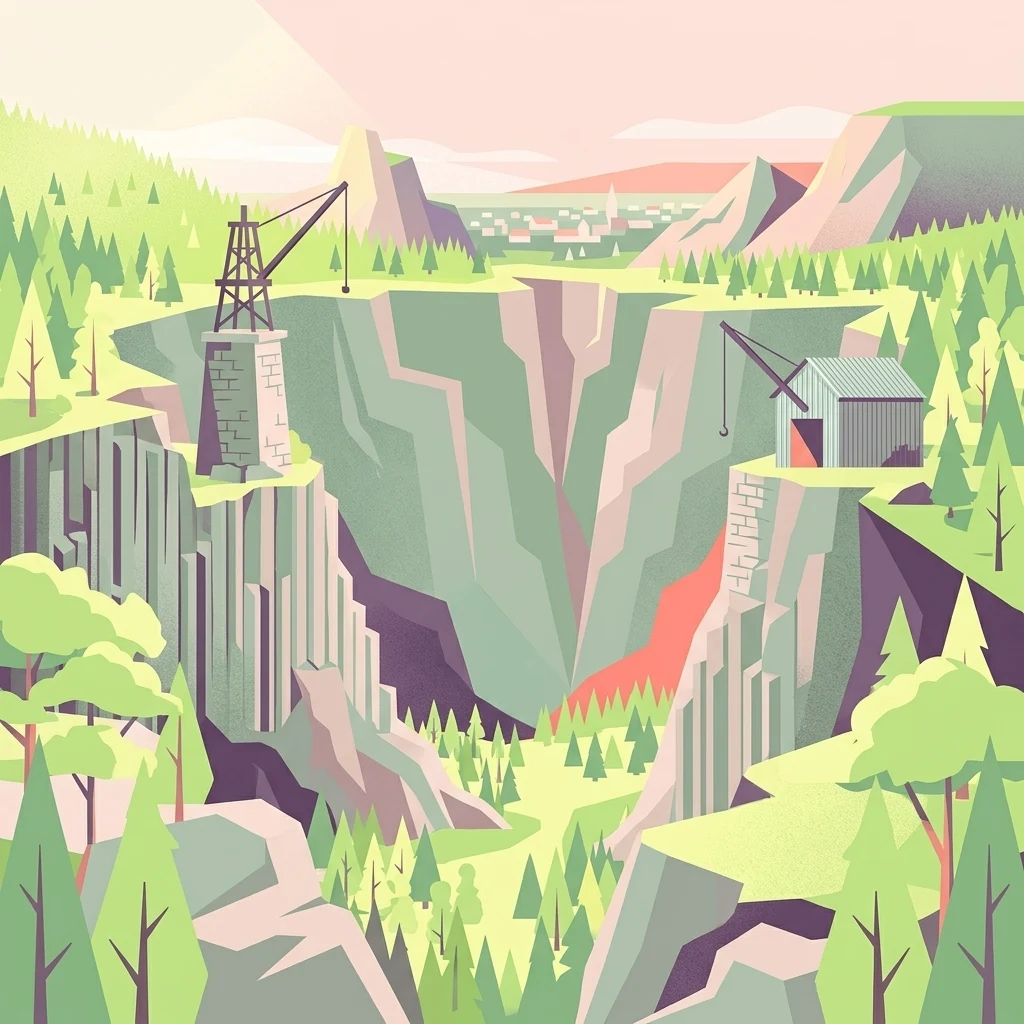
A flat-design, colorful illustration of a deep, rocky quarry with steep cliff faces, dense forest surrounding the edges, and historical mining cranes and buildings on the plateau.

Mayener Grubenfeld

Protected area

Park overview

Structured park overview, official facts, and landscape profile for Mayener Grubenfeld

Mayener Grubenfeld park facts, protected area profile, and essential visitor context

Review the core facts for Mayener Grubenfeld, including designation, size, terrain, visitor scale, habitats, and operating context in one park-focused overview.

About Mayener Grubenfeld

Mayener Grubenfeld lies on the northeastern edge of the town of Mayen, embedded in the Vordereifel, the eastern part of the Vulkaneifel volcanic landscape in Rhineland-Palatinate. The ground beneath the field and the wider region consists of layered deposits from the Quaternary volcanic activity of the Eifel, most importantly the Bellerberg volcano group, whose lava flows reached the valley of the Nette and hardened into a thick bed of basalt. The Mayener Grubenfeld preserves the visible record of how, for more than seven millennia, communities exploited this particular rock for a remarkable range of purposes.

The earliest humans to use the basalt came here because the overlying tuff and breccia layers had eroded back enough to expose solid stone at the surface. The rock's hardness and porosity made it ideal for grinding grain, and Neolithic people collected loose boulders and split them with fire-setting, wedges, and levers to produce quern stones. By the Bronze Age urnfield era, more formal shallow quarry pits had developed, and by the time of the Roman conquest, the area had become one of the most important millstone-producing districts in the north-western provinces of the Roman world. Roman Mayener millstones travelled the Rhine to Britain and the Mediterranean; examples have been identified as far away as Volubilis in modern Morocco, and the same material was traded into the Viking-Age emporium of Haithabu.

In the late Middle Ages, miners learned to bypass the thick volcanic overburden by sinking vertical shafts through it and expanding the basalt below into underground halls. They developed the ingenious Geglöcks technique, in which the natural, colonnar jointing of the basalt was exploited to leave hanging bell-shaped ceilings of basalt locked against each other with wedges. These vaulted chambers were then enlarged sideways into an extensive underground network. The same galleries, with their consistent temperature of around 8 degrees Celsius, were later repurposed as brewery storage cellars, giving Mayen the kind of natural refrigeration advantage that anchored a local brewing tradition until the rise of mechanical cooling in the late 19th century.

The 20th century brought electrification, pneumatic hammers, electric stone saws, and mechanical crushing plants, and basalt was quarried increasingly for railway construction, road ballast, and paving. After the economically recoverable deposits were essentially exhausted, the last open-cast workings closed in the 1970s. Today, the roughly one square kilometre of historically preserved terrain carries the layered memory of all these phases: filled or collapsed shafts, overgrown quarry hollows, small lakes, intact Geglöcks, fragments of crane bases, rusting rails, the remains of a processing plant, and a network of underground brewery cellars.

Quick facts and research context for Mayener Grubenfeld

Mayener Grubenfeld is a former basalt quarrying landscape in the eastern Vulkaneifel, near the town of Mayen in the Landkreis Mayen-Koblenz, Rhineland-Palatinate. Mining here began in the Neolithic and continued into the 1970s, making the field arguably the oldest and most important quarry district north of the Alps. At its pre-industrial peak around 1910, as many as 1,000 workers were employed.

The basalt itself is the so-called Mayener Basaltlava, a hard but porous rock that originated in lava flows from the Bellerberg volcano system. Because full industrial extraction ended only in the 1970s, the area today combines industrial-archaeological relicts, natural reclamation, and active conservation: it has been part of the FFH/Natura-2000 network since 2000 and has been a German Naturschutzgebiet since 2014, while also featuring a visitor centre (Erlebniswelten Grubenfeld) and an open-air basalt sculpture park called Lapidea.

Protection and recognition

Documented terrestrial protection history, management scope, and recognition data

Mayener Grubenfeld Protection Status and Designated Area Records

Mayener Grubenfeld holds a documented terrestrial protection status established in two thousand fourteen within official conservation tracking databases. Structured records present verified designation timelines, management parameters, and international recognition sources for the protected area.

Protection details

Protection scope
Terrestrial
Designated year
2014
Transboundary protection
No
WDPA ID
555520946
Park context

Deeper park guide and search-rich context for Mayener Grubenfeld

Mayener Grubenfeld history, landscape, wildlife, and travel context

Explore Mayener Grubenfeld through its history, landscape character, ecosystems, wildlife, conservation priorities, cultural context, and seasonal travel timing in a structured park guide built for atlas discovery and search intent.

Why Mayener Grubenfeld stands out

The Mayener Grubenfeld is best known for the extraordinary continuity of its basalt mining, from Neolithic grain-grinding stones through Roman querns exported as far as Roman Britain and North Africa, up to industrial-era paving stone extraction in the 20th century. Its underground Geglöcks, vaulted chambers made from the natural bell-like columns of basalt, are among the most distinctive mining landscapes of the region. The site is also recognized as one of the most important bat hibernation and swarming sites in Central Europe. Frost-free, humid, and undisturbed, the disused galleries shelter around 14 bat species plus two further species observed hunting in the area; counts and estimates suggest roughly 50,000 to 100,000 bats use the caves seasonally, drawing animals from up to 300 kilometres around during the late-summer swarm period.
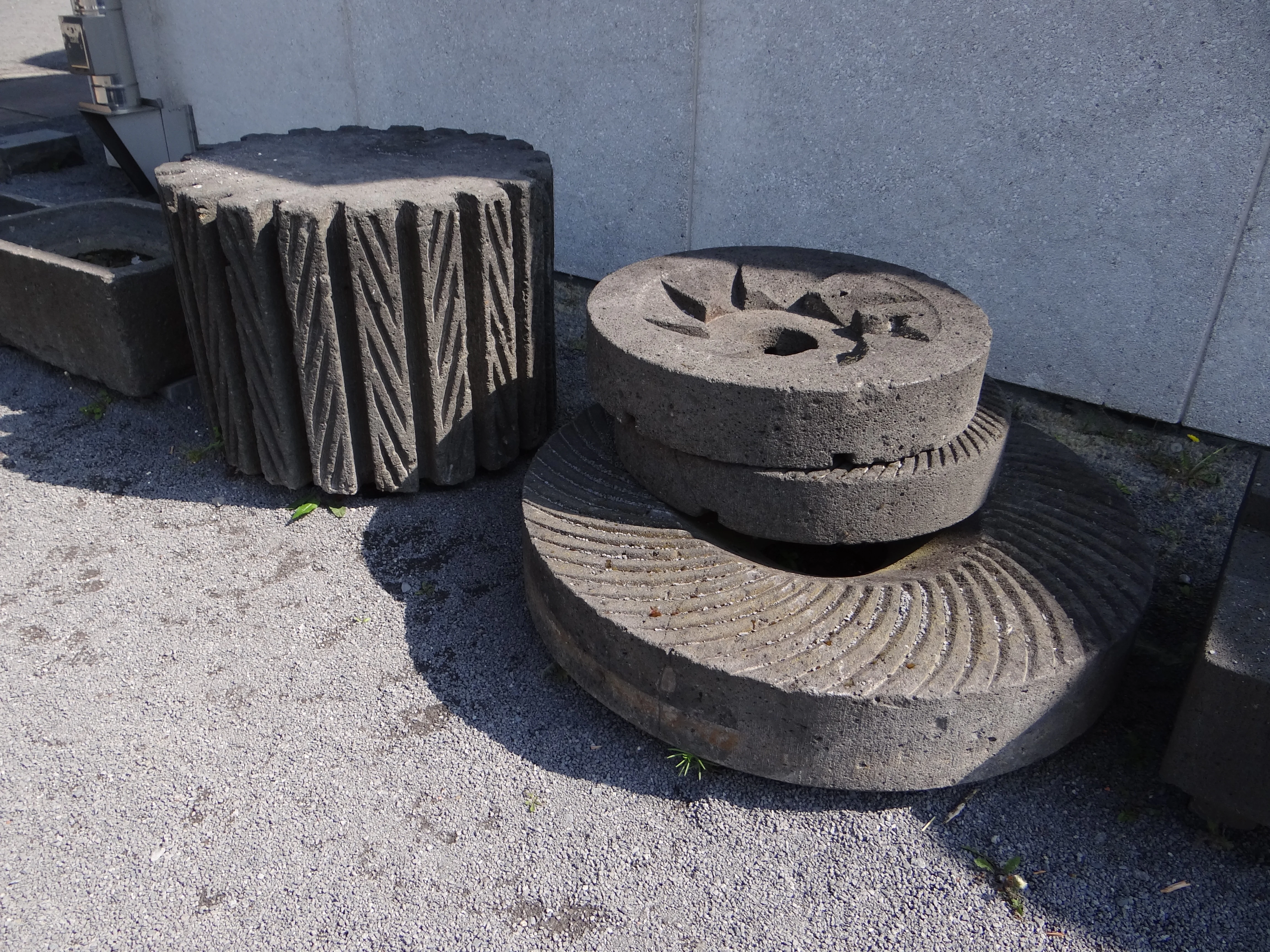
A collection of carved circular basalt millstones resting on a gravel surface next to a white wall.
Historical basalt millstones on display at the Terra Vulcania exhibition within Mayener Grubenfeld.

Mayener Grubenfeld history and protected-area timeline

Mining at the Mayener Grubenfeld has been documented, continuously and without major interruption, for roughly 7,000 years. Early Neolithic fragments of quern stones from the late fifth millennium BCE already show the rock being collected and shaped; by the Bronze Age urnfield era, around 1000 BCE, small formal quarry pits had been cut into the basalt, and by the Michelsberg culture, stone axes, hammer-stones, and rill-strike balls were also being made from the site. In the Iron Age, Hallstatt and La Tène craftspeople used the same basalt for more advanced quern stones, including the characteristic biconical Napoleon's-hat stones.

Roman control of the area, beginning in the mid-first century BCE following the Gallic Wars, transformed the field into an industrial millstone district. Around 600 workers are estimated to have been employed at the Roman peak, supplying hand-mills for legionaries, large horse- or man-driven mills known as Göpelmühlen, and rough building stone to markets across the Roman West. Millstones from Mayen have been identified by petrological analysis in Roman Britain, at sites along the upper Rhine and Danube, and as far away as Roman Volubilis in northern Morocco; the same trade continued into the Viking world via Haithabu.

From the late Middle Ages onwards, around 1400 CE, the work shifted heavily underground. Shafts roughly seven to eight metres in diameter were sunk through the tuff cover into the basalt below, where miners exploited the rock's columnar jointing to create vaulted Geglöcks chambers that were then extended laterally into cave-like galleries. From about 1700, human- and horse-powered Göpelwerke lifted stone out of these shafts.

In the second half of the 19th century, the advent of roller-mill technology in large industrial flour mills collapsed demand for traditional basalt millstones. Mayener millstones were largely replaced by imported French freshwater quartzite and the underground millstone workings were abandoned around 1870 and fully given up by about 1900. The galleries then survived primarily as brewery cellars, a use that several Mayen breweries maintained into the mid-20th century. Above ground, the focus moved back into open-cast stone quarrying, mechanised from the 1920s onwards, mechanised crushing for ballast and paving. A railway line opened in 1878 between Andernach, Mendig, and Mayen mainly to carry basalt. After the workable reserves were exhausted, the last operations within the historic field closed in the 1970s, although basalt is still commercially quarried along its northern and eastern edges today.

Mayener Grubenfeld landscape and geographic character

The Mayener Grubenfeld sits in a gently undulating section of the Vulkaneifel, its surface shaped both by the underlying Quaternary volcanic geology and by 7,000 years of human extraction. The shallow-tilled, altered older bedrock here belongs to Devonian clay and slate, onto which the lava of the Bellerberg volcano, dating from roughly 140,000 to 200,000 years ago, poured in three broad flows running some 2.5 kilometres long and averaging 1.2 kilometres wide down to the Nette valley. With cooling, the lava hardened into a roughly 10 to 30 metre thick basalt sheet, whose porosity of up to 25 percent volume came from gas bubbles trapped in the slowly degassing magma.

Later volcanic activity blanketed the basalt with an additional covering up to ten metres thick of breccia-like Dielsteiner Gebirge, a coarse mix of trass tuff, pumice, slag, and other volcanic debris. Across the millennia, erosion stripped parts of this cover away, locally exposing the basalt at the surface, which both enabled early quarrying and shaped today's varied surface topography: low plateaus and spoil heaps punctuated by circular shaft openings, weathered quarry faces, and steep rims where basalt columnar jointing is visible.

Where the surface has been left without further disturbance, the land has returned to a mosaic of dry grassland, ruderal vegetation, overgrown scree slopes, scattered trees, and patches of damp ground around flooded pits. The largest water-filled former quarry, the Silbersee, anchors the visual rhythm of the preserved area. Around it, the remaining shafts, intact Geglöcks, abandoned crane bases, narrow-gauge trackways, the settling basin, and the partly ruined processing buildings together give the landscape an unusually layered industrial-archaeological character.
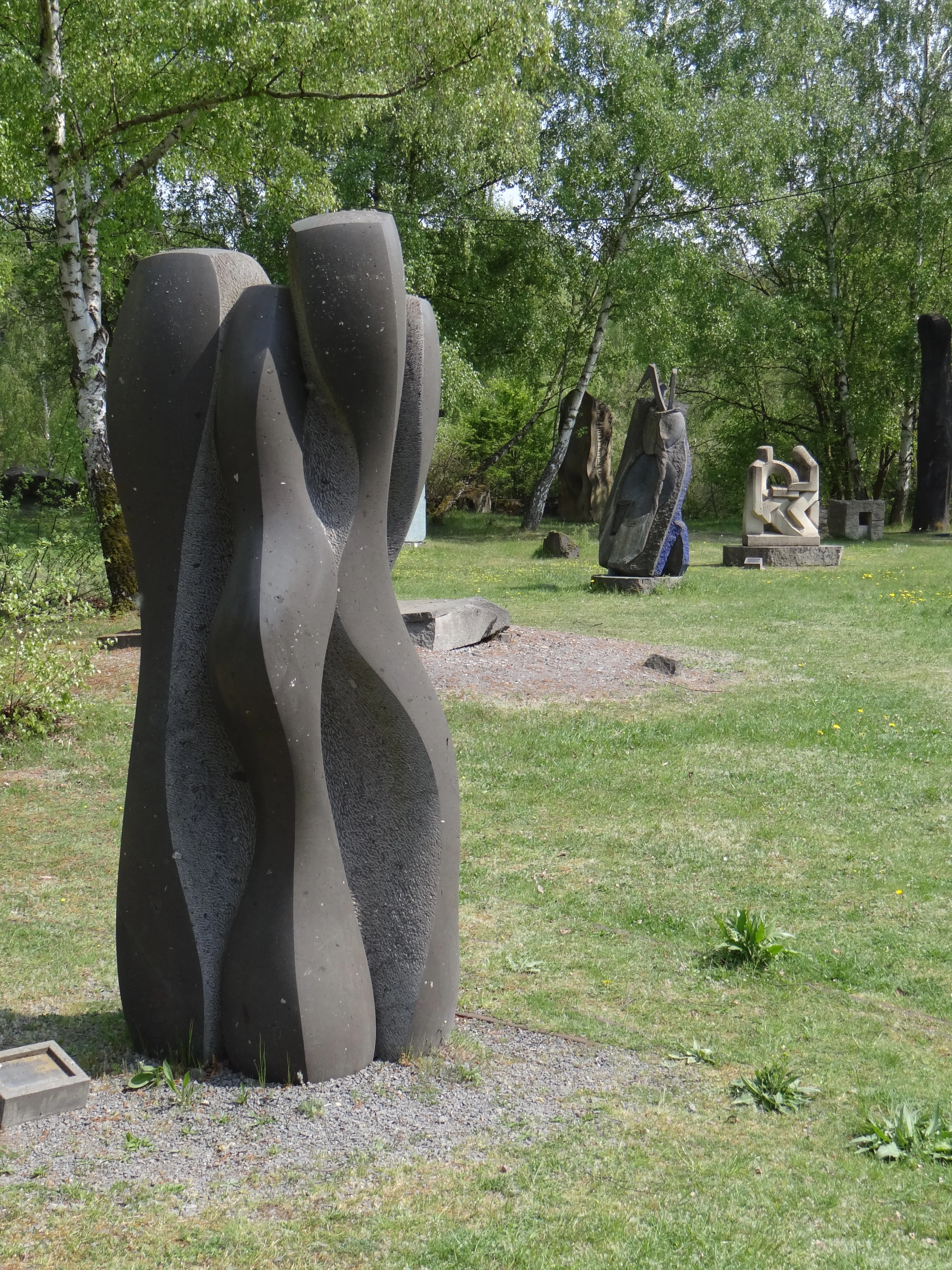
A large, dark, abstract stone sculpture stands in the foreground, with several other sculptures placed on a grassy lawn surrounded by trees.
A collection of stone sculptures set among trees in the Mayener Grubenfeld sculpture park.

Mayener Grubenfeld ecosystems, habitats, and plant life

Nature has reclaimed the formerly active Mayener Grubenfeld in decades of quiet regrowth, producing a mosaic of habitats unusual for the region. The dry, sunny, stony slopes and ledges support species-rich, semi-dry grassland and ruderal communities; frost-free, humid basalt caves provide subterranean conditions rare under open skies; and the water-filled quarry hollows recreate pond-like micro-habitats otherwise missing from the surrounding agricultural and forested Eifel landscape.

On the surface, the quarry edges and stone-strewn ground create dry grasslands similar in character to the volcanic outcrops elsewhere in the Vulkaneifel: warm, exposed, and botanically distinctive. Around the water-filled hollows and damp cave mouths, conditions shift to moisture-loving communities of rushes and reeds, while fallen basalt blocks and rubble piles provide microhabitats for ground-nesting insects, reptiles, and small mammals.

The combination of dry, sun-exposed basalt, cool humid caves, and standing water on the same compact site has allowed a wide range of plant communities to coexist. The very different microclimates enable thermophilic species to live door-to-door with cave-dwelling fauna, and the area is now an important refuge within an otherwise fairly intensively used regional landscape.
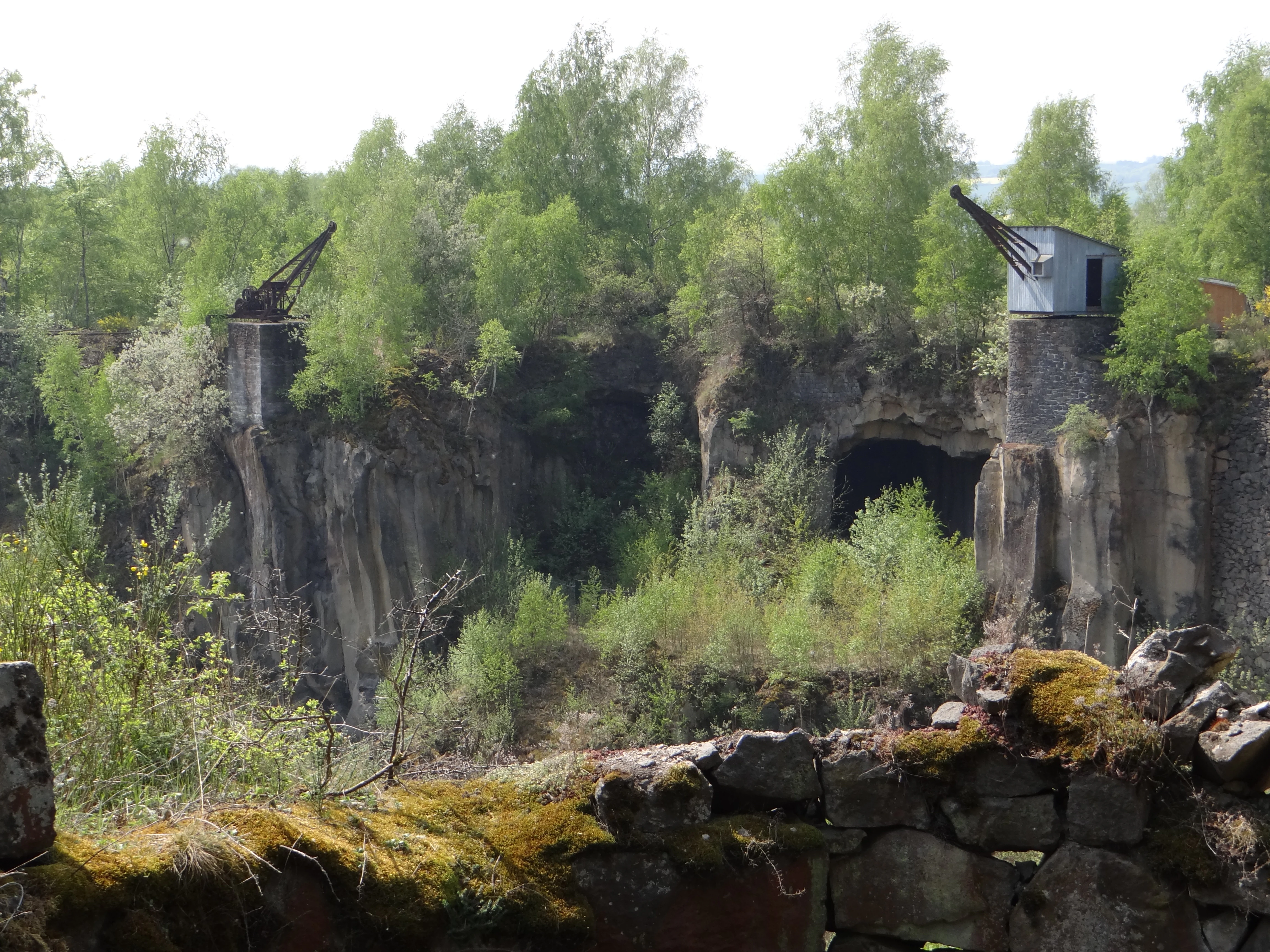
A view of the Mayener Grubenfeld quarry showing rocky cliff faces, deciduous trees, and two old industrial cranes perched on stone pillars.
Historic industrial cranes overlooking the abandoned basalt quarry at Mayener Grubenfeld.

Mayener Grubenfeld wildlife and species highlights

Bats define the wildlife identity of the Mayener Grubenfeld. At least 14 bat species hibernate in the cool, frost-free galleries of the former basalt mine, and two additional species have been recorded hunting or as skeletal remains. Documented hibernators include the barbastelle, northern bat, Bechstein's bat, Daubenton's bat, the pond bat, Natterer's bat, the whiskered bat, Nathusius's pipistrelle, the common pipistrelle, Brandt's bat, the whiskered bat's close relative Myotis mystacinus, the greater mouse-eared bat, the greater horseshoe bat, the brown long-eared bat, and the grey long-eared bat. The lesser horseshoe bat, lost from the region by about 1960, very likely once lived in the site as well. Several of these species appear on Germany's red list of threatened fauna.

The overwintering bat population is estimated at 50,000 to 100,000 individuals, and during the late summer and autumn swarm period bats arrive from as far as 300 kilometres around. Together with the caves at Niedermendig, the Mayener Grubenfeld is regarded as probably the most important bat hibernation site in Germany and one of the most significant in Central Europe according to EUROBATS.

Beyond bats, the field supports unusually rich cave fauna. A cave-cricket species discovered here in 1999 is otherwise almost unknown in Germany, and the cave-dwelling harvestman Leiobunum religiosum, normally a species of the Alps and the Mediterranean, also lives here. Reptiles including the western green lizard, the wall lizard, the sand lizard, the slow-worm, the grass snake, and the smooth snake share the dry quarry edges with amphibians such as the common toad, the natterjack toad, and the midwife toad. Dry grassland preserves species-rich insect communities including butterflies such as the scarce Spanish flag moth, grasshoppers, and wild bees; insect hotels were installed specifically to support these groups. The quarry faces also provide breeding sites for rare birds such as the woodlark and the common whitethroat, while eagle owls have been documented breeding in the basalt cliffs.
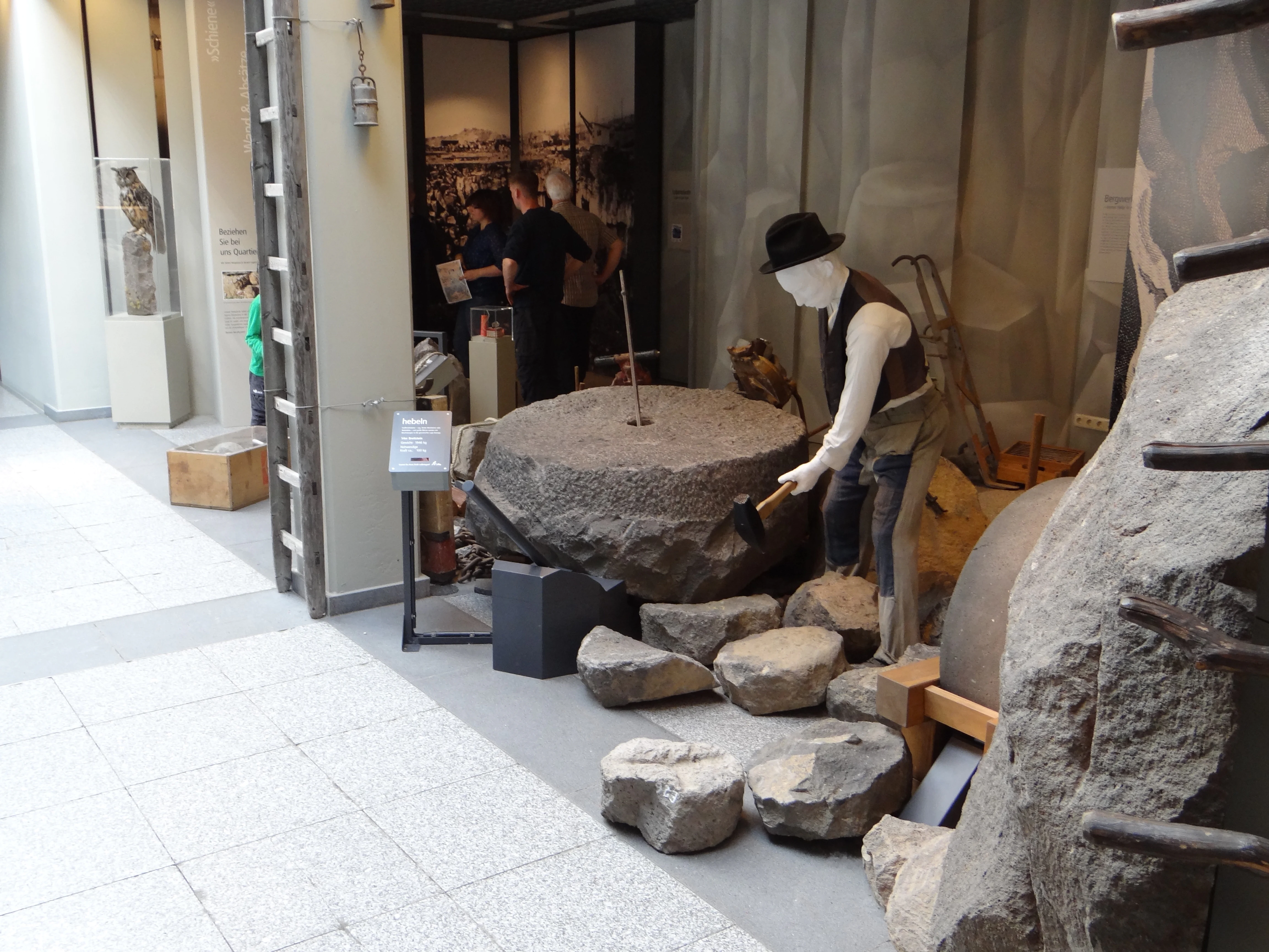
A life-sized diorama in a museum featuring a mannequin dressed in historic work clothing, holding a hammer over a large circular basalt stone, representing traditional quarrying activities.
A museum display at Terra Vulcania detailing the historical basalt quarrying methods used at Mayener Grubenfeld.

Mayener Grubenfeld conservation status and protection priorities

Ecologically, the Mayener Grubenfeld's most distinctive value lies in its underground microclimate. The frost-free, humid, dark basalt galleries, abandoned by industry, now provide some of the most valuable bat hibernation conditions anywhere in Central Europe, a function that depends critically on the voids being kept open, structurally stable, and undisturbed.

This value was formally recognized only in stages. Beginning in the 1990s, conservationists led by NABU Rheinland-Pfalz and supported financially by the Bundesamt für Naturschutz and the state of Rhineland-Palatinate began purchasing core galleries, including the MAYKO-Bierkeller, the Mauerstollen, and a third major gallery, and stabilizing them between 2009 and 2011 against collapse so that they could continue to serve as bat habitat. In 2000, parts of the site became part of the FFH area 'Unterirdische stillgelegte Basaltgruben Mayen und Niedermendig' (DE-5609-301), and on 2 May 2014, the larger Mayener Grubenfeld was officially designated as a Naturschutzgebiet under German law.

The conservation challenge at Mayen has been unusually layered. The site is at once a Natura 2000 habitat, a German Naturschutzgebiet, a protected cultural monument, an archaeological artefact, and a tourism destination. The site is also a station of the Vulkanpark in the Landkreis Mayen-Koblenz and falls within the Nationaler Geopark Laacher See, integrating the bat-protection work with industrial-archaeological presentation through the Erlebniswelten Grubenfeld visitor centre and the basalt sculpture park Lapidea.

Mayener Grubenfeld cultural meaning and human context

The Mayener Grubenfeld sits in a region whose identity is shaped by Quaternary volcanism and the long human use of its rocks. Centuries of trade moved Mayener basalt far from the Eifel: Roman millstones reached Britain and the Mediterranean world, including Volubilis in modern North Africa, and the same material appears in Viking-Age Haithabu. The local brewing tradition that grew up around the underground cellars after Roman and medieval mining is still a recognizable part of the regional culture, and the tradition of the tri-annual Lapidea stone-sculpture symposium between 1985 and 2006 tied the modern identity of the site directly back to its geological resource.

Until the early 2010s, the landscape was also an active industrial zone, with newly planted forestry, agricultural fields, and an industrial estate sitting above older shafts that were largely filled or demolished. The shift toward treating the same terrain simultaneously as a habitat for rare bats, a monument to 7,000 years of basalt mining, a Natura 2000 site, and an outdoor classroom within the Vulkanpark is itself an expression of the broader change in how Vulkaneifel landscapes are now valued, as a fusion of natural, cultural, and industrial heritage.
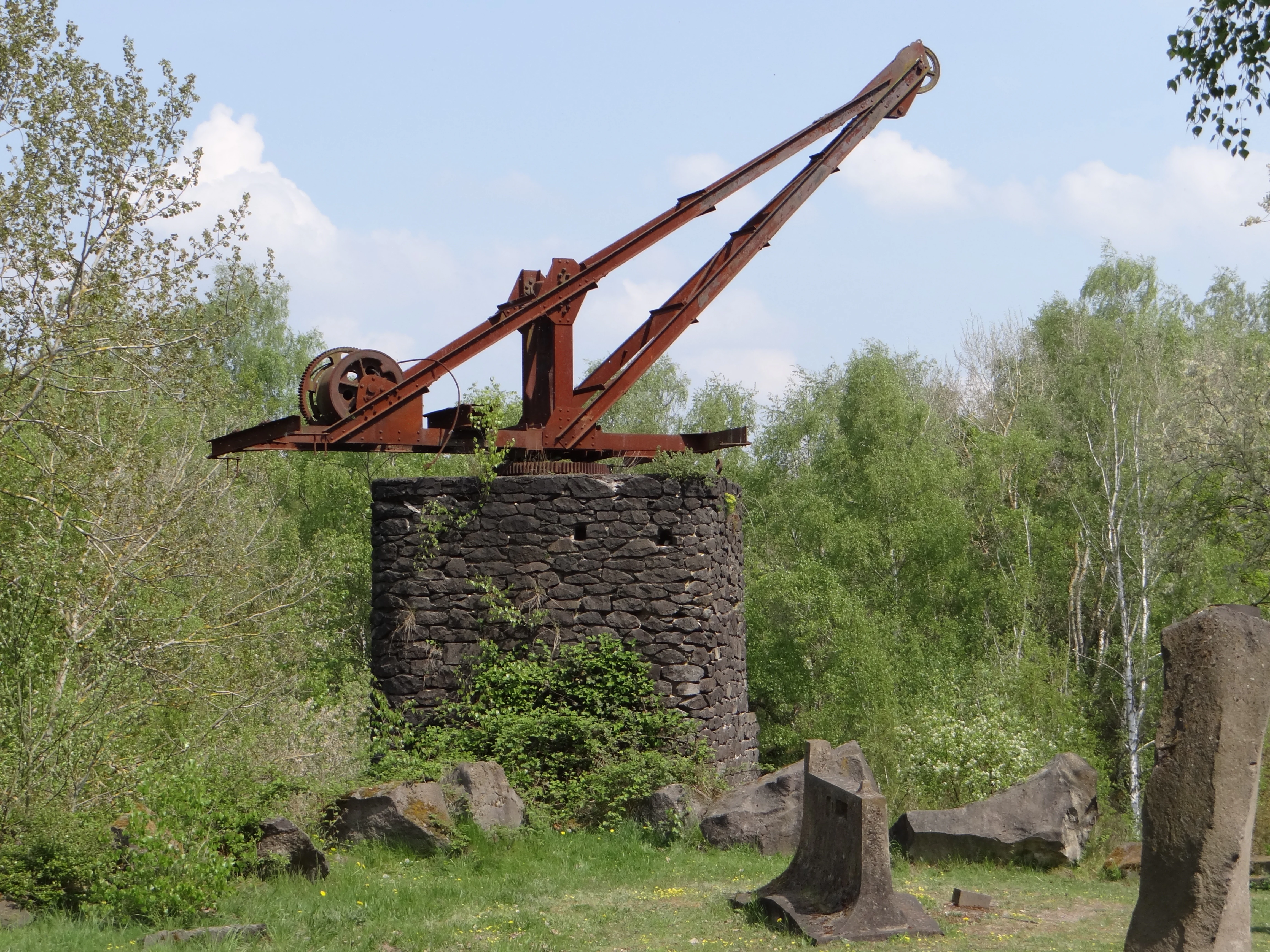
A weathered, rusted historic quarry crane sits atop a circular dry-stacked stone pedestal, surrounded by green trees and scattered basalt boulders.
An old, rusted quarry crane mounted on a stone pedestal at Mayener Grubenfeld.

Top sights and standout views in Mayener Grubenfeld

The Mayener Grubenfeld combines three layers of value in a single landscape. First, a continuous 7,000-year mining record, traceable from Neolithic quern stones through Roman exported millstones to 20th-century railway ballast, anchored by the distinctive underground Geglöcks chambers made from the natural columnar jointing of the basalt. Second, an exceptional bat hibernation and swarming complex, with an estimated 50,000 to 100,000 bats across at least 14 species, drawing animals from up to 300 kilometres around in late summer. Third, a living cultural-landscape presentation, anchored by the Erlebniswelten Grubenfeld visitor centre at the edge of the field and by the Lapidea open-air basalt sculpture park.
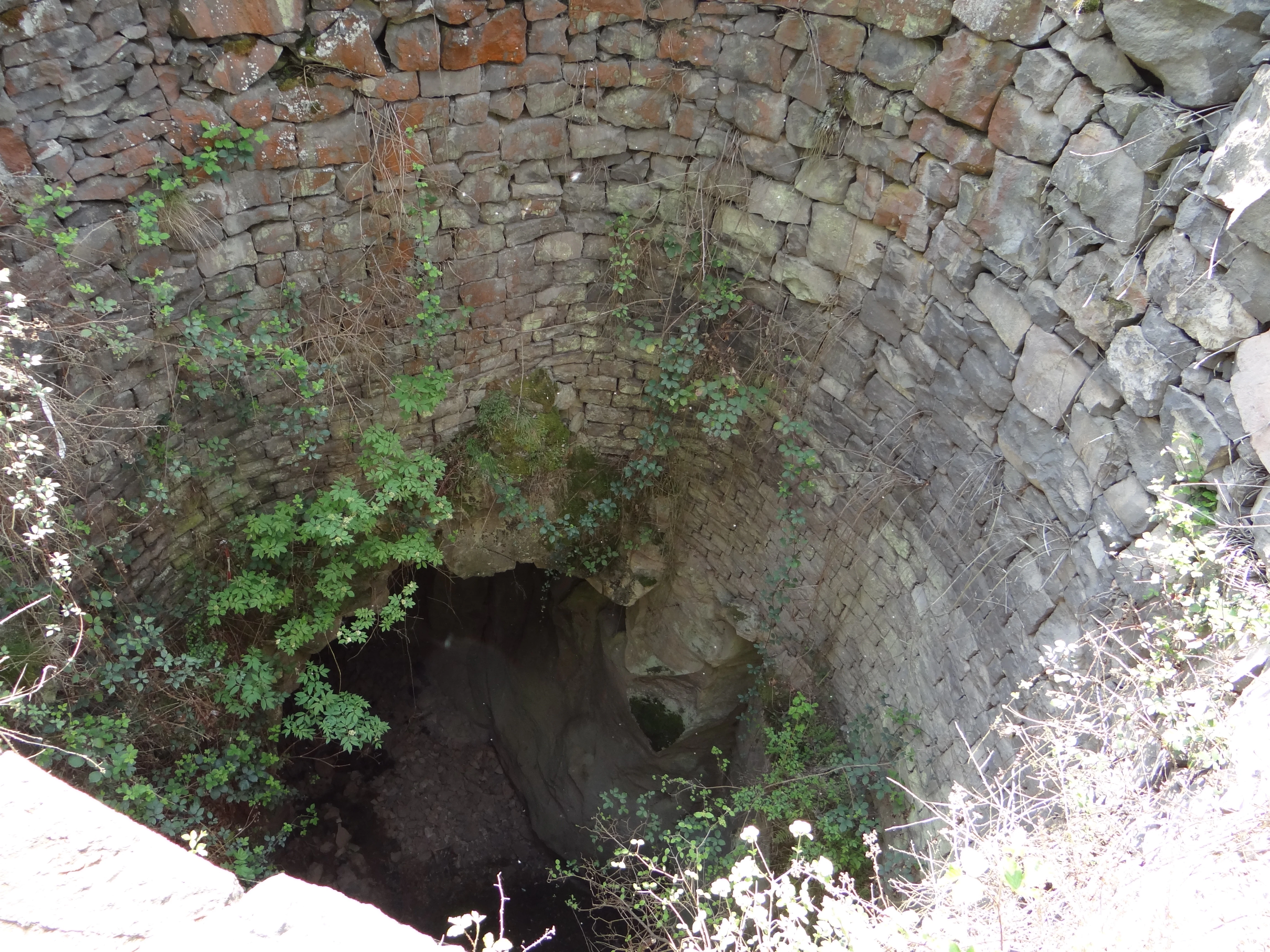
A deep circular shaft lined with dry-stone masonry, overgrown with small green shrubs and weeds inside a rocky former quarry site.
A view into a historic basalt quarry excavation shaft at Mayener Grubenfeld.

Best time to visit Mayener Grubenfeld

Spring and early summer typically offer the mildest weather for walking the open terrain and viewing the protected surface flora and fauna, when the dry-grassland vegetation is most active and reptile and insect life are out. Late summer and early autumn are also visually distinctive but are also the bat swarming season, when bat conservation sensitivities restrict access to active galleries and require visitors to stay with guided offers. The underground galleries themselves maintain a fairly steady cool temperature year round, so visits are not strongly seasonal in the caves themselves. Bat observers, photographers of the Lapidea sculptures, and visitors interested in industrial-archaeological remains like the Silbersee and the surviving shaft openings will generally find the most informative conditions in the warmer months, when the surface paths are most pleasant and the contrast between the dry quarry edges and the small lakes is at its sharpest.

Monthly climate preview

Long-term monthly temperature ranges and precipitation patterns across representative coordinates

Mayener Grubenfeld Climate Normals: Measured Temperature and Precipitation Rhythm

Representative coordinate measurements track recorded monthly temperature variations alongside daily precipitation averages for Mayener Grubenfeld. Examining the complete twelve-month climatology profile reveals structured long-term environmental patterns across the protected landscape.
Annual mean9 °C
0 °C19 °C
Jan
Feb
Mar
Apr
May13°
Jun16°
Jul19°
Aug18°
Sep14°
Oct
Nov
Dec
Warmest month
July

18.7 °C

Coolest month
January

0 °C

Wettest month
December

2.5 mm/day

Driest month
April

1.6 mm/day

Park location guide

Geography guide, regional context, and park location map for Mayener Grubenfeld

Mayener Grubenfeld park geography, regions, and map view in Germany

Understand where Mayener Grubenfeld sits in Germany through a broader geographic reading of the surrounding landscape, nearby location context, and its mapped position within the national park landscape.

How Mayener Grubenfeld fits into Germany

Germany is a federal republic in Western and Central Europe with a population of over 83 million across sixteen constituent states. It is Europe's largest economy by nominal GDP and a major global exporter and importer. The capital is Berlin, and the country borders Denmark, Poland, Czech Republic, Austria, Switzerland, France, Luxembourg, Belgium, and the Netherlands.

Wider geography shaping Mayener Grubenfeld in Germany

Germany is located in Western and Central Europe, spanning 357,022 km². It borders Denmark to the north, Poland and the Czech Republic to the east, Austria and Switzerland to the south, and France, Luxembourg, Belgium, and the Netherlands to the west. The country has coastlines on the Baltic Sea and North Sea to the north, with the Alps located in the southern region.

Map view of Mayener Grubenfeld

Use this park location map to pinpoint Mayener Grubenfeld in Germany, understand its exact geographic position, and read its mapped placement within the surrounding landscape more clearly.

Pigeon | © OpenStreetMap contributors

Location context for Mayener Grubenfeld

Rheinland-Pfalz

Explore photographic documentation of basalt formations, quarry lakes, and protected Vulkaneifel habitats.

Mayener Grubenfeld Photos and Landscape Scenery: Visualizing the Volcanic Quarry Terrain

Visual records capture the volcanic topography, basalt quarry hollows, and subterranean chambers that define the Mayener Grubenfeld protected area. Examining these detailed landscape photographs clarifies the unique geological character, industrial heritage, and diverse ecological habitats preserved across the region.

A collection of carved circular basalt millstones resting on a gravel surface next to a white wall.

A wide view of a former basalt quarry featuring high rocky walls with indentations, rusted historic cranes, and lush green vegetation growing throughout the site.

A large, dark, abstract stone sculpture stands in the foreground, with several other sculptures placed on a grassy lawn surrounded by trees.

A view of the Mayener Grubenfeld quarry showing rocky cliff faces, deciduous trees, and two old industrial cranes perched on stone pillars.

A life-sized diorama in a museum featuring a mannequin dressed in historic work clothing, holding a hammer over a large circular basalt stone, representing traditional quarrying activities.

A vintage crane with a stone base and metal housing perched on a rock formation within a quarry, framed by birch trees.

A weathered, rusted historic quarry crane sits atop a circular dry-stacked stone pedestal, surrounded by green trees and scattered basalt boulders.

A deep circular shaft lined with dry-stone masonry, overgrown with small green shrubs and weeds inside a rocky former quarry site.

A close up view of dark, hexagonal basalt column formations creating a natural ceiling above a rocky quarry wall.

A common wall lizard with patterned brown and green scales rests on the textured, light grey surface of a basalt rock.

A deep circular stone shaft at the Mayener Grubenfeld park, with a stone retaining wall and visitors walking in the background.

A close up view of an old circular stone-lined mine shaft opening at the Mayener Grubenfeld quarry, surrounded by green trees and shrubs.

A metal viewing platform and fenced entrance structure over a mining shaft, with two children standing on the metal stairs, surrounded by trees and a stone retaining wall.

Park atlas

Compare adjacent volcanic terrain and connected conservation areas across the region

Parks Near Mayener Grubenfeld and Regional Protected Landscapes

Visitors exploring Mayener Grubenfeld can continue into other protected areas, comparing volcanic terrain and industrial heritage across the surrounding region. Broadening the geographic scope reveals adjacent parks and connected conservation landscapes that share similar geological roots.
Nature reserveRhineland-Palatinate
About 1.2 km away#1 closest

East

Nettetal Nature Reserve: Geography and Protected Boundaries in Rhineland-Palatinate

Steep-sided valley landscapes and biodiversity corridors.

Nettetal Nature Reserve offers a deep look into the geomorphology of a classic Kerbtal in Rhineland-Palatinate. This protected area along the Nette tributary showcases a rare density of contrasting terrains, from sun-exposed rock formations to damp valley floors, providing a clear window into regional conservation mapping.

Area
7.05 km²
Established
1986
Scope
Terrestrial
Water
Major water bodies
A horizontal watercolor painting showing a soft, stylized landscape of green rolling hills and volcanic peaks behind a line of pine trees and a calm body of water in the foreground.
Nature reserveRheinland-Pfalz
About 4.2 km away#2 closest

Northwest

Hochsimmer Nature Reserve: Volcanic Topography and Forested Highlands of the Eastern Eifel

A study of basaltic twin cones and protected regional wilderness

Hochsimmer is a well-defined volcanic cinder cone near the Mayen-Koblenz district, characterized by its twin-peak profile and expansive woodland canopy. This protected nature reserve anchors the local topography where the volcanic Eifel meets the Middle Rhine basin, offering an essential reference for understanding the geological and ecological structure of the Rhineland-Palatinate high country.

Area
2.491 km²
Established
1973
Relief
Mountain
Climate
Temperate
A soft watercolor painting of a green, rolling hillside with trees, set against a pale, light-filled background.
Nature reserveRhineland-Palatinate
About 4.4 km away#3 closest

North

Hochstein Nature Reserve: Geological Mapping and Protected Eifel Landscape Context

An extinct volcanic cone protected within Rhineland-Palatinate

Hochstein stands as a representative Vulkanberg in the Osteifel, offering a clear visual landmark of Germany's volcanic history. This protected nature reserve encompasses forested slopes, the storied Genoveva Cave, and the surrounding drainage basins of the Nette river system, providing a deep look into the regional geology and conservation boundaries of the Middle Rhine highland.

Area
3.511 km²
Established
1983
Relief
Mountain
Scope
Terrestrial
Watercolor painting of a calm lake with a shoreline of green trees and distant, soft-hued rolling hills in the background.
Nature reserveRheinland-Pfalz
About 8.9 km away#4 closest

North

Naturschutzgebiet Laacher See: Volcanic Crater Lake and Protected Regional Landscape

Geographic overview of the Eifel volcanic caldera and nature reserve.

Naturschutzgebiet Laacher See is a significant nature reserve in the Eifel volcanic field, centering on a deep crater lake of great ecological importance. Its protected boundaries encompass surrounding volcanic crater slopes, providing a critical refuge for waterfowl and breeding birds throughout the year. This record details the unique terrain and regional landscape context of this primary Rhineland-Palatinate conservation site.

Area
21.04 km²
Established
1940
IUCN
IV
Nature reserveRhineland-Palatinate
About 11 km away#5 closest

Northwest

Lehrenkopf Nature Reserve: Mapped Volcanic Terrain and Regional Eifel Geography

Geological landscape and protected botanical site in Ahrweiler

Lehrenkopf stands as a compact nature reserve characterized by its 496-meter volcanic hill, which anchors the botanical and geological identity of the site. Spanning across the municipal territories of Kempenich and Brenk, this protected area serves as a focal point for regional conservation within the Eifel, emphasizing the preservation of rare wild plant species and the maintenance of distinct skyline features in the Ahrweiler district.

Area
0.35 km²
Established
1989
IUCN
IV
Relief
Mountain
A watercolor painting showing a reddish-brown layered geological formation, likely a quarry or volcanic cliff, topped with trees, with softer green hills in the distance.
Nature reserveRhineland-Palatinate
About 13 km away#6 closest

Northeast

Nastberg Nature Reserve: Volcanic Geology and Protected Landscapes in Rhineland-Palatinate

Tracing volcanic fissures and scoria cone history in the Middle Rhine region

Nastberg represents a significant geological site within the Vulkanpark network. The nature reserve exposes complex layers of tuff and scoria, documenting a long history of explosive activity. With views extending across the Neuwied Basin toward the Westerwald and Hunsrück, this site offers deep insight into the regional volcanic geography of western Germany.

Relief
Mountain
Climate
Temperate
Access
Easy access
Scope
Terrestrial
Nature reserveRhineland-Palatinate
About 14 km away#7 closest

Northwest

Wacholderheiden Raßberg und Heidbüchel: Protected Juniper Heathland in Rhineland-Palatinate

Mapping traditional Eifel bergheide landscapes

Located in the Arft municipality, this nature reserve protects two distinct sections of Raßberg and Heidbüchel. The area is defined by its characteristic juniper-dotted slopes that exemplify the rare mountain-heath ecosystems once common across the German uplands. This site serves as a vital anchor for regional habitat conservation within the broader Rhein-Ahr-Eifel landscape context.

Area
0.24 km²
Established
1981
Relief
Upland
Scope
Terrestrial
Nature reserveRheinland-Pfalz
About 15 km away#8 closest

North

Bausenberg Nature Reserve: Geological Scoria Cone and Volcanic Landscape in Rhineland-Palatinate

Protected Eifel volcanic terrain and ancient earthwork geography.

Bausenberg serves as a protected window into eastern Eifel volcanism, showcasing a classic scoria cone and horseshoe-shaped crater profile. Located between Niederzissen and Waldorf, this 127-hectare reserve preserves critical lava-flow remnants and rare habitats, offering a deep look at the volcanic and human history shaped into the landscape of Rhineland-Palatinate.

Area
1.27 km²
Established
1981
Relief
Mountain
Climate
Temperate

Common questions about visiting, size, designation, and location context for Mayener Grubenfeld

Mayener Grubenfeld FAQs for park facts, access, geography, and protected area context

Find quick answers about Mayener Grubenfeld, including protected-area facts, park geography, trail and visitor context, and how the park fits into its surrounding country and regional landscape.
MoriAtlas Explorer

Continue Your Protected Areas Search Across the Global Atlas

Deepen your exploration by continuing the structured search for national parks and protected areas worldwide. Utilize the comprehensive filtering capabilities to compare different conservation landscapes and refine your understanding of global park geography. Discover more about the distribution and characteristics of protected natural areas.

Global natural geography