
Islands
Park geography
A detailed look at regional terrain, mountain peaks, and coastal landscape characteristics
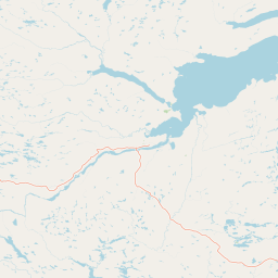
Geographic Profile and Mapped Boundaries of Mealy Mountains National Park Reserve, Canada
Mealy Mountains National Park Reserve encompasses a vast protected area in Newfoundland and Labrador, Canada, spanning over 10,700 square kilometers. This geographic profile details the diverse environment, including mountainous terrain, boreal forest, and coastal features, providing a structured overview of the park's physical boundaries and natural expanse.
Related tags
Boreal ForestTundraMountain TerrainCoastal LandscapeWildlife Habitat
Canada's largest national park reserve protecting the easternmost boreal wilderness
Akami−Uapishkᵘ−KakKasuak−Mealy Mountains National Park Reserve
Akami−Uapishkᵘ−KakKasuak−Mealy Mountains National Park Reserve is a vast wilderness protected area in the Labrador region of Newfoundland and Labrador, Canada. Established in 2015, it encompasses approximately 10,700 square kilometres of boreal forest, tundra, and coastal landscapes along the Labrador Sea and Lake Melville. The park is the largest national park in eastern Canada and the largest protected area in all of eastern North America, representing a significant conservation achievement for the continent. The reserve takes its name from Indigenous sources, with Akami−Uapishkᵘ being the Innu name meaning White Mountain across, and KakKasuak being the Labrador Inuit word for mountain. This designation reflects the deep cultural connections between the land and the Indigenous peoples who have inhabited the region for generations.
- Location
- Canada
- Park type
- National park
- Established
- 2015
- Area
- 10,700 km²
Location overview
Regional placement and coastal status in Labrador, Canada
Mealy Mountains National Park Reserve: Coastal Park Geography
Mealy Mountains National Park Reserve lies within Labrador in the province of Newfoundland and Labrador, Canada. Administrative records classify the area as a coastal park, positioned entirely within national borders.
- Countries
- Canada
- Regions
- Labrador, Newfoundland and Labrador
- Primary location
- Newfoundland and Labrador
- Geographic setting
- Coastal
Boundary and coordinates
A 10,700 km² outline with geographic context
Mealy Mountains National Park Reserve mapped boundary and area
Mealy Mountains National Park Reserve is mapped across an immense recorded 10,700 km². Its footprint supplies strong geographic context for the reserve without claiming to define an official survey boundary.
- Boundary area
- 10,711.2 km²
- Boundary perimeter
- 1,000.3 km
- Northernmost point
- 54.2914° N
- Southernmost point
- 52.8978° N
- Easternmost point
- 57.0057° W
- Westernmost point
- 59.5688° W
- Geographic centre
- 53.5724° N, 58.3439° W
- North–south span
- 155.1 km
- East–west span
- 169.7 km
Terrain and natural features
Explore mountain classifications and recorded geographic features
Mealy Mountains National Park Reserve Terrain and Named Natural Features
Mealy Mountains National Park Reserve encompasses designated mountain terrain along with recorded named natural features within the protected boundaries. Linked feature cards supply specific feature types, names, and spatial relationships.
Selected named natural features
Capes
Matchims Point
Capes
Duck Head
Bays
Upper Fish Cove
Peaks
Kamitshuapishekat
1,180 m
Bays
Partridge Harbour
Environmental setting
Boreal climate zones, mountain relief, and major forest cover across protected terrain
Mealy Mountains National Park Reserve Environmental Classification and Terrain Settings
Recorded classifications group boreal climate zones, mountain relief, and major forest cover into complementary categories for physical setting analysis. Associated atlas entries link each recorded environmental category to broader geographic destinations.
- Relief
- Mountain
- Climate
- Boreal
- Water
- Major water bodies
- Forest cover
- Mostly forested
- Seasonality
- Year-round
Landscape features
Mountains · Forest · Coast · Lakes · Rivers · Tundra
Habitat types
Boreal forest · Tundra habitat · Coastal habitat · Riverine habitat · Lacustrine habitat
Park atlas
Trace the broader geographic context of Eastern Canada's protected landscapes and wilderness areas surrounding this immense reserve.
Explore Related National Parks and Protected Areas Near Mealy Mountains National Park Reserve
After exploring Mealy Mountains National Park Reserve, browse other significant national parks and protected areas within Canada, including adjacent wilderness zones and boreal forest reserves across Newfoundland and Labrador. Compare diverse protected landscapes, including tundra, coastal ecosystems, and mountain terrain, to understand the broader conservation efforts and ecological spread throughout Eastern Canada.
Wildlife reserveQuebec
About 199 km away#1 closest
Southeast

Baie-de-Brador Migratory Bird Sanctuary: Mapped Geography and Protected Landscapes
A remote wildlife reserve in the Gulf of St. Lawrence.
Located near the Lower North Shore of Quebec, this protected area spans both land and sea to preserve critical colonial seabird habitats. The site features the rocky islands of Île aux Perroquets and Île Greenly, set within a marine buffer zone that reflects the cold, subarctic character of the Atlantic corridor.
- Area
- 5.59 km²
- Established
- 1925
- IUCN
- Ia
Wildlife reserveQuebec
316 km away#2 closest
South
Refuge d'oiseaux migrateurs de la Baie-des-Loups Protected Area and Coastal Map
Marine-focused wildlife reserve on the Quebec coast
This wildlife reserve protects essential island and offshore foraging grounds in the Gulf of St. Lawrence. Its geography highlights the intersection of protected land and marine environments, creating a critical habitat for North Atlantic seabird populations along the Quebec lower North Shore.
- Area
- 38.72 km²
- Established
- 1925
- IUCN
- Ia
National parkCanada
332 km away#3 closest
South
Gros Morne National Park: A Canadian National Park for Geographic Exploration
Discover its mapped protected boundaries and regional landscape context.
Explore Gros Morne National Park, a designated National Park within Canada, offering deep insights into its protected landscape and geographic significance. This page details its mapped boundaries and natural terrain, providing essential context for understanding its role within Canada's broader atlas of protected areas. Engage with the specific geography of this park to deepen your knowledge of natural landscapes and conservation.
- Area
- 1,805 km²
- Established
- 2005
- IUCN
- II
- Relief
- Mountain
National parkMinganie Regional County Municipality
400 km away#4 closest
Southwest
Mingan Archipelago National Park Reserve: Mapped Protected Landscape
Discover its national park geography in Minganie
Mingan Archipelago National Park Reserve is a designated national park offering a distinct protected landscape within the Minganie Regional County Municipality. This entry provides core geographic context and mapped details crucial for atlas exploration. Understand the park's boundaries and its regional landscape setting for comprehensive discovery of Canada's protected natural areas.
- Area
- 151 km²
- Established
- 1984
- IUCN
- II
- Visitors
- 44K annual
Wildlife reserveMinganie
About 418 km away#5 closest
Southwest
Refuge d'oiseaux migrateurs de Betchouane: Wildlife Reserve and Coastal Geography
Mapped protected island terrain in the Minganie region.
The Refuge d'oiseaux migrateurs de Betchouane comprises a cluster of small islands and surrounding marine environments along the north shore of the Gulf of St. Lawrence. This wildlife reserve serves as a critical nesting site, showcasing the intersection of Precambrian geology and marine conservation. Gain a clear understanding of the sanctuary boundaries and the island-focused terrain that defines this unique protected sector of the Minganie coastline.
- Area
- 4.35 km²
- Established
- 1925
- IUCN
- Ia
- Relief
- Lowland
National parkNewfoundland and Labrador
573 km away#6 closest
North
Torngat Mountains National Park: National Park Atlas and Protected Landscape Exploration
Explore the mapped geography and protected status of this Canadian national park.
Gain a structured understanding of Torngat Mountains National Park, a protected national park in Newfoundland and Labrador. This destination focuses on its geographic identity, mapped boundaries, and place within the broader regional landscape of the Canadian Arctic. Discover the park's terrain and conservation context, essential for anyone exploring Canada's protected areas and natural geography.
- Area
- 9,700 km²
- Established
- 2008
- IUCN
- II
- Visitors
- 599 annual
National parkNewfoundland and Labrador
576 km away#7 closest
Southeast
Terra Nova National Park: National Park Protected Landscape and Regional Geography
Explore mapped boundaries and landscape context.
Terra Nova National Park represents a significant protected area with a distinct geographic footprint within Newfoundland and Labrador. This page provides a detailed atlas-style view of its mapped landscape and protected land status, highlighting its role in the regional geography and Canada's network of natural reserves.
- Area
- 399 km²
- Established
- 1957
- IUCN
- II
- Visitors
- 45.2K annual
National parkQuebec
578 km away#8 closest
Southwest
Forillon National Park: Quebec National Park Protected Landscape and Geography
Explore mapped park boundaries and regional terrain.
Forillon National Park represents a crucial component of Quebec's protected lands, offering a rich subject for geographic discovery and atlas exploration. This national park's specific landscape characteristics and mapped boundaries provide essential context for understanding its role within the wider regional geography of Canada. Dive into the mapped terrain and protected area details that make Forillon National Park a unique element in any natural landscape atlas.
- Area
- 244 km²
- Established
- 1970
- IUCN
- II
- Visitors
- 164.1K annual
MoriAtlas Explorer
Continue Exploring Mealy Mountains National Park Reserve's Geographic Landscape and Boundaries
Deepen your understanding of Mealy Mountains National Park Reserve by exploring its specific geographic features and protected area map context. This structured approach allows for detailed discovery of its natural landscapes and regional setting within Newfoundland and Labrador. Continue to investigate the unique atlas-defined characteristics that make this national park a significant protected landscape for geographic exploration.
Browse next
Global natural geography
Explore related park routes
Explore MoriAtlas Global ParksBrowse All MoriAtlas ParksGlobal Park Map DiscoveryMoriAtlas: Browse All CountriesBrowse All MoriAtlas ContinentsNational Park Environment AtlasGrand Canyon National Park AtlasYellowstone National Park AtlasYosemite National Park Atlas and GeographySerengeti National Park AtlasGalápagos National Park Protected LandscapeBanff National Park Geography and AtlasKruger National Park Atlas EntryUluṟu-Kata Tjuṯa National Park AtlasExplore Uluru-Kata Tjuta National Park GeographyPlitvice Lakes National Park AtlasFiordland National Park Protected LandscapeGreat Smoky Mountains National Park AtlasAfghanistan National Parks and Protected AreasAlbania National Parks and Protected AreasAlgeria National Parks and Protected AreasAmerican Samoa National Parks and Protected AreasAndorra National Parks and Protected AreasAngola National Parks and Protected AreasAntarctica National Parks and Protected AreasAntigua and Barbuda Park List