Mori Atlas logo
National parkMealy Mountains National Park Reserve

Discover the mapped boundaries and natural terrain of this national park in Newfoundland and Labrador.

Mealy Mountains National Park Reserve: Explore Its Protected Landscape and Geographic Setting

(Akami−Uapishkᵘ−KakKasuak−Mealy Mountains National Park Reserve)

Mealy Mountains National Park Reserve stands as a significant protected area within the vast geography of Newfoundland and Labrador. This national park offers a unique lens through which to explore its mapped boundaries, diverse natural landscapes, and regional context. Understand the protected land's identity and its place within the broader Canadian geography through structured atlas-style discovery, focusing on its landscape and terrain.

Boreal ForestTundraMountain TerrainCoastal LandscapeWildlife HabitatIndigenous Heritage

Mealy Mountains National Park Reserve

National park

Park overview

Structured park overview, official facts, and landscape profile for Akami−Uapishkᵘ−KakKasuak−Mealy Mountains National Park Reserve

Akami−Uapishkᵘ−KakKasuak−Mealy Mountains National Park Reserve park facts, protected area profile, and essential visitor context
Review the core facts for Akami−Uapishkᵘ−KakKasuak−Mealy Mountains National Park Reserve, including designation, size, terrain, visitor scale, habitats, and operating context in one park-focused overview.

About Akami−Uapishkᵘ−KakKasuak−Mealy Mountains National Park Reserve

Akami−Uapishkᵘ−KakKasuak−Mealy Mountains National Park Reserve represents a monumental conservation achievement for Canada and North America. Spanning approximately 10,700 square kilometres in the remote Labrador region, it stands as the largest national park in eastern Canada and the most extensive protected area in eastern North America. The reserve encompasses a remarkable diversity of landscapes, from the boreal forests that blanket much of the interior to the tundra ecosystems found at higher elevations and along the coast. The Mealy Mountains themselves rise prominently from the surrounding terrain, representing the highest land in Labrador and lending their name to the protected area. Over 50 kilometres of shoreline along the Labrador Sea and Lake Melville fall within the park's boundaries, providing critical coastal habitat and scenic beauty. The establishment of this park reserve reflects a new approach to conservation in Canada, one that recognizes and accommodates the traditional land uses and rights of Indigenous peoples. Unlike most national parks, the Mealy Mountains reserve permits activities such as hunting, trapping, fishing, and cutting wood for personal use, reflecting the deep connections between local communities and this landscape. This approach represents a significant evolution in Canadian park management philosophy, demonstrating that meaningful conservation can coexist with Indigenous cultural practices and local traditions.

Quick facts and research context for Akami−Uapishkᵘ−KakKasuak−Mealy Mountains National Park Reserve

The park is located in Labrador, Newfoundland and Labrador, approximately 10,700 square kilometres in area. It was officially established on July 31, 2015 as Canada's 46th national park. The nearest population centre is Happy Valley-Goose Bay. The reserve protects over 50 kilometres of shoreline along the Labrador Sea and Lake Melville, encompassing the Mealy Mountains range which represents the highest land in Labrador. The park operates under a unique management framework that allows for the continuation of traditional Indigenous activities including hunting, trapping, fishing, and wood collection for personal use.

Park context

Deeper park guide and search-rich context for Akami−Uapishkᵘ−KakKasuak−Mealy Mountains National Park Reserve

Akami−Uapishkᵘ−KakKasuak−Mealy Mountains National Park Reserve history, landscape, wildlife, and travel context
Explore Akami−Uapishkᵘ−KakKasuak−Mealy Mountains National Park Reserve through its history, landscape character, ecosystems, wildlife, conservation priorities, cultural context, and seasonal travel timing in a structured park guide built for atlas discovery and search intent.

Why Akami−Uapishkᵘ−KakKasuak−Mealy Mountains National Park Reserve stands out

The Mealy Mountains National Park Reserve is best known for protecting one of the largest intact boreal forest ecosystems in eastern North America. The reserve encompasses the Mealy Mountains, a range that dominates the Labrador landscape and represents the highest terrain in the region. It is also notable for its significant populations of threatened woodland caribou and healthy runs of Atlantic salmon. The park's establishment represents a landmark achievement in Canadian conservation as the largest protected area in eastern North America.

Akami−Uapishkᵘ−KakKasuak−Mealy Mountains National Park Reserve history and protected-area timeline

The establishment of Mealy Mountains National Park Reserve spans several decades of negotiation, study, and Indigenous partnership. Beginning in the 1970s, Parks Canada sought to represent the eastern boreal forest within the national park system, but early efforts were rejected by the Innu people who inhabited the region. A pivotal turning point came in 2001, following the conclusion of a framework for a land claim agreement, when the Innu Nation invited Parks Canada to conduct a feasibility study for a new park in Labrador. A steering committee was formed and held extensive consultations with local communities near Lake Melville, addressing concerns about traditional land uses including personal cabins, berry picking, fishing, and hunting. In May 2008, the committee concluded that a park was feasible, leading to the announcement of the park on February 5, 2010 by then Minister of the Environment Jim Prentice in Happy Valley-Goose Bay. The park began as a reserve due to unresolved land claims negotiations with the Innu, a status that maintains national park management under the National Parks Act while pending final land claim settlement. The federal government renewed its commitment in 2015, proposing the Indigenous name Akami−Uapishkᵘ−KakKasuak−Mealy Mountains, and the reserve was officially established on July 31, 2015 with the signing of a federal-provincial Land Transfer Memorandum of Agreement. The lands were officially transferred to the federal government by the province of Newfoundland and Labrador on July 10, 2017.

Akami−Uapishkᵘ−KakKasuak−Mealy Mountains National Park Reserve landscape and geographic character

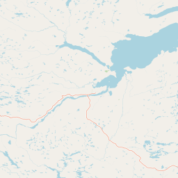
The Mealy Mountains National Park Reserve showcases a spectacular array of northern Canadian landscapes. The Mealy Mountains themselves form a prominent mountain range that rises dramatically from the surrounding boreal terrain, representing the highest elevations in all of Labrador. The lower elevations are dominated by the dense boreal forest, a vast ecosystem of coniferous and mixed forest species adapted to the subarctic climate. At higher elevations and in exposed coastal areas, the forest gives way to tundra, where hardy low-growing vegetation survives in the harsh northern environment. The park protects over 50 kilometres of shoreline along the Labrador Sea, where the boreal forest meets the cold Atlantic waters. Lake Melville, a large estuarine lake that connects to the sea, provides additional coastal habitat within the reserve. The landscape exhibits the characteristic beauty of the Labrador wilderness, with pristine rivers, remote terrain, and vast undeveloped spaces that remain largely untouched by human activity.

Akami−Uapishkᵘ−KakKasuak−Mealy Mountains National Park Reserve ecosystems, habitats, and plant life

The ecological diversity of Mealy Mountains National Park Reserve is remarkable for its representation of the eastern boreal forest natural region. The park protects extensive tracts of boreal forest, one of the largest intact forest ecosystems remaining in eastern North America. This forest type supports a complex web of life adapted to the subarctic conditions, including coniferous species that form the backbone of the ecosystem. The transition from forest to tundra at higher elevations creates a mosaic of habitats that supports species adapted to both environments. The coastal areas along the Labrador Sea and Lake Melville provide additional ecological diversity, with estuarine and marine-influenced habitats that differ significantly from the interior forests. The park's establishment was specifically intended to protect representative examples of the east coast boreal forest within Canada's national park system, filling a significant gap in the protection of this important biome.

Akami−Uapishkᵘ−KakKasuak−Mealy Mountains National Park Reserve wildlife and species highlights

Mealy Mountains National Park Reserve supports a diverse community of wildlife species characteristic of the boreal forest and tundra ecosystems. The park is home to the threatened Mealy Mountains woodland caribou herd, a population of boreal woodland caribou that represents a significant conservation priority. These iconic northern deer have experienced declines across much of their range, making the protected habitat within the reserve critically important for their survival. The reserve also supports healthy populations of wild Atlantic salmon, a species that has suffered declines throughout much of its global range, making this population particularly significant. Mammal populations include wolf packs, black bear, American marten, and two species of fox. The coastal waters and wetlands provide important habitat for migratory birds, with numerous species utilizing the area during seasonal migrations. The combination of forest, tundra, and coastal habitats creates a diverse environment that supports multiple wildlife communities.

Akami−Uapishkᵘ−KakKasuak−Mealy Mountains National Park Reserve conservation status and protection priorities

The establishment of Mealy Mountains National Park Reserve represents a landmark achievement in North American conservation. As the largest protected area in eastern North America, it safeguards vast tracts of intact boreal forest and tundra habitat that would otherwise face development pressure. The park protects critical habitat for threatened species including the boreal woodland caribou, whose survival depends on large tracts of contiguous forest territory. The protection of Atlantic salmon populations is particularly significant given the widespread declines this species has experienced across its range. The park's location along the Labrador Sea and its protection of river ecosystems provides benefits for aquatic biodiversity that extend beyond the park's boundaries. The reserve also plays an important role in maintaining ecological processes across a large landscape, allowing natural disturbance patterns such as fire to continue functioning across extensive areas. This ecological integrity at such a large scale is increasingly rare in the populated regions of eastern North America.

Akami−Uapishkᵘ−KakKasuak−Mealy Mountains National Park Reserve cultural meaning and human context

Mealy Mountains National Park Reserve is deeply intertwined with the Indigenous peoples and local communities of Labrador. The park's name, Akami−Uapishkᵘ−KakKasuak, reflects this connection, with Akami−Uapishkᵘ being the Innu name for the area meaning White Mountain across, and KakKasuak being the Labrador Inuit word for mountain. Three Indigenous groups have formal relationships with the reserve: the Innu, the Inuit, and the NunatuKavut. The establishment of the park required navigating complex relationships with these communities, including addressing concerns about traditional land uses that had been rejected in earlier attempts to create protected areas in the region. A significant innovation in this park's management is the continuation of traditional Aboriginal activities that are not permitted in most other Canadian national parks, including hunting, trapping, fishing, and cutting wood for personal use. Agreements with Indigenous peoples allow for the sharing of various management and planning responsibilities, and the continuation of Indigenous rights in the protected area. Local Labradorians have expressed concerns about maintaining access to traditional areas, personal cabins, and the various activities that connect them to this landscape.

Top sights and standout views in Akami−Uapishkᵘ−KakKasuak−Mealy Mountains National Park Reserve

Mealy Mountains National Park Reserve stands as Canada's 46th national park and the largest protected area in eastern North America. The reserve protects the Mealy Mountains, the highest terrain in Labrador, along with extensive boreal forest and tundra ecosystems. Over 50 kilometres of pristine shoreline along the Labrador Sea and Lake Melville fall within the park's boundaries. The park provides crucial habitat for threatened woodland caribou and significant populations of Atlantic salmon. A unique management framework allows for traditional Indigenous activities including hunting, trapping, and fishing, reflecting a new model for conservation that integrates Indigenous rights and local traditions. The park represents the eastern boreal forest natural region within Canada's national park system, filling a critical gap in the protection of this important biome.

Best time to visit Akami−Uapishkᵘ−KakKasuak−Mealy Mountains National Park Reserve

The optimal time to experience Mealy Mountains National Park Reserve reflects its subarctic location and the variety of landscapes it encompasses. Summer months offer the warmest conditions for exploring the boreal forest and coastal areas, with extended daylight hours providing ample opportunity for outdoor activities. The summer season also corresponds with the best wildlife viewing opportunities, as animals are more active in the warmer months. Autumn can bring spectacular fall colours to the boreal forest and may offer excellent conditions for viewing migratory birds as they head south. Winter provides access to a completely different character of the park, with snow-covered landscapes and opportunities for winter wilderness experiences, though access and infrastructure may be more limited. The shoulder seasons of late spring and early fall often provide a good balance of conditions and fewer visitors. Visitors should be aware that the remote nature of the park means that access and services are limited compared to more developed parks, and careful planning is essential regardless of the season.

Park location guide

Geography guide, regional context, and park location map for Akami−Uapishkᵘ−KakKasuak−Mealy Mountains National Park Reserve

Akami−Uapishkᵘ−KakKasuak−Mealy Mountains National Park Reserve park geography, regions, and map view in Canada
Understand where Akami−Uapishkᵘ−KakKasuak−Mealy Mountains National Park Reserve sits in Canada through a broader geographic reading of the surrounding landscape, nearby location context, and its mapped position within the national park landscape.

How Akami−Uapishkᵘ−KakKasuak−Mealy Mountains National Park Reserve fits into Canada

Canada is a federal parliamentary constitutional monarchy spanning North America from the Atlantic to the Pacific and Arctic Oceans. With a population of over 41 million, it is officially bilingual in English and French at the federal level. The country gained independence from the United Kingdom through a gradual process culminating in 1982.

Wider geography shaping Akami−Uapishkᵘ−KakKasuak−Mealy Mountains National Park Reserve in Canada

Canada occupies the northern portion of North America, sharing its longest international border with the United States. The country extends from the Atlantic Ocean to the Pacific Ocean and northward into the Arctic Ocean, giving it the longest coastline of any nation.

Map view of Akami−Uapishkᵘ−KakKasuak−Mealy Mountains National Park Reserve

Use this park location map to pinpoint Akami−Uapishkᵘ−KakKasuak−Mealy Mountains National Park Reserve in Canada, understand its exact geographic position, and read its mapped placement within the surrounding landscape more clearly.

Pigeon | © OpenStreetMap contributors

Location context for Akami−Uapishkᵘ−KakKasuak−Mealy Mountains National Park Reserve

LabradorNewfoundland and Labrador
Park atlas

Trace the broader geographic context of Eastern Canada's protected landscapes and wilderness areas surrounding this immense reserve.

Explore Related National Parks and Protected Areas Near Mealy Mountains National Park Reserve
After exploring Mealy Mountains National Park Reserve, browse other significant national parks and protected areas within Canada, including adjacent wilderness zones and boreal forest reserves across Newfoundland and Labrador. Compare diverse protected landscapes, including tundra, coastal ecosystems, and mountain terrain, to understand the broader conservation efforts and ecological spread throughout Eastern Canada.
National parkCanada

Gros Morne National Park: A Canadian National Park for Geographic Exploration

Discover its mapped protected boundaries and regional landscape context.

Explore Gros Morne National Park, a designated National Park within Canada, offering deep insights into its protected landscape and geographic significance. This page details its mapped boundaries and natural terrain, providing essential context for understanding its role within Canada's broader atlas of protected areas. Engage with the specific geography of this park to deepen your knowledge of natural landscapes and conservation.

Area
1,805 km²
Established
2005
IUCN
II
Relief
Mountain
National parkMinganie Regional County Municipality

Mingan Archipelago National Park Reserve: Mapped Protected Landscape

Discover its national park geography in Minganie

Mingan Archipelago National Park Reserve is a designated national park offering a distinct protected landscape within the Minganie Regional County Municipality. This entry provides core geographic context and mapped details crucial for atlas exploration. Understand the park's boundaries and its regional landscape setting for comprehensive discovery of Canada's protected natural areas.

Area
151 km²
Established
1984
IUCN
II
Visitors
44K annual
National parkQuebec

Forillon National Park: Quebec National Park Protected Landscape and Geography

Explore mapped park boundaries and regional terrain.

Forillon National Park represents a crucial component of Quebec's protected lands, offering a rich subject for geographic discovery and atlas exploration. This national park's specific landscape characteristics and mapped boundaries provide essential context for understanding its role within the wider regional geography of Canada. Dive into the mapped terrain and protected area details that make Forillon National Park a unique element in any natural landscape atlas.

Area
244 km²
Established
1970
IUCN
II
Visitors
164.1K annual
National parkNewfoundland and Labrador

Terra Nova National Park: National Park Protected Landscape and Regional Geography

Explore mapped boundaries and landscape context.

Terra Nova National Park represents a significant protected area with a distinct geographic footprint within Newfoundland and Labrador. This page provides a detailed atlas-style view of its mapped landscape and protected land status, highlighting its role in the regional geography and Canada's network of natural reserves.

Area
399 km²
Established
1957
IUCN
II
Visitors
45.2K annual
National parkNewfoundland and Labrador

Torngat Mountains National Park: National Park Atlas and Protected Landscape Exploration

Explore the mapped geography and protected status of this Canadian national park.

Gain a structured understanding of Torngat Mountains National Park, a protected national park in Newfoundland and Labrador. This destination focuses on its geographic identity, mapped boundaries, and place within the broader regional landscape of the Canadian Arctic. Discover the park's terrain and conservation context, essential for anyone exploring Canada's protected areas and natural geography.

Area
9,700 km²
Established
2008
IUCN
II
Visitors
599 annual
National parkNova Scotia

Cape Breton Highlands National Park: Mapped Protected Landscape in Nova Scotia

Discover its national park geography and natural terrain.

Uncover the protected landscape identity of Cape Breton Highlands National Park, a national park situated in Nova Scotia. This atlas-focused content details its mapped boundaries, regional geographic context, and natural terrain. It serves as a definitive resource for understanding the park's protected-area status and its contribution to the mapped natural landscapes of the region.

Area
949 km²
Established
1936
IUCN
II
Visitors
277.2K annual
National parkPrince Edward Island

Prince Edward Island National Park: A Mapped Protected Landscape within Canada's Maritime Region

Discover its geographic context and natural terrain.

Prince Edward Island National Park offers a distinct protected area for exploration within the Canadian Maritimes. As a national park, it represents a commitment to preserving specific natural landscapes and their geographic characteristics. This resource provides insight into its mapped boundaries, regional setting on Prince Edward Island, and its contribution to the broader atlas of protected lands.

Area
27 km²
Established
1937
IUCN
II
Relief
Lowland
National parkNew Brunswick

Kouchibouguac National Park: New Brunswick Protected Landscape Atlas

Mapped protected area boundaries and regional geography.

Kouchibouguac National Park is a designated national park offering a rich canvas for geographic discovery. This entry focuses on understanding its protected landscape, detailing its specific mapped boundaries within New Brunswick. It serves as a vital component for atlas exploration, providing the context needed to grasp the park's natural terrain and its significance within the regional geography.

Area
238 km²
Established
1969
IUCN
II
Visitors
243.5K annual

Common questions about visiting, size, designation, and location context for Akami−Uapishkᵘ−KakKasuak−Mealy Mountains National Park Reserve

Akami−Uapishkᵘ−KakKasuak−Mealy Mountains National Park Reserve FAQs for park facts, access, geography, and protected area context
Find quick answers about Akami−Uapishkᵘ−KakKasuak−Mealy Mountains National Park Reserve, including protected-area facts, park geography, trail and visitor context, and how the park fits into its surrounding country and regional landscape.
MoriAtlas Explorer

Continue Your Protected Areas Search Across the Global Atlas

Deepen your exploration by continuing the structured search for national parks and protected areas worldwide. Utilize the comprehensive filtering capabilities to compare different conservation landscapes and refine your understanding of global park geography. Discover more about the distribution and characteristics of protected natural areas.

Global natural geography