
Mori Atlas logo
Wildlife reserveMiddle Prong Wilderness

Mapping high-elevation Appalachian ridges and the headwaters of the Pigeon River watershed

Middle Prong Wilderness: Exploring the Rugged Protected Landscapes of Western North Carolina

Middle Prong Wilderness stands as a significant protected block within the southern Blue Ridge Mountains, defined by steep terrain, deep ravines, and high-elevation forest ecosystems. Located in western North Carolina near the Pisgah National Forest, the area preserves the essential headwaters of the Middle Prong of the Pigeon River. This rugged expanse provides a critical look at the vertical landscape transitions that characterize the Appalachian wilderness network.

wilderness areaAppalachian forestBlue Ridge Mountainshigh-elevation terrainPisgah National Forestriver headwaters
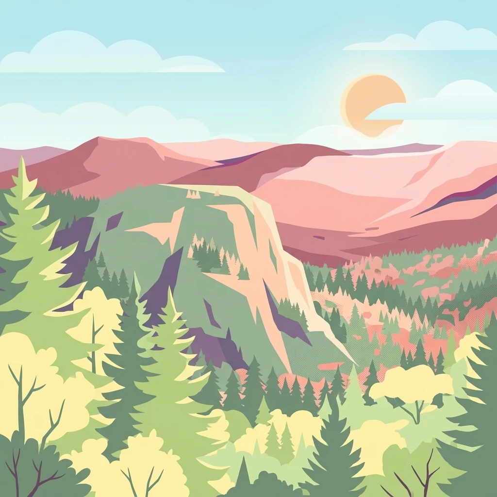
A flat vector illustration of a mountainous wilderness scene with layered evergreen forests in the foreground and pink-toned mountain ridges under a sunlit sky.

Middle Prong Wilderness

Wildlife reserve

Park overview

Structured park overview, official facts, and landscape profile for Middle Prong Wilderness

Middle Prong Wilderness park facts, protected area profile, and essential visitor context

Review the core facts for Middle Prong Wilderness, including designation, size, terrain, visitor scale, habitats, and operating context in one park-focused overview.

About Middle Prong Wilderness

Middle Prong Wilderness occupies a rugged slice of the southern Blue Ridge Mountains in western North Carolina, within the Pisgah National Forest. Although relatively compact at about 7,900 acres, the wilderness packs a wide range of elevation and terrain into its boundaries, rising from around 3,200 feet on lower slopes to more than 6,400 feet along the highest ridgelines. This vertical relief, combined with the moist climate of the southern Appalachians, supports transitions between lower hardwood forests and high-elevation spruce and fir communities typical of the region's upper slopes.

The wilderness is named for the Middle Prong of the Pigeon River, a stream whose headwaters rise within its borders. Protecting these headwaters is one of the defining reasons for the area's Wilderness designation, ensuring that a key tributary of the larger Pigeon River system continues to flow from an undisturbed, forested landscape. The terrain is steep and oftenrocky, with narrow ridges, coves, and drainages that have remained largely free of roads, logging, and other development.

Designated by Congress in 1984 and managed by the U.S. Forest Service, Middle Prong is classified as an IUCN Category Ib wilderness area, emphasizing its preserved, low-impact character. To the northeast, North Carolina Highway 215 forms the boundary with Shining Rock Wilderness, and together the two areas create a substantial, connected block of protected high-country forest. The result is a wilderness experience that feels remote despite its location within a heavily used national forest and near the popular gateway town of Brevard.

Quick facts and research context for Middle Prong Wilderness

Middle Prong Wilderness is a 7,900-acre Wilderness Area located in Haywood County in western North Carolina, within the Pisgah National Forest. It was designated in 1984 and is managed by the U.S. Forest Service under IUCN Category Ib (wilderness area). Nearest town is Brevard, and North Carolina Highway 215 separates it from the neighboring Shining Rock Wilderness to the northeast.

Protection and recognition

Documented terrestrial protection scope and historical designation data

Middle Prong Wilderness Protection Status and Designation History

Middle Prong Wilderness maintains a documented terrestrial protection scope established through designation history recorded in 1984. Official records outline the baseline conservation framework and management scope without additional international recognition sources.

Protection details

Protection scope
Terrestrial
Designated year
1984
Transboundary protection
No
Park context

Deeper park guide and search-rich context for Middle Prong Wilderness

Middle Prong Wilderness history, landscape, wildlife, and travel context

Explore Middle Prong Wilderness through its history, landscape character, ecosystems, wildlife, conservation priorities, cultural context, and seasonal travel timing in a structured park guide built for atlas discovery and search intent.

Why Middle Prong Wilderness stands out

Middle Prong Wilderness is best known for its steep, high-elevation Appalachian ridges and for protecting the headwaters of the Middle Prong of the Pigeon River. It is also recognized as part of a large connected block of Wilderness in the Pisgah National Forest, contributing to one of the most significant expanses of undeveloped southern Appalachian forest in the eastern United States.
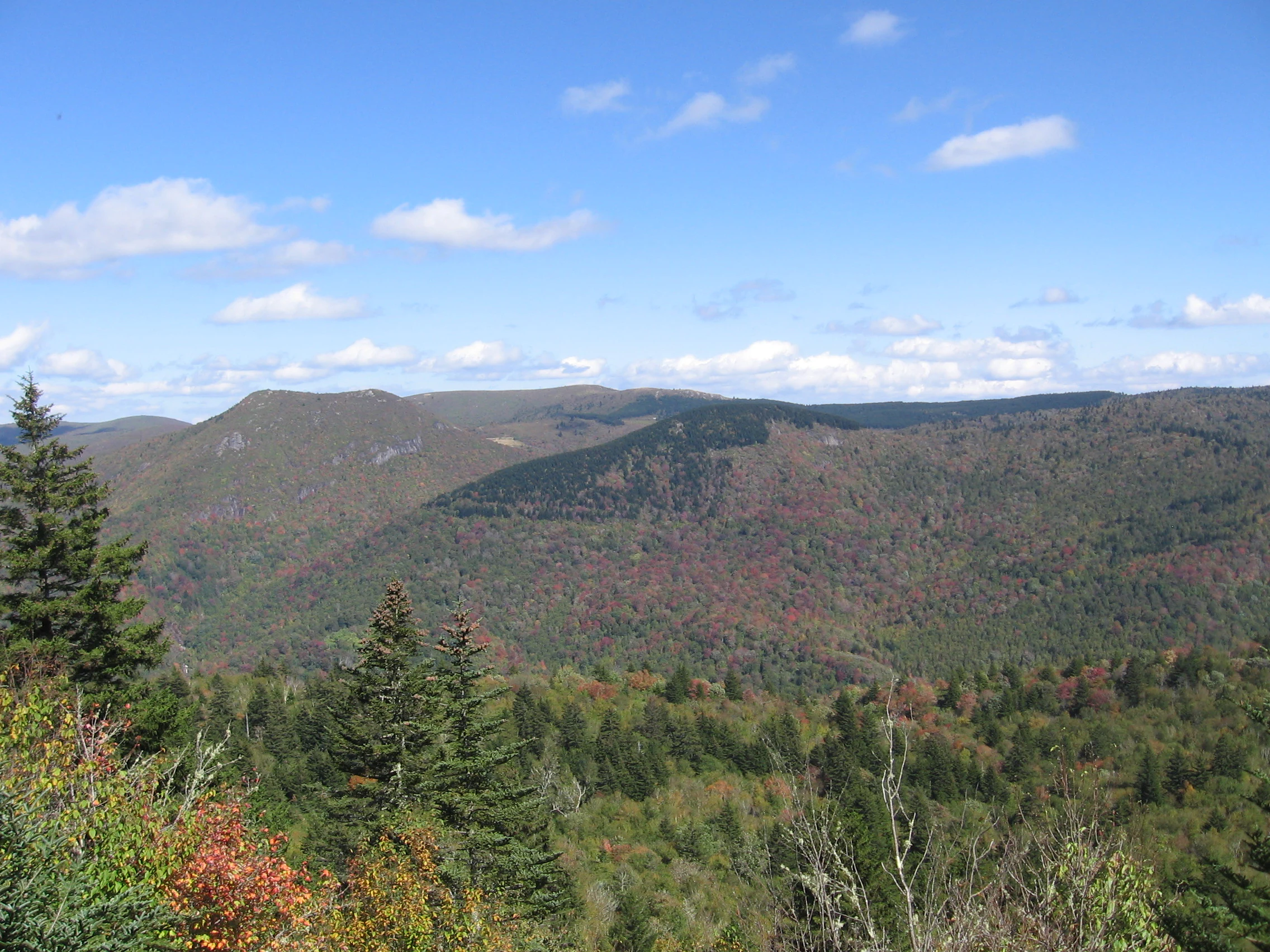
A wide, eye-level landscape photograph looking out over a series of forested mountain ridges under a blue sky with scattered clouds.
A scenic overlook capturing the layered ridgelines and vast forests of Middle Prong Wilderness.

Middle Prong Wilderness history and protected-area timeline

Middle Prong Wilderness was formally designated as a federal Wilderness Area in 1984, becoming one of several Wilderness Areas carved from the larger Pisgah National Forest in the southern Appalachians. Its establishment reflected a broader movement to protect representative examples of the region's high-elevation forest ecosystems and the headwaters of major river systems in their natural state.

Because the area lies within the long-managed Pisgah National Forest, much of the surrounding land had a history of timber harvest, watershed protection efforts, and early forest conservation work dating back to the early twentieth century. The Wilderness designation formalized the protection of this particular tract, restricting road building, mechanized use, and commercial activity in order to preserve its character. The proximity of North Carolina Highway 215, which serves as the boundary with Shining Rock Wilderness, has historically marked the line between heavily visited recreation areas and the more protected interior of the wilderness.

Middle Prong Wilderness landscape and geographic character

The landscape of Middle Prong Wilderness is defined by the steep, dissected terrain of the southern Blue Ridge Mountains. Rugged ridges rise quickly from valleys, and the wilderness spans an elevation range from approximately 3,200 feet at its lowest points to more than 6,400 feet on its highest summits. This dramatic vertical change occurs within a comparatively small area, producing a mosaic of slopes, coves, clifflines, and narrow ridges.

The Middle Prong of the Pigeon River and its smaller tributaries cut through these mountains, carving shallow ravines and shaping a surface dominated by forest cover and exposed rock rather than open vistas. The combination of high elevation, heavy rainfall, and varied topography gives the wilderness a distinctly Appalachian character, with cool, moisture-laden cove forests contrasting against more exposed, wind-shaped ridgetops.

Middle Prong Wilderness ecosystems, habitats, and plant life

Middle Prong Wilderness preserves a representative slice of high-elevation southern Appalachian forest within the Pisgah National Forest. Because of its wide elevation span and steep topographic relief, the area supports multiple overlapping forest communities typical of the Blue Ridge, including hardwood-dominated slopes at lower elevations and more coniferous, high-elevation forests higher up. Cool, shaded coves and moister drainages contrast with drier, more exposed ridgetops, producing a varied habitat mosaic within the wilderness boundaries.

Continuous forest cover and minimal road infrastructure make the area ecologically significant for species that depend on large, unbroken tracts of mountain habitat. The undisturbed forest also contributes to watershed health, with the canopy and underlying soils playing a key role in regulating runoff from steep slopes. This ecological character places Middle Prong firmly within the larger network of protected forest ecosystems in western North Carolina.

Middle Prong Wilderness wildlife and species highlights

The continuous forest cover and intact riparian corridors of Middle Prong Wilderness provide habitat typical of the southern Appalachians. Songbirds, raptors, and a variety of forest-interior species are supported by the mix of hardwood and high-elevation coniferous forest, while the Middle Prong river corridor and seasonal berry and mast crops offer food resources through much of the year.

Large blocks of contiguous wilderness like Middle Prong, combined with the adjoining Shining Rock Wilderness, are important for wildlife that requires extensive, undisturbed habitat. While specific wildlife inventories for this particular wilderness are limited in the source material, the broader Pisgah National Forest context points to typical Appalachian fauna including black bears, white-tailed deer, wild turkey, and various small mammals and amphibians that inhabit the region's forests and streams.

Middle Prong Wilderness conservation status and protection priorities

Middle Prong Wilderness plays a meaningful conservation role within the Pisgah National Forest by safeguarding both high-elevation forest habitat and the headwaters of the Middle Prong of the Pigeon River. Its Wilderness designation, established in 1984 and administered by the U.S. Forest Service, restricts road construction, logging, and mechanized use, keeping the landscape in a largely undeveloped state.

In combination with neighboring Shining Rock Wilderness, Middle Prong contributes to one of the largest concentrations of designated Wilderness in the eastern United States. This proximity enhances the conservation value of both areas by expanding the total extent of contiguous, roadless habitat available to forest species and by protecting the hydrological integrity of the Pigeon River watershed at its source.

Middle Prong Wilderness cultural meaning and human context

The Middle Prong area sits within a region of western North Carolina long associated with Appalachian mountain culture, including traditional uses of surrounding national forest lands for hunting, fishing, and dispersed recreation. The town of Brevard, just south of the wilderness, has long served as a gateway community for outdoor recreation in the southern Blue Ridge, and the forest corridors leading into Middle Prong have historically connected local residents and visitors to the high country of the Pisgah range.

Top sights and standout views in Middle Prong Wilderness

The wilderness's chief highlights are its steep Blue Ridge topography, its role as the headwaters of the Middle Prong of the Pigeon River, and its place within the expansive Pisgah National Forest Wilderness network. Together with the adjoining Shining Rock Wilderness, it forms a substantial block of protected high-elevation Appalachian forest, offering a quiet, rugged contrast to the more heavily visited recreation areas nearby.

Best time to visit Middle Prong Wilderness

Spring and fall are generally the most approachable seasons for visiting Middle Prong Wilderness, when milder temperatures make the steep terrain more manageable and the surrounding forest canopy shows seasonal color. Summer brings lush, fully leafed-out conditions and warmer weather, though it is also when thunderstorm activity is most frequent in the southern Appalachians. Winter can transform the high-elevation ridges into a colder, more austere landscape, with potential for snow and ice on exposed slopes above 4,000 or 5,000 feet.

Monthly climate preview

Track representative monthly temperature and precipitation data for North Carolina

Middle Prong Wilderness Climate Normals and Long-Term Weather Patterns

Long-term climatology data from representative coordinates outline the annual temperature progression and monthly precipitation averages across Middle Prong Wilderness. Reviewing the complete twelve-month profile provides deeper analytical context on measured weather patterns throughout the protected area.
Annual mean12 °C
1 °C22 °C
Jan
Feb
Mar
Apr12°
May16°
Jun20°
Jul22°
Aug22°
Sep18°
Oct13°
Nov
Dec
Warmest month
July

22.1 °C

Coolest month
January

1 °C

Wettest month
February

4.2 mm/day

Driest month
October

2.8 mm/day

Park location guide

Geography guide, regional context, and park location map for Middle Prong Wilderness

Middle Prong Wilderness park geography, regions, and map view in United States of America

Understand where Middle Prong Wilderness sits in United States of America through a broader geographic reading of the surrounding landscape, nearby location context, and its mapped position within the national park landscape.

How Middle Prong Wilderness fits into United States of America

The United States of America is a federal presidential republic and one of the world's largest countries by area and population. It consists of 50 states across a vast territory spanning multiple time zones, with its capital in Washington, D.C. and largest city in New York City. The nation has a diverse economy, influential political system, and significant cultural and military presence globally.

Wider geography shaping Middle Prong Wilderness in United States of America

The United States occupies a vast territory in North America, bordered by Canada to the north and Mexico to the south. The 48 contiguous states stretch from the Atlantic to the Pacific Ocean, while Alaska occupies the northwestern region and Hawaii is an archipelago in the Pacific. The country encompasses diverse terrain including the Rocky Mountains, Appalachian Mountains, Great Plains, and extensive river systems.

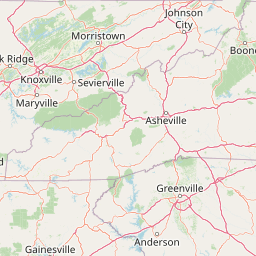
Map view of Middle Prong Wilderness

Use this park location map to pinpoint Middle Prong Wilderness in United States of America, understand its exact geographic position, and read its mapped placement within the surrounding landscape more clearly.

Pigeon | © OpenStreetMap contributors

Location context for Middle Prong Wilderness

North Carolina
Recorded earthquake history

View Recorded Earthquake History for Middle Prong Wilderness

Explore the documented seismic record near Middle Prong Wilderness. This collection provides geographic context for historical earthquakes in the surrounding Blue Ridge Mountains, allowing researchers and observers to browse data points through a structured and accessible regional interface.

Middle Prong Wilderness Earthquake History

Catalogued events

8 events

Strongest magnitude

Magnitude 3.7

Most recent event

Jun 4, 2023

This history includes earthquakes recorded inside the park or within 50 km of its borders

Visual reference of rugged Blue Ridge ridges, river headwaters, and protected forest habitats.

Middle Prong Wilderness Landscape Photos and High Elevation Scenery

Examine Middle Prong Wilderness imagery to understand the steep terrain, dense hardwood forests, and high-elevation topography of the southern Blue Ridge Mountains. Visual records reveal the sheltered coves, exposed rock ridgetops, and protected watersheds that define this rugged ecosystem.

A wide, eye-level landscape photograph looking out over a series of forested mountain ridges under a blue sky with scattered clouds.

Park atlas

Compare adjacent Blue Ridge mountain reserves and regional forest habitats

Parks Near Middle Prong Wilderness and Surrounding Protected Landscapes

Browse protected areas and high elevation terrain located close to Middle Prong Wilderness. Extending geographic comparison across the southern Appalachian region reveals broader patterns in forest conservation and rugged mountain topography.
Watercolor painting of a winding trail through grassy hills with mountains in the background, using a soft pastel color palette of greens, purples, and yellows.
Protected landscapeNorth Carolina
Park boundaries overlap#1 closest

East

Pisgah National Forest: Protected Appalachian Mountain Geography and Regional Mapping

An extensive mountain forest in western North Carolina

Pisgah National Forest represents a major protected landscape in the southern Appalachian Mountains of North Carolina. Its diverse terrain includes high peaks above 6,000 feet, dense hardwood forests, and deep river gorges. Recognized as a historic center for professional forestry, the area protects extensive watersheds and wilderness zones, offering a detailed case study in Appalachian geography, conservation science, and rugged mountain topography.

Area
2,075.06 km²
Established
1916
Relief
Mountain
Climate
Temperate
A horizontal watercolor painting depicting a soft green landscape with rolling hills, a meandering stream, and foreground grasses against a light white background.
Protected landscapeNorth Carolina
0.2 km away#2 closest

West

Nantahala National Forest: Geographic Overview of Protected Appalachian Mountain Landscapes

Mapping deep river gorges and temperate rainforests in North Carolina

The Nantahala National Forest represents a significant conservation achievement, encompassing diverse southern Appalachian mountain terrain. The landscape features deep river gorges, ancient old-growth forests, and extensive networks of waterfalls. This overview provides mapped context on its vast wilderness areas, including Joyce Kilmer-Slickrock, and the long-distance trail corridors that traverse this temperate rainforest region.

Area
2,150 km²
Established
1920
Relief
Mountain
Climate
Temperate
National parkTennessee
23 km away#3 closest

Northwest

Great Smoky Mountains National Park: Exploring Its Protected Landscape and Regional Geography

Tennessee's premier national park, mapped for landscape discovery.

Delve into the protected area identity of Great Smoky Mountains National Park, a significant natural landmark within Tennessee. This page provides detailed context on its mountainous terrain, mapped ecological zones, and its foundational role in the broader geography of eastern North America. Understanding the park's specific protected landscape features and its geographic setting is essential for appreciating its unique conservation value.

Area
2,114.15 km²
Established
1934
IUCN
II
Visitors
12.2M annual
Protected landscapeSouth Carolina
32 km away#4 closest

Southeast

Sumter National Forest: Mapping Protected Landscapes and Terrain in South Carolina

Bridging Piedmont forests and Appalachian mountain foothills

Sumter National Forest offers a study in geographic contrast, as its three districts span the transition from South Carolina Piedmont ridges to the rugged spurs of the Blue Ridge Mountains. This protected area features the Chattooga Wild and Scenic River corridor, expansive hardwood-conifer mosaics, and complex mountain watersheds. The forest provides a window into regional land restoration, where reclaimed farmland and mountain ridges now form a continuous network of protected natural terrain.

Area
1,500.98 km²
Established
1936
Relief
Mixed relief
Climate
Temperate
A soft watercolor illustration depicting a winding river, a small waterfall over layered rocks, and distant rolling mountains in muted green, blue, and brown tones.
Wildlife reserveUnited States of America
33 km away#5 closest

South

Ellicott Rock Wilderness: Geographic and Historic Protected Landscape Overview

A rare tri-state wilderness in the Southern Appalachian Mountains

Discover the mapped terrain of Ellicott Rock Wilderness, a protected area defined by its steep river gorges, dense cove forests, and unique position at the tripoint of three U.S. states. This wilderness area preserves the Chattooga River corridor and historic survey landmarks within the southern Blue Ridge Mountains, offering deep insight into the regional geography of the American southeast.

Area
33.48 km²
Established
1975
IUCN
Ib
Relief
Mountain
A horizontal watercolor painting showing a soft, impressionistic landscape with mature trees in the foreground, rolling green hills in the midground, and faded purple mountain silhouettes in the distance against a white background.
Wildlife reserveNorth Carolina
84 km away#6 closest

West

Joyce Kilmer-Slickrock Wilderness: Mapped Topography and Protected Forest Boundaries

Old-growth Appalachian wilderness in North Carolina

Analyze the dramatic valley-and-ridge geography of the Joyce Kilmer-Slickrock Wilderness. This protected area, encompassing the rare Joyce Kilmer Memorial Forest, serves as a vital reference for eastern forest conservation, featuring ancient hardwood groves and sweeping mountain vistas across the Unicoi range.

Area
70 km²
Established
1975
IUCN
Ib
Relief
Mountain
A pale, minimalist watercolor painting showing layers of soft green hills and a gentle stream against a white background.
Wildlife reserveGeorgia
101 km away#7 closest

Southwest

Raven Cliffs Wilderness: Exploring the Appalachian Ridges and Protected Forest Landscapes

High-elevation wilderness area in northern Georgia.

Spanning steep ridges and narrow valleys, Raven Cliffs Wilderness represents a significant protected area within the Chattahoochee National Forest. The landscape transitions from high, exposed ridgelines to dense hardwood forest, offering a compact yet varied study in Appalachian mountain geography.

Area
36.89 km²
Established
1986
IUCN
Ib
Relief
Mountain
A soft watercolor painting of a river flowing through a lush green valley with rolling mountains in the hazy background.
Wildlife reserveNorth Carolina
103 km away#8 closest

Northeast

Linville Gorge Wilderness: Rugged Canyon Geography and Protected Appalachian Forest

Historic wildlife reserve in North Carolina

Spanning over 10,000 acres, Linville Gorge Wilderness is defined by its steep cliff walls, vertical elevation drops, and an absence of road infrastructure. As one of the original areas designated under the Wilderness Act, this North Carolina landmark offers a unique look at undisturbed old-growth hardwoods and pine communities nestled within the dramatic peaks of the Blue Ridge Mountains.

Area
47.7 km²
Established
1964
IUCN
Ib
Relief
Mountain

Common questions about visiting, size, designation, and location context for Middle Prong Wilderness

Middle Prong Wilderness FAQs for park facts, access, geography, and protected area context

Find quick answers about Middle Prong Wilderness, including protected-area facts, park geography, trail and visitor context, and how the park fits into its surrounding country and regional landscape.
MoriAtlas Explorer

Continue Your Protected Areas Search Across the Global Atlas

Deepen your exploration by continuing the structured search for national parks and protected areas worldwide. Utilize the comprehensive filtering capabilities to compare different conservation landscapes and refine your understanding of global park geography. Discover more about the distribution and characteristics of protected natural areas.

Global natural geography