

Mori Atlas logo
Protected landscapeMiechowicka Ostoja Leśna

Mapping the layered terrain and historic arboretum within the Silesian Upland forest system.

Miechowicka Ostoja Leśna Protected Landscape: Geographic Context and Industrial Woodland History

(Zespół przyrodniczo-krajobrazowy Miechowicka Ostoja Leśna)

Miechowicka Ostoja Leśna is an expansive protected landscape complex located in the Bytom district of southern Poland. This site offers a window into the complex geography of the Silesian Upland, where native deciduous woodlands meet a 19th-century arboretum and industrial-era landforms. Visitors can explore a terrain defined by historical mining remnants, including sunken shafts and heaps, now reclaimed by nature and structured by a series of woodland ponds and historic walking paths.

urban forest refugeprotected landscape complexSilesian Uplandpost-mining landscapehistoric arboretumexotic tree plantings
A stylized flat vector illustration of a valley with mountains in the background, a lake in the midground, and a moss-covered stone circular structure in the foreground.

Miechowicka Ostoja Leśna

Protected landscape

Park overview

Structured park overview, official facts, and landscape profile for Miechowicka Ostoja Leśna

Miechowicka Ostoja Leśna park facts, protected area profile, and essential visitor context

Review the core facts for Miechowicka Ostoja Leśna, including designation, size, terrain, visitor scale, habitats, and operating context in one park-focused overview.

About Miechowicka Ostoja Leśna

Miechowicka Ostoja Leśna is a municipally protected forest complex in the Miechowice quarter of Bytom, set on the Silesian Upland in southern Poland. Although it sits within the densely urbanised industrial landscape of Upper Silesia, the site preserves a surprisingly rich and varied woodland environment, blending native deciduous forest with 19th-century exotic tree plantings and a network of ponds, springs, and clearings shaped by both natural processes and centuries of mining activity.

The forest belongs to the historic Lasy Bytomskie (Forests of Bytom) and is administered by the Brynek Forest District of the State Forests. It functions today as a community-scale natural area, used for walking, cycling, environmental education, and quiet recreation. A 2.2-kilometre nature trail around the Three Ponds was revitalised soon after the refuge was formally established, and several longer walking and cycling routes cross its territory, including the named paths known as Droga Klary, Droga Ewy, Droga Ronota, and Droga Różana.

The site's identity rests on three interwoven elements: a recovering native forest ecosystem, an inherited private arboretum of exotic species, and a post-mining topography of heaps and collapsed shafts. Together they create a landscape that tells both an ecological story of regeneration and an industrial story of depletion and subsequent conservation response. The 2004 community campaign to protect the forest, which culminated in the 2012 legal designation, gave the refuge a strong local identity as a place reclaimed by the residents of Bytom for nature, science, and recreation.

Quick facts and research context for Miechowicka Ostoja Leśna

Miechowicka Ostoja Leśna is a zespoł przyrodniczo-krajobrazowy (a Polish category of protected landscape complex) created on 25 January 2012 by resolution XXIII/321/12 of the Bytom City Council. Its area covers approximately 305.60 hectares within forest divisions 666 to 671, 673 to 677, and part of division 678 of the Brynek Forest District.

It lies within the Wyżyna Śląska mesoregion in the Silesian Voivodeship, bounded by the Rokitnica district of Zabrze to the west, ulica ks. Jana Frenzla to the south, ulica Stolarzowicka to the north, and the residential Miechowice quarter to the east. The site is a surviving fragment of the historic Puszcza Śląska (Silesian Forest) that, after heavy industrial exploitation, was rehabilitated as an accessible landscape reserve after a successful community campaign beginning in 2004.

Protection and recognition

Examine the documented protection framework and administrative scope for Miechowicka Ostoja Leśna

Miechowicka Ostoja Leśna Protection Status and Terrestrial Conservation Scope

Miechowicka Ostoja Leśna holds a recorded terrestrial protection scope within the regional conservation inventory. Readers can review documented management details, administrative classifications, and official designation data without relying on external assumptions.

Protection details

Protection scope
Terrestrial
Transboundary protection
No
Park context

Deeper park guide and search-rich context for Miechowicka Ostoja Leśna

Miechowicka Ostoja Leśna history, landscape, wildlife, and travel context

Explore Miechowicka Ostoja Leśna through its history, landscape character, ecosystems, wildlife, conservation priorities, cultural context, and seasonal travel timing in a structured park guide built for atlas discovery and search intent.

Why Miechowicka Ostoja Leśna stands out

The protected area is best known for its 150-year-old pedunculate oak that has become the unofficial symbol of the refuge, and for the unusual mix of native European broadleaf species with exotic 19th-century arboretum plantings introduced by the Tiele-Winckler industrialist family. Together with the Three Ponds valley and the historic Kamienna Ława 'Rosen-Bank' of 1888, these features give the forest a strongly layered character that visitors do not typically expect from an urban-edge woodland. It is also recognised for its visible post-mining landscape of sunken shafts, heaps, and reshaped terrain, a testimony to the zinc, lead, and iron ore industry that once consumed much of the surrounding forest. The combination of restored woodland, historic recreational architecture, and industrially altered topography makes Miechowicka Ostoja Leśna distinctive within the broader Lasy Bytomskie system.

A brown Ringlet butterfly with distinct eye-spots on its wings perched on top of a cluster of small purple hemp-agrimony flowers with a soft, out-of-focus green background.
A Ringlet butterfly resting on a hemp-agrimony flower in Miechowicka Ostoja Leśna.

Miechowicka Ostoja Leśna history and protected-area timeline

The forests around Miechowice were once part of the large medieval Puszcza Śląska, the Silesian Forest, but were heavily logged and transformed from at least the 14th century onward to supply nearby industrial operations. In 1812 the Miechowice area, together with the Miechowice-Rokitnica forests, was acquired by the merchant Ignarz Domes of Czeladź; the woodlands subsequently passed to the Aresin family and then to the Tiele-Winckler industrial dynasty, who owned extensive mining and metallurgical enterprises in the region.

The Tiele-Wincklers introduced many exotic tree species to the Miechowice forest, and in the 1860s Hubert von Tiele-Winckler set aside part of the property for private recreation. By the 1880s walking paths had been laid out and several springs had been walled and ornamented, including the historic 'Rosen-Bank' stone bench dated 1888. In 1923 Klaus von Tiele-Winckler sold the forest to Preussengrube AG, owner of the Preussen coal mine, but in 1926 the city of Bytom leased part of the forest and, on 1 May 1927, opened the publicly accessible Waldpark Miechowitz-Rokittnitz (Miechowice-Rokitnica Forest Park), an initiative of Mayor Adolf Knackrick and district administrator Kurt Urbanek, who also began creating a botanical garden character along Droga Ronota and Droga Różana.

After World War II the forest became state property managed by the State Forests as part of the Brynek Forest District and, because it fell within the protective forest belt of the Upper Silesian Industrial District (GOP), was excluded from industrial timber harvesting. Between 1952 and the following years, some of the most valuable exotic trees were transplanted to the Silesian Park in Chorzów. In 2004 local residents launched a successful community campaign to safeguard the remaining Miechowice forest, and on 25 January 2012 the Bytom City Council formally established the Miechowicka Ostoja Leśna protected landscape complex. Since then, new educational, hiking, and cycling trails have been created, officially opened on 1 December 2012.

Miechowicka Ostoja Leśna landscape and geographic character

The terrain of Miechowicka Ostoja Leśna belongs to the gently rolling Wyżyna Śląska, an upland mesoregion in southern Poland. Its surface has been profoundly reshaped by industrial activity, so that alongside natural woodland one encounters heaps, sunken mine shafts, and irregular hollows that have since been colonised by vegetation and small water bodies.

The hydrological system is a particular feature: the Rokitnica Stream passes through the broader forest complex, while one of its left-bank tributaries feeds the celebrated Dolina Trzech Stawów, the Three Ponds Valley, accompanied by numerous smaller pools and woodland ponds. Several springs rise within the protected area and have been walled with stone, most notably the Źródło Różane (Rose Spring) in the Three Ponds Valley, surrounded by a historic stone circle that probably served recreational purposes.

Clearings and former pathways break up the dense canopy. The open glades near Droga Ronota, the forester's lodge area, and several meadows along Droga Ewy provide the kind of half-open landscape that supports both oak-aged standard trees and young regeneration under a mosaic of light conditions.

A close up view of a small white Orthezia urticae insect clinging to a bright green, fuzzy, vertical plant stem.
An adult female Orthezia urticae resting on a nettle stem.

Miechowicka Ostoja Leśna ecosystems, habitats, and plant life

Ecologically, the protected area is a mosaic of semi-natural broadleaf woodland, planted exotic stands, water bodies, and post-industrial open ground. The canopy is dominated by European oak, beech, and mixed deciduous species, with a notable contingent of introduced North American and East Asian trees that persist from the Tiele-Winckler arboretum, including Lawson cypress, Canadian hemlock, green Douglas fir, swamp oak, Japanese Katsura, Californian fir, European black pine, eastern white pine, Serbian spruce, Siberian spruce, and American tulip tree.

The water network supports wetland microhabitats, and the damp margins of the Three Ponds and smaller ponds provide habitat for amphibians and aquatic invertebrates. Open clearings and meadow edges, sometimes formed on former mining heaps, host populations of protected herbaceous plants, including a documented stand of the rare wild garlic Allium victorialis (czosnek siatkowaty). The combination of mature broadleaf forest, shrubby margins, ponds, springs, and mineral-rich post-mining substrates gives the refuge an unusually broad spectrum of habitat types within a compact urban-edge setting.
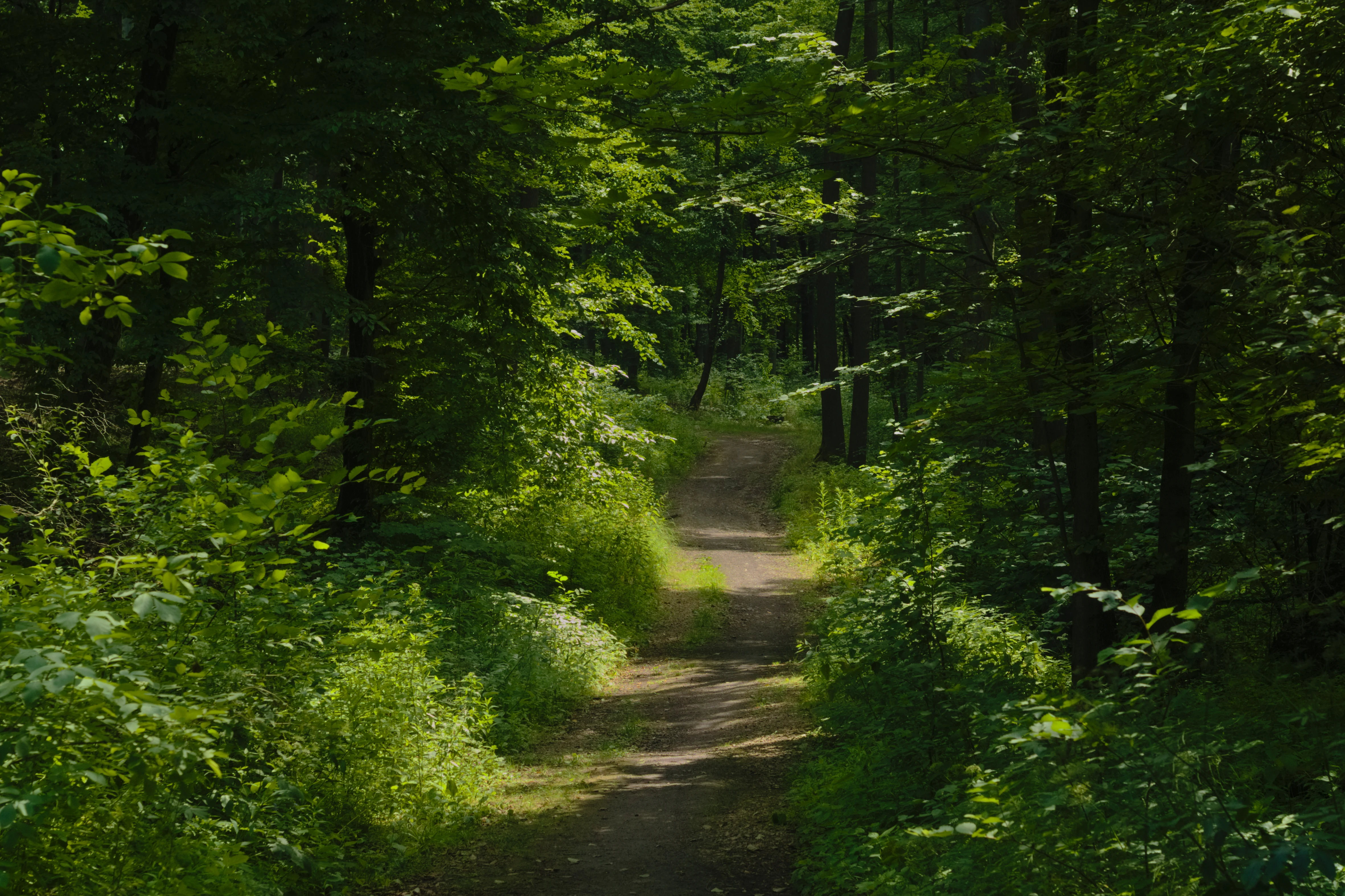
A narrow dirt trail winding through a dense, green deciduous forest in Bytom, Poland.
A narrow dirt path winds through the dense, verdant forest of Miechowicka Ostoja Leśna.

Miechowicka Ostoja Leśna wildlife and species highlights

The refuge supports a typical central-European forest fauna. Mammals recorded in the area include wild boar, red fox, roe deer, pine marten, European hedgehog, European mole, and red squirrel, along with bats that use the older trees and built structures as roosting habitat.

The bird community is diverse for an urban-edge forest, with white stork visiting open areas, and woodland species such as great spotted woodpecker, common pheasant, grey partridge, common buzzard, European robin, Eurasian bullfinch, great tit, Eurasian jay, common chaffinch, and skylark regularly present. The surrounding thickets also support the thrush nightingale. Reptiles include the common lizard, slow worm, grass snake, and common European viper in suitable microhabitats. Amphibians are well represented, with fire-bellied toad, common toad, European tree frog, smooth newt, great crested newt, moor frog, common frog, and pool frog breeding around the ponds. Insect diversity has been noted as particularly high, with several hundred species recorded in the area.
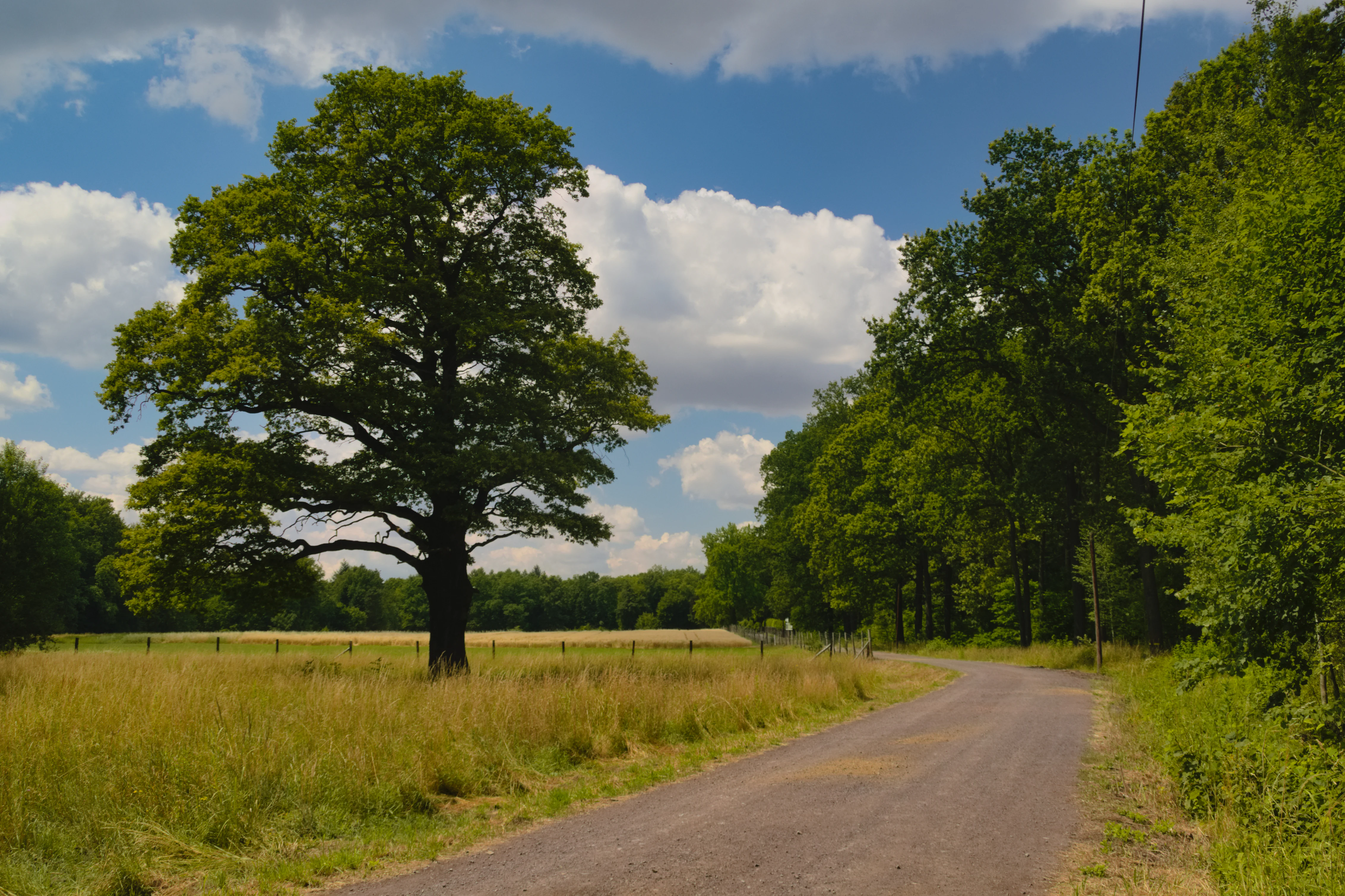
A large, mature oak tree stands alone in a grassy field next to an unpaved road, with a forest line and blue sky with white clouds in the background.
A solitary old oak tree stands in a clearing along a quiet rural road in Miechowicka Ostoja Leśna.

Miechowicka Ostoja Leśna conservation status and protection priorities

The Miechowicka Ostoja Leśna designation was driven by a need to preserve for scientific, educational, and landscape reasons a surviving fragment of the heavily exploited Bytom Forests, including its water bodies, clearings, and the distinctive post-mining landforms created by historical extraction of zinc, lead, and iron ores. The protection order explicitly cites the presence of plant and animal habitats covered by species-level conservation status as a justification for formal landscape-level safeguarding.

Beyond habitat protection, the refuge represents a successful example of local community-driven conservation. A 2004 residents' campaign laid the groundwork for the 2012 legal designation, and the subsequent revitalisation of the Three Ponds trail, the introduction of information boards, and the creation of new educational and cycling paths demonstrate ongoing investment in both ecological recovery and public engagement. Its position within the former GOP protective forest belt, which excluded industrial timber harvesting, has also been important in allowing mature, biologically rich stands to persist amid a heavily industrialised region.

Miechowicka Ostoja Leśna cultural meaning and human context

The forest sits within one of Europe's most historically industrialised landscapes and carries visible traces of that past. Stone benches such as the carved 'Rosen-Bank' of 1888 and stone circles near the springs reflect the late-19th-century habit of Upper Silesian industrial families, especially the Tiele-Wincklers, of creating private recreation grounds within their forest estates. Several paths retain their original named character, including Droga Ewy, named for Ewa von Tiele Winckler.

The 2012 name 'Ostoja Leśna' itself nods to the older Bytom site known as 'Ostoja Pokoju', embedding the refuge within a local tradition of 'haven' place-names. The community campaign of 2004 and the subsequent volunteer and municipal efforts to mark trails, plant signage, and host environmental education give the refuge a strong identity as a place reclaimed by the city's residents from industrial decline.
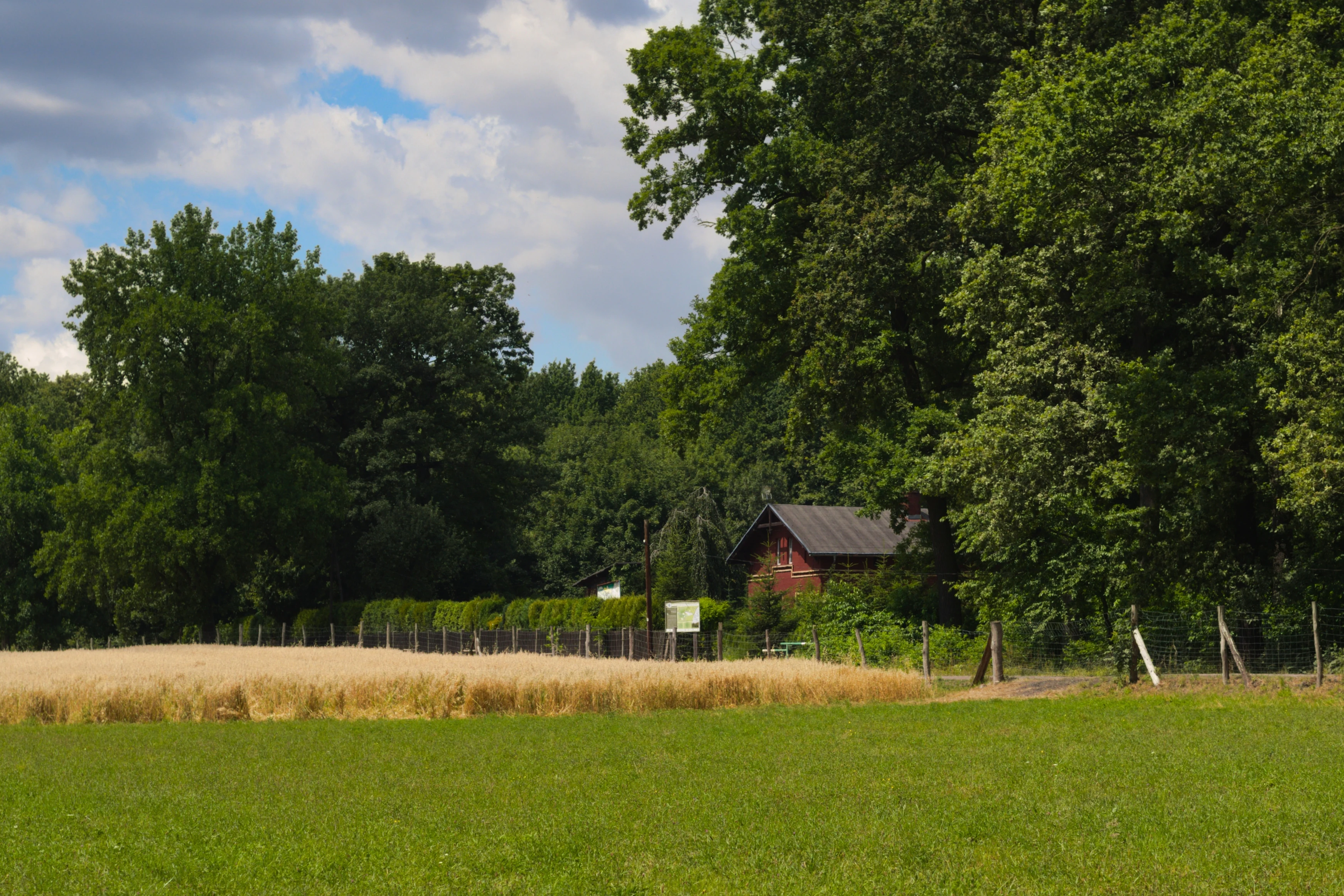
A small wooden building partially obscured by green trees, sitting behind a field of golden wheat and a patch of green grass.
A forester's lodge situated along the forest edge in Miechowicka Ostoja Leśna.

Top sights and standout views in Miechowicka Ostoja Leśna

A 150-year-old pedunculate oak that serves as the symbolic tree of the refuge stands in a clearing near Droga Ronota, anchored by the historic forester's lodge. The Three Ponds Valley, with its walled springs, stone circles, and the Rose Spring with its inscribed Rosen-Bank bench, anchors the refuge's historic character as a 19th-century recreational woodland.

The exotic arboretum plantings, from Lawson cypress to American tulip tree, layered with native beech and oak, are unusual for an urban-edge Polish forest. Together with the visible heaps and collapsed mining shafts, and a network of named paths and dendrological trails such as 'Ciekawe drzewa Lasu Bytomskiego', they make the protected area a compact, legible landscape of forest recovery and industrial memory.
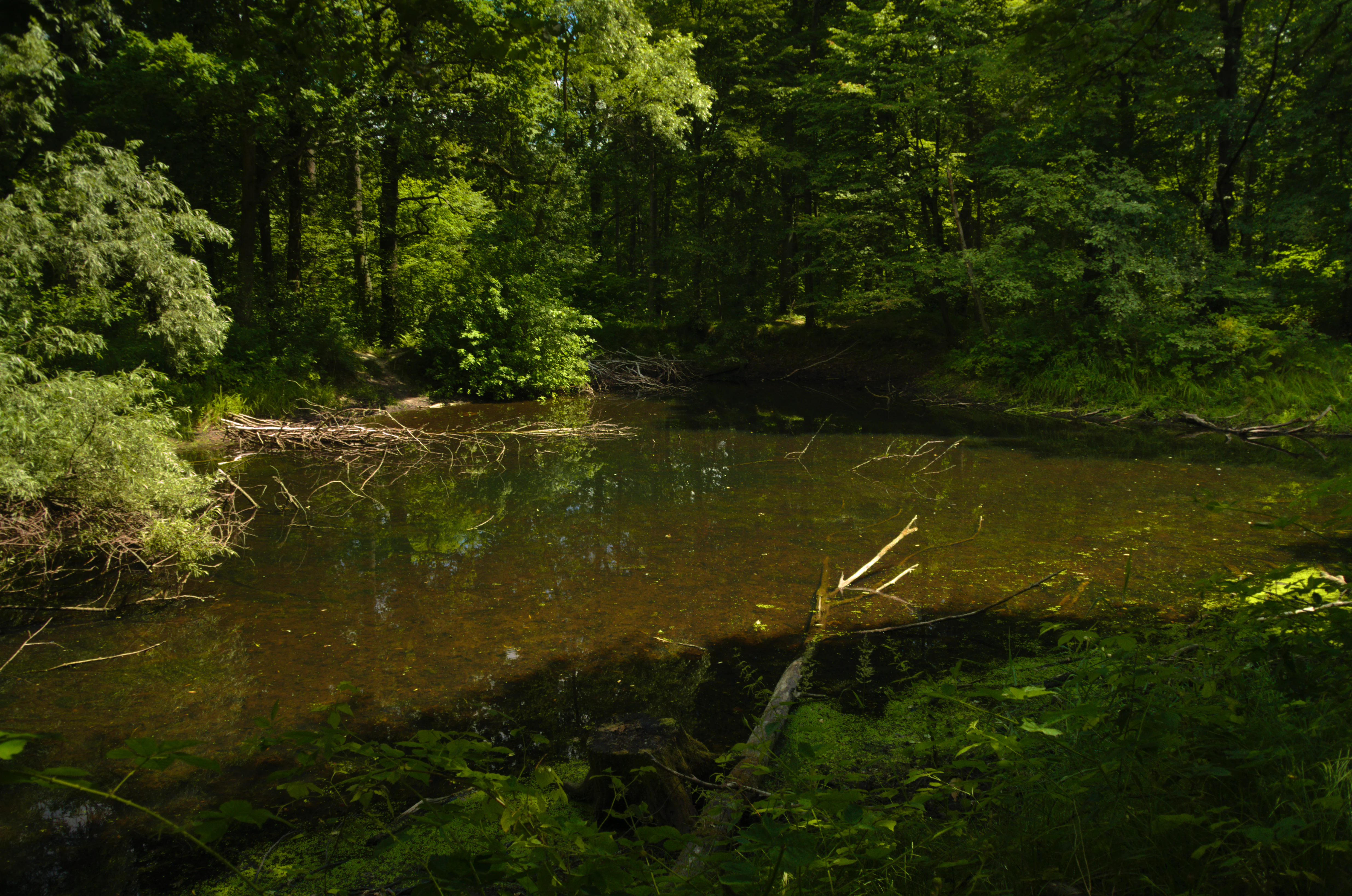
A small, calm pond tucked within a lush green forest, with a fallen tree branch partially submerged in the dark water.
A shaded forest pond surrounded by dense vegetation in Miechowicka Ostoja Leśna.

Best time to visit Miechowicka Ostoja Leśna

Miechowicka Ostoja Leśna is a year-round green space, with each season offering a different character. Spring brings fresh foliage over the ponds and active amphibian breeding around the Three Ponds Valley, while autumn highlights the mature oaks and mixed exotic plantings that produce one of the most varied autumn colour displays in the Bytom area. Summer offers dense canopy cover and lively insect and bird activity along the trails. Winter, with snow on the cleared paths around the ponds and the exposed branches of the older oaks and exotic conifers, gives the place a quieter, more sculptural atmosphere. Visitors interested in the largest stand of exotic trees, the historic stonework, and the clearest reading of the post-mining topography will find the leaf-off period particularly rewarding.


Monthly climate preview

Long-term representative monthly temperature and precipitation rhythm for Miechowicka Ostoja Leśna

Miechowicka Ostoja Leśna Climate Normals and Annual Temperature Range

Representative coordinate records show average temperatures ranging from sub-zero winter lows to warm summer maximums alongside measured monthly precipitation patterns. Detailed monthly climatology data provides complete insight into the long-term meteorological rhythm recorded at this protected area.
Annual mean8 °C
-3 °C20 °C
Jan-3°
Feb-2°
Mar
Apr
May14°
Jun18°
Jul20°
Aug20°
Sep14°
Oct
Nov
Dec-2°
Warmest month
July

20 °C

Coolest month
January

-3.3 °C

Wettest month
July

2.9 mm/day

Driest month
January

1.5 mm/day

Park location guide

Geography guide, regional context, and park location map for Miechowicka Ostoja Leśna

Miechowicka Ostoja Leśna park geography, regions, and map view in Poland

Understand where Miechowicka Ostoja Leśna sits in Poland through a broader geographic reading of the surrounding landscape, nearby location context, and its mapped position within the national park landscape.

How Miechowicka Ostoja Leśna fits into Poland

Poland, officially the Republic of Poland, is a Central European country spanning from the Baltic Sea in the north to the Carpathian Mountains in the south. It borders Germany, Czech Republic, Slovakia, Ukraine, Belarus, Lithuania, and Kaliningrad Oblast. The country has a temperate climate, diverse landscapes, and is known for its rich history, cultural heritage, and strong economic position within the EU.

Wider geography shaping Miechowicka Ostoja Leśna in Poland

Poland occupies 312,696 km2 in Central Europe, extending from the Baltic Sea coast in the north to the Sudetes and Carpathian Mountains in the south. It borders Germany to the west, Czech Republic and Slovakia to the south, Ukraine and Belarus to the east, and Lithuania and Kaliningrad Oblast to the northeast. The landscape includes lowland plains, uplands, and mountain ranges.

Map view of Miechowicka Ostoja Leśna

Use this park location map to pinpoint Miechowicka Ostoja Leśna in Poland, understand its exact geographic position, and read its mapped placement within the surrounding landscape more clearly.

Pigeon | © OpenStreetMap contributors

Location context for Miechowicka Ostoja Leśna

Silesian Voivodeship

Examine the terrain, mixed broadleaf forest habitats, and post mining landscape character.

Miechowicka Ostoja Leśna Photos and Landscapes: Visual Exploration of the Protected Area

Visual records capture the restored woodland canopy, historic arboretum plantings, and unique industrial topography across the protected landscape. Examining these photographs helps reveal the ecological recovery and structural diversity defining the forest refuge.

A brown Ringlet butterfly with distinct eye-spots on its wings perched on top of a cluster of small purple hemp-agrimony flowers with a soft, out-of-focus green background.

A close-up view of a green-veined white butterfly with pale wings featuring dark veins resting on a green leaf.

A close up view of a small white Orthezia urticae insect clinging to a bright green, fuzzy, vertical plant stem.

A narrow dirt trail winding through a dense, green deciduous forest in Bytom, Poland.

A large, mature oak tree stands alone in a grassy field next to an unpaved road, with a forest line and blue sky with white clouds in the background.

A weathered, circular stone structure built around a natural spring in a woodland setting, surrounded by fallen leaves and mossy ground.

A small wooden building partially obscured by green trees, sitting behind a field of golden wheat and a patch of green grass.

A small, calm pond tucked within a lush green forest, with a fallen tree branch partially submerged in the dark water.

Park atlas

Compare nearby regional forests, upland reserves, and connected conservation areas.

Parks Near Miechowicka Ostoja Leśna and Surrounding Protected Landscapes

Continue exploring regional park geography by comparing adjacent woodland reserves and protected landscapes situated across the surrounding Silesian Upland. Discover how nearby natural refuges share similar post-mining terrain, mixed broadleaf forests, and restored ecosystems.
Protected areaPoland
About 1.9 km away#1 closest

North

Podziemia Tarnogórsko-Bytomskie: Industrial Mining Heritage and Protected Subterranean Landscapes

Historic silver mining tunnels in Upper Silesia, Poland

Explore the geography of Podziemia Tarnogórsko-Bytomskie, a massive subterranean network of shafts, galleries, and adits beneath the Polish countryside. This protected landscape documents centuries of silver and lead extraction while serving as a essential refuge for diverse bat species within the region.

Area
34.908 km²
Established
1955
Access
Easy access
Scope
Terrestrial
Watercolor painting of a lush green landscape with trees, rolling hills, and a water feature in a soft pastel palette.
Protected landscapeSilesian Voivodeship
About 22 km away#2 closest

Southwest

Park Krajobrazowy Cysterskie Kompozycje Krajobrazowe Rud Wielkich: A Silesian Protected Area

Riverine landscapes, forest corridors, and historic Cistercian pond networks

Situated in the Silesian Voivodeship, this protected landscape encompasses a significant portion of the Upper Oder basin. Its geography is characterized by a balance of managed forest, agricultural fields, and an intricate lattice of fishponds. These features provide critical refuge for waterbirds and preserve riparian woodland patterns that reflect centuries of deliberate landscape transformation by the Cistercian order.

Area
493.87 km²
Established
1993
Relief
Lowland
Climate
Temperate
Protected areaSilesian Voivodeship
About 35 km away#3 closest

East

Łąki w Sławkowie Protected Area: Silesian Voivodeship Landscape and Map Analysis

Mapping rare fen and meadow habitats in southern Poland

Łąki w Sławkowie is a crucial protected habitat area situated west of Sławków. Its landscape consists of four connected enclaves characterized by wet meadow communities and calcareous fens. This data-driven overview highlights the site's hydrological and ecological significance within the broader Silesian Voivodeship and Poland's Natura 2000 network.

Area
0.51 km²
Relief
Lowland
Scope
Terrestrial
Water
Minor water
A watercolor painting of a serene landscape showing a pond, green trees, and low hills in the background.
Nature reserveJaworzno
About 43 km away#4 closest

East

Rezerwat przyrody Dolina Żabnika: Protected Stream Valley and Wetland Map in Jaworzno

A dense ecological sanctuary within the Silesian Highlands

Rezerwat przyrody Dolina Żabnika protects a rare concentration of aquatic and peat-forming habitats along the Żabnik stream. This nature reserve offers a distinct look at transitional bog ecosystems and pine forest integration in southern Poland, providing a mapped window into the complex drainage geography and preserved biodiversity of the Silesian Voivodeship.

Area
0.48 km²
Established
1996
Relief
Lowland
Climate
Temperate
Nature reserveSilesian Voivodeship
About 43 km away#5 closest

East

Ostoja Środkowojurajska Nature Reserve: Protected Area Geography and Habitat Mapping

Regional karst terrain and protected beech forest mosaic

Analyze the geographic structure of Ostoja Środkowojurajska, a vital Natura 2000 site in the Silesian Voivodeship. This protected area features a unique concentration of inland dunes, rocky limestone outcrops, and multiple forest types. Explore the site to understand its role in regional conservation and its varied, karst-influenced physical geography.

Area
57.676 km²
Established
2009
Relief
Upland
Climate
Temperate
Watercolor painting depicting a soft-focus landscape with light sandy ground in the foreground, a line of green trees in the midground, and layered rolling hills in the background.
Protected areaMałopolskie
About 45 km away#6 closest

East

Pustynia Błędowska: Protected Inland Sand Dunes and Geographic Map Context in Poland

An expansive shifting sand landscape within the Małopolskie region

Pustynia Błędowska stands as a unique protected site in Poland, defined by its extensive quartz sand sheets and inland dune formations. This landscape offers a compelling look at the intersection of anthropogenic history and ecological restoration, supporting rare sand-dwelling flora and invertebrates within a specialized grassland habitat.

Area
33 km²
Established
2004
Relief
Upland
Climate
Temperate
A soft watercolor painting of a rolling landscape featuring light-colored limestone cliffs, green hills, and a winding path, rendered in pale pastel tones.
Nature reserveSilesian Voivodeship
About 50 km away#7 closest

Northeast

Ostoja Olsztyńsko-Mirowska: A Detailed Map and Geographic Overview of the Protected Reserve

Karst limestone formations and diverse forest habitats in Silesian Voivodeship.

Ostoja Olsztyńsko-Mirowska stands as a centerpiece of the Częstochowa Upland, characterized by its dramatic mogotes, caves, and sheltered xerothermic grasslands. This atlas-focused entry details the area's topographic complexity, ranging from the wooded ridges of Sokole Góry to the historic limestone spurs housing medieval ruins. Uncover the ecological dynamics of this protected landscape where beech forest stands and rare cave systems form a critical regional biodiversity network.

Area
22.109 km²
Established
2008
Relief
Upland
Climate
Temperate
Protected areaSilesian Voivodeship
About 51 km away#8 closest

Northeast

Ostoja Złotopotocka: Mapping the Protected Habitats and Limestone Geography of Silesian Voivodeship

Natura 2000 protected zone in southern Poland

Ostoja Złotopotocka encompasses a rich mosaic of natural habitats across the Częstochowa Upland. From the calcareous rock faces and deep karst caves to the expansive beechwood forests and inland sand dunes, this area serves as a primary site for ecological conservation. Use this resource to understand the complex terrain, boundary layout, and structural diversity that define this protected landscape within the Polish region.

Area
27.48 km²
Relief
Upland
Climate
Temperate
Access
Access unknown

Common questions about visiting, size, designation, and location context for Miechowicka Ostoja Leśna

Miechowicka Ostoja Leśna FAQs for park facts, access, geography, and protected area context

Find quick answers about Miechowicka Ostoja Leśna, including protected-area facts, park geography, trail and visitor context, and how the park fits into its surrounding country and regional landscape.
MoriAtlas Explorer

Continue Your Protected Areas Search Across the Global Atlas

Deepen your exploration by continuing the structured search for national parks and protected areas worldwide. Utilize the comprehensive filtering capabilities to compare different conservation landscapes and refine your understanding of global park geography. Discover more about the distribution and characteristics of protected natural areas.

Global natural geography