
Mori Atlas logo
Nature reserveRezerwat przyrody Międzyrzecze

A vital protected nature reserve featuring glacial terrain, natural springs, and mixed forest ecosystems.

Rezerwat przyrody Międzyrzecze: Mapping Protected Forest Landscapes in Podlaskie Voivodeship

(Rezerwat przyrody „Międzyrzecze”)

Rezerwat przyrody Międzyrzecze preserves a critical fragment of the Knyszyn Forest, defined by its undulating glacial topography and active groundwater springs. This protected area within the Podlaskie Voivodeship safeguards well-developed lowland woodland communities that rely on the specific hydrological conditions of the region. Through detailed landscape analysis and mapped terrain, this documentation provides a clear look at how forest fragmentation and water sources define this protected environment.

forest reservelowland mixed forestKnyszyn Forestsprings and seepagesPodlasieactive conservation
A stylized flat illustration of a forest with tall pine trees, a calm stream with fallen logs, and high rocky mountains in the background featuring a small waterfall.

Rezerwat przyrody Międzyrzecze

Nature reserve

Park overview

Structured park overview, official facts, and landscape profile for Międzyrzecze Nature Reserve

Międzyrzecze Nature Reserve park facts, protected area profile, and essential visitor context

Review the core facts for Międzyrzecze Nature Reserve, including designation, size, terrain, visitor scale, habitats, and operating context in one park-focused overview.

About Międzyrzecze Nature Reserve

Międzyrzecze Nature Reserve represents one of the formally protected forest fragments within the wider Knyszyn Forest, a large woodland that stretches across the borderlands of Podlasie in northeastern Poland. The reserve's establishment in 1990 reflected growing recognition of the value of preserving intact forest communities outside the strictly conserved areas, while still applying a regulated protection regime.

The reserve lies in the Sokółka hills area, a landscape of gentle relief shaped by older glacial activity. Within this setting, Międzyrzecze preserves forest sections where the interaction of surface topography and spring activity has produced a mosaic of natural plant communities. The presence of numerous springs is a particularly important characteristic, because such places sustain moisture-loving woodland species and create transition zones between drier upland forest and wetter lowland stands.

In administrative terms, the reserve falls within the Knyszyn Forest Landscape Park, giving it an additional layer of regional protection. The combined designation, as both a nature reserve and a component of a broader landscape park, underlines the importance of Międzyrzecze as a representative example of lowland mixed forest conservation in the Podlaskie region.

Quick facts and research context for Międzyrzecze Nature Reserve

Międzyrzecze is a forest nature reserve in the Podlaskie Voivodeship of northeastern Poland, within the Sokółka County area and specifically the territory of Gmina Szudziałowo. It lies in the geographical mesoregion of the Wzgórza Sokólskie, a region of rolling terrain shaped by glacial processes.

The reserve was created in 1990 by order recorded in Monitor Polski, the official Polish legal gazette. It is classified as a phytocoenotic reserve of forest and woodland communities, with a focus on protecting mixed lowland forest stands. The protection regime applied is active conservation, meaning that management interventions are used to maintain or restore the intended natural character of the habitats.

Protection and recognition

Documented terrestrial protection metrics and official conservation status details

Rezerwat przyrody Międzyrzecze Protection Status and Terrestrial Conservation Data

Rezerwat przyrody Międzyrzecze maintains a documented terrestrial protection scope within the regional conservation network. Structured facts outline available designation records and management frameworks associated with the protected landscape.

Protection details

Protection scope
Terrestrial
Park context

Deeper park guide and search-rich context for Międzyrzecze Nature Reserve

Międzyrzecze Nature Reserve history, landscape, wildlife, and travel context

Explore Międzyrzecze Nature Reserve through its history, landscape character, ecosystems, wildlife, conservation priorities, cultural context, and seasonal travel timing in a structured park guide built for atlas discovery and search intent.

Why Międzyrzecze Nature Reserve stands out

Międzyrzecze is best known for protecting a fragment of the Knyszyn Forest that combines varied terrain with abundant natural springs. This combination of topographic diversity and reliable groundwater seepage gives rise to characteristic, well-developed plant communities that are not as clearly expressed elsewhere in the surrounding woodland. Its other defining feature is its position inside the Knyszyn Forest Landscape Park, allowing the reserve to contribute to a broader landscape-scale conservation framework in the Podlasie region.
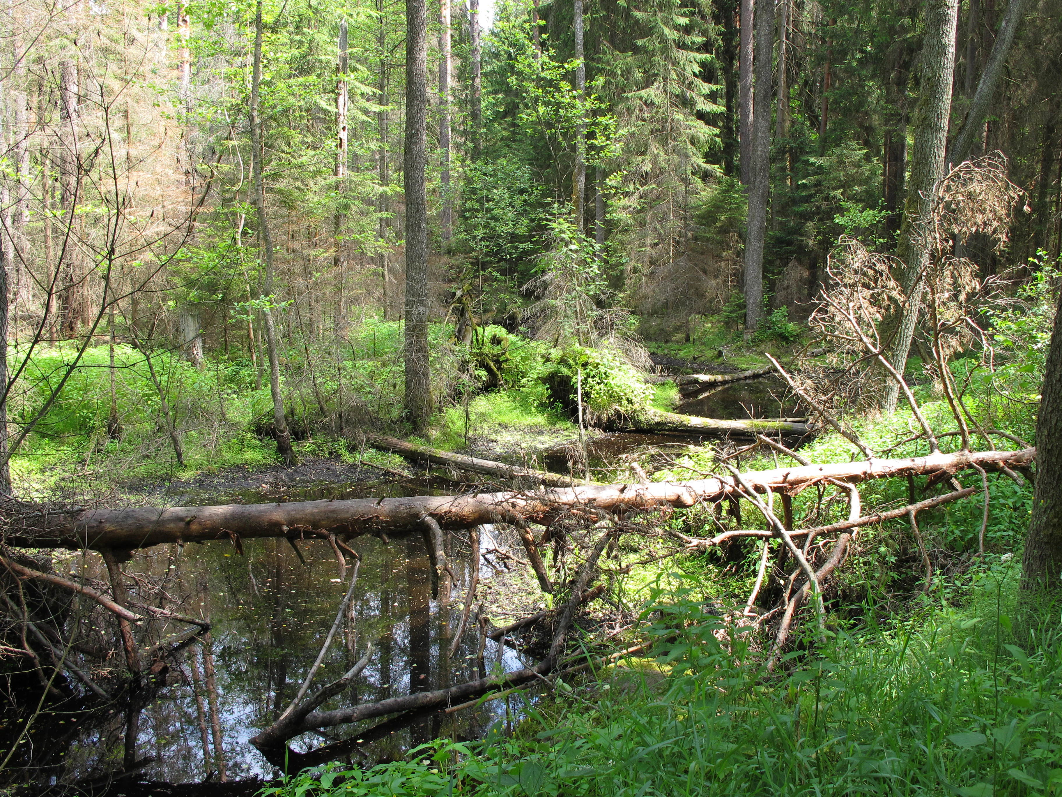
A small, dark forest stream flowing under a fallen log in a dense, green woodland area.
The Kowszowka stream flowing through the forested landscape of Międzyrzecze Nature Reserve.

Międzyrzecze Nature Reserve history and protected-area timeline

Międzyrzecze Nature Reserve was established in 1990 through a regulation recorded in the Polish journal Monitor Polski. The reserve's creation came at a time when Poland's protected-area system was being expanded to safeguard representative examples of the country's natural forest heritage, particularly within large forest complexes such as the Knyszyn Forest.

The founding order covered an area that, according to later measurements, totals roughly 250 hectares, indicating that the original boundaries and surface documentation may have been refined after the reserve's formal establishment. Over time, the reserve has continued to be managed under an active conservation regime, which involves deliberate habitat management interventions aimed at maintaining the natural characteristics of the forest communities that justified its protection.

Międzyrzecze Nature Reserve landscape and geographic character

The landscape of Międzyrzecze reflects the character of the Wzgórza Sokólskie mesoregion, an area of moderate relief formed by past glacial processes. Rather than dramatic peaks or cliffs, the terrain consists of gently undulating ground with subtle elevation changes that nonetheless create meaningful ecological variation across the forest floor.

This varied topography interacts directly with the reserve's hydrology. The presence of numerous springs and seepages is one of the most prominent landscape features of Międzyrzecze, with small streams and water tracks such as the Kowszówka stream threading through the protected area. These water features shape the soils, the distribution of vegetation, and the overall forest microclimate.

Międzyrzecze Nature Reserve ecosystems, habitats, and plant life

The ecological identity of Międzyrzecze is rooted in its mix of lowland forest communities. As a phytocoenotic reserve focused on forest associations, its purpose is to maintain plant communities that are characteristic of the Knyszyn Forest. These communities include mixed and deciduous-coniferous woodland types typical of northeastern Poland's lowlands, where oak, hornbeam, spruce, and pine can form layered stands across mosaic terrain.

A defining ecological feature of the reserve is the way its springs support moisture-dependent vegetation. Where groundwater emerges, the forest transitions into wetter forest and marsh-edge communities, creating ecological gradients that add biodiversity value beyond what would be expected in a uniform upland forest. The combination of varied relief and abundant water sources is central to the reserve's ecological significance.

Międzyrzecze Nature Reserve conservation status and protection priorities

From a conservation perspective, Międzyrzecze contributes to the protection of representative forest habitats of the Knyszyn Forest, one of the major forest complexes of northeastern Poland. The reserve's designation as a phytocoenotic forest reserve places emphasis on the preservation of plant communities and their structural diversity rather than on a single species.

Its location within the Knyszyn Forest Landscape Park adds a regional conservation dimension. By protecting an interior forest fragment with distinctive terrain and water features, the reserve reinforces the broader landscape-scale strategy of conserving the ecological coherence of the Knyszyn Forest. The active conservation regime also implies an ongoing commitment to habitat management, suggesting that protective measures are intended not only to prevent loss but also to actively sustain the forest communities over time.

Top sights and standout views in Międzyrzecze Nature Reserve

Międzyrzecze is recognized for protecting a Knyszyn Forest landscape defined by combined terrain variety and active springs. Its reserves include characteristic lowland mixed forest plant communities that are among the defining features of the broader region.

The reserve's integration into the Knyszyn Forest Landscape Park reinforces its role within a wider conservation network in the Podlasie region, making it a meaningful example of how smaller, strictly protected forest fragments contribute to landscape-level habitat preservation.

Best time to visit Międzyrzecze Nature Reserve

As a forest reserve whose appeal centers on woodland scenery, springs, and characteristic plant communities, Międzyrzecze tends to be most rewarding to visit during the warmer months, when vegetation is fully expressed and the water features of the reserve are most visible. Spring and early summer can be particularly favorable for observing fresh foliage and the activity around the reserve's streams and seepages. Late summer and early autumn also present the changing colors of mixed lowland forest. Winter visits offer a quieter atmosphere, though access conditions and snow cover may limit practical exploration of the interior forest paths.
Monthly climate preview

Long-term temperature ranges and precipitation patterns across representative coordinates

Rezerwat przyrody Międzyrzecze Climate Normals and Monthly Weather Records

Rezerwat przyrody Międzyrzecze exhibits measured long-term temperature swings and consistent monthly precipitation values across its representative coordinate point. Accessing the complete monthly profile provides deeper historical averages for temperature and precipitation metrics.
Annual mean7 °C
-5 °C19 °C
Jan-5°
Feb-4°
Mar
Apr
May13°
Jun17°
Jul19°
Aug18°
Sep13°
Oct
Nov
Dec-3°
Warmest month
July

18.8 °C

Coolest month
January

-5.3 °C

Wettest month
July

2.7 mm/day

Driest month
March

1.4 mm/day

Park location guide

Geography guide, regional context, and park location map for Międzyrzecze Nature Reserve

Międzyrzecze Nature Reserve park geography, regions, and map view in Poland

Understand where Międzyrzecze Nature Reserve sits in Poland through a broader geographic reading of the surrounding landscape, nearby location context, and its mapped position within the national park landscape.

How Międzyrzecze Nature Reserve fits into Poland

Poland, officially the Republic of Poland, is a Central European country spanning from the Baltic Sea in the north to the Carpathian Mountains in the south. It borders Germany, Czech Republic, Slovakia, Ukraine, Belarus, Lithuania, and Kaliningrad Oblast. The country has a temperate climate, diverse landscapes, and is known for its rich history, cultural heritage, and strong economic position within the EU.

Wider geography shaping Międzyrzecze Nature Reserve in Poland

Poland occupies 312,696 km2 in Central Europe, extending from the Baltic Sea coast in the north to the Sudetes and Carpathian Mountains in the south. It borders Germany to the west, Czech Republic and Slovakia to the south, Ukraine and Belarus to the east, and Lithuania and Kaliningrad Oblast to the northeast. The landscape includes lowland plains, uplands, and mountain ranges.

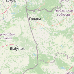
Map view of Międzyrzecze Nature Reserve

Use this park location map to pinpoint Międzyrzecze Nature Reserve in Poland, understand its exact geographic position, and read its mapped placement within the surrounding landscape more clearly.

Pigeon | © OpenStreetMap contributors

Location context for Międzyrzecze Nature Reserve

Podlaskie Voivodeship

Explore detailed imagery of glacial terrain, woodland habitats, and natural springs in the Knyszyn Forest

Rezerwat przyrody Miedzyrzecze Photos and Landscapes: Visual Guide to Protected Forest Scenery

Visual documentation captures the undulating glacial terrain, active natural springs, and lowland mixed forest habitats defining Rezerwat przyrody Miedzyrzecze. Examining these protected-area photographs reveals how subtle topographic variations and groundwater systems shape the regional woodland ecosystem.

A small, dark forest stream flowing under a fallen log in a dense, green woodland area.

Park atlas

Compare adjacent woodland reserves and regional forest geography across northeastern Poland

Parks Near Rezerwat Przyrody Międzyrzecze and Regional Protected Landscapes

Browsing protected areas near Rezerwat przyrody Międzyrzecze reveals connected woodland habitats and glacial terrain throughout the Podlasie region. Extending the geographic comparison uncovers broader forest reserves and landscape park components within northeastern Poland.
Nature reservePodlaskie Voivodeship
About 7.1 km away#1 closest

South

Bahno w Borkach Nature Reserve: Mapping the Boreal Peatland Landscapes of Podlaskie

A study of protected mire habitats and forest mosaics

Bahno w Borkach Nature Reserve protects a vital boreal-influenced peatland habitat within the larger Knyszyn Forest complex. The mapped landscape includes a complex mosaic of low-mire communities and forest patches that serve as an important reference site for ecological studies of the eastern Polish lowlands.

Area
2.899 km²
Established
1990
Relief
Lowland
Climate
Boreal
Nature reservePodlaskie Voivodeship
About 32 km away#2 closest

Southeast

Rezerwat przyrody Jezioro Wiejki: Wetland Geography and Protected Landscape in Eastern Poland

Glacial lake basin and peatland ecology in Podlaskie Voivodeship

This nature reserve protects a rare mesotrophic lake and peatland complex, serving as a testament to the glacial history of the Białystok Highlands. The site is noted for its concentric wetland vegetation bands, including floating bog communities and populations of endangered low birch, which offer a clear window into the ecological dynamics of northeastern Polish water systems.

Area
0.225 km²
Established
2005
Relief
Lowland
Climate
Temperate
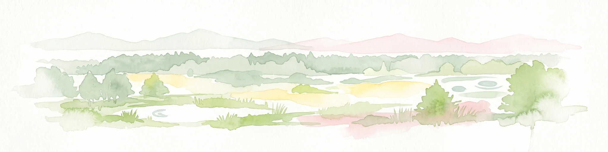
A soft, light-toned watercolor painting of a lowland forest landscape with trees, meadows, and distant hills.
Protected areaPoland
About 40 km away#3 closest

South

Puszcza Białowieska Protected Area: Primeval Forest Geography and Mapped Boundaries

Ancient lowland forest landscapes of the Polish-Belarusian border

Examine the geographic composition of Puszcza Białowieska, an extensive primeval lowland forest characterized by multi-aged tree stands and abundant deadwood ecosystems. The area serves as a primary site for ecological research into natural forest regeneration and megafauna protection, specifically for the European bison and diverse predator populations living within its protected landscape boundaries.

Area
1,500 km²
Established
1932
Relief
Lowland
Climate
Temperate
Watercolor painting showing a winding river through marshy fields with distant hills
National parkPodlaskie Voivodeship
About 40 km away#4 closest

West

Narew National Park: Discover Poland's Premier Wetland National Park with Unique River Geography

Explore its mapped boundaries and rich protected landscape.

Narew National Park represents a significant protected area within the Podlaskie Voivodeship, distinguished by its one-of-a-kind anastomosing river system where the Narew River splits into numerous interconnected channels. This dynamic wetland environment provides critical habitat and showcases a complex interplay of water, land, and diverse ecosystems. Users can explore the park's geographic features, understand its protected landscape status, and appreciate its vital role within the regional atlas through detailed mapping and factual context.

Area
73.5 km²
Established
1996
IUCN
II
Relief
Lowland
A horizontal watercolor illustration showing a wooden boardwalk winding through a green and marshy landscape with soft hills in the background.
National parkPodlaskie Voivodeship
About 40 km away#5 closest

Southwest

Narwiański Park Narodowy: Mapped Wetland Geography and Protected Floodplain Landscapes

Examining the hydrologic patterns and marshland terrain of the Narew River valley.

Narwiański Park Narodowy features a unique, water-dominated geography in Podlaskie Voivodeship. This protected area centers on the anastomosing Narew River, creating a shifting mosaic of streams, oxbows, and managed grasslands that serves as a vital refuge for wetland birds and aquatic species within the broader Polish landscape.

Area
68.1 km²
Established
1996
Visitors
15K annual
Relief
Lowland
Watercolor painting showing a wetland scene with reeds, patches of water, and trees under a light sky
National parkPodlaskie Voivodeship
About 44 km away#6 closest

West

Biebrza National Park: Protected Fenlands and River Basin Geography in Northeastern Poland

Tracing the largest lowland peat bog complex in the European landscape

Biebrza National Park serves as the premier protected wetland area in Poland, characterized by its vast, intact marshlands and the meandering Biebrza River valley. This geographic profile details the park's critical fen ecosystems, floodplain dynamics, and distinctive habitats that support diverse avian and mammalian populations within the Podlaskie region.

Area
592.23 km²
Established
1993
IUCN
II
Relief
Lowland
A watercolor painting of a flat wetland landscape with a winding river in the foreground, small clusters of trees, and rolling hills in the soft, distant background.
National parkPodlaskie Voivodeship
About 44 km away#7 closest

Northwest

Biebrzański Park Narodowy: A Protected Wetland Landscape in Podlaskie Voivodeship, Poland

Mapped river valley and peatland geography.

Located in the northeast of Poland, Biebrzański Park Narodowy protects a sprawling, flat basin defined by the slow-meandering Biebrza River. This critical protected area encompasses rare peat bogs, floodplain meadows, and alder carrs, functioning as a vital refuge for wetland species within the broader Podlaskie Voivodeship landscape.

Area
592.23 km²
Established
1993
Visitors
23.2K annual
Relief
Lowland
Nature reservePodlaskie Voivodeship
About 46 km away#8 closest

South

Dolina Waliczówki Nature Reserve: Protected Forest and Stream Valley Geography

Key protected area within the Białowieża Forest of Poland

Spanning over 44 hectares, Dolina Waliczówki Nature Reserve serves as a concentrated site for the preservation of natural forest communities and springhead flora in the Podlaskie Voivodeship. The protected terrain, defined by the small Waliczówka stream, illustrates the ecological detail of the broader Białowieża Forest lowland woodland.

Area
0.448 km²
Established
1995
Relief
Lowland
Scope
Terrestrial

Common questions about visiting, size, designation, and location context for Międzyrzecze Nature Reserve

Międzyrzecze Nature Reserve FAQs for park facts, access, geography, and protected area context

Find quick answers about Międzyrzecze Nature Reserve, including protected-area facts, park geography, trail and visitor context, and how the park fits into its surrounding country and regional landscape.
MoriAtlas Explorer

Continue Your Protected Areas Search Across the Global Atlas

Deepen your exploration by continuing the structured search for national parks and protected areas worldwide. Utilize the comprehensive filtering capabilities to compare different conservation landscapes and refine your understanding of global park geography. Discover more about the distribution and characteristics of protected natural areas.

Global natural geography