
Mori Atlas logo
Protected landscapeMittleres Neckartal

Examine the mapped boundaries, floodplain features, and working landscape characteristics of this regional corridor.

Mittleres Neckartal Protected Landscape and Neckar River Valley Geography in Baden-Württemberg

(Landschaftsschutzgebiet „Mittleres Neckartal“)

The Mittleres Neckartal stands as a designated protected landscape stretching across the river valley between Tübingen and Reutlingen in Baden-Württemberg. This area provides a continuous strip of protected land defined by its engineered river channels, floodplain agriculture, and series of gravel-pit lakes. Through detailed map exploration, trace how this cultivated corridor balances industrial transport infrastructure with regional ecological continuity.

Neckar valleyriver floodplainprotected landscapeBaden-Württembergagricultural lowlandriver corridor
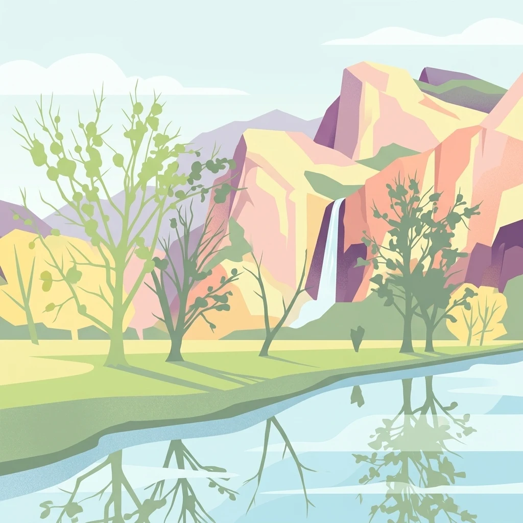
A graphic illustration showing a river in the foreground with trees on its bank, and a tall waterfall cascading from pink and orange cliffs in the background.

Mittleres Neckartal

Protected landscape

Park overview

Structured park overview, official facts, and landscape profile for Mittleres Neckartal

Mittleres Neckartal park facts, protected area profile, and essential visitor context

Review the core facts for Mittleres Neckartal, including designation, size, terrain, visitor scale, habitats, and operating context in one park-focused overview.

About Mittleres Neckartal

Mittleres Neckartal covers the central section of the Neckar valley between Tübingen-Lustnau and Reutlingen-Mittelstadt, occupying parts of both the Tübingen district and the Reutlingen district in Baden-Württemberg. The protected area is formally classified as a Landschaftsschutzgebiet, or landscape protection area, and falls under IUCN Category V, recognizing it as a protected landscape whose character depends on the interplay of natural features and human land use.

Geographically, the area focuses on the Neckar floodplain, where the river has long been channelized and shaped by engineering works. Within the floodplain, side canals and former gravel pits have created small artificial lakes, including lakes near Kirchentellinsfurt and Altenburg. These waterbodies, along with the river itself, are central to the area's character. The rest of the protected area is largely made up of agricultural land, with the valley floor intensively farmed as part of the productive Neckar lowlands.

The protection area is also shaped by infrastructure. The route of the heavily traveled Bundesstraße 27 runs through the area, reflecting the fact that the Neckar valley serves as a major transportation and settlement corridor in southern Germany. Within this context, the designation of Mittleres Neckartal reflects an effort to preserve rural and ecological elements of the valley while acknowledging that the landscape will continue to be used and modified by human activity.

Quick facts and research context for Mittleres Neckartal

Mittleres Neckartal is a landscape protection area (Landschaftsschutzgebiet) along the central stretch of the Neckar River valley in Baden-Württemberg, Germany. It spans parts of the Tübingen and Reutlingen districts, covering roughly 5,318 hectares across the municipalities involved. The area is classified under IUCN Category V as a Protected Landscape.

The protection area was established by the Tübingen district office on 15 December 1961 and extended to the Reutlingen district by ordinance on 23 January 1963, making it one of the older formal landscape designations in the region. Administratively it functions as two separate protected areas because of historical boundary changes, but geographically it forms a continuous stretch of the Neckar valley between Tübingen and Reutlingen.

Park context

Deeper park guide and search-rich context for Mittleres Neckartal

Mittleres Neckartal history, landscape, wildlife, and travel context

Explore Mittleres Neckartal through its history, landscape character, ecosystems, wildlife, conservation priorities, cultural context, and seasonal travel timing in a structured park guide built for atlas discovery and search intent.

Why Mittleres Neckartal stands out

Mittleres Neckartal is best known for protecting a culturally and ecologically significant segment of the Neckar valley between the university city of Tübingen and the historic city of Reutlingen. The protected area encompasses the floodplain zone of a heavily modified but still landscape-defining river, framed by the surrounding agricultural lowlands and bordered by larger protected areas such as the Schönbuch to the northwest. Its identity is tied less to wilderness and more to the working river-valley landscape: straightened channels, side canals, gravel-pit lakes, and farmland used intensively for agriculture. Within the dense settlement corridor of the Neckar region, it represents an effort to maintain the valley's open, scenic, and ecological continuity between two major towns.
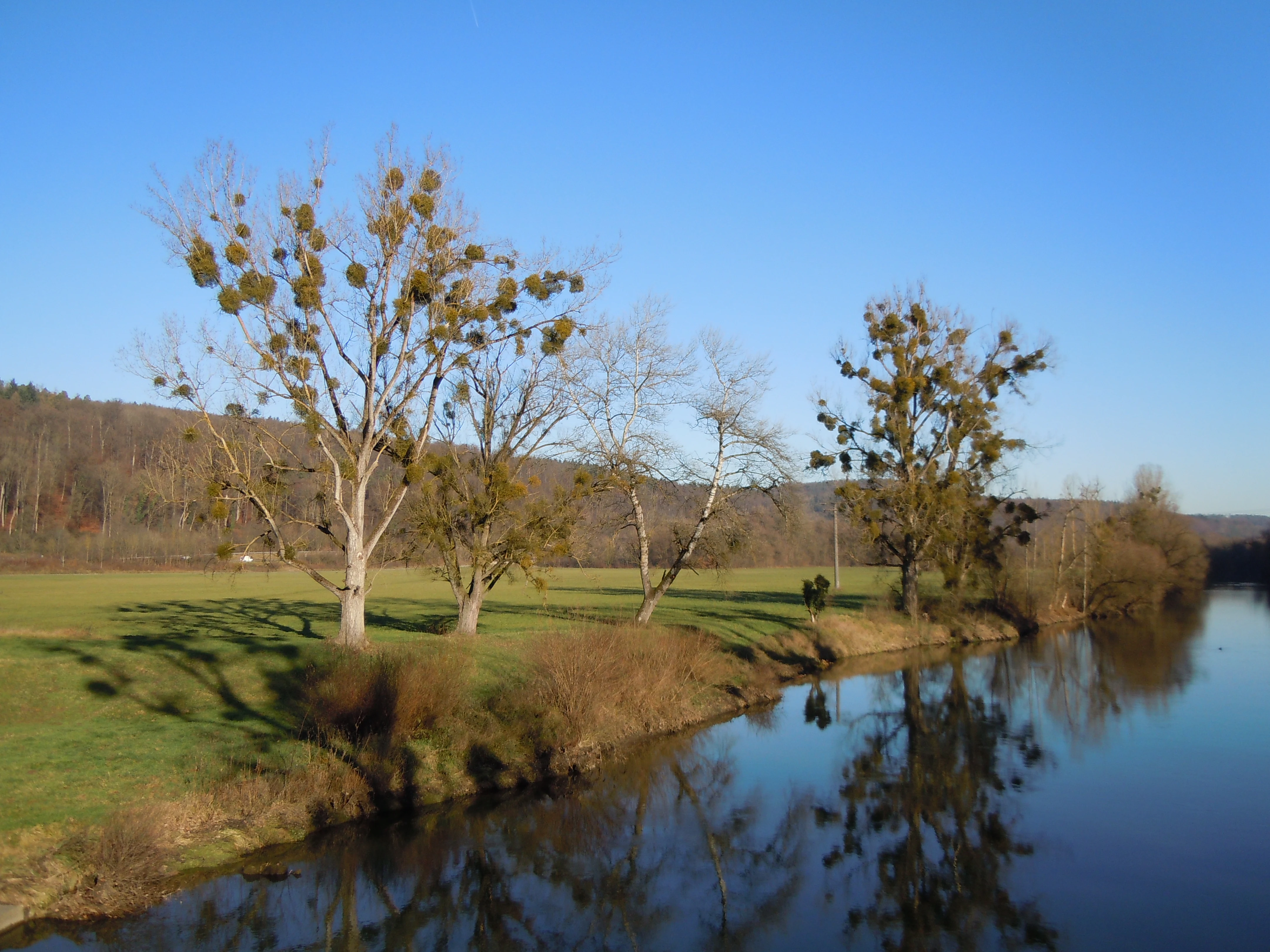
A calm river flowing alongside a grassy meadow with trees covered in mistletoe under a clear blue sky.
The Neckar river flowing through the pastoral landscape near Kirchentellinsfurt.

Mittleres Neckartal history and protected-area timeline

Mittleres Neckartal was formally designated as a landscape protection area by the Tübingen district office through an ordinance issued on 15 December 1961. The protection area was then extended to include territory in the Reutlingen district through a separate ordinance issued on 23 January 1963 by the Reutlingen district office. Together, these two ordinances form the protected area as it exists today.

The two-step establishment reflects historical administrative boundaries. At the time of designation, the municipality of Pliezhausen still belonged to the Tübingen district, which is why the portion of the protected area on Pliezhausen territory was issued under the Tübingen ordinance. When responsibility for landscape protection areas in Baden-Württemberg is held by the districts, this division effectively means that Mittleres Neckartal exists administratively as two separate but geographically continuous protected areas. The establishment of the area as one of the earlier formal landscape protection designations in the region reflects growing awareness of the need to manage the intensively used Neckar valley as a coherent landscape unit rather than just as separate patches of farmland or river corridor.

Mittleres Neckartal landscape and geographic character

The landscape of Mittleres Neckartal is defined by the Neckar River valley and its broad floodplain. Between Tübingen and Reutlingen, the Neckar has been substantially straightened over the centuries, so the river today flows in an engineered channel through a relatively open lowland corridor. This modified setting gives the valley a flat, expansive character where the river and its associated floodplain form the dominant landform.

Within the floodplain, side channels and former gravel pits (Baggerseen) have created a series of small lakes along the river, including the Epplesee and Mayersee near Kirchentellinsfurt and the Weimarsee near Altenburg. These lakes, together with the side canals, introduce small-scale water features into the otherwise agricultural floodplain. Most of the surrounding land is intensively used for agriculture, contributing to the open, cultivated appearance of the valley floor.

The valley is also crossed by transport infrastructure, with the route of Bundesstraße 27 passing through the area as a major regional road. Flanked on one side by the larger Schönbuch protected area and connected in turn to other valley landscapes upstream and downstream, Mittleres Neckartal forms a continuous strip of protected valley landscape in an otherwise densely settled part of Baden-Württemberg.

Mittleres Neckartal ecosystems, habitats, and plant life

The ecological character of Mittleres Neckartal is closely tied to the Neckar floodplain and the modified but still functioning river environment. Although the river itself has been straightened, the floodplain zone retains a combination of open water, gravel-pit lakes, side canals, meadows, and intensively cultivated farmland. This mosaic creates a working landscape in which ecological value depends on the interplay between water features and surrounding agricultural land.

The protected area sits within a regional network of connected landscape protection zones and nature reserves. To the northwest it borders the Schönbuch landscape protection area, to the south it adjoins the Härten landscape protection area and the Blaulach nature reserve, and downstream in the Esslingen district it continues as the Neckar-, Erms- and Autmuttal protected landscape around Neckartenzlingen. This regional connectivity means that Mittleres Neckartal functions as a key link in a longer chain of protected valley landscapes along the Neckar and its tributaries, supporting ecological continuity between larger natural areas in the region.

Mittleres Neckartal conservation status and protection priorities

Mittleres Neckartal is a Category V protected landscape, a designation aimed at preserving the overall character of a lived-in and actively used landscape rather than setting aside strictly regulated wilderness. Its conservation value lies in maintaining the open valley character of a heavily modified river corridor and in integrating that landscape with surrounding farmland, small lakes, and transport infrastructure.

The area is part of a broader conservation network in the Neckar region. By adjoining the Schönbuch to the northwest, the Härten landscape protection area and Blaulach nature reserve to the south, and the Neckar-, Erms- and Autmuttal protected landscape downstream, it contributes to a connected system of protected valley landscapes in northern Baden-Württemberg. Its significance is therefore not as an isolated reserve but as a central link in the regional effort to maintain ecological and scenic continuity in the Neckar valley between Tübingen and Reutlingen.

Mittleres Neckartal cultural meaning and human context

The Neckar valley between Tübingen and Reutlingen has been a long-settled and intensively used cultural landscape. Both Tübingen, with its historic university townscape, and Reutlingen, a city with medieval roots, have shaped the valley for centuries, supporting agriculture, milling, transport, and later industrial and infrastructure development. The river itself has been engineered and regulated over generations, which is reflected in the straightened channels, side canals, and gravel-pit lakes that now characterize the floodplain.

The designation of Mittleres Neckartal as a landscape protection area reflects a recognition of this cultural-landscape identity. Rather than treating the valley purely as productive farmland or transport corridor, the designation acknowledges the Neckar valley as a regionally significant landscape whose visual and ecological continuity between the two cities has cultural and scenic value worth preserving.

Top sights and standout views in Mittleres Neckartal

Mittleres Neckartal's most distinctive feature is its role as a protected landscape corridor along the Neckar between two major Baden-Württemberg cities, combining river floodplain features, gravel-pit lakes, and intensively used farmland into a single protected unit. Its boundaries connect it directly to the Schönbuch landscape protection area and to the protected valley landscapes downstream in the Esslingen district.

Another defining quality is its administrative character: although it functions in practice as one continuous valley landscape, it is technically two separate landscape protection areas because of how the districts of Tübingen and Reutlingen issued their original ordinances in 1961 and 1963. This makes Mittleres Neckartal a useful illustration of how Baden-Württemberg's system of district-led landscape protection shapes the management of working landscapes around its historic towns.

Best time to visit Mittleres Neckartal

The Neckar valley landscape of Mittleres Neckartal has a temperate southern German climate, with mild summers and cold winters typical of the region. Spring and early summer tend to highlight the green floodplain meadows and agricultural fields bordering the river, while summer offers long daylight hours for exploring the valley. Late autumn brings quieter conditions and softer light across the agricultural lowlands. Winter visits can emphasize the open valley character and the contrast between the river corridor and the wooded slopes of nearby protected areas such as the Schönbuch. As a working landscape crossed by busy roads, the area can be explored comfortably throughout the year; the choice of season mainly influences atmosphere rather than access.

Monthly climate preview

Monthly temperature ranges and precipitation averages recorded at representative coordinates

Mittleres Neckartal Climate Normals and Long-Term Temperature Patterns

Representative coordinate records show average temperatures ranging from negative values in winter months to over thirty degrees in midyear, accompanied by stable precipitation rates throughout the year. Reviewing the comprehensive monthly climate profile provides deeper context for long-term meteorological patterns across the protected landscape.
Annual mean8 °C
-1 °C18 °C
Jan-1°
Feb
Mar
Apr
May13°
Jun16°
Jul18°
Aug18°
Sep14°
Oct
Nov
Dec
Warmest month
July

18.2 °C

Coolest month
January

-1.1 °C

Wettest month
July

3.2 mm/day

Driest month
February

1.7 mm/day

Park location guide

Geography guide, regional context, and park location map for Mittleres Neckartal

Mittleres Neckartal park geography, regions, and map view in Germany

Understand where Mittleres Neckartal sits in Germany through a broader geographic reading of the surrounding landscape, nearby location context, and its mapped position within the national park landscape.

How Mittleres Neckartal fits into Germany

Germany is a federal republic in Western and Central Europe with a population of over 83 million across sixteen constituent states. It is Europe's largest economy by nominal GDP and a major global exporter and importer. The capital is Berlin, and the country borders Denmark, Poland, Czech Republic, Austria, Switzerland, France, Luxembourg, Belgium, and the Netherlands.

Wider geography shaping Mittleres Neckartal in Germany

Germany is located in Western and Central Europe, spanning 357,022 km². It borders Denmark to the north, Poland and the Czech Republic to the east, Austria and Switzerland to the south, and France, Luxembourg, Belgium, and the Netherlands to the west. The country has coastlines on the Baltic Sea and North Sea to the north, with the Alps located in the southern region.

Map view of Mittleres Neckartal

Use this park location map to pinpoint Mittleres Neckartal in Germany, understand its exact geographic position, and read its mapped placement within the surrounding landscape more clearly.

Pigeon | © OpenStreetMap contributors

Location context for Mittleres Neckartal

Baden-Württemberg

Explore photographic records of floodplain terrain, gravel pit lakes, and working lowland scenery.

Mittleres Neckartal Photos and Scenery: Visualizing the Protected River Valley

Visual documentation captures the engineered river corridors, broad agricultural floodplains, and open valley terrain defining Mittleres Neckartal. Photographic records provide clear insight into the protected landscape features and working habitats found throughout the southern German river basin.

A calm river flowing alongside a grassy meadow with trees covered in mistletoe under a clear blue sky.

Park atlas

Compare regional valley reserves, river floodplains, and adjacent conservation zones.

Explore Parks Near Mittleres Neckartal and Surrounding Protected Landscapes

Browse other protected areas and river valley reserves located near Mittleres Neckartal across Baden-Württemberg. Comparing adjacent regional landscapes reveals broader patterns in valley conservation and working river ecosystems.
Protected landscapeBaden-Württemberg
About 10 km away#1 closest

West

Unteres Ammertal Protected Landscape: Regional Geography and Valley Maps

A structured cultural valley in Baden-Württemberg

Unteres Ammertal serves as a critical example of a managed agricultural landscape near Tübingen. This protected area preserves a rich variety of wet meadows, hedgerows, and river channels, offering insights into the complex land-use patterns of the Swabian foothills and the broader ecology of the Neckar basin.

Area
3.479 km²
Established
1999
IUCN
V
Relief
Lowland
Watercolor painting of a green, rolling landscape with forested hills and a soft, hazy background.
Protected landscapeBaden-Württemberg
About 14 km away#2 closest

West

Pfaffenberg Landscape Protection Area: Geography and Mapped Natural Features

Examining geological formations and cultural land use in Baden-Württemberg

Pfaffenberg is a significant protected landscape in Germany, recognized for its identity as an isolated Keuper-stage Zeugenberg. The area preserves a unique mosaic of mixed forest and historic orchard meadows, revealing the complex geological and agricultural heritage of the upper Neckar region within the Baden-Württemberg state boundaries.

Area
3.168 km²
Established
1967
IUCN
V
Protected landscapeBaden-Württemberg
About 15 km away#3 closest

West

Oberes Ammertal mit dem Seitental Merkental Protected Landscape and Regional Map Context

Baden-Württemberg protected valley and limestone terrain

Situated in the Schönbuch and Glemswald region, this protected area safeguards the upper Ammer valley's meadow floodplains and botanical limestone slopes. It represents a significant mosaic of habitat types; including dry grassland and small quarry-fed water bodies; that maintain the ecological integrity of the local southwestern German geography.

Area
0.202 km²
Established
1982
IUCN
V
Protected landscapeBaden-Württemberg
About 15 km away#4 closest

Northwest

Ghägnet östlich dem Waldteil Häselhau mit Umgebung: Landscape and Geography Overview

Protected orchard meadows in the Böblingen district of Germany.

This protected landscape in Baden-Württemberg spans 3.1 hectares of Jurassic slope loam soils. It is recognized for its traditional Swabian orchard meadows and wet grassland vegetation, functioning as an ecological corridor adjacent to the Hochberg protected area within the greater Schönbuch forest zone.

Area
0.031 km²
Established
1974
IUCN
V
Protected landscapeBaden-Wuerttemberg
About 16 km away#5 closest

Northwest

Hangflächen um die Pfefferburg: A Protected Landscape in Baden-Württemberg

Orchard meadows, hillside terrain, and local geography.

Hangflächen um die Pfefferburg forms a compact protected landscape defined by its southern-facing orchard meadows and moisture-rich spring zones. Located near Schönaich, the area preserves traditional land-use patterns on a diverse hillside, connecting regional protected zones within the broader geography of the Böblingen district.

Area
0.252 km²
Established
1974
IUCN
V
Relief
Upland
Protected landscapeBaden-Württemberg
About 17 km away#6 closest

East

Neuffen auf Gemarkungen Neuffen und Kappishäusern Protected Area and Regional Landscape

Geography of the Swabian Alb escarpment and riparian zones

This protected landscape defines the visual and ecological character of the area surrounding the Hohenneuffen and Jusi hills. The terrain spans limestone slopes, fruit-bearing orchards, and the Steinach river valley. By integrating local habitat protection with regional biosphere networks, the region serves as a vital transition point between the plateau and the Neckar basin.

Area
13.41 km²
Established
1993
IUCN
V
Relief
Mountain
Protected landscapeBaden-Württemberg
About 21 km away#7 closest

East

Tiefenbachtal Protected Landscape: Geographic Boundaries and Regional Terrain Map

Swabian Alb foothill mosaic in the Esslingen district

Investigate the protected landscape of Tiefenbachtal, where gently rolling terrain and stream-cut valleys form a continuous ecological corridor. This record covers the physical geography, meadow and woodland composition, and the broader context of this site within the Baden-Württemberg pre-Alb landscape.

Area
0.35 km²
Established
1958
IUCN
V
Relief
Upland
Watercolor painting of a green valley with a winding river and a small group of trees under a light sky.
Protected landscapeZollernalbkreis
About 23 km away#8 closest

Southwest

Mittleres Starzeltal Protected Landscape: Mapping the Geography of the Zollernalbkreis District

A detailed look at the Starzel river valley and forest mosaic.

The Mittleres Starzeltal protected landscape represents a significant river corridor in the Zollernalbkreis district. This area spans through Hechingen and Bisingen, characterized by its traditional orchard meadows and dense forest slopes that frame the middle Starzel valley. Explore the boundaries and topographic features that define this protected territory within the Swabian Alb conservation network.

Area
12.454 km²
Established
1963
IUCN
V
Relief
Upland

Common questions about visiting, size, designation, and location context for Mittleres Neckartal

Mittleres Neckartal FAQs for park facts, access, geography, and protected area context

Find quick answers about Mittleres Neckartal, including protected-area facts, park geography, trail and visitor context, and how the park fits into its surrounding country and regional landscape.
MoriAtlas Explorer

Continue Your Protected Areas Search Across the Global Atlas

Deepen your exploration by continuing the structured search for national parks and protected areas worldwide. Utilize the comprehensive filtering capabilities to compare different conservation landscapes and refine your understanding of global park geography. Discover more about the distribution and characteristics of protected natural areas.

Global natural geography