
Mori Atlas logo
Nature reserveMkhambathi Nature Reserve

A critical conservation zone defined by Pondoland plant endemism, riverine forests, and open grassland plateaus.

Mkhambathi Nature Reserve: Mapped Protected Landscapes, River Ravines, and Coastal Geography

(Mkambati Nature Reserve)

Mkhambathi Nature Reserve stands as a pivotal protected area on South Africa's Wild Coast, integrating diverse ecosystems from coastal grasslands to sheltered swamp forests. The landscape is carved by the Msikaba and Mtentu river systems, which create deep, forested ravines supporting localized species like the Pondo palm. As a Ramsar site adjacent to marine protected zones, the reserve offers deep insight into the biodiversity of the Pondoland region.

coastal reserveWild Coasteastern capepondoland endemismgrasslandsindigenous forest
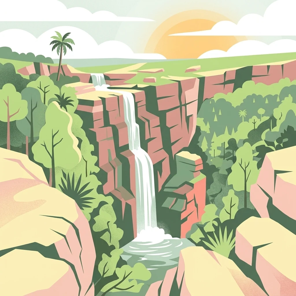
A digital illustration showing a waterfall flowing over layered rock cliffs into a pool, surrounded by lush green forest and palm trees under a setting sun.

Mkhambathi Nature Reserve

Nature reserve

Park overview

Structured park overview, official facts, and landscape profile for Mkhambathi Nature Reserve

Mkhambathi Nature Reserve park facts, protected area profile, and essential visitor context

Review the core facts for Mkhambathi Nature Reserve, including designation, size, terrain, visitor scale, habitats, and operating context in one park-focused overview.

About Mkhambathi Nature Reserve

Mkhambathi Nature Reserve is one of the most botanically important protected areas on South Africa's Wild Coast. Located near the town of Lusikisiki in the Eastern Cape, the reserve lies within a region long recognized for its extraordinary concentration of endemic plant species. The landscape is shaped by a mix of coastal grasslands, pockets of evergreen and swamp forest, and the deeply incised river valleys of the Msikaba and Mtentu, which carve through the plateau and create lush, sheltered ravine habitats.

The reserve sits within the Pondoland Centre of Plant Endemism, a globally significant botanical region, and falls within the larger Maputaland, Pondoland, and Albany biodiversity hotspot that extends across parts of South Africa and Mozambique. This setting gives Mkhambathi an unusually high botanical value for its size. Endemic and near-endemic species such as the false water-berry and the Pondo palm are among the most distinctive elements of its flora.

Along the coast, the reserve neighbors the Pondoland Marine Protected Area, which extends conservation responsibilities offshore into some of the most productive marine waters along the South African coast. This combination of terrestrial and marine protection strengthens the reserve's role in maintaining ecological connectivity, from coastal grasslands and forested valleys through estuarine and near-shore environments.

Established in 2009, Mkhambathi has increasingly been recognized for its conservation significance beyond botany alone. It supports a rich bird community, with Cape vultures breeding in the area in significant numbers, and a notable range of forest and grassland bird species. Mammals such as bushbuck, eland, common duiker, and chacma baboon are typical of the region, while smaller mammals like the Zulu golden mole add to the reserve's faunal interest.

Quick facts and research context for Mkhambathi Nature Reserve

Mkhambathi Nature Reserve lies near Lusikisiki in the Eastern Cape of South Africa, occupying about 7,720 hectares along the Wild Coast. It falls within the Pondoland Centre of Plant Endemism, a globally recognized hotspot of plant diversity, and forms part of the larger Maputaland, Pondoland, and Albany biodiversity region.

The reserve was established in 2009 and was formally recognized as a Ramsar wetland site in February 2025. Its coastal edge borders the Pondoland Marine Protected Area, extending protection from the grasslands and forested ravines inland out to the ocean.

Protection and recognition

Documented international conservation designations and protected area records

Mkhambathi Nature Reserve Protection Status and Ramsar Recognition

Mkhambathi Nature Reserve holds official Ramsar wetland recognition within its documented conservation framework. Official records compile verified international designations and protected area data for the reserve.
Park context

Deeper park guide and search-rich context for Mkhambathi Nature Reserve

Mkhambathi Nature Reserve history, landscape, wildlife, and travel context

Explore Mkhambathi Nature Reserve through its history, landscape character, ecosystems, wildlife, conservation priorities, cultural context, and seasonal travel timing in a structured park guide built for atlas discovery and search intent.

Why Mkhambathi Nature Reserve stands out

Mkhambathi Nature Reserve is best known for its exceptional plant endemism within the Pondoland region. It supports rare and localized species such as the endemic false water-berry, Rhynchocalyx lawsonioides, and the Pondo palm, which grows only along the Msikaba and Mtentu river banks. The reserve is also distinguished by its varied terrain, from open grasslands and swamp forests to the dramatic forested ravines of two major rivers, and by its important birdlife, including a breeding colony of threatened Cape vultures. The combination of riverine forest, coastal grassland, and marine protection makes it a key conservation landscape along the Wild Coast.
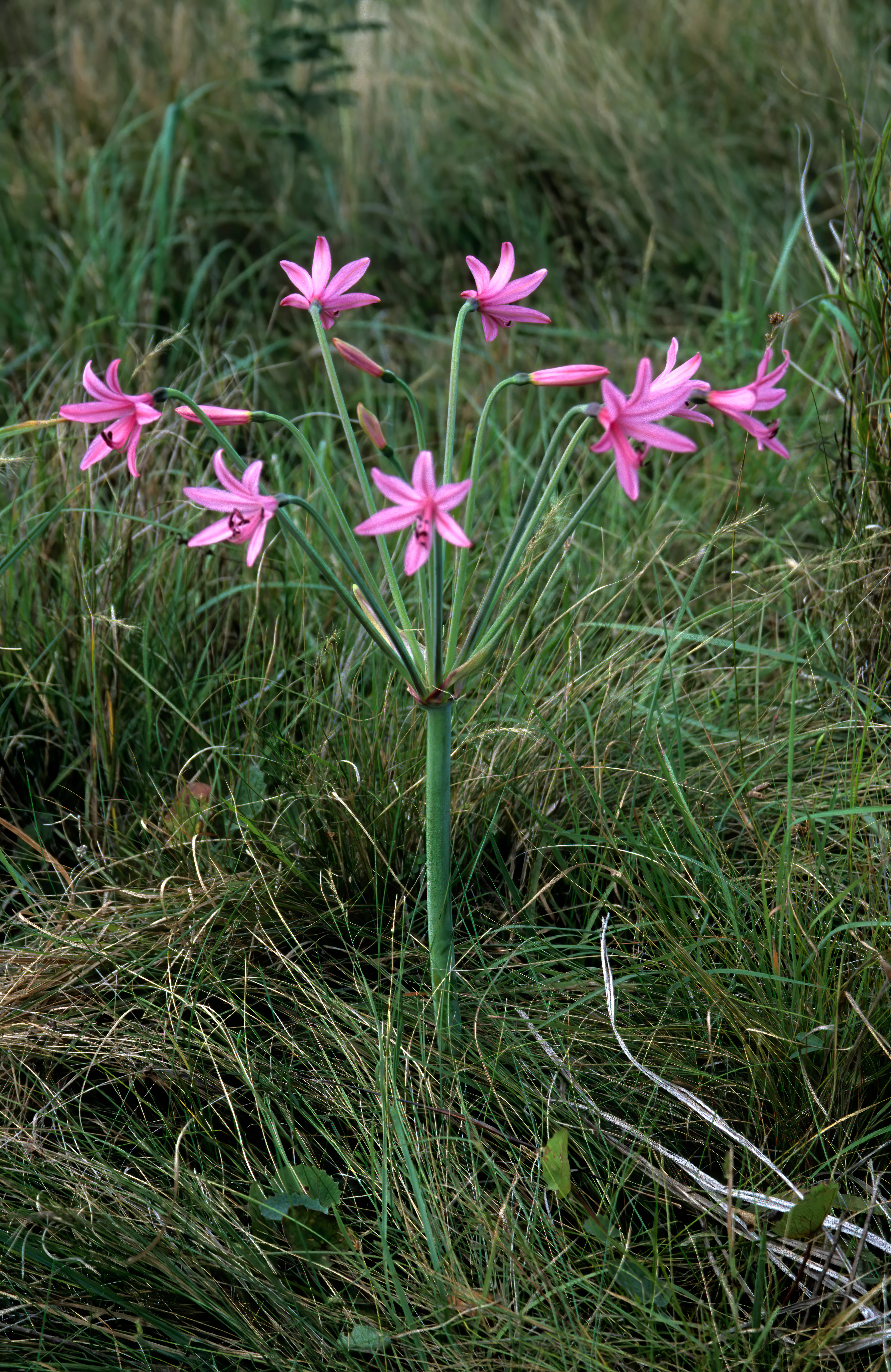
A pink Brunsvigia grandiflora flower with multiple stems radiating from a single central stalk, growing in a field of tall green grass.
A Brunsvigia grandiflora flower blooming within the coastal grassland of Mkhambathi Nature Reserve.

Mkhambathi Nature Reserve history and protected-area timeline

Mkhambathi Nature Reserve was formally established in 2009 as a protected area on the Eastern Cape Wild Coast, near Lusikisiki. The reserve was created to safeguard the region's exceptional plant diversity, particularly the endemic species associated with the Pondoland Centre of Plant Endemism.

In February 2025, the reserve was internationally recognized when it was listed as a Ramsar wetland site, with reference number 2554, under the official Ramsar designation 'Mkambati Nature Reserve.' This listing acknowledged the ecological value of its grasslands, swamp forests, and river systems as wetlands of international importance.

The reserve also sits adjacent to the Pondoland Marine Protected Area, reflecting an integrated approach to conservation that links its inland habitats with offshore marine protection along one of South Africa's least developed coastlines.

Mkhambathi Nature Reserve landscape and geographic character

The landscape of Mkhambathi Nature Reserve is defined by a striking contrast between open coastal plateau and deeply incised river valleys. Much of the reserve is covered in rolling open grasslands, interrupted by patches of indigenous forest and areas of swamp forest where water collects in low-lying zones.

Two major rivers, the Msikaba and Mtentu, cut through the reserve and form forested ravines that are among its most dramatic features. These ravines harbor dense, sheltered vegetation, including populations of the highly localized Pondo palm along the riverbanks. Falls such as Mkambati Falls and Mkambati Horseshoe Falls, along with features along the Mtentu Swallow Trail, illustrate the rugged terrain created by these systems.

The coast itself, part of the broader Wild Coast shoreline, is met by the Indian Ocean, with the adjacent Pondoland Marine Protected Area extending protection offshore. The interplay of grassland, forest patch, river canyon, and ocean gives the reserve a layered and visually varied character.
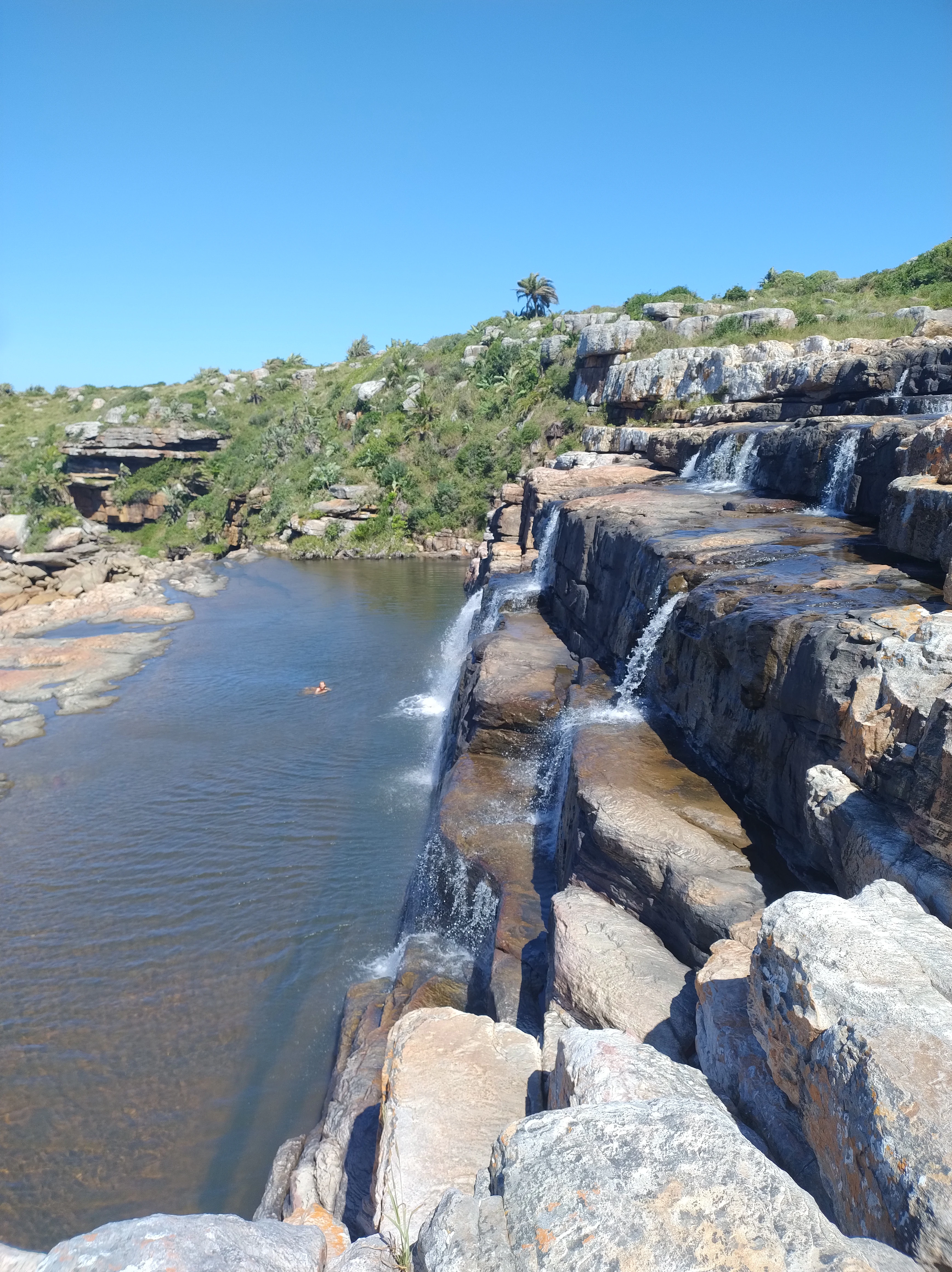
A high-angle view of a tiered waterfall cascading over rocky ledges into a dark pool, surrounded by grassy coastal landscape under a clear blue sky.
Mkambati Falls flowing into a calm pool within the Mkhambathi Nature Reserve.

Mkhambathi Nature Reserve ecosystems, habitats, and plant life

Mkhambathi's ecological identity is dominated by its plant life, particularly its high level of endemism within the Pondoland botanical region. The reserve protects open grassland communities interspersed with isolated patches of indigenous forest and more extensive swamp forest in areas where water accumulates.

These habitats support a wide range of plant species, several of which occur nowhere else. Endemic taxa such as the false water-berry (Rhynchocalyx lawsonioides) and the Pondo palm, which grows only along the Msikaba and Mtentu rivers, are central to the reserve's ecological importance. Brunsvigia grandiflora, Watsonia pillansii, Protea afra, and the rare Brunia trigyna, of which only a few individuals remain, are among the notable plant species present.

The combination of grassland, forest patch, swamp forest, riverine habitat, and adjacent marine environment gives the reserve an unusually diverse ecological profile within a relatively compact area.
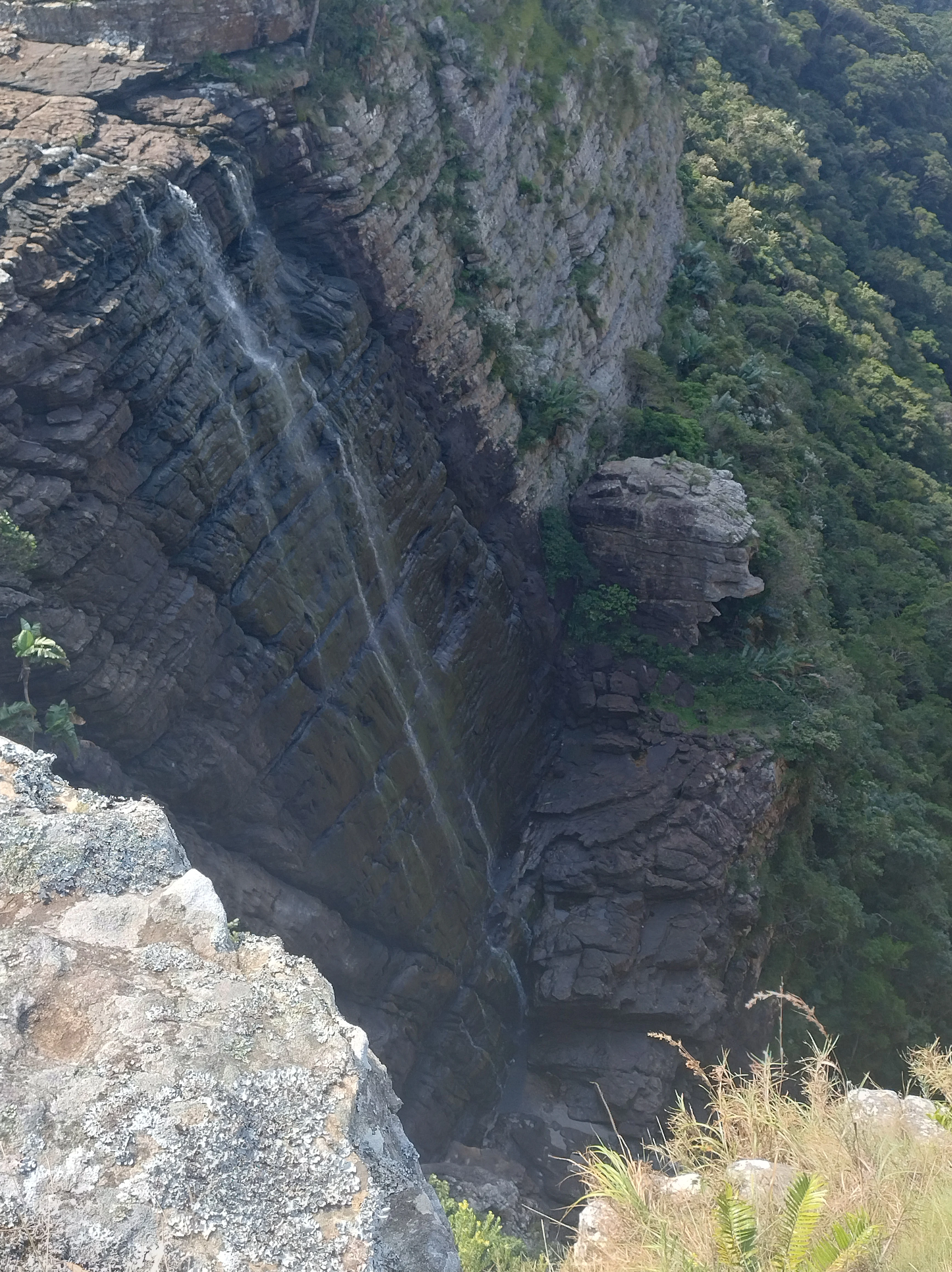
A slender waterfall flows over a steep, rocky cliffside surrounded by lush green coastal vegetation in Mkhambathi Nature Reserve.
A narrow waterfall cascading down a sheer rock face along the Mtentu Swallow Trail.

Mkhambathi Nature Reserve wildlife and species highlights

The wildlife of Mkhambathi Nature Reserve reflects the mosaic of grassland, forest, and river habitats along the Wild Coast. One of the most notable features of the reserve's fauna is its breeding colony of Cape vultures, a threatened species, with several hundred individuals recorded in the area.

The reserve also supports a rich bird community that includes species such as the African finfoot, African grass owl, black-bellied bustard, broad-tailed warbler, buff-streaked chat, chorister robin-chat, crowned eagle, Denham's bustard, grey crowned crane, Gurney's sugarbird, half-collared kingfisher, Knysna woodpecker, southern ground hornbill, spotted ground thrush, swamp nightjar, and white-backed night heron. Gurney's sugarbird occurs in protea bushes, while broad-tailed warblers are associated with marshland habitats.

Typical larger mammals of the region include bushbuck, common duiker, eland, southern reedbuck, chacma baboon, and black-backed jackal. Smaller mammals such as the Zulu golden mole, the forest shrew, and the least dwarf shrew are also present, contributing to the reserve's overall faunal diversity. Reptiles documented in the area include the Natal black snake, the southern brown egg eater, and the variable legless skink, while amphibians are represented by species such as the bush squeaker, forest tree frog, Knysna leaf-folding frog, plaintive rain frog, and yellow-striped reed frog.
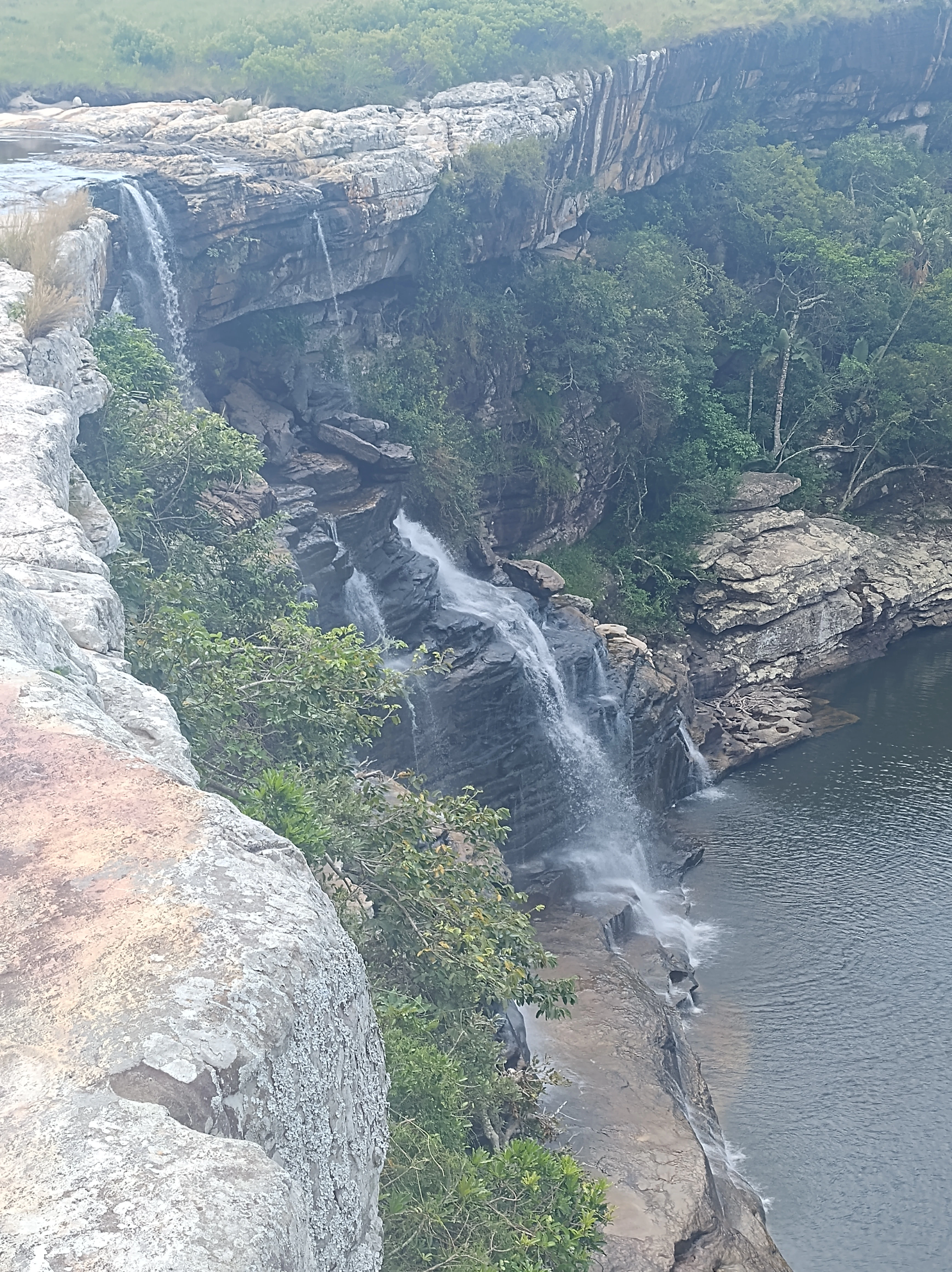
A waterfall flows over a layered rocky cliff into a pool below, surrounded by green coastal grassland and forest vegetation.
Horseshoe Falls cascading over rocky cliffs in Mkhambathi Nature Reserve.

Mkhambathi Nature Reserve conservation status and protection priorities

Mkhambathi Nature Reserve is a conservation area of considerable significance, primarily because of its position within the Pondoland Centre of Plant Endemism and the larger Maputaland, Pondoland, and Albany biodiversity hotspot. Its plant life includes endemic and near-endemic species with extremely limited global ranges, making the reserve critical for their survival.

The 2025 Ramsar listing of the reserve under the official name Mkambati Nature Reserve marked international recognition of its wetland values, encompassing grasslands, swamp forests, river systems, and associated habitats. Its position next to the Pondoland Marine Protected Area also extends conservation coverage into the marine environment, supporting ecological connectivity between inland and coastal systems.

Conservation challenges in the reserve include fire regimes linked to poaching activity, which affect sensitive endemic plant populations, and the spread of invasive alien plants such as black wattle, guava, tickberry, and triffid weed. Managing these threats is central to maintaining the integrity of one of South Africa's most botanically distinctive protected landscapes.

Mkhambathi Nature Reserve cultural meaning and human context

The reserve lies in the broader Pondoland region of the Eastern Cape, an area historically associated with the Pondo people. While the available material does not detail specific cultural or traditional practices inside the reserve, the region forms part of a rural coastal landscape where small communities have long maintained a connection to the land and its resources. The reserve's name reflects this regional identity, and its setting within the Wild Coast connects it to a broader cultural and geographic heritage of the Eastern Cape seaboard.
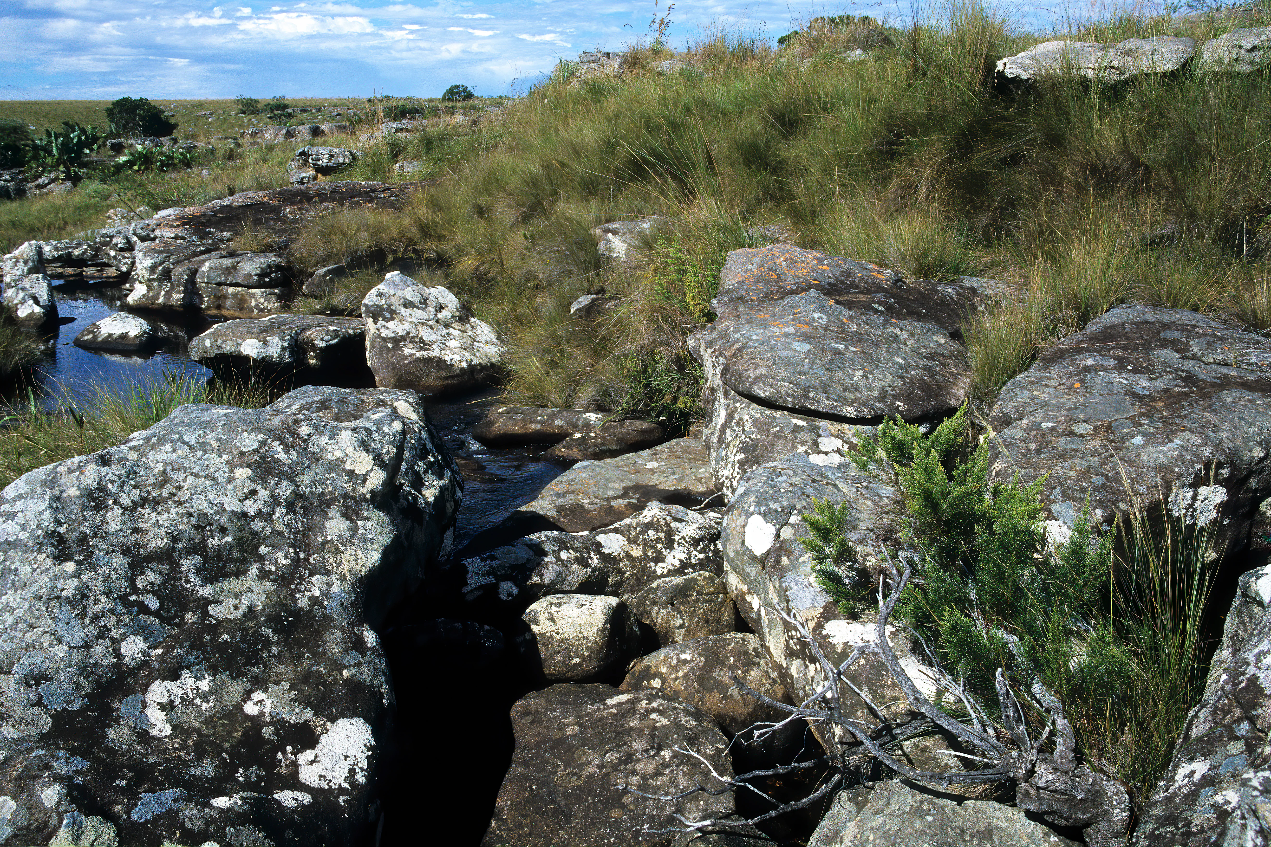
A rocky, grassy landscape with a small stream, featuring a specific, low-growing green plant in the foreground typical of the Mkhambathi coastal grassland habitat.
A habitat view featuring rare flora in Mkhambathi Nature Reserve.

Top sights and standout views in Mkhambathi Nature Reserve

Mkhambathi's defining highlights include the endemic-rich Pondoland flora, the forested ravines and palm-lined banks of the Msikaba and Mtentu rivers, the open coastal grasslands, and a large breeding colony of threatened Cape vultures. The reserve's Ramsar-recognized wetlands and its position alongside the Pondoland Marine Protected Area further underscore its conservation importance.

Additional highlights include dramatic landscape features such as Mkambati Falls and the Mtentu Swallow Trail Falls, rare plant species such as Brunia trigyna and the Pondo palm, and a diverse bird community that links forest, grassland, and wetland species in a single protected landscape.
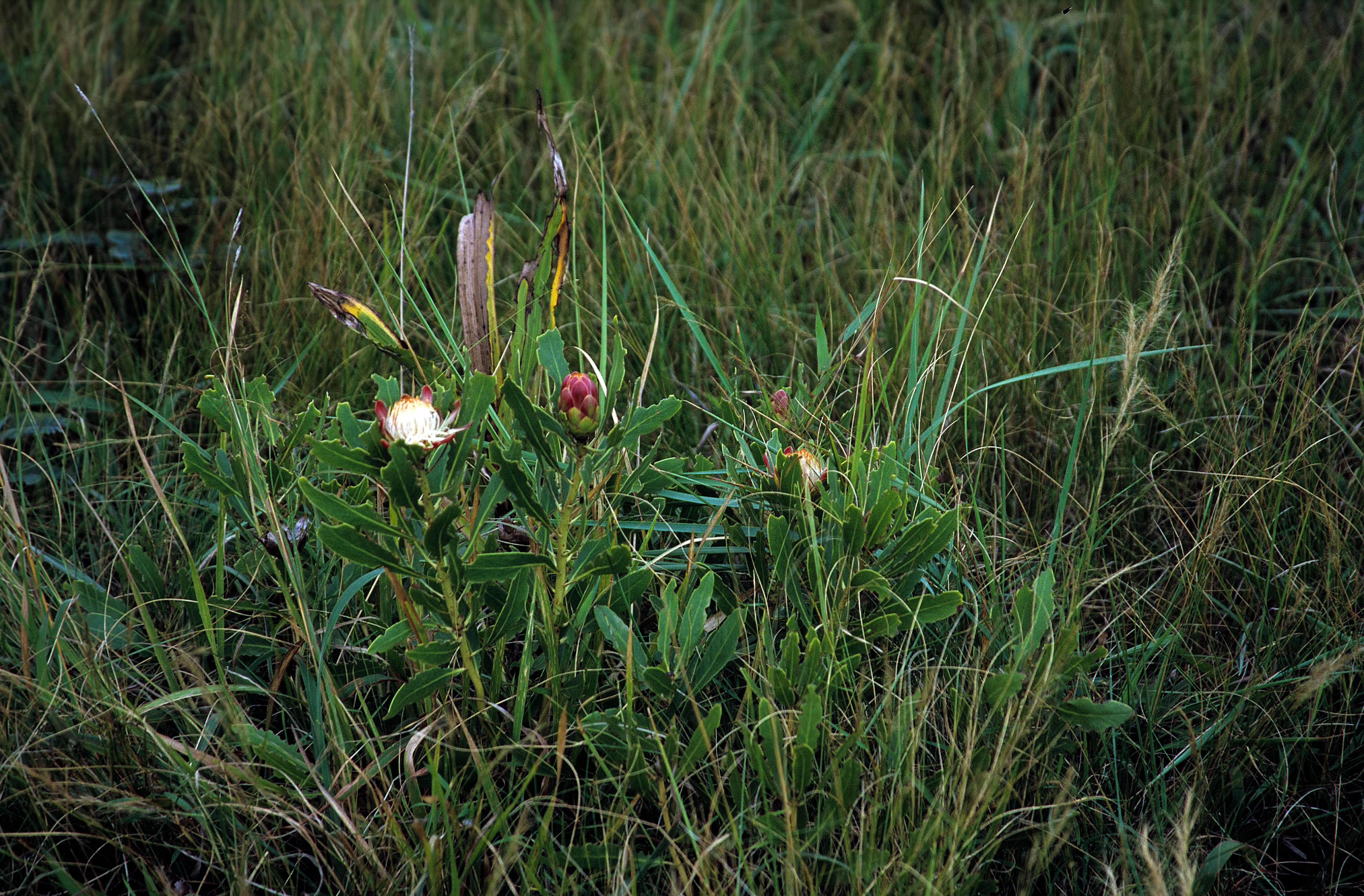
A low-growing green plant with small white and pink flower heads situated in a patch of tall wild grass.
A flowering Protea afra suffrutex plant in the grasslands of Mkhambathi Nature Reserve.

Best time to visit Mkhambathi Nature Reserve

The Wild Coast region around Mkhambathi has a mild coastal climate, and the reserve can be visited across much of the year. The warmer, drier months tend to offer more accessible conditions for exploring grasslands and forest patches, while wetter periods highlight the swamp forests, river flow, and waterfall features such as those along the Msikaba and Mtentu systems.

Birding is a year-round attraction, though seasonal variation in species presence and breeding activity, including the Cape vulture colony, can shape the experience. Visitors interested in plant endemism may find flowering and seasonal changes in grassland and protea habitats particularly rewarding during the warmer months.
Monthly climate preview

Track representative monthly temperature averages and precipitation totals across the protected landscape

Mkhambathi Nature Reserve Climate Normals, Long-Term Temperature and Precipitation Rhythm

Representative coordinates indicate measured monthly temperature variations alongside long-term precipitation rhythms recorded across the protected landscape. Examining the full twelve-month profile provides complete analytical depth for comparison across the reserve coordinate point.
Annual mean22 °C
19 °C25 °C
Jan24°
Feb25°
Mar24°
Apr23°
May22°
Jun20°
Jul19°
Aug19°
Sep20°
Oct20°
Nov21°
Dec23°
Warmest month
February

24.6 °C

Coolest month
July

19.2 °C

Wettest month
November

3.8 mm/day

Driest month
June

1 mm/day

Park location guide

Geography guide, regional context, and park location map for Mkhambathi Nature Reserve

Mkhambathi Nature Reserve park geography, regions, and map view in South Africa

Understand where Mkhambathi Nature Reserve sits in South Africa through a broader geographic reading of the surrounding landscape, nearby location context, and its mapped position within the national park landscape.

How Mkhambathi Nature Reserve fits into South Africa

South Africa is the southernmost country in Africa, spanning 1.22 million km² with a population of over 63 million. The country operates with three capital cities, Pretoria (executive), Cape Town (legislative), and Bloemfontein (judicial), and is renowned for its biodiversity, national parks, and multicultural society.

Wider geography shaping Mkhambathi Nature Reserve in South Africa

South Africa occupies the southernmost region of Africa, with coastline along both the Atlantic Ocean to the west and the Indian Ocean to the east. The interior features elevated plateaus including the Highveld, with the Drakensberg escarpment marking the eastern highlands. The country shares borders with Namibia, Botswana, Zimbabwe, Mozambique, Eswatini, and Lesotho.

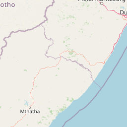
Map view of Mkhambathi Nature Reserve

Use this park location map to pinpoint Mkhambathi Nature Reserve in South Africa, understand its exact geographic position, and read its mapped placement within the surrounding landscape more clearly.

Pigeon | © OpenStreetMap contributors

Location context for Mkhambathi Nature Reserve

Eastern Cape
Recorded earthquake history

Explore Historical Earthquake Records Associated with Mkhambathi Nature Reserve

Examine the seismic history of the region surrounding Mkhambathi Nature Reserve through this documented catalogue of USGS-derived records. Gain insight into past local earthquake events, including magnitude and epicentre distance, within this important Eastern Cape conservation landscape.

Mkhambathi Nature Reserve Earthquake History

Catalogued events

3 events

Strongest magnitude

Magnitude 4.5

Most recent event

Feb 12, 1988

This history includes earthquakes recorded inside the park or within 50 km of its borders

Visual reference of coastal grasslands, riverine ravines, and protected habitats

Mkhambathi Nature Reserve Photos and Landscape Scenery

Visual records illustrate the dramatic terrain transitions across Mkhambathi Nature Reserve, capturing open coastal plateaus, swamp forests, and deep river canyons. Photographic documentation provides clear visual context for evaluating the protected landscapes and distinct botanical habitats found along the Wild Coast.

A pink Brunsvigia grandiflora flower with multiple stems radiating from a single central stalk, growing in a field of tall green grass.

A small green shrub identified as Brunia trigyna growing from a crevice between dark, lichen-covered rocks, with a dry, weathered branch lying in the foreground.

A high-angle view of a tiered waterfall cascading over rocky ledges into a dark pool, surrounded by grassy coastal landscape under a clear blue sky.

A slender waterfall flows over a steep, rocky cliffside surrounded by lush green coastal vegetation in Mkhambathi Nature Reserve.

A waterfall flows over a layered rocky cliff into a pool below, surrounded by green coastal grassland and forest vegetation.

A close-up view of two bright orange flowering Watsonia pillansii stems rising from a patch of green grass.

A rocky, grassy landscape with a small stream, featuring a specific, low-growing green plant in the foreground typical of the Mkhambathi coastal grassland habitat.

A low-growing green plant with small white and pink flower heads situated in a patch of tall wild grass.

Park atlas

Compare adjacent coastal reserves, riverine habitats, and protected areas across the surrounding region

Parks Near Mkhambathi Nature Reserve: Exploring Related Protected Landscapes and Regional Geography

Visitors reviewing Mkhambathi Nature Reserve can continue browsing related protected areas to compare coastal grasslands, riverine ravines, and regional conservation terrain. Expanding the geographic scope reveals connected ecosystems and alternative natural habitats throughout the surrounding coastal corridor.
Nature reserveKwaZulu-Natal
About 28 km away#1 closest

Northeast

Umtamvuna Nature Reserve: Geographic Atlas of the South African Coastal Sandstone Gorges

Protected riverine terrain in the KwaZulu-Natal province

Located along the Mtamvuna River in KwaZulu-Natal, this protected area features steep sandstone cliffs and extensive river frontage. The landscape provides a critical intersection between coastal scarp forest and plateau grasslands, offering a rich study in localized topography and endemic plant environments.

Area
32.57 km²
Established
1971
Relief
Upland
Climate
Subtropical
Nature reserveKwaZulu-Natal
About 96 km away#2 closest

Northwest

Mount Currie Nature Reserve: A Detailed Geographic Atlas of KwaZulu-Natal Mountains

High-altitude wetlands and protected Drakensberg foothills

Mount Currie Nature Reserve encompasses a rugged expanse of Drakensberg foothills characterized by sharp dolerite cliffs and expansive central wetland systems. This protected area acts as a crucial ecological intersection, bridging montane grassland and Afromontane forest patches while providing a sanctuary for diverse avian life and significant cultural heritage sites.

Area
17.77 km²
Established
1980
IUCN
IV
Relief
Mountain
Nature reserveKwaZulu-Natal
120 km away#3 closest

North

Ntsikeni Nature Reserve: High-Elevation Wetland Geography and Protected Landscape Atlas

A remote Drakensberg foothills wetland and montane grassland reserve.

Ntsikeni Nature Reserve is recognized as the largest and one of the highest wetlands in South Africa. Located in the KwaZulu-Natal province, this protected area features a unique, misty plateau landscape that sustains diverse orchid flora and essential headwater ecosystems. Use these geographic maps to examine the terrain, park boundaries, and the ecological transition between rolling foothills and the Drakensberg escarpment.

Area
92.87 km²
Established
1978
Relief
Upland
Climate
Temperate
Nature reserveEastern Cape
About 144 km away#4 closest

Southwest

Dwesa Nature Reserve and Wild Coast Protected Landscapes in Eastern Cape

Coastal forest, marine protection, and rugged river valley topography

Dwesa Nature Reserve protects a distinctive interface between land and sea, featuring shaded indigenous forests that descend into a series of open coves and cliffs along the Indian Ocean. This geographic study reveals how varied habitats from woodland to estuary are preserved within a single unit in South Africa, providing significant insights into regional biodiversity and coastal land management.

Area
54.5 km²
Established
1975
Relief
Lowland
Access
Access unknown
Nature reserveKwaZulu-Natal
About 150 km away#5 closest

North

Coleford Nature Reserve: Protected Grasslands and Wetlands in KwaZulu-Natal

Tracing the landscape of a key Drakensberg foothill reserve

The Coleford Nature Reserve represents a critical protected area in the Southern Drakensberg, featuring threatened Drakensberg Foothill Moist Grassland. Its landscape is defined by the Ngwagwane River valley and diverse wetland systems, providing essential habitat for endangered bird species. This reserve functions as a gateway to the broader montane geography of the southwestern KwaZulu-Natal region.

Area
12.72 km²
Established
1948
IUCN
IV
Relief
Highland
Protected areaKwaZulu-Natal
160 km away#6 closest

North

uKhahlamba-Drakensberg Park: Protected Mountain Landscapes and Escarpment Geography in South Africa

Exploring the basalt cliffs and alpine plateau of KwaZulu-Natal.

uKhahlamba-Drakensberg Park encompasses an expansive protected region where the Drakensberg escarpment rises sharply from the foothills of KwaZulu-Natal. This atlas record details the park landscape, including its transition from sandstone terraces to high-altitude basalt, its extensive river gorges, and the concentration of archaeological cave sites. Use this resource to understand the geographic scale of this transboundary conservation area.

Area
2,429.13 km²
Relief
Mountain
Climate
Temperate
Access
Access unknown
A watercolor illustration featuring soft, green rolling hills in the foreground with pale, layered mountain peaks in the background, set against a plain white field.
Protected areaKwaZulu-Natal
160 km away#7 closest

Northwest

Maloti-Drakensberg Park Geography: Mountain Escarpments and Alpine Plateau Exploration

A transboundary protected landscape spanning South Africa and Lesotho

Spanning the core of the Drakensberg mountain system, Maloti-Drakensberg Park provides a unique window into high-altitude biodiversity and geological drama. The protected area features basalt cliffs, rolling valleys, and an extensive plateau, forming a critical ecological and cultural corridor. This atlas entry covers the topographic features and spatial distribution of one of southern Africa's most significant protected landscapes.

Area
2,493.13 km²
Established
2001
Relief
Mountain
Climate
Alpine
National parkQacha's Nek District
161 km away#8 closest

Northwest

Sehlabathebe National Park: Mapped Protected Landscape in Lesotho's Maloti Mountains

Explore high-altitude terrain, waterfalls, and ancient rock art sites.

Sehlabathebe National Park stands as a protected national park within the rugged Maloti Mountains of Lesotho's Qacha's Nek District. This destination is vital for understanding the geographic context of protected areas, featuring dramatic cliffs, iconic waterfalls like Tsoelikana, and numerous rock art sites that speak to its cultural and historical significance. Its high-altitude Afro-Alpine and sub-alpine ecosystems offer unique landscape characteristics and support notable biodiversity, making it a key point of interest for atlas-driven exploration of natural and protected terrains.

Area
69.5 km²
Established
1969
IUCN
IV
Relief
Mountain

Common questions about visiting, size, designation, and location context for Mkhambathi Nature Reserve

Mkhambathi Nature Reserve FAQs for park facts, access, geography, and protected area context

Find quick answers about Mkhambathi Nature Reserve, including protected-area facts, park geography, trail and visitor context, and how the park fits into its surrounding country and regional landscape.
MoriAtlas Explorer

Continue Your Protected Areas Search Across the Global Atlas

Deepen your exploration by continuing the structured search for national parks and protected areas worldwide. Utilize the comprehensive filtering capabilities to compare different conservation landscapes and refine your understanding of global park geography. Discover more about the distribution and characteristics of protected natural areas.

Global natural geography