
Mori Atlas logo
Nature reserveMöhnesee

Understanding the ecological geography of this vital waterbird sanctuary in Kreis Soest.

Möhnesee Nature Reserve: A Detailed Atlas of Westphalian Wetlands and Protected Landscapes

(EU-Vogelschutzgebiet "Möhnesee")

Möhnesee is a protected nature reserve in the Kreis Soest district of North Rhine-Westphalia, serving as a critical staging and wintering ground for international waterfowl populations. The landscape is defined by the extensive Möhnetalsperre reservoir, where the northern foothills of the Sauerland intersect with the rolling terrain of the Westphalian Bight. This unique geographic transition creates a diverse aquatic environment characterized by open water, forested slopes, and marshy margins that support both migratory passage and resident bird species.

bird sanctuarywaterbirdsreservoirSauerlandWestphaliaNatura 2000
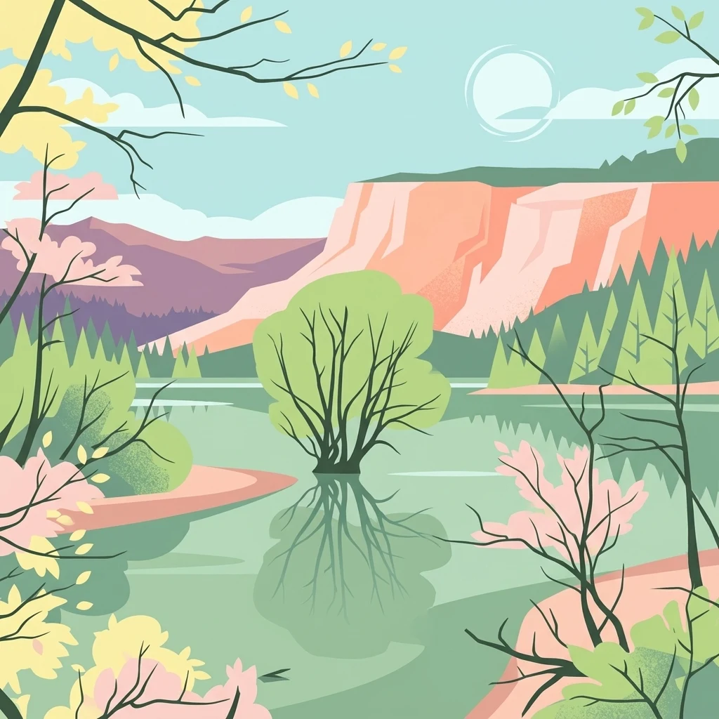
A flat, stylized illustration showing a calm lake reflecting a central tree, with forested shorelines and rocky cliffs in the background under a pale sky.

Möhnesee

Nature reserve

Park overview

Structured park overview, official facts, and landscape profile for Möhnesee Bird Sanctuary

Möhnesee Bird Sanctuary park facts, protected area profile, and essential visitor context

Review the core facts for Möhnesee Bird Sanctuary, including designation, size, terrain, visitor scale, habitats, and operating context in one park-focused overview.

About Möhnesee Bird Sanctuary

Möhnesee Bird Sanctuary centers on the Möhnetalsperre, a sizeable reservoir created on the River Möhne in the Sauerland region of North Rhine-Westphalia. The protected area spans the transition between the wooded uplands of the Sauerland and the more open Westphalian Bight to the north, capturing both the lake itself and the immediately surrounding landscape of forest, small settlements, and marginal land.

Designated in 1983 under the European Union Birds Directive, the sanctuary is one component of the larger Natura 2000 ecological network across Germany. The site code DE-4514-401 is used at both EU and national reporting levels, and the area is administered by the Regierungspräsidium Arnsberg. In ecological classification terms the area falls within IUCN Category IV, a habitat and species management area, reflecting the active role the designation plays in maintaining conditions for vulnerable bird populations.

The site's defining feature is its function as a major inland staging and wintering ground for waterbirds. Surveys and site documentation describe peak counts of up to around 20,000 resting waterbirds, with goosander, common goldeneye, and common pochard highlighted as characteristic species. The open water environment that supports these concentrations also sustains breeding birds along the shoreline and feeder streams, and offers hunting habitat for passage raptors and waders moving along regional corridors.

Beyond the reservoir, the sanctuary includes narrow belts of deciduous woodland, small areas of plantation forest, and minimal built-up land. These wooded sections are ecologically meaningful, providing nesting, roosting, and feeding substrate for species such as the middle spotted woodpecker, as well as structural diversity along the shore that benefits the common kingfisher and other riparian breeders. The interplay between open water, wooded margins, and the surrounding cultural landscape gives the protected area its broad conservation relevance.

Quick facts and research context for Möhnesee Bird Sanctuary

Möhnesee Bird Sanctuary (site code DE-4514-401) is a European Special Protection Area of about twelve square kilometers, established in 1983 by the Arnsberg regional government authority. It lies in the Kreis Soest district of North Rhine-Westphalia, on the Möhne reservoir where the forested Sauerland transitions into the Westphalian Bight. Inland waters dominate about 95 percent of the habitat, with deciduous forest, plantation woodland, and minor built-up areas making up the remainder.

The site is a nationally and internationally important staging and wintering area for waterbirds, especially goosander, common goldeneye, and common pochard, with peak counts near 20,000 birds. It is part of the Natura 2000 network and links with the Arnsberger Wald Nature Park and the Hevearm und Hevesee nature reserve.

Protection and recognition

Examine terrestrial protected area designations, management scopes, and recognition sources.

Möhnesee Protection Status and International Recognition Records

Möhnesee holds documented terrestrial protection status within the global database without transboundary designations or external international recognition sources. Structured administrative records outline the official management scope and verified territorial classification for this protected landscape.

Protection details

Protection scope
Terrestrial
Transboundary protection
No
WDPA ID
555537519
Park context

Deeper park guide and search-rich context for Möhnesee Bird Sanctuary

Möhnesee Bird Sanctuary history, landscape, wildlife, and travel context

Explore Möhnesee Bird Sanctuary through its history, landscape character, ecosystems, wildlife, conservation priorities, cultural context, and seasonal travel timing in a structured park guide built for atlas discovery and search intent.

Why Möhnesee Bird Sanctuary stands out

Möhnesee is best known as one of North Rhine-Westphalia's most significant inland waterbird sanctuaries. The reservoir's calm waters and shallow margins attract large concentrations of diving and dabbling ducks during migration and winter, while the mosaic of meadows, riparian woodland, and nearby forests supports a wider breeding and passage bird community. Its recognition as an internationally important staging and wintering site under the EU Birds Directive sets it apart from purely local protected areas. The combination of open water, old deciduous stands, and connective land use with neighboring reserves gives the sanctuary a layered ecological character that extends well beyond the reservoir itself.
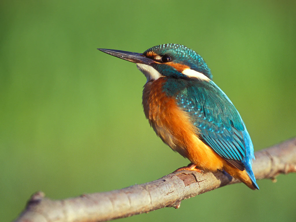
A close up view of a common kingfisher with vibrant blue and orange plumage, perched on a bare wooden branch against a soft green blurred background.
A common kingfisher perched on a branch at the Möhnesee bird sanctuary.

Möhnesee Bird Sanctuary history and protected-area timeline

The protected area was formally designated in 1983 through an ordinance issued by the Regierungspräsidium Arnsberg, the regional administration responsible for the Arnsberg governmental district in North Rhine-Westphalia. Its establishment coincided with Germany's early implementation of European Community nature protection obligations, particularly the Birds Directive (Council Directive 79/409/EEC), which obliged member states to identify and safeguard suitable habitat for wild bird populations.

The selection of the Möhne reservoir as a Special Protection Area reflected an already established appreciation of the site as an outstanding inland wetland for waterbirds. The reservoir itself, the Möhnetalsperre, had long functioned as a wintering and staging area for ducks and sawbill species, and its integration into the European network gave formal recognition to that role.

Over the following decades the site continued to be reported and reviewed under the Natura 2000 framework, with management guidance updated for individual target species. By the early 2020s, conservation documentation continued to list key waterbirds, breeding woodland species, and passage visitors such as the black stork and red kite as central to the site's purpose, reflecting an evolving but stable protection history.

Möhnesee Bird Sanctuary landscape and geographic character

The Möhnetalsperre reservoir dominates the sanctuary's landscape, its broad open water surface framed by the forested slopes of the Sauerland to the south and grading northward into the more gently rolling terrain of the Westphalian Bight. This transitional position gives the area a layered character, with steep wooded banks in places and shallower vegetated margins in others.

The shoreline itself is not uniform. Steep sections with eroded banks and exposed substrate alternate with quieter bays, inflowing streams, and pockets of reeds and overhanging vegetation. These structural variations are not incidental: they shape where birds can feed, rest, and nest, and they form a major part of the area's ecological value. Small islands and peninsula-like features emerging from the water add further complexity to the lakefront profile.

Surrounding the reservoir, the terrestrial component of the landscape is relatively limited in extent but diverse in character. Scattered deciduous woodland patches dominated by beech transitions into mixed and plantation forest, and there are minor inclusions of roads, settlements, and infrastructure associated with the dam and reservoir management. The result is a landscape in which water overwhelmingly sets the tone, but with enough land-based structural variety to support an unusually broad range of bird species.
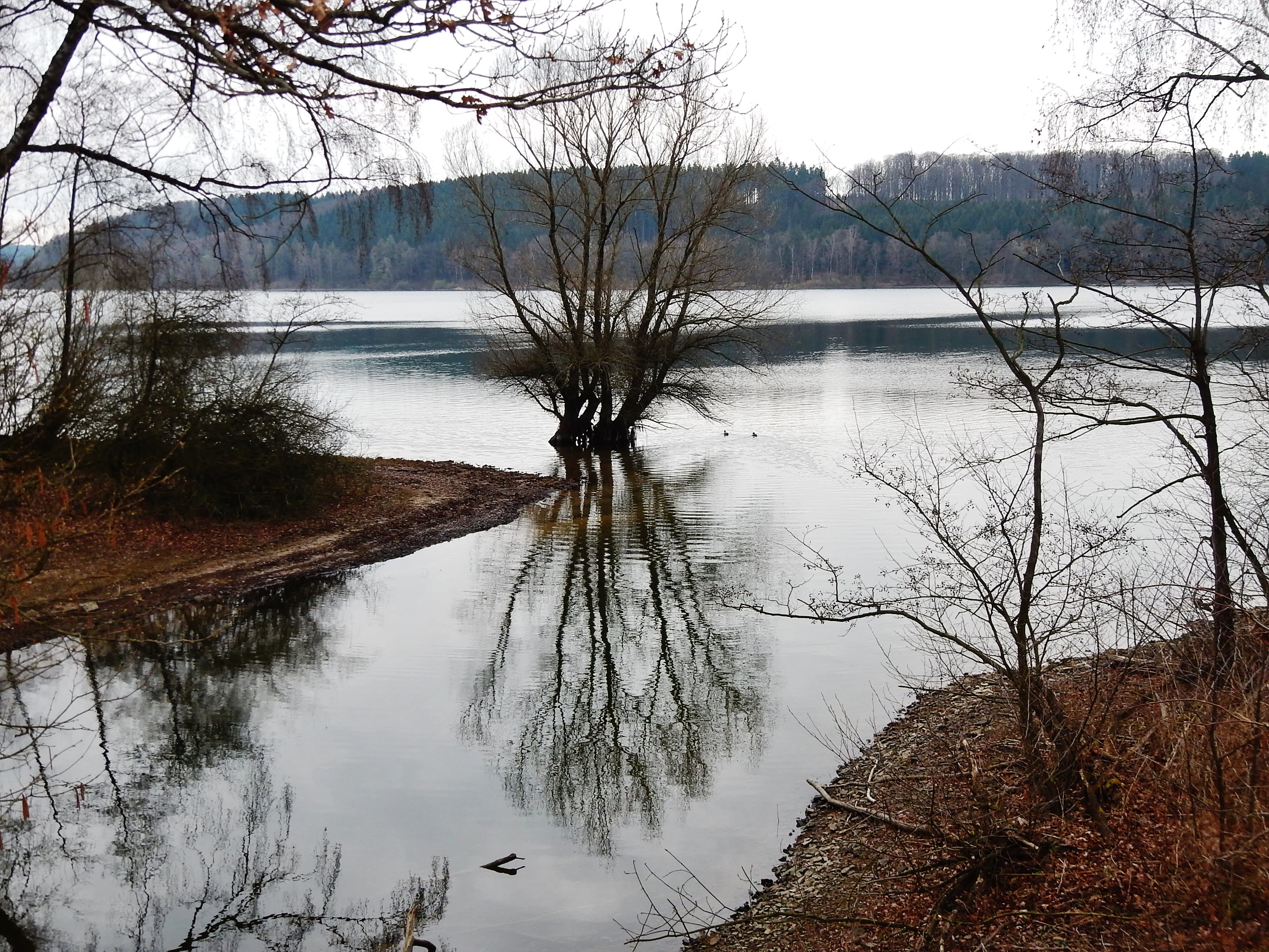
A calm, reflective lake scene with a single leafless tree standing in the water near the shore, under an overcast sky.
The Hevesee within the Möhnesee bird sanctuary, showing a reflective water scene in late autumn or winter.

Möhnesee Bird Sanctuary ecosystems, habitats, and plant life

The sanctuary's nature is fundamentally shaped by water. Inland surface waters, both standing and flowing, account for by far the largest share of the habitat, providing the foundation for the site's role as a major waterbird refuge. Around this aquatic core, narrow zones of deciduous woodland, plantation forest, and minimal human settlement create a small but ecologically important matrix of supporting habitats.

Aquatic and shoreline vegetation patterns are typical of large central European reservoirs. Reeds fringe gentler bays and inflow areas, while steeper shores may have minimal emergent vegetation, instead offering open banks and exposed substrates that suit particular feeding strategies. Inflowing brooks, including the Heve, add structurally distinct riparian conditions, with faster, oxygen-rich water contrasting against the still main body of the reservoir.

The woodland component contributes minority but well-defined habitat types. Beech-dominated forest and mixed oak-hornbeam stands echo the broader Arnsberger Wald landscape, while plantation forest in narrow transitions adds a different structural character. Together these elements create enough habitat diversity to support not just waterbirds but also woodland and forest-edge species, reinforcing the sanctuary's role as a connective ecological node in the region.
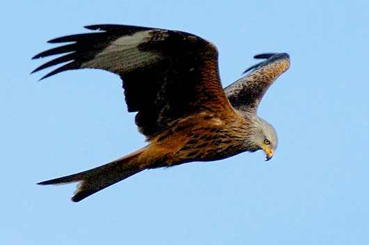
A red kite seen from the side, flying against a clear blue sky, showing its reddish-brown plumage and distinct forked tail.
A red kite in flight over the Möhnesee bird sanctuary area.

Möhnesee Bird Sanctuary wildlife and species highlights

The Möhnesee sanctuary is defined above all by its waterbirds. The reservoir hosts large seasonal concentrations of ducks and sawbills, with goosander, common goldeneye, and common pochard singled out as particularly characteristic wintering and staging species. Descriptions of the site emphasize peak counts reaching around 20,000 resting waterbirds, placing it among the most important inland sites of its kind in North Rhine-Westphalia.

A broader community of ducks uses the area, including species such as Eurasian teal, northern shoveler, and northern pintail, along with smaller numbers of diving ducks like tufted duck and ferruginous duck relatives that utilize the deeper water. The little grebe also uses vegetated margins as breeding habitat, while great egret and, in some seasons, black stork appear as winter visitors or passage migrants.

Outside the water, the wooded margins and surrounding cultural landscape host additional breeding and passage species. The common kingfisher uses steep banks and exposed root systems along the reservoir and inflows for nesting, while the middle spotted woodpecker relies on older deciduous stands rich in deadwood, particularly oak-rich forest. Raptors such as the red kite and, occasionally, the osprey hunt over and around the site, taking advantage of the mix of open water, woodland edges, and structured farmland visible from above.
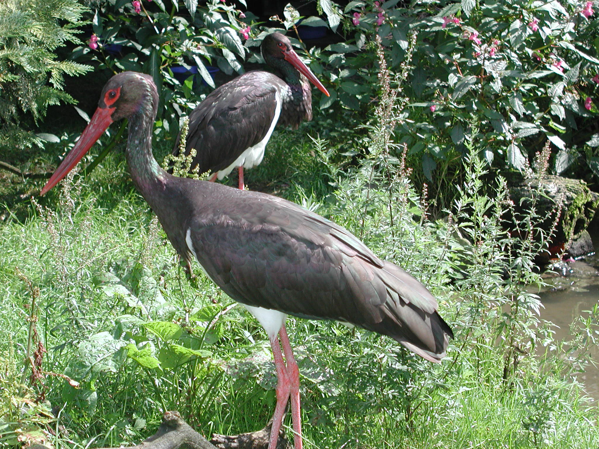
Two black storks with dark plumage and long red beaks standing in green vegetation beside a body of water.
Two black storks standing in lush vegetation near the water at Mohnesee.

Möhnesee Bird Sanctuary conservation status and protection priorities

The sanctuary exists first and foremost to secure and, where possible, improve the conditions used by waterbirds during their migration and wintering periods. Its fundamental conservation goal is ensuring that the reservoir continues to function as a reliable refuge within the broader European network of protected wetlands, particularly for species that depend on large undisturbed expanses of standing freshwater.

Species-specific targets reflect the diversity of pressures affecting the area. For waterbirds, management emphasizes undisturbed resting and feeding areas, resilient food supplies, and buffered shorelines that reduce noise and contamination. For breeding woodland species like the middle spotted woodpecker, conservation efforts focus on preserving older deciduous forest with sufficient deadwood, encouraging oak-rich stands, and avoiding fragmentation of suitable woodland blocks.

Riparian and shoreline species such as the common kingfisher and black storch benefit from protection of steep banks, natural erosion processes, and clean water conditions that support fish and amphibian prey. The sanctuary's integration with neighboring protected areas, particularly the Arnsberger Wald Nature Park and the Hevearm und Hevesee nature reserve, extends the practical conservation footprint well beyond the formal site boundary and reinforces its role as part of a larger, interconnected ecological landscape.

Top sights and standout views in Möhnesee Bird Sanctuary

Möhnesee Bird Sanctuary's core highlight is the Möhnetalsperre itself, one of the largest inland waterbird refuges in North Rhine-Westphalia and a site of recognized international importance for wintering and migrating waterfowl. The combination of open water with wooded shorelines, inflowing streams, and connected terrestrial reserves gives the sanctuary a layered ecological identity rather than a single-habitat profile.

The site's formal status within the Natura 2000 network, its long history of designation since 1983, and its administrative integration with broader protected-area planning underscore its lasting role within the regional conservation landscape. Together these qualities make the sanctuary a notable node in the ecological fabric of the Sauerland and Westphalian Bight transition zone.

Best time to visit Möhnesee Bird Sanctuary

The sanctuary is most ecologically significant during the colder half of the year, when the reservoir functions as a staging and wintering ground for large numbers of waterbirds. Late autumn through early spring is typically the period when concentrations of ducks and sawbills, including goosander, common goldeneye, and common pochard, are most visible on the open water. Breeding species such as common kingfisher are best observed along quieter shoreline sections in spring and early summer.

Summer visits emphasize woodland edges, inflowing streams, and the broader landscape of the surrounding Arnsberger Wald Nature Park, when deciduous cover is at its fullest and migratory raptors and other passage species may be present. Year-round, the sensory character of the area varies with reservoir water levels, forest canopy development, and weather conditions across the sheltered valley.


Monthly climate preview

Long-term representative point measurements tracking monthly climate patterns for Möhnesee

Möhnesee Climate Normals and Measured Annual Temperature and Precipitation Rhythm

Historical data recorded at a representative coordinate tracks the measured monthly temperature range and precipitation rhythm across the year at Möhnesee. Reviewing the complete twelve-month profile provides deep baseline context for understanding long-term regional climate conditions.
Annual mean9 °C
0 °C18 °C
Jan
Feb
Mar
Apr
May12°
Jun16°
Jul18°
Aug18°
Sep14°
Oct
Nov
Dec
Warmest month
July

18.2 °C

Coolest month
January

0.3 °C

Wettest month
December

2.7 mm/day

Driest month
April

1.7 mm/day

Park location guide

Geography guide, regional context, and park location map for Möhnesee Bird Sanctuary

Möhnesee Bird Sanctuary park geography, regions, and map view in Germany

Understand where Möhnesee Bird Sanctuary sits in Germany through a broader geographic reading of the surrounding landscape, nearby location context, and its mapped position within the national park landscape.

How Möhnesee Bird Sanctuary fits into Germany

Germany is a federal republic in Western and Central Europe with a population of over 83 million across sixteen constituent states. It is Europe's largest economy by nominal GDP and a major global exporter and importer. The capital is Berlin, and the country borders Denmark, Poland, Czech Republic, Austria, Switzerland, France, Luxembourg, Belgium, and the Netherlands.

Wider geography shaping Möhnesee Bird Sanctuary in Germany

Germany is located in Western and Central Europe, spanning 357,022 km². It borders Denmark to the north, Poland and the Czech Republic to the east, Austria and Switzerland to the south, and France, Luxembourg, Belgium, and the Netherlands to the west. The country has coastlines on the Baltic Sea and North Sea to the north, with the Alps located in the southern region.

Map view of Möhnesee Bird Sanctuary

Use this park location map to pinpoint Möhnesee Bird Sanctuary in Germany, understand its exact geographic position, and read its mapped placement within the surrounding landscape more clearly.

Pigeon | © OpenStreetMap contributors

Location context for Möhnesee Bird Sanctuary

Kreis SoestNordrhein-Westfalen

Explore high-resolution photography capturing the waterbirds, forested shorelines, and wetland terrain of Möhnesee.

Möhnesee Photos and Protected Landscape Scenery: Visualizing the Reservoir Habitat

Visual documentation reveals the distinct topography and habitat structures defining the Möhnetalsperre reservoir and its surrounding protected lands. Examining these landscape views provides a clearer understanding of the ecological transition zones uniting the Sauerland slopes with the Westphalian Bight.

A close up view of a common kingfisher with vibrant blue and orange plumage, perched on a bare wooden branch against a soft green blurred background.

A male common pochard duck with a reddish brown head and pale grey back swimming on calm water.

A calm, reflective lake scene with a single leafless tree standing in the water near the shore, under an overcast sky.

A red kite seen from the side, flying against a clear blue sky, showing its reddish-brown plumage and distinct forked tail.

Two black storks with dark plumage and long red beaks standing in green vegetation beside a body of water.

Park atlas

Compare surrounding regional geography and connected wetland habitats across Central Westphalia

Explore Parks Near Möhnesee and Discover Related Protected Landscapes

Browse other parks near Möhnesee to evaluate connected protected landscapes and regional water habitats. Extending geographic comparison beyond the reservoir reveals a wider network of forest reserves and specialized bird sanctuaries.
Nature reserveGermany
About 3.8 km away#1 closest

Southwest

Naturschutzgebiet Quellbäche der Schlibbecke: Protected Headwaters and Brook-Valley Geography

A vital nature reserve within the Northern Sauerland forest landscape.

This nature reserve protects the near-natural headwaters and floodplain forest of the Schlibbecke brook system in Germany. It features a varied topography of steep, narrow valley slopes and moist alder-dominated woodlands, serving as a crucial biotope connection within the broader, largely conifer-influenced regional landscape of the Hochsauerlandkreis.

Area
0.093 km²
Established
1998
Relief
Upland
Scope
Terrestrial
Nature reserveHochsauerlandkreis
About 5.8 km away#2 closest

South

Naturschutzgebiet Oberlauf des Saliesiepens: Protected Riparian Woodland and Brook Geography

A vital stream-side habitat in the Hochsauerlandkreis uplands

This protected area stands out for its narrow, meandering Saliesiepen brook and the surrounding alder forest patches. It offers a focused view of riparian restoration in a region otherwise dominated by conifer plantations. The reserve represents a specific, linear valley landscape providing essential connectivity for local water-dependent flora and fauna.

Area
0.054 km²
Established
2021
Relief
Lowland
Scope
Terrestrial
A soft watercolor illustration depicting rolling green hills, dense forest patches, and a winding stream flowing through a grassy meadow.
Protected landscapeGermany
About 8.8 km away#3 closest

Southwest

Luerwald und Bieberbach Protected Landscape: Regional Forest Map and Habitat Overview

A major continuous woodland reserve in North Rhine-Westphalia, Germany.

Spanning the landscape between Neheim and Menden, Luerwald und Bieberbach functions as a critical Special Protection Area. The terrain features extensive beech and oak woodlands intersected by the Bieberbach stream, creating an important haven for woodland species and maintaining a large, undisturbed environmental mosaic across the northern Sauerland.

Nature reserveHochsauerlandkreis
About 8.8 km away#4 closest

South

Naturschutzgebiet Schlossberg Osthang: Protected Forest Geography in Hochsauerlandkreis

A specialized limestone slope debris nature reserve overlooking the Ruhr valley.

Spanning a small but ecologically vital area, Naturschutzgebiet Schlossberg Osthang protects a rare limestone slope debris forest. The site features extreme topography and thin calcareous soils that support specialized mollusks and plant communities, marking it as a critical refugial biotope within the broader Arnsberg landscape plan.

Area
0.003 km²
Established
2021
Relief
Upland
Climate
Temperate
Watercolor illustration of a calm lake surrounded by low, rolling green hills and a forested shoreline with wildflower foreground.
Protected landscapeHochsauerlandkreis
About 10 km away#5 closest

Southeast

Landschaftsschutzgebiet Arnsberg: Protected Landscape and Regional Geography

Forested hills and historical cultural landscape in Hochsauerlandkreis

Landschaftsschutzgebiet Arnsberg encompasses a complex network of 219 separate sub-areas across the rolling hills of the Sauerland region. This protected landscape preserves important ecological functions through its vast spruce and beech forests while buffering nearby natural reserves. Its mosaic structure and historical mining relics offer a unique view into the development of the forested landscape bordering the city of Arnsberg.

Area
57.958 km²
Established
1998
Relief
Upland
Climate
Temperate
Nature reserveGermany
About 11 km away#6 closest

Southeast

Schatthangwald Egge Nature Reserve: Geographic Overview and Protected Forest Boundaries

A preserved oak-beech slope forest in Germany

Focusing on the northern Ruhr valley, this nature reserve protects a shade-dense oak-beech slope and essential deadwood habitats. Explore the mapped terrain of this Arnsberg-based area, where strict conservation rules prioritize natural forest turnover and the protection of forest interior conditions near the regional rail infrastructure.

Area
0.093 km²
Established
2021
Relief
Upland
Scope
Terrestrial
Nature reserveHochsauerlandkreis
About 11 km away#7 closest

Southwest

Naturschutzgebiet Oelinghauser Bruch: Nature Reserve and Protected Brook Valley Map

Detailed geographic overview of Hochsauerlandkreis floodplain forest and valley terrain.

Naturschutzgebiet Oelinghauser Bruch acts as a vital refugium for floodplain and brook-side communities. This nature reserve, situated north of Oelinghausen in the Hochsauerlandkreis region, contains a sharp Kerbtal landform and rare alder-ash wet woodland. The area demonstrates active forest restoration and ecological connectivity across its varied slopes and narrow valley floor.

Area
0.098 km²
Established
1998
Relief
Upland
Climate
Temperate
A soft, watercolor painting depicting a winding stream flowing through a gentle green valley with rolling hills in the background.
Nature reserveHochsauerlandkreis
About 11 km away#8 closest

South

Mühlbachtal Nature Reserve and the Protected Valley Landscapes of Hochsauerlandkreis, Germany

A riparian valley landscape defined by medieval water management and stream ecology

This protected valley in the Hochsauerlandkreis serves as a case study in landscape continuity, linking a meandering trout stream to centuries of monastic engineering. The reserve showcases a mosaic of alder galleries, orchid meadows, and mixed deciduous woods that characterize the local geography while highlighting the cultural layering inherent in this German nature reserve.

Area
0.069 km²
Established
1998
Water
Major water bodies
Season
Year-round

Common questions about visiting, size, designation, and location context for Möhnesee Bird Sanctuary

Möhnesee Bird Sanctuary FAQs for park facts, access, geography, and protected area context

Find quick answers about Möhnesee Bird Sanctuary, including protected-area facts, park geography, trail and visitor context, and how the park fits into its surrounding country and regional landscape.
MoriAtlas Explorer

Continue Your Protected Areas Search Across the Global Atlas

Deepen your exploration by continuing the structured search for national parks and protected areas worldwide. Utilize the comprehensive filtering capabilities to compare different conservation landscapes and refine your understanding of global park geography. Discover more about the distribution and characteristics of protected natural areas.

Global natural geography