Mori Atlas logo
Nature reserveMoore und Heiden des westlichen Münsterlandes

Mapping the peatland landscapes and rare bird habitats of western North Rhine-Westphalia

Moore und Heiden des westlichen Münsterlandes Protected Nature Reserve and Wetland Atlas

(EU-Vogelschutzgebiet Moore und Heiden des westlichen Münsterlandes)

The Moore und Heiden des westlichen Münsterlandes nature reserve serves as an essential ecological refuge across six interconnected sub-areas along the German and Dutch border. This protected landscape preserves rare raised bogs, wet heathland, and species-rich meadows that sustain significant populations of migratory and breeding wetland birds. The geography is defined by flat Pleistocene sands and stable high water tables that support an internationally recognized bog complex.

bird sanctuaryNatura 2000EU Bird Protection Arearaised bogwet heathlanddry heath

Moore und Heiden des westlichen Münsterlandes

Nature reserve

Park overview

Structured park overview, official facts, and landscape profile for Moore und Heiden des westlichen Münsterlandes

Moore und Heiden des westlichen Münsterlandes park facts, protected area profile, and essential visitor context

Review the core facts for Moore und Heiden des westlichen Münsterlandes, including designation, size, terrain, visitor scale, habitats, and operating context in one park-focused overview.

About Moore und Heiden des westlichen Münsterlandes

Moore und Heiden des westlichen Münsterlandes is one of the largest coherent lowland bog and heath complexes remaining in North Rhine-Westphalia. Although the protected zone is fragmented into six sub-areas, the individual pieces still hold remnant raised bogs, intact wet and dry heathland, species-rich wet meadows, old acidic oak forest on sand, and small dystrophic and mesotrophic standing waters. This combination of acidic and calcareous-influenced wetland features is rare in the densely populated state and gives the site an unusually high ecological density.

The area sits in the northwest of the Münsterland, directly on the German-Dutch border, in a lowland landscape shaped by Pleistocene sand deposits and long-standing peat formation. The semi-natural and cultural landscape around the moors has historically been shaped by grazing, mowing and small-scale peat cutting, and much of that traditional land use is still visible in the mosaic of wet meadows, juniper heaths and forest patches that frame the open bogs.

Designated as an EU Bird Protection Area in 1983, the site protects breeding, resting and wintering bird populations of supra-regional importance. Protection is focused not on trophy species but on habitat integrity: maintaining stable high water tables, avoiding fragmentation, controlling scrub encroachment, and keeping arable and grassland use extensive. The result is a working cultural landscape whose openness and ecological continuity create conditions suitable for species that have retreated almost everywhere else in central Europe.

Quick facts and research context for Moore und Heiden des westlichen Münsterlandes

The site has been a formally designated EU Bird Protection Area since 1983, under a regulation issued by the Bezirksregierung Münster. It carries the official Natura 2000 code DE-3807-401 and is administered jointly by the Regierungspräsidium Münster and the state nature agency (LANUV) in Recklinghausen. The total area covers roughly 23 square kilometres, distributed across six separate sub-sites within the Kreis Borken at the western edge of North Rhine-Westphalia.

The area is structured around peatland and wet heathland, classified across eight habitat classes dominated by wet and mesophilic grassland, raised bogs and swamps, and arable land. It supports one of the largest breeding populations of Bluethroat and Mediterranean Gull in North Rhine-Westphalia, as well as the world's northernmost breeding colony of Greater Flamingo in the Zwillbrocker Venn.

Protection and recognition

Documented conservation status and official protected area records

Moore und Heiden des westlichen Münsterlandes Protection Status and Recognition

Protected area records for Moore und Heiden des westlichen Münsterlandes outline the documented conservation scope and administrative background. Atlas references compile verified international data points to provide transparent framework details for this protected landscape.

Protection details

WDPA ID
555537461
Park context

Deeper park guide and search-rich context for Moore und Heiden des westlichen Münsterlandes

Moore und Heiden des westlichen Münsterlandes history, landscape, wildlife, and travel context

Explore Moore und Heiden des westlichen Münsterlandes through its history, landscape character, ecosystems, wildlife, conservation priorities, cultural context, and seasonal travel timing in a structured park guide built for atlas discovery and search intent.

Why Moore und Heiden des westlichen Münsterlandes stands out

Moore und Heiden des westlichen Münsterlandes is most renowned for its peatland and heathland bird life, especially the combination of restored raised bogs, wet heath with Erica tetralix and Myrica gale, and structurally rich wet meadows. It is a leading breeding area in North Rhine-Westphalia for Bluethroat, Mediterranean Gull and European Nightjar, and a key staging site for ducks and waders. The protected area is also distinguished internationally by the world's northernmost breeding colony of Greater Flamingo, which has nested at the Zwillbrocker Venn since 1993. The combination of threatened bird species, peatland hydrology and rare North Atlantic wet heath communities gives the site an unusually clear ecological identity within the German and European Natura 2000 network.
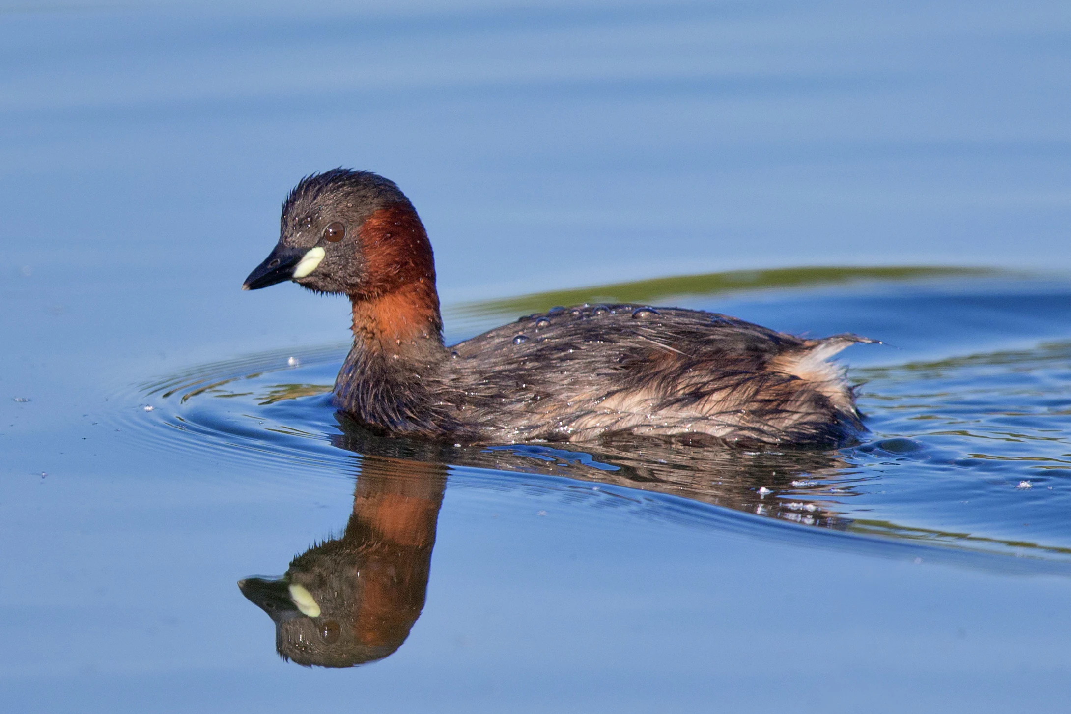
A small water bird, a Little Grebe, swimming on calm blue water with its reflection clearly visible below it.
A Little Grebe swimming in the wetlands of the park.

Moore und Heiden des westlichen Münsterlandes history and protected-area timeline

The site's formal recognition dates to 1983, when the Regierungspräsidium Münster issued the ordinance designating Moore und Heiden des westlichen Münsterlandes as a European Bird Protection Area under the EU Birds Directive. The designation brought together a patchwork of existing nature reserves and unprotected peat and heath fragments into a single coordinated conservation framework.

Within the bird protection area lie several established Naturschutzgebiete with their own conservation histories, including Amtsvenn-Hündfelder Moor, Zwillbrocker Venn, Lüntener Fischteiche, Ellewicker Feld, Krosewicker Grenzwald, Ammeloer Venn, Bennekampshaar, Lüntener Wald, Witte Venn and the western part of the Eper-Graeser Venn. The former ammunition depot at Lünten, now a DBU Naturerbe site, was later added to the protected mosaic, extending conservation management onto former military land.

The defining ecological event of recent decades has been the establishment, in 1993, of a breeding colony of Greater Flamingos in the Zwillbrocker Venn. The first chicks fledged that year, marking the northernmost successful flamingo breeding globally and giving the area a unique profile within the European nature conservation system. Over time, the site has come to function as a model for hydrological restoration and for integrating traditional agricultural use with the conservation of peatland bird communities.

Moore und Heiden des westlichen Münsterlandes landscape and geographic character

The landscape is shaped by low-lying Pleistocene sands overlain by peat deposits, producing a gentle, flat to slightly undulating terrain typical of the western Münsterland. The protected fragments are clustered close to the German-Dutch border, where raised bog remnants alternate with wet heath, dry heath, mown wet meadows, scattered oak-birch forest on sand, and bog woodland (Moorwald) along peat edges.

Small standing waters, including dystrophic and eutrophic lakes, ponds and peat pools, interrupt the open ground. Groundwater levels are critical across the area and have been the focus of restoration in several sub-sites. The Zwillbrocker Venn, as the largest and best-known bog complex within the site, combines open water, reedbeds, wet meadows and low heaths in a relatively compact layout, while sites such as Amtsvenn-Hündfelder Moor and Ellewicker Feld extend the same general character across larger surrounding moors. The impression is of a quiet, open, water-dominated cultural landscape rather than a dramatic mountain or coastal setting.
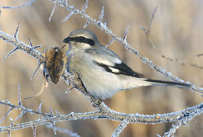
A Great Grey Shrike perched on a frost-covered, thorny branch with a small mammal carcass impaled on a thorn.
A Great Grey Shrike perched on a frost-covered branch, displaying its typical behavior of impaling prey on thorns.

Moore und Heiden des westlichen Münsterlandes ecosystems, habitats, and plant life

Ecologically, the area is dominated by peatland and wet grassland habitats. The habitat class breakdown shows that wet and mesophilic grassland, raised bogs and swamps, and farmland together account for the great majority of the surface, with smaller but ecologically vital shares of dry heathland, deciduous forest and bog woodland.

Several priority and rare habitat types are present. These include oligotrophic to mesotrophic standing waters with Littorelletea and Isoëtion vegetation, natural eutrophic lakes, dystrophic lakes and ponds, wet North Atlantic heaths with Erica tetralix, dry European heaths, lowland hay meadows, degraded raised bogs still capable of regeneration, bog pools and hollows, old acidic oak forests with Quercus robur on sand, and threatened bog woodland. The bog woodland in particular is listed as a priority habitat type for which the European Community bears special responsibility.

Hydrology is the central ecological driver. Many of the conservation measures in the area focus on stabilising high groundwater levels, protecting open water surfaces and preventing the drying and afforestation of peatland. The combination of intact peatland, traditional wet meadows and structurally rich heath creates a layered habitat mosaic that supports a wide range of breeding, migrating and wintering bird species.
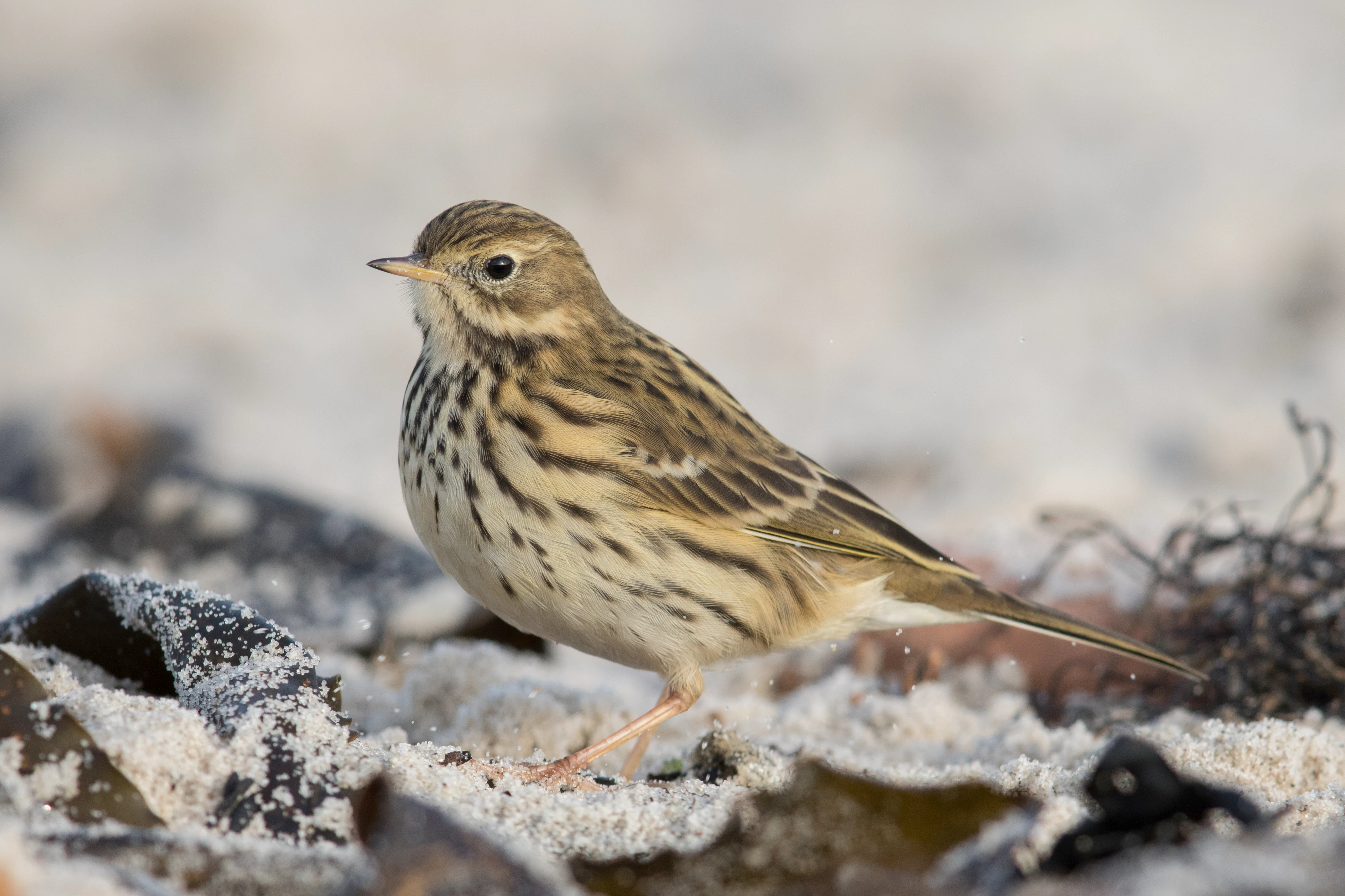
A small brownish meadow pipit bird with dark streaks on its breast, standing on a sandy ground with scattered dark organic debris.
A meadow pipit standing in sandy terrain.

Moore und Heiden des westlichen Münsterlandes wildlife and species highlights

The area is primarily significant for its bird fauna, and protection targets a long list of breeding, migratory and wintering species. Among breeding birds, key species include Bluethroat, Eurasian Curlew, Black-tailed Godwit, Common Redshank, European Nightjar, Northern Lapwing, Garganey, Common Teal, Northern Shoveler, Snipe, Black-headed Gull-type Mediterranean Gull, Savi's Warbler, Spotted Crake, Water Rail, Marsh Harrier, Black Woodpecker, Lesser Spotted Woodpecker, Red-backed Shrike, Whinchat, European Stonechat, Common Rosefinch's relative the Golden Oriole, Hobby, Common Quail's larger relative the Corncrake, and Little Grebe.

The site is also a recognised staging and wintering area for migratory waterbirds. Regular species include Barnacle Goose, Bean Goose, Greylag Goose, White-fronted Goose, Tundra Swan, Whooper Swan's relative the Bewick's Swan type, Northern Pintail, Eurasian Wigeon, Common Goldeneye, Goosander, Great Egret, Hen Harrier, Merlin, Peregrine Falcon, Common Crane, Black-tailed Godwit in flocks, Spotted Redshank, Greenshank, Ruff, Wood Sandpiper, Green Sandpiper, Dunlin, Eurasian Curlew flocks, and Short-eared Owl.

The world's northernmost breeding colony of Greater Flamingo is located in the Zwillbrocker Venn part of the site. Flamingos have bred successfully here since 1993 and use the Rhine-Meuse delta in the Netherlands as their wintering quarters. The combination of rare breeding waders and ducks, an internationally exceptional flamingo colony, and a diverse suite of migratory waterfowl gives the site a profile that goes well beyond the regional scale.
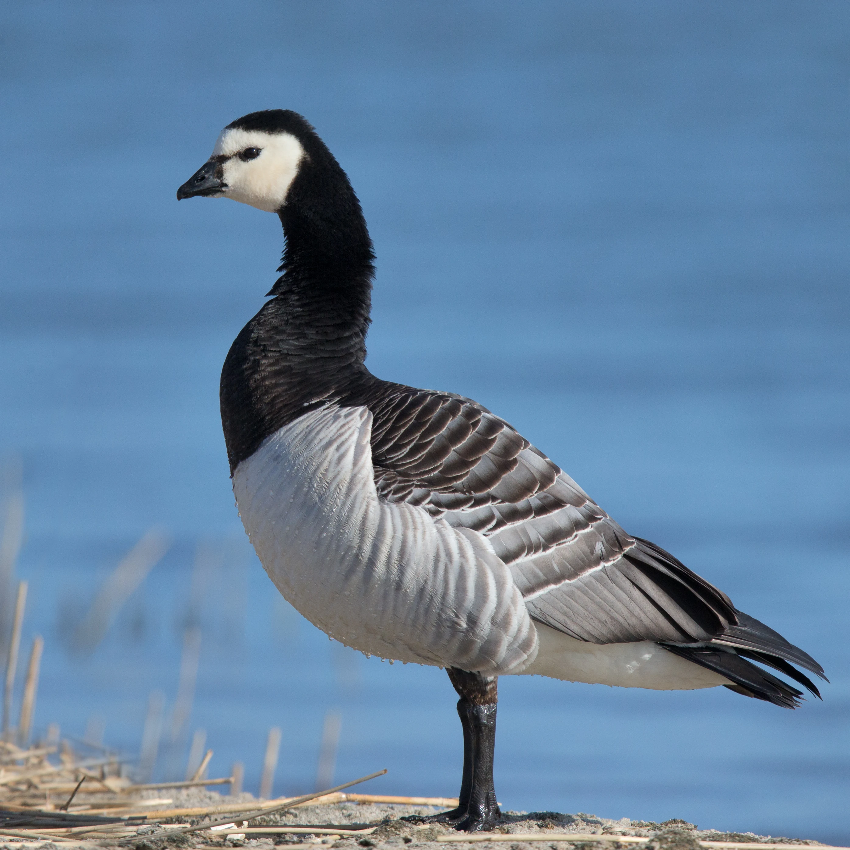
A barnacle goose with a white face, black neck, and grey patterned wings standing on a bank with blue water in the background.
A barnacle goose standing near the water in the Moore und Heiden des westlichen Münsterlandes.

Moore und Heiden des westlichen Münsterlandes conservation status and protection priorities

The site's conservation significance is defined by its role under the EU Birds Directive, which obliges member states to protect the habitats of wild bird species occurring in the EU. As a designated Special Protection Area (SPA), Moore und Heiden des westlichen Münsterlandes is part of the European Natura 2000 network and is protected both for its individual species and for the coherence of its habitat mosaic.

Protection is targeted rather than uniform. Each principal species has its own conservation objectives, ranging from maintaining high groundwater tables and preventing scrub encroachment in Bluethroat and Snipe habitat, through protecting dry heath with juniper and open sand patches for European Nightjar, to maintaining prey-rich open landscapes for Hen Harrier, Merlin and Short-eared Owl. The Mediterranean Gull requires undisturbed, sparsely vegetated islands and shorelines during its April-to-July breeding period.

A core conservation theme is hydrological restoration. Across the six sub-areas, measures focus on raising and stabilising water tables, restoring peat-forming vegetation, keeping wet meadows open through late mowing and reduced livestock grazing, avoiding fertiliser and pesticide inputs near breeding sites, and keeping recreational pressure away from sensitive colonies. The presence of priority habitat types, including bog woodland and degraded but restorable raised bogs, adds a Europe-level responsibility to the local management of the site.

Moore und Heiden des westlichen Münsterlandes cultural meaning and human context

The moors and heaths of the western Münsterland are an old cultural landscape. Peat cutting, low-intensity grazing, hay-making on species-rich wet meadows, and small-scale heathland management have shaped the area for centuries and produced the very openness on which the bird fauna now depends. The mosaic of farms, villages, field paths and remnant semi-natural habitats around the protected fragments remains an integral part of the landscape character.

Several of the constituent nature reserves, such as Zwillbrocker Venn, Amtsvenn and Ellewicker Feld, are tightly intertwined with local identity in the towns of Ahaus, Vreden and Gronau. The former ammunition depot at Lünten, now managed as a DBU Naturerbefläche, shows how former military land in the border region has been progressively returned to nature. The international dimension of the site, including the world's northernmost Greater Flamingo colony, also connects a quiet local cultural landscape to broader European conservation narratives.
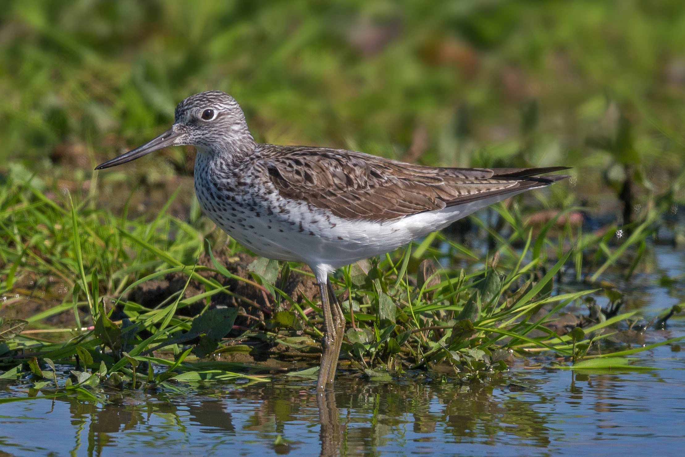
A common greenshank bird standing in shallow water among green marsh grasses.
A common greenshank wading in the wetlands of the Münsterland region.

Top sights and standout views in Moore und Heiden des westlichen Münsterlandes

Six interconnected sub-areas along the Dutch border collectively preserve one of the last large coherent bog complexes in North Rhine-Westphalia, combining raised bogs, wet and dry heath, wet meadows, old oak forest on sand and bog woodland.

The site is the most important breeding area in the state for Bluethroat, Mediterranean Gull and European Nightjar, and protects an outstanding suite of waders, ducks and reedbed species. It also hosts the world's northernmost breeding colony of Greater Flamingo at the Zwillbrocker Venn, an internationally exceptional feature for a site at this latitude.
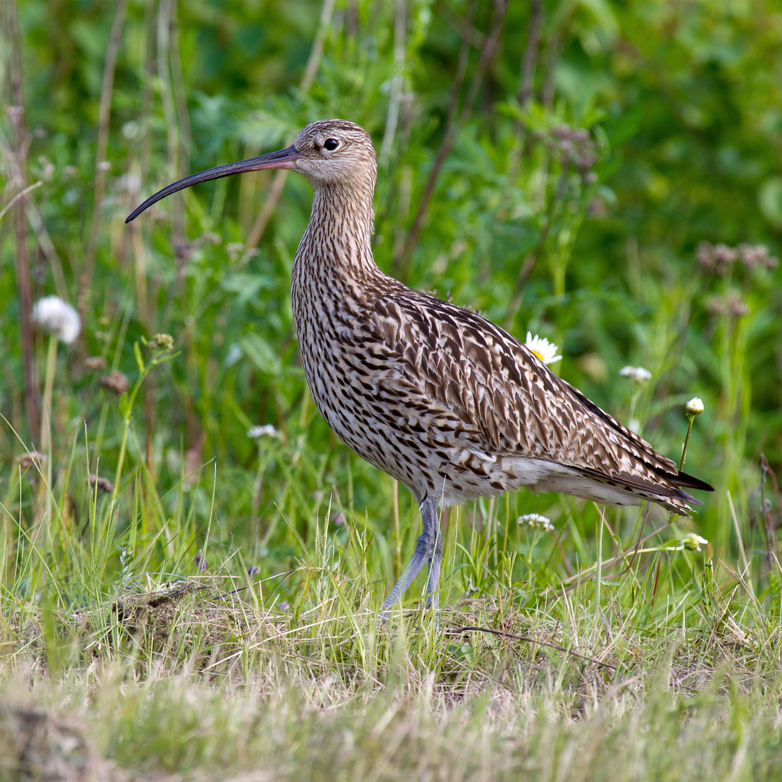
A side profile view of a Eurasian Curlew with a long curved bill standing in a meadow of green grass and small wildflowers.
A Eurasian Curlew standing in the grassy meadows of the protected area.

Best time to visit Moore und Heiden des westlichen Münsterlandes

The ecological character of the area is strongly seasonal. Spring and early summer bring breeding activity for waders, ducks and reedbed birds, with most species concentrated between March and July; this is also when wet meadows and heaths are at their most diverse in flowering plants and insects.

Late summer and autumn bring migratory geese, ducks and waders to the wet meadows and open water, and winter brings flocks of Barnacle Goose, Bean Goose, Whooper-type swans and large roosts of Hen Harrier and Merlin across the open agricultural edges of the moors. The protected character of the site means access is generally restricted to marked paths and observation points, so visiting for birdwatching and quiet landscape experience is best planned around dawn and dusk hours outside the sensitive breeding season.

Monthly climate preview

Long-term annual temperature and precipitation normals for Moore und Heiden des westlichen Münsterlandes

Moore und Heiden des westlichen Münsterlandes climate and temperature profile

Representative coordinates record measured monthly temperature swings from sub-zero winter minimums to warm summer maximums alongside steady year-round precipitation rates. Examining the full twelve-month dataset reveals detailed long-term climate normals across the protected landscape.
Annual mean10 °C
2 °C18 °C
Jan
Feb
Mar
Apr
May13°
Jun16°
Jul18°
Aug18°
Sep15°
Oct10°
Nov
Dec
Warmest month
July

18.4 °C

Coolest month
January

1.6 °C

Wettest month
December

2.5 mm/day

Driest month
April

1.5 mm/day

Park location guide

Geography guide, regional context, and park location map for Moore und Heiden des westlichen Münsterlandes

Moore und Heiden des westlichen Münsterlandes park geography, regions, and map view in Germany

Understand where Moore und Heiden des westlichen Münsterlandes sits in Germany through a broader geographic reading of the surrounding landscape, nearby location context, and its mapped position within the national park landscape.

How Moore und Heiden des westlichen Münsterlandes fits into Germany

Germany is a federal republic in Western and Central Europe with a population of over 83 million across sixteen constituent states. It is Europe's largest economy by nominal GDP and a major global exporter and importer. The capital is Berlin, and the country borders Denmark, Poland, Czech Republic, Austria, Switzerland, France, Luxembourg, Belgium, and the Netherlands.

Wider geography shaping Moore und Heiden des westlichen Münsterlandes in Germany

Germany is located in Western and Central Europe, spanning 357,022 km². It borders Denmark to the north, Poland and the Czech Republic to the east, Austria and Switzerland to the south, and France, Luxembourg, Belgium, and the Netherlands to the west. The country has coastlines on the Baltic Sea and North Sea to the north, with the Alps located in the southern region.

Map view of Moore und Heiden des westlichen Münsterlandes

Use this park location map to pinpoint Moore und Heiden des westlichen Münsterlandes in Germany, understand its exact geographic position, and read its mapped placement within the surrounding landscape more clearly.

Pigeon | © OpenStreetMap contributors

Location context for Moore und Heiden des westlichen Münsterlandes

Nordrhein-Westfalen

Visualizing the peatland terrain, wet heath habitats, and water-dominated scenery of the German-Dutch border region

Moore und Heiden des westlichen Münsterlandes Photos and Protected Landscape Imagery

Visual records reveal the flat Pleistocene sands, raised bogs, and interconnected heathland fragments that define the protected landscape. Examining these photographs helps observers understand the fragile hydrology and habitat diversity sustaining regional bird populations.

A small water bird, a Little Grebe, swimming on calm blue water with its reflection clearly visible below it.

A white great egret with a long yellow beak standing in tall green grass, looking down.

A Great Grey Shrike perched on a frost-covered, thorny branch with a small mammal carcass impaled on a thorn.

A small brownish meadow pipit bird with dark streaks on its breast, standing on a sandy ground with scattered dark organic debris.

A barnacle goose with a white face, black neck, and grey patterned wings standing on a bank with blue water in the background.

A black-tailed godwit with orange-brown plumage on its head and chest, and mottled brown wings, standing on a weathered wooden post against a blurred green background.

A common greenshank bird standing in shallow water among green marsh grasses.

A side profile view of a Eurasian Curlew with a long curved bill standing in a meadow of green grass and small wildflowers.

A common snipe with distinctive long bill and mottled brown plumage standing in shallow, muddy water.

A greater flamingo stands on a muddy shoreline alongside a small flock of white and grey black-headed gulls, with a lush green grassy bank in the background.

Park atlas

Compare surrounding wetland habitats and regional protected areas in northwestern Germany

Parks Near Moore und Heiden des westlichen Münsterlandes and Related Protected Landscapes

Browsing other parks near Moore und Heiden des westlichen Münsterlandes reveals connected peatland corridors and regional protected landscapes across the German and Dutch border. Expanding the comparison across nearby lowland reserves provides deeper insight into northwestern European wetland conservation networks.
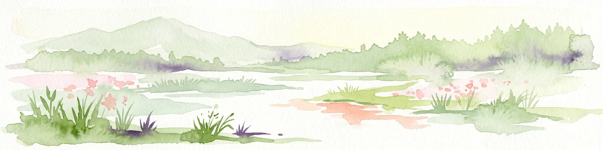
A soft, light watercolor painting of a serene marshy landscape with green hills, lush vegetation, and pink flowers in the foreground.
Nature reserveNordrhein-Westfalen
About 0.3 km away#1 closest

Northwest

Krosewicker Grenzwald Nature Reserve: Protected Woodland and Border Geography Atlas

Münsterland nature reserve with cross-border habitat significance

Krosewicker Grenzwald is a rare island of woodland set within the intensely cultivated agricultural plains of the western Münsterland. This nature reserve, straddling the German-Dutch border, supports specialized birch and pipegrass communities while functioning as a critical component of the broader Natura 2000 conservation framework.

Area
0.074 km²
Established
1985
IUCN
IV
Watercolor painting of a low-lying, marshy landscape with soft green meadows and sparse vegetation against a white background.
Nature reserveNorth Rhine-Westphalia
About 9.2 km away#2 closest

Northeast

Lüntener Fischteiche Nature Reserve: Geography and Protected Area Landscape Map

A preserved mosaic of Münsterland heath and bog ecosystems

Lüntener Fischteiche is a specialized nature reserve in North Rhine-Westphalia, documented here for its distinct heath-pond character and ecological significance within the German-Dutch borderland. The site preserves remnants of bog and heath vegetation embedded within a pine forest matrix, serving as an important hub for regional waterbird populations and transboundary habitat connectivity.

Area
1.011 km²
Established
1959
IUCN
IV
Nature reserveGelderland
About 11 km away#3 closest

Southwest

Korenburgerveen Nature Reserve: Geography and Protected Peatland Landscapes in Gelderland

A vital wetland and raised bog complex in the Dutch Achterhoek

Korenburgerveen represents a key protected peatland basin in Gelderland, featuring a diverse mosaic of marsh woodland, blue grassland, and active raised bog. Use this geographic entry to analyze the reserve's position within the wider Nationaal Landschap Winterswijk and observe the hydrological restoration of its rare wetland terrain.

Relief
Lowland
Climate
Temperate
Scope
Terrestrial
Water
Major water bodies
Nature reserveOverijssel
About 12 km away#4 closest

Northeast

Witte Veen Nature Reserve: Mapped Protected Landscapes and Bog Terrain in Overijssel, NL

Regional peatland geography and cross-border conservation status

Witte Veen is a protected nature reserve in eastern Overijssel, known for its distinct raised bog habitat and active restoration efforts. This site forms an essential link in the Dutch-German border chain, offering a unique look at fragmented wetland terrain, bog pools, and heathland ecosystems managed for ecological recovery.

Area
2.9 km²
Established
2013
Relief
Lowland
Climate
Temperate
Nature reserveGelderland
About 17 km away#5 closest

West

Stelkampsveld Protected Nature Reserve and Restored Achterhoek Kampenlandschap in Gelderland

Tracing the mapped boundaries of historic heath and fen ecosystems

Stelkampsveld acts as an ecologically distinctive protected area in the eastern Netherlands. Covering 102 hectares, the terrain showcases a recovered mosaic of hedgerows, small enclosed fields, and re-established wetlands. The site is recognized for its botanical diversity, including rare orchid and moss species within the broader Natura 2000 network of Gelderland.

Area
1.02 km²
Established
2013
Relief
Lowland
Climate
Temperate
Nature reserveNetherlands
About 18 km away#6 closest

South

Wooldse Veen Nature Reserve: Mapped Geography and Protected Bog Landscapes in the Netherlands

A transboundary peatland system in Gelderland.

Wooldse Veen preserves a rare fragment of raised bog and peatland habitat in the Dutch-German borderlands. The reserve features restored bog pools, historic smugglers paths, and a mosaic of heathland and birch woodland that reflects the regional geography of the Winterswijk National Landscape.

Area
1.5 km²
Established
1949
Relief
Lowland
Climate
Temperate
Nature reserveOverijssel
About 24 km away#7 closest

North

Landgoed Lonnekermeer Nature Reserve: Geographic Landscape and Protected Area Mapping

Twente region, Overijssel province, Netherlands

Landgoed Lonnekermeer is a 98 hectare nature reserve in Overijssel characterized by a designed early twentieth century landscape, lakes originating from historic sand quarries, and expansive wet heath. Explore the protected boundaries of this estate as it serves as a living model for habitat restoration, showcasing the successful recovery of local fens, brooks, and biodiversity-rich hay meadows within the eastern Netherlands.

Area
1.05 km²
Established
1902
Relief
Lowland
Climate
Temperate
Watercolor painting of a wide landscape with clusters of trees, green meadows, and soft, distant hills under a pastel sky.
Nature reserveOverijssel
About 29 km away#8 closest

Northwest

Borkeld Nature Reserve: Overijssel Protected Landscape and Geographic Atlas

Heathland, juniper shrubland, and prehistoric archaeological terrain

Discover the geographic character of the Borkeld nature reserve in Overijssel. This protected area stands out for its large juniper shrubland, unique clay pit habitats, and deep archaeological history preserved within a gently rolling landscape of forest and heath.

Area
6 km²
Relief
Upland
Climate
Temperate
Access
Easy access

Common questions about visiting, size, designation, and location context for Moore und Heiden des westlichen Münsterlandes

Moore und Heiden des westlichen Münsterlandes FAQs for park facts, access, geography, and protected area context

Find quick answers about Moore und Heiden des westlichen Münsterlandes, including protected-area facts, park geography, trail and visitor context, and how the park fits into its surrounding country and regional landscape.
MoriAtlas Explorer

Continue Your Protected Areas Search Across the Global Atlas

Deepen your exploration by continuing the structured search for national parks and protected areas worldwide. Utilize the comprehensive filtering capabilities to compare different conservation landscapes and refine your understanding of global park geography. Discover more about the distribution and characteristics of protected natural areas.

Global natural geography