
Mori Atlas logo
Wildlife reserveMount Charleston Wilderness

A rugged sky-island wilderness defined by ancient bristlecone pine forests and sharp ridgelines above the Mojave Desert

Mount Charleston Wilderness: Protected Mountain Terrain and High-Elevation Ecosystems in Southern Nevada

(Mount Charleston Wilderness Area)

The Mount Charleston Wilderness protects the dramatic crest of the Spring Mountains in southern Nevada. This wilderness area preserves a vital high-elevation ecosystem that rises abruptly from the surrounding Mojave Desert basin to reach subalpine summits. Through its network of forested slopes, deep canyons, and exposed ridges, the landscape functions as a critical natural sanctuary for ancient bristlecone pine groves and diverse mountain wildlife.

wilderness areamountain wildernessbristlecone pinesky island ecosystemSpring MountainsNevada mountains
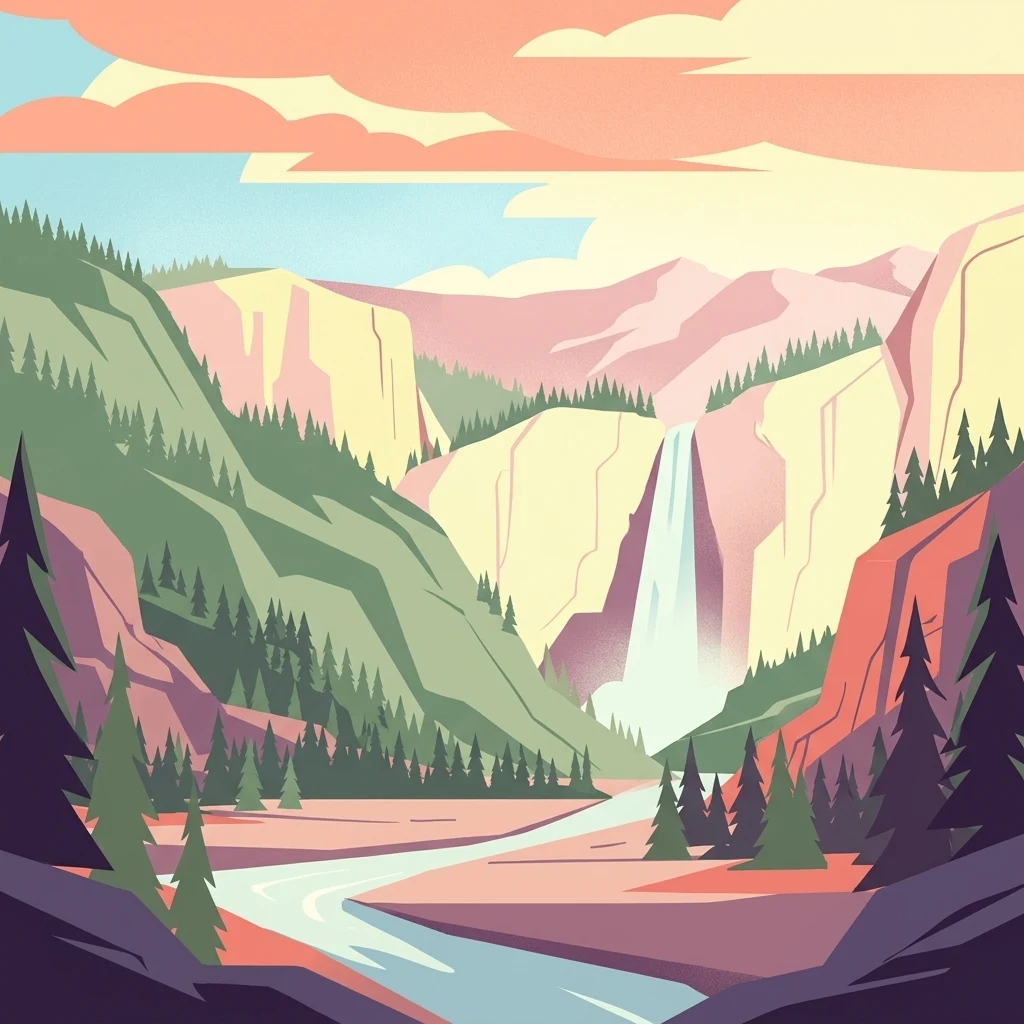
Stylized digital illustration of a mountain valley featuring a central waterfall, a flowing river, pine trees, and layered cliffs under a warm sky.

Mount Charleston Wilderness

Wildlife reserve

Park overview

Structured park overview, official facts, and landscape profile for Mount Charleston Wilderness

Mount Charleston Wilderness park facts, protected area profile, and essential visitor context

Review the core facts for Mount Charleston Wilderness, including designation, size, terrain, visitor scale, habitats, and operating context in one park-focused overview.

About Mount Charleston Wilderness

Mount Charleston Wilderness is one of southern Nevada's most significant natural areas and serves as a high-country counterpart to the desert landscapes that dominate Clark County. Tucked into the Spring Mountains Range within easy reach of Las Vegas, the wilderness protects a substantial block of mountain terrain that includes the highest peaks, deepest canyons, and most ecologically diverse habitats of the range. Its proximity to a major urban center, combined with its altitude and habitat diversity, gives it an outsized role in regional conservation and outdoor recreation.

The area's ecological importance is rooted in its elevation. While Las Vegas sits in one of the hottest valleys in North America, the Spring Mountains rise high enough to support pine forests, alpine zones, and cool microclimates that host species found nowhere else in the immediate region. This makes the wilderness a classic example of a sky-island ecosystem, where isolated mountain habitats preserve biodiversity that cannot survive in the surrounding lowlands.

For the U.S. Forest Service and the Bureau of Land Management, the wilderness represents both a conservation success and an ongoing management responsibility. Protection under the Wilderness Act of 1964 ensures that the landscape remains largely undeveloped, while its accessibility from a metropolitan area of millions of people places steady recreational demand on its trail system and natural resources. The wilderness therefore occupies an unusual position in the American protected-areas network: a remote-feeling mountain refuge located within an hour of a major city.

Quick facts and research context for Mount Charleston Wilderness

Mount Charleston Wilderness is a federally designated wilderness of about 57,442 acres in Clark County, Nevada, within the Spring Mountains Range. It lies west of Las Vegas and was established on January 1, 1989, as part of the National Wilderness Preservation System under the Wilderness Act of 1964. Management is shared between the U.S. Forest Service, which oversees the bulk of the area, and the Bureau of Land Management, which administers a smaller portion.

The wilderness encompasses the highest peaks of the Spring Mountains, including Charleston Peak at 11,908 feet, and protects roughly 18,000 acres of bristlecone pine forest. It also harbors the only known herd of Rocky Mountain elk in Clark County and supports populations of Palmer's chipmunk, an endangered species. Around 40 miles of trails connect the wilderness to the broader Spring Mountains National Recreation Area.

Protection and recognition

Explore terrestrial conservation parameters and international recognition frameworks

Mount Charleston Wilderness Protection Status and Recognition Data

Mount Charleston Wilderness maintains a documented terrestrial protection scope without imported international recognition sources. Review official conservation frameworks, management boundaries, and designation records associated with this protected landscape.

Protection details

Protection scope
Terrestrial
Transboundary protection
No
Park context

Deeper park guide and search-rich context for Mount Charleston Wilderness

Mount Charleston Wilderness history, landscape, wildlife, and travel context

Explore Mount Charleston Wilderness through its history, landscape character, ecosystems, wildlife, conservation priorities, cultural context, and seasonal travel timing in a structured park guide built for atlas discovery and search intent.

Why Mount Charleston Wilderness stands out

The Mount Charleston Wilderness is best known for holding the largest concentration of bristlecone pines in the U.S. Intermountain Region, with roughly 18,000 acres of these ancient trees scattered across its high ridges. It also stands out for the dramatic ecological contrast it provides: a cool, forested mountain environment rising abruptly above one of the hottest metropolitan areas in the American Southwest. The wilderness is closely associated with Charleston Peak, the highest summit in the Spring Mountains, and with the unusual biological richness of a sky-island ecosystem in the Mojave Desert region. Wildlife sightings, bristlecone pine groves, and the striking transition from desert basin to subalpine forest together define the wilderness's identity.
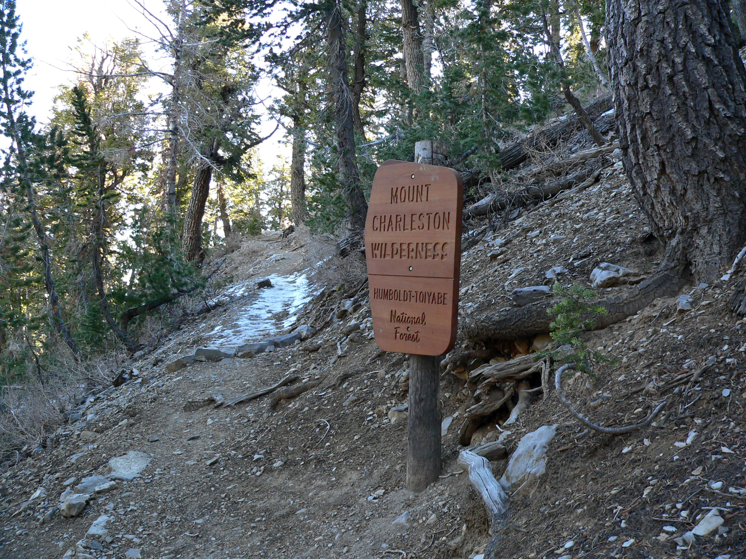
A brown wooden trail sign reading Mount Charleston Wilderness stands on a dirt path surrounded by evergreen trees in a mountain forest.
A wooden sign marks the entrance to the Mount Charleston Wilderness along the South Loop Trail.

Mount Charleston Wilderness history and protected-area timeline

The Mount Charleston Wilderness Area was created by the U.S. Congress on January 1, 1989, as part of the ongoing expansion of the National Wilderness Preservation System. Its designation was made under the legal framework established by the Wilderness Act of 1964, which defines how Congress can set aside federal lands for permanent protection in their natural condition.

Since its designation, the wilderness has been co-managed by the U.S. Forest Service, which oversees the majority of the acreage within the Spring Mountains National Forest, and by the Bureau of Land Management, which administers a smaller, but ecologically significant, portion of the protected area. This shared management reflects the patchwork of federal land ownership in the Spring Mountains.

The 1989 designation placed formal legal protection on a landscape that had long served as a recreational and ecological escape from the Las Vegas Valley. In doing so, it strengthened the conservation standing of the broader Spring Mountains region and ensured that its bristlecone pine groves, elk habitat, and high-elevation ecosystems would remain shielded from future development pressures.

Mount Charleston Wilderness landscape and geographic character

The Mount Charleston Wilderness spans the full crest of the Spring Mountains Range, a prominent block of uplifted terrain rising sharply from the Mojave Desert basin. The defining geographic feature is Charleston Peak, which at 11,908 feet is the highest point in the range and one of the most prominent summits in southern Nevada. Around this peak, a network of ridges, deep canyons, and forested slopes shapes a mountainous landscape that feels a world apart from the arid lowlands below.

Elevation plays a central role in the area's scenery. The wilderness rises from pinyon-juniper woodlands in its lower reaches through ponderosa pine and mixed conifer forests to the high, exposed ridges where ancient bristlecone pines cling to rocky promontories. Because the mountains catch more precipitation than the surrounding desert and experience winter snowfall, they develop a distinctly alpine character at higher elevations, including cool summers that contrast sharply with the heat of nearby Las Vegas.

Geologically, the Spring Mountains belong to a complex system of fault-block ranges that characterize the Great Basin and Mojave regions. The result is a landscape of steep relief, sharp ridgelines, sheltered valleys, and long vistas across the desert basin. The wilderness's topography not only defines its scenic value but also creates the varied microclimates that support its unusual biological richness.

Mount Charleston Wilderness ecosystems, habitats, and plant life

Ecologically, the Mount Charleston Wilderness is defined by its role as a high-elevation island within an otherwise arid region. As elevation increases within the Spring Mountains, vegetation shifts dramatically from desert scrub and pinyon-juniper woodland through montane pine forests and finally into the subalpine zone dominated by bristlecone pine. This compressed layering of vegetation zones is typical of sky-island ecosystems in the American Southwest and supports a corresponding diversity of animal life.

The wilderness's most celebrated ecological feature is its bristlecone pine forest, with roughly 18,000 acres making up the largest such stand in the U.S. Intermountain Region. Bristlecone pines are among the longest-living organisms on Earth, and their presence lends the high ridges of Mount Charleston both ecological and scientific significance. The forests they form are slow-growing, drought-adapted, and resilient to harsh conditions.

Beyond its conifer forests, the wilderness includes a mosaic of rocky slopes, talus fields, sheltered canyons, and riparian pockets. These varied habitats support a wide range of wildlife and contribute to the area's role as a refugium for species that would not otherwise survive in the surrounding Mojave Desert landscape.

Mount Charleston Wilderness wildlife and species highlights

Wildlife in the Mount Charleston Wilderness reflects the diversity of habitats packed into the Spring Mountains, from low-elevation woodlands to high-elevation bristlecone pine forests. The wilderness is home to the only known herd of Rocky Mountain elk in Clark County, an unusual population that occupies a geographic niche normally associated with more northern or mountainous regions of the American West.

Among smaller mammals, the endangered Palmer's chipmunk is one of the most notable species in the wilderness. Restricted in range and dependent on the specific habitat conditions of the Spring Mountains, Palmer's chipmunk is often observed at campsites and along trails, making it both a conservation priority and a familiar presence for visitors. Other mammals typical of mountain habitats in the region, such as mule deer, are also associated with the wilderness's forested slopes and canyons.

Birdlife in the area benefits from the cooler, forested conditions that contrast with the surrounding desert basin, and raptors, songbirds, and resident montane species can be expected throughout the wilderness. Together, the mix of large ungulates, rare chipmunks, and montane bird communities gives the wilderness a wildlife profile that is unexpectedly rich for a mountain range embedded in the Mojave Desert.

Mount Charleston Wilderness conservation status and protection priorities

From a conservation standpoint, Mount Charleston Wilderness is significant as one of the largest and most ecologically intact protected areas in southern Nevada. Its 1989 designation under the Wilderness Act of 1964 placed formal federal protection on a landscape that safeguards roughly 18,000 acres of bristlecone pine forest, the largest such concentration in the Intermountain Region, along with the habitats of several sensitive species.

The wilderness also plays a critical role in preserving the genetic and ecological integrity of the Spring Mountains ecosystem. By limiting development, motorized access, and resource extraction, the designation helps maintain the natural conditions that allow long-lived bristlecone pine groves, the local elk herd, and endangered Palmer's chipmunk populations to persist. The wilderness thus contributes directly to biodiversity conservation in a region where climate stress and urban expansion are growing pressures.

Additionally, the protected area supports watershed functions for the surrounding region. The Spring Mountains absorb winter precipitation and release it gradually, supporting downstream ecosystems and human water needs in the Las Vegas area. In this sense, the wilderness is not only a refuge for rare species but also a key component of regional environmental resilience.

Top sights and standout views in Mount Charleston Wilderness

The Mount Charleston Wilderness stands out for combining ancient bristlecone pine forests, the highest peaks of the Spring Mountains, and rare wildlife in a single protected landscape. Its Charleston Peak, large bristlecone groves, and the only Clark County herd of Rocky Mountain elk define some of its most recognizable features.

Just as importantly, the wilderness provides a striking ecological transition from Mojave Desert lowlands to cool subalpine ridges. This dramatic shift, combined with shared management by the U.S. Forest Service and Bureau of Land Management, makes the area a notable example of federally protected mountain wilderness in the American Southwest.

Best time to visit Mount Charleston Wilderness

The Mount Charleston Wilderness is most attractive during the warmer months, when cooler mountain temperatures offer a sharp contrast to the heat of the Las Vegas Valley below. Spring and early summer are particularly good for wildflowers and active wildlife, while the bristlecone pine groves can be appreciated year-round against the high ridgelines.

Winter brings significant snowfall to the higher elevations, which can close roads and limit access, but also transforms the mountain into a snowy escape that stands in dramatic contrast to the surrounding desert. Visitors planning to explore higher trails should generally favor late spring through fall, when conditions on most of the wilderness's roughly 40 miles of trails are most accessible.

Monthly climate preview

Long-term representative temperature and precipitation patterns across the elevation

Mount Charleston Wilderness Climate Normals and Weather by Month

Representative coordinate records show measured monthly averages ranging from freezing winter lows to warm summer maximums alongside consistent precipitation rhythms. Examining the complete twelve-month climatology profile reveals detailed variations in historical temperature and moisture trends.
Annual mean14 °C
3 °C27 °C
Jan
Feb
Mar
Apr12°
May18°
Jun24°
Jul27°
Aug26°
Sep22°
Oct15°
Nov
Dec
Warmest month
July

27.2 °C

Coolest month
December

2.8 °C

Wettest month
February

1.1 mm/day

Driest month
June

0.1 mm/day

Park location guide

Geography guide, regional context, and park location map for Mount Charleston Wilderness

Mount Charleston Wilderness park geography, regions, and map view in United States of America

Understand where Mount Charleston Wilderness sits in United States of America through a broader geographic reading of the surrounding landscape, nearby location context, and its mapped position within the national park landscape.

How Mount Charleston Wilderness fits into United States of America

The United States of America is a federal presidential republic and one of the world's largest countries by area and population. It consists of 50 states across a vast territory spanning multiple time zones, with its capital in Washington, D.C. and largest city in New York City. The nation has a diverse economy, influential political system, and significant cultural and military presence globally.

Wider geography shaping Mount Charleston Wilderness in United States of America

The United States occupies a vast territory in North America, bordered by Canada to the north and Mexico to the south. The 48 contiguous states stretch from the Atlantic to the Pacific Ocean, while Alaska occupies the northwestern region and Hawaii is an archipelago in the Pacific. The country encompasses diverse terrain including the Rocky Mountains, Appalachian Mountains, Great Plains, and extensive river systems.

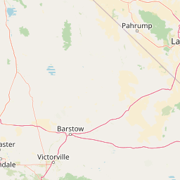
Map view of Mount Charleston Wilderness

Use this park location map to pinpoint Mount Charleston Wilderness in United States of America, understand its exact geographic position, and read its mapped placement within the surrounding landscape more clearly.

Pigeon | © OpenStreetMap contributors

Location context for Mount Charleston Wilderness

Clark CountyNevada
Recorded earthquake history

Explore Historical Earthquake Records for Mount Charleston Wilderness

Review documented seismic events associated with the Mount Charleston Wilderness geography. The MoriAtlas catalogue provides a structured way to observe historical event data, including magnitude and proximity, for this significant protected area in the Spring Mountains of southern Nevada.

Mount Charleston Wilderness Earthquake History

Catalogued events

64 events

Strongest magnitude

Magnitude 4.8

Most recent event

Aug 9, 2026

This history includes earthquakes recorded inside the park or within 50 km of its borders

Visual reference collection showcasing mountain terrain, ancient bristlecone pine forests, and alpine habitats.

Mount Charleston Wilderness Photos, Scenery, and Protected Landscape Views

Visual documentation captures the rugged mountain terrain and high elevation ecosystems that define Mount Charleston Wilderness. Detailed photography reveals the stark ecological contrast between arid desert lowlands and cool subalpine ridges.

A brown wooden trail sign reading Mount Charleston Wilderness stands on a dirt path surrounded by evergreen trees in a mountain forest.

A wide view of a mountain ridgeline with sparse coniferous trees and dry, grassy slopes under a partly cloudy sky.

Park atlas

Compare adjacent Mojave mountain ranges, alpine habitats, and protected desert terrain.

Explore Parks Near Mount Charleston Wilderness and Surrounding Protected Landscapes

Compare nearby national parks and protected areas sharing the rugged terrain of the Spring Mountains and surrounding desert basins. Broaden your geographic scope by examining connected high-elevation ecosystems and regional conservation landscapes.
A watercolor painting showing soft green hills, distant pink-hued mountains, and a pale blue lake in a serene, stylized landscape.
Protected landscapeNevada
Park boundaries overlap#1 closest

North

Humboldt, Toiyabe National Forest: Protected Landscape and Regional Mountain Geography

A vast network of Nevada mountain ranges and alpine wilderness

Humboldt, Toiyabe National Forest serves as a defining public land entity across Nevada and eastern California. As the largest national forest in the contiguous United States, it preserves a striking collection of isolated mountain ranges, including the Ruby Mountains and the rugged Jarbidge wilderness, within a broader basin-and-range landscape. Examine the boundaries and terrain that characterize this complex, high-desert ecosystem.

Area
25,454 km²
Established
1908
Relief
Mountain
Access
Easy access
Watercolor painting of green rolling hills and distant purple mountains with a small waterfall flowing into a body of water in the foreground.
Protected landscapeNevada
Park boundaries overlap#2 closest

Southwest

Spring Mountains National Recreation Area: Alpine Geography and Protected Mountain Landscapes

A rugged mountain anchor in the southern Nevada desert

Rising sharply from the desert floor, Spring Mountains National Recreation Area features dramatic elevation shifts across 316,000 acres of forested canyons and rocky ridges. This protected landscape preserves vital mountain habitat and diverse terrain, ranging from pinyon-juniper woodlands to high-alpine environments near Mount Charleston, serving as a distinct natural contrast to the Mojave surroundings.

Area
1,280 km²
Established
1993
IUCN
V
Relief
Mountain
National parkCalifornia
45 km away#3 closest

West

Death Valley National Park: Exploring California's Mapped Protected Landscape

View the geographic boundaries and desert terrain.

Access a detailed atlas perspective of Death Valley National Park, a protected national park situated in California. Understand the park's distinct mapped boundaries and its role within the regional geography. This resource highlights the unique desert landscape, offering focused insights into its protected-area identity and natural terrain for geographic discovery.

Area
13,848.4 km²
Established
1994
IUCN
II
Visitors
1.1M annual
A watercolor painting showing a soft-toned landscape with a winding river in the foreground, a forested middle ground, and rolling mountains in the distance.
Protected landscapeUnited States of America
60 km away#4 closest

East

Lake Mead National Recreation Area: Desert Reservoir and Protected Landscape Atlas

United States protected geography and reservoir terrain

Spanning the lower Colorado River, Lake Mead National Recreation Area represents a unique convergence of desert ecosystems and large-scale water management. Its geography includes extensive reservoir shorelines, deep canyon corridors, and volcanic basin terrain that provide a foundational look at the arid environments of the American Southwest. The area remains a significant study of how engineered water features alter and interact with complex desert landscapes.

Area
6,053.31 km²
Established
1936
IUCN
V
Visitors
6.4M annual
Wildlife reserveNevada
About 70 km away#5 closest

Southeast

Jimbilnan Wilderness: Geographic Overview and Protected Desert Landscape in Nevada

Mapping the canyons, washes, and plateaus of the Black Mountains

Jimbilnan Wilderness offers a dense mosaic of Mojave Desert habitats within a compact protected footprint. Located in Clark County, this Nevada wildlife reserve features a transition from deep, rocky canyons carved into the Black Mountains to wide desert washes and benches near Lake Mead. The area is notable for its botanical diversity, including rare milkvetch and buckwheat, serving as a critical link between upland desert systems and the lacustrine environment of the reservoir.

Area
76.4 km²
Established
2002
IUCN
Ib
Relief
Mountain
A horizontal watercolor painting depicting soft desert hills in shades of green, yellow, and soft pink.
Wildlife reserveClark County
About 78 km away#6 closest

East

Muddy Mountains Wilderness: Geographic Atlas and Protected Desert Landscape Map

Exploration of sandstone terrain and Clark County topography.

Navigate the complex desert geography of the Muddy Mountains Wilderness, a protected area characterized by its vivid red cliffs, ancient cross-bedded sandstone, and steep elevation gains. This atlas entry provides essential context on the wilderness boundaries, regional landscape patterns, and environmental features that define this significant Mojave Desert refuge.

Area
194.87 km²
Established
2002
Relief
Mountain
Water
Minor water
Wildlife reserveNevada
About 98 km away#7 closest

Southeast

Ireteba Peaks Wilderness: Protected Desert Mountains and Lake Mohave Reservoir Shoreline

Mapping the Eldorado Mountains within southern Nevada desert protected areas.

Spanning the southern Eldorado Mountains and the northern shores of Lake Mohave, Ireteba Peaks Wilderness represents a critical Mojave Desert protected area. This landscape integrates rugged, rocky ridgelines with arid desert slopes and reservoir inlets. Its geographic character, shaped by both federal wilderness designation and proximity to the Avi Kwa Ame National Monument, preserves a vital slice of Nevada desert terrain and native ecological habitat.

Area
132.51 km²
Established
2002
IUCN
Ib
Relief
Mountain
Wildlife reserveClark County
About 127 km away#8 closest

East

Jumbo Springs Wilderness: Geographic Profile and Protected Landscape Atlas

A rugged desert preserve in Clark County, Nevada

Jumbo Springs Wilderness preserves a dense concentration of desert geology within a compact footprint. Users can analyze the protected boundaries, which feature Precambrian metamorphic formations and granitic domes that rise above arid drainages. This area functions as a critical desert refuge near the Lake Mead reservoir, providing a distinct look at the transition between rocky mountain slopes and water-influenced desert microhabitats.

Area
18.74 km²
Established
2002
IUCN
Ib
Relief
Upland

Common questions about visiting, size, designation, and location context for Mount Charleston Wilderness

Mount Charleston Wilderness FAQs for park facts, access, geography, and protected area context

Find quick answers about Mount Charleston Wilderness, including protected-area facts, park geography, trail and visitor context, and how the park fits into its surrounding country and regional landscape.
MoriAtlas Explorer

Continue Your Protected Areas Search Across the Global Atlas

Deepen your exploration by continuing the structured search for national parks and protected areas worldwide. Utilize the comprehensive filtering capabilities to compare different conservation landscapes and refine your understanding of global park geography. Discover more about the distribution and characteristics of protected natural areas.

Global natural geography