
Mori Atlas logo
Nature reserveMount Makiling

Tracing the geological contours and protected forest boundaries of this iconic Philippine stratovolcano

Mount Makiling Forest Reserve and Volcanic Landscape in the Calabarzon Region of Luzon

(Makiling Forest Reserve)

Mount Makiling stands as a prominent stratovolcanic feature and protected forest reserve within the Calabarzon region. This inactive volcano serves as a foundational landmark in the conservation history of the Philippines, encompassing a diverse array of volcanic landforms, geothermal hot springs, and vital watershed ecosystems. By exploring the mapped boundaries and complex terrain of the mountain, one can better understand its role as a regional anchor for biodiversity, education, and enduring cultural heritage.

inactive volcanostratovolcanoforest reserveformer national parkASEAN Heritage Parkwatershed
Vector-style illustration of a large mountain range with a river, waterfalls, and coniferous forest in the foreground.

Mount Makiling

Nature reserve

Park overview

Structured park overview, official facts, and landscape profile for Mount Makiling

Mount Makiling park facts, protected area profile, and essential visitor context

Review the core facts for Mount Makiling, including designation, size, terrain, visitor scale, habitats, and operating context in one park-focused overview.

About Mount Makiling

Mount Makiling is a heavily forested extinct-looking volcanic mountain sitting between the populated lowlands of Laguna and Batangas, just south of Metro Manila. Although classified as inactive, it remains a landmark on the Luzon landscape, visible from highways such as the South Luzon Expressway and recognizable across the Calabarzon skyline. Its slopes rise from agricultural and urban areas into dense forest that supports a wide range of ecological, educational, and cultural functions.

As a protected area, Mount Makiling carries a remarkable institutional history. From its origins as a forest reserve in 1910, to its designation as the first national park of the Philippines in 1933, to its reclassification as a university-administered forest reserve in the 1960s, and its elevation to ASEAN Heritage Park in 2013, the mountain has been a testbed for Philippine conservation policy. It is now managed by the University of the Philippines Los Baños, where it functions as a living laboratory for forestry, biodiversity, and watershed studies.

Ecologically, the mountain is significant as a forested watershed that feeds numerous rivers and creeks and supports biodiversity in a region otherwise dominated by lowland development and agriculture. Geologically, it is a stratovolcano with mud springs, hot springs, satellite hills, small cones, and a maar lake, all of which reveal its eruptive past within the Laguna Volcanic Field. Culturally, it has long been imagined as the home of Maria Makiling and remains a popular hiking destination as well as a sacred mountain for pilgrims and local communities.

Quick facts and research context for Mount Makiling

Mount Makiling is an inactive stratovolcano located on the island of Luzon in the Philippines, spanning the boundary of Laguna and Batangas provinces within the Calabarzon region. At roughly 1,090 meters in elevation, it is the dominant peak of the Laguna Volcanic Field and an important watershed for nearby towns and Laguna de Bay.

The mountain was declared the first national park of the Philippines in 1933 under Proclamation No. 552, then reclassified and transferred to the University of the Philippines Los Baños in 1963, becoming the Makiling Forest Reserve under university administration. It was later recognized as an ASEAN Heritage Park in 2013. Mud springs, hot springs, secondary cones, crater lakes, and a network of rivers are all part of its volcanic and hydrological makeup.

Protection and recognition

Terrestrial protected area framework and designation records established in 2013

Mount Makiling Protection Status and Designated Conservation History

Mount Makiling maintains a documented terrestrial protection status established through official designation records from 2013. Structured conservation data outlines the established management scope and baseline regulatory framework associated with the natural reserve.

Protection details

Protection scope
Terrestrial
Designated year
2013
Transboundary protection
No
Park context

Deeper park guide and search-rich context for Mount Makiling

Mount Makiling history, landscape, wildlife, and travel context

Explore Mount Makiling through its history, landscape character, ecosystems, wildlife, conservation priorities, cultural context, and seasonal travel timing in a structured park guide built for atlas discovery and search intent.

Why Mount Makiling stands out

Mount Makiling is best known as the first national park of the Philippines and as a deeply layered forest reserve with both volcanic and cultural significance. Its status as the country's pioneering national park, combined with its later role as a university-managed forest reserve and ASEAN Heritage Park, gives it a uniquely important place in the country's conservation history. Equally distinctive is the mountain's cultural identity. Mount Makiling is associated with the legendary guardian Maria Makiling, who is said to dwell within its slopes, and many visitors and pilgrims regard the mountain as a sacred landscape. Its family of subsidiary cones, maars such as Alligator Lake, and a network of rivers and hot springs further define the mountain's profile as a volcanic landform with both ecological and mythic character.
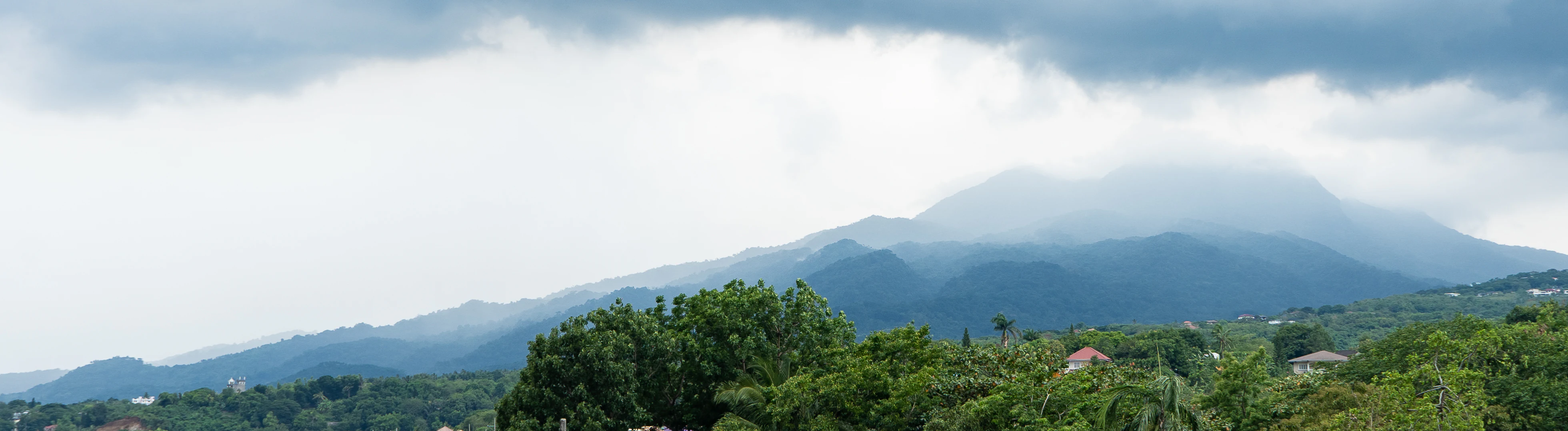
A wide shot of the Mount Makiling stratovolcano, partly obscured by clouds and mist, rising above a foreground of lush green trees and distant residential buildings.
A view of Mount Makiling from the surrounding landscape in Laguna.

Mount Makiling history and protected-area timeline

Mount Makiling's formal protection history begins with Proclamation No. 106 in 1910, when the Makiling Forest Reserve was established by Governor General William Cameron Forbes under the Bureau of Forestry. The reserve was intended to support a forest school and silvicultural research, marking the mountain as one of the earliest dedicated forest reserves in the American colonial Philippines.

In 1920, Proclamation No. 60 renamed the area the Makiling National Botanic Gardens, formalizing its scientific study role. The mountain's most consequential designation came on February 23, 1933, when Proclamation No. 552, issued by Governor General Theodore Roosevelt Jr., renamed it the Makiling National Park, making it the first national park of the Philippines. It was designated as a game refuge and a public benefit area, and additional forest blocks were added in 1937 through Proclamation No. 214.

The park's administration was later shifted to the Commission of Parks and Wildlife in 1952 under Republic Act 826. In 1960, Proclamation No. 692 transferred jurisdiction to the University of the Philippines for forestry education and research, and in 1963, Republic Act No. 3523 disestablished the national park and formally ceded it to the university as the Makiling Forest Reserve. Later developments included issuing Executive Order 224 in 1987 over watershed management to the National Power Corporation and Republic Act 6967 in 1990, which consolidated the reserve's administration under UPLB. Executive Order 121 in 1994 further connected the reserve's stewardship with the Laguna Lake region through a presidential development commission.

Mount Makiling landscape and geographic character

Mount Makiling is a stratovolcanic mountain whose contour is famously said to resemble a reclining figure. Its summit, Peak 2, sits at roughly 1,090 meters above sea level and rises sharply above the surrounding lowlands of Laguna and Batangas. The mountain is the tallest feature of the Laguna Volcanic Field and dominates the Calabarzon landscape, visible from major transportation corridors including the South Luzon Expressway and from high vantage points such as Tagaytay.

Surrounding the main peak are a series of smaller volcanic landforms that together give the massif a complex profile. Named hills include La Mesa Hill in Calamba, Mayondon Hill and Sison Hill in Los Baños, while a set of secondary mountains, including Mount Bijiang, Mount Camotes, Mount Masaia, Mount Cabulugan, Mount Buboy, Mount Bulalo, Mount Tamlong, and Mount Olila, encircle the central peak. The mountain also hosts Alligator Lake, a maar in Los Baños, as well as Mud Springs, often mistakenly identified as the volcanic crater.

The mountain's drainage network is equally rich. Subwatersheds including Molawin-Dampalit, Cambantoc, Greater Sipit, and Tigbi feed creeks and rivers such as the Munting River, Dampalit River, Molawin Creek, Sipit Creek, Pansipit Creek, Maitim River, and Calo River. Together these waterways support both natural ecosystems and downstream communities, and they help the mountain function as a major watershed in the region.
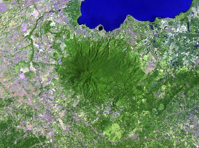
Top-down satellite imagery of Mount Makiling, appearing as a dense circular area of green forest surrounded by agricultural and urban land, with a large blue body of water to the north.
A satellite view showing the verdant, forest-covered massif of Mount Makiling rising above the surrounding landscape and adjacent to Laguna de Bay.

Mount Makiling ecosystems, habitats, and plant life

Mount Makiling's forests form one of the most ecologically significant forested blocks in southern Luzon. Because of its elevation gradient, varied terrain, and proximity to Laguna de Bay, the mountain supports a mosaic of lowland and upland vegetation types. Heavily wooded slopes, forested ridges, patchy openings, and disturbed vegetation near trails collectively shape its ecological character.

The mountain's protected status under the University of the Philippines Los Baños and its designation as an ASEAN Heritage Park highlight its biodiversity importance. As a working forest reserve tied to one of the country's principal forestry education institutions, Mount Makiling has long been associated with scientific study of tropical forest ecology, watershed function, and biodiversity conservation in the Philippines. The reserve acts as a green buffer between rapidly urbanizing lowlands and the lake system of Laguna de Bay.
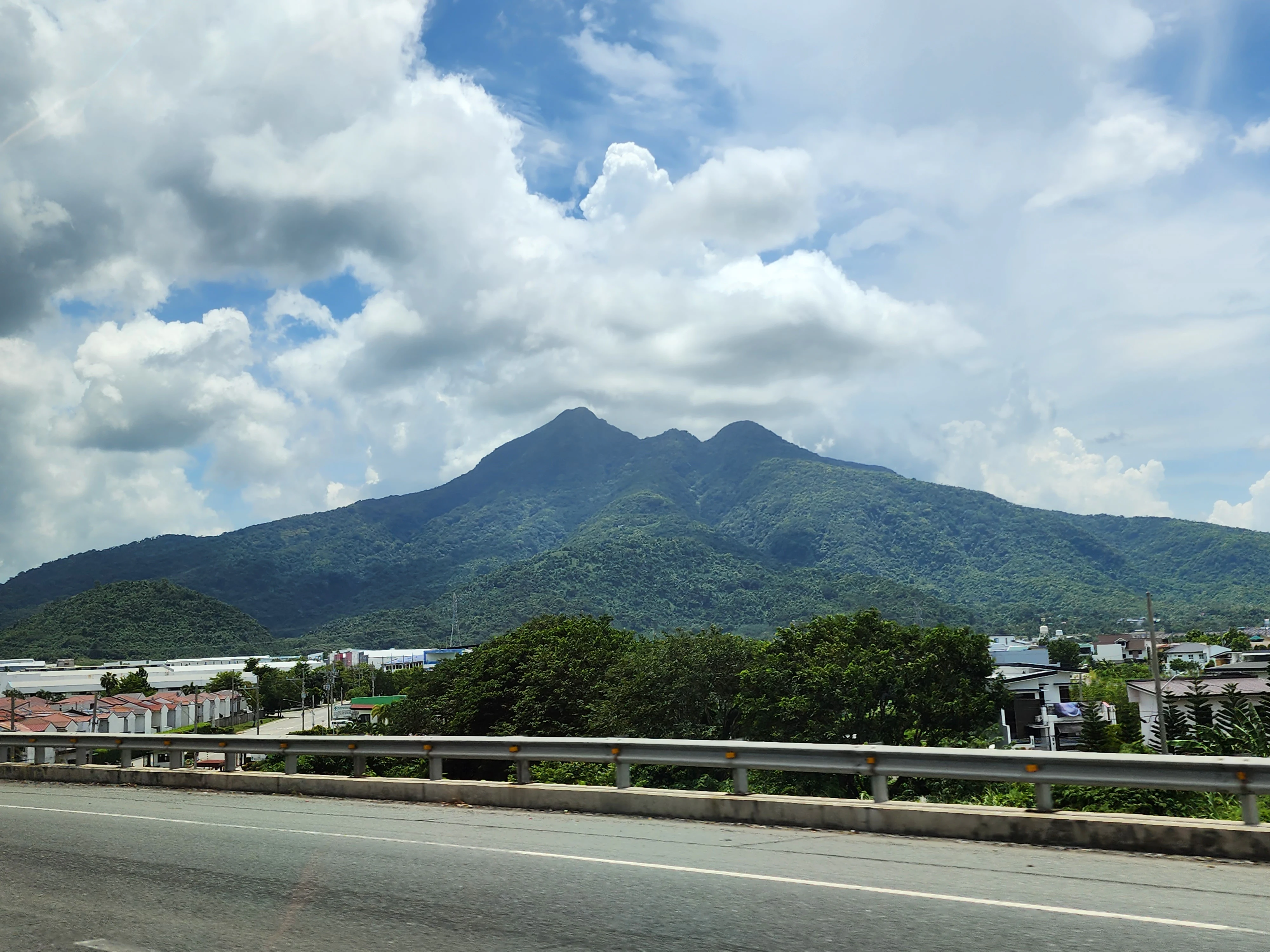
A wide view of the inactive stratovolcano Mount Makiling, covered in dense green forest, under a partly cloudy sky, with a highway guardrail and road in the foreground.
Mount Makiling viewed from the South Luzon Expressway.

Mount Makiling wildlife and species highlights

Mount Makiling's forested slopes support the wildlife communities typical of southern Luzon's tropical forest reserves. Its combination of continuous canopy cover, elevation change, and protected status has made it an important refuge for native fauna in a region under heavy human pressure. Hikers and researchers regularly describe the mountain as a site where leeches are common along the trails, a familiar feature of lowland and mid-elevation Philippine forests.

Beyond trail-level wildlife encounters, Mount Makiling's broader significance for fauna comes from its long use as a research and training site by the University of the Philippines Los Baños College of Forestry, where biodiversity studies in forestry, flora, and fauna have been a core part of its mission since the mid-twentieth century.
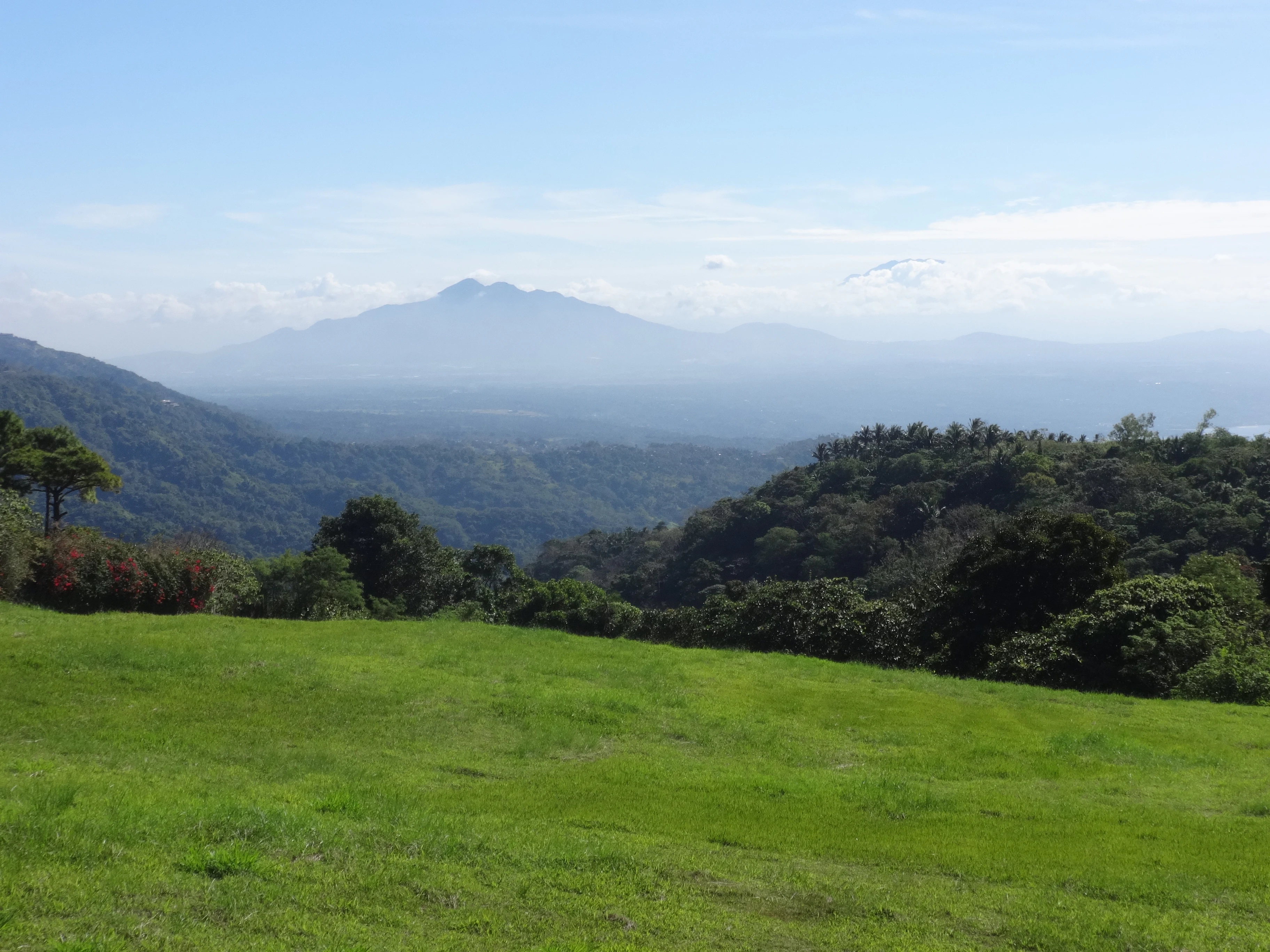
A wide, scenic view of Mount Makiling, an inactive stratovolcano, rising above layers of lush green forest and hilly terrain, viewed from a grassy field under a bright sky.
Mount Makiling viewed from the distance in Tagaytay, Philippines.

Mount Makiling conservation status and protection priorities

Mount Makiling holds a unique place in the Philippines' conservation history. It was the country's first national park when it was proclaimed in 1933, an early signal of how the Philippine government intended to protect natural and scenic landscapes for public benefit. Although it lost its formal national park status in 1963, the mountain continued to be protected through its designation as the Makiling Forest Reserve under the University of the Philippines Los Baños.

Today, the reserve is significant on multiple conservation fronts. It serves as a forested watershed for rivers that supply surrounding municipalities, supports biodiversity research and training at UPLB, and was declared an ASEAN Heritage Park in 2013 with the title "Mount Makiling Forest Reserve," recognizing its contribution to regional ecological heritage. The mountain's conservation role is closely intertwined with geothermal energy, given the Makiling-Banahaw Geothermal Plant to its south, and with broader policy on Laguna de Bay development through Executive Order 121 of 1994.

Mount Makiling cultural meaning and human context

Mount Makiling is one of the most mythologically significant mountains in the Philippines. According to longstanding Filipino folklore, the mountain is the home of Maria Makiling, a beautiful diwata, or nature spirit, who watches over the slopes, the surrounding wildlife, and the people who depend on the mountain's resources. In pre-Spanish tradition she was known simply as Makiling, said to have been sent by the supreme deity Bathala to aid humanity in daily life; the name "Maria" was later added during the Spanish colonial era as part of an effort to reframe indigenous belief under Catholic imagery.

The mountain's silhouette is often said to resemble Maria Makiling in a reclining posture, and stories tell of her withdrawing from human sight after being heartbroken by a mortal. Whether or not one accepts the legend literally, the mountain functions as a bundok dambana, a sacred mountain, in Calabarzon, and pilgrims, hikers, and local communities continue to treat it as a culturally charged landscape. Its mythology also gives Mount Makiling a firm place in Filipino art, where the diwata Maria Makiling is a recurring subject among painters, sculptors, and graphic novelists.
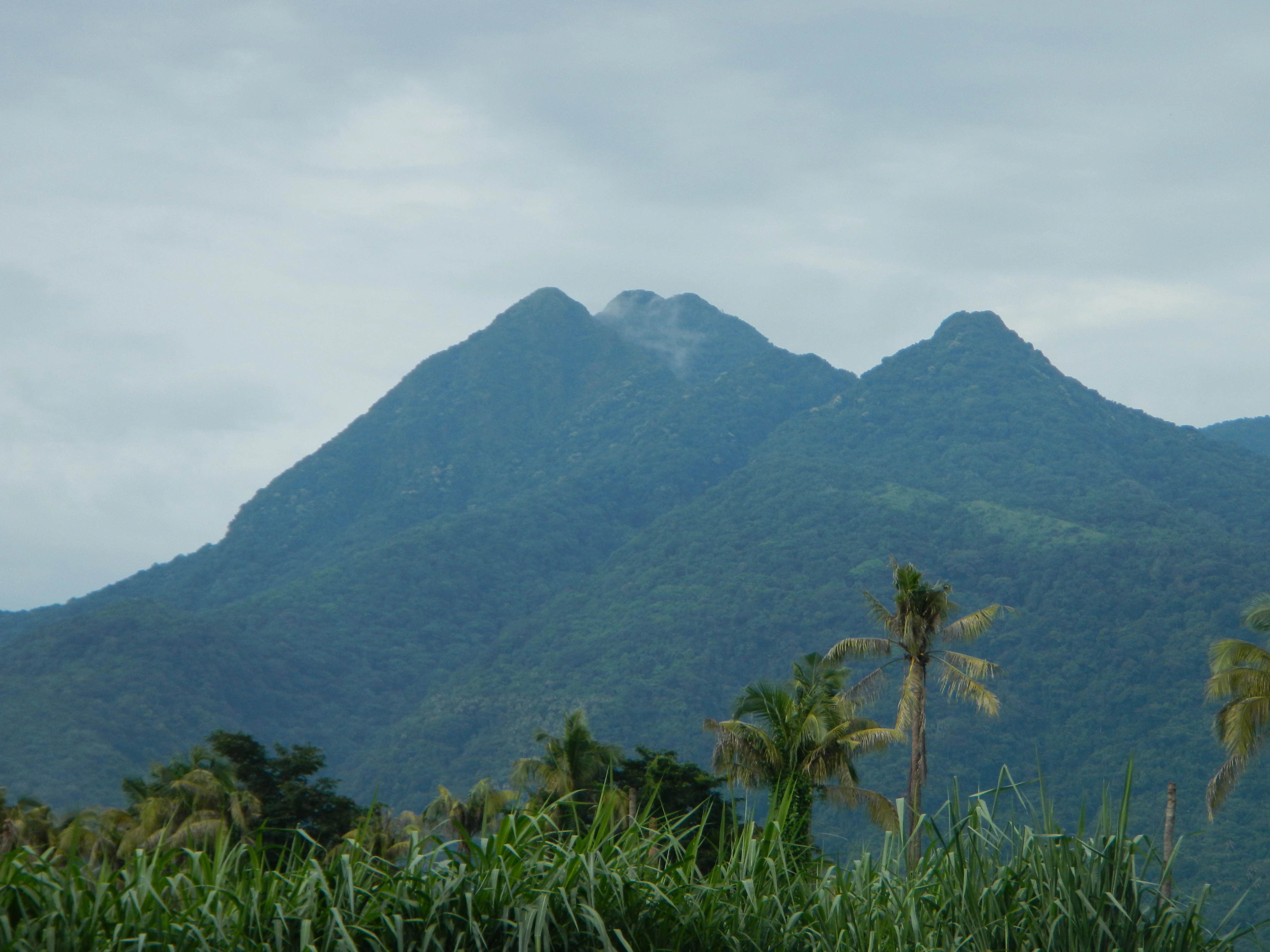
A wide, eye-level view of the verdant, rugged peaks of Mount Makiling under a cloudy sky, with tall grasses and palm trees in the foreground.
Mount Makiling as seen from the Maharlika Highway in Santo Tomas, Batangas.

Top sights and standout views in Mount Makiling

Mount Makiling stands out as a layered landmark: an inactive stratovolcano, a pioneering national park, a university-managed forest reserve, and an ASEAN Heritage Park all at once. The mountain's claim as the first national park of the Philippines gives it a foundational role in the country's conservation story, while its transfer to the University of the Philippines Los Baños reshaped it into a working research and education site.

Equally memorable is the mountain's natural and cultural texture, from the mud springs and hot springs that hint at its volcanic origins, to subsidiary cones like Mount Bijiang and Mount Masaia, to the maar lake known as Alligator Lake. Set against this physical richness is the enduring presence of the diwata Maria Makiling in local imagination, ensuring that Mount Makiling remains both a scientific and a mythic landmark on Luzon.
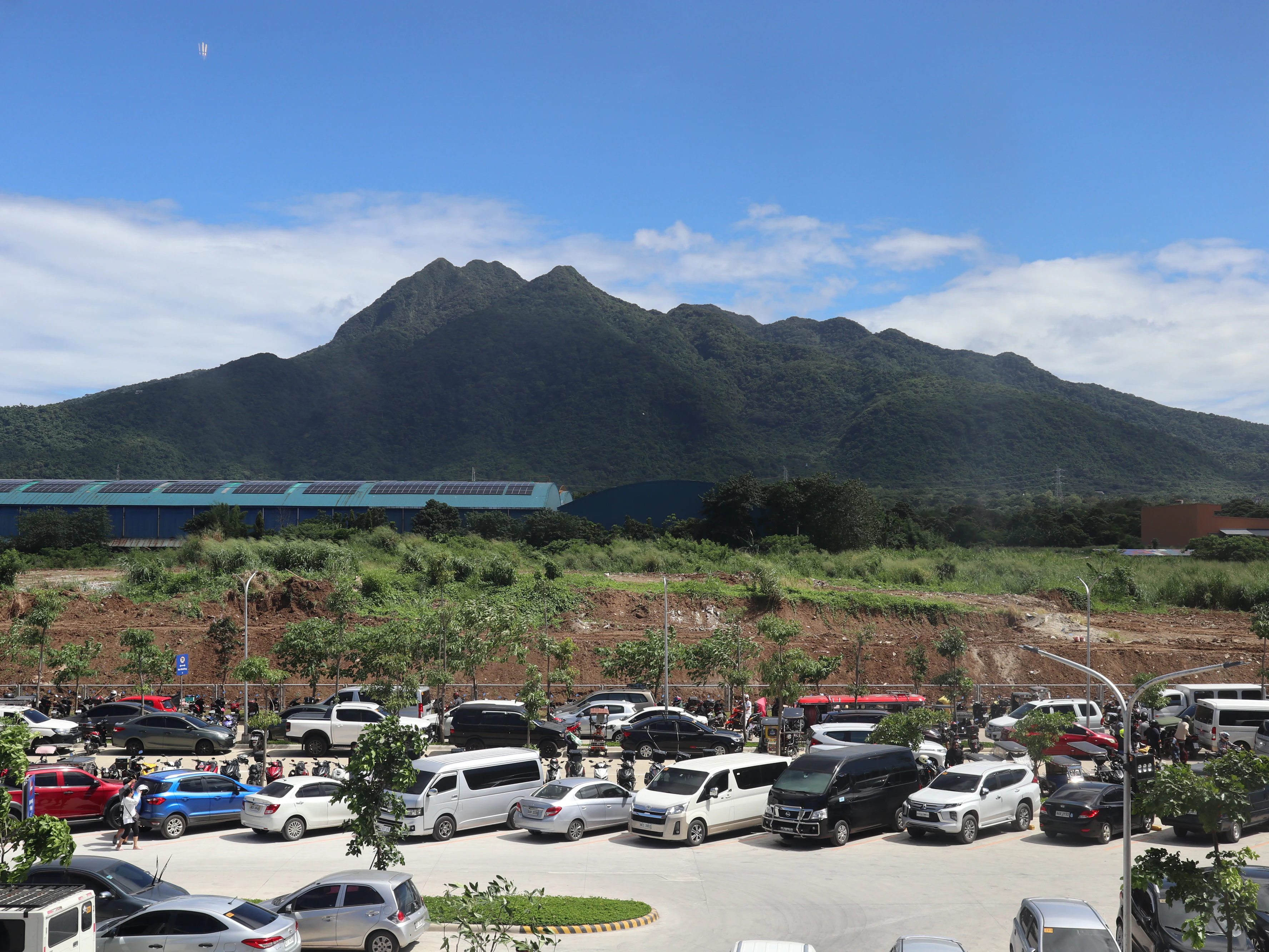
A wide view of the forested peak of Mount Makiling rising above a large, busy parking lot filled with various vehicles.
Mount Makiling viewed from the parking area of a commercial establishment in Santo Tomas, Batangas.

Best time to visit Mount Makiling

Mount Makiling, like much of southern Luzon, has a climate shaped by the annual rainy season and the cooler, drier months that follow. The mountain's forest trails, creeks, and summits are most pleasant when conditions are drier and the risk of typhoon-related trail damage is lower. Hikers commonly plan ascents around the drier months, when clearer views from Peak 2 and from nearby vantage points such as Tagaytay are more likely.

That said, the mountain's appeal is not season-dependent in a narrow sense. Its forest character, hot springs, and cultural significance remain year-round, and the itinerary usually depends on personal tolerance for rain, mud, and leeches rather than a strict seasonal calendar. Travelers interested in combining hiking with appreciation of the area's mythology and landscapes will find the mountain rewarding whenever conditions are safe.

Monthly climate preview

Long-term temperature and precipitation records across twelve months

Mount Makiling Climate Normals and Annual Weather by Month

Representative coordinate measurements reveal annual temperature ranges and monthly precipitation totals across the protected landscape. Examining the full twelve-month profile provides complete historical averages for detailed environmental analysis.
Annual mean26 °C
24 °C28 °C
Jan24°
Feb24°
Mar25°
Apr27°
May28°
Jun27°
Jul26°
Aug26°
Sep26°
Oct26°
Nov25°
Dec24°
Warmest month
May

28.1 °C

Coolest month
January

23.6 °C

Wettest month
December

12.4 mm/day

Driest month
April

2.9 mm/day

Park location guide

Geography guide, regional context, and park location map for Mount Makiling

Mount Makiling park geography, regions, and map view in Philippines

Understand where Mount Makiling sits in Philippines through a broader geographic reading of the surrounding landscape, nearby location context, and its mapped position within the national park landscape.

How Mount Makiling fits into Philippines

The Philippines, officially the Republic of the Philippines, is an archipelagic nation in Southeast Asia comprising approximately 7,641 islands categorized into three main geographical divisions: Luzon, Visayas, and Mindanao. Located in the western Pacific Ocean, it shares maritime borders with Taiwan, Japan, Palau, Indonesia, Malaysia, Vietnam, and China. Manila serves as the capital city, while Quezon City is the most populated city, both within Metro Manila.

Wider geography shaping Mount Makiling in Philippines

The Philippines is an archipelagic nation in Southeast Asia, positioned in the western Pacific Ocean. Its islands are bounded by the South China Sea to the west, Philippine Sea to the east, and Celebes Sea to the south. The country shares maritime borders with Taiwan to the north, Japan to the northeast, Palau to the east and southeast, Indonesia to the south, Malaysia to the southwest, Vietnam to the west, and China to the northwest.

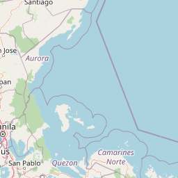
Map view of Mount Makiling

Use this park location map to pinpoint Mount Makiling in Philippines, understand its exact geographic position, and read its mapped placement within the surrounding landscape more clearly.

Pigeon | © OpenStreetMap contributors

Location context for Mount Makiling

BatangasCalabarzonLaguna

Explore protected area views, tropical forest habitats, and volcanic terrain features.

Mount Makiling Photos and Scenery: Visualizing the Volcanic Landscapes

Visual documentation reveals the complex stratovolcanic terrain, dense forest canopies, and geothermal features defining Mount Makiling. Photographic records help researchers and naturalists examine park habitats, elevation profiles, and conservation boundaries across the reserve.

A wide shot of the Mount Makiling stratovolcano, partly obscured by clouds and mist, rising above a foreground of lush green trees and distant residential buildings.

A wide view of Mount Makiling, an inactive stratovolcano covered in forest, appearing beneath heavy, dark rain clouds.

Top-down satellite imagery of Mount Makiling, appearing as a dense circular area of green forest surrounded by agricultural and urban land, with a large blue body of water to the north.

A wide view of the inactive stratovolcano Mount Makiling, covered in dense green forest, under a partly cloudy sky, with a highway guardrail and road in the foreground.

A wide, scenic view of Mount Makiling, an inactive stratovolcano, rising above layers of lush green forest and hilly terrain, viewed from a grassy field under a bright sky.

A cobblestone hiking trail path leading into a lush green forest with tall trees and thick vegetation on both sides.

A wide, eye-level view of the verdant, rugged peaks of Mount Makiling under a cloudy sky, with tall grasses and palm trees in the foreground.

A wide view of the forested peak of Mount Makiling rising above a large, busy parking lot filled with various vehicles.

A distant view of the Mount Makiling dormant volcano silhouette rising above a highway with cars and power line towers in the foreground.

Park atlas

Compare adjacent volcanic landscapes and connected conservation reserves across Luzon.

Exploring Parks Near Mount Makiling and Surrounding Regional Protected Areas

Discover related protected areas and natural reserves located near Mount Makiling in the Calabarzon region. Comparing these adjacent volcanic landscapes provides broader context for regional forest reserves and watershed geography.
Protected landscapeCalabarzon
About 26 km away#1 closest

Southwest

Taal Volcano Protected Landscape: Geographic Profile and Protected Area Map

Volcanic caldera and nested lake system in Calabarzon

Explore the layered topography of the Taal Volcano Protected Landscape. This protected area showcases a rare nested volcanic island within a freshwater lake, offering significant insights into the geological and aquatic geography of the Calabarzon region of the Philippines.

Area
622.92 km²
Established
1996
Water
Major water bodies
National parkLaguna
About 32 km away#2 closest

Northeast

Pagsanjan Gorge National Park: Philippines National Park & Protected Area Mapping

Explore the geographic context and mapped terrain.

Pagsanjan Gorge National Park represents a key protected natural area within the Laguna region, offering insights into Philippine national park geography. This entry focuses on understanding its mapped boundaries and the surrounding landscape context, providing a foundational element for anyone exploring protected lands through maps and regional atlases. It serves as a gateway to comprehending the park's specific geographic identity and its place within the natural environment of the Philippines.

Area
1.526 km²
Established
1939
IUCN
II
Relief
Upland
Watercolor illustration depicting a serene wetland scene with soft green marshland, a central body of water, and distant rolling hills.
Protected areaMetro Manila
About 46 km away#3 closest

Northwest

Las Piñas, Parañaque Wetland Park: Protected Coastal Geography in Metro Manila

Mangroves, tidal mudflats, and essential avian migratory corridors.

Discover the geographic layout and protected status of Las Piñas, Parañaque Wetland Park. This coastal refuge provides a rare natural contrast to the dense urbanization of Metro Manila, safeguarding critical mangrove habitats and tidal environments that support diverse migratory bird species.

Area
1.81 km²
Established
2007
Relief
Lowland
Climate
Tropical
Protected landscapeRizal
About 60 km away#4 closest

North

Upper Marikina River Basin Protected Landscape: Watershed Geography and Sierra Madre Mapping

A critical forest reserve and hydrological basin in Rizal

Covering the upper reaches of the Marikina River, this protected landscape forms a massive forested block within the southern Sierra Madre. The area serves as a primary catchment system, defined by its rugged mountain ridges, descending river corridors, and long-standing role in regional water management. Mapping these protected lands reveals the essential link between mountain ecosystems and downstream hydrological stability.

Area
261.256 km²
Established
1904
IUCN
V
Relief
Mountain
Protected landscapeQuezon
About 68 km away#5 closest

East

Quezon Protected Landscape: Mapping the Rainforests and Karst Terrain of Quezon Province

An essential protected landscape in the southern Sierra Madre mountain range.

Quezon Protected Landscape serves as a vital ecological corridor, featuring a rugged mix of karst topography, lowland rainforests, and underground water systems. Explore the geographic layout of this Philippine reserve, which encompasses symbolic summits, cascading waterfalls, and diverse endemic habitats within the southern Sierra Madre foothills.

Area
9.38 km²
Established
2003
IUCN
V
Relief
Mountain
A horizontal watercolor illustration of a soft, hazy landscape featuring rolling green hills, dense tree clusters, and gentle valleys.
Nature reserveMetro Manila
About 69 km away#6 closest

North

La Mesa Watershed Reservation: Mapping the Urban Rainforest and Water Catchment

A critical nature reserve within the Metro Manila region.

La Mesa Watershed Reservation is the last major lowland forest block within Metro Manila, functioning as a vital nature reserve and drinking water catchment for the metropolitan area. The area features a complex mosaic of closed-canopy rainforest, reservoir wetlands, and swampforest, providing a distinct geographic counterpoint to the surrounding urban density. It remains a key case study in urban conservation and hydrological management for the Philippine capital.

Area
26.59 km²
Established
2007
Visitors
300K annual
Relief
Upland
National parkBataan
About 87 km away#7 closest

Northwest

Bataan National Park: Philippines Protected Landscape and National Park Geography

Mapped boundaries and regional natural landscape context.

This detail entry for Bataan National Park provides essential context for understanding its role as a protected landscape within the Philippines. Users can explore the park's mapped boundaries, its geographic setting in the Bataan region, and its identity as a national park. The focus is on atlas-style discovery, allowing for a deeper appreciation of the park's natural terrain and its place within the country's protected area network.

Area
236.88 km²
Established
1945
IUCN
II
Relief
Mountain
Wildlife reserveQuezon
About 90 km away#8 closest

East

Alabat Watershed Forest Reserve: Wildlife Reserve and Regional Watershed Geography in Quezon

Exploring the protected lowland rainforests of Alabat Island.

Located in Quezon, the Alabat Watershed Forest Reserve represents a significant wildlife reserve defined by its ridge and valley topography. The landscape serves as a protected catchment for the Langas River, maintaining essential lowland forest cover amidst the island environment. This entity provides a clear look at the ecological significance and mapped boundaries of a vital Philippine watershed and forest system.

Area
6.88 km²
Established
1987
Relief
Upland
Scope
Terrestrial

Common questions about visiting, size, designation, and location context for Mount Makiling

Mount Makiling FAQs for park facts, access, geography, and protected area context

Find quick answers about Mount Makiling, including protected-area facts, park geography, trail and visitor context, and how the park fits into its surrounding country and regional landscape.
MoriAtlas Explorer

Continue Your Protected Areas Search Across the Global Atlas

Deepen your exploration by continuing the structured search for national parks and protected areas worldwide. Utilize the comprehensive filtering capabilities to compare different conservation landscapes and refine your understanding of global park geography. Discover more about the distribution and characteristics of protected natural areas.

Global natural geography