
Mori Atlas logo
Wildlife reserveMount Massive Wilderness

A unique high-elevation wilderness area anchoring the Continental Divide in central Colorado.

Mount Massive Wilderness: Exploring the Rugged Sawatch Range and Alpine Protected Landscapes

Mount Massive Wilderness preserves a expansive block of high-alpine terrain within the Sawatch Range of central Colorado. The protected landscape spans from dense subalpine forests to the rocky summit of Mount Massive, characterizing the region with deep glacial valleys and exposed ridges. This wilderness area holds a unique institutional status as a protected forest unit integrated with national fish hatchery grounds, offering a distinct vantage point along the Continental Divide.

sawatch-rangealpine-wildernesscolorado-rockieshigh-elevationcontinental-dividesubalpine-forest
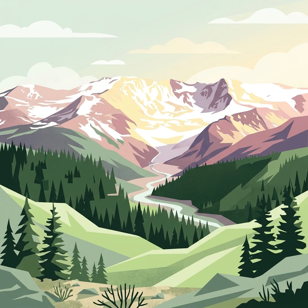
A digital illustration of snow-capped mountains above a pine forest and a winding river valley, featuring a soft, pastel color palette.

Mount Massive Wilderness

Wildlife reserve

Park overview

Structured park overview, official facts, and landscape profile for Mount Massive Wilderness

Mount Massive Wilderness park facts, protected area profile, and essential visitor context

Review the core facts for Mount Massive Wilderness, including designation, size, terrain, visitor scale, habitats, and operating context in one park-focused overview.

About Mount Massive Wilderness

Mount Massive Wilderness is one of the larger and more topographically dramatic wilderness areas in the central Colorado Rockies. It lies within the Sawatch Range, a high spine of mountains that runs north-south through the heart of the state and contains many of Colorado's highest peaks. The wilderness's defining geographical feature is Mount Massive itself, whose summit reaches 14,421 feet, making it the second-highest peak in Colorado after Mount Elbert, located just to the south.

The terrain within the protected area spans an enormous vertical range. Lower elevations around 9,700 feet hold montane and subalpine forests, while the upper slopes climb into exposed alpine zones with permanent rock, lingering snowfields, and seasonal tundra. The result is a landscape of deep valleys framed by high ridges, with the rocky pyramid of Mount Massive rising above a network of forested creeks and lakes.

On the western edge of the wilderness, the Continental Divide forms a notable boundary, separating Mount Massive Wilderness from the Hunter-Fryingpan Wilderness to the west on the opposite side of the divide. This positioning gives the wilderness an interconnected quality with adjacent protected lands, even though access into Mount Massive itself remains relatively quiet compared to its better-known neighbors.

Management of the wilderness is split between two federal agencies, an unusual arrangement that gives the area its distinctive identity. The vast majority of the wilderness sits within the San Isabel National Forest, administered by the U.S. Forest Service, while a smaller portion lies within the Leadville National Fish Hatchery, administered by the U.S. Fish and Wildlife Service. This makes Mount Massive Wilderness the only federally designated wilderness area in the country that is part of the National Fish Hatchery System.

Quick facts and research context for Mount Massive Wilderness

Mount Massive Wilderness sits in the Sawatch Range of central Colorado in Lake County, with Leadville as the nearest city. It covers roughly 30,540 acres, split between the San Isabel National Forest and the Leadville National Fish Hatchery. Elevations range from about 9,700 feet along lower drainages to 14,421 feet at the summit of Mount Massive, Colorado's second-highest peak. Congress designated the area as wilderness in 1980, and it remains one of the more remote and minimally developed wilderness blocks in the central Rockies.

Protection and recognition

Examine the official protection scope and designation records for Mount Massive Wilderness.

Mount Massive Wilderness Protection Status and Territorial Designation Data

Terrestrial protection records for Mount Massive Wilderness outline the established conservation boundaries and management scope for this landscape. Reference data details the formal protection status alongside international recognition sources for structured analysis.

Protection details

Protection scope
Terrestrial
Transboundary protection
No
Park context

Deeper park guide and search-rich context for Mount Massive Wilderness

Mount Massive Wilderness history, landscape, wildlife, and travel context

Explore Mount Massive Wilderness through its history, landscape character, ecosystems, wildlife, conservation priorities, cultural context, and seasonal travel timing in a structured park guide built for atlas discovery and search intent.

Why Mount Massive Wilderness stands out

Mount Massive Wilderness is best known for protecting the slopes and surrounding terrain of Mount Massive, one of the most prominent fourteeners in the contiguous United States. Its defining character is extreme vertical relief combined with classic Sawatch Range scenery: broad, glacially carved valleys, subalpine forest, tundra-tinged high country, and an approach to the Continental Divide. The wilderness is also distinctively known as the only federally designated wilderness area within the National Fish Hatchery System, a status tied to its inclusion of a portion of the Leadville National Fish Hatchery. Together, these traits give it a profile that combines iconic Rocky Mountain alpine scenery with a unique administrative character.
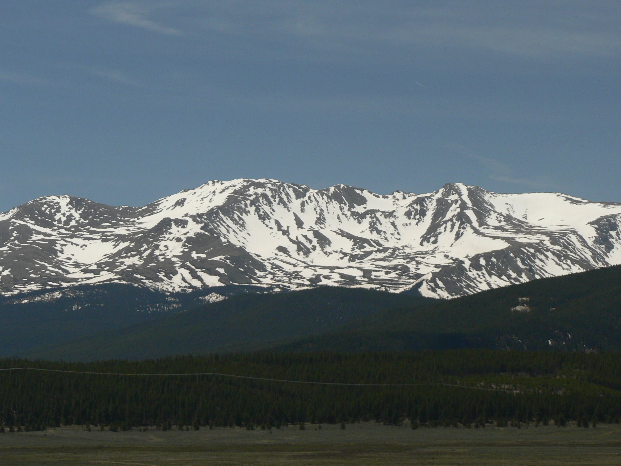
A wide landscape view of a prominent mountain range with snowy peaks, rising above a dark forested slope and a grassy foreground under a blue sky.
A view of the snow-capped peak of Mount Massive in the Sawatch Range.

Mount Massive Wilderness history and protected-area timeline

Mount Massive Wilderness was formally designated by the U.S. Congress in 1980 as part of the broader expansion of the National Wilderness Preservation System during that era. Its designation brought federal wilderness protection to a substantial block of the central Sawatch Range, including the slopes leading up to Mount Massive, one of Colorado's signature fourteeners.

The wider area around modern-day Leadville has a long human history tied to mining and high-country settlement, and several of the trailheads that serve the wilderness follow historic routes into the mountains. Trails such as those leading from Halfmoon Creek toward Mount Massive reflect patterns of access that predate wilderness designation and have continued to shape how visitors approach the area.

Over time, the wilderness has come to be valued less for extractive use and more for its preserved ecological and scenic character. Its inclusion of land tied to the Leadville National Fish Hatchery also tied its protection to broader conservation efforts around aquatic habitat in the upper Arkansas River watershed, helping to ensure that the wilderness's identity is not just alpine but also connected to downstream river systems.

Mount Massive Wilderness landscape and geographic character

The landscape of Mount Massive Wilderness is shaped by the high backbone of the Sawatch Range and the dominant presence of Mount Massive. The range is characterized by broad, uplifted ridges and the remains of ancient glacial activity, producing a patchwork of cirques, basins, and U-shaped valleys layered beneath the higher summits.

Within the wilderness, elevations span from roughly 9,700 feet in lower forested valleys to 14,421 feet at the top of Mount Massive. The mid-elevations hold dense stands of subalpine conifers, spruce, and fir, giving way to open alpine meadows, talus slopes, and rocky ridges as the terrain climbs. Several lakes and creeks, including Native Lake, Windsor Lake, and the waters of the Halfmoon Creek drainage, add reflective surfaces and riparian texture to the otherwise rugged terrain.

On its western margin, the Continental Divide runs through or along the edge of the wilderness, creating a sharp boundary between the Pacific and Atlantic drainages. North America's Continental Divide is one of the most significant geographical features in the area, and its proximity gives the wilderness a sense of being perched on the roof of the continent, with sweeping views in nearly every direction from the higher ridges.

Mount Massive Wilderness ecosystems, habitats, and plant life

The ecosystems of Mount Massive Wilderness reflect the strong influence of elevation typical of the Colorado high country. Lower portions of the wilderness are dominated by coniferous forest, including spruce, fir, and pine, creating cool, shaded environments along creeks and valley bottoms. These forests transition upward into more open subalpine parkland and ultimately into the sparse, windswept alpine zone above treeline.

Because of the wide elevation range, the wilderness supports a layered ecological profile: dense montane and subalpine forests at lower elevations, transitional meadows and willow thickets near lakes and streams, and exposed alpine tundra at the highest reaches. Seasonal snow cover shapes the landscape for much of the year, with snowfields lingering into the warmer months in shaded cirques and on the upper slopes of Mount Massive.

The portion of the wilderness tied to the Leadville National Fish Hatchery contributes an additional ecological dimension, linking the alpine terrain to broader watershed conservation efforts in the upper Arkansas River basin. This connection between high-country habitat and downstream aquatic systems adds depth to the area's ecological identity.

Mount Massive Wilderness wildlife and species highlights

The combination of dense subalpine forest, alpine tundra, lakes, and streams typical of the central Rockies gives Mount Massive Wilderness habitat suitable for a range of high-country wildlife. Forests within the wilderness provide cover for elk, mule deer, and other ungulates that move through the Sawatch Range, while the alpine zones above treeline support smaller mammals adapted to harsh, exposed conditions.

Birds associated with Colorado's high country are characteristic of the area as well, with species typically found in mixed-conifer forests and along alpine ridges likely to be present in and around the wilderness. Streams and small lakes such as Native Lake, Windsor Lake, and the Halfmoon Creek drainage provide freshwater habitat that contributes to the broader ecological network of the region, including the aquatic connections valued by the Leadville National Fish Hatchery portion of the wilderness.

Mount Massive Wilderness conservation status and protection priorities

Mount Massive Wilderness contributes to conservation in the central Rockies by preserving a large, contiguous block of high-alpine terrain from logging, road-building, and other development. Its elevation range, from forested valley bottoms to the summit of one of Colorado's highest peaks, allows it to protect a vertically stratified set of habitats that would otherwise be vulnerable to fragmentation.

The wilderness also stands out because of its connection to the Leadville National Fish Hatchery and, through it, the National Fish Hatchery System. This makes the area the only federally designated wilderness within that system, blending the conservation priorities of upland ecosystems and aquatic habitat. The result is a protected landscape that serves both as alpine wilderness and as part of broader efforts to maintain the ecological health of the upper Arkansas River watershed.

At the same time, standard wilderness regulations apply, restricting large group sizes, encouraging minimum-impact practices around lakes and trails, and limiting activities that could degrade the area's natural conditions. These protections help ensure that the wilderness retains its remote and ecologically intact character over the long term.

Mount Massive Wilderness cultural meaning and human context

The cultural context of Mount Massive Wilderness is rooted in the mining and high-country settlement history of the Leadville area. Leadville, the nearest city, grew into one of Colorado's most prominent nineteenth-century mining towns, and the surrounding mountains, including the Sawatch Range, were extensively explored and worked for silver and other minerals.

This history shapes how people have approached Mount Massive and its surrounding terrain. Historic travel routes, including those that evolved into modern trailheads, reflect patterns of movement between the town, surrounding ranches, and the high passes of the range. Today, the wilderness preserves this landscape in a non-extractive state, offering a counterpoint to the area's more industrial past.

Top sights and standout views in Mount Massive Wilderness

Mount Massive Wilderness combines the signature scenery of the Sawatch Range with the unusual administrative identity of being part wilderness, part national fish hatchery. Its highest point is Mount Massive, the second-highest peak in Colorado, surrounded by a substantial block of glacially carved terrain drained by the Halfmoon Creek system and laced with lakes such as Native Lake and Windsor Lake.

The wilderness is also notable for its position along the Continental Divide, providing sweeping high-altitude scenery and direct ecological connections with neighboring protected areas such as the Hunter-Fryingpan Wilderness. Its relatively limited number of trailheads keeps the area quieter than some other Colorado wilderness areas, even though it sits in the heart of the state's fourteeners country.

Best time to visit Mount Massive Wilderness

Mount Massive Wilderness is fundamentally shaped by elevation, so the most rewarding visits generally occur during the warmer months when snow has receded from the lower trails and high passes. Summer and early fall typically bring the most accessible conditions in the subalpine zone, while the higher ridges and the summit of Mount Massive itself remain challenging environments subject to sudden weather changes even in peak season.

In winter and early spring, deep snow and extreme conditions close off most recreational use of the upper wilderness, and even lower trails can be difficult to follow. Shoulder seasons can offer quieter experiences, but access is more weather-dependent.

Monthly climate preview

Long-term representative monthly temperature and precipitation data patterns

Mount Massive Wilderness Climate Normals and Annual Temperature Rhythm

Mount Massive Wilderness records a measured annual temperature and precipitation rhythm across twelve distinct monthly intervals from NASA POWER climatology. Examining the complete monthly climate normals reveals detailed average temperature ranges and precipitation trends for this Colorado location.
Annual mean0 °C
-12 °C14 °C
Jan-12°
Feb-12°
Mar-7°
Apr-2°
May
Jun10°
Jul14°
Aug12°
Sep
Oct
Nov-6°
Dec-12°
Warmest month
July

13.6 °C

Coolest month
January

-12.5 °C

Wettest month
April

1.7 mm/day

Driest month
June

1 mm/day

Park location guide

Geography guide, regional context, and park location map for Mount Massive Wilderness

Mount Massive Wilderness park geography, regions, and map view in United States of America

Understand where Mount Massive Wilderness sits in United States of America through a broader geographic reading of the surrounding landscape, nearby location context, and its mapped position within the national park landscape.

How Mount Massive Wilderness fits into United States of America

The United States of America is a federal presidential republic and one of the world's largest countries by area and population. It consists of 50 states across a vast territory spanning multiple time zones, with its capital in Washington, D.C. and largest city in New York City. The nation has a diverse economy, influential political system, and significant cultural and military presence globally.

Wider geography shaping Mount Massive Wilderness in United States of America

The United States occupies a vast territory in North America, bordered by Canada to the north and Mexico to the south. The 48 contiguous states stretch from the Atlantic to the Pacific Ocean, while Alaska occupies the northwestern region and Hawaii is an archipelago in the Pacific. The country encompasses diverse terrain including the Rocky Mountains, Appalachian Mountains, Great Plains, and extensive river systems.

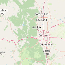
Map view of Mount Massive Wilderness

Use this park location map to pinpoint Mount Massive Wilderness in United States of America, understand its exact geographic position, and read its mapped placement within the surrounding landscape more clearly.

Pigeon | © OpenStreetMap contributors

Location context for Mount Massive Wilderness

Colorado
Recorded earthquake history

Review the Historical Earthquake Catalogue for Mount Massive Wilderness

Access a structured collection of recorded seismic events associated by distance with Mount Massive Wilderness. This catalogue, powered by MoriAtlas data, allows for the exploration of historical seismic activity across this unique Sawatch Range landscape without inferring future risk.

Mount Massive Wilderness Earthquake History

Catalogued events

3 events

Strongest magnitude

Magnitude 3.4

Most recent event

Jul 8, 1993

This history includes earthquakes recorded inside the park or within 50 km of its borders

Explore high-elevation terrain, subalpine forests, and protected Rocky Mountain habitats

Mount Massive Wilderness Photos and Landscapes: Visualizing Colorado Alpine Scenery

Visual records capture the rugged topography and high-altitude habitats that define Mount Massive Wilderness across the Sawatch Range. Examining these protected landscapes reveals the glacial valleys, rocky ridges, and alpine tundra surrounding Colorado's second-highest summit.

A wide landscape view of a prominent mountain range with snowy peaks, rising above a dark forested slope and a grassy foreground under a blue sky.

Park atlas

Compare adjacent Sawatch Range wilderness areas and regional mountain terrain.

Other Parks Near Mount Massive Wilderness and Surrounding Protected Landscapes

Browsing nearby national parks and protected areas provides broader regional context for high alpine terrain around Mount Massive Wilderness. Comparing connected mountain landscapes reveals shared ecological patterns and topographical gradients across the Sawatch Range.
Watercolor painting of a serene mountain landscape featuring rolling hills, coniferous trees, and a lake in the foreground, rendered in light pastel tones.
Protected landscapeColorado
Park boundaries overlap#1 closest

Southeast

San Isabel National Forest: Geographic Overview and Protected Mountain Landscape Atlas

Central Colorado alpine terrain and designated wilderness areas

Spanning eleven counties in central Colorado, San Isabel National Forest serves as a cornerstone of the Southern Rocky Mountains. The forest landscape is dominated by the Sawatch and Sangre de Cristo ranges, offering a unique atlas of alpine tundra, dense coniferous forests, and high-altitude peaks that define the character of the region. This protected area provides a vital habitat and a vast, rugged environment characterized by volcanic formations like the Spanish Peaks and glacial geological features.

Area
4,533.42 km²
Established
1902
Relief
Mountain
Climate
Alpine
Wildlife reserveColorado
3 km away#2 closest

North

Holy Cross Wilderness: Mapped Alpine Landscapes and Colorado Protected Areas

Glacial valleys and high-country geography in the Sawatch Range

Discover the geographic layout of the Holy Cross Wilderness, a vital protected area in central Colorado. This resource details the rugged Sawatch Range environment, from high alpine lake basins to the iconic northern couloirs of its namesake mountain, offering a clear view of the park boundaries and surrounding high-country terrain.

Area
496.94 km²
Established
1980
IUCN
Ib
Relief
Mountain
A soft watercolor painting of a mountain landscape with rolling green hills in the foreground and layered, pale purple peaks in the distance.
Wildlife reservePitkin County
About 6.9 km away#3 closest

West

Hunter-Fryingpan Wilderness: Mapped Protected Geography in the Central Rocky Mountains

High-altitude wilderness area in Pitkin County, Colorado

Hunter-Fryingpan Wilderness encompasses approximately 82,000 acres of rugged terrain near the continental divide. This protected area acts as a headwaters sanctuary for the Fryingpan River and Hunter Creek, defined by its steep granite ridges, subalpine meadows, and clusters of pristine alpine lakes. Understanding its geography reveals the stark, glaciated character of the central Colorado Rockies.

Area
331.95 km²
Established
1978
IUCN
Ib
Relief
Mountain
A soft watercolor illustration depicting a simplified, layered landscape of rolling hills and distant mountains in shades of light green, pale yellow, and soft pink.
Protected areaColorado
18 km away#4 closest

East

Pike National Forest: Protected Mountain Landscapes and Regional Geography in Central Colorado

Granite peaks, montane forests, and diverse alpine terrain

Spanning from the rolling foothills of the Front Range to the high alpine summits of the Rocky Mountains, Pike National Forest is a significant protected area defined by its unique Pikes Peak granite bedrock and deep river-carved canyons. This analysis provides a structured look at its expansive wilderness boundaries, drainage basins, and the vertical transitions that characterize this vital central Colorado highland.

Area
4,478.27 km²
Established
1892
Relief
Mountain
Climate
Alpine
Wildlife reserveColorado
35 km away#5 closest

North

Eagles Nest Wilderness: Alpine Geography and Protected Landscape of the Colorado Gore Range

High-mountain protected area in the White River National Forest

Spanning the southern Gore Range, Eagles Nest Wilderness represents a core protected landscape in Colorado characterized by high-elevation peaks, glacial cirque lakes, and extensive backcountry trail networks. Its geography bridges the gap between deep coniferous forests and exposed alpine tundra, maintaining significant ecological and historical value within the mountainous terrain of Eagle and Summit Counties.

Area
546.79 km²
Established
1976
IUCN
Ib
Relief
Mountain
Protected areaColorado
47 km away#6 closest

West

Raggeds Wilderness: Geographic Profile and Protected Area Mapping for the Elk Mountains

High altitude wilderness terrain in west-central Colorado

Raggeds Wilderness encompasses over 65,000 acres of protected high-country terrain in the Elk Mountains. This atlas record provides a detailed look at the park, covering its dramatic vertical transitions from deep forest drainages to jagged peaks and its function as a major node in the regional wilderness network.

Area
264.64 km²
Established
1980
IUCN
Ib
Relief
Mountain
A wide watercolor illustration depicting a gentle landscape with green hills, scattered trees, and a pale sky with pink and purple hues.
Wildlife reserveGunnison County
About 48 km away#7 closest

South

Fossil Ridge Wilderness: Mapped Geography and Protected Landscapes in Gunnison County

High-altitude ridges, Paleozoic geology, and alpine wilderness character.

Fossil Ridge Wilderness sits as a compact but geographically rich protected area within the Gunnison National Forest. This site offers an detailed look at high-elevation Rocky Mountain terrain, characterized by exposed carbonate rock, deep drainage corridors, and dramatic vertical relief that serves as essential habitat for bighorn sheep and mountain goats.

Area
56.62 km²
Established
1993
IUCN
Ib
Relief
Mountain
A watercolor painting showing purple and white mountain peaks rising above green rolling hills and meadows in a wide panoramic format
Protected areaColorado
67 km away#8 closest

Northeast

Mount Evans Wilderness: Alpine Landscapes and Protected Geography in Colorado

Glacial cirques and high-altitude wilderness ecosystems.

Mount Evans Wilderness offers a premier look at the Colorado Front Range, defined by its dramatic relief, sheer cliff lines, and extensive glacial history. This entry examines the wilderness as a protected zone that transitions from montane forests to tundra, providing a reference for high-elevation mountainous geography within the United States.

Area
301.09 km²
Established
1980
IUCN
Ib
Relief
Mountain

Common questions about visiting, size, designation, and location context for Mount Massive Wilderness

Mount Massive Wilderness FAQs for park facts, access, geography, and protected area context

Find quick answers about Mount Massive Wilderness, including protected-area facts, park geography, trail and visitor context, and how the park fits into its surrounding country and regional landscape.
MoriAtlas Explorer

Continue Your Protected Areas Search Across the Global Atlas

Deepen your exploration by continuing the structured search for national parks and protected areas worldwide. Utilize the comprehensive filtering capabilities to compare different conservation landscapes and refine your understanding of global park geography. Discover more about the distribution and characteristics of protected natural areas.

Global natural geography