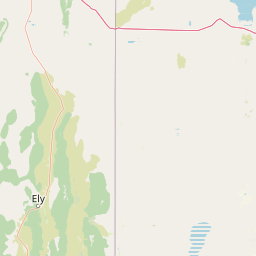
Why Mount Moriah Wilderness stands out
Mount Moriah Wilderness is best known for the high, flat-topped Table plateau that extends north and west of its namesake peak, and for its unusual concentration of limestone bedrock and shallow caves within an otherwise typical Great Basin mountain setting. The wilderness is also recognized for its bristlecone pine stands at upper elevations, its position between the broad Snake and Spring valleys, and its quiet blend of sagebrush foothills, conifer forests, and open alpine ridges. Its mix of National Forest and Bureau of Land Management jurisdiction within a single wilderness boundary is another distinguishing feature.
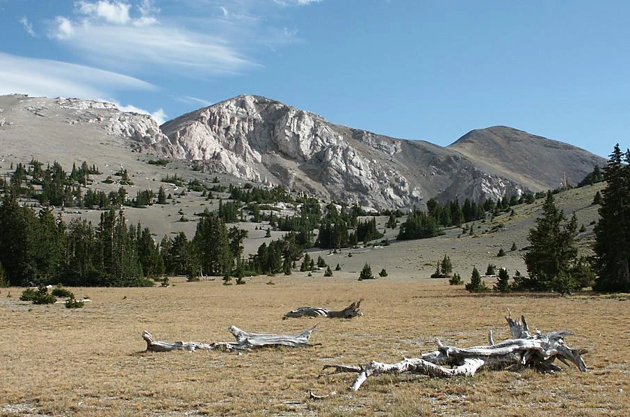
Mount Moriah Wilderness history and protected-area timeline
The Mount Moriah Wilderness has a long pre-designation history shaped by Indigenous presence in the Snake Range. Archaeological evidence across the area includes caves that were used by Native Americans, along with pictographs and lithic scatters, pointing to sustained human activity in this part of the Great Basin long before any modern administrative boundaries were drawn.
The modern history of the wilderness began on December 5, 1989, when the area was formally designated through the U.S. wilderness system. From that point forward, the area has been jointly administered, with most of the territory falling under the Humboldt-Toiyabe National Forest managed by the U.S. Forest Service, while roughly 8,700 acres in the northern portion of the wilderness remained under the care of the U.S. Bureau of Land Management because the federal land there had historically been BLM-administered rather than national forest land. This dual-agency arrangement remains a defining feature of how the wilderness is governed.
Mount Moriah Wilderness landscape and geographic character
The landscape of Mount Moriah Wilderness is defined by the high country of the northern Snake Range, where rugged mountain terrain meets the broad, dry valleys of the eastern Great Basin. Mount Moriah itself rises to 12,050 feet, with the Table, an unusually flat-topped plateau, stretching north and west of the peak at about 11,000 feet and providing one of the most distinctive landforms in the area. The eastern front of the range drops toward Snake Valley, while the western slopes face Spring Valley, giving the wilderness a strong sense of vertical relief framed by two major basin landscapes.
Underlying much of the terrain is limestone, which expresses itself in shallow caves and rocky exposures distributed across the wilderness. These limestone features, together with the broad plateau and the steep flanks of the Snake Range, give Mount Moriah a layered and varied topography that ranges from cliff-rimmed high country to gentler subalpine benches and sagebrush terraces lower down.
Mount Moriah Wilderness ecosystems, habitats, and plant life
Mount Moriah Wilderness sits within the broader Intermountain sagebrush and ponderosa pine ecosystem of the Great Basin, and its plant communities change noticeably with elevation. The lower slopes are dominated by pinyon pine and juniper, the characteristic woodland of the Great Basin foothills. Moving upward, the vegetation shifts into denser conifer forests of ponderosa pine, aspen, mountain mahogany, white fir, Douglas fir, and limber pine, with stands of bristlecone pine persisting in some of the highest and most exposed sites.
This gradient from arid lowlands to subalpine and near-alpine forests creates a continuum of habitats within a relatively compact geographic footprint. Perennial streams such as Hampton Creek, Hendry's Creek, and Smith Creek add a riparian thread through the otherwise dry mountain terrain, supporting trout populations as well as localized bands of vegetation that contrast with the surrounding sagebrush and conifer slopes. The interplay of limestone geology, sharp elevation change, and reliable surface water gives the wilderness a strong and recognizable ecological identity within the Snake Range.
Mount Moriah Wilderness wildlife and species highlights
The wildlife profile of Mount Moriah Wilderness reflects its Great Basin mountain setting, with both upland game species and cold-water fish supported by the area's streams and sagebrush-covered slopes. Much of the wilderness functions as summer range for mule deer, while lower-elevation benches and riparian zones along creeks provide year-round habitat for some animals, creating a seasonal mix of use across the landscape.
Rocky Mountain bighorn sheep are present throughout the year in the rocky, high-relief terrain. The upland bird community includes blue grouse, sage grouse, and chukar partridge, with sagebrush and montane habitats each supporting different components of this guild. In the perennial streams that drain the wilderness, anglers and biologists recognize populations of rainbow trout, brook trout, and the native Bonneville cutthroat trout, the last of which is a distinctive regional species tied to the ancient Lake Bonneville drainage system.
Mount Moriah Wilderness conservation status and protection priorities
Mount Moriah Wilderness is significant for conservation because it preserves an unbroken elevational gradient in the northern Snake Range, from sagebrush basins and pinyon-juniper foothills up through montane conifer forests to bristlecone pine stands on the highest terrain. By safeguarding this sequence of plant communities, the wilderness retains a representative cross-section of Intermountain West ecosystems in a single, contiguous protected block.
The wilderness also plays an important role in protecting water resources and aquatic biodiversity in the region. Perennial creeks like Hampton, Hendry's, and Smith Creek shelter rainbow trout, brook trout, and the regionally significant Bonneville cutthroat trout, while their associated riparian corridors also support mule deer and other wildlife across seasons. The dual administrative structure, with the U.S. Forest Service managing most of the area within the Humboldt-Toiyabe National Forest and the Bureau of Land Management overseeing roughly 8,700 acres in the north, reflects an effort to bring all the relevant public lands under a unified wilderness designation while maintaining their original agency ownership.
Mount Moriah Wilderness cultural meaning and human context
The cultural context of Mount Moriah Wilderness is rooted in long Indigenous use of the Snake Range. Caves throughout the wilderness were used by Native Americans, and the surrounding terrain carries pictographs and lithic scatters that mark prehistoric and historic activity in the area. These sites connect the wilderness to broader Great Basin cultural traditions in which caves, springs, and high ridges served as focal points for human life in an otherwise harsh landscape.
In the modern era, the wilderness has taken on a different cultural role as a federally protected landscape within the Humboldt-Toiyabe National Forest complex, valued by backcountry travelers, hunters, anglers, and those interested in the region's archaeology. The remote setting, with Ely as the nearest city, reinforces the wilderness's character as a place where contemporary recreational and scientific use is layered on top of a much older human presence in the mountains.
Top sights and standout views in Mount Moriah Wilderness
The Mount Moriah Wilderness stands out for the unusual combination of a high limestone plateau, the Table, perched just below the 12,050-foot summit of Mount Moriah, and a full elevational gradient of Great Basin vegetation from sagebrush to bristlecone pine. Its shallow caves and limestone exposures add a distinctive geological layer not always present in neighboring Snake Range terrain, while archaeological sites, including cave use, pictographs, and lithic scatters, give the area depth beyond its natural history.
Best time to visit Mount Moriah Wilderness
Mount Moriah Wilderness is best experienced in summer and early fall, when higher elevations become accessible and the contrast between cool conifer forests and warm basin-edge sagebrush is most pronounced. Summer is the most reliable window for reaching the bristlecone pine stands and the Table plateau above 11,000 feet, although afternoon thunderstorms are common in the Snake Range. Late spring and fall can extend the hiking season at lower and middle elevations, but winter brings heavy snow to the high country and typically closes access to the upper wilderness for much of the year.