

Why Mount St. Catherine Forest Reserve stands out
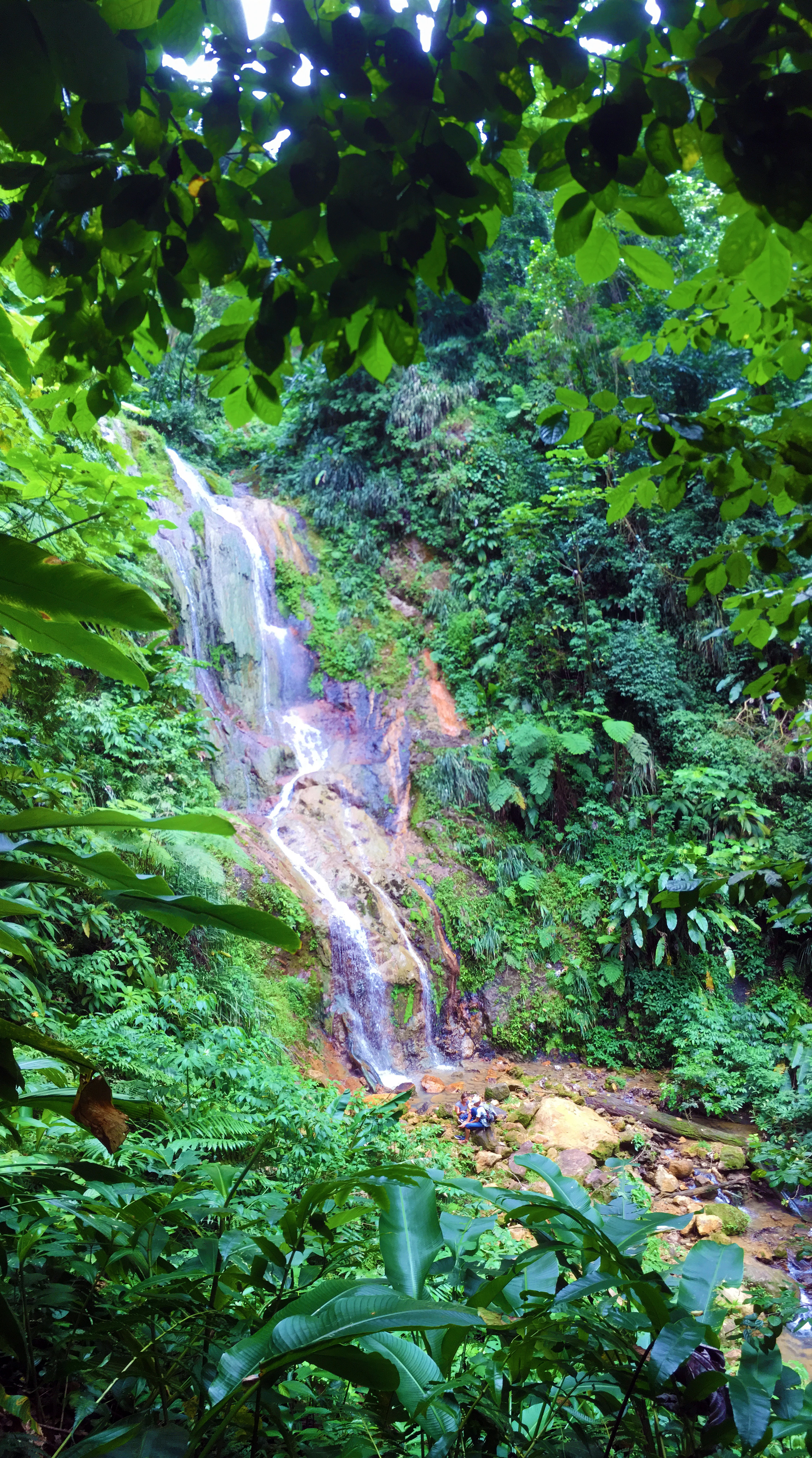
Mount St. Catherine Forest Reserve is best known for the cloud forest and elfin woodland that cap Grenada's highest peak, and for the role those forested highlands play in capturing rainfall and feeding the rivers that serve much of the island. The reserve is also recognized for its volcanic character, which sets it apart from the other terrestrial protected areas in Grenada. Within these highland forests, visitors and researchers prize the rare tropical montane cloud forest ecosystem, a fragile formation described as probably disappearing faster than any other forest type in the neotropics. The reserve is equally celebrated for the dramatic waterfalls, hot springs, and fumaroles of the Mt. St. Catherine volcanic system, including Tufton Hall Waterfalls, Hapsack Springs, and Clabony Sulphur Springs, which together give the protected area its distinctive combination of ecological, hydrological, and geothermal significance.
Mount St. Catherine Forest Reserve landscape and geographic character
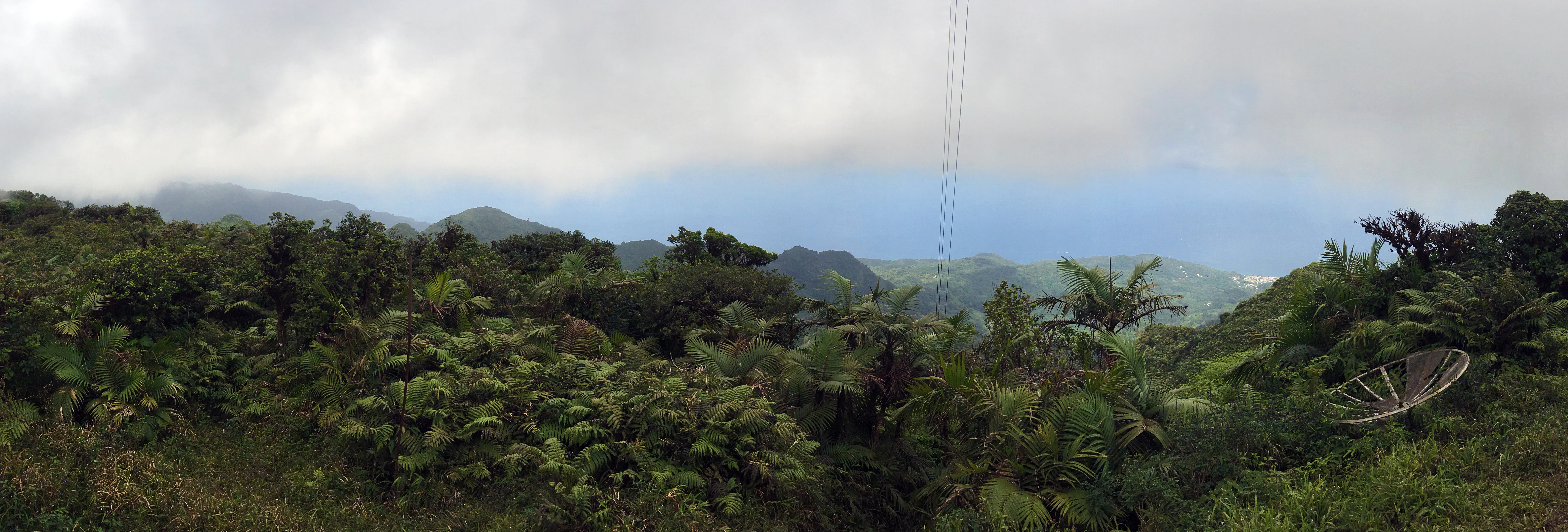
The landscape of Mount St. Catherine Forest Reserve is dominated by a single volcanic massif that reaches into the cloud zone above the rest of Grenada. Mount Saint Catherine itself stands at 840 meters, the highest point on the island, and its flanks fold outward into a network of forested ridges and lesser peaks, including Mount Hope. The terrain is steep and rugged above the lower slopes, with deeply incised ravines that channel the headwaters of the island's principal rivers.
At higher elevations, weathering has produced the harsh exposure that supports the distinctive elfin and Sierra palm cloud forest on the summit ridges. The mid-elevation slopes carry transitional and tall cloud forest, while the sheltered lower elevations hold relatively mature rainforest comparable to other Grenadian forests such as Grand Etang and Annandale. Around the periphery of the reserve, the natural topography blends into a working agricultural landscape, with mixed-woody plantations, particularly agroforestry plots of nutmeg and cacao, intersecting the forest boundary especially near Victoriaville and Mt. Horne. Geothermal features punctuate the volcanic flanks, including the country's most accessible sulphur bathing pool at Clabony Sulphur Springs and the hottest spring at Hapsack Springs.
Mount St. Catherine Forest Reserve ecosystems, habitats, and plant life
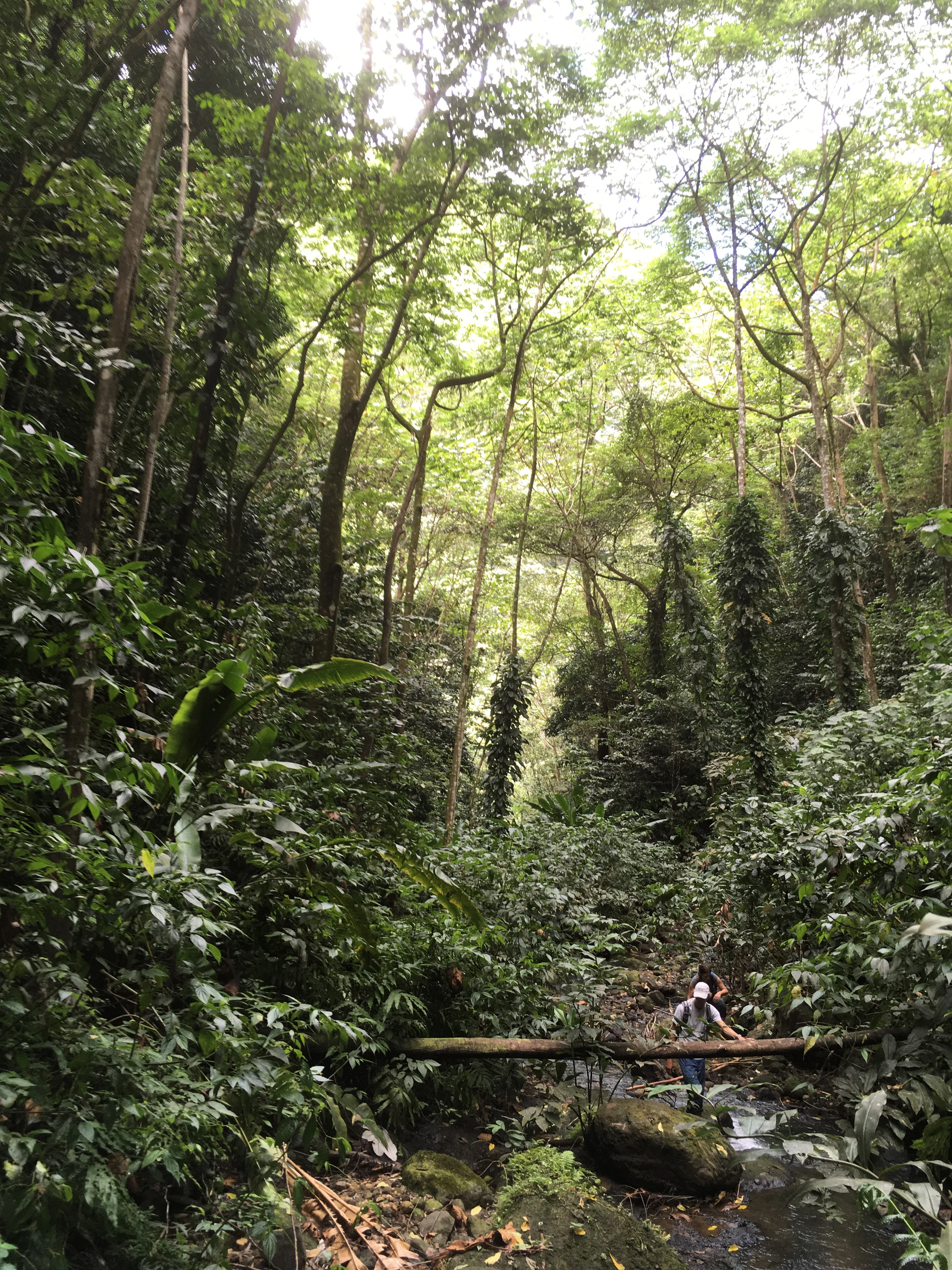
The reserve hosts a layered tropical forest ecosystem whose character changes with altitude. In the sheltered lowlands, mature rainforest with relatively large trees and tall canopy establishes a structure comparable to other Grenadian rainforests. Moving upward, this gives way to lower montane cloud forest and then to the transitional and tall cloud forest that lines the rivers and ravines leading to waterfalls such as Tufton Hall.
Near and on the summit, the vegetation compresses into the elfin and Sierra palm cloud forest typical of tropical mountains where clouds cling to the canopy almost continuously. These high forests are low in stature, with small tough leaves, low tree diversity, low productivity, and slow nutrient cycling, but they are exceptionally rich in ferns, mosses, and other epiphytes that hang from branches and trunks.
On the lower and outer ridges, secondary forest regrowth from past cut-over rainforest is widespread, and the boundary between protected forest and farmland is soft, with agroforestry plantations of nutmeg and cacao meeting the reserve's edge. Together, these zones form one of the rarest and most fragile forest formations in the Neotropics, considered highly endangered and potentially disappearing faster than any other tropical forest type.
Mount St. Catherine Forest Reserve conservation status and protection priorities
Mount St. Catherine Forest Reserve matters for conservation because it safeguards one of the last extensive tropical montane cloud forest ecosystems in the Lesser Antilles. These cloud forests are recognized as highly endangered formations in the Neotropics, rare and fragile, and likely vanishing faster than any other tropical forest type. By protecting the full altitudinal sequence from lowland rainforest to summit elfin woodland on a single massif, the reserve conserves ecological gradients that are difficult or impossible to restore once lost.
Its conservation value extends directly to water security. The highland forests intercept heavy rainfall and cloud-mist condensate, slowly releasing water that feeds seven of the largest watersheds in Grenada and supplies catchment basins used for water distribution and agriculture downstream. Only about ten percent of drinking water for the population is generated through groundwater, so protecting this forested source area is essential for hydrological regulation, flood control, groundwater recharge, water quality, and soil conservation.
The reserve also has a unique volcanic dimension among Grenada's protected areas. As the most morphologically preserved of the island's five volcanic centers, and the only one still showing hot springs and fumaroles on its flanks, it preserves geothermal systems and associated habitats of significant scientific and management interest, making its conservation both ecological and geophysical.
Mount St. Catherine Forest Reserve cultural meaning and human context
The reserve is woven into the working agricultural landscape of central Grenada, particularly around the communities of Victoria, Victoriaville, and Mt. Horne. Much of the area where forests meet farmland is shaped by agroforestry, especially nutmeg and cacao plantations that historically drove the construction of old estate roads and tracks now repurposed as the main trail system into the forest reserve.
This blending of protected natural area with intensive smallholder tree crops reflects the broader Grenadian tradition of mixed-woody agriculture integrated with hillside forest. Several of the trails into the reserve pass through these agroforestry settings, meaning that hiking the mountain is also an encounter with a living rural and cultural landscape rather than a purely natural environment. The reserve's role as a primary catchment for the island's rivers further embeds it in everyday life on Grenada, affecting domestic water supply as well as farming downstream.
Top sights and standout views in Mount St. Catherine Forest Reserve
The reserve's defining highlights include the summit of Mount Saint Catherine at 840 meters, Grenada's tallest point, and the rare elfin and Sierra palm cloud forest that caps it. Equally distinctive is the layered sequence of rainforest and cloud forest down the slopes of the massif, an altitudinal zonation framed by the volcanic geology that makes the mountain Grenada's only live volcano.
Water shapes the visitor experience as much as the ecology. Tufton Hall Waterfalls, the tallest in the country, pours through transitional and tall cloud forest along the St. Mark's River, while the headwaters of seven of Grenada's largest watersheds rise within the reserve and supply catchment basins essential to the island. Geothermal features add a third layer of distinctiveness, with Hapsack Springs marking the country's hottest known spring and Clabony Sulphur Springs providing the most accessible bathing pool.
Best time to visit Mount St. Catherine Forest Reserve
The reserve's character shifts with the seasons in ways that matter for both scenery and conditions on the trails. Rainfall is highly seasonal and locally limited across Grenada, with the cloud forests of Mount Saint Catherine receiving significant rainfall and cloud-mist condensate throughout the year, meaning that the mountain is reliably moist and the rivers flowing from it are perennial.
Periods with heavier rainfall tend to make the steep summit trails muddier and more demanding, and increase the volume of water at waterfalls and rivers, which can either enhance or complicate river trekking to geothermal features and cascades. Drier seasons typically bring more stable footing on the main summit routes and clearer views toward the coast, including the outlook toward Victoriaville from the summit exit on clear days. Because the reserve's mountains capture clouds almost continuously at the highest elevations, visitors can expect a cool, humid, montane atmosphere even when lower parts of the island are warm and sunny.



