Mori Atlas logo
Wildlife reserveMountain Lake Wilderness

Tracing the high-elevation ecosystems and watershed boundaries of this Virginia wilderness area

Mountain Lake Wilderness: An Atlas of Protected Appalachian Ridge and Valley Landscapes

Mountain Lake Wilderness preserves a unique intersection of northern-affinity habitats and classic Appalachian terrain across the Eastern Continental Divide. Situated within the George Washington and Jefferson National Forests, the area encompasses high-elevation mountain bogs, red spruce wetlands, and rocky ridgeline overlooks. This protected landscape serves as a critical watershed crossroads for the James and New River systems, offering deep insight into the complex geology and ecology of the Ridge and Valley region of Virginia.

Appalachian MountainsWilderness AreaMountain BogsVernal PondsRed Spruce ForestsHardwood Forests

Mountain Lake Wilderness

Wildlife reserve

Park overview

Structured park overview, official facts, and landscape profile for Mountain Lake Wilderness

Mountain Lake Wilderness park facts, protected area profile, and essential visitor context

Review the core facts for Mountain Lake Wilderness, including designation, size, terrain, visitor scale, habitats, and operating context in one park-focused overview.

About Mountain Lake Wilderness

Mountain Lake Wilderness is one of the more ecologically distinctive Wilderness Areas in the southern Appalachians, set within the broader George Washington and Jefferson National Forests and spanning the Virginia and West Virginia border. The wilderness preserves a high-elevation landscape defined by the meeting of the Ridge and Valley topography with unusual northern-affinity plant communities, an outcome shaped largely by elevation, frequent moisture, and the area's position along the Eastern Continental Divide.

The territory is anchored by the privately owned Mountain Lake and a mosaic of ridges, including Potts Mountain, Salt Pond Mountain, Piney Ridge, and Little Mountain. The intersection of Potts Mountain and Salt Pond Mountain forms a plateaulike interior, and the surrounding ridges frame the wilderness and produce the rocky overlooks that have become some of the most memorable features of the area. White Rocks, War Spur Overlook, Bear Cliffs, and Windrock are among the most commonly referenced viewpoints, all offering wide perspectives over the eastern hardwood forests that dominate the lower slopes and hollows.

Ecologically, the wilderness reflects both its Appalachian context and its unusual microclimate. Mountain bogs, vernal ponds, and red spruce wetlands support plants such as flexuous peatmoss, red peatmoss, tawny cotton-grass, southern mountain cranberry, and yellow birch, species more commonly associated with northern regions. These wet communities coexist with forests of eastern hemlock, oak, and hickory, as well as long stretches of eastern hardwood forest along the ridges and valleys.

The area's role as a watershed crossroads adds to its significance. Because the Eastern Continental Divide passes through the wilderness, water flowing from one side ultimately reaches the James River and the Atlantic Ocean, while water from the other side flows into the New River and on toward the Gulf of Mexico. The Johns Creek side of the divide once drained into the New River watershed, but over geologic time the James River system expanded and captured the stream, a subtle but meaningful reminder of the dynamic landscape history of the region.

Quick facts and research context for Mountain Lake Wilderness

Mountain Lake Wilderness spans roughly 11,035 acres across Virginia and West Virginia and encompasses about 8,314 acres in Virginia and 2,721 acres in West Virginia. It has been a federally designated Wilderness Area since 1984 and is administered by the George Washington and Jefferson National Forests through the U.S. Forest Service. Elevations range from approximately 2,200 feet to over 4,000 feet, and the area is bisected by the Eastern Continental Divide, making it a rare watershed crossroads within the Appalachians.

The wilderness is anchored around the privately owned Mountain Lake and includes Potts Mountain, Salt Pond Mountain, Piney Ridge, and Little Mountain. Roughly seventeen miles of trails cross the area, including five miles of the Appalachian Trail, and notable rock outcrops such as White Rocks, War Spur Overlook, Bear Cliffs, and Windrock provide dramatic viewpoints.

Protection and recognition

Documented terrestrial protection scope, management framework, and international recognition details

Mountain Lake Wilderness Protection Status and Official Designation Data

Mountain Lake Wilderness features a documented terrestrial protection scope and structured management framework within conservation records. Official designation metrics and international recognition sources outline the protected area framework for this wilderness landscape.

Protection details

Protection scope
Terrestrial
Transboundary protection
No
Park context

Deeper park guide and search-rich context for Mountain Lake Wilderness

Mountain Lake Wilderness history, landscape, wildlife, and travel context

Explore Mountain Lake Wilderness through its history, landscape character, ecosystems, wildlife, conservation priorities, cultural context, and seasonal travel timing in a structured park guide built for atlas discovery and search intent.

Why Mountain Lake Wilderness stands out

Mountain Lake Wilderness is best known for its cool, high-elevation Appalachian habitats that resemble ecosystems more typical of the northern United States. Frequent rain and elevation together create the conditions for mountain bogs, vernal ponds, and red spruce wetlands, ecological communities that are exceptional in the southern Appalachians. Beyond these unusual habitats, the wilderness is also recognized for its sweeping views from rocky overlooks along the ridge lines. White Rocks, War Spur Overlook, Bear Cliffs, and Windrock offer wide panoramas over eastern hardwood forests and dissected Appalachian terrain, while a section of the Appalachian Trail draws long-distance hikers who experience both the wilderness character and the larger trail's continuity through the region.

Mountain Lake Wilderness history and protected-area timeline

Mountain Lake Wilderness was established in 1984 as a federally designated Wilderness Area within the George Washington and Jefferson National Forests. The designation placed the area under formal protection as part of the National Wilderness Preservation System, with management focused on preserving its wilderness character, ecological values, and backcountry quality.

The forest landscape visible in the wilderness today reflects a complex human and natural history. Forests in the area were altered by logging during the 1920s, and many upland forests were further transformed in the twentieth century by the loss of the American chestnut following the spread of chestnut blight. More recently, eastern hemlock has been under pressure from the hemlock woolly adelgid, an introduced insect that is reshaping hemlock stands across the Appalachians.

At a much longer timescale, the regional landscape owes its present drainage patterns to ancient shifts in river systems: Johns Creek, which today drains into the James River watershed, once belonged to the New River system before the James River's watershed expanded over millions of years and captured the stream. Geologic history of this kind has shaped both the terrain and the ecological geography visible across the wilderness.

Mountain Lake Wilderness landscape and geographic character

Mountain Lake Wilderness lies within the Ridge and Valley system of the Appalachian Mountains, a region defined by long parallel ridgelines separated by forested valleys. Within the wilderness, the key landforms include Potts Mountain and Salt Pond Mountain, whose intersection creates a plateaulike interior; Piney Ridge running along the northeast; and Little Mountain along the northwest. The privately owned Mountain Lake sits at the heart of the area, surrounded by steep forested slopes and ridgelines.

Elevations range from about 2,200 feet to over 4,000 feet, giving the wilderness a vertical span wide enough to support noticeably different microhabitats. The Eastern Continental Divide bisects the terrain, and that hydrologic split makes the wilderness a true crossroads of watersheds: streams on the western side flow into Johns Creek and ultimately the James River, reaching the Atlantic; streams on the southeastern side flow into the New River and eventually the Gulf of Mexico.

The wilderness is also notable for its rocky exposures and overlook viewpoints. White Rocks, War Spur Overlook, Bear Cliffs, and Windrock create openings in the forest canopy and allow sweeping views over the surrounding mountains. These rocky outcrops, combined with the contrast between boggy interiors and dry ridge tops, give the area a varied and visually layered landscape despite its relatively compact size.

Mountain Lake Wilderness ecosystems, habitats, and plant life

The natural character of Mountain Lake Wilderness reflects an unusual overlap between typical southern Appalachian ecosystems and habitats more commonly found much farther north. The driving factors are elevation and persistent moisture, which together produce cooler, wetter conditions than would ordinarily be expected at this latitude.

Mountain bogs, vernal ponds, and red spruce wetlands are some of the most distinctive features of the area. These habitats support northern-style plants such as flexuous peatmoss, red peatmoss, tawny cotton-grass, southern mountain cranberry, flame azalea, and yellow birch. Cinnamon ferns, New York ferns, and a wide variety of other wetland plants thrive in the vernal pools, while yellow Clintonia, mayflower, pinxter, and rhododendron appear along the trails.

Surrounding these wet communities, the slopes and ridges are cloaked in eastern hardwood forest, including oak and hickory typical of the Virginia section of the Appalachians. Eastern hemlock is also present, though it is increasingly vulnerable to the hemlock woolly adelgid, an introduced pest that is reducing hemlock populations across the region. A rich seasonal display of wildflowers extends the ecological interest of the area well beyond its bogs, with spring bloomers like bloodroot, trillium, hepatic, jack-in-the-pulpit, and trailing arbutus giving way in summer and fall to goldenrods, great blue lobelia, jewelweed, and stiff gentian.

Mountain Lake Wilderness wildlife and species highlights

Mountain Lake Wilderness supports a wide variety of wildlife for an Appalachian protected area of its size. The forest, bog, and stream habitats together have been documented as hosting more than forty mammal species and over seventy bird species, giving the wilderness strong year-round faunal interest.

Among the more commonly observed mammals are wild turkey, muskrat, beaver, and gray fox. Smaller or less common species recorded in the area include least shrew, meadow jumping mouse, long-tailed weasel, striped skunk, and harvest mouse. Salamanders also have a notable presence, with at least one endangered species potentially present in the area's moist habitats.

Birdlife is particularly tied to the high-elevation forests and deep woodland habitats. Characteristic species include red crossbill, winter wren, veery, black-capped chickadee, Blackburnian warbler, rose-breasted grosbeak, and cerulean warbler. The streams of the wilderness also support important aquatic life, including the endangered James spiny mussel in the Johns Creek system and the candy darter, a colorful fish classified as endangered by the International Union for Conservation of Nature, in waters flowing toward Big Stony Creek.

Mountain Lake Wilderness conservation status and protection priorities

Mountain Lake Wilderness has conservation significance at several levels. As a federally designated Wilderness Area established in 1984, it sits within the National Wilderness Preservation System and benefits from a management framework focused on preserving ecological processes, limiting development, and protecting its wilderness character. Its position within the George Washington and Jefferson National Forests also connects it to broader landscape-scale conservation across the central Appalachians.

The wilderness is notable for protecting unusual northern-affinity habitats within a southern Appalachian setting, including mountain bogs, vernal ponds, and red spruce wetlands. These communities are uncommon in the region and are widely considered priorities for conservation because of their limited distribution and vulnerability to disturbance. The presence of endangered aquatic species, especially the James spiny mussel and the candy darter, gives the watersheds of the area specific conservation value and reinforces the importance of protecting stream quality.

At a broader scale, the wilderness sits on the Eastern Continental Divide, which makes the area ecologically significant as a meeting point for two major watersheds. Preserving the integrity of these headwaters supports downstream biodiversity, water quality, and habitat connectivity far beyond the wilderness boundary. The protected area is also part of the Mountain Lake Wilderness Cluster, linking it to a wider network of conservation lands in the region.

Mountain Lake Wilderness cultural meaning and human context

Cultural context for Mountain Lake Wilderness is closely tied to its Appalachian landscape and the long history of human interaction with these forests. The area's woodlands reflect the impact of twentieth-century logging, particularly during the 1920s, as well as the profound ecological changes triggered by the loss of the American chestnut to chestnut blight.

The wilderness also sits within a region shaped by rural Appalachian land use, including small communities connected by winding state routes such as Virginia 615, 632, and 635 and others nearby. Mountain Lake itself, privately owned and surrounded by the wilderness, has long been a distinctive local landmark, both as a natural feature and as a touchstone in the regional identity of southwest Virginia and adjoining parts of West Virginia. The Appalachian Trail, which passes through the wilderness, also carries a strong cultural resonance, linking the area to the broader hiking and heritage traditions of the Eastern United States.

Top sights and standout views in Mountain Lake Wilderness

Mountain Lake Wilderness stands out for the unusual combination of northern-affinity habitats and classic Appalachian scenery within a relatively compact protected area. Its red spruce wetlands, mountain bogs, and vernal ponds are ecological highlights that make it a significant site for understanding Appalachian biodiversity, while the rocky overlooks at White Rocks, War Spur Overlook, Bear Cliffs, and Windrock give visitors some of the most striking viewpoints in this part of the Appalachians.

Equally significant is the wilderness's role as a watershed crossroads along the Eastern Continental Divide, linking the James River and New River systems, and its place within the Mountain Lake Wilderness Cluster and the larger George Washington and Jefferson National Forests. A network of about seventeen miles of trails, including a five-mile segment of the Appalachian Trail, completes the picture of an area that blends ecological rarity, scenic beauty, and connection to broader regional landscapes.

Best time to visit Mountain Lake Wilderness

Because Mountain Lake Wilderness is a federally managed Wilderness Area without commercial development, its character changes primarily with the seasons in ways that affect scenery, conditions underfoot, and wildlife activity. Spring is one of the most rewarding periods to visit, as the trails come alive with wildflowers such as bloodroot, trillium, hepatica, trailing arbutus, and violets, and the bogs and vernal ponds are typically at their fullest.

Summer and fall offer different but equally notable experiences. Summer conditions in the bogs and streams support lush stands of ferns and late-blooming wildflowers, while autumn brings strong foliage color across the eastern hardwood forests of oak, hickory, and birch, with cooler temperatures improving hiking comfort and dramatic views from the rocky overlooks. Winter can bring snow to the higher elevations and a quieter atmosphere over the ridges, though conditions on trails at this elevation require appropriate preparation. Across the year, the area's cool, moist character means rain is common, and wet-weather conditions should be expected regardless of season.

Monthly climate preview

Long-term representative monthly averages for temperature and precipitation rhythm

Mountain Lake Wilderness Climate Normals and Annual Temperature Patterns

Representative coordinate measurements reveal long-term temperature ranges and precipitation rates spanning twelve distinct monthly periods for Mountain Lake Wilderness. Detailed monthly climate normals provide broader context for studying annual weather variations across the protected terrain.
Annual mean11 °C
-1 °C22 °C
Jan-1°
Feb
Mar
Apr11°
May16°
Jun20°
Jul22°
Aug22°
Sep18°
Oct12°
Nov
Dec
Warmest month
July

22.3 °C

Coolest month
January

-1.1 °C

Wettest month
May

3.6 mm/day

Driest month
October

2.3 mm/day

Park location guide

Geography guide, regional context, and park location map for Mountain Lake Wilderness

Mountain Lake Wilderness park geography, regions, and map view in United States of America

Understand where Mountain Lake Wilderness sits in United States of America through a broader geographic reading of the surrounding landscape, nearby location context, and its mapped position within the national park landscape.

How Mountain Lake Wilderness fits into United States of America

The United States of America is a federal presidential republic and one of the world's largest countries by area and population. It consists of 50 states across a vast territory spanning multiple time zones, with its capital in Washington, D.C. and largest city in New York City. The nation has a diverse economy, influential political system, and significant cultural and military presence globally.

Wider geography shaping Mountain Lake Wilderness in United States of America

The United States occupies a vast territory in North America, bordered by Canada to the north and Mexico to the south. The 48 contiguous states stretch from the Atlantic to the Pacific Ocean, while Alaska occupies the northwestern region and Hawaii is an archipelago in the Pacific. The country encompasses diverse terrain including the Rocky Mountains, Appalachian Mountains, Great Plains, and extensive river systems.

Map view of Mountain Lake Wilderness

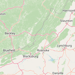
Use this park location map to pinpoint Mountain Lake Wilderness in United States of America, understand its exact geographic position, and read its mapped placement within the surrounding landscape more clearly.

Pigeon | © OpenStreetMap contributors

Location context for Mountain Lake Wilderness

VirginiaWest Virginia
Recorded earthquake history

Explore Historical Earthquake Records Near Mountain Lake Wilderness

Review the documented history of seismic events associated with the region surrounding Mountain Lake Wilderness. This MoriAtlas catalogue provides a clear, factual overview of past earthquake activity, offering geographic context for the seismic profile of this Appalachian protected area.

Mountain Lake Wilderness Earthquake History

Catalogued events

6 events

Strongest magnitude

Magnitude 3.6

Most recent event

Sep 13, 2017

This history includes earthquakes recorded inside the park or within 50 km of its borders

Park atlas

Compare adjacent ridge systems, national forests, and connected wilderness terrain

Parks Near Mountain Lake Wilderness and Surrounding Appalachian Protected Areas

Browse national parks and protected areas near Mountain Lake Wilderness to examine broader Appalachian ridgelines, forest reserves, and watershed divides. Comparing adjacent conservation landscapes reveals how high-elevation habitats and regional geography connect across the surrounding region.
Watercolor painting showing layers of soft green hills and mountain ridges fading into a light hazy background.
Protected landscapeWest Virginia
40 km away#1 closest

North

Monongahela National Forest: Protected Appalachian Landscapes and Regional Geography

Mapping West Virginia wilderness and mountain terrain

Monongahela National Forest protects nearly one million acres of the central Appalachian Mountains. This massive federally managed landscape is defined by the Allegheny Front, the highest peak in the Allegheny range at Spruce Knob, and iconic geological formations like Seneca Rocks. The region represents a vital intersection of climate, hydrology, and biodiversity in the eastern United States, housing eight distinct wilderness areas and complex high-altitude ecosystems.

Area
3,727.8 km²
Established
1920
Visitors
3M annual
Relief
Mountain
National parkWest Virginia
42 km away#2 closest

Northwest

New River Gorge National Park and Preserve: Appalachian River Gorge Protected Landscape Atlas

Mapped terrain and geographic context within West Virginia.

Delve into the protected landscape identity of New River Gorge National Park and Preserve, a significant national park in West Virginia. This page details its role as a protected area, highlighting the dramatic river gorge geography, mapped terrain, and its place within the Appalachian Mountains. Understand the park's boundaries and the natural context that makes it a key destination for geographic discovery and conservation appreciation.

Area
294.64 km²
Established
2020
IUCN
V
Visitors
1.6M annual
A soft, light-toned watercolor illustration of a winding creek flowing through a lush, green landscape with distant rolling hills and scattered trees.
Wildlife reserveBland County
47 km away#3 closest

Southwest

Kimberling Creek Wilderness: Geography and Protected Land Boundaries in Bland County

A trail-free Appalachian wilderness reserve in Jefferson National Forest

Kimberling Creek Wilderness represents a significant protected enclave in the central Appalachians of Virginia. This detail covers the steep topography extending from Kimberling Creek to the ridgeline of Hogback Mountain, characterized by sheltered cove forests and diverse oak-hickory stands. The area offers a rare glimpse into recovering eastern old-growth forest ecosystems within an entirely trail-free wilderness environment.

Area
23.99 km²
Established
1984
IUCN
Ib
Relief
Mountain
Wildlife reserveBland County
65 km away#4 closest

Southwest

Hunting Camp Creek Wilderness: Mapped Protected Landscapes in Bland County

Wildlife reserve terrain and Appalachian mountain geography

Hunting Camp Creek Wilderness encompasses an 8,471-acre protected area in Virginia, defined by the Garden Mountain and Brushy Mountain ridges. This wildlife reserve features deep valleys, dense forests, and a core section of the Appalachian Trail, serving as a critical refuge for local mountain biodiversity and wild backcountry exploration.

Area
34.28 km²
Established
2009
IUCN
Ib
Relief
Mountain
A watercolor painting showing a soft, stylized landscape with rolling green hills, a winding stream, and trees under a pale sky.
Protected areaVirginia
75 km away#5 closest

Southwest

Garden Mountain Wilderness: Appalachian Protected Area and Regional Landscape Geography

Old-growth forest and ridge-bound Appalachian terrain in Virginia

Garden Mountain Wilderness encompasses a significant Appalachian ridge and the deep Lick Creek valley within western Virginia. This protected area harbors diverse hardwood forests, old-growth remnants, and critical habitat for rare species. The topography is defined by parallel ridges and enclosed valleys, showcasing the geological complexity of the central Appalachians and the importance of localized conservation efforts.

Area
13.48 km²
Established
2009
IUCN
Ib
Relief
Mountain
Wildlife reserveVirginia
76 km away#6 closest

Northeast

Rough Mountain Wilderness: Mapping Appalachian Ridges and Protected Terrain

Remote wildlife reserve in western Virginia

Spanning over 9,000 acres, Rough Mountain Wilderness provides a rare example of undisturbed Appalachian forest. The area is characterized by consistently steep slopes, sharp ridgeline topography, and a deep sense of isolation within the George Washington and Jefferson National Forests of western Virginia.

Area
38 km²
Established
1987
IUCN
Ib
Relief
Mountain
Wildlife reserveVirginia
77 km away#7 closest

Northeast

Rich Hole Wilderness: Appalachian Wildlife Reserve and Forest Geography

Protected cove hardwood forest in western Virginia

Rich Hole Wilderness represents a protected high quality forest landscape located within the James River Ranger District. This area spans steep, narrow hollows and high ridge crests, providing critical habitat and showcasing old growth timber specimens. Use this resource to understand the park terrain, drainage patterns, and its position within the broader Appalachian forest network of western Virginia.

Area
26.1 km²
Established
1988
IUCN
Ib
Relief
Mountain
A wide watercolor illustration showing rolling mountains in pastel shades of pink, purple, and green, with a line of trees and a reflective body of water in the foreground, framed by bare tree branches on the sides.
Protected areaVirginia
82 km away#8 closest

East

James River Face Wilderness: Mapping the Topography of Virginia's Blue Ridge Protected Landscapes

Geographic overview of mountain wildlands and boulder fields

Spanning over 8,900 acres, James River Face Wilderness serves as a vital protected area within the Appalachian mountain chain. The landscape contains steep creek drainages, vertical ridgelines, and significant geological formations such as the Devils Marbleyard, offering a comprehensive study of central Virginia's complex forest ecosystems and rugged mountain terrain.

Area
36.05 km²
Established
1975
IUCN
Ib
Relief
Mountain

Common questions about visiting, size, designation, and location context for Mountain Lake Wilderness

Mountain Lake Wilderness FAQs for park facts, access, geography, and protected area context

Find quick answers about Mountain Lake Wilderness, including protected-area facts, park geography, trail and visitor context, and how the park fits into its surrounding country and regional landscape.
MoriAtlas Explorer

Continue Your Protected Areas Search Across the Global Atlas

Deepen your exploration by continuing the structured search for national parks and protected areas worldwide. Utilize the comprehensive filtering capabilities to compare different conservation landscapes and refine your understanding of global park geography. Discover more about the distribution and characteristics of protected natural areas.

Global natural geography