
Mori Atlas logo
Nature reserveMuckenbruch

Mapping the ecological mosaic of bog woodland, sedge marshes, and restored wetland habitats

Muckenbruch Nature Reserve: A Structured Geographic Atlas of Protected Lowland Peatland Landscapes

(Naturschutzgebiet Muckenbruch)

Muckenbruch functions as a vital protected lowland peat bog within the Hellwegbörde landscape of North Rhine-Westphalia. This nature reserve preserves a complex mosaic of reedbeds, wet meadows, and near-natural spring-fed streams that define the local hydrologic terrain. Through active restoration and rewetting efforts, the area serves as a key site for studying the recovery of peatland ecosystems and their role within the broader European Natura 2000 network.

lowland peat bogwetlandnature reservebog woodlandmoorreedbeds
A flat-style digital illustration of a scenic valley with a winding river, stylized green trees in the foreground, and high mountain cliffs with a small waterfall in the background under a sunrise sky.

Muckenbruch

Nature reserve

Park overview

Structured park overview, official facts, and landscape profile for Muckenbruch

Muckenbruch park facts, protected area profile, and essential visitor context

Review the core facts for Muckenbruch, including designation, size, terrain, visitor scale, habitats, and operating context in one park-focused overview.

About Muckenbruch

Muckenbruch is a small but ecologically rich nature reserve situated at the northwestern edge of Bad Westernkotten, a district of Erwitte in the Kreis Soest. Although it lies immediately beside the village, the 97-hectare area has been formally protected since 1996 and today forms a key node in the regional Natura 2000 network. Its protected status under both the Habitats Directive (as part of FFH area DE-4315-302) and the European Birds Directive (within the Hellwegbörde bird protection area DE-4416-401) reflects its cross-border importance for biodiversity conservation in northwestern Germany.

The defining feature of the reserve is its concentration of groundwater-dependent wetland habitats within a single, clearly bounded area. Bog woodland dominated by black alder and ash, mixed sedge stands, reedbeds, wet grassland, and small near-natural streams all occur in close proximity, producing the structural complexity that is increasingly rare in intensively farmed lowland landscapes. This habitat mosaic supports a notably high variety of plant species typical of traditionally undrained lowland peat, as well as characteristic wetland fauna.

Beyond its biological value, Muckenbruch has also become an important local reference for peatland restoration practice. Decades of agricultural drainage had lowered groundwater levels and triggered ongoing peat decomposition. Management interventions beginning in 2014, including the closing of drainage ditches and the construction of overflow weirs along paths, have begun to raise water tables and allow typical bog vegetation to re-establish. The recolonization by the European beaver in 2022 underscores the recovery of hydrological conditions suitable for demanding wetland species.

Quick facts and research context for Muckenbruch

Muckenbruch is a 97.1-hectare nature reserve established in 1996 by the Bezirksregierung Arnsberg and confirmed through the Erwitte-Anröchte landscape plan. It lies in the Kreis Soest in North Rhine-Westphalia, adjoining the village of Bad Westernkotten, and has been part of the FFH site Manninghofer Bach sowie Gieseler und Muckenbruch (DE-4315-302) since 2004.

The reserve is also part of the Hellwegbörde European Bird Protection Area (DE-4416-401) and is managed as a mosaic of lowland peat habitats, including bog woodland, reeds, sedge marshes, wet grassland, and near-natural streams. Restoration work since 2014 has focused on rewetting drained peatland to halt ongoing moor degradation.

Protection and recognition

Examine the terrestrial protected area designation and management scope for Muckenbruch

Muckenbruch Protection Status and International Recognition Record

Muckenbruch maintains a documented terrestrial protection status within its regional conservation landscape. Verification records compile official designation history and management scope without external assumptions.

Protection details

Protection scope
Terrestrial
Park context

Deeper park guide and search-rich context for Muckenbruch

Muckenbruch history, landscape, wildlife, and travel context

Explore Muckenbruch through its history, landscape character, ecosystems, wildlife, conservation priorities, cultural context, and seasonal travel timing in a structured park guide built for atlas discovery and search intent.

Why Muckenbruch stands out

Muckenbruch is best known as one of the most structurally diverse lowland peat bogs in the Hellwegbörde, where a small, village-edge reserve protects a near-intact mosaic of bog woodland, sedge marshes, reeds, wet meadows, and spring-fed streams. Its significance lies in combining traditional peatland habitats with active rewetting management that has already begun to restore characteristic wetland vegetation and improve groundwater levels.
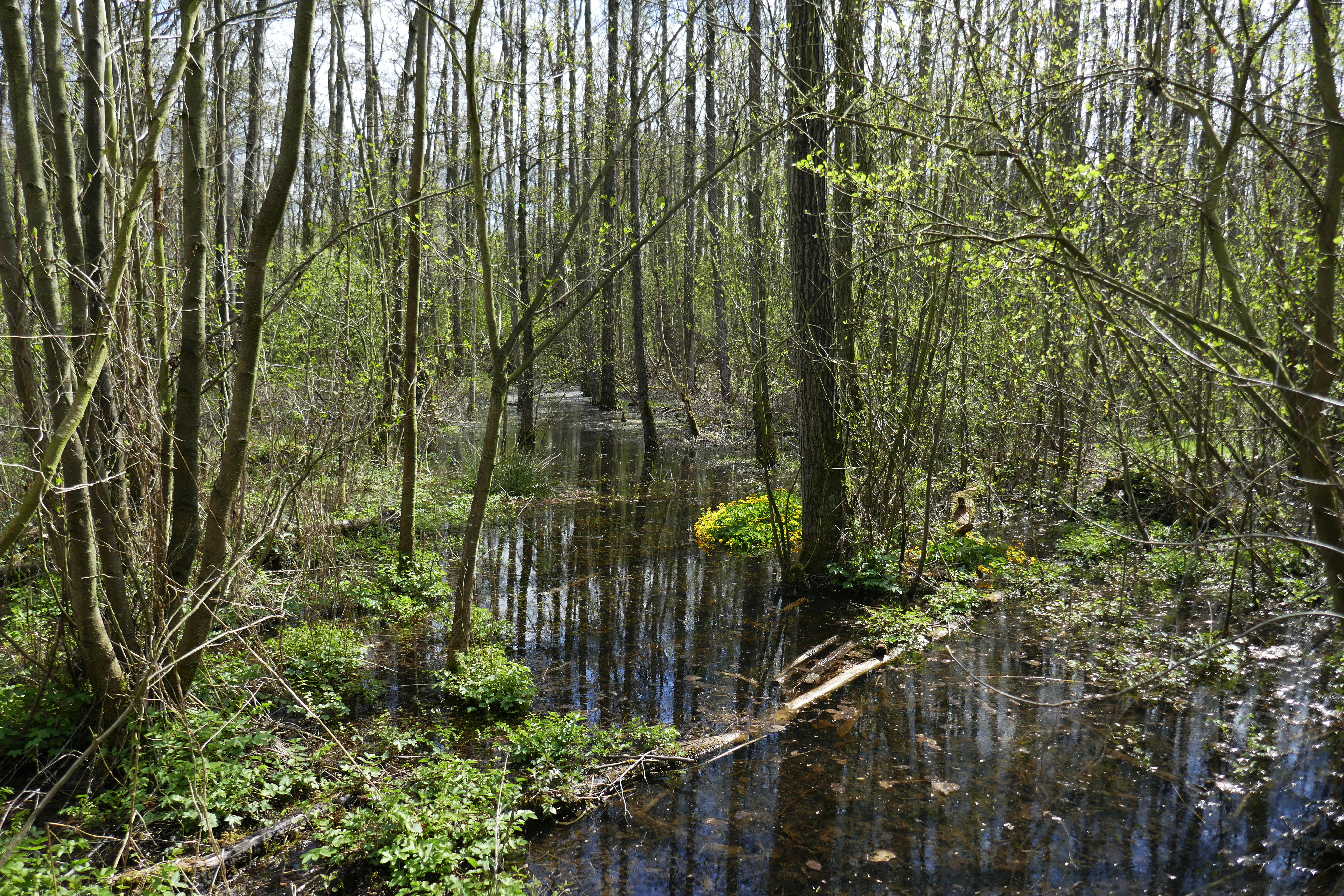
A swampy woodland scene with thin, tall trees growing out of still, dark water, with patches of bright green vegetation and yellow flowers visible at the base.
A view of the wetland habitat within the Muckenbruch nature reserve.

Muckenbruch history and protected-area timeline

Historically, the peatland of Muckenbruch was used by local communities as a source of domestic heating fuel, with peat cut from the bog over long periods. This traditional use shaped the open, irregular surface of the reserve, leaving behind numerous former peat-cutting pits that today form some of the most ecologically valuable microhabitats within the area.

As twentieth-century drainage expanded across the surrounding agricultural landscape, water levels in Muckenbruch fell and the bog began to lose its characteristic peat-forming vegetation. Recognizing both the biodiversity value and the conservation significance of the site, the Bezirksregierung Arnsberg formally designated it as the Naturschutzgebiet Muckenbruch in 1996, covering roughly 97 hectares. The protection was subsequently reaffirmed through the Erwitte-Anröchte landscape plan adopted by the Kreistag of Kreis Soest.

In 2004, the reserve was integrated into the EU-wide Natura 2000 network as part of the FFH area Manninghofer Bach sowie Gieseler und Muckenbruch, and it later became part of the Hellwegbörde European Bird Protection Area. By the 2010s, sustained peat loss led to active rewetting interventions: in 2014 several drainage ditches were closed and pedestrian paths were rerouted or removed to allow more natural water distribution. By 2024, restoration work had focused mainly on the northern municipal portion of the bog, while private land within the reserve remained largely unrestored. Since 2015, the traditional pollarded willows (Kopfweiden) outside the forested area have also been actively maintained and replaced where lost.

Muckenbruch landscape and geographic character

The landscape of Muckenbruch is a classic lowland peatland mosaic set within the gently undulating agricultural terrain of the Hellwegbörde. Although its surroundings are dominated by farmland and the modern spa settlement of Bad Westernkotten, the reserve itself preserves an unexpectedly varied wetland topography shaped by centuries of peat cutting, groundwater fluctuation, and small-scale watercourse activity.

Old and current peat cuttings create shallow pools, hummocks, and wet depressions that interrupt the otherwise flat surface. Through these openings run near-natural brooks and spring-fed channels bordered by reeds, sedges, and tall forbs. Bog woodland, wet meadows, and open sedge- and reed-dominated areas alternate across short distances, giving the site a richly textured appearance that contrasts strongly with the surrounding fields.

The reserve's microtopography is closely tied to its hydrology. Following drainage and rewetting interventions, water levels now rise visibly in the cooler months, sometimes flooding sections of the bog woodland and softening the boundaries between open water, wet grassland, and wooded areas. In summer, lowered water tables expose cracking peat surfaces, highlighting the fragile balance between intact bog soils and degrading peat.
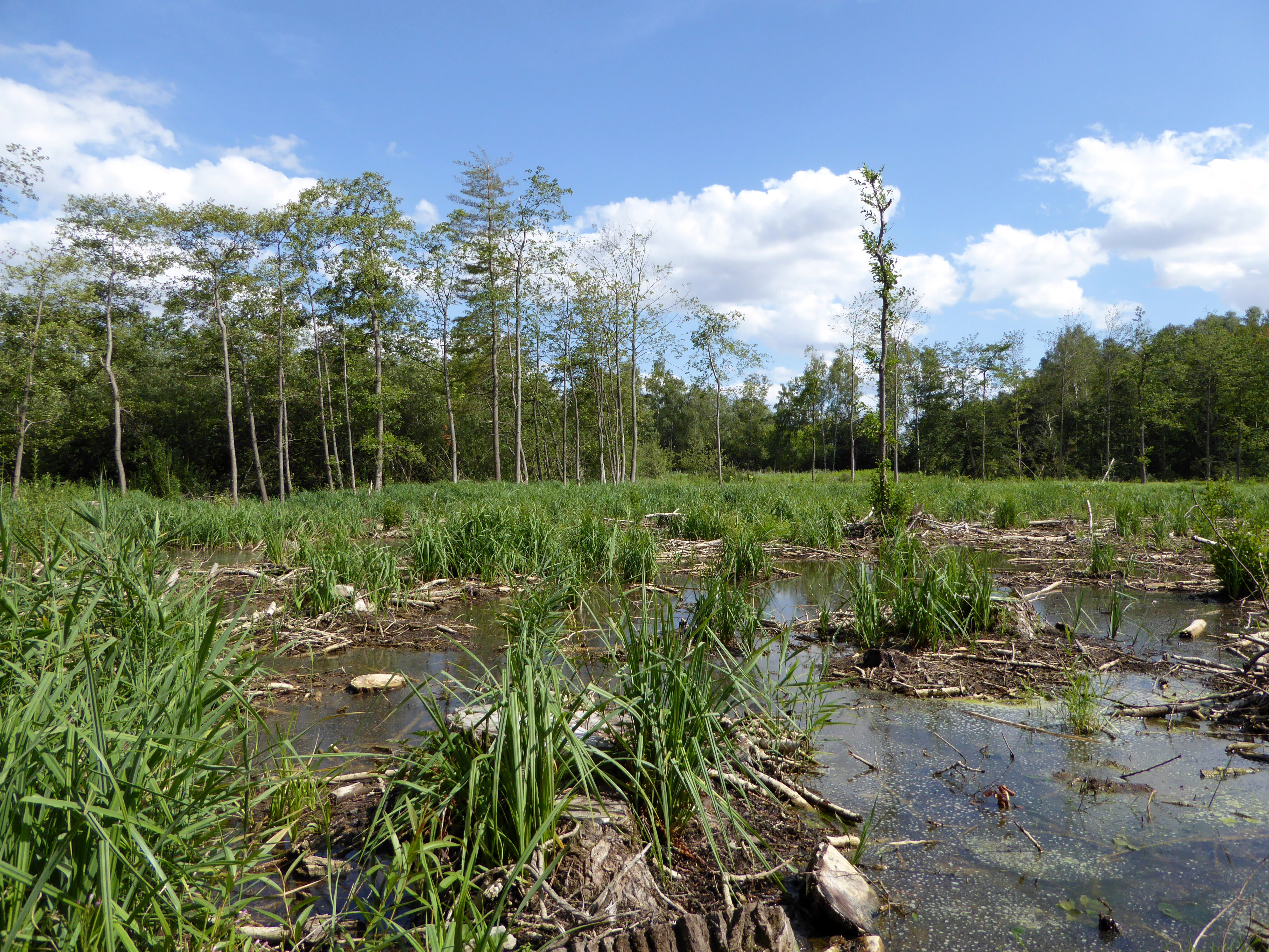
A lowland moor landscape featuring shallow pools of water, patches of grasses, and a background line of deciduous trees under a blue sky.
The Muckenbruch nature reserve features a mosaic of wetland habitats including fen bog and riparian woodland.

Muckenbruch ecosystems, habitats, and plant life

Ecologically, Muckenbruch belongs to the increasingly rare category of structurally intact lowland peat bogs in northwestern Germany. Its value lies in the diversity of wetland habitat types packed into a compact area: alder and ash floodplain forests, sedge marshes, reedbeds, wet meadows, and small flowing waters each occupy clearly distinguishable zones shaped by groundwater depth and seasonal inundation.

The vegetation is typical of base-rich to moderately acidic peatland. Sedges, reeds, marsh marigolds, common marsh valerian, marsh forget-me-nots, water mint, various pondweeds, and a long list of wet-grassland and moist woodland plants form the botanical backbone of the reserve. In restored sections the recovery of sedge- and reed-dominated communities has come at the expense of nettle and tall goldenrod stands that had colonized during the drier decades.

Habitats for amphibians, dragonflies, and wetland invertebrates combine with mature and recovering bog woodland to produce a layered ecological structure. The re-establishment of stable wet conditions after rewetting has been a decisive factor in supporting characteristic wetland species groups once again.
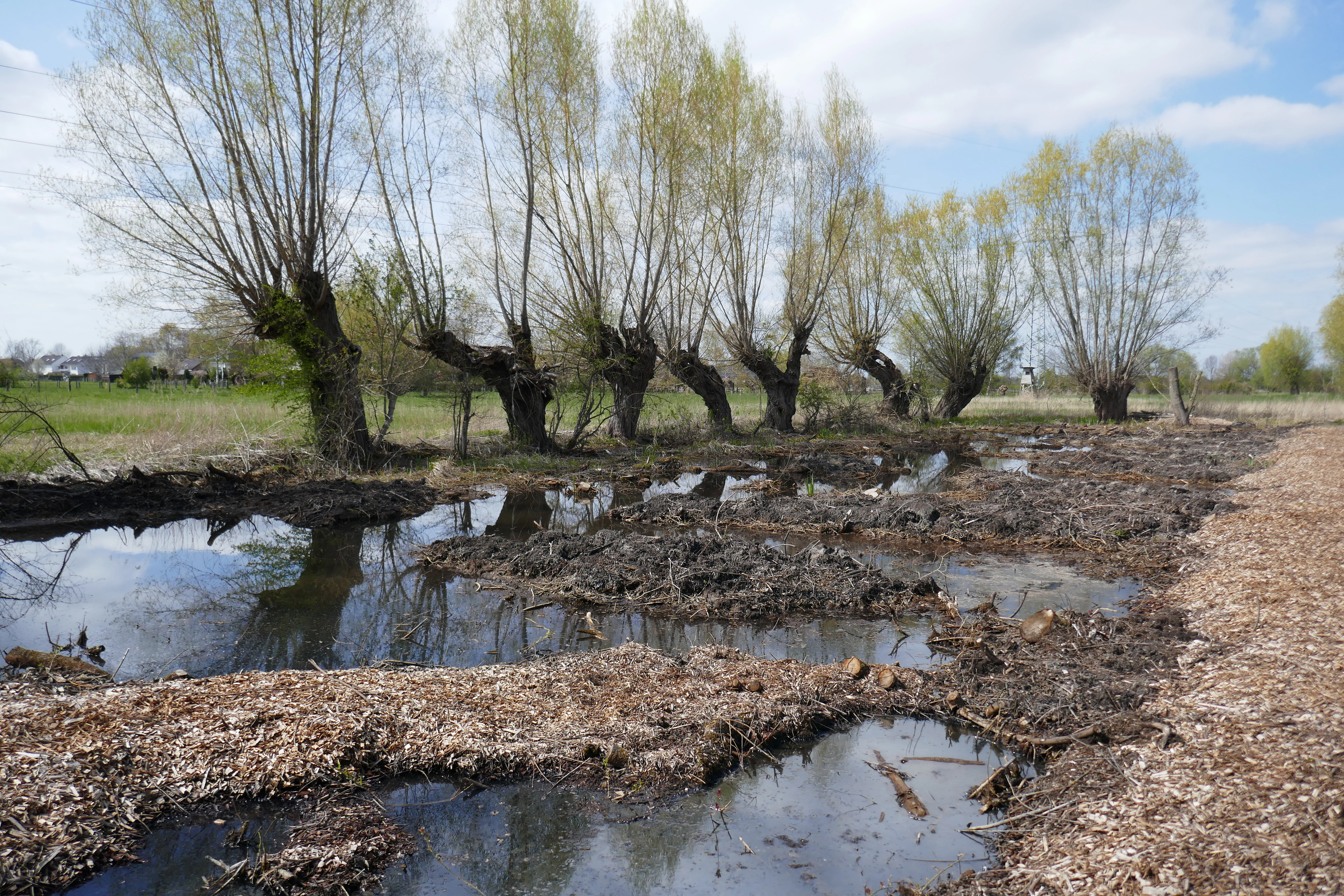
A row of pollard willow trees standing along a muddy wetland area with standing water and wood chips in the foreground.
A view of the wetland habitat and pollard willows at the Muckenbruch nature reserve.

Muckenbruch wildlife and species highlights

Wildlife in Muckenbruch reflects the diversity of wetland habitats the reserve protects. Confirmed fauna includes the European bullhead fish in the brooks, the marsh harrier and kingfisher as characteristic bird species, and the yellow-bellied toad, which uses the former and current peat cuttings as breeding habitat. The yellow-bellied toad population in the reserve was historically one of the most significant in Westphalia, although it has declined in part due to predation pressure from raccoons.

A notable milestone for the site occurred in 2022, when the European beaver became established in the reserve, an indicator that hydrological conditions have recovered sufficiently to support a mammal with demanding wetland habitat requirements. Wetland birds, amphibians, and aquatic invertebrates all benefit from the rewetted peatland mosaic, while the older bog woodland and pollarded willows provide nesting and roosting structures for a range of species.
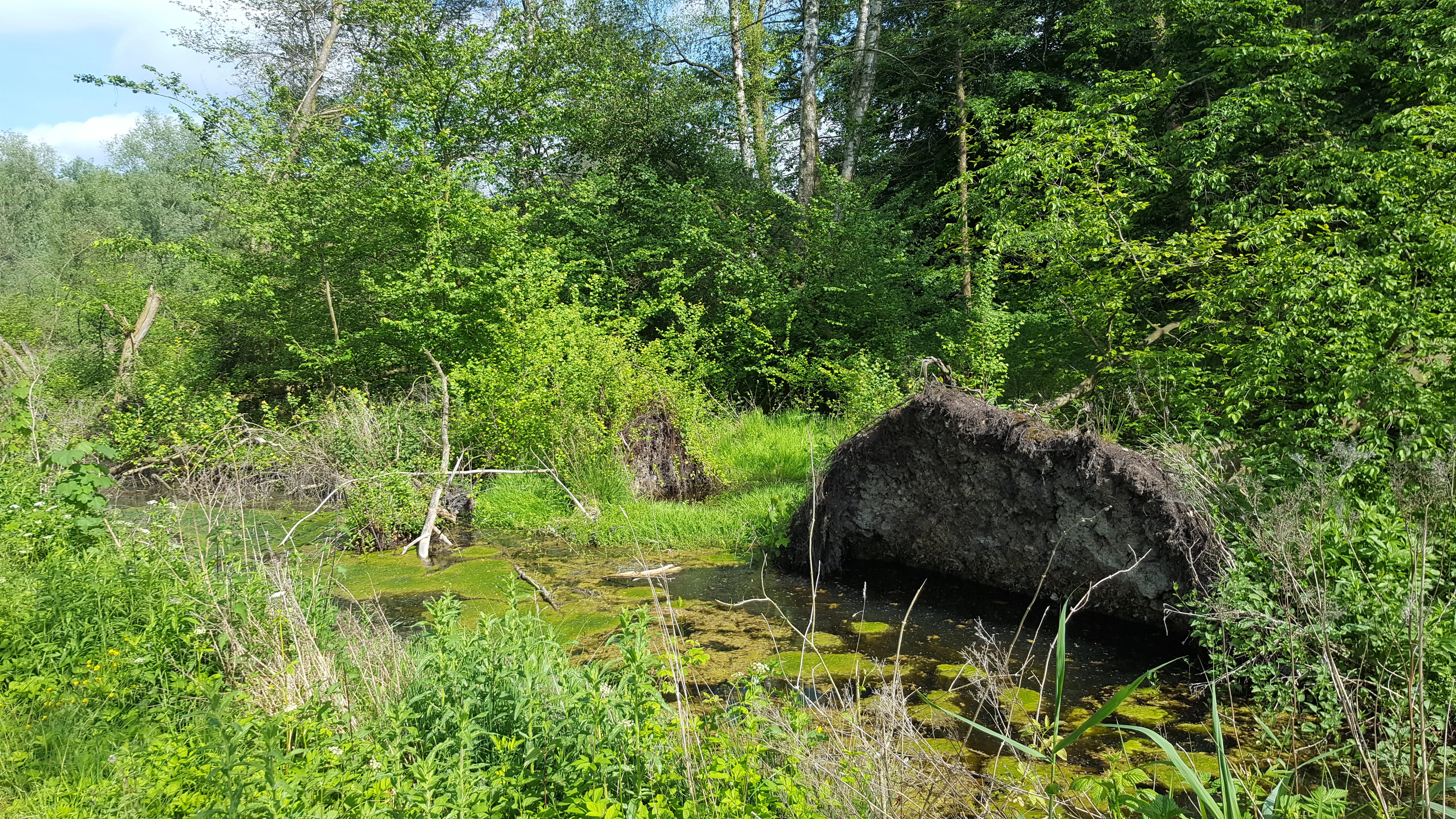
A small pond covered in algae, with a large uprooted tree stump partially submerged in the foreground, surrounded by lush green foliage and trees.
A fallen tree resting in a small pond within the Muckenbruch nature reserve.

Muckenbruch conservation status and protection priorities

The conservation significance of Muckenbruch extends well beyond its local scale. As a nature reserve within the Kreis Soest and a component of two EU Natura 2000 designations, it contributes to the protection of lowland peatland habitats and their associated species within the wider Hellwegbörde ecological landscape. Its inclusion in the Hellwegbörde European Bird Protection Area underscores its role in safeguarding bird populations of European concern.

Active management is central to the reserve's conservation story. Decades of agricultural drainage had caused peat decomposition, loss of typical bog vegetation, and expanding colonization by nettle and tall goldenrod. Rewetting measures implemented from 2014 onward, including the closure of drainage ditches, removal of unnecessary paved paths, and the installation of overflow structures to distribute water following natural slope patterns, have begun to reverse this trend. By 2024 the result is visible in rising water tables in parts of the northern municipal area, recovering sedge and reed stands, retreating invasive plants, and the return of beaver.

Muckenbruch cultural meaning and human context

Muckenbruch reflects a long-standing human relationship with lowland peatlands in the Hellwegbörde. Peat was historically cut from the bog for domestic heating, shaping both the surface of the reserve and the traditional rural landscape around Bad Westernkotten. The persistent presence of pollarded willows (Kopfweiden), now actively maintained since 2015, ties the modern reserve to older countryside practices of willow management along wet field margins and ditches.

The reserve also sits at the interface between a historic agricultural lowland and a modern spa village, meaning that conservation here is closely tied to questions of land use, private property, and local identity. The distinction between actively restored municipal land and unrestored private parcels within the protected boundary highlights the social dimension of peatland conservation in densely settled lowland Germany.

Top sights and standout views in Muckenbruch

Within a compact footprint at the edge of Bad Westernkotten, Muckenbruch combines bog woodland, reedbeds, sedge marshes, wet meadows, and small flowing waters into one of the more structurally intact lowland peat mosaics in the Hellwegbörde. Its formal Natura 2000 status, both as an FFH site and a European Bird Protection Area, places it in a network of internationally significant wetland habitats.

The reserve stands out for its active rewetting program, which has demonstrably raised water tables, restored characteristic sedge and reed vegetation, and supported the recolonization by the European beaver. The combination of traditional peatland elements, including pollarded willows and former peat cuttings, with contemporary restoration practice gives Muckenbruch a distinctive identity among the nature reserves of Kreis Soest.

Best time to visit Muckenbruch

Late spring is generally a good time to experience Muckenbruch, when marsh marigolds and other wetland wildflowers are in bloom and the bog woodland is visibly saturated by high winter and spring groundwater levels. Spring visits tend to show the site at its wettest, with standing water in the peat cuttings and along parts of the bog woodland.

Summer offers drier surface conditions and active dragonfly and amphibian presence around the remaining open water bodies, but also exposes the cracked peat surfaces that illustrate why rewetting work is so important here. Autumn and winter bring the highest water levels of the year, when rewetted sections may show extensive flooding and bird activity becomes a more prominent feature of the landscape.

Monthly climate preview

Long-term temperature and precipitation averages recorded at representative coordinates

Muckenbruch Climate Normals and Measured Monthly Weather Patterns

Representative point measurements reveal the long-term temperature ranges and precipitation rates shaping Muckenbruch across twelve distinct months. Detailed monthly climate profiles provide complete statistical records for comparing seasonal shifts in local weather conditions.
Annual mean9 °C
0 °C18 °C
Jan
Feb
Mar
Apr
May12°
Jun16°
Jul18°
Aug18°
Sep14°
Oct
Nov
Dec
Warmest month
July

18.2 °C

Coolest month
January

0.3 °C

Wettest month
December

2.7 mm/day

Driest month
April

1.7 mm/day

Park location guide

Geography guide, regional context, and park location map for Muckenbruch

Muckenbruch park geography, regions, and map view in Germany

Understand where Muckenbruch sits in Germany through a broader geographic reading of the surrounding landscape, nearby location context, and its mapped position within the national park landscape.

How Muckenbruch fits into Germany

Germany is a federal republic in Western and Central Europe with a population of over 83 million across sixteen constituent states. It is Europe's largest economy by nominal GDP and a major global exporter and importer. The capital is Berlin, and the country borders Denmark, Poland, Czech Republic, Austria, Switzerland, France, Luxembourg, Belgium, and the Netherlands.

Wider geography shaping Muckenbruch in Germany

Germany is located in Western and Central Europe, spanning 357,022 km². It borders Denmark to the north, Poland and the Czech Republic to the east, Austria and Switzerland to the south, and France, Luxembourg, Belgium, and the Netherlands to the west. The country has coastlines on the Baltic Sea and North Sea to the north, with the Alps located in the southern region.

Map view of Muckenbruch

Use this park location map to pinpoint Muckenbruch in Germany, understand its exact geographic position, and read its mapped placement within the surrounding landscape more clearly.

Pigeon | © OpenStreetMap contributors

Location context for Muckenbruch

North Rhine-Westphalia

Visualizing lowland peat bog habitats, rewetting zones, and reserve terrain

Muckenbruch Landscape Photos and Protected Wetland Scenery

Photographic documentation reveals the intricate topography of bog woodland, sedge marshes, and spring-fed channels across the protected reserve. Examining these visual records helps clarify wetland restoration patterns and the diverse microclimates shaping the peatland environment.

A swampy woodland scene with thin, tall trees growing out of still, dark water, with patches of bright green vegetation and yellow flowers visible at the base.

A cluster of vibrant yellow marsh marigold flowers growing in shallow dark water at the base of a tree in a wetland area.

A lowland moor landscape featuring shallow pools of water, patches of grasses, and a background line of deciduous trees under a blue sky.

A row of pollard willow trees standing along a muddy wetland area with standing water and wood chips in the foreground.

A small pond covered in algae, with a large uprooted tree stump partially submerged in the foreground, surrounded by lush green foliage and trees.

Park atlas

Compare nearby wetland reserves and regional lowland habitats across the wider regional geography

Explore Parks Near Muckenbruch and Surrounding Protected Landscapes

Browsing other protected areas near Muckenbruch reveals a broader network of regional wetland habitats and lowland conservation zones. Extending the geographic comparison helps trace similar peatland restoration projects and connected protected landscapes throughout the surrounding region.
Protected landscapeKreis Paderborn
About 17 km away#1 closest

Southeast

Landschaftsschutzgebiet FFH-Gebiet Wälder bei Büren: Regional Protected Forest Landscapes

Geographic map and protected area context in Kreis Paderborn

Landschaftsschutzgebiet FFH-Gebiet Wälder bei Büren functions as a European-level habitat site defined by its interconnected beech forest mosaic. The area is characterized by a mix of woodruff and rough blue-grass beech woodland, interwoven with intermittent stream courses, source areas, and geological sinkholes that create varied microhabitats within the North Rhine-Westphalia landscape.

Area
28.045 km²
Established
2007
Relief
Upland
Climate
Temperate
Watercolor painting of a peaceful wetland landscape with green grassy fields, small groups of trees, and a central pond, set against a soft, pale background.
Nature reserveNordrhein-Westfalen
About 20 km away#2 closest

North

Rietberger Emsniederung mit Steinhorster Becken: Geography and Nature Reserve Atlas

Protected floodplain habitats in North Rhine-Westphalia

Situated along the upper Ems river, this protected area serves as an essential ecological corridor. Examine the mapped extent of its wet meadows, basin structures, and riverine channels that distinguish this region from the surrounding agricultural landscape.

Area
9.28 km²
Established
2000
Relief
Lowland
Climate
Temperate
Nature reserveNordrhein-Westfalen
About 20 km away#3 closest

Northwest

Märzenbecherwald Nature Reserve: Wetland Mosaic and Protected Forest in Nordrhein-Westfalen

A rare calcareous fen and alder swamp forest ecosystem

This protected nature reserve in the Warendorf district serves as a vital ecological anchor, preserving a mosaic of spring-fed seeps, damp woodlands, and calcareous fens. Despite its modest size, the area provides a sharp contrast to the surrounding agricultural fields of the Münsterland region, maintaining a essential water-logged habitat for specialized plant species.

Area
0.016 km²
Established
1995
IUCN
IV
Relief
Lowland
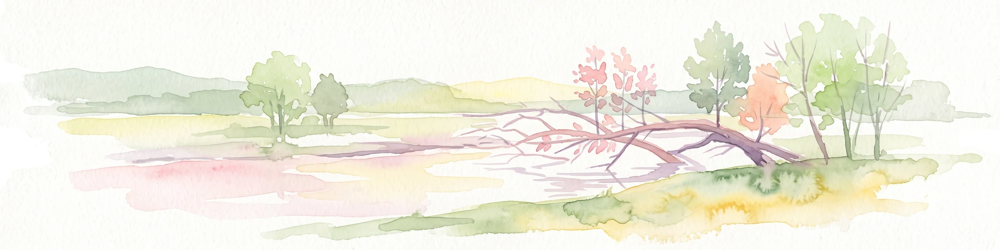
A soft watercolor illustration showing a calm, light-toned landscape with a river, a fallen tree reaching into the water, and sparse trees against a backdrop of gentle hills.
Nature reserveNordrhein-Westfalen
About 20 km away#4 closest

West

Lippeaue zwischen Hamm und Lippstadt mit Ahsewiesen Protected Area and Wetland Geography

Mapping the floodplain meadows and river restoration in Nordrhein-Westfalen

Investigate the complex landscape structure of this prominent nature reserve, defined by its extensive floodplain meadows, reed beds, and remnants of alluvial forest. The site offers a clear look at how restored river meanders and managed grassland complexes function within the wider lowland geography of Germany.

Area
72 km²
Established
2004
Relief
Lowland
Climate
Temperate
A horizontal watercolor painting showing rolling, abstract hills with patches of green, yellow, and soft red, accented with stylized coniferous forest lines.
Nature reserveNordrhein-Westfalen
About 21 km away#5 closest

Southeast

Leiberger Wald Nature Reserve: Protected Woodland and Stream Geography in Paderborn

A mapped forest complex within the Nordrhein-Westfalen landscape

Leiberger Wald encompasses an extensive series of beech forests and riparian habitats that form a key protected node in the Kreis Paderborn. As a significant nature reserve, the area supports a wide range of woodland and aquatic species, serving as a critical refuge within the broader ecological network of western Germany.

Area
17.86 km²
Established
1994
IUCN
IV
Watercolor painting of soft rolling hills, grassy meadows, and distant mountain ridges in muted green and pink tones.
Nature reserveNorth Rhine-Westphalia
About 22 km away#6 closest

South

Naturschutzgebiet Piusberg: Protected Limestone and Calcareous Grassland Landscape in North Rhine-Westphalia

Mapping cliff habitats and dry grassland ecosystems in Warstein

Naturschutzgebiet Piusberg preserves a dense concentration of limestone geology and thermoophilic habitats across 8.3 hectares. This protected area in North Rhine-Westphalia showcases an instructive terrain gradient, ranging from steep northern rock faces to southern semi-dry meadows, serving as a vital ecological anchor for local biodiversity.

Area
0.083 km²
Established
2000
Relief
Upland
Scope
Terrestrial
A soft watercolor painting depicting a marshy wetland with green meadows, tall grasses, and distant rolling hills on a white background.
Nature reserveKreis Gütersloh
About 22 km away#7 closest

North

Im Binner Nature Reserve: Geographic Overview of the Ems Sand Plain Protected Landscape

Mapped wetlands and meadow habitats in Kreis Gütersloh, Germany

Im Binner is a defined nature reserve that anchors a fragment of the historic Ems sand plain ecosystem. This site encompasses a distinctive mix of wet grasslands, shrub-lined boundaries, and converted aquatic habitats, serving as an essential ecological refuge within the intensively farmed lowland geography of North Rhine-Westphalia.

Area
0.3 km²
Established
1988
IUCN
IV
Protected landscapeKreis Paderborn
About 23 km away#8 closest

Northeast

Landschaftsschutzgebiet Delbrücker Rücken Protected Landscape Map and Regional Context

A rural ridge mosaic in the Kreis Paderborn district

This protected landscape in the Kreis Paderborn district features a characteristic mix of deciduous forests, field hedgerows, and agricultural zones on a gentle Westphalian ridge. Its geographic layout provides a clear example of rural land protection integrated into the local environmental buffer system, showcasing a distinct mosaic of terrain that stretches across the lands north and east of Delbrück.

Area
16.1 km²
Established
1970
Relief
Lowland
Climate
Temperate

Common questions about visiting, size, designation, and location context for Muckenbruch

Muckenbruch FAQs for park facts, access, geography, and protected area context

Find quick answers about Muckenbruch, including protected-area facts, park geography, trail and visitor context, and how the park fits into its surrounding country and regional landscape.
MoriAtlas Explorer

Continue Your Protected Areas Search Across the Global Atlas

Deepen your exploration by continuing the structured search for national parks and protected areas worldwide. Utilize the comprehensive filtering capabilities to compare different conservation landscapes and refine your understanding of global park geography. Discover more about the distribution and characteristics of protected natural areas.

Global natural geography