
Mori Atlas logo
National parkMüritz National Park

Discover the mapped boundaries and ecological significance of Germany's largest national park.

Müritz National Park: Protected Landscape and Glacial Terrain in Mecklenburg-Vorpommern

Müritz National Park, situated in the heart of Mecklenburg-Vorpommern, stands as Germany's most expansive protected terrestrial area. This national park offers a unique lens into glacial landscapes, featuring over a hundred lakes, expansive old-growth beech forests recognized by UNESCO, and vital wetlands. The park's geography is defined by its Weichselian glacial origins, shaping terminal moraines and outwash plains that create a distinctive terrain ideal for atlas-based discovery of its protected boundaries and natural contours.

National ParksGermanyLakelandOld-Growth ForestsUNESCO World HeritageWetlands
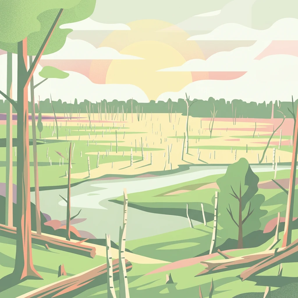
Illustrated view of a river winding through a forested wetland with trees and a sunset sky

Müritz National Park

National park

Park overview

Structured park overview, official facts, and landscape profile for Müritz National Park

Müritz National Park park facts, protected area profile, and essential visitor context

Review the core facts for Müritz National Park, including designation, size, terrain, visitor scale, habitats, and operating context in one park-focused overview.

About Müritz National Park

Müritz National Park represents a remarkable conservation achievement in the heart of Germany's lakeland region. Established in 1990 as one of the final acts of the German Democratic Republic's environmental program, the park was created to protect the outstanding natural values of the Müritz region while allowing for the eventual restoration of more natural forest ecosystems. The park's dual-area structure, with the Müritz section encompassing the eastern hinterland of Germany's largest internal lake and the Serrahn portion extending into the more hilly terrain to the east, creates a diverse protected landscape that spans multiple ecological zones.

The geological foundation of the park dates to the Weichselian glaciation, when massive ice sheets advanced across northern Europe and later retreated, leaving behind the characteristic terminal moraines, glacial valleys, sandur plains, and numerous kettle holes that now form the park's distinctive topography. The Pommersche Hauptendmoräne, or Main Pomeranian End Moraine, runs through the park, creating the higher elevations found in the Serrahn section, including the park's highest points at Hirschberg and Warsberg. The outwash plains created by glacial meltwater deposited the sand-rich soils that dominate much of the park's surface, influencing both the vegetation patterns and the historical land-use limitations.

Today, the park serves as a living laboratory for ecological restoration. While large areas were historically converted to monotonous pine plantations during intensive forestry operations, the National Park administration has undertaken systematic efforts to restore more natural forest conditions. Since 2018, timber harvesting has been completely suspended within the park boundaries. Visitors to the Serrahn section can already observe the transformation underway, where old-growth beech forests demonstrate the ecological potential of allowing natural processes to proceed without human intervention. The restoration of drainage systems and rewetting of peatlands represents another major focus, with former channels and ditches being blocked to raise groundwater levels and restore natural hydrological conditions.

Quick facts and research context for Müritz National Park

Müritz National Park covers approximately 318 square kilometers in northeastern Germany, making it the country's largest terrestrial national park. The protected area comprises about 65% forest, 12% lakes, with the remaining territory consisting of wetlands and meadows. The park contains approximately 108 lakes exceeding one hectare in size, embedded within a terminal moraine and sandur landscape formed during the Weichselian glaciation around 15,000 years ago. Located roughly midway between Berlin and Rostock, the park is administered from Hohenzieritz with visitor information available at the Müritzeum in Waren.

Protection and recognition

Documenting the terrestrial boundaries, designation history, and European network alignment

Müritz National Park Protection Status and European Natura 2000 Recognition

Müritz National Park features a dedicated terrestrial protection status established in 2011 to safeguard its specific conservation landscape. The protected landscape aligns with the European Natura 2000 network, offering a verified framework to analyze regional environmental management.

International recognition

Protection details

Protection scope
Terrestrial
Designated year
2011
Transboundary protection
No
Park context

Deeper park guide and search-rich context for Müritz National Park

Müritz National Park history, landscape, wildlife, and travel context

Explore Müritz National Park through its history, landscape character, ecosystems, wildlife, conservation priorities, cultural context, and seasonal travel timing in a structured park guide built for atlas discovery and search intent.

Why Müritz National Park stands out

Müritz National Park is especially renowned for its extensive old-growth beech forests, which earned UNESCO World Heritage status in 2011 as part of the Primeval Beech Forests of Europe extension. The park protects one of the largest remaining tracts of near-natural beech forest in Germany, particularly within the Serrahn section where visitors can observe primeval forest conditions with abundant deadwood and naturally regenerating tree populations. The park is also celebrated for its remarkable avifauna, including populations of white-tailed eagles, ospreys, black storks, and cranes, which can be observed from designated viewing platforms throughout the reserve. The Müritz lakeland setting, with its countless lakes, glacial kettle holes, and river systems, creates a distinctive mosaic of aquatic and terrestrial habitats uncommon in central European protected areas.
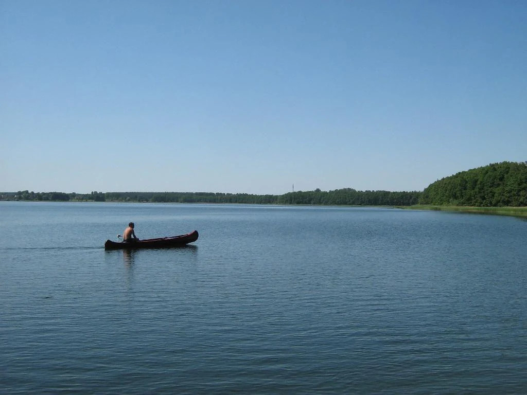
A person paddling a canoe on a calm lake with forested shoreline under a clear blue sky
Canoe on Käbelicksee within Müritz National Park

Müritz National Park history and protected-area timeline

Müritz National Park was established on October 1, 1990, as one of several large protected areas designated during the final months of the German Democratic Republic. The park's creation was driven by Deputy Environment Minister Michael Succow and fellow conservationists who worked within the framework of the DDR's Nationalparkprogramm to secure protection for significant natural areas before political changes might otherwise prevent such designations. This effort represented one of the most ambitious conservation initiatives in East German history.

Prior to the park's establishment, the region experienced intensive human use that significantly altered its natural character. The extremely sparsely populated area was utilized for military exercises by the Soviet Army, with approximately 3,500 hectares in what is now the central Müritz section used as tank training and firing ranges. Large areas were managed as state hunting grounds, with public access prohibited. Intensive forestry operations converted much of the original deciduous forest to coniferous plantations, primarily pine monocultures that replaced the naturally occurring mixed and beech-dominated forests.

The park's history also includes a period of systematic drainage during the DDR era, when extensive canal and ditch systems were constructed to lower groundwater levels for agricultural and forestry purposes. This drainage led to the widespread development of birch woodlands on former wetland areas. Since the park's establishment, significant restoration work has focused on reversing these drainage impacts by blocking channels and allowing natural hydrological conditions to recover, resulting in observable changes as birch stands die back and original wetland vegetation reestablishes itself.

The historic cultural landscape of the region extends much further back, with evidence of human settlement dating to the end of the last glacial period. Both nomadic tribes and later Slavic populations utilized the area for settlement, though the nutrient-poor sandy soils limited agricultural development during medieval times and contributed to the region's relative remoteness until the modern era.

Müritz National Park landscape and geographic character

The Müritz National Park landscape is fundamentally shaped by its glacial origins, presenting a characteristic lakeland terrain of terminal moraines, outwash sandurs, and numerous kettle lakes. The western Müritz section features a generally flatter terrain dominated by the eastern shore of Lake Müritz, with the landscape transitioning from lakeside zones through mixed forests to extensive pine plantation areas. The highest elevation in this western portion is the Käflingsberg at 100.3 meters above sea level, which supports an observation tower offering panoramic views across the park's forested interior.

The eastern Serrahn section presents a more hilly character, with the Serrahner Berge reaching 124.2 meters and the park's highest points at Hirschberg and Warsberg at 143.7 and 143.2 meters respectively. This portion of the park is more heavily forested and less dominated by open water, though it contains significant lakes including the Großer Fürstenseer See, Schweingartensee, and Zwirnsee. The transition zone between the two sections encompasses the urban area of Neustrelitz.

The park contains approximately 108 lakes exceeding one hectare in surface area, along with countless smaller kettle holes, pools, and ephemeral water bodies. The Havel River originates within the park's Müritz section, rising at the watershed between the Baltic Sea and North Sea catchments. The landscape also features extensive juniper heathlands on the eastern shore of Lake Müritz, a cultural landscape element created by centuries of grazing use that has been maintained through conservation management.
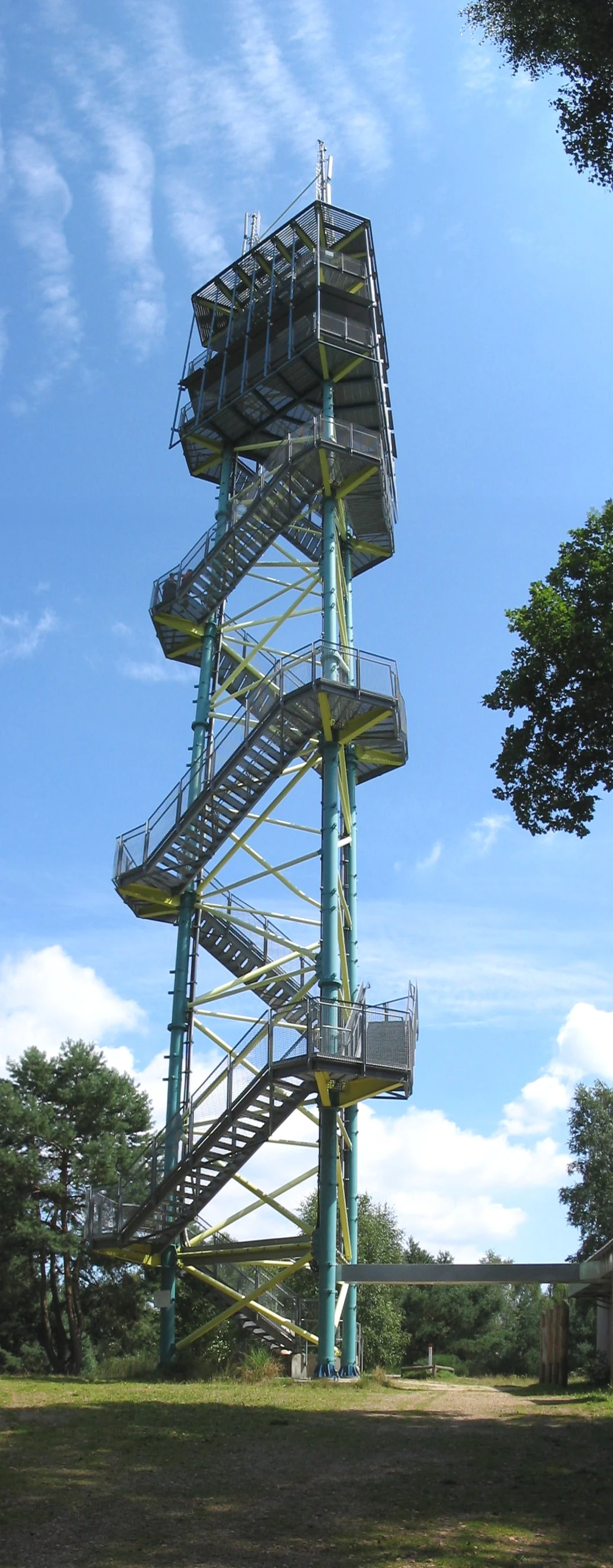
A tall metal observation tower with spiral stairs and multiple viewing platforms surrounded by trees and grass under a clear blue sky.
The Käflingsbergturm observation tower in Müritz National Park, Germany.

Müritz National Park ecosystems, habitats, and plant life

The ecological character of Müritz National Park centers on its extensive forest ecosystems, which cover approximately 72% of the park's territory according to German sources. The old-growth beech forests of the Serrahn section represent the park's most significant ecological treasure, characterized by mature beech trees, substantial quantities of deadwood, and naturally regenerating forest communities that have developed without significant human intervention. These forests were recognized by UNESCO in 2011 as outstanding examples of Europe's primeval beech forests, representing ecological conditions that have persisted since the post-glacial colonization of the continent.

The park's wetland systems constitute another major ecological component, encompassing approximately 8% of the area as bogs and mires. These peatland habitats support specialized plant communities including rare sedge species such as saw grass and provide critical habitat for waterbirds and amphibians. The transition from drained agricultural land to restored wetland ecosystems represents an ongoing ecological restoration priority, with visible results as former drainage channels are blocked and groundwater levels recover.

The aquatic environment, covering about 13% of the park, encompasses not only the major lakes like Müritz but also countless smaller water bodies of glacial origin. These range from large kettle lakes to small sinkholes and ephemeral pools, creating a diverse aquatic habitat mosaic. The seasonal dynamics of water levels, influenced by the park's position at the Baltic-North Sea watershed, contribute to the ecological diversity of shoreline and wetland habitats.
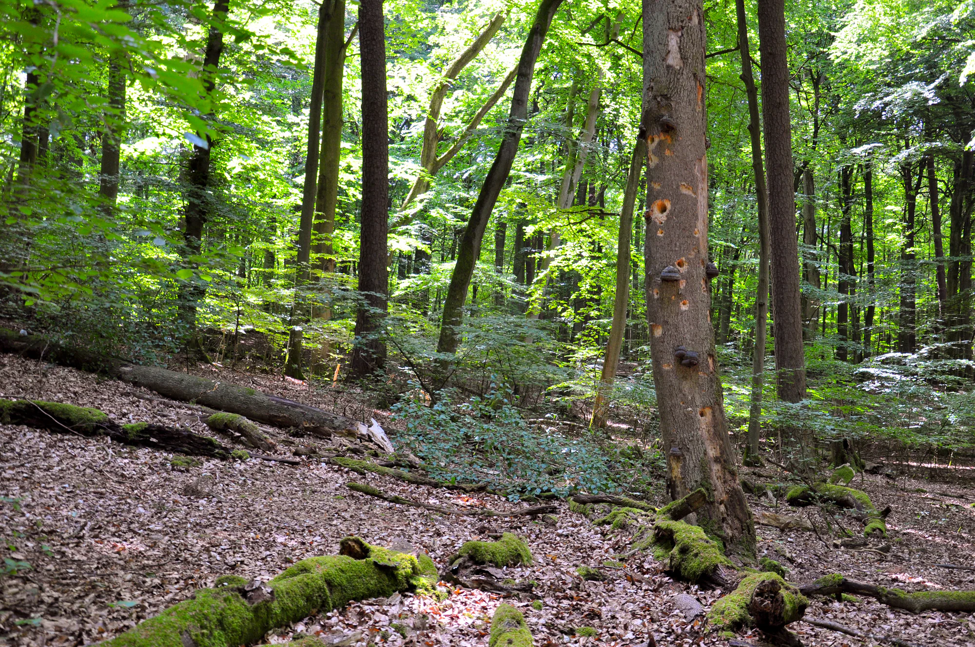
Tall beech trees with moss-covered logs on forest floor, dense green foliage in a natural woodland setting
Old-growth beech forest in the Serrahn area of Müritz National Park

Müritz National Park wildlife and species highlights

Müritz National Park supports a rich wildlife community across its diverse terrestrial and aquatic habitats. The park is particularly notable for its raptor populations, with both white-tailed eagles and ospreys breeding within the reserve and regularly observable from viewing platforms and observation blinds. The white-tailed eagle, Europe's largest eagle species, has recovered significantly across Germany in recent decades, and the Müritz region's extensive forests and lakes provide ideal breeding habitat.

The park's bird fauna includes over 214 documented species, making it one of the most significant ornithological sites in Germany. Wetland and waterbird species are particularly well-represented, with great bitterns, common cranes, black storks, and various duck species including teal, garganey, and the common redshank breeding in the marsh and lake-edge habitats. During migration seasons, the park hosts significant numbers of waders and shorebirds, including little stints, redshanks, and greenshanks that stop over to rest and feed in the shallow wetland areas.

Large mammals include red deer as the most prominent ungulate species, along with populations of roe deer, wild boar, fallow deer, and mouflon. The park has also recorded the presence of wolves, with the first confirmed
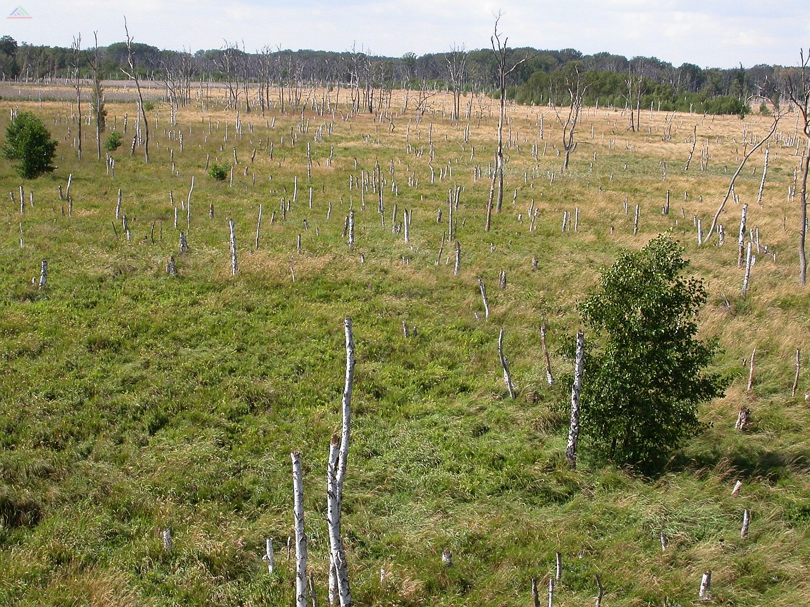
Grassland area with numerous tree stumps and a few remaining trees, indicating a former forest
Former birch forest landscape in Müritz National Park with scattered tree stumps and sparse vegetation

Best time to visit Müritz National Park

Müritz National Park can be visited throughout the year, with each season offering distinct experiences. Spring and early summer bring the most active bird activity, with breeding season providing excellent opportunities to observe cranes, black storks, and nesting waterfowl. The wetland areas come alive with bird song during May and June, while the juniper heaths bloom with colorful wildflowers. Autumn offers excellent conditions for forest walks, particularly in the Serrahn section where the beech forests display spectacular fall coloration, and the onset of the hunting season in September brings increased wildlife activity in the early morning and evening hours. Winter provides a different perspective on the park, with snow-covered forests and frozen lakes creating a serene atmosphere. While some facilities may have reduced services during the colder months, the lack of visitors offers a more isolated wilderness experience. The transitional seasons of spring and autumn can bring variable weather conditions, but also offer the most dramatic atmospheric effects and the best chances for wildlife observation as animals become more active during temperature changes.

Monthly climate preview

Monthly weather averages and temperature variations across thirty years of observations

Climate Normals and Monthly Weather Averages for Müritz National Park

Climatology records from a central park elevation of sixty meters indicate average temperatures scaling from below zero winter lows to warm summer peaks near thirty degrees Celsius. Accessing the complete twelve month weather by month profile reveals historical daily precipitation rates and exact temperature spreads for detailed regional comparison.
Annual mean9 °C
-1 °C19 °C
Jan-1°
Feb
Mar
Apr
May13°
Jun16°
Jul19°
Aug18°
Sep14°
Oct
Nov
Dec
Warmest month
July

18.5 °C

Coolest month
January

-0.8 °C

Wettest month
July

2.5 mm/day

Driest month
April

1.2 mm/day

Park location guide

Geography guide, regional context, and park location map for Müritz National Park

Müritz National Park park geography, regions, and map view in Germany

Understand where Müritz National Park sits in Germany through a broader geographic reading of the surrounding landscape, nearby location context, and its mapped position within the national park landscape.

How Müritz National Park fits into Germany

Germany is a federal republic in Western and Central Europe with a population of over 83 million across sixteen constituent states. It is Europe's largest economy by nominal GDP and a major global exporter and importer. The capital is Berlin, and the country borders Denmark, Poland, Czech Republic, Austria, Switzerland, France, Luxembourg, Belgium, and the Netherlands.

Wider geography shaping Müritz National Park in Germany

Germany is located in Western and Central Europe, spanning 357,022 km². It borders Denmark to the north, Poland and the Czech Republic to the east, Austria and Switzerland to the south, and France, Luxembourg, Belgium, and the Netherlands to the west. The country has coastlines on the Baltic Sea and North Sea to the north, with the Alps located in the southern region.

Map view of Müritz National Park

Use this park location map to pinpoint Müritz National Park in Germany, understand its exact geographic position, and read its mapped placement within the surrounding landscape more clearly.

Pigeon | © OpenStreetMap contributors

Location context for Müritz National Park

Mecklenburg-Vorpommern

Explore the diverse protected landscapes and unique glacial terrain that define this significant national park in northeastern Germany.

Müritz National Park Photos: Visualizing Germany's Lakelands, Ancient Beech Forests, and Protected Habitats

Browse comprehensive images showcasing Müritz National Park's distinct glacial landscapes, expansive lakeland terrain, and UNESCO-listed old-growth beech forests. These photographs provide a deeper understanding of the park's protected habitats, diverse ecosystems, and the overall environmental character of this significant German protected area.

A person paddling a canoe on a calm lake with forested shoreline under a clear blue sky

Wide landscape view of Müritz Lake surrounded by dense green forests under a partly cloudy sky

A tall metal observation tower with spiral stairs and multiple viewing platforms surrounded by trees and grass under a clear blue sky.

Tall beech trees with moss-covered logs on forest floor, dense green foliage in a natural woodland setting

Grassland area with numerous tree stumps and a few remaining trees, indicating a former forest

Park atlas

Discover connected protected landscapes, comparing Germany's national parks and conservation areas within the region.

Explore Other Protected Areas and National Parks Near Müritz National Park

After exploring Müritz National Park, continue your discovery by browsing other national parks and protected areas across Germany. Compare diverse landscapes, from glaciated lakelands to old-growth beech forests, to understand regional conservation efforts and their geographic spread.
Protected landscapeMecklenburg-Vorpommern
About 22 km away#1 closest

West

Naturpark Nossentiner/Schwinzer Heide: Geographic Atlas of an Inland Protected Landscape

Glacial Sanders and Lake Ecosystems in Mecklenburg-Vorpommern

This protected landscape features extensive pine-covered outwash plains and diverse kettle lakes shaped by glacial meltwater. Spanning the Mecklenburg-Vorpommern region, the park provides an essential study in inland natural geography, ranging from its unique sandy forest clearings to the protected moorland habitats that shelter bird populations.

Area
355 km²
Established
1990
Relief
Lowland
Scope
Terrestrial
A soft watercolor painting showing a panoramic view of green hills, meadows, and water, with a light sunrise or sunset sky.
Protected landscapeMecklenburg-Vorpommern
About 31 km away#2 closest

North

Naturpark Mecklenburgische Schweiz und Kummerower See Protected Area and Landscape Map

Glacial lakes and Peene river valley geography

Located in Mecklenburg-Vorpommern, this protected landscape encompasses broad glacial lakes including Malchiner See and Kummerower See. The region is defined by its slow-moving river systems, ancient oak woodlands, and a historic network of manor estates that shape the surrounding terrain and biodiversity.

Area
673 km²
Established
1997
Relief
Upland
Climate
Temperate
Watercolor illustration of a winding river surrounded by soft green trees and low hills under a pale sky.
Nature reserveBrandenburg
33 km away#3 closest

Southeast

Kastavenseen-Molkenkammersee Protected Nature Reserve: Mapped Lake Geography and Forest Terrain

A key node in the Brandenburg lake and forest conservation network

Kastavenseen-Molkenkammersee is a notable nature reserve in Brandenburg defined by its four core waterbodies. The area features a complex mosaic of wetlands, reedbeds, and mixed woodland typical of the post-glacial lake districts. As a protected landscape, it serves as an essential link in the ecological corridor between the Uckermark and the neighboring Mecklenburg borderlands.

Area
2.68 km²
Established
2009
IUCN
IV
Nature reserveBrandenburg
About 35 km away#4 closest

Southwest

Dömnitz Nature Reserve: Geographic Atlas and Protected Landscape Overview in Brandenburg

Riparian corridor mapping and lowland habitat preservation

The Dömnitz Nature Reserve, located in Brandenburg, protects 160 hectares of diverse riparian and forest habitat along a tributary of the Stepenitz. This atlas entry provides geographic data on the reserve, tracing its function as a managed wetland corridor and its place within the broader network of nature reserves defining the Prignitz countryside.

Area
1.6 km²
Established
2018
IUCN
IV
Relief
Lowland
Nature reserveBrandenburg
About 48 km away#5 closest

Southeast

Kleine Schorfheide Nature Reserve: Brandenburg Protected Area and Landscape Atlas

Mapped terrain, river floodplains, and forest mosaic in Northern Brandenburg

Spanning over 73 square kilometres, Kleine Schorfheide stands as a significant nature reserve in Brandenburg. It protects a vast, contiguous mosaic of open former military training lands, the natural Havel river floodplain, and the Himmelpforter Heide forest, creating a distinct regional landscape defined by its varied terrain and interconnected lake systems.

Area
73.75 km²
Established
1994
IUCN
IV
Nature reserveBrandenburg
About 51 km away#6 closest

Southwest

Königsfließ Nature Reserve in Brandenburg: Mapping Wetland Lowland and Protected Terrain

Exploration of peat-based mosaic habitats in northeastern Germany.

Königsfließ represents a significant nature reserve in Brandenburg, defined by its flat peat lowlands and interconnected moist habitats. This overview explores the ecological mosaic of wet meadows and alder swamp forests that characterize the local geography. Gain insights into how this unfragmented protected area functions within the broader Prignitz and Ostprignitz-Ruppin landscape framework.

Area
2.6 km²
Established
2003
Relief
Lowland
Climate
Temperate
Nature reserveBrandenburg
54 km away#7 closest

Southwest

Bärenbusch Nature Reserve: Brandenburg Protected Forest and River Geography

A riparian woodland habitat in the Prignitz landscape.

Bärenbusch stands as a significant nature reserve in Brandenburg, covering 458 hectares of flat lowland terrain. Situated between the Dosse and Jäglitz rivers, this site serves as a vital example of managed woodland habitat and riparian forest corridors in the Prignitz. Explore the geographic structure of this protected area and its role within the regional landscape network.

Area
4.58 km²
Established
2001
IUCN
IV
Nature reserveBrandenburg
About 56 km away#8 closest

East

Zerweliner Koppel Nature Reserve: Mapped Protected Landscapes in the Brandenburg Region

A preserved mosaic of woodland and lakeside habitats

Located in the Uckermark district, Zerweliner Koppel represents a vital protected area characterized by its interweaving of wet and dry habitats. This nature reserve supports an array of ecosystems ranging from nutrient-poor lakes and calcareous fens to oak and beech forests, providing a stable refuge for diverse wildlife species in northeastern Germany.

Area
1.93 km²
Established
2005
IUCN
IV
Relief
Lowland

Common questions about visiting, size, designation, and location context for Müritz National Park

Müritz National Park FAQs for park facts, access, geography, and protected area context

Find quick answers about Müritz National Park, including protected-area facts, park geography, trail and visitor context, and how the park fits into its surrounding country and regional landscape.
MoriAtlas Explorer

Continue Your Protected Areas Search Across the Global Atlas

Deepen your exploration by continuing the structured search for national parks and protected areas worldwide. Utilize the comprehensive filtering capabilities to compare different conservation landscapes and refine your understanding of global park geography. Discover more about the distribution and characteristics of protected natural areas.

Global natural geography