

Mori Atlas logo
National parkMunga-Thirri National Park

Discover the vast parallel sand ridges and arid ecosystem of Queensland's largest national park.

Munga-Thirri National Park: Iconic Dune Landscape and Protected Desert in Queensland

Munga-Thirri National Park represents a significant protected landscape within Queensland, Australia, defined by its expansive and iconic sand dune system. This vast national park preserves one of the continent's most striking arid environments, characterized by towering red sand ridges stretching for hundreds of kilometres across the Simpson Desert. As the largest national park in Queensland, Munga-Thirri offers a unique opportunity to explore a fragile desert ecosystem, understand its mapped geography, and appreciate its profound natural and cultural heritage.

Desert landscapeSand dunesArid ecosystemsQueensland national parks Simpson DesertRed dunes

Munga-Thirri National Park

National park

Park overview

Structured park overview, official facts, and landscape profile for Munga-Thirri National Park

Munga-Thirri National Park park facts, protected area profile, and essential visitor context

Review the core facts for Munga-Thirri National Park, including designation, size, terrain, visitor scale, habitats, and operating context in one park-focused overview.

About Munga-Thirri National Park

Munga-Thirri National Park occupies a vast tract of the Simpson Desert in far-western Queensland, representing one of Australia's most significant desert protected areas. The park's defining feature is its extensive system of parallel sand dunes, which run predominantly north-south across the landscape. These dunes, formed over approximately 30,000 years, create a striking visual pattern of alternating red sand ridges and intervening valleys. The dunes can reach heights of 50 metres with spacings of around one kilometre between ridges, though most fall within the 10 to 35 metre range. Beyond the dunes, the park contains salt lakes and claypans that add ecological variety to the otherwise arid terrain. The park is situated in a region of extreme climatic conditions, where summer temperatures can reach 50 degrees Celsius and winter mornings may freeze. Rainfall is sparse and unpredictable, yet when significant rains occur, the dormant wildflowers across the desert floor transform into a remarkable display of colour. The park's isolation and harsh conditions have preserved both its natural values and cultural heritage, with the Wangkangurru people maintaining strong connections to Country through the ongoing stewardship of traditional owners.

Quick facts and research context for Munga-Thirri National Park

Munga-Thirri National Park spans 10,120 km² in far-western Queensland, making it the state's largest national park. The park protects the Simpson Desert's characteristic parallel sand dunes, with most dunes ranging between 10 and 35 metres in height though some reach 50 metres. The longest continuous sand ridge extends 200 kilometres through the park. The iconic 'Big Red' dune, located 35 kilometres west of Birdsville, is the largest in the park. The dunes began forming approximately 30,000 years ago. The park is part of the Simpson Desert Important Bird Area identified by BirdLife International, supporting habitat for the Eyrean grasswren and up to 180 bird species total.

Protection and recognition

Mapping terrestrial designation details and official conservation framework boundaries

Documented Protection Status and Conservation Profile of Munga-Thirri National Park

Researchers and conservation explorers can examine the official terrestrial protection status and documented geographic boundaries of Munga-Thirri National Park. Verifying official terrestrial designations helps build an accurate spatial profile of regional conservation efforts and arid wilderness preservation.

Protection details

Protection scope
Terrestrial
Transboundary protection
No
Park context

Deeper park guide and search-rich context for Munga-Thirri National Park

Munga-Thirri National Park history, landscape, wildlife, and travel context

Explore Munga-Thirri National Park through its history, landscape character, ecosystems, wildlife, conservation priorities, cultural context, and seasonal travel timing in a structured park guide built for atlas discovery and search intent.

Why Munga-Thirri National Park stands out

Munga-Thirri is best known for its spectacular parallel sand dune system, one of the most iconic desert landscapes in Australia. The massive red dunes, particularly the famous 'Big Red' dune, define the park's visual identity and represent one of the country's most accessible and recognizable desert environments. The park also protects a remarkable arid ecosystem that supports surprising biodiversity, including the Eyrean grasswren and significant birdlife within the Simpson Desert Important Bird Area. The combination of extreme desert conditions, ancient dune formations, and the cultural connection to the Wangkangurru people makes this park a unique conservation area in the Australian protected area network.

Munga-Thirri National Park history and protected-area timeline

Aboriginal peoples, particularly the Wangkangurru people, have lived in the Simpson Desert region for generations, surviving in the arid conditions by digging deep soaks in the depressions between dunes. Some of these water sources were reportedly seven metres deep, demonstrating sophisticated understanding of desert hydrology. The first non-Aboriginal person to cross the central and southern Simpson Desert was David Lindsay in 1886, followed by Ted Colson who traversed the full length of the desert in 1936. The concept of establishing a national park in the Simpson Desert was first proposed in 1965 by the National Parks Association of Queensland, leading to the creation of Simpson Desert National Park in 1967. The park was significantly expanded northward in 1991, incorporating additional arid lands with more diverse vegetation, and was renamed Munga-Thirri to reflect the Indigenous heritage of the area. As of 2019, the park has been managed by Wangkangurru elder and traditional owner Don Rowlands OAM as Head Ranger, representing an important example of Indigenous leadership in Australian park management.

Munga-Thirri National Park landscape and geographic character

The landscape of Munga-Thirri National Park is dominated by the Simpson Desert's spectacular sand dune system, one of the most extensive and visually striking dune fields in Australia. The parallel dunes, predominantly oriented north-south, create a rhythmic landscape of red sand ridges separated by valley floors. The dunes vary considerably in height, with the tallest reaching approximately 50 metres while the majority fall between 10 and 35 metres. The spacing between dunes is typically around one kilometre, and the longest continuous sand ridge extends an remarkable 200 kilometres through the park. The sand itself derives its distinctive red-orange colour from iron oxide coatings on the quartz grains, a characteristic that defines the visual character of the Australian desert interior. Between the dunes lie claypans and occasional salt lakes, which retain moisture and provide important habitat pockets in an otherwise arid environment. The age of these dune formations, estimated at 30,000 years, represents a remarkably stable landscape that has evolved over millennia of climatic change.

Munga-Thirri National Park ecosystems, habitats, and plant life

Munga-Thirri National Park protects a diverse arid ecosystem that challenges assumptions about desert biological poverty. The park supports up to 180 bird species, making it surprisingly rich for an arid environment. The park falls within the Simpson Desert Important Bird Area, recognized by BirdLife International as significant habitat for the Eyrean grasswren, a species specifically adapted to the spinifex grass and dune environments of this region. The desert ecosystem is characterized by extreme adaptations among its flora and fauna, with plants and animals evolved to survive prolonged drought and extreme temperatures. When seasonal rains arrive, the dormant wildflower seeds across the dune valleys germinate rapidly, creating brief but spectacular displays of desert blooming. The vegetation across the park varies from sparse dune crests to more dense valley floors, with the 1991 northern expansion bringing additional arid land with more diverse vegetation types into the protected area.

Munga-Thirri National Park wildlife and species highlights

The wildlife of Munga-Thirri reflects the remarkable adaptations required to survive in one of Australia's harshest environments. Mammals resident in the park include the iconic red kangaroo, Australia's largest marsupial, which has evolved to tolerate extreme heat and limited water sources. The dingo, Australia's wild dog, hunts across the desert landscape as a top predator. The park also contains populations of feral camels, descendants of animals released or escaped during the camel-trading era of the 19th and early 20th centuries. Reptile diversity includes various gecko species, well-adapted to the nocturnal temperatures when surface activity is possible. The avifauna is particularly notable, with up to 180 species recorded, making the Simpson Desert an important bird area despite its arid character. The Eyrean grasswren depends on the spinifex grasslands growing along dune slopes, while other species utilise the scattered water sources in claypans and the margins of salt lakes.

Munga-Thirri National Park conservation status and protection priorities

Munga-Thirri National Park represents the largest protected area in Queensland and serves as a crucial conservation reservoir for the Simpson Desert ecosystem. The park's inclusion in the Simpson Desert Important Bird Area designation by BirdLife International recognises its international significance for bird conservation, particularly for species like the Eyrean grasswren that depend on specialized desert habitats. The 1991 northward expansion of the park added important arid lands featuring more diverse vegetation, enhancing the protected area's ecological representativeness. The park's management by Wangkangurru traditional owner Don Rowlands OAM exemplifies contemporary approaches to Indigenous involvement in conservation. However, the park faces challenges from increasing visitor numbers, which have begun depleting wood supplies that native fauna depend upon, leading to management encouragement of gas stoves over wood fires. The extreme isolation and harsh conditions that make this region difficult to access also serve as natural protection for its desert values.

Munga-Thirri National Park cultural meaning and human context

The Wangkangurru people have maintained continuous connection to the Simpson Desert region for generations, surviving in the arid environment through sophisticated water-capture techniques including digging deep soaks in dune depressions. These traditional knowledge systems demonstrate remarkable adaptation to desert living. The park's renaming from Simpson Desert National Park to Munga-Thirri in 1991 reflects formal recognition of this Indigenous heritage, with the name derived from the Wangkangurru language. The current Head Ranger, Don Rowlands OAM, is an elder of the Wangkangurru people and traditional owner, representing ongoing Indigenous leadership in park management that is particularly significant in the Australian conservation context. The desert region was crossed by non-Aboriginal explorers David Lindsay in 1886 and Ted Colson in 1936, but these explorations came millennia after Indigenous peoples had established deep cultural connections to this landscape.

Top sights and standout views in Munga-Thirri National Park

The massive red sand dunes of Munga-Thirri, particularly the iconic 'Big Red' dune 35 kilometres west of Birdsville, represent one of Australia's most recognizable desert landscapes. The park protects the longest sand ridge in the country at 200 kilometres, with dunes reaching 50 metres in height. The Simpson Desert Important Bird Area designation highlights the surprising biodiversity of this arid environment, supporting up to 180 bird species including the specialized Eyrean grasswren. The park's status as Queensland's largest national park at 10,120 square kilometres makes it a significant conservation area. The combination of extreme desert conditions, ancient dune formations dating back 30,000 years, and management by Wangkangurru traditional owners creates a uniquely Australian protected area that embodies both natural and cultural values.

Best time to visit Munga-Thirri National Park

The optimal time to visit Munga-Thirri National Park is during the cooler months from April to October, when daytime temperatures are more manageable and the risk of extreme heat is reduced. Summer temperatures in the Simpson Desert can soar to 50 degrees Celsius, making travel dangerous and uncomfortable. Winter mornings can be freezing, though daytime temperatures are generally pleasant. The winter dry season also provides more reliable access, as summer rains can cause flooding that leads to park closures. Visitors should note that the park has no formed roads and requires four-wheel-drive vehicles, with the QAA Line serving as the main access corridor. Travelling in a two-vehicle party with long-distance communication equipment is strongly encouraged given the park's remote location and limited services.
Monthly climate preview

Track long-term climate normals and annual precipitation patterns for this Queensland reserve

Munga-Thirri National Park Climate and Monthly Temperature Averages

Representative measurements from Munga-Thirri National Park show an arid cycle where average monthly maximums climb above 45 degrees Celsius alongside low annual precipitation. Reviewing the complete monthly profile reveals the long-term climatology data needed to compare temperature swings and dry patterns throughout the year.
Annual mean24 °C
14 °C33 °C
Jan33°
Feb32°
Mar29°
Apr24°
May19°
Jun15°
Jul14°
Aug17°
Sep22°
Oct26°
Nov29°
Dec32°
Warmest month
January

33.5 °C

Coolest month
July

14.2 °C

Wettest month
February

1.1 mm/day

Driest month
August

0.1 mm/day

Park location guide

Geography guide, regional context, and park location map for Munga-Thirri National Park

Munga-Thirri National Park park geography, regions, and map view in Australia

Understand where Munga-Thirri National Park sits in Australia through a broader geographic reading of the surrounding landscape, nearby location context, and its mapped position within the national park landscape.

How Munga-Thirri National Park fits into Australia

Australia is a constitutional monarchy and federal parliamentary democracy comprising six states and ten territories. With a population of nearly 28 million, it is one of the world's most urbanised countries, with most people concentrated on the eastern seaboard. The country has a high Human Development Index and is known for its cultural diversity, ancient Aboriginal heritage, and unique wildlife.

Wider geography shaping Munga-Thirri National Park in Australia

Australia occupies the entire Australian continent, the island of Tasmania, and numerous smaller islands. It is the world's flattest and driest inhabited continent, featuring vast deserts in the interior (the Outback), tropical rainforests along the eastern coast, and a coastline bordering the Indian and Pacific Oceans.

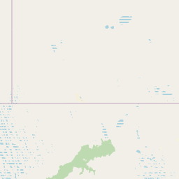
Map view of Munga-Thirri National Park

Use this park location map to pinpoint Munga-Thirri National Park in Australia, understand its exact geographic position, and read its mapped placement within the surrounding landscape more clearly.

Pigeon | © OpenStreetMap contributors

Location context for Munga-Thirri National Park

Queensland
Recorded earthquake history

Review Historical Seismic Records Near Munga-Thirri National Park

Access a detailed catalogue of recorded seismic events associated with the geography of Munga-Thirri National Park. This resource provides data on past earthquakes to support geographic exploration and regional seismic context, as aggregated by MoriAtlas for research and discovery purposes.

Munga-Thirri National Park Earthquake History

Catalogued events

5 events

Strongest magnitude

Magnitude 3.8

Most recent event

Jan 15, 2003

This history includes earthquakes recorded inside the park or within 50 km of its borders

Park atlas

Trace the unique desert geography and protected landscapes near Munga-Thirri National Park, exploring Queensland's vast arid interior.

Explore Other National Parks and Protected Areas Around Munga-Thirri National Park

After exploring Munga-Thirri National Park, continue your atlas discovery by browsing other national parks and protected areas across Queensland's expansive Simpson Desert region. This context allows for direct comparison of diverse arid ecosystems, vast dune formations, and unique conservation efforts within similar remote desert landscapes.
National parkSouth Australia
Park boundaries overlap#1 closest

South

Munga-Thirri, Simpson Desert National Park: Explore South Australia's Vast National Park Territory

Mapped boundaries and arid landscape context.

Munga-Thirri, Simpson Desert National Park is a crucial national park located in South Australia, offering a detailed look into the mapped geography and protected landscape characteristics of Australia's arid interior. This page facilitates an atlas-driven understanding of the park's protected boundaries, regional context, and unique desert terrain. Explore the fundamental geographic identity of this significant protected area, providing essential data for landscape discovery.

Area
36,000 km²
Established
1967
IUCN
Ia
Relief
Lowland
Nature reserveQueensland
About 17 km away#2 closest

North

Ethabuka Reserve: Protected Dunefields and Arid Wilderness in Queensland

Nature reserve geography and desert landforms

Ethabuka Reserve serves as a foundational piece of private conservation in the Australian interior. The reserve showcases a vast, ecologically intact landscape featuring linear dune ridges, expansive gibber plains, and gidgee woodlands. These diverse habitats support a rich suite of arid-zone species, forming a crucial block of protected desert territory alongside the neighbouring Pilungah Reserve.

Area
2,155 km²
Established
2004
Relief
Lowland
Scope
Terrestrial
Nature reserveQueensland
About 93 km away#3 closest

North

Pilungah Reserve: Protected Arid Landscapes and Geography in Western Queensland

Exploration of desert dunefields and Mulligan River catchments

Pilungah Reserve protects over 200,000 hectares of diverse desert terrain, from the rugged Toomba Range to the expansive gibber plains of Central West Queensland. This nature reserve serves as an important ecological refuge, preserving rare reptile and bird habitats within the Channel Country and Simpson Strzelecki Dunefields. The area also holds cultural significance to the Wangkamadla people, reflecting a deep connection between traditional heritage and modern conservation.

Area
2,330 km²
Established
2005
Relief
Mixed relief
Climate
Arid
National parkSouth Australia
183 km away#4 closest

Southwest

Witjira National Park: Explore its Protected Landscape and South Australian Geography

Mapped terrain and regional park context.

Witjira National Park in South Australia serves as a distinct protected area for detailed geographic exploration. This national park provides essential context for understanding its mapped boundaries and its role within the broader regional landscape of Australia. Discover the park's specific geographic identity and its significance as a protected natural area for atlas-based research and landscape appreciation.

Area
7,726.73 km²
Established
1985
IUCN
VI
Visitors
15K annual
National parkSouth Australia
192 km away#5 closest

Southeast

Malkumba-Coongie Lakes National Park: A Protected Landscape in South Australia

Explore its mapped geography and regional park context.

Malkumba-Coongie Lakes National Park stands as a protected natural area within South Australia. This national park offers specific insights into the mapped landscape and regional geography of the Australian state. Understanding its boundaries and protected status contributes to a broader atlas view of conservation landscapes. Discover the unique geographic identity of this area for structured exploration and geographic context.

Area
266.69 km²
Established
2005
IUCN
II
Relief
Lowland
National parkQueensland
195 km away#6 closest

East

Astrebla Downs National Park: Queensland's Protected Landscape and Geographic Context

Mapping the protected boundaries and regional natural terrain.

Astrebla Downs National Park stands as a distinct national park within Queensland, Australia, contributing to the state's rich tapestry of protected lands. Its landscape offers a unique geographic profile, providing vital context for understanding the mapped terrain and the distribution of natural areas across northeastern Australia. This entry serves as a gateway to exploring the specific geographic features and protected-area significance of Astrebla Downs National Park for atlas-based discovery.

Area
1,740 km²
Established
1996
IUCN
II
Relief
Lowland
Nature reserveSouth Australia
About 213 km away#7 closest

South

Kalamurina Sanctuary Nature Reserve: Geographic Overview and Protected Landscape Mapping

Arid terrain in the Lake Eyre Basin of South Australia

Covering roughly 6,700 square kilometres, Kalamurina Sanctuary serves as a critical protected node in the Australian interior. The property provides a continuous habitat mosaic of saline lakes, riparian channels, and arid uplands. This reserve bridges the gap between the Simpson Desert and the Lake Eyre landscape, supporting conservation-focused land management and the recovery of threatened arid-zone species.

Area
6,700 km²
Established
2007
Relief
Lowland
Climate
Arid
National parkQueensland
230 km away#8 closest

Northeast

Diamantina National Park: Queensland National Park Protected Landscape Atlas

Mapped boundaries and regional geography in Queensland.

Diamantina National Park serves as a significant protected area within Queensland's northeastern Australian geography. This detail page offers a focused look at its designation as a national park, providing users with essential information for understanding its mapped landscape and protected boundaries. It is an important entry for anyone exploring the atlas of Australian conservation lands and regional natural terrain.

Area
5,070 km²
Established
1993
IUCN
II
Relief
Lowland

Common questions about visiting, size, designation, and location context for Munga-Thirri National Park

Munga-Thirri National Park FAQs for park facts, access, geography, and protected area context

Find quick answers about Munga-Thirri National Park, including protected-area facts, park geography, trail and visitor context, and how the park fits into its surrounding country and regional landscape.
MoriAtlas Explorer

Continue Your Protected Areas Search Across the Global Atlas

Deepen your exploration by continuing the structured search for national parks and protected areas worldwide. Utilize the comprehensive filtering capabilities to compare different conservation landscapes and refine your understanding of global park geography. Discover more about the distribution and characteristics of protected natural areas.

Global natural geography