Mori Atlas logo
National parkWitjira National Park

Explore the mapped boundaries and regional terrain of this significant national park.

Witjira National Park: Protected Landscape and Geographic Context in South Australia

Witjira National Park stands as a key protected area within the vast geography of South Australia. This national park offers users a structured entry point for understanding its protected landscape identity, mapped boundaries, and its place within the regional atlas. Engage with the park's geographic context to appreciate its unique natural terrain and its role in South Australia's conservation landscape.

Artesian springsOutbackDesert wetlandsMound springsIndigenous joint managementGreat Artesian Basin

Witjira National Park

National park

Park overview

Structured park overview, official facts, and landscape profile for Witjira National Park

Witjira National Park park facts, protected area profile, and essential visitor context
Review the core facts for Witjira National Park, including designation, size, terrain, visitor scale, habitats, and operating context in one park-focused overview.

About Witjira National Park

Witjira National Park occupies a vast tract of remote outback in northern South Australia, situated within the expansive desert landscapes of the Simpson-Strzelecki Dunefields region. The park's defining feature is the Dalhousie Mounds Springs complex, where groundwater from the Great Artesian Basin rises to the surface through natural vents, creating a chain of permanent springs that form isolated wetland habitats scattered across the arid terrain. These springs have been continuously flowing for thousands of years, making them among the most reliable water sources in the Australian interior. The park's classification as an IUCN Category VI protected area reflects its management approach that balances conservation with sustainable use of natural resources, recognizing both ecological and cultural values. The park's remote location means visitors experience true outback solitude, with the nearest community being the small settlement of Finke (Aputula) nearby. Access involves travelling through extensive dunefields and gibber plains, rewarding those who venture here with encounters with one of Australia's most unusual desert environments.

Quick facts and research context for Witjira National Park

Witjira National Park covers 7,726.73 square kilometres of semi-arid outback in northern South Australia. The park was established on 21 November 1985 primarily to protect the Dalhousie Mound Springs complex, Australia's largest array of artesian springs. In 2007, it became the first protected area in South Australia to implement formal joint management arrangements between traditional owners and the state government. The park receives approximately 15,000 visitors annually and contains the historically significant Dalhousie Homestead Ruins, listed on the South Australian Heritage Register.

Park context

Deeper park guide and search-rich context for Witjira National Park

Witjira National Park history, landscape, wildlife, and travel context
Explore Witjira National Park through its history, landscape character, ecosystems, wildlife, conservation priorities, cultural context, and seasonal travel timing in a structured park guide built for atlas discovery and search intent.

Why Witjira National Park stands out

Witjira National Park is best known for the Dalhousie Mounds Springs complex, a nationally significant collection of artesian springs that form the largest array of such springs in Australia. These permanent warm-water springs create unique wetland ecosystems in the heart of the arid Simpson Desert region, supporting vegetation communities and wildlife found nowhere else. The springs emerge from the Great Artesian Basin through ancient geological formations, forming pools and streams that have flowing water year-round despite the surrounding desert environment. This makes the park an ecological oasis of exceptional scientific and conservation importance.

Witjira National Park history and protected-area timeline

Witjira National Park was proclaimed on 21 November 1985 with the specific purpose of protecting Australia's largest array of artesian springs, particularly the nationally significant Dalhousie Mound Springs complex. The establishment recognized that these springs represented irreplaceable ecological and cultural assets requiring formal protection. A landmark development occurred in 2007 when Witjira became the first protected area in South Australia to implement formal joint management arrangements between the traditional owners and the Government of South Australia, establishing the Witjira Co-management Board to oversee park management collaboratively. In November 2021, the South Australian government permanently excluded mining from the Dalhousie Springs National Heritage Area, ensuring the springs and their immediate surroundings remain protected from extractive activities. The extent of land occupied by the national park was gazetted as a locality under the name Witjira in April 2013. Within the park boundaries lie the Dalhousie Homestead Ruins, remains of the former Dalhousie Station pastoral lease, which are separately listed on the South Australian Heritage Register.

Witjira National Park landscape and geographic character

The landscape of Witjira National Park encompasses the characteristic terrain of the Simpson-Strzelecki Dunefields, featuring extensive parallel sand dunes separated by interdune corridors and gibber plains covered with stony desert pavement. The terrain is predominantly flat to gently undulating, with the distinctive red sands of the Simpson Desert dominating the eastern portions of the park. Within this arid matrix, the Dalhousie Springs rise as prominent mounded formations where mineral deposits from the flowing water have built up over centuries, creating distinctive white and cream-colored mounds that contrast sharply with the red desert landscape. The springs themselves form pools and shallow channels where water flows continuously, creating lush green vegetation zones that appear as isolated oases amid the surrounding desert. The visual contrast between the permanent water and verdant growth against the harsh, dry outback creates one of the most striking landscape patterns in South Australia's protected areas.

Witjira National Park ecosystems, habitats, and plant life

The nature of Witjira National Park is defined by the unique ecological dynamics created by the artesian springs in an otherwise arid environment. The Great Artesian Basin groundwater that feeds the springs is ancient, having taken thousands of years to percolate through underground rock formations before emerging at the surface at consistent temperatures. This reliable water source supports wetland vegetation communities including rushes, sedge species, and river red gums that form dense stands around the spring pools. These isolated wetlands function as biological refugia in the desert, providing habitat for species that cannot survive in the surrounding arid terrain. The springs also support specialized aquatic invertebrates and fish adapted to the warm, constant conditions. The broader park landscape supports typical arid-zone biodiversity including various reptile species, desert birds, and mammals adapted to water-conserving lifestyles, with the springs providing critical water sources that sustain wildlife throughout the dry periods.

Witjira National Park wildlife and species highlights

The wildlife of Witjira National Park reflects the dual nature of the park's habitats: the desert surroundings support typical arid-zone fauna adapted to harsh conditions, while the spring environments provide refuge for species requiring more consistent water and vegetation cover. Birdlife is particularly notable around the springs, where waterbird species congregate at the permanent water sources including various ducks, grebes, and herons. Reptiles are well-represented throughout the park, with numerous lizard and snake species inhabiting the dune fields and gibber plains. Mammals present include red kangaroos, euros, and various small marsupials and rodents adapted to desert conditions. The springs themselves support aquatic fauna including fish and invertebrates adapted to the warm, constant water temperatures. The isolated nature of the spring wetlands means they function as ecological islands supporting species that cannot survive in the surrounding desert, making them particularly significant for biodiversity conservation.

Witjira National Park conservation status and protection priorities

Witjira National Park holds exceptional conservation significance as Australia's largest and most important artesian springs protected area. The Dalhousie Mound Springs complex represents a rare example of intact, flowing artesian springs in Australia, where groundwater continues to reach the surface naturally rather than being captured by bore fields. These springs are irreplaceable, as once the pressure in the Great Artesian Basin is depleted through over-extraction, the natural flows cannot be restored on human timescales. The 2021 decision to permanently exclude mining from the Dalhousie Springs National Heritage Area provides strongest-possible protection for the core spring environment. The joint management arrangement with traditional owners, established in 2007, represents an innovative conservation model that integrates Indigenous knowledge and values into park management. The park was listed on the now-defunct Register of the National Estate during or after 1998, acknowledging its national heritage significance.

Witjira National Park cultural meaning and human context

Witjira National Park has deep cultural significance for the Indigenous communities who have lived in and managed this landscape for thousands of years. The artesian springs would have provided critical water sources and supported continuous human habitation in an environment where water is otherwise scarce, making this area a significant cultural landscape for Aboriginal people. The establishment of formal joint management arrangements in 2007 recognized both the traditional owners' ongoing connection to the country and their right to participate in decisions about its management. The Witjira Co-management Board provides a framework for collaborative decision-making between the state government and traditional owner groups. The presence of the Dalhousie Homestead Ruins within the park also reflects more recent pastoral history, representing European settlement attempts in the remote outback during the nineteenth and twentieth centuries before the area was set aside for conservation.

Top sights and standout views in Witjira National Park

The Dalhousie Springs remain the undisputed highlight of Witjira National Park, offering visitors the chance to swim in warm, clear spring water surrounded by desert scenery. The springs create a network of interconnected pools and channels set against the red sands and dunes of the Simpson Desert, providing a genuinely unique Australian landscape. The contrast between the lush green vegetation surrounding the springs and the harsh surrounding desert creates memorable visual scenes. The park offers genuine outback solitude and the opportunity to experience one of Australia's most remote and least-visited protected landscapes. The joint management arrangement with traditional owners represents a pioneering approach to conservation in South Australia and demonstrates how Indigenous partnerships can shape park management.

Best time to visit Witjira National Park

The cooler months from April to September represent the most comfortable time to visit Witjira National Park, when daytime temperatures are more moderate and outdoor exploration is enjoyable. Summer months from November to February can bring extreme heat, making outdoor activities challenging and potentially dangerous. However, the springs themselves remain accessible year-round and can be particularly pleasant during cooler periods. Visitors should note that the park's remote location requires careful planning, including adequate supplies of water, fuel, and food, as services are not available within the park. The combination of reliable spring flows and desert landscapes means the park maintains its appeal across seasons, though spring and autumn offer the most pleasant conditions for camping and exploring the outdoor environments.

Park location guide

Geography guide, regional context, and park location map for Witjira National Park

Witjira National Park park geography, regions, and map view in Australia
Understand where Witjira National Park sits in Australia through a broader geographic reading of the surrounding landscape, nearby location context, and its mapped position within the national park landscape.

How Witjira National Park fits into Australia

Australia is a constitutional monarchy and federal parliamentary democracy comprising six states and ten territories. With a population of nearly 28 million, it is one of the world's most urbanised countries, with most people concentrated on the eastern seaboard. The country has a high Human Development Index and is known for its cultural diversity, ancient Aboriginal heritage, and unique wildlife.

Wider geography shaping Witjira National Park in Australia

Australia occupies the entire Australian continent, the island of Tasmania, and numerous smaller islands. It is the world's flattest and driest inhabited continent, featuring vast deserts in the interior (the Outback), tropical rainforests along the eastern coast, and a coastline bordering the Indian and Pacific Oceans.

Map view of Witjira National Park

Use this park location map to pinpoint Witjira National Park in Australia, understand its exact geographic position, and read its mapped placement within the surrounding landscape more clearly.

Pigeon | © OpenStreetMap contributors

Location context for Witjira National Park

South Australia
Park atlas

Trace the geographic spread of conservation landscapes across South Australia's arid outback, extending from Witjira's unique spring systems.

Discover National Parks and Protected Areas Near Witjira National Park
Browse additional national parks and protected areas geographically connected to Witjira National Park, mapping the broader reach of conservation landscapes across South Australia's vast arid outback. Compare varied desert terrains, artesian spring systems, and protected habitats to gain a comprehensive regional perspective of Australian conservation efforts.
National parkSouth Australia

Munga-Thirri, Simpson Desert National Park: Explore South Australia's Vast National Park Territory

Mapped boundaries and arid landscape context.

Munga-Thirri, Simpson Desert National Park is a crucial national park located in South Australia, offering a detailed look into the mapped geography and protected landscape characteristics of Australia's arid interior. This page facilitates an atlas-driven understanding of the park's protected boundaries, regional context, and unique desert terrain. Explore the fundamental geographic identity of this significant protected area, providing essential data for landscape discovery.

Area
36,000 km²
Established
1967
IUCN
Ia
Relief
Lowland
National parkQueensland

Munga-Thirri National Park: Queensland's Premier Desert Dune Protected Landscape

Explore the vast sand ridges and unique arid ecosystems of this national park.

Munga-Thirri National Park is Queensland's largest national park, preserving a spectacular desert landscape dominated by extensive parallel sand dunes. Situated in the remote central west, this protected area offers a unique lens into arid ecosystems, showcasing striking red dunes that define its geographic identity. Discover the mapped features and landscape context of this significant Australian protected land, offering a deep dive into the Simpson Desert's unique terrain and natural heritage.

Area
10,120 km²
Established
1967
IUCN
II
Relief
Lowland
National parkNorthern Territory

Tjoritja / West MacDonnell National Park: National Park Atlas and Protected Landscape

Explore the dramatic MacDonnell Ranges terrain and geography.

Delve into the protected geography of Tjoritja / West MacDonnell National Park, a significant national park in Australia's Northern Territory. This landscape features striking mountain formations, deep gorges like Standley Chasm and Glen Helen, and is intrinsically linked to the famous Larapinta Trail and the Arrernte people's cultural heritage. Understanding its mapped boundaries and regional context provides essential insight into this iconic Central Australian protected area.

Area
2,568.61 km²
Established
1992
IUCN
II
Relief
Mountain
National parkNorthern Territory

Dulcie Range National Park National Park: Mapped Protected Landscape in Northern Territory

Explore its geographic boundaries and regional terrain.

Dulcie Range National Park, a protected national park in Australia's Northern Territory, offers a focus for structured geographic discovery. This page details its mapped protected area, contributing to an understanding of the regional landscape and terrain. It serves as a vital entry point for exploring the park's specific natural and geographic identity within the vast context of Northern Australia.

Area
191.12 km²
Established
1991
IUCN
II
Relief
Upland
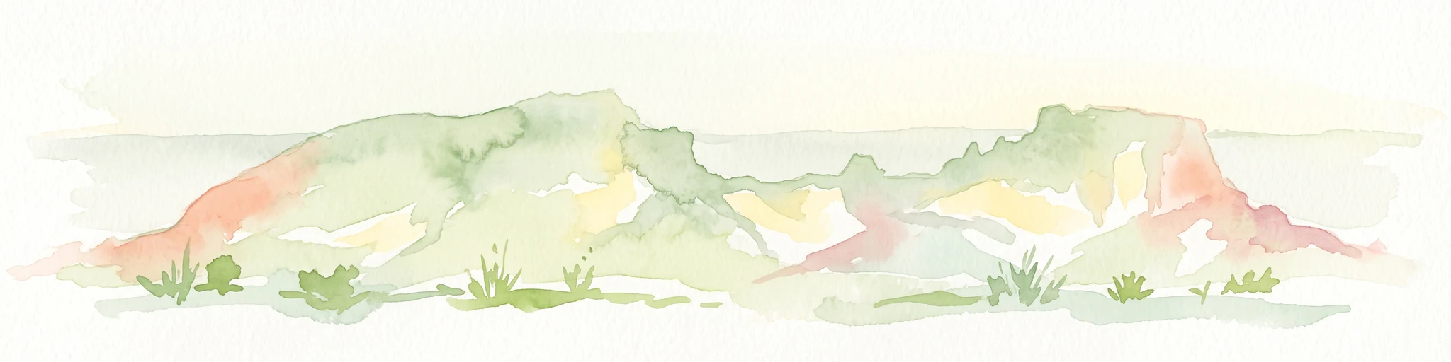
Watercolor painting of a landscape with green valleys, pink and yellow mountain peaks, and distant hills
National parkNorthern Territory

Finke Gorge National Park: Explore Its Protected Landscape and Geographic Identity

Mapped boundaries and natural terrain within Northern Territory.

Finke Gorge National Park represents a significant protected area within the Northern Territory, Australia. This national park offers valuable insights into the region's geography, mapped landscapes, and natural terrain. Detailed information helps users understand the park's protected boundaries and its role in the broader context of Australian conservation lands, ideal for focused atlas exploration.

Area
452.85 km²
Established
1966
IUCN
V
Visitors
18K annual
National parkSouth Australia

Malkumba-Coongie Lakes National Park: A Protected Landscape in South Australia

Explore its mapped geography and regional park context.

Malkumba-Coongie Lakes National Park stands as a protected natural area within South Australia. This national park offers specific insights into the mapped landscape and regional geography of the Australian state. Understanding its boundaries and protected status contributes to a broader atlas view of conservation landscapes. Discover the unique geographic identity of this area for structured exploration and geographic context.

Area
266.69 km²
Established
2005
IUCN
II
Relief
Lowland
National parkNorthern Territory

Watarrka National Park: Central Australian National Park with Iconic Canyon Landscapes

Explore its mapped terrain and protected area geography.

Watarrka National Park, located in the Northern Territory, is distinguished by the dramatic sandstone formations of Kings Canyon. This protected area showcases a unique arid zone biodiversity, including rare plant species and ancient cycad forests. Its geological significance and Aboriginal heritage make it a compelling point of study for understanding Central Australia's natural and cultural landscapes through structured atlas exploration.

Area
1,051.85 km²
Established
1989
IUCN
II
Visitors
176.1K annual
National parkSouth Australia

Nilpena Ediacara National Park: South Australia National Park and Protected Landscape Identity

Mapped protected area within the regional geography of South Australia.

Nilpena Ediacara National Park represents a significant protected landscape within South Australia. This entry provides a detailed geographic context for the park, focusing on its role as a national park and its mapped boundaries. Delve into the specific atlas-driven understanding of this protected area, its landscape context, and its significance within the broader geographic framework of the Australian state.

Area
606.17 km²
Established
2021
IUCN
VI
Relief
Mountain

Common questions about visiting, size, designation, and location context for Witjira National Park

Witjira National Park FAQs for park facts, access, geography, and protected area context
Find quick answers about Witjira National Park, including protected-area facts, park geography, trail and visitor context, and how the park fits into its surrounding country and regional landscape.
MoriAtlas Explorer

Continue Your Protected Areas Search Across the Global Atlas

Deepen your exploration by continuing the structured search for national parks and protected areas worldwide. Utilize the comprehensive filtering capabilities to compare different conservation landscapes and refine your understanding of global park geography. Discover more about the distribution and characteristics of protected natural areas.

Global natural geography