

Mori Atlas logo
National parkMalkumba-Coongie Lakes National Park

Discover the mapped boundaries and regional atlas context of this national park.

Malkumba-Coongie Lakes National Park: Explore South Australia's Protected Landscape Geography

Malkumba-Coongie Lakes National Park represents a key protected area within South Australia. As a national park, it offers a distinct geographic identity for atlas-based discovery. Users can explore its mapped landscape context, understand its role as a protected land within the Australian state, and gain insight into its specific regional geography. This page serves as the primary entry point for understanding the park's presence in the natural landscape and its value for structured geographic exploration.

Ramsar siteWetland ecosystemOutback wildernessBirdwatchingMigratory birdsArid landscape

Malkumba-Coongie Lakes National Park

National park

Park overview

Structured park overview, official facts, and landscape profile for Malkumba-Coongie Lakes National Park

Malkumba-Coongie Lakes National Park park facts, protected area profile, and essential visitor context
Review the core facts for Malkumba-Coongie Lakes National Park, including designation, size, terrain, visitor scale, habitats, and operating context in one park-focused overview.

About Malkumba-Coongie Lakes National Park

Malkumba-Coongie Lakes National Park protects a remarkable wetland ecosystem in one of Australia's most arid regions. The park sits within the Cooper Creek drainage basin, where seasonal flooding creates a dynamic mosaic of lakes, channels, floodplains, and associated terrestrial habitats. The Coongie Lakes themselves form a chain of interconnected water bodies that fill during periods of high flow, supporting an extraordinary concentration of aquatic life and attracting vast numbers of waterbirds. The wetland system operates on an irregular flood cycle, with major filling events occurring perhaps once every several years, followed by periods where many lakes contract to smaller remnants or dry completely. This variable wetting regime is fundamental to the ecological character of the site, driving the productivity that makes it so valuable for wildlife. The surrounding landscape is characterized by low, undulating sand dunes, gibber plains, and extensive arid shrubland, creating a stark contrast with the lush wetland environments. The park provides visitor experiences focused on appreciating this unique outback wetland environment, with opportunities for birdwatching, bushwalking, and remote camping in a landscape that feels far from civilization.

Quick facts and research context for Malkumba-Coongie Lakes National Park

Malkumba-Coongie Lakes National Park covers 266.69 square kilometres of remote outback terrain in north-eastern South Australia. The park was formally proclaimed on 31 March 2005 under the National Parks and Wildlife Act 1972, originally as Coongie Lakes National Park, and renamed in 2014. It is classified as an IUCN Category II protected area, denoting its national park status. The park is co-managed by the South Australian Department for Environment and Water in partnership with the Yandruwandha Yawarrawarrka Parks Advisory Committee, representing the traditional owners of the land. The Coongie Lakes wetland system has been listed under the Ramsar Convention since 1987, making it one of Australia's internationally recognized wetland protected areas.

Park context

Deeper park guide and search-rich context for Malkumba-Coongie Lakes National Park

Malkumba-Coongie Lakes National Park history, landscape, wildlife, and travel context
Explore Malkumba-Coongie Lakes National Park through its history, landscape character, ecosystems, wildlife, conservation priorities, cultural context, and seasonal travel timing in a structured park guide built for atlas discovery and search intent.

Why Malkumba-Coongie Lakes National Park stands out

Malkumba-Coongie Lakes National Park is best known for its exceptional wetland values in an arid landscape setting. The Coongie Lakes chain represents one of the most significant inland wetland systems in Australia, providing critical habitat for enormous congregations of migratory waterbirds that travel along the East Asian-Australasian Flyway. The park's floodplain environments support spectacular displays of birdlife following seasonal rains that fill the lakes and channels. Its location within the Cooper Creek system, a major arid-zone river that flows through the heart of the channel country, makes it a rare oasis of biodiversity in a vast semi-desert landscape. The park's Ramsar designation underscores its international significance as a wetland conservation site.

Malkumba-Coongie Lakes National Park history and protected-area timeline

The Coongie Lakes area has been recognized for its exceptional natural values for decades before formal national park protection was established. The wetland system was inscribed on the List of Wetlands of International Importance under the Ramsar Convention in 1987, well before the national park was proclaimed. This Ramsar listing recognized the Coongie Lakes as a wetland of outstanding universal value, particularly for the waterbird communities they support. The national park was subsequently proclaimed on 31 March 2005 under South Australia's National Parks and Wildlife Act 1972, created from land that had previously been part of the Innamincka Regional Reserve. The stated purposes of the proclamation were to conserve significant wetlands, provide experiences for visitors, and ensure protection of the core component of the Coongie Lakes system. In 2014, the park was renamed Malkumba-Coongie Lakes National Park, with the new name incorporating the indigenous term Malkumba alongside the well-established Coongie Lakes name. This renaming reflected the growing recognition of the cultural significance of the area and the establishment of co-management arrangements with the Yandruwandha Yawarrawarrka people, the traditional owners of the land.

Malkumba-Coongie Lakes National Park landscape and geographic character

The physical landscape of Malkumba-Coongie Lakes National Park is defined by the interaction between the Cooper Creek river system and the surrounding arid terrain of the South Australian outback. Cooper Creek, a major arid-zone river, flows through the region in a complex network of channels that spread across the landscape during flood events, creating the Coongie Lakes chain. The lakes vary from relatively permanent deep water bodies to extensive shallow floodplains that fill and dry according to the unpredictable flow regime. Surrounding the wetlands, the landscape features low sand dunes oriented roughly north-south, gibber-covered stony plains, and vast areas of arid shrubland dominated by species such as saltbush and bluebush. The visual character of the park changes dramatically with the flood cycle, transforming from a seemingly dry and dusty outback environment to a lush wetland landscape with abundant waterbird life following periods of substantial inflow.

Malkumba-Coongie Lakes National Park ecosystems, habitats, and plant life

The ecological character of Malkumba-Coongie Lakes National Park centers on its wetland habitats, which support remarkable biodiversity despite the arid setting. The park encompasses a range of wetland types including permanent lakes, seasonal floodplain channels, temporary swamps, and mudflats, each supporting different ecological communities. The seasonal flooding that drives the wetland system brings nutrients and organic material into the floodplain, triggering pulses of productivity that support huge populations of aquatic invertebrates, fish, and waterbirds. The surrounding samphire grasslands and arid shrubland communities are adapted to the extreme climate variability of the region, with many species able to rapidly exploit the brief periods of increased moisture following rain. The park sits within the Cooper Creek catchment, connecting the wetland system to broader landscape-scale ecological processes across the channel country of outback South Australia.

Malkumba-Coongie Lakes National Park wildlife and species highlights

Malkumba-Coongie Lakes National Park is renowned for its extraordinary waterbird populations, particularly during periods when the lakes fill with water. The wetland system supports congregations of ducks, geese, swans, herons, egrets, ibises, spoonbills, and cranes that can number in the hundreds of thousands during peak periods. The park is situated along the East Asian-Australasian Flyway, a major migratory route for waterbirds moving between breeding grounds in the northern hemisphere and southern Australia. Species such as the Australian pelican, black swan, various duck species, and the iconic brolga are commonly observed, while the shallow wetlands and mudflats provide feeding habitat for numerous shorebird species. The wetland system also supports fish populations including bony bream and golden perch, which in turn sustain populations of birds such as the little pied cormorant and the annual breeding colonies of the endangered Murray cod in supported waterways.

Malkumba-Coongie Lakes National Park conservation status and protection priorities

The conservation significance of Malkumba-Coongie Lakes National Park is underscored by its Ramsar listing, which recognizes the wetland system as a site of international importance under the Convention on Wetlands. The Coongie Lakes were designated as a Ramsar site in 1987 due to their outstanding universal value as a habitat for waterbirds and their role in supporting ecological processes in an arid environment. The national park designation provides formal protection for the core wetland area, complementing the broader Ramsar-listed site. Co-management arrangements with the Yandruwandha Yawarrawarrka people integrate traditional ecological knowledge into conservation planning, while the South Australian Department for Environment and Water manages the site in partnership with natural resources management bodies. The park's protection ensures that this remarkable arid wetland ecosystem remains functional despite the pressures of climate variability and the challenges of managing water resources in an increasingly dry region.

Malkumba-Coongie Lakes National Park cultural meaning and human context

Malkumba-Coongie Lakes National Park lies within the traditional Country of the Yandruwandha and Yawarrawarrka peoples, who have lived in this region for thousands of years and maintain deep cultural connections to the land and waterways. The inclusion of the indigenous term Malkumba in the park's name reflects the recognition of this ongoing connection and the importance of Aboriginal cultural heritage in the management of the area. The Yandruwandha Yawarrawarrka Parks Advisory Committee participates in the co-management of the park, bringing traditional knowledge and perspectives to conservation planning and visitor management. The Cooper Creek system and its wetlands hold cultural significance for Aboriginal people, with the waterways and surrounding landscapes featuring in traditional stories and supporting traditional practices. This cultural context adds an important dimension to the park's identity beyond its ecological values.

Top sights and standout views in Malkumba-Coongie Lakes National Park

The defining highlight of Malkumba-Coongie Lakes National Park is the opportunity to experience a thriving wetland ecosystem in the heart of Australia's arid outback, where the transformation of a dry landscape into a bird-filled oasis following seasonal floods creates one of nature's most dramatic spectacles. The park offers exceptional birdwatching opportunities, with the chance to observe massive congregations of waterbirds including pelicans, swans, ducks, and brolgas in their natural wetland habitat. The remote character of the park, far from major population centers, provides a genuine wilderness experience where visitors can appreciate the silence and scale of the outback landscape. The Cooper Creek channels and the Coongie Lakes chain create a distinctive visual landscape unlike typical desert environments, with the interplay between water and arid terrain producing a unique ecological character.

Best time to visit Malkumba-Coongie Lakes National Park

The best time to visit Malkumba-Coongie Lakes National Park depends largely on rainfall patterns and the resulting flood conditions, which are highly variable and unpredictable in this arid region. Visiting after significant rainfall in the Cooper Creek catchment has filled the lakes provides the most spectacular wildlife viewing opportunities, with abundant waterbirds present throughout the wetland system. The cooler months from May to September generally offer more comfortable conditions for exploring the park, with milder daytime temperatures making outdoor activities more pleasant. Summer months from November to February can be extremely hot, with temperatures regularly exceeding 40 degrees Celsius, making daytime activities challenging. The park can be inaccessible during wet periods when roads become impassable, while very dry conditions may result in limited water and fewer birds visible.
Park location guide

Geography guide, regional context, and park location map for Malkumba-Coongie Lakes National Park

Malkumba-Coongie Lakes National Park park geography, regions, and map view in Australia
Understand where Malkumba-Coongie Lakes National Park sits in Australia through a broader geographic reading of the surrounding landscape, nearby location context, and its mapped position within the national park landscape.

How Malkumba-Coongie Lakes National Park fits into Australia

Australia is a constitutional monarchy and federal parliamentary democracy comprising six states and ten territories. With a population of nearly 28 million, it is one of the world's most urbanised countries, with most people concentrated on the eastern seaboard. The country has a high Human Development Index and is known for its cultural diversity, ancient Aboriginal heritage, and unique wildlife.

Wider geography shaping Malkumba-Coongie Lakes National Park in Australia

Australia occupies the entire Australian continent, the island of Tasmania, and numerous smaller islands. It is the world's flattest and driest inhabited continent, featuring vast deserts in the interior (the Outback), tropical rainforests along the eastern coast, and a coastline bordering the Indian and Pacific Oceans.

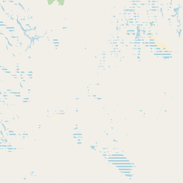
Map view of Malkumba-Coongie Lakes National Park

Use this park location map to pinpoint Malkumba-Coongie Lakes National Park in Australia, understand its exact geographic position, and read its mapped placement within the surrounding landscape more clearly.

Pigeon | © OpenStreetMap contributors

Location context for Malkumba-Coongie Lakes National Park

South Australia
Park atlas

Browse surrounding protected landscapes and compare other remote arid-zone wetlands across South Australia.

Explore Related National Parks and Protected Areas Near Malkumba-Coongie Lakes National Park
Explore other national parks and protected areas in South Australia, continuing your geographic discovery from Malkumba-Coongie Lakes National Park. This curated selection helps trace regional protected landscapes, identify wetland systems, and compare conservation efforts across Australia's unique outback environment.
National parkSouth Australia

Munga-Thirri, Simpson Desert National Park: Explore South Australia's Vast National Park Territory

Mapped boundaries and arid landscape context.

Munga-Thirri, Simpson Desert National Park is a crucial national park located in South Australia, offering a detailed look into the mapped geography and protected landscape characteristics of Australia's arid interior. This page facilitates an atlas-driven understanding of the park's protected boundaries, regional context, and unique desert terrain. Explore the fundamental geographic identity of this significant protected area, providing essential data for landscape discovery.

Area
36,000 km²
Established
1967
IUCN
Ia
Relief
Lowland
National parkQueensland

Munga-Thirri National Park: Queensland's Premier Desert Dune Protected Landscape

Explore the vast sand ridges and unique arid ecosystems of this national park.

Munga-Thirri National Park is Queensland's largest national park, preserving a spectacular desert landscape dominated by extensive parallel sand dunes. Situated in the remote central west, this protected area offers a unique lens into arid ecosystems, showcasing striking red dunes that define its geographic identity. Discover the mapped features and landscape context of this significant Australian protected land, offering a deep dive into the Simpson Desert's unique terrain and natural heritage.

Area
10,120 km²
Established
1967
IUCN
II
Relief
Lowland
National parkNew South Wales

Narriearra Caryapundy Swamp National Park: National Park Protected Landscape and Geographic Atlas

Explore mapped boundaries and regional context within New South Wales.

Narriearra Caryapundy Swamp National Park is a designated national park focused on preserving its unique protected landscape. This entry provides essential geographic context, detailing the park's mapped boundaries and its role within the regional atlas of New South Wales. Understand the protected natural area's identity and its place within the broader geographic framework for atlas exploration.

Area
1,534 km²
Established
2020
Relief
Lowland
Climate
Arid
National parkSouth Australia

Vulkathunha-Gammon Ranges National Park: South Australia National Park Atlas Exploration

Mapped boundaries and regional geographic context.

Dive into the specifics of Vulkathunha-Gammon Ranges National Park, a designated national park situated in South Australia. This detailed resource focuses on its role as a protected landscape, providing users with critical geographic information. Understand the park's mapped boundaries and its relation to the broader regional geography, perfect for anyone engaged in atlas-based exploration of Australia's natural areas.

Area
1,257.23 km²
Established
1970
IUCN
II
Relief
Mountain
National parkSouth Australia

Lake Frome National Park: Mapped Protected Area and Regional Geographic Identity in South Australia

Explore South Australia's unique landscape and park boundaries.

Lake Frome National Park offers a distinct focus for exploring the geography and protected landscape of South Australia. As a national park, it contributes to the mapped conservation network of the region, allowing for detailed study of its environmental context and geographic positioning. Discover the mapped terrain and regional park boundaries that define this significant protected area, crucial for a comprehensive atlas-based understanding of South Australia's natural heritage.

Area
2,582.4 km²
Established
1991
IUCN
VI
Relief
Lowland
National parkQueensland

Lake Bindegolly National Park: A Mapped Protected Wetland Sanctuary in Queensland

Discover its rare flora and vital bird habitat in the Mulga Lands.

Lake Bindegolly National Park is a significant protected natural area situated in the Mulga Lands of Queensland, Australia. This national park preserves a unique three-lake system, essential for rare plant conservation and recognized internationally as an Important Bird Area. The transient wetlands within the park attract a remarkable diversity of bird species, especially waterfowl, making it a key destination for understanding inland Australian geography and the importance of protected landscapes.

Area
140 km²
Established
1991
IUCN
II
Relief
Lowland
National parkAustralia

Welford National Park: Australia's Protected Landscape and Geographic Identity

Mapped boundaries and regional atlas information for this national park.

Welford National Park is a key protected area offering insights into Australia's natural geography and mapped landscapes. As a national park, its specific boundaries delineate a territory of conservation significance. Users can utilize this entry to understand the park's role within the Australian continent's atlas, exploring its terrain and geographic context in detail. This park detail page serves as an anchor for discovering its unique protected landscape and its place in broader regional geography.

Area
1,240 km²
Established
1994
IUCN
II
Relief
Mixed relief
National parkSouth Australia

Nilpena Ediacara National Park: South Australia National Park and Protected Landscape Identity

Mapped protected area within the regional geography of South Australia.

Nilpena Ediacara National Park represents a significant protected landscape within South Australia. This entry provides a detailed geographic context for the park, focusing on its role as a national park and its mapped boundaries. Delve into the specific atlas-driven understanding of this protected area, its landscape context, and its significance within the broader geographic framework of the Australian state.

Area
606.17 km²
Established
2021
IUCN
VI
Relief
Mountain

Common questions about visiting, size, designation, and location context for Malkumba-Coongie Lakes National Park

Malkumba-Coongie Lakes National Park FAQs for park facts, access, geography, and protected area context
Find quick answers about Malkumba-Coongie Lakes National Park, including protected-area facts, park geography, trail and visitor context, and how the park fits into its surrounding country and regional landscape.
MoriAtlas Explorer

Continue Your Protected Areas Search Across the Global Atlas

Deepen your exploration by continuing the structured search for national parks and protected areas worldwide. Utilize the comprehensive filtering capabilities to compare different conservation landscapes and refine your understanding of global park geography. Discover more about the distribution and characteristics of protected natural areas.

Global natural geography