

Mori Atlas logo
National parkNááts'ihch'oh National Park Reserve

Understand the mapped boundaries and geographic context of this protected natural area.

Nááts'ihch'oh National Park Reserve: Northwest Territories Protected Landscape and Atlas Discovery

Nááts'ihch'oh National Park Reserve is a designated national park in the Northwest Territories, Canada, offering a distinct protected landscape for geographic exploration. This entry provides structured details for understanding its mapped boundaries, regional context, and overall atlas significance. Discover the unique geographic identity of this protected area within the broader Northwest Territories landscape.

National Park ReserveNorthwest TerritoriesMackenzie MountainsBoreal ForestAlpine TundraDene Cultural Heritage

Nááts'ihch'oh National Park Reserve

National park

Park overview

Structured park overview, official facts, and landscape profile for Nááts'ihch'oh National Park Reserve

Nááts'ihch'oh National Park Reserve park facts, protected area profile, and essential visitor context

Review the core facts for Nááts'ihch'oh National Park Reserve, including designation, size, terrain, visitor scale, habitats, and operating context in one park-focused overview.

About Nááts'ihch'oh National Park Reserve

Nááts'ihch'oh National Park Reserve represents one of Canada's newest protected areas, established in 2014 to preserve a distinctive portion of the Mackenzie Mountains and the upper South Nahanni River watershed. The reserve lies entirely within the Sahtú Settlement Area, the traditional territory of the Shúhtaot'ine or Mountain Dene people, for whom the area holds profound personal and cultural importance. The landscape is characterized by rugged mountain terrain, deep river valleys, and ecological zones ranging from boreal forest on lower slopes to alpine tundra at higher elevations. The park shares a border with Nahanni National Park Reserve to the south, though the two areas are administered separately, reflecting the different Indigenous land claims and settlement areas involved. The creation of the reserve followed more than a decade of negotiations between the federal government and Sahtu Dene and Métis organizations, addressing both conservation objectives and concern over industrial development in the region. The reserve explicitly prohibits new mining operations while respecting existing mineral claims, balancing ecological protection with established economic interests.

Quick facts and research context for Nááts'ihch'oh National Park Reserve

Nááts'ihch'oh National Park Reserve is located in the Northwest Territories of Canada, encompassing the upper watershed of the South Nahanni River within the Mackenzie Mountains. The reserve was established through federal legislation under the National Parks Act on December 18, 2014, following negotiations with Sahtu Dene and Métis communities. It covers 4,850 square kilometres and is governed by Parks Canada in coordination with local Indigenous land corporations. The nearest community is Tulita, located nearby on the banks of the North Nahanni River. The highest peaks within the reserve reach approximately 2,456 metres, with Nááts'ihch'oh (Mount Wilson) standing at 2,245 metres.

Protection and recognition

Analyzing the documented terrestrial management scope and official designations

Nááts'ihch'oh National Park Reserve Protection Status and Conservation Framework

Verified regional databases detail the terrestrial protection status and formal designation history of Nááts'ihch'oh National Park Reserve. Reviewing baseline records helps map out the official management scope, regional conservation boundaries, and verified international frameworks.

Protection details

Protection scope
Terrestrial
Transboundary protection
No
Park context

Deeper park guide and search-rich context for Nááts'ihch'oh National Park Reserve

Nááts'ihch'oh National Park Reserve history, landscape, wildlife, and travel context

Explore Nááts'ihch'oh National Park Reserve through its history, landscape character, ecosystems, wildlife, conservation priorities, cultural context, and seasonal travel timing in a structured park guide built for atlas discovery and search intent.

Why Nááts'ihch'oh National Park Reserve stands out

Nááts'ihch'oh is best known for its namesake mountain, a visually striking peak that the Shúhtaot'ine describe as standing like a porcupine quill, a name carrying deep cultural and spiritual significance. The reserve protects critical habitat for boreal woodland caribou and represents the northernmost Canadian population of Rocky Mountain goats in its montane zones. The South Nahanni River, known as Tehjeh Deé in the Dene language, flows through the park offering paddling opportunities through challenging rock gardens, while the Broken Skull River provides a more accessible alternative route. The landscape combines deep river valleys, alpine tundra, and forested slopes that support diverse wildlife including grizzly bears, wolves, moose, Dall sheep, and numerous smaller mammals.

Nááts'ihch'oh National Park Reserve history and protected-area timeline

The establishment of Nááts'ihch'oh National Park Reserve followed a prolonged negotiation process beginning in the early 2000s. In February 2003, the Government of Canada announced the withdrawal of approximately 7,600 square kilometres of land from industrial development to enable the creation of a protected area. The formal intention to establish a park reserve was announced in April 2008 by Federal Environment Minister John Baird, who characterized the agreement as protecting Canada's North for future generations. Negotiations between the federal government and Sahtu Dene and Métis land corporations focused on developing an impact and benefit plan for the reserve. The region had faced increasing industrial pressure from roads, pipelines, mineral exploration, and oil and gas development, and the Dene and Métis communities sought to ensure their interests were protected while preserving their relationship with the land. Three boundary scenarios were proposed, with mining interests favouring the option that left 70 percent of mineral potential outside the park while retaining substantial habitat protection. In March 2012, federal, Dene, and Métis representatives signed the impact and benefit plan. Prime Minister Stephen Harper visited the area in August 2012 to announce the reserve's boundaries, and the protected area was formally established through legislation passed in December 2014, becoming Canada's eighth national park reserve.

Nááts'ihch'oh National Park Reserve landscape and geographic character

The landscape of Nááts'ihch'oh National Park Reserve is defined by its position within the Mackenzie Mountains, a remote and rugged mountain range in the northwestern Canadian interior. The terrain is dominated by steep-sided valleys carved by the South Nahanni River and its tributaries, with the Broken Skull River merging with the main watercourse within the park boundaries. The highest peaks reach approximately 2,456 metres, with Nááts'ihch'oh (Mount Wilson) standing at 2,245 metres at the northern end of the reserve. This distinctive mountain, from which the park takes its name, features a sharp pointed profile that the Shúhtagot'ine (Slavey language) speakers describe as resembling a porcupine quill. The landscape transitions from boreal forest on lower valley floors through subalpine zones to alpine tundra and rock outcrops at higher elevations. The South Nahanni River flows through the park in a series of rapids and the challenging rock garden section that paddlers can navigate from Moose Ponds (Nááts'ı̨hch'oh Tué) at the river's upper extent.

Nááts'ihch'oh National Park Reserve ecosystems, habitats, and plant life

The ecological character of Nááts'ihch'oh spans multiple biomes typical of the northern Canadian mountain environment. The lower elevations support boreal forest composed of coniferous species adapted to the subarctic climate, while higher slopes give way to alpine tundra and exposed rock. The river valleys provide riparian corridors that differ from the surrounding terrain, offering diverse habitat conditions. The protected area encompasses significant portions of the upper South Nahanni watershed, connecting with the adjacent Nahanni National Park Reserve to create a larger conservation complex. The montane zones contain the northernmost Canadian population of Rocky Mountain goats, a notable ecological distinction. The watershed provides important habitat for species that depend on clean water and intact river systems, supporting the broader ecological function of the region.

Nááts'ihch'oh National Park Reserve wildlife and species highlights

The wildlife of Nááts'ihch'oh includes numerous iconic North American species characteristic of the boreal and mountain environments. Large mammals present include American black bears, grizzly bears, gray wolves, boreal woodland caribou, and moose. The montane areas support Dall sheep and Rocky Mountain goats, with the latter representing the northernmost population of this species in Canada. Smaller mammals found throughout the reserve include Arctic hares, beavers, collared pikas, hoary marmots, muskrats, porcupines, and snowshoe hares. Carnivores in the region include Canada lynx, red fox, American marten, American mink, ermine, and wolverines. North American river otters hunt fish in the riverine habitats. This assemblage of species reflects the ecological diversity of the Mackenzie Mountains region, from valley-bottom riparian zones through forested slopes to alpine areas.

Nááts'ihch'oh National Park Reserve conservation status and protection priorities

Nááts'ihch'oh National Park Reserve contributes to Canada's protected areas network by preserving a significant portion of the upper South Nahanni watershed and associated mountain ecosystems. The reserve was created following extended negotiations that balanced conservation objectives with the region's mineral potential and existing industrial interests. The final boundary configuration protects approximately 70 percent of grizzly bear habitat and 44 percent of woodland caribou summer calving grounds within the park, while leaving 70 percent of the region's mineral potential available for potential future development outside the protected area. The reserve prohibits the opening of new mines but respects existing mineral claims, reflecting a compromise approach to industrial activity. The creation of the park fulfills Canada's commitment to establishing protected areas in the North and works in conjunction with the adjacent Nahanni National Park Reserve to create a larger conservation landscape spanning the South Nahanni watershed.

Nááts'ihch'oh National Park Reserve cultural meaning and human context

Nááts'ihch'oh holds profound cultural significance for the Shúhtaot'ine (Mountain Dene), a Sahtu group of the Tulita District whose traditional territory encompasses the park area. The mountain for which the reserve is named, Nááts'ihch'oh (Mount Wilson), is credited with great powers in Shúhtaot'ine tradition and forms an important part of the cultural landscape. The entire region has been long travelled and valued for hunting and its wealth of natural resources. The park creation process involved negotiations with Sahtu Dene and Métis land corporations established under the Sahtu land claim agreement, resulting in an impact and benefit plan that addresses Indigenous interests in the protected area. The South Nahanni River is known as Tehjeh Deé in the Dene language, reflecting the deep historical connection between the Shúhtaot'ine and this waterway that runs through the heart of the reserve.

Top sights and standout views in Nááts'ihch'oh National Park Reserve

Nááts'ihch'oh National Park Reserve offers paddling opportunities on the South Nahanni River through its renowned rock garden section, accessible from Moose Ponds at the river's upper extent, while the Broken Skull River provides a less technically demanding alternative. The reserve protects habitat for boreal woodland caribou and supports the northernmost population of Rocky Mountain goats in Canada. The sacred mountain Nááts'ihch'oh, with its distinctive porcupine-quill shape, anchors the cultural identity of the reserve and the Shúhtaot'ine people. Visitors can explore deep river valleys, alpine tundra, and diverse ecosystems within the Mackenzie Mountains, adjacent to but separate from the more established Nahanni National Park Reserve.

Best time to visit Nááts'ihch'oh National Park Reserve

The optimal season for visiting Nááts'ihch'oh National Park Reserve aligns with the short subarctic summer, typically from mid-June through September, when conditions are most suitable for backcountry travel and paddling. The summer months offer extended daylight, relatively mild temperatures in the valley bottoms, and snow-free conditions on lower elevation trails. Wildlife viewing opportunities are strongest during this period as animals are more active in the warmer months. Winter visits would require specialized cold-weather equipment and preparation for extreme conditions, while spring and fall transitions feature rapidly changing weather and less predictable access. The remote location and limited infrastructure mean that most visitors plan their trips well in advance, with the peak season concentrating on the warmest weeks of the year.
Monthly climate preview

Analyze long term temperature averages and seasonal precipitation cycles within the subarctic mountain landscape.

Climate Profiles and Monthly Weather for Nááts'ihch'oh National Park Reserve

Long term average measurements from a representative coordinate at 1574.6 meters show sub-zero mean temperatures spanning most months alongside increased precipitation during the brief summer period. Accessing the comprehensive twelve month profile delivers structured historical data to help compare seasonal patterns and extreme cold thresholds across the protected subarctic reserve.
Annual mean-8 °C
-21 °C9 °C
Jan-21°
Feb-19°
Mar-16°
Apr-8°
May-1°
Jun
Jul
Aug
Sep
Oct-10°
Nov-18°
Dec-20°
Warmest month
July

8.5 °C

Coolest month
January

-21 °C

Wettest month
July

4.8 mm/day

Driest month
March

1.1 mm/day

Park location guide

Geography guide, regional context, and park location map for Nááts'ihch'oh National Park Reserve

Nááts'ihch'oh National Park Reserve park geography, regions, and map view in Canada

Understand where Nááts'ihch'oh National Park Reserve sits in Canada through a broader geographic reading of the surrounding landscape, nearby location context, and its mapped position within the national park landscape.

How Nááts'ihch'oh National Park Reserve fits into Canada

Canada is a federal parliamentary constitutional monarchy spanning North America from the Atlantic to the Pacific and Arctic Oceans. With a population of over 41 million, it is officially bilingual in English and French at the federal level. The country gained independence from the United Kingdom through a gradual process culminating in 1982.

Wider geography shaping Nááts'ihch'oh National Park Reserve in Canada

Canada occupies the northern portion of North America, sharing its longest international border with the United States. The country extends from the Atlantic Ocean to the Pacific Ocean and northward into the Arctic Ocean, giving it the longest coastline of any nation.

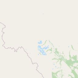
Map view of Nááts'ihch'oh National Park Reserve

Use this park location map to pinpoint Nááts'ihch'oh National Park Reserve in Canada, understand its exact geographic position, and read its mapped placement within the surrounding landscape more clearly.

Pigeon | © OpenStreetMap contributors

Location context for Nááts'ihch'oh National Park Reserve

Northwest Territories
Natural feature types

Explore the Geographic Landmarks of Nááts'ihch'oh National Park Reserve

Trace the diverse landscape features of Nááts'ihch'oh National Park Reserve by browsing its catalog of named landforms and waterways. Use this geographic resource to understand the spatial relationships between the mountain peaks and river systems that characterize this protected wilderness area in the Mackenzie Mountains.
Recorded earthquake history

Review Recorded Seismic History for Nááts'ihch'oh National Park Reserve

Examine the historical catalogue of seismic events associated by proximity with Nááts'ihch'oh National Park Reserve. This dataset on MoriAtlas offers a clear, structured view of recorded epicentres and magnitude data for the surrounding Mackenzie Mountains region.

Nááts'ihch'oh National Park Reserve Earthquake History

Catalogued events

9 events

Strongest magnitude

Magnitude 5

Most recent event

May 12, 2023

This history includes earthquakes recorded inside the park or within 50 km of its borders

Park atlas

Compare protected areas across the Mackenzie Mountains region, mapping the diverse subarctic landscapes and conservation zones.

Explore Nearby National Parks and Protected Areas Surrounding Nááts'ihch'oh National Park Reserve

Beyond Nááts'ihch'oh National Park Reserve, browse other national parks and protected areas within the vast Mackenzie Mountains and the wider Northwest Territories. This exploration allows for rich geographic comparison, revealing how different protected landscapes connect and contribute to regional conservation efforts.
National parkNorthwest Territories
Park boundaries overlap#1 closest

Southeast

Nahanni National Park Reserve National Park: Protected Landscape and Geographic Mapping

Explore the mapped terrain and protected area boundaries in Northwest Territories.

Navigate the protected landscape of Nahanni National Park Reserve, a designated national park within the Northwest Territories. This entry provides detailed insight into the park's mapped geographic boundaries and its role as a significant protected area. Understanding its place within the regional atlas allows for a deeper appreciation of its natural terrain and conservation significance, offering factual context for geographic exploration.

Area
30,050 km²
Established
1972
IUCN
II
Visitors
1.1K annual
Wildlife reserveYukon
271 km away#2 closest

Southwest

Nisutlin River Delta National Wildlife Area: Yukon Delta and Wetland Geography

Protected boreal river delta and lake ecosystem.

The Nisutlin River Delta National Wildlife Area occupies a strategic position where riverine flow meets the expansive basin of Teslin Lake. The reserve is characterized by its dramatic seasonal transitions, transforming from high-water spring channels to expansive autumn mudflats. This dynamic geography supports essential migratory corridors through the boreal forest terrain of the southern Yukon.

Area
54.83 km²
Established
1995
IUCN
III
State or regional parkBritish Columbia
About 343 km away#3 closest

South

Liard River Hot Springs Provincial Park: Boreal Geothermal Mapping and Regional Geography

Protected northern wilderness, thermal water systems, and muskeg wetland terrain

Liard River Hot Springs Provincial Park serves as a protected geographic nexus where thermal water discharge creates a unique biological oasis. The park landscape combines expansive boreal forest with sensitive muskeg wetlands, centered around a natural hot spring system that supports orchid populations and regular wildlife sightings. This atlas entry provides essential context on the physical boundaries and ecological features that define this significant regional park in northern British Columbia.

Area
10.82 km²
Established
1957
IUCN
III
Relief
Lowland
State or regional parkBritish Columbia
About 361 km away#4 closest

South

Horneline Creek Provincial Park: Protected Canyon Landscapes and Rocky Mountain Trench Geography

Remote glacial-terrace wilderness in northern British Columbia

Located deep in the Rocky Mountain Trench, Horneline Creek Provincial Park is defined by its deep-cut canyon and ancient glacial terraces. This protected area offers an intimate view of sub-boreal terrain where mineral-stained walls and aspen-dotted grasslands create a concentrated, ecologically significant landscape within a remote corner of northern British Columbia.

Area
2.98 km²
Established
1999
IUCN
II
Relief
Upland
State or regional parkBritish Columbia
About 381 km away#5 closest

Southeast

Maxhamish Lake Provincial Park and Protected Area: Mapping Northern British Columbia Wilderness

Boreal lake ecosystems and protected indigenous heritage lands

Spanning over 27,500 hectares, Maxhamish Lake Provincial Park and Protected Area is a remote boreal refuge characterized by its central lake and extensive coniferous forests. This park provides a critical habitat for moose, deer, and cold-water fish species while maintaining deep ties to the Fort Nelson First Nation and Acho Dene Koe. Its geography reveals a distinct northern basin, offering insight into the ecological character and protected landscape features of northeastern British Columbia.

Area
275.16 km²
IUCN
II
Water
Major water bodies
Season
Seasonal
State or regional parkBritish Columbia
391 km away#6 closest

South

Denetiah Provincial Park and Protected Area: Regional Geography and Wilderness Mapping

An undisturbed boreal reserve in the Stikine Region

Discover the geographic structure of Denetiah Provincial Park and Protected Area, a vast roadless landscape in northern British Columbia. This park protects pristine boreal forests, elongated glacial lake basins, and critical river headwaters that serve as a benchmark for northern conservation within the Muskwa-Kechika Management Area.

Area
1,053.49 km²
Established
1999
IUCN
II
Relief
Upland
State or regional parkBritish Columbia
About 436 km away#7 closest

Southeast

Jackpine Remnant Provincial Park: Protected Boreal Landscape and Regional Map Context

Conservation and terrain data for the Fort Nelson region

Jackpine Remnant Provincial Park provides a critical study in northern conservation geography. Located in the Fort Nelson area of British Columbia, this 148-hectare site protects a rare stand of jack pine trees. Its mapped boundaries and boreal forest terrain offer a focused look at small-scale protected landscapes and their significance within the broader regional ecosystem of the Canadian north.

Area
1.48 km²
Established
2001
IUCN
II
Relief
Lowland
State or regional parkBritish Columbia
About 443 km away#8 closest

South

Dune Za Keyih Provincial Park and Protected Area: Watershed and Terrain Geography

Remote wilderness landscape in northern British Columbia

Dune Za Keyih Provincial Park and Protected Area protects the largest unlogged watershed in British Columbia. Situated within the Muskwa-Kechika Management Area, this remote wilderness is defined by the geological structures of the Rocky Mountain Trench, providing a continuous corridor of undisturbed mountain forest, riparian zones, and highland terrain.

Area
3,468.33 km²
Established
2001
IUCN
Ib
Relief
Mountain

Common questions about visiting, size, designation, and location context for Nááts'ihch'oh National Park Reserve

Nááts'ihch'oh National Park Reserve FAQs for park facts, access, geography, and protected area context

Find quick answers about Nááts'ihch'oh National Park Reserve, including protected-area facts, park geography, trail and visitor context, and how the park fits into its surrounding country and regional landscape.
MoriAtlas Explorer

Continue Your Protected Areas Search Across the Global Atlas

Deepen your exploration by continuing the structured search for national parks and protected areas worldwide. Utilize the comprehensive filtering capabilities to compare different conservation landscapes and refine your understanding of global park geography. Discover more about the distribution and characteristics of protected natural areas.

Global natural geography