Mori Atlas logo
National parkNamaqua National Park

Detailed map context and natural terrain exploration for this significant national park.

Namaqua National Park: Protected Landscape and Geographic Atlas in South Africa's Northern Cape

Namaqua National Park stands as a key protected area within the vast geography of South Africa's Northern Cape province. This page offers an atlas-driven exploration of its distinct landscape, mapped park boundaries, and its place within the region's natural context. Understand the protected land's geographic identity and discover its unique features through structured geographic data.

Spring WildflowersSucculent Karoo BiomeSemi-Desert LandscapeBiodiversity HotspotEndemic PlantsSouth African National Parks

Namaqua National Park

National park

Park overview

Structured park overview, official facts, and landscape profile for Namaqua National Park

Namaqua National Park park facts, protected area profile, and essential visitor context

Review the core facts for Namaqua National Park, including designation, size, terrain, visitor scale, habitats, and operating context in one park-focused overview.

About Namaqua National Park

Namaqua National Park occupies a remarkable position in global conservation as the primary protected area within the Succulent Karoo, a semi-desert biome recognised internationally as a biodiversity hotspot of exceptional significance. The park's landscape consists of rolling hills, rocky outcrops, and coastal plains that remain predominantly brown and barren for much of the year until the winter rains trigger one of nature's most dramatic transformations. The spring bloom brings dramatic displays of colour across the landscape, with flowers sensitive to sunlight and typically opening fully between 10 a.m. and 4 p.m. each day. The park includes the Skilpad section, which remains the primary tourist-accessible area during the flower season, though development remains limited with only basic facilities including four chalets for overnight visitors. Tourism has been identified by the South African government as a key driver for economic improvement in this region, which continues to face significant challenges with high unemployment and low incomes despite the area's natural beauty and ecological importance.

Quick facts and research context for Namaqua National Park

Namaqua National Park lies in the Northern Cape Province of South Africa near the Namibia border, occupying more than 1,300 square kilometres of semi-desert terrain within the Succulent Karoo biome. The park was officially gazetted in 1999 with the Skilpad Nature Reserve, established in 1993, serving as its core. The region experiences hot dry summers and cold winters with most rainfall occurring between May and August. The eastern portions of the park receive more precipitation than the coastal western sections. The park is managed by South African National Parks and supports more than 4,000 plant species, including over 1,000 endemic flower types found nowhere else on the planet.

Protection and recognition

Tracing documented management scope, designation records, and global conservation metrics

Namaqua National Park Protection Status and Designated Area Profile

Geographic datasets track the official protection status, management scope, and designated boundaries established for Namaqua National Park. Reviewing official registry records and regional conservation frameworks offers essential baseline context on the global status of the protected landscape.

Protection details

Protection scope
Mixed
Transboundary protection
No
Park context

Deeper park guide and search-rich context for Namaqua National Park

Namaqua National Park history, landscape, wildlife, and travel context

Explore Namaqua National Park through its history, landscape character, ecosystems, wildlife, conservation priorities, cultural context, and seasonal travel timing in a structured park guide built for atlas discovery and search intent.

Why Namaqua National Park stands out

Namaqua National Park is renowned worldwide for its spectacular spring wildflower bloom, when thousands of brightly coloured daisies, lilies, aloes, and perennial herbs transform the normally barren desert landscape into a vivid carpet of colour spanning hundreds of square kilometres. This phenomenon occurs annually from August through September following the winter rains and draws approximately 100,000 visitors each year, with 65 percent from South Africa and 35 percent from international destinations. The park protects the heart of the Succulent Karoo, the arid biome containing the greatest concentration of succulent plants in the world, including the iconic quiver tree with its distinctive fat water-storing trunk and the low-growing vygies with their stone-like appearance and vibrant blooms. The region represents one of only two desert biodiversity hotspots globally and contains approximately 40 percent endemic plant species, making it critical for conservation of arid-land flora.

Namaqua National Park history and protected-area timeline

Namaqua National Park's creation emerged from decades of recognition that Namaqualand's unique flora required formal protection. The Skilpad Nature Reserve was established in 1993 specifically to conserve the region's exceptional plant life, particularly the endemic succulent species and the spectacular wildflower displays that draw visitors from around the world. This reserve formed the nucleus when the national park was officially gazetted in August 1999, with approximately 500 square kilometres of additional land incorporated to create the new protected area. Since establishment, roughly 270 square kilometres has been added to the park's territory, expanding protection for this ecologically critical landscape. The park was formally declared a national park in 2001 under the management of South African National Parks, representing South Africa's commitment to preserving one of the world's most unusual and biodiverse desert ecosystems. The creation of the park also acknowledged the need to balance conservation with sustainable development opportunities for local communities in this economically disadvantaged region.

Namaqua National Park landscape and geographic character

The park sits on the edge of the Atlantic coast in the northwest corner of South Africa's Northern Cape Province, a landscape defined by its semi-desert character and dramatic seasonal transformations. The terrain consists of undulating plains broken by occasional rocky ridges and granite outcrops, with the coastal section supporting a distinct environment from the inland areas. The eastern portions of the park receive higher rainfall than the western coastal zone, creating subtle variation in vegetation density across the protected area. During most of the year, the landscape appears predominantly brown and barren, with only hardy shrubs and succulents visible across the otherwise stark terrain. The arrival of winter rains between May and August triggers the remarkable transformation that makes this region famous, with the normally harsh environment bursting into colour as wildflowers emerge across hundreds of square kilometres. The coastal area supports different plant communities than the interior, with the scorpion Hottentotta arenaceus among the species specifically adapted to this zone.

Namaqua National Park ecosystems, habitats, and plant life

The Succulent Karoo biome that encompasses Namaqua National Park represents one of the most ecologically unusual arid regions on Earth, distinguished by its extraordinary concentration of succulent plant species and remarkable biodiversity despite harsh conditions. This biome spans approximately 107,200 square kilometres along the western coasts of South Africa and southern Namibia, containing more than 5,000 plant species of which approximately 40 percent are endemic and found nowhere else. The park protects a portion of this critical habitat, which holds more than one-third of all succulent species in the world despite occupying less than 0.5 percent of Africa's land area. The semi-desert environment supports diverse invertebrate and reptile populations, with many species endemic to this region and facing significant threats from illegal plant harvesting, overgrazing, and mining activities. Only a very small percentage of the Succulent Karoo is formally protected, making national parks like Namaqua essential for conserving this globally significant ecosystem. The region's flora includes species adapted to store water in various ways, from the plump leaves of vygies to the massive trunks of quiver trees, demonstrating remarkable evolutionary solutions to surviving in this challenging environment.

Namaqua National Park wildlife and species highlights

While Namaqua National Park is celebrated primarily for its plant life and spectacular flower displays, the protected area also supports diverse animal populations adapted to the semi-desert environment. The park is home to the speckled padloper, the smallest tortoise in the world, a species perfectly camouflaged against the rocky terrain and succulent-covered landscape. Numerous insect species are attracted to the abundant flowers during the spring bloom, forming a crucial part of the ecosystem's food web. Arachnid surveys conducted by 2017 documented 21 families and approximately 60 species of spiders within the park, including the pale orange-yellow scorpion Hottentotta arenaceus in the coastal section and the spider Diaphorocellus biplagiatus, which has only been recorded in Namaqua and Angola. The spider Asemesthes affinis occurs in the park and has been found nowhere else except distant Angola, illustrating the exceptional endemism characterising this region. Small mammals such as steenbok inhabit the area, moving among the fynbos vegetation and succulent stands that provide cover and forage in this challenging environment.

Namaqua National Park conservation status and protection priorities

Namaqua National Park plays a critical role in protecting one of the world's most threatened and under-protected biomes, representing South Africa's commitment to conserving the Succulent Karoo's extraordinary biodiversity. The park was specifically established to protect endemic flowers and the unique desert ecosystem they inhabit, addressing a significant gap in formal protection for this biodiversity hotspot where less than one percent of the biome is currently protected in reserves. The Succulent Karoo faces numerous threats including illegal plant harvesting of valuable succulents, overgrazing by livestock, and mining activities that destroy habitat and remove endemic species. Approximately 18 percent of the biome's plant species are threatened with extinction, making protected areas like Namaqua essential refuges for species survival. The park works to protect the more than 1,000 flower species found nowhere else on Earth, including many succulent varieties targeted by illegal collectors. Conservation efforts also focus on managing visitor impact during the popular flower season, with strict regulations prohibiting the picking of wildflowers under penalty of fines.

Namaqua National Park cultural meaning and human context

Namaqua National Park lies within the traditional territory of the Nama people, an indigenous Khoikhoi group who have inhabited this arid region for centuries and whose cultural identity is closely tied to the landscape. The park is located in Namaqualand, a region that takes its name from this indigenous population and encompasses approximately 440,000 square kilometres spanning both South Africa and Namibia. The local economy remains challenging, with the region experiencing high unemployment rates and low incomes despite the natural beauty and tourism potential of the area. The South African government has identified tourism as a mechanism for improving economic conditions in the region, though benefits to local communities have remained limited. The flower season represents both a natural phenomenon and a cultural event, with the spectacular displays drawing visitors who witness a transformation that local communities have observed for generations.

Top sights and standout views in Namaqua National Park

The spring wildflower bloom remains the park's signature attraction, a natural phenomenon that transforms the semi-desert into a kaleidoscope of colour and draws visitors from around the world each August and September. The Succulent Karoo biome protected within the park contains the world's largest concentration of succulent plants, with over 1,000 endemic flower species found nowhere else on Earth. The iconic quiver tree, with its distinctive forked branches and massive water-storing trunk, represents one of the most recognisable symbols of the African desert landscape. The park offers a five-kilometre scenic route, two nature walks, picnic areas, and an information centre, providing structured opportunities to experience the landscape. The speckled padloper tortoise, the smallest species in the world, inhabits the park and represents a remarkable example of miniaturisation adapted to this harsh environment. The contrast between the barren off-season landscape and the spectacular bloom creates a visitor experience that defines the park's identity and ecological significance.

Best time to visit Namaqua National Park

The optimal time to experience Namaqua National Park is during the spring flower season from August through September, when the winter rains have triggered the spectacular bloom that makes this region famous worldwide. Flowers typically open fully during sunny days between approximately 10 a.m. and 4 p.m., and the display is heavily dependent on the amount of rainfall received during the winter months between May and August. Visitors planning trips during this period should be aware that the Skilpad area, the primary tourist-accessible section, is only open during the flower season, and accommodation options are limited with only four chalets available. The park can be visited throughout the year, though the experience outside the bloom season is markedly different, with the landscape appearing predominantly brown and barren as only hardy shrubs and succulents remain visible. Summer months from October to March bring hot and dry conditions, while winters can be cold with variable rainfall concentrated in the May to August period.
Monthly climate preview

Annual temperature fluctuations and precipitation trends across the Northern Cape landscape

Namaqua National Park Weather by Month and Long-Term Climate Normals

Historical weather by month data at a representative elevation of 300 meters highlights a clear cycle of hot, dry periods and cooler months with minor precipitation. Accessing the complete monthly profile reveals detailed long-term averages for daily temperature extremes and precipitation patterns across the conservation area.
Annual mean19 °C
14 °C23 °C
Jan23°
Feb23°
Mar22°
Apr20°
May17°
Jun14°
Jul14°
Aug14°
Sep16°
Oct19°
Nov20°
Dec22°
Warmest month
February

23.3 °C

Coolest month
July

13.9 °C

Wettest month
June

1 mm/day

Driest month
December

0.2 mm/day

Park location guide

Geography guide, regional context, and park location map for Namaqua National Park

Namaqua National Park park geography, regions, and map view in South Africa

Understand where Namaqua National Park sits in South Africa through a broader geographic reading of the surrounding landscape, nearby location context, and its mapped position within the national park landscape.

How Namaqua National Park fits into South Africa

South Africa is the southernmost country in Africa, spanning 1.22 million km² with a population of over 63 million. The country operates with three capital cities, Pretoria (executive), Cape Town (legislative), and Bloemfontein (judicial), and is renowned for its biodiversity, national parks, and multicultural society.

Wider geography shaping Namaqua National Park in South Africa

South Africa occupies the southernmost region of Africa, with coastline along both the Atlantic Ocean to the west and the Indian Ocean to the east. The interior features elevated plateaus including the Highveld, with the Drakensberg escarpment marking the eastern highlands. The country shares borders with Namibia, Botswana, Zimbabwe, Mozambique, Eswatini, and Lesotho.

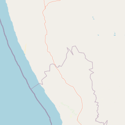
Map view of Namaqua National Park

Use this park location map to pinpoint Namaqua National Park in South Africa, understand its exact geographic position, and read its mapped placement within the surrounding landscape more clearly.

Pigeon | © OpenStreetMap contributors

Location context for Namaqua National Park

Northern Cape
Park atlas

Compare the unique Succulent Karoo biome's protected landscapes and national parks throughout South Africa's Northern Cape region.

Discover National Parks Near Namaqua National Park, South Africa's Arid Coastal Protected Areas

After viewing Namaqua National Park, explore other national parks and protected areas across South Africa's Northern Cape Province, tracing the vast Succulent Karoo biome. Compare these protected landscapes to understand regional conservation efforts, mapped geography, and the unique biodiversity found throughout the arid coastal and inland zones.
National parkNorthern Cape
101 km away#1 closest

North

Richtersveld National Park: Geographic and Protected Area Map Context

Exploring arid volcanic landscapes in Northern Cape

Richtersveld National Park represents a vast, complex protected area defined by its rugged mountain ridges and arid desert ecology. Centered in South Africa's Northern Cape, the landscape is shaped by the Orange River and high-altitude volcanic formations. This profile offers detailed insight into the park's natural boundaries, endemic plant habitats, and its role as a living cultural landscape within the wider regional geography.

Area
1,624.45 km²
Established
1991
Relief
Mountain
Climate
Arid
Nature reserveWestern Cape
About 154 km away#2 closest

South

Bird Island Nature Reserve: Mapped Coastal Protected Areas and Seabird Habitats

Geography and protected island landscapes in Western Cape, South Africa

Bird Island Nature Reserve represents a key protected coastal landform off the West Coast of South Africa. This three hectare reserve functions as a critical nesting ground, characterized by flat rocky shelves and sun-bleached outcrops. Browse the mapped boundaries and geographic features of this marine sanctuary, which plays a major role in regional seabird conservation and coastal ecological study.

Area
0.03 km²
Established
1988
Relief
Lowland
Climate
Mediterranean
Nature reserveNorthern Cape
About 157 km away#3 closest

Southeast

Oorlogskloof Nature Reserve; Protected Mountain Landscapes and River Gorges of Northern Cape

A diverse protected area featuring Karoo-fynbos biome transitions.

Oorlogskloof Nature Reserve presents a dramatic study in regional geography, characterized by deep river canyons, exposed rock shelves, and vast semi-desert plateaus. Located near the edge of the Knersvlakte, the reserve creates a refuge where seasonal waterfalls and rocky basins provide essential freshwater habitats. This atlas entry focuses on the interplay between its steep cliff formations and the surrounding Northern Cape plains, offering a comprehensive view of the terrain and ecological diversity.

Area
47.76 km²
Established
1971
Relief
Mountain
Scope
Terrestrial
Nature reserveWestern Cape
About 208 km away#4 closest

South

Rocherpan Nature Reserve: Mapping Coastal Wetlands and Strandveld Landscapes in the Western Cape

Protected coastal reserve on the South African West Coast.

Located along the Atlantic shore between Velddrif and Elands Bay, Rocherpan Nature Reserve encompasses a rare, seasonal wetland system. The reserve protects a complex of dune cordons, sandy beaches, and low-lying coastal veld that transforms dramatically with the winter rains. This map-focused entry highlights the ecological layering and geographic significance of this South African protected area.

Area
18 km²
Established
1976
Relief
Lowland
Climate
Mediterranean
Wildlife reserveNamibia
About 208 km away#5 closest

North

ǀAi-ǀAis Hot Springs Game Park: A Namibian Wildlife Reserve Bridging Desert and Geothermal Landscapes

Explore mapped boundaries and regional park geography.

ǀAi-ǀAis Hot Springs Game Park represents a vital protected area within Namibia's arid southern reaches. This wildlife reserve is characterized by its namesake hot springs, which foster unique riparian ecosystems against a backdrop of rugged desert mountains and the impressive Fish River canyon. Its inclusion in a transfrontier conservation effort underscores its significance for regional landscape mapping and the preservation of stark desert beauty and geothermal features.

IUCN
II
Relief
Mixed relief
Climate
Arid
Access
Remote access
Protected areaNamibia
About 208 km away#6 closest

North

Ai-Ais/Richtersveld Transfrontier Park: Mapped Boundaries of a Southern African Protected Area

Exploring its desert terrain and cross-border conservation geography.

Ai-Ais/Richtersveld Transfrontier Park is a significant protected area that spans across Namibia and South Africa, embodying a vital component of Southern Africa's conservation efforts. This page focuses on the park's geographic identity, detailing its arid landscape characteristics and the mapped extent of its protected boundaries. Understanding this transfrontier park offers insight into cross-border ecological cooperation and the unique desert terrain it encompasses, providing a foundation for structured geographic discovery.

Area
6,045 km²
Established
2003
IUCN
II
Relief
Mountain
Wildlife reserveWestern Cape
About 218 km away#7 closest

Southeast

Cederberg Wilderness Area: Geographic Overview of Western Cape Protected Landscapes

Mapped sandstone peaks and diverse fynbos wilderness.

The Cederberg Wilderness Area represents a rugged mountain range defined by its resistant Peninsula Formation sandstone and complex geological history. Encompassing dramatic rock formations, ancient caves, and unique botanical endemics, the area offers a study in the intersection of mountainous terrain and the Cape Floral Region. Understand the regional context and physical geography that shape this protected sanctuary.

Area
710 km²
Established
1973
Relief
Mountain
Climate
Mediterranean
National parkWestern Cape
246 km away#8 closest

South

West Coast National Park: A National Park's Mapped Boundaries and Geographic Identity

Explore its protected landscape within the Western Cape region.

West Coast National Park is a protected national park situated in the Western Cape province of South Africa. This dedicated page provides a structured view of its geographic scope, emphasizing its mapped boundaries and its significance as a protected landscape within the region's broader atlas context. Gain insight into the park's distinct natural terrain and regional geography.

Area
362.59 km²
Established
1985
Climate
Mediterranean
Access
Easy access

Common questions about visiting, size, designation, and location context for Namaqua National Park

Namaqua National Park FAQs for park facts, access, geography, and protected area context

Find quick answers about Namaqua National Park, including protected-area facts, park geography, trail and visitor context, and how the park fits into its surrounding country and regional landscape.
MoriAtlas Explorer

Continue Your Protected Areas Search Across the Global Atlas

Deepen your exploration by continuing the structured search for national parks and protected areas worldwide. Utilize the comprehensive filtering capabilities to compare different conservation landscapes and refine your understanding of global park geography. Discover more about the distribution and characteristics of protected natural areas.

Global natural geography