
Mori Atlas logo
Protected landscapeNaturpark Knüll

Mapping the basalt ridges, forested uplands, and complex river valleys of northern Germany

Naturpark Knüll: A Comprehensive Geographic Overview of Hesse's Volcanic Protected Landscape

Naturpark Knüll represents a significant protected landscape in northern Hesse, characterized by its distinct volcanic origins and complex geological terrain. This area encompasses the Knüllgebirge, featuring a mosaic of beech forests, agricultural mosaics, and meandering brook valleys that flow toward the Fulda river system. Through this detailed atlas, analyze the distribution of its basalt hilltops and protected zones that define this ecologically rich central German region.

low mountain rangebasalt landscapebeech forestsmeadow valleysfloodplainorchard meadows
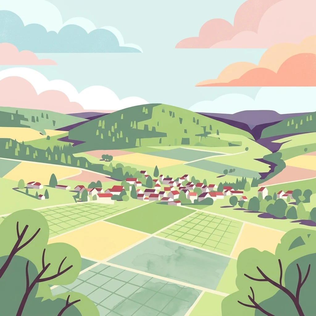
A digital illustration of a rural landscape with rolling green hills, patchwork fields, and a small village nestled in a valley under a soft, pastel-colored sky.

Naturpark Knüll

Protected landscape

Park overview

Structured park overview, official facts, and landscape profile for Naturpark Knüll

Naturpark Knüll park facts, protected area profile, and essential visitor context

Review the core facts for Naturpark Knüll, including designation, size, terrain, visitor scale, habitats, and operating context in one park-focused overview.

About Naturpark Knüll

Naturpark Knüll represents a newly forged conservation and regional development initiative in the heart of northern Hesse. Centred on the low mountain range of the same name, the park preserves a landscape shaped by ancient volcanic activity, where basalt plugs and ridges push up through sandstone and tertiary sediments to form a striking topography of rounded summits, sheltered valleys, and broad forested uplands.

The park's defining character lies in the interplay between near-natural ecosystems and an intensively lived-in cultural landscape. Forests cover more than half of the area, but the remaining agricultural land is far from uniform: small-scale farming, traditional orchards, hedgerow-lined meadows, and floodplain pastures along the Fulda and Schwalm rivers reflect centuries of human stewardship. The park's motto, "Fabelhafte Vielfalt" (Fabulous Diversity), reflects this small-scale mosaic, where shifting geology between basalt, bunter sandstone, shell limestone, and Zechstein formations creates a constant turnover of soil types, plant communities, and land uses over short distances.

Established in 2021 as Germany's 104th Naturpark, the protected area sits within one of Germany's recognised systems of large-scale conservation landscapes, the Nationalen Naturlandschaften. It is managed through close cooperation with 17 member municipalities spread across the Schwalm-Eder-Kreis and the Landkreis Hersfeld-Rotenburg. Beyond conservation, the park places strong emphasis on environmental education, sustainable regional development, and the creation of new long-distance hiking routes such as the 170-kilometre network of Fabelwege, which were certified as premium trails in 2023. Together, these elements create a park whose identity is anchored less in dramatic wilderness and more in the careful preservation of a richly varied, lived-in central German landscape.

Quick facts and research context for Naturpark Knüll

Naturpark Knüll is a nature park covering about 83,258 hectares in northern Hesse, Germany, with roughly half of its area forested and much of the remainder in agricultural use. Founded on 1 June 2021, it is administered by the Zweckverband Knüllgebiet and headquartered at Schloss Neuenstein. The park lies within the Knüllgebirge low mountain range and reaches its highest point at the Eisenberg (635.5 m). Within its boundaries sit 12 nature reserves, 14 landscape protection areas, and 11 EU Habitats Directive (FFH) sites, alongside portions of larger floodplain protection corridors along the Schwalm and Fulda rivers.

Protection and recognition

Terrestrial protection framework, designation history, and international recognition records

Naturpark Knüll Protection Status and Designated Area Records

Naturpark Knüll maintains documented terrestrial protection status established in twenty-twenty-one, outlining its official conservation framework and management scope. Verification records detail the protected area designation history, regulatory context, and international recognition parameters without supplementary assumptions.

Protection details

Protection scope
Terrestrial
Designated year
2021
Transboundary protection
No
Park context

Deeper park guide and search-rich context for Naturpark Knüll

Naturpark Knüll history, landscape, wildlife, and travel context

Explore Naturpark Knüll through its history, landscape character, ecosystems, wildlife, conservation priorities, cultural context, and seasonal travel timing in a structured park guide built for atlas discovery and search intent.

Why Naturpark Knüll stands out

Naturpark Knüll is best known for its unusual geological structure: a mosaic of basalt hilltops rising from a sandstone and tertiary substrate, sometimes called the "little brother" of the nearby Vogelsberg. The park's signature scenery includes the large, contiguous forests of the "Hoher Knüll," species-rich beechwoods on basalt, and a remarkably varied network of meandering brook valleys that drain into the Schwalm and Fulda rivers. Its habitats support characteristic species such as the red kite, black stork, European wildcat, and beaver, while the open, traditional agricultural landscapes and orchards create one of the most richly structured cultural landscapes in Hesse.
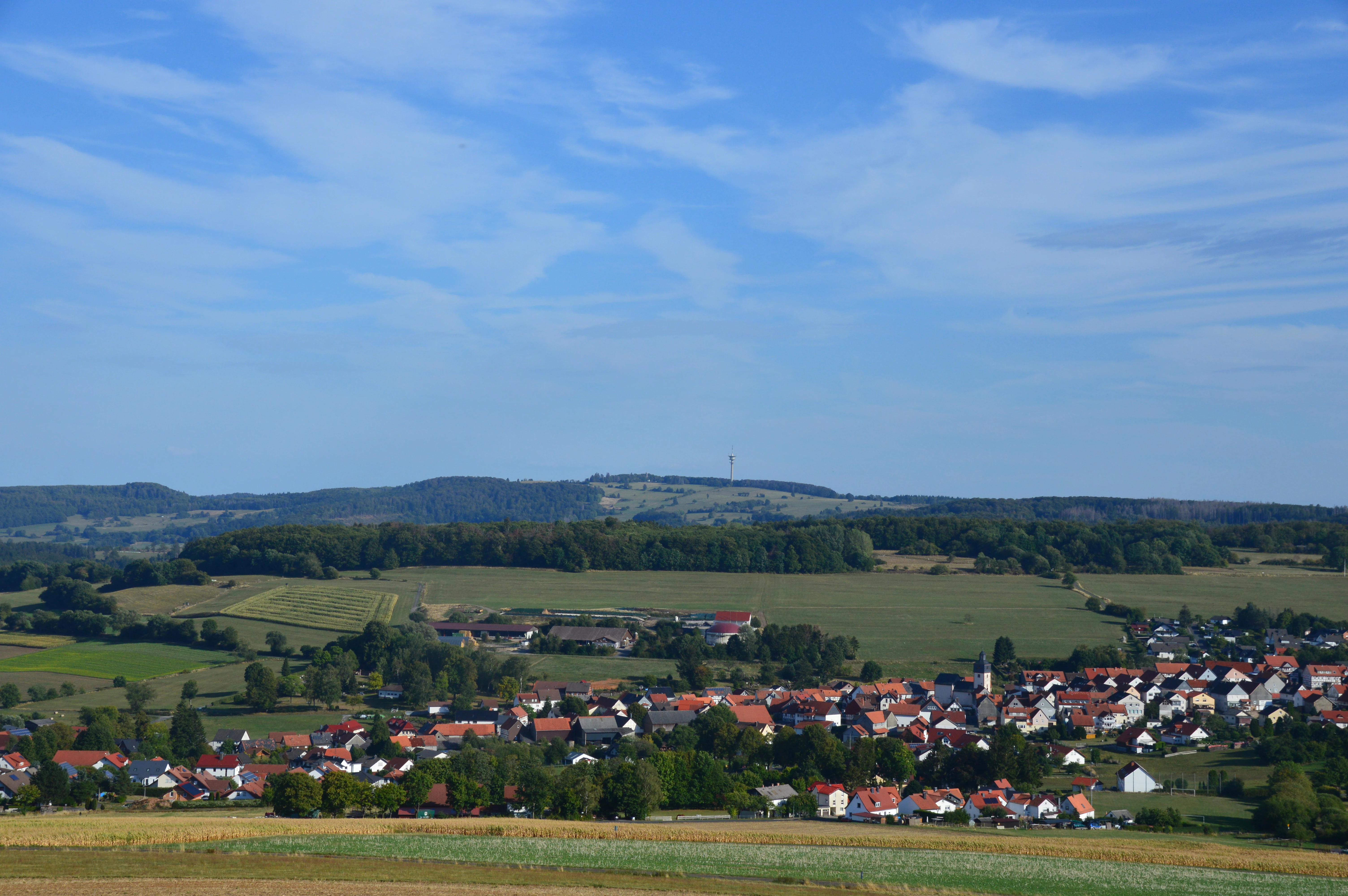
A wide shot looking down over a small town with red-roofed houses, set within rolling green hills and forested ridges under a blue sky.
A view overlooking the town of Schwarzenborn and the surrounding hilly landscape of Naturpark Knüll.

Naturpark Knüll history and protected-area timeline

The idea of establishing a nature park in the Knüllgebirge to promote regional tourism and protect the area's distinctive cultural landscape had circulated for more than fifty years. Multiple attempts to bring this goal to fruition in past decades did not succeed, leaving the region without formal nature park status for much of the post-war period.

Renewed momentum came in 2018, when changes to the Hessian implementation law of the Federal Nature Conservation Act eased the criteria that an area had to meet to qualify as a Naturpark. By late 2019, the Zweckverband Knüllgebiet had commissioned a feasibility study to explore the creation of a Naturpark Knüll. The initiative bore fruit on 1 June 2021, when the park was officially established as the 104th German Naturpark. Its seat is located in Neuenstein, and since March 2022 its administrative office has been based at Schloss Neuenstein, a historic castle venue that anchors the park's public presence in the region.

Naturpark Knüll landscape and geographic character

The Knüllgebirge is a low mountain range of magmatic origin that arose in the middle Tertiary, roughly 10 million years ago. Its formation ran parallel to that of the much larger Vogelsberg massif and was triggered by subsidence processes along the Hessian Depression. As a result, hundreds of basalt cones, ridges, and hilltops emerged in irregular arrangement across the landscape, giving the Knüll its characteristic profile of round, dark-stoned summits rising above a softer substrate of bunter sandstone and tertiary sediments.

Topographically, the park ranges from around 450 m up to over 600 m, with the basalt-rooted summits creating a more open hill country in the north, while the eastern part is dominated by extensive woodland and the west opens onto fertile farmland. In the southeast, the park gradually descends into the broad floodplain of the Fulda. Gently undulating loess-based agricultural land fringes the basalt uplands, and at places like Lenderscheid and Großropperhausen, fields merge seamlessly with the wooded slopes.

The park's brook valleys are particularly distinctive. Streams such as the Rohrbach, Geisbach, Aula, and Jossa meander through forests and meadows, with the bedrock changing frequently from basalt to sandstone to limestone over short distances. These transitions generate a structurally rich hydrological network. Further down, the open, expansive Fulda floodplain extends deep into the Knüll via the wider valley sections, creating wet meadows, oxbows, ponds, and extensively grazed steep slopes bordered by traditional hedgerow terraces.
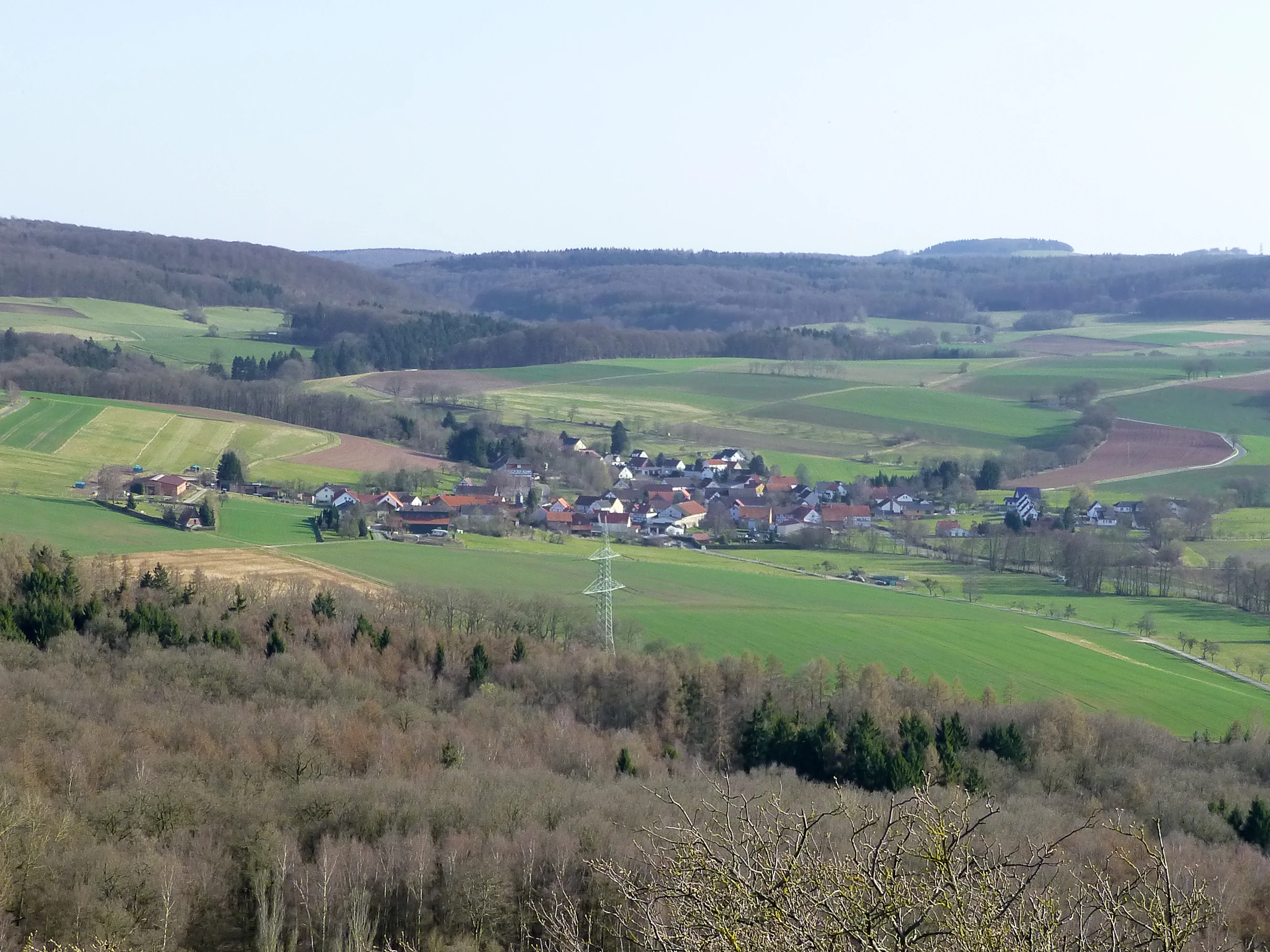
A wide aerial view of a small rural German village nestled in a valley with surrounding green fields and forested hills.
A view of the village of Allmuthshausen surrounded by the rolling hills and forests of Naturpark Knüll.

Naturpark Knüll ecosystems, habitats, and plant life

Ecologically, Naturpark Knüll is defined less by single dominant ecosystems and more by the constant transition between them. On the basaltic uplands of the Hoher Knüll, near-natural and species-rich mesophilic beech forests form the dominant cover, while the sandstone-dominated Fulda-Werra hill country and the Fulda-Haune plateau are characterised by conifer plantations and more acidic, species-poor beechwood.

Mosaic habitats are a defining feature. Hedgerow-framed meadows, traditional orchards (Streuobstwiesen), and small stream valleys with mixed geology all create transitional zones that host a wide range of plant and animal species. The Zechstein-influenced hilly landscape in the northeast, near Oberellenbach, retains marginal forest character but opens quickly toward the Fulda floodplain. Across the region, extensively grazed steep slopes with traditional terrace hedges (Hangstufenhecken) preserve some of the most characteristic cultural-natural habitats of the area.

The floodplains of the Fulda and Schwalm anchor the park's aquatic and wetland diversity. Wide, slow-moving stretches of the Fulda and its tributaries support floodplain meadows, oxbows, ponds, and gallery forests. These dynamic systems contrast with the relatively stable upland forests and open farmland, giving the park an unusually broad spectrum of ecological conditions within a compact area.

Naturpark Knüll wildlife and species highlights

A range of characteristic large and mid-sized species mark the wildlife profile of Naturpark Knüll. Red kites and black storks soar over the mixed agricultural and forest mosaic, while the elusive European wildcat inhabits the larger, older forest tracts of the uplands. Roe deer are common across woodland edges, and red deer are also present in the more extensive forests. Beavers have established themselves along the slower stretches of the Fulda and its floodplain streams, reshaping riverbanks and wetland vegetation.

The park's birdlife reflects its habitat diversity. Black woodpeckers and Eurasian eagle-owls find refuge in mature woodland, while woodcock favour damp, sheltered forest interior. The common raven patrols the uplands, and in the open farmland, grey partridge and European hare survive in areas where traditional small-scale agriculture and field margins provide sufficient cover. The wetland stretches of the Fulda floodplain add dabbling duck and heron species to the mix.

Among insects, the park highlights the silver-washed fritillary, the large tortoiseshell, and the rare bird's-eye fritillary as characteristic Lepidoptera of its meadows and forest edges. Together, these species underscore the park's value as a refuge for taxa sensitive to landscape fragmentation and intensification.

Naturpark Knüll conservation status and protection priorities

As one of Germany's Nationalen Naturlandschaften, Naturpark Knüll contributes to a coordinated nationwide framework that includes national parks and biosphere reserves. Within its boundaries, twelve designated nature reserves cover about 463 hectares, fourteen landscape protection areas add roughly 6,300 hectares, and eleven FFH (Habitats Directive) sites anchor the park's contribution to Europe's Natura 2000 network. Major floodplain corridors along the Fulda and Schwalm, parts of which lie within the park, extend this conservation value beyond the immediate hill country.

The park's conservation value lies heavily in its landscape heterogeneity. The constant shifts between basalt, sandstone, and limestone substrates produce a wide range of soil conditions over short distances, supporting particular plant communities and species assemblages that would not survive in a more uniform environment. Traditional land use patterns, particularly small-scale grazing, hedgerow maintenance, orchard management, and the conservation of floodplain meadows, are central to maintaining this diversity.

Particular attention is given to species considered Leitarten, or indicator species, of the park: red kite, black stork, wildcat, woodcock, red deer, black woodpecker, raven, grey partridge, European hare, eagle owl, beaver, silver-washed fritillary, large tortoiseshell, and bird's-eye fritillary. Maintaining viable populations of these species is treated as a benchmark for the park's conservation success.

Naturpark Knüll cultural meaning and human context

The Knüll region carries a long tradition of small-scale, family-based farming, and the park's landscape still reflects this cultural inheritance. Farms tend to be small, with extensive rather than intensive land use, and the resulting patchwork of orchards, meadows, and field margins is integral to what the park seeks to protect. Traditional features such as Hangstufenhecken, terrace-shaped hedgerow systems on steep valley slopes, are both ecological structures and expressions of generations of local agricultural knowledge.

The park also intersects with regional tourism networks and storytelling traditions. Its hiking routes incorporate myth-inspired "Fabelwege" trails, and the broader region belongs to the destination brand "GrimmHeimat NordHessen," which ties the landscape to the literary legacy of the Brothers Grimm. Local castles, such as the Burg Herzberg and Schloss Neuenstein, add historical depth to the cultural map of the park, while small communities like Schwarze-born, Neukirchen, and Knüllwald embody the rural character that the park designators wish to preserve.

Top sights and standout views in Naturpark Knüll

Naturpark Knüll's strongest distinguishing qualities are its unusually varied geology in such a compact area, the persistent small-scale mosaic of forests, meadows, orchards, and floodplain habitats, and its recently renewed role as a coordinated conservation and regional development platform. The new Fabelwege hiking network, totalling more than 170 km and certified as premium trails in 2023, reflects this combination of conservation, recreation, and cultural identity. The park also stands out as one of Germany's youngest nature parks, established as recently as 2021, and its tiered system of nature reserves, landscape protection areas, and FFH sites demonstrates a layered approach to protecting both species and land-use traditions.

Best time to visit Naturpark Knüll

Spring and early summer are particularly rewarding for visiting Naturpark Knüll. As meadows and floodplain pastures come into bloom, wildflowers brighten the meandering brook valleys and forest edges, while migratory and breeding birds, including red kites, black woodpeckers, and woodcock, are most active. Late spring also brings the best conditions for walking the newly certified Fabelwege premium trails, when forest paths are dry and viewpoints along the basalt hilltops offer expansive views over the wooded landscape.

Autumn offers another strong window, with deciduous beech forests turning colour, rutting red deer in the larger forest tracts, and mushroom activity peaking in the older woodlands. The Fulda floodplain landscapes remain visually open year-round, while orchards produce fruit and traditional harvest activities continue in many small villages. Winter visits can be quieter and colder, with snow occasionally settling on the higher basalt summits such as the Eisenberg, though visitors should expect variable conditions at elevation.

Monthly climate preview

Long-term representative point measurements tracking monthly temperature ranges and precipitation rhythm

Naturpark Knüll Climate Normals, Annual Temperature, and Monthly Precipitation Patterns

Naturpark Knüll records measured long-term temperature swings and daily precipitation rates across a representative baseline coordinate in Hesse. Reviewing the complete twelve-month climatology profile helps trace annual thermal shifts and monthly moisture distribution in greater detail.
Annual mean9 °C
-1 °C19 °C
Jan-1°
Feb
Mar
Apr
May12°
Jun16°
Jul19°
Aug18°
Sep14°
Oct
Nov
Dec
Warmest month
July

18.6 °C

Coolest month
January

-0.8 °C

Wettest month
July

2.5 mm/day

Driest month
April

1.4 mm/day

Park location guide

Geography guide, regional context, and park location map for Naturpark Knüll

Naturpark Knüll park geography, regions, and map view in Germany

Understand where Naturpark Knüll sits in Germany through a broader geographic reading of the surrounding landscape, nearby location context, and its mapped position within the national park landscape.

How Naturpark Knüll fits into Germany

Germany is a federal republic in Western and Central Europe with a population of over 83 million across sixteen constituent states. It is Europe's largest economy by nominal GDP and a major global exporter and importer. The capital is Berlin, and the country borders Denmark, Poland, Czech Republic, Austria, Switzerland, France, Luxembourg, Belgium, and the Netherlands.

Wider geography shaping Naturpark Knüll in Germany

Germany is located in Western and Central Europe, spanning 357,022 km². It borders Denmark to the north, Poland and the Czech Republic to the east, Austria and Switzerland to the south, and France, Luxembourg, Belgium, and the Netherlands to the west. The country has coastlines on the Baltic Sea and North Sea to the north, with the Alps located in the southern region.

Map view of Naturpark Knüll

Use this park location map to pinpoint Naturpark Knüll in Germany, understand its exact geographic position, and read its mapped placement within the surrounding landscape more clearly.

Pigeon | © OpenStreetMap contributors

Location context for Naturpark Knüll

Hesse

Examine the basalt hilltops, beech forests, and valley habitats that define the protected landscape.

Naturpark Knüll Photos and Landscapes: Visual Exploration of the Protected Area

Visual records capture the low mountain terrain, volcanic ridges, and winding brook valleys characterizing the protected territory. Detailed photography reveals the mosaic of wooded uplands, agricultural meadows, and river floodplains that shape regional biodiversity.

A wide shot looking down over a small town with red-roofed houses, set within rolling green hills and forested ridges under a blue sky.

A wide, sunny landscape view of the Eisenberg mountain with a prominent observation tower on its forested summit, overlooking rolling green agricultural fields and meadows in the foreground.

A wide aerial view of a small rural German village nestled in a valley with surrounding green fields and forested hills.

Park atlas

Compare surrounding regional geography and connected nature reserves

Parks Near Naturpark Knüll and Related Protected Landscapes to Explore

Browsing other protected areas near Naturpark Knüll reveals the broader volcanic terrain and river floodplains of central Germany. This regional comparison extends the exploration of forested uplands, basalt ridges, and contiguous low mountain ecosystems.
Watercolor illustration of a dirt path leading through green fields towards a distant line of trees and rolling hills against a white background.
Nature reserveHesse
About 6.2 km away#1 closest

Southwest

Buchenbachtal bei Christerode Nature Reserve: Protected Landscape and Regional Geography

Mapped stream corridors and wet meadow ecosystems in Hesse

Located in central-western Germany, Buchenbachtal bei Christerode focuses on the conservation of small low-mountain streams and broadleaf forest transition zones. This nature reserve provides a essential look at riparian habitat management and the traditional agricultural integration that shapes the natural terrain of the northern Hessian region.

Area
120.5 km²
Established
1995
Water
Major water bodies
A horizontal watercolor painting depicting a soft-toned, rolling landscape with green meadows, distant tree lines, and a light-filled sky.
Nature reserveHesse
About 7 km away#2 closest

Northeast

Roßbachtal bei Völkershain Nature Reserve: Geography and Protected Valley Landscapes

Stream-fed meadow and forest habitats in Hesse

Located in the Schwalm-Eder-Kreis, Roßbachtal bei Völkershain encompasses a linear valley environment within the Knüllgebirge. The reserve tracks the Roßbach stream as it moves toward the Breitenbach, featuring a protected alignment of meadows and slopes that serves as a focused habitat management area in central Germany.

Area
1.141 km²
Established
1988
IUCN
IV
A watercolor painting showing a soft, stylized landscape of green hills, a winding stream, and coniferous forest sections under a pale sky.
Nature reserveHesse
About 12 km away#3 closest

North

Eichelskopf Nature Reserve: Protected Geological and Historical Landscapes in Hesse

Regional conservation profile and mapped boundaries in Schwalm-Eder.

Examine the conservation history of Eichelskopf, a key nature reserve in the Schwalm-Eder district of Hesse. Established in 1927, this site remains a vital point of interest for understanding the evolution of species protection and geological heritage management in central Germany.

Area
0.027 km²
Established
1927
Scope
Terrestrial
Nature reserveHesse
About 14 km away#4 closest

Southwest

Immichenhainer Teiche Nature Reserve: Protected Wetland and Geographic Map in Hesse, Germany

Mapped wetland refugium in the eastern Hessian uplands

Immichenhainer Teiche is a specialized nature reserve in Hesse, Germany, characterized by a series of ponds that support essential wetland habitats. Positioned within the Osthessisches Bergland, the site provides a compact, protected landscape that contrasts with the surrounding agricultural terrain. This location is recognized both as a formal nature reserve and as a European Natura 2000 FFH site, highlighting its significance for regional freshwater conservation and habitat management.

Area
0.232 km²
Established
1985
IUCN
IV
A wide watercolor illustration showing a pale sky above a line of green trees and a foreground of pink and green grassy meadows.
Nature reserveSchwalm-Eder-Kreis
About 15 km away#5 closest

North

Mosenberg bei Homberg Nature Reserve: Mapped Protected Landscape and Regional Geography

Nature reserve terrain in the Schwalm-Eder-Kreis district of northern Hesse

Spanning 64 hectares, Mosenberg bei Homberg preserves a diverse mixture of traditional agricultural landscapes including open grasslands and wood-pastures. The area provides a critical habitat for specialized birds, defined by its steep basalt scree and proximity to the Klingelbach stream. This site offers a clear example of how historic coppice woodland systems maintain significant biodiversity across the northern Hesse region.

Area
0.646 km²
Established
1986
Relief
Upland
Climate
Temperate
A watercolor painting showing a tranquil lake shore with soft green vegetation and distant muted hills.
Nature reserveSchwalm-Eder-Kreis
About 16 km away#6 closest

Northwest

Borkener See Nature Reserve: Geographic Overview of a Reclaimed Wetland and Bird Sanctuary

A protected landscape featuring oligotrophic lake waters in Schwalm-Eder-Kreis.

Borkener See serves as a focal point for understanding the reclamation of mining landscapes in northern Germany. As an officially protected nature reserve, it provides a stable habitat for migratory bird species, with deep water basins and carefully managed wetland buffers defining its physical and ecological presence in the Westhessische Senke.

Area
3.5 km²
Established
1990
Relief
Lowland
Climate
Temperate
A horizontal watercolor painting of a serene lake bordered by a shoreline with trees and distant rolling hills against a soft background.
Nature reserveSchwalm-Eder-Kreis
About 17 km away#7 closest

North

Goldbergsee Nature Reserve and Mapped Protected Landscapes in Schwalm-Eder-Kreis

Ecological transition and inland water-body geography.

Goldbergsee stands as a prime case study of industrial renaturalization in northern Hesse. This protected nature reserve, characterized by its clear spring-fed water and successional woodland habitat, offers a window into how former open-cast mining sites evolve into ecologically balanced water bodies within the Schwalm-Eder-Kreis mountain foothills.

Established
1991
A watercolor painting showing a soft, minimalist landscape with rolling green hills, patches of grass in the foreground, and a distant line of trees under a light, warm-toned sky.
Nature reserveMengshausen
About 19 km away#8 closest

Southeast

Bruchwiesen bei Mengshausen: A Protected Nature Reserve in the Fulda River Floodplain

Geography, floodplain terrain, and protected wetland habitat overview

Bruchwiesen bei Mengshausen serves as a critical wetland enclave within the Fulda valley. This nature reserve, located near the village of Mengshausen, safeguards a vital stretch of marshland, reed beds, and wet pastures. Through careful conservation grazing, the area provides essential habitat for endangered bird species, acting as a representative fragment of the natural floodplain landscape in eastern Hesse.

Area
0.104 km²
Established
1987
IUCN
IV
Relief
Lowland

Common questions about visiting, size, designation, and location context for Naturpark Knüll

Naturpark Knüll FAQs for park facts, access, geography, and protected area context

Find quick answers about Naturpark Knüll, including protected-area facts, park geography, trail and visitor context, and how the park fits into its surrounding country and regional landscape.
MoriAtlas Explorer

Continue Your Protected Areas Search Across the Global Atlas

Deepen your exploration by continuing the structured search for national parks and protected areas worldwide. Utilize the comprehensive filtering capabilities to compare different conservation landscapes and refine your understanding of global park geography. Discover more about the distribution and characteristics of protected natural areas.

Global natural geography