
Mori Atlas logo
Protected landscapeNaturpark Rhein-Taunus

Mapping the forested ridges, deep river valleys, and cultural heritage of this tranquil German nature park.

Naturpark Rhein-Taunus: An Extensive Protected Landscape in the Heart of the Hessian Taunus Mountains

Naturpark Rhein-Taunus serves as a significant protected landscape within the Hessian Taunus range, characterized by extensive beech and oak woodlands and deep, secluded river valleys. Spanning the transition from metropolitan Frankfurt and Wiesbaden to the Rhine wine country, the park protects rare forest complexes like the Hinterlandswald. This geographic expanse links vital ecological corridors with major cultural landmarks, including sections of the UNESCO World Heritage Roman Limes and the Upper Middle Rhine Valley.

low mountainsmixed forestbeech forestrivers and valleysRhine Valleywine region
A flat-style digital illustration depicting a scene with evergreen and deciduous trees in the foreground, a prominent hill with a waterfall in the center, and rolling hills in the background.

Naturpark Rhein-Taunus

Protected landscape

Park overview

Structured park overview, official facts, and landscape profile for Naturpark Rhein-Taunus

Naturpark Rhein-Taunus park facts, protected area profile, and essential visitor context

Review the core facts for Naturpark Rhein-Taunus, including designation, size, terrain, visitor scale, habitats, and operating context in one park-focused overview.

About Naturpark Rhein-Taunus

Naturpark Rhein-Taunus occupies a central position in the German low mountain landscape, bridging the wooded Taunus highlands with the vine-clad slopes of the Rheingau above the Rhine. Covering approximately 81,000 hectares across the Rheingau-Taunus district and the state capital Wiesbaden, it is one of the larger nature parks in Hesse and one of the most visited in Germany by virtue of its metropolitan accessibility. In its official function, it belongs to the National Natural Landscapes category, alongside national parks and biosphere reserves.

Geographically, the park belongs to the Rhenish Slate Mountains and includes the Hoher Taunus, Rheingaugebirge, and western Hintertaunus. The Taunus main ridge forms a central spine, rising above 600 metres in features like the Hohe Wurzel and the Kalte Herberge, and acting as a watershed and weather divide between valleys draining in different directions. The Wispertaunus in the west, the Aartaunus around the deep Aar valley, and the Idsteiner Senke to the east each give the park a distinct regional character.

More than 60 percent of the park is forested, and these woodlands are managed using near-natural forestry principles. The result is broad, species-rich stands of European beech, sessile oak, Norway spruce and Douglas fir, with the Hinterlandswald serving as the largest, most ecologically intact forest block. Around the forest edges, vineyards, orchards, and traditional villages shape the cultural landscape, particularly along the Rhine, where the wine villages of Lorch, Lorchhausen and Rauenthal, together with Kloster Eberbach, anchor the Rheingau portion of the park.

The park's identity is also strongly cultural. Two UNESCO World Heritage sites lie within or partly within its boundaries: the Upper Middle Rhine Valley, famed for its romantic river scenery, and the Obergermanisch-Raetischer Limes, the once-frontier line of the Roman Empire that crossed the Taunus. Walking paths such as the Rheinsteig trace these landscapes, while archaeological trails interpret the Roman heritage. Together with the surrounding metropolitan region, the park forms a landscape where forest ecology, viticulture, river scenery and ancient history are tightly interwoven.

Quick facts and research context for Naturpark Rhein-Taunus

Naturpark Rhein-Taunus covers about 810 square kilometres across the Rheingau-Taunus district and the city of Wiesbaden in Hesse, Germany. It was established in 1968 as a non-profit municipal association and is recognized as one of Germany's National Natural Landscapes. The park's highest point is the Windhain at 629.3 metres, and it is dominated by deciduous and mixed forests covering more than 60 percent of its area.

It includes portions of two UNESCO World Heritage sites, the Upper Middle Rhine Valley and the Roman Limes, and borders the Naturpark Taunus to the east and Naturpark Nassau in Rhineland-Palatinate. Waters from the park drain into four major systems: the Upper Rhine, the Middle Rhine via the Wisper valley, the Lahn via the Aar, and the Lahn via the Wörsbach and Emsbach.

Protection and recognition

Documented terrestrial protection scope and official recognition details

Naturpark Rhein-Taunus Protection Status and International Recognition

Naturpark Rhein-Taunus maintains a documented terrestrial protection scope without imported international recognition sources. Official records detail the established conservation framework and management designation governing the protected landscape.

Protection details

Protection scope
Terrestrial
Transboundary protection
No
Park context

Deeper park guide and search-rich context for Naturpark Rhein-Taunus

Naturpark Rhein-Taunus history, landscape, wildlife, and travel context

Explore Naturpark Rhein-Taunus through its history, landscape character, ecosystems, wildlife, conservation priorities, cultural context, and seasonal travel timing in a structured park guide built for atlas discovery and search intent.

Why Naturpark Rhein-Taunus stands out

Naturpark Rhein-Taunus is best known for its extensive, near-natural low mountain forests, which include beech, oak, spruce and Douglas fir stands, and for the large, road-free forest complexes such as the Hinterlandswald. This stretch of woodland is one of the largest contiguous forest areas in Hesse not cut by motorways or federal roads, and has historically served as a key refuge for the European wildcat. The park is equally recognized for the way it combines ecological protection with cultural heritage. It encompasses sections of two UNESCO World Heritage sites, the Upper Middle Rhine Valley and the Roman Limes, and sits right on the doorstep of Wiesbaden and the Frankfurt/Rhein-Main metropolitan region, making it an unusually accessible yet quiet low mountain landscape.
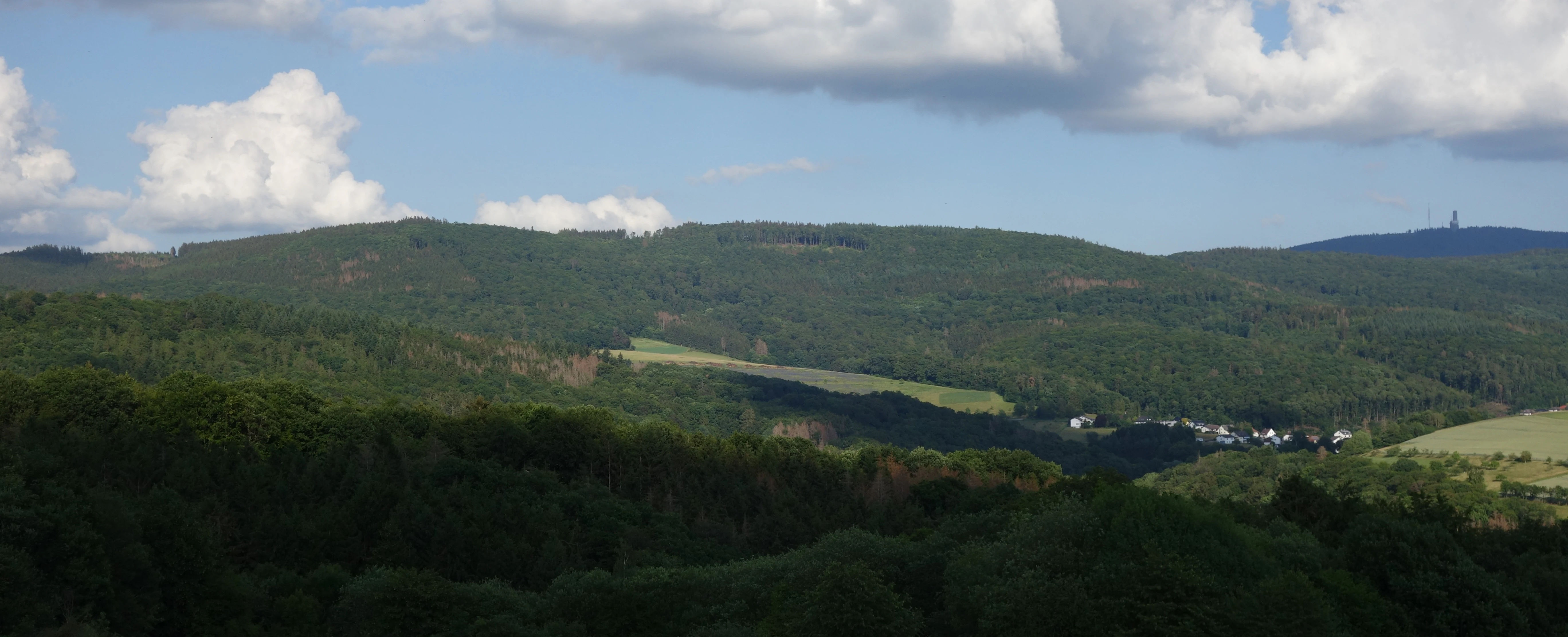
A wide, eye-level landscape view of rolling, forested hills in the Naturpark Rhein-Taunus under a partly cloudy sky, with a small settlement visible in the valley.
A view of the forested hills of the Naturpark Rhein-Taunus, featuring the Windhain ridge.

Naturpark Rhein-Taunus history and protected-area timeline

The Naturpark Rhein-Taunus was created in 1967 and 1968, when the Rheingau-Taunus district and the city of Wiesbaden jointly founded a non-profit municipal association to manage the area. Its purpose was, and remains, to implement the goals laid out in Germany's federal nature conservation law for nature parks, including the protection of native flora and fauna, the preservation and care of the landscape, and the provision of nature-oriented recreation for visitors. The headquarters of the association has been located in Idstein.

Beginning in 2018, the park adopted a structured Naturpark concept, defining four areas of activity: nature conservation and cultural landscape; recreation and sustainable tourism; environmental and sustainability education; and sustainable regional development. This concept guides both personnel and financial planning.

The park has earned several recognitions for its work. It was first certified as a 'Quality Nature Park' by the Association of German Nature Parks in 2015 and successfully reconfirmed in 2020. In 2016, a project promoting a colony network for the Bechstein's bat, a national responsibility species, was named an official project of the UN Decade on Biodiversity. The park has also participated in the Ökoprofit environmental management programme and, since 2015, in the fairtrade towns initiative.

Between 2012 and 2019, the park coordinated one of its largest conservation efforts through the Federal Programme for Biological Diversity. Working with 17 municipal forest owners and HessenForst, it developed a model protection project and practical handbook for the Bechstein's bat, covering its central European population.

Naturpark Rhein-Taunus landscape and geographic character

The landscape of Naturpark Rhein-Taunus is defined by the forested ridges and deeply cut valleys of the Taunus low mountain range, which geologically belong to the Rhenish Slate Mountains. The Taunus main ridge forms the park's central spine, with summits such as the Hohe Wurzel and the Kalte Herberge rising above 600 metres. The highest point within the park itself is the Windhain at 629.3 metres, located near the eastern boundary and forming part of the Feldberg-Langhals-Pferdskopf block that also marks the border with the neighbouring Naturpark Taunus.

Four major valley systems shape the terrain. To the south, the landscape descends toward the Upper Rhine. To the west, the deeply incised, sparsely settled Wisper valley opens into the Upper Middle Rhine at Lorch. To the north and east, the Aar and the Wörsbach and Emsbach valleys carry water toward the Lahn. Portions of the park lie within the Rhine rift system, which has influenced geology, hydrology, and even the presence of warm and hot mineral springs in the lower Wisper, Aar and Rhine valleys.

Below the mountains, the southeastern park reaches almost to the urban edge of Wiesbaden, while the western fringes blend into the Rheingau's wine country, with vineyards and historic villages such as Lorchhausen, Lorch and Rauenthal. Across the entire area, more than 60 percent of the surface is forested, and these woodlands, managed using near-natural forestry, give the park its quiet, broad-horizon character. Despite its location next to one of Germany's busiest metropolitan regions, large parts of the park, including the Hinterlandswald, remain remarkably tranquil, ranking among the quietest places in Hesse by acoustic measurements.
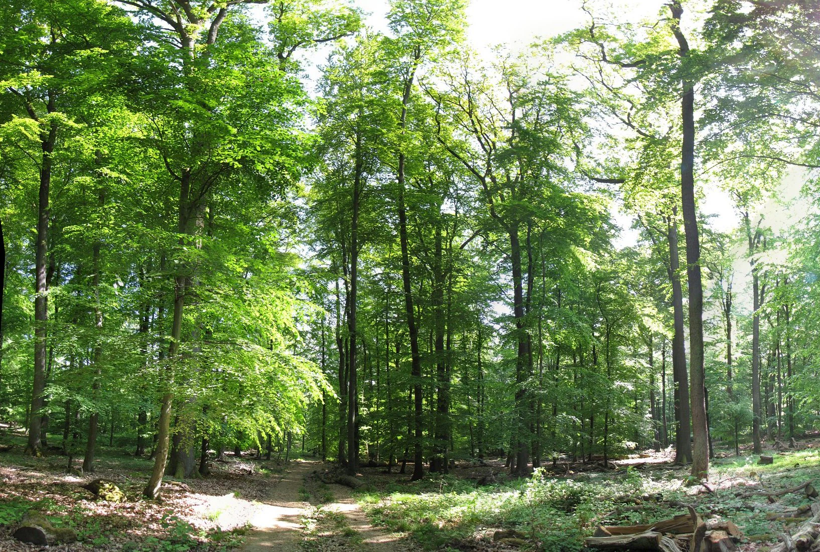
A wide angle view of a bright, sunlit deciduous forest with tall tree trunks and dense green canopy in the Naturpark Rhein-Taunus.
A bright, sunny view of the lush deciduous forest in the Honigberg area of Naturpark Rhein-Taunus.

Naturpark Rhein-Taunus ecosystems, habitats, and plant life

Ecologically, Naturpark Rhein-Taunus represents a near-natural low mountain landscape, shaped above all by its extensive mixed and deciduous forests. European beech and sessile oak dominate the older forests, with Norway spruce and introduced Douglas fir contributing to the modern mixed stands managed under near-natural forestry principles. These species-rich forests cover more than 60 percent of the park and form large, structurally diverse woodland complexes that are rare in such close proximity to a major metropolitan region.

Beyond the core forest areas, the park contains several clearly defined sub-regions, each with its own ecological character. The Idsteiner Senke to the east lies within the Rhine rift system and is drained by the Emsbach and Wörsbach valleys. The Aartaunus to the west features deeply cut, meandering stretches of the Aar river. Further west, the Wispertaunus wraps around the Hinterlandswald, a large forested spine that runs into the Upper Middle Rhine Valley.

Along the lower edges of the park, particularly along the Rhine, the natural character shifts toward vineyards, orchards, and open valley landscapes. The transition zones between forest and wine country host specialized habitats, including warm slopes and steep river valleys that support distinctive plant and animal communities. Mineral springs and warm-water sources in the Wisper, Aar and Rhine valleys further mark the geological and ecological richness of the area.
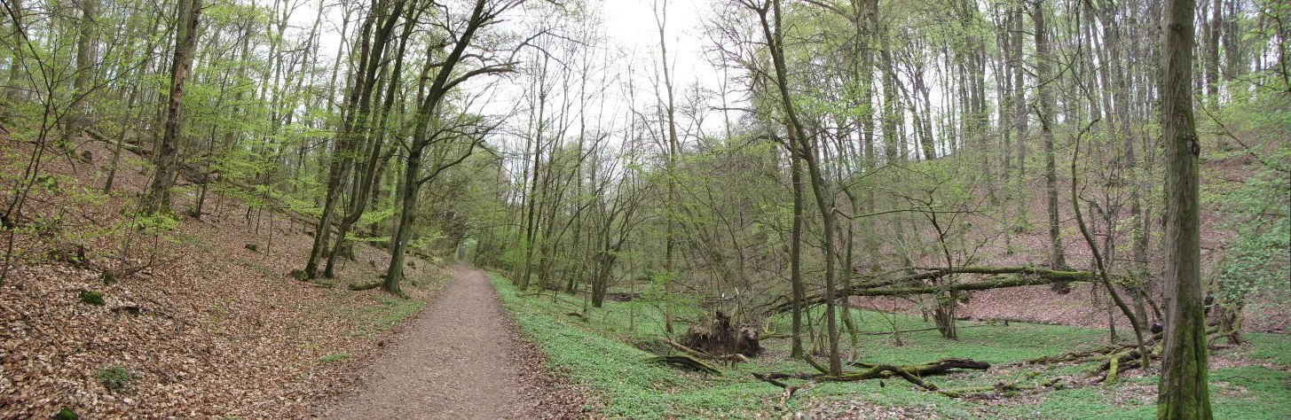
A wide dirt trail travels through a deciduous forest with light green foliage, passing a small, damp, brush-filled depression on the right side.
A dirt hiking path winding through the forested valley of Erlenbachtal in Naturpark Rhein-Taunus.

Naturpark Rhein-Taunus wildlife and species highlights

The wildlife profile of Naturpark Rhein-Taunus is closely tied to its extensive, near-natural woodlands and to its valley and slope habitats. The large forest complexes, particularly the Hinterlandswald, are recognized as some of the most important refuges in Hesse for sensitive forest species. The European wildcat, for instance, found one of its most significant German strongholds in these woods during the second half of the twentieth century, when populations elsewhere were under pressure.

The park has also built an international profile through its work on the Bechstein's bat, a national responsibility species for Germany. Between 2012 and 2019, the park coordinated a conservation project that established a network of colonies across the central European population centre of the species, paired with a practical handbook for forest managers.

Birdlife is supported by the mosaic of forest, valley, vineyard and river-edge habitats, while the rivers and streams of the Wisper, Aar, Wörsbach and Emsbach provide habitat for aquatic species and act as ecological corridors. The relative quietness of areas like the Hinterlandswald, recognized as the largest area of acoustic calm in Hesse, further enhances the value of the park for sensitive wildlife.
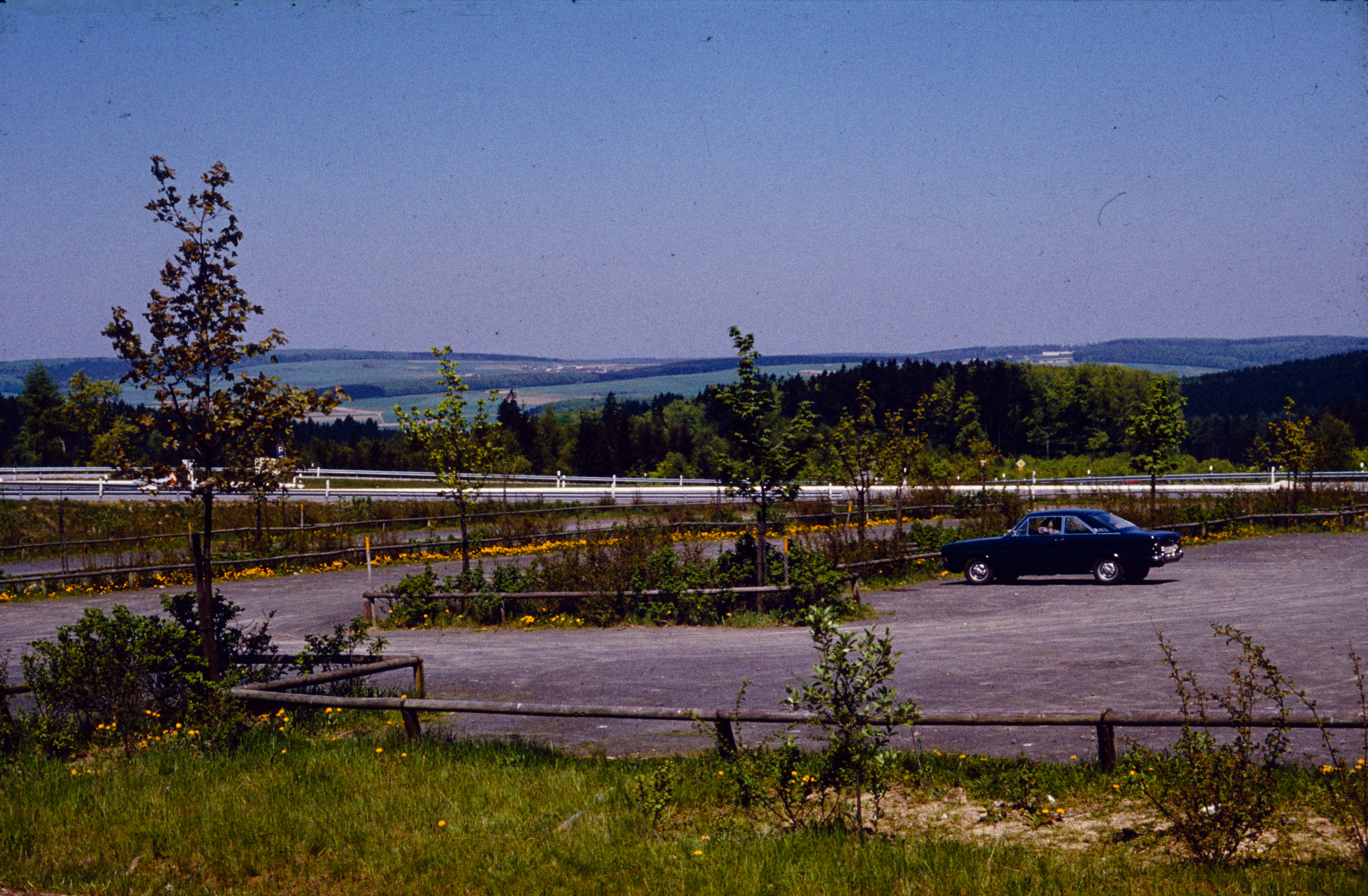
A vintage color photograph showing a gravel parking area with a lone dark car, surrounded by young trees and wooden fencing, overlooking a distant hilly forest landscape under a clear blue sky.
Historical view of the parking area near Jagdschloss Platte in Naturpark Rhein-Taunus, circa 1970.

Naturpark Rhein-Taunus conservation status and protection priorities

Naturpark Rhein-Taunus is formally part of Germany's National Natural Landscapes, the same overarching category that includes national parks and biosphere reserves. Its conservation mandate comes directly from the Federal Nature Conservation Act, which assigns nature parks the long-term task of protecting native flora and fauna, preserving and shaping the cultural landscape, and enabling nature-oriented recreation. These goals form the basis of the park's official charter.

Forest conservation is a central pillar of the park's work. Roughly 60 percent of the park is forested, and management is guided by near-natural forestry principles. In partnership with HessenForst and 17 municipal forest owners, the park has carried out targeted species protection projects, most notably its long-running programme for the Bechstein's bat, which was officially recognized as a project of the UN Decade on Biodiversity in 2016.

The park also places strong emphasis on sustainability beyond its borders. It is a certified 'Quality Nature Park' under the German national quality programme, participates in the Ökoprofit environmental management system, and supports the fairtrade towns initiative. Its 2018 Nature Park Concept organizes its work around four areas: nature conservation and cultural landscape, recreation and sustainable tourism, environmental and sustainability education, and sustainable regional development, giving conservation a clear institutional framework.

Naturpark Rhein-Taunus cultural meaning and human context

The cultural context of Naturpark Rhein-Taunus is unusually rich, partly because of the historical importance of the landscapes it contains. Two UNESCO World Heritage sites lie at least partly within the park: the Upper Middle Rhine Valley, celebrated for its centuries-old interplay of river, vineyard, castle and town, and the Obergermanisch-Raetischer Limes, the Roman frontier that once defined the edge of the Roman Empire and crosses the Taunus mountain range.

The Rheingau portion of the park, with the wine villages of Lorch, Lorchhausen and Rauenthal and the historic Kloster Eberbach, forms one of Germany's most distinctive wine regions. This agricultural and monastic heritage shapes the lower-elevation valleys along the Rhine and gives the park a strong regional identity tied to viticulture, river trade and medieval religious culture.

Closer to the mountains, the Taunus area preserves its own traditions of forest use, hiking culture and low-mountain village life. Walking clubs such as the Rheingau-Taunus-Klub maintain extensive path networks linking settlements, viewpoints and historic sites. The result is a park where Roman archaeology, medieval cloisters, wine country and nineteenth-century health resort culture, as in nearby Wiesbaden, all coexist within a single protected landscape.

Top sights and standout views in Naturpark Rhein-Taunus

Among the most distinctive features of Naturpark Rhein-Taunus are its extensive near-natural beech, oak and mixed forests, and especially the Hinterlandswald, which is the largest unbroken woodland in Hesse not crossed by motorways or federal roads. This forest complex supports some of the park's most important wildlife, including a historic stronghold of the European wildcat, and was the focal area for the park's national Bechstein's bat protection project.

The park is also notable for the way it links two UNESCO World Heritage sites, the Upper Middle Rhine Valley and the Roman Limes, with protected low mountain forest. Its position directly adjacent to Wiesbaden and within the Frankfurt/Rhein-Main metropolitan area makes it unusually accessible, while its trail network, including long-distance paths such as the Rheinsteig and the Wispertalsteig plus several hundred kilometres of quality-certified and locally marked routes, makes it one of the most rewarding walking landscapes in Hesse.

Best time to visit Naturpark Rhein-Taunus

Naturpark Rhein-Taunus can be experienced across the full year because its landscapes combine forest, valley and vineyard settings, each with their own seasonal rhythm. Spring and early summer are particularly appealing for woodland walks, when the beech, oak and mixed forests of the Taunus ridge are fresh and full of bird activity. The vineyards of the Rheingau also come into leaf during this period, softening the lower slopes above the Rhine.

Late summer and early autumn bring a second high point, with the Rheingau wine villages in harvest mood and warm evenings ideal for riverside walks. Autumn colours across the beech and oak forests make the higher trails especially attractive. Winter is quieter; with reduced flight activity around Frankfurt Airport, even the Hinterlandswald area can return closer to its naturally quiet state, offering clearer views and, when conditions allow, snow scenery across the Taunus ridge.

Monthly climate preview

Representative baseline measurements detailing the annual temperature rhythm and monthly precipitation patterns

Naturpark Rhein-Taunus Climate Normals, Long-Term Temperature and Precipitation Preview

Naturpark Rhein-Taunus records average monthly temperatures spanning from sub-zero winter minimums to warm summer maximums alongside consistent daily precipitation rates across the representative coordinate. Reviewing the complete twelve-month climatology profile provides deeper analytical context regarding long-term temperature ranges and precipitation normals.
Annual mean9 °C
0 °C20 °C
Jan
Feb
Mar
Apr
May13°
Jun17°
Jul20°
Aug19°
Sep15°
Oct
Nov
Dec
Warmest month
July

19.6 °C

Coolest month
January

-0.1 °C

Wettest month
July

2.2 mm/day

Driest month
April

1.5 mm/day

Park location guide

Geography guide, regional context, and park location map for Naturpark Rhein-Taunus

Naturpark Rhein-Taunus park geography, regions, and map view in Germany

Understand where Naturpark Rhein-Taunus sits in Germany through a broader geographic reading of the surrounding landscape, nearby location context, and its mapped position within the national park landscape.

How Naturpark Rhein-Taunus fits into Germany

Germany is a federal republic in Western and Central Europe with a population of over 83 million across sixteen constituent states. It is Europe's largest economy by nominal GDP and a major global exporter and importer. The capital is Berlin, and the country borders Denmark, Poland, Czech Republic, Austria, Switzerland, France, Luxembourg, Belgium, and the Netherlands.

Wider geography shaping Naturpark Rhein-Taunus in Germany

Germany is located in Western and Central Europe, spanning 357,022 km². It borders Denmark to the north, Poland and the Czech Republic to the east, Austria and Switzerland to the south, and France, Luxembourg, Belgium, and the Netherlands to the west. The country has coastlines on the Baltic Sea and North Sea to the north, with the Alps located in the southern region.

Map view of Naturpark Rhein-Taunus

Use this park location map to pinpoint Naturpark Rhein-Taunus in Germany, understand its exact geographic position, and read its mapped placement within the surrounding landscape more clearly.

Pigeon | © OpenStreetMap contributors

Location context for Naturpark Rhein-Taunus

Hesse

Visualizing the forested ridges, river valleys, and protected habitats of this German low mountain park

Naturpark Rhein-Taunus Photos and Landscape Scenery

Visual documentation captures the varied terrain, near-natural woodlands, and expansive topography defining Naturpark Rhein-Taunus. Examining these protected-area views helps visitors understand the natural environment and landscape character more clearly.

A wide, eye-level landscape view of rolling, forested hills in the Naturpark Rhein-Taunus under a partly cloudy sky, with a small settlement visible in the valley.

A green, open meadow in the foreground with scattered white blooming trees in the midground and rolling, forested mountains under a cloudy sky in the background.

A wide angle view of a bright, sunlit deciduous forest with tall tree trunks and dense green canopy in the Naturpark Rhein-Taunus.

A wide dirt trail travels through a deciduous forest with light green foliage, passing a small, damp, brush-filled depression on the right side.

A vintage color photograph showing a gravel parking area with a lone dark car, surrounded by young trees and wooden fencing, overlooking a distant hilly forest landscape under a clear blue sky.

Park atlas

Compare adjacent low mountain terrain, river valleys, and regional conservation landscapes

Explore Other Parks Near Naturpark Rhein-Taunus and Surrounding Protected Areas

Browsing other parks near Naturpark Rhein-Taunus allows visitors to evaluate similar low mountain protected areas across the surrounding region. Extending geographic comparisons reveals how adjacent woodland reserves, river valleys, and regional nature parks connect within the broader landscape.
A watercolor illustration of a landscape with green meadows, flowering bushes, and distant rolling hills on a white background.
Nature reserveHesse
About 4.1 km away#1 closest

East

Rabengrund von Wiesbaden: Mapping Protected Landscapes and Habitats in Hesse

Nature reserve and FFH site in the Taunus foothills

Rabengrund von Wiesbaden serves as a distinct protected valley system characterized by a compact coexistence of acid grasslands, reedbeds, and orchid-rich meadows. Managed as both a nature reserve and a Natura 2000 site, this area provides a rare window into the historical cultural landscape of the Taunus region. The site offers essential insight into small-scale habitat diversity near the urban core of the Hessian state capital.

Area
0.791 km²
Established
1988
IUCN
IV
Relief
Upland
A horizontal watercolor illustration of a natural valley scene, featuring an open meadow in the foreground, forest edges in the midground, and rolling hills in the background.
Nature reserveHesse
About 5.6 km away#2 closest

South

Rechtebachtal bei Georgenborn Nature Reserve: Geographic Profile and Protected Landscape

A mapped stream valley ecosystem in the Hesse Taunus foothills

The Rechtebachtal bei Georgenborn nature reserve protects a two-part valley corridor along the Rechtebach stream near Georgenborn and Martinsthal. This site preserves rare habitat mosaics of meadows and woodland that characterize the transitional zone between the Taunus highlands and the Rhine valley, offering a distinct study in regional conservation geography.

Area
0.185 km²
Established
1989
IUCN
IV
Relief
Upland
Watercolor painting of a gentle green valley with scattered trees and a winding path, featuring soft pastel tones.
Nature reserveHessen
About 6.6 km away#3 closest

Northwest

Pohlbachtal bei Adolfseck Nature Reserve: Geography and Protected Area Profile

Western Hintertaunus mosaic landscape in Hessen

Pohlbachtal bei Adolfseck protects a near-natural brook valley and surrounding slopes within the Rhein-Taunus Nature Park. This reserve sustains diverse habitats, from wet meadow floodplains to deciduous forest fringes, while preserving historical layers like the Roman Limes along its valley edges in Hessen.

Area
0.226 km²
Established
1990
IUCN
IV
A watercolor painting showing a soft, atmospheric landscape with a river flowing through green hills and gentle, misty mountains.
Nature reserveRhineland-Palatinate
About 9.6 km away#4 closest

Southeast

Inselrhein Nature Reserve, Rhineland-Palatinate: A Geographic and Protected-Area Atlas

River islands, floodplain forests, and Upper Rhine wetlands

Inselrhein features a chain of natural river islands and side channels forming a critical wetland habitat. The terrain transition from soft-wood to hardwood forest communities creates a layered landscape. Examine the protected boundaries and geographic significance of this river corridor between Mainz and Bingen, documented within the Rhineland-Palatinate atlas.

Relief
Lowland
Climate
Temperate
Access
Easy access
Scope
Terrestrial
Watercolor painting of a misty river landscape with green trees, reeds, and soft hills in the background.
Nature reserveHesse
About 10 km away#5 closest

South

Niederwallufer Bucht Nature Reserve: Rhine Floodplain Landscape and Geographic Context

Protected riparian habitat in the state of Hesse

Niederwallufer Bucht represents a key example of a conserved Rhine riverbank environment. This nature reserve protects a delicate mix of soft-wood forests, sheltered backwater bays, and riparian meadows. By maintaining these wetlands against the backdrop of the heavily settled Rheingau, the site provides a vital node of ecological continuity and a clear look at floodplain terrain within central Germany.

Area
0.13 km²
Established
2000
IUCN
IV
A wide watercolor illustration showing a winding river flowing through a green floodplain with scattered trees and pale pink and purple hills in the distance.
Nature reserveHesse
About 11 km away#6 closest

South

Rettbergsaue Nature Reserve: Geography and Protected Landscapes in the Rhine Valley

A vital river island ecosystem and floodplain forest in Hesse.

Rettbergsaue serves as an essential riverine habitat in the Upper Rhine. This nature reserve, characterized by its alluvial woodland and riparian meadows, offers a detailed study of sediment-formed islands and the interplay between main-channel water flow and sheltered side-arm environments within the state of Hesse.

Area
0.68 km²
Established
1978
Relief
Lowland
Climate
Temperate
A horizontal watercolor painting of a river landscape with lush green trees, grasses, and a winding waterway under a soft light.
Nature reserveHessen
About 13 km away#7 closest

Southwest

Mariannenaue Nature Reserve: Protected River Island Geography and Landscape Atlas

Rhine river island and floodplain forest in Hessen, Germany.

Mariannenaue serves as a prominent example of a protected inland island in the Upper Rhine. Its geography encompasses a complex mix of veteran floodplain forest, still-water habitats, and centuries-old vineyard cultivation. This detail page provides insights into the park boundaries, the surrounding riverine terrain, and the ecological network that connects this site to the broader Rheingau landscape.

Area
1.96 km²
Established
1972
Relief
Lowland
Climate
Temperate
A soft watercolor painting of a forest landscape with slender trees, green grass, and distant rolling hills against a pale, warm sky.
Nature reserveRhineland-Palatinate
About 13 km away#8 closest

South

Lennebergwald Nature Reserve: Mapped Geography and Protected Forest Landscapes in Germany

Rhineland-Palatinate woodland and dry forest ecosystem analysis

Analyze the Lennebergwald nature reserve through its geological and ecological profile. This protected area in Rhineland-Palatinate showcases a rare inland sand forest structure, linking together pine and oak stands with vital dry grassland habitats that form a critical ecological mosaic in central Germany.

Area
8 km²
Established
1996
Relief
Lowland
Climate
Temperate

Common questions about visiting, size, designation, and location context for Naturpark Rhein-Taunus

Naturpark Rhein-Taunus FAQs for park facts, access, geography, and protected area context

Find quick answers about Naturpark Rhein-Taunus, including protected-area facts, park geography, trail and visitor context, and how the park fits into its surrounding country and regional landscape.
MoriAtlas Explorer

Continue Your Protected Areas Search Across the Global Atlas

Deepen your exploration by continuing the structured search for national parks and protected areas worldwide. Utilize the comprehensive filtering capabilities to compare different conservation landscapes and refine your understanding of global park geography. Discover more about the distribution and characteristics of protected natural areas.

Global natural geography