
Why Naturschutzgebiet Obergraben westlich Wickede stands out
The reserve is especially known for its importance to birds along a former stretch of the Ruhr. Its mix of floodplain woodland, species-rich meadows, planted hedgerows, pollarded trees, and river island habitat provides breeding, moulting, and wintering grounds for threatened waterbirds and characteristic floodplain songbirds such as the red-backed shrike, common whitethroat, lesser whitethroat, and yellowhammer. Hen harriers have also been recorded here, underscoring the area's value as a quiet refuge within an otherwise heavily used river landscape.
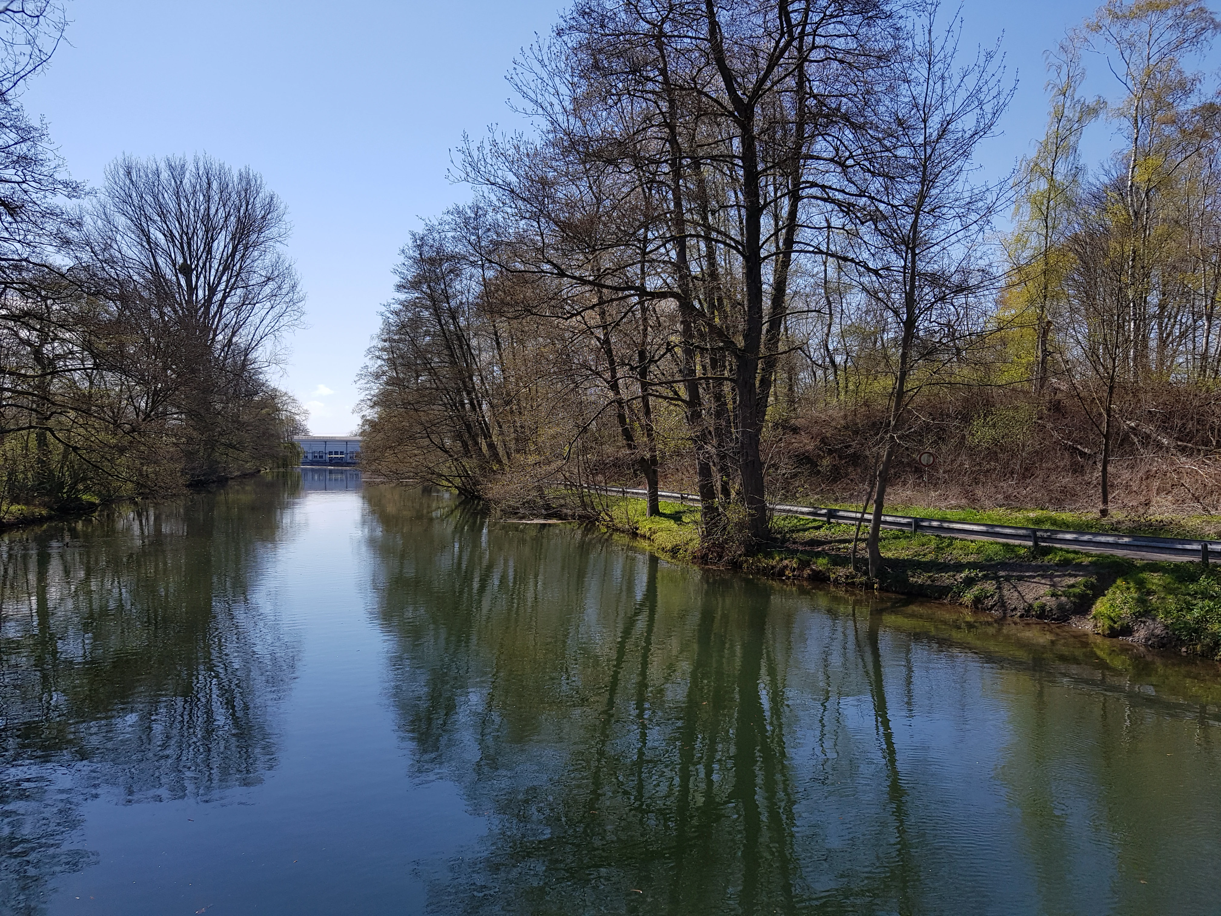
Naturschutzgebiet Obergraben westlich Wickede history and protected-area timeline
The area now protected as Naturschutzgebiet Obergraben westlich Wickede was brought under formal nature protection in 2002, when it was legally designated under the German Naturschutzgesetz with the official code UN-042. Its establishment was embedded in the regional landscape planning framework of Kreis Unna, specifically Landscape Plan 7 covering the Fröndenberg area, originally adopted in November 2002 and later adjusted in August 2019.
The reserve was created around land that has long followed an old course of the Ruhr, including the upper drainage channel known as the Obergraben. Recognising the ecological value of the near-natural woodland, floodplain meadows, and river shoreline, the responsible authorities designated the area to safeguard threatened species and habitats, and to preserve the distinctive character of the Ruhr floodplain. In doing so, they also integrated the site into the broader Natura 2000 network along the Ruhr, where it functions as the westernmost protected segment of that corridor.
Naturschutzgebiet Obergraben westlich Wickede landscape and geographic character
The reserve occupies a transitional band where the cultural landscape of the Ruhr region softens into a more natural floodplain setting. Its northern edge traces an old course of the Ruhr, while the southern and eastern boundary runs along the Obergraben drainage channel, an artificial upper channel that shapes how water moves through the area. The dominant landform is a low-elevation river floodplain, shallow and gently undulating, flanked by small elevated terraces that carry the near-natural woodland of the Warmer Löhen.
In the south, the landscape opens into species-poor but ecologically interesting meadows dominated by ryegrass and white clover, interlaced with hedgerows and solitary pollarded trees. The In der Stövenkamp island feature within the reserve, together with the gravelly and vegetated river margins, gives the area a varied shoreline character. Altogether, the reserve reads as a quiet, narrow green ribbon threaded between river, woodland, and meadow, set against the broader urbanised Ruhr region.
Naturschutzgebiet Obergraben westlich Wickede ecosystems, habitats, and plant life
Ecologically, the reserve is best understood as a small but well-structured floodplain mosaic. The Warmer Löhen woodland is dominated by hornbeam-pedunculate oak associations alongside beech stands, occupying the higher ground out of frequent flood reach. The lower-lying areas combine grazed or mown meadows with planted hedgerows and traditional pollarded trees, creating a layered habitat of canopy, shrub, and open ground that supports a wide range of species.
The wet elements of the reserve, including the In der Stövenkamp island and the riverbank sections along the old Ruhr course and the Obergraben, are equally important. These zones offer feeding and resting opportunities for waterbirds and provide habitat for wetland-edge flora, while the ditch and channel network helps maintain the overall hydrology of the floodplain. The site's integration into the Natura 2000 Ruhr area reflects its role as a refuge of relatively natural floodplain dynamics that have largely disappeared elsewhere in the region.
Naturschutzgebiet Obergraben westlich Wickede wildlife and species highlights
Birdlife is the most prominent wildlife interest of the reserve. The meadow and hedgerow mosaic hosts the red-backed shrike, common whitethroat, lesser whitethroat, and yellowhammer as regular breeding species, and hen harriers have been observed in the Warmer Löhen woodland in early spring. The riverbank and island habitats, particularly around In der Stövenkamp and along the old Ruhr course, are valued as breeding, moulting, and wintering sites for threatened waterbirds.
Species specifically associated with the water-side habitats include the common kingfisher, sand martin, tufted duck, grey heron, little ringed plover, and common sandpiper. Together, they underline how even a small floodplain reserve can host a remarkable cross-section of waterbirds, farmland-edge birds, and woodland species, provided that disturbance is kept low and habitat structure is maintained.
Naturschutzgebiet Obergraben westlich Wickede conservation status and protection priorities
The reserve was designated to preserve, develop, and restore habitats and communities of wild plants and animals, and to protect the particular character and beauty of the Ruhr floodplain. It is classified as an IUCN Category IV area, meaning Habitat/Species Management Area, allowing targeted measures to maintain the mosaic of woodland, meadow, hedge, and wetland. Its integration into the Natura 2000 network along the Ruhr, where it serves as the westernmost segment of that corridor, gives it importance beyond its local scale.
The site's conservation value rests largely on its combined features: near-natural floodplain woodland, traditionally structured meadows with hedgerows and pollarded trees, and river shoreline along both an old Ruhr channel and the Obergraben drainage. The continuity of protected habitats across the boundary into the neighbouring Naturschutzgebiet Ruhraue strengthens its role as a refuge for waterbirds and other floodplain-dependent species in an otherwise heavily used part of the Ruhr region.
Naturschutzgebiet Obergraben westlich Wickede cultural meaning and human context
Although the reserve is principally a natural and ecological site, its name and structure reflect the long history of human management of the Ruhr floodplain. The 'Obergraben', or upper channel, speaks to a long tradition of watercourse engineering in the Ruhr valley, while the presence of planted hedgerows and pollarded trees reveals a cultural landscape shaped by traditional agricultural practices rather than a fully wild setting. The river island name In der Stövenkamp and field name Warmer Löhen reflect regional, historically rooted place naming that ties the protected area into the local identity of Fröndenberg/Ruhr and Wickede (Ruhr).
Top sights and standout views in Naturschutzgebiet Obergraben westlich Wickede
The reserve is a compact but ecologically rich floodplain fragment in the Ruhr valley, where floodplain woodland, species-rich meadows, hedgerows, and river shoreline come together in a single protected mosaic. Its combination of traditional cultural landscape elements with functioning wet habitats supports a remarkable diversity of breeding, moulting, and wintering birds for an area of its size. As the westernmost component of the Natura 2000 Ruhr area and a direct neighbour of the larger Ruhraue reserve, it plays a meaningful connecting role in the regional network of protected floodplain sites.
Best time to visit Naturschutzgebiet Obergraben westlich Wickede
Spring and early summer are particularly rewarding periods to experience the reserve. Migrant and breeding birds, including warblers, the red-backed shrike, and various waterbirds along the river, are most active then, while meadows are rich with flowering herbs. Early spring can produce occasional sightings of hen harriers around the Warmer Löhen woodland, and observers interested in waterbirds may also find quieter conditions outside the main breeding season when winter visitors and passage species use the channels and shoreline.