
Mori Atlas logo
Nature reserveNaturschutzgebiet Orchideenwiese bei Heintjeshammer

Examining the ecological terrain, mapped boundaries, and meadow habitats within the Bergische Hochfläche

Naturschutzgebiet Orchideenwiese bei Heintjeshammer: Protected Landscapes and Regional Geography

The Naturschutzgebiet Orchideenwiese bei Heintjeshammer functions as a vital habitat node on the Bergische Hochfläche, preserving a unique mosaic of wet grasslands, nutrient-poor meadows, and wooded valley slopes. This area provides a crucial refuge for specialized plant species, including wild orchids and cottongrass, while acting as a significant ecological corridor within the broader Eschbach valley landscape context.

nature reserveorchid meadowwet grasslandnutrient-poor grasslandspring mireheathland relic
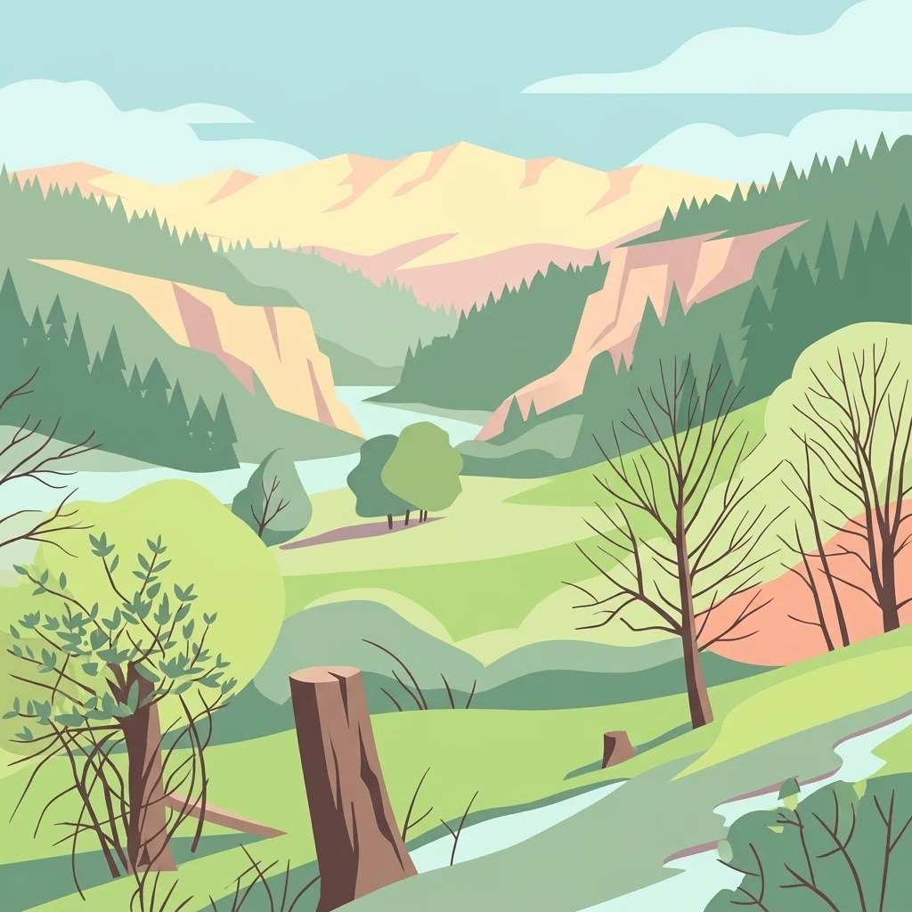
A digital illustration of a scenic valley with green meadows in the foreground, forest-covered hillsides, and distant mountains under a pale sky.

Naturschutzgebiet Orchideenwiese bei Heintjeshammer

Nature reserve

Park overview

Structured park overview, official facts, and landscape profile for Orchideenwiese bei Heintjeshammer Nature Reserve

Orchideenwiese bei Heintjeshammer Nature Reserve park facts, protected area profile, and essential visitor context

Review the core facts for Orchideenwiese bei Heintjeshammer Nature Reserve, including designation, size, terrain, visitor scale, habitats, and operating context in one park-focused overview.

About Orchideenwiese bei Heintjeshammer Nature Reserve

The Orchideenwiese bei Heintjeshammer Nature Reserve sits on a slope on the south side of the Landstraße 408 in the Eschbach valley, just north of the Pohlhausen district of Wermelskirchen. The protected area comprises a triangular block of open grassland flanked by woodland on three sides, with the valley floor of the Eschbach and the Eschbach floodplain lying below the road. This juxtaposition of hillside meadow, mire, brook, and surrounding forest gives the site a compact but ecologically layered character unusual for such a small reserve.

The defining feature of the site is its mosaic of different grassland and mire habitats, which together support a disproportionately rich flora. The reserve includes nutrient-poor meadows (Magerwiesen), nutrient-poor pastures (Magerweiden), sedge- and rush-rich wet meadows, reeds, and swamp areas, as well as relict heath vegetation and spring-mire (Quellmoor) communities that reflect older land use on the Bergische Hochfläche. Although the area is only a few hectares in size, the combination of open meadow, damp hollows, and woodland edge creates enough habitat diversity to sustain a remarkable variety of plant and insect species.

From a landscape-planning perspective, the reserve is positioned as a habitat-connection area of outstanding importance. It links woodland, valley grassland, and mire habitats along the Eschbach, functioning both as a stepping stone in the regional biotope network and as a refuge for plant communities that have largely vanished from the surrounding intensively used countryside. Its management approach, embedded in the Wermelskirchen landscape plan and overseen by the lower landscape authority of the Rheinisch-Bergischer Kreis, reflects a deliberate effort to maintain traditional semi-natural grassland through appropriate grazing and the protection of groundwater conditions.

Quick facts and research context for Orchideenwiese bei Heintjeshammer Nature Reserve

The reserve lies in Wermelskirchen, Rheinisch-Bergischer Kreis, in the German state of North Rhine-Westphalia, and covers approximately 4.3 hectares of hillside habitat between 180 and 240 metres above sea level. Designated in 2000 under the official code GL-041, it is classified as an IUCN Category IV habitat/species management area focused on the conservation of orchid-rich wet and nutrient-poor grasslands.

The site is administered by the lower landscape authority of the Rheinisch-Bergischer Kreis and forms part of the landscape plan for Wermelskirchen. It is also recorded internationally in the World Database on Protected Areas under WDPA ID 329565, reflecting its formal recognition as part of Germany's network of statutory nature reserves.

Protection and recognition

Documented terrestrial protection scope, management context, and official registry records for this protected area.

Naturschutzgebiet Orchideenwiese bei Heintjeshammer Protection Status and Terrestrial Conservation Data

Terrestrial protection status, designation history, and administrative records for Naturschutzgebiet Orchideenwiese bei Heintjeshammer remain fully documented through verified database sources. Official registry entries track the established conservation scope and international records without assuming additional management outcomes.

Protection details

Protection scope
Terrestrial
Transboundary protection
No
WDPA ID
329565
Park context

Deeper park guide and search-rich context for Orchideenwiese bei Heintjeshammer Nature Reserve

Orchideenwiese bei Heintjeshammer Nature Reserve history, landscape, wildlife, and travel context

Explore Orchideenwiese bei Heintjeshammer Nature Reserve through its history, landscape character, ecosystems, wildlife, conservation priorities, cultural context, and seasonal travel timing in a structured park guide built for atlas discovery and search intent.

Why Orchideenwiese bei Heintjeshammer Nature Reserve stands out

The reserve is best known for its population of wild orchids, which thrive in the wet, nutrient-poor meadows that are otherwise rare on the Bergische Hochfläche. Species such as the broad-leaved marsh orchid and the spotted orchid are among the most striking elements of the flora, alongside narrow-leaved cottongrass and sphagnum mosses that characterise the site's moist, acidic soils. It is also recognised for its historical heath and spring-mire character, with seepage zones and a small brook fed by woodland springs giving the area a distinctive combination of open meadow, mire, and wooded valley habitats in a very compact space.
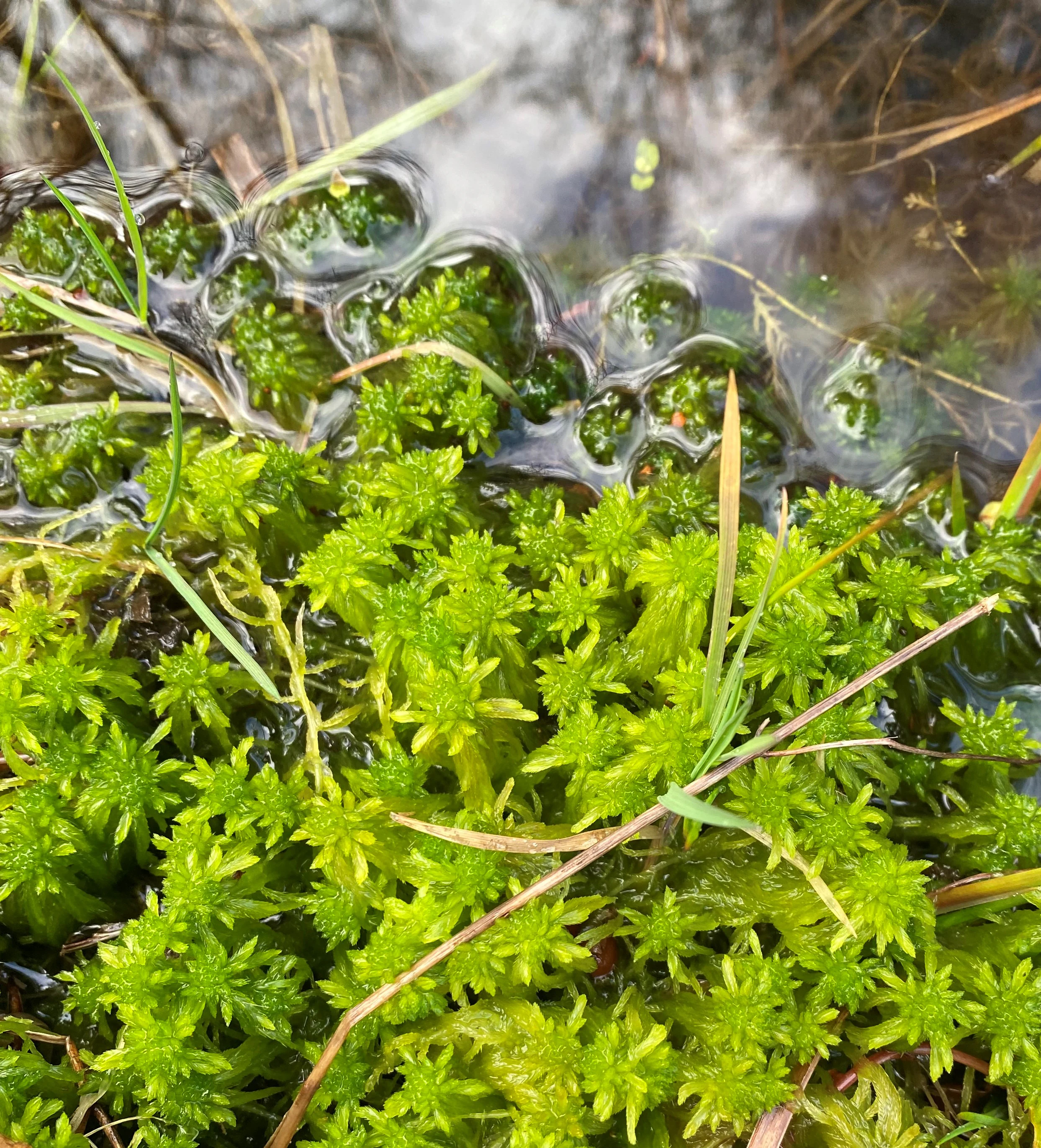
A close-up view of bright green, star-shaped Sphagnum moss growing in shallow, clear water.
Bright green Sphagnum moss growing in a wet habitat, a characteristic species of the Orchideenwiese bei Heintjeshammer nature reserve.

Orchideenwiese bei Heintjeshammer Nature Reserve history and protected-area timeline

The site's ecological roots stretch back to a period when the slopes of the Bergische Hochfläche carried extensive heath and spring-mire habitats used in low-intensity traditional farming. Over the course of the twentieth century, agricultural intensification, drainage, and afforestation led to widespread losses of such habitats across the region, and the surviving orchid-rich meadows around Heintjeshammer became increasingly rare.

In 2000, the area was formally designated as a nature reserve under the German Naturschutzgesetz, with the official code GL-041, to safeguard the remaining wet and nutrient-poor grassland, the historic heath and spring-mire relics, and the small wooded valley. The designation was embedded within the broader Wermelskirchen landscape plan, formalising its role as a protected habitat node within the regional ecological network. Since then, the site has continued to be managed as an IUCN Category IV habitat and species management area, with restrictions on activities that could alter groundwater levels or otherwise disrupt the delicate hydrology of the meadow and mire.

Orchideenwiese bei Heintjeshammer Nature Reserve landscape and geographic character

The reserve occupies a south-facing slope above the Eschbach valley, positioned between roughly 180 and 240 metres above sea level and separated from the brook and its floodplain by the Landstraße 408 that runs along the valley edge. The hillside setting gives the meadow a slightly terraced feel, with shallow depressions and seepage lines where groundwater reaches the surface, creating the moist conditions that support the orchid-rich vegetation.

The surrounding landscape is shaped by the broader topography of the Bergische Hochfläche, a gently rolling upland crossed by narrow forested valleys with small brooks. Open farmland in the region tends to be improved grassland or arable land, which makes the surviving traditional meadows at Heintjeshammer visually distinctive: an island of tall, flower-rich sward ringed by woodland and edged by a wooded Siefen, a small steep-sided side valley typical of the area.
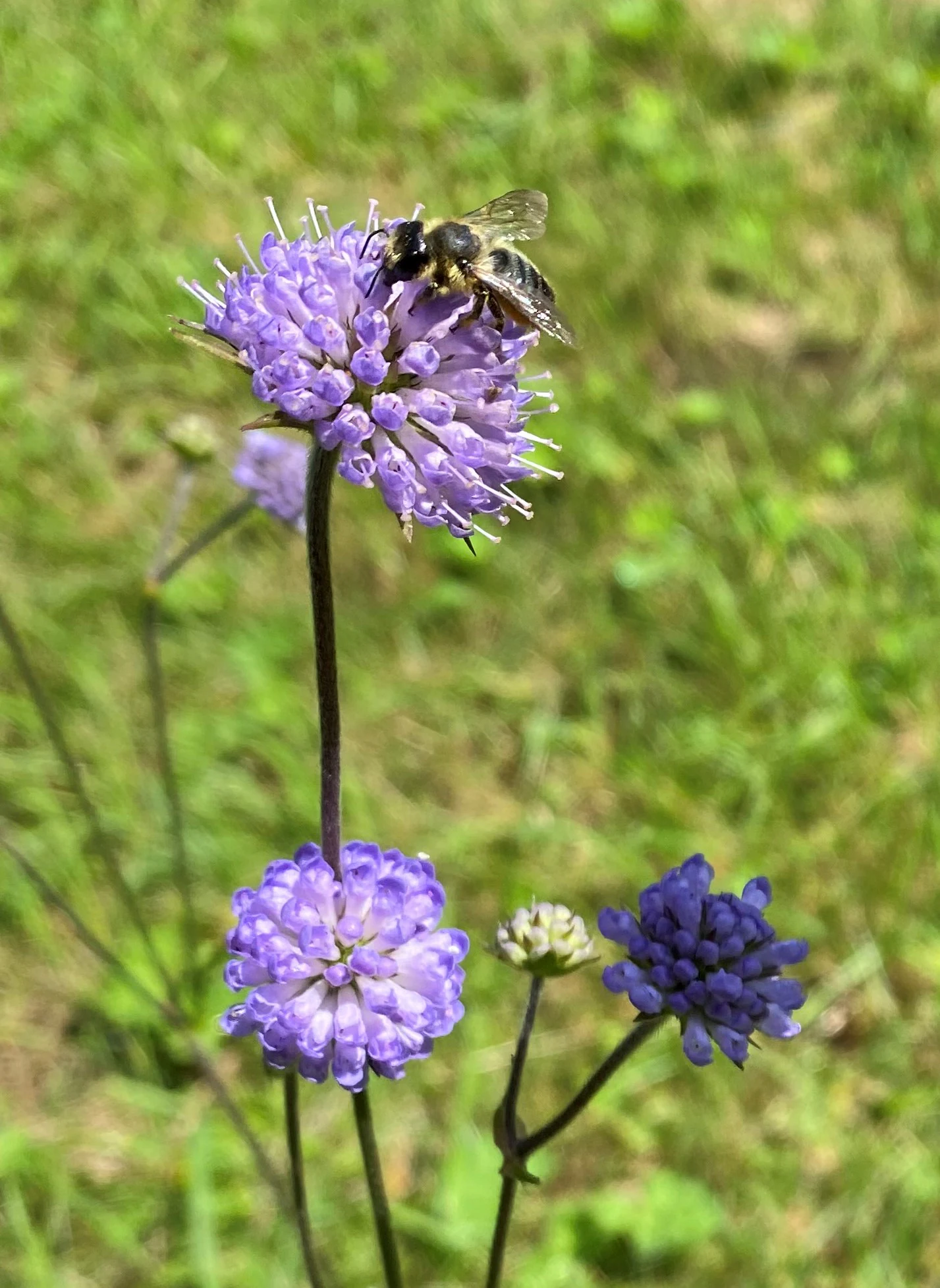
A close-up of a small bee resting on a purple-blue globular flower head of a Devil's bit scabious plant, with out-of-focus green grass in the background.
A bee pollinating a Devil's bit scabious flower (Succisa pratensis) in the meadow.

Orchideenwiese bei Heintjeshammer Nature Reserve ecosystems, habitats, and plant life

Ecologically, the reserve is defined by the coexistence of several closely related semi-natural habitat types that have become rare in the modern Bergische Hochfläche. Nutrient-poor meadows and pastures, characterised by low-fertility soils and a diverse mix of grasses and herbs, form the open core of the site. Sedge- and rush-rich wet meadows, reeds, and swampy areas occupy the damper parts, while relict heath and spring-mire communities survive in the wettest zones, fed by groundwater and small woodland springs.

These habitats share an underlying ecological logic: they all depend on consistently moist, low-nutrient conditions that limit the dominance of vigorous grasses and allow specialist plants to persist. The reserve's designation explicitly recognises the area as a habitat-connection site of outstanding importance, linking woodland edge habitats along the Eschbach valley with open grassland and mire communities further up the slope. Woodland is included in the protected area only along parts of the southern margin and along the small Siefen, enough to frame the meadow and provide a stable microclimate.
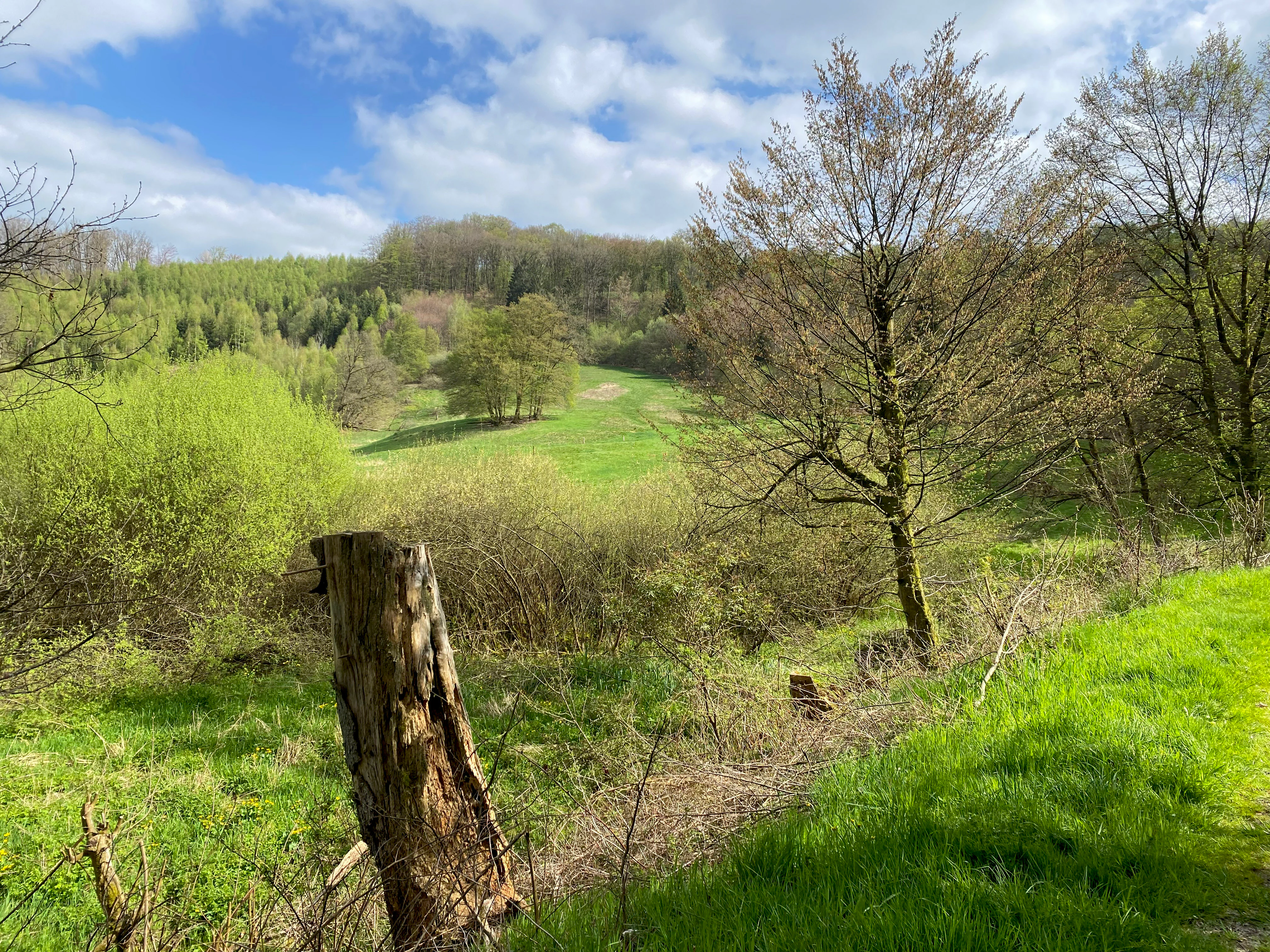
A green meadow in a valley with a tree stump in the foreground and a forested hillside in the background under a partly cloudy sky.
A view across the green meadows and wooded hillsides of the Orchideenwiese bei Heintjeshammer nature reserve.

Orchideenwiese bei Heintjeshammer Nature Reserve wildlife and species highlights

Wildlife interest in the reserve centres on its invertebrate fauna, particularly the butterflies and moths that thrive in flower-rich, unimproved grassland. The complex floral structure of the meadows provides nectar sources and host plants for a wide range of species, including the forester moth, which was named Butterfly of the Year in Germany in 2023, and the sooty copper, a small butterfly associated with low-intensity grasslands.

Amphibians are also noted among the site's fauna, with the common frog breeding in the wetter parts of the reserve that are fed by the surrounding woodland spring system. The mixture of open meadow, damp hollows, woodland edges, and a small brook creates a useful range of microhabitats for insects, spiders, and other invertebrates, and the reserve is valued less for charismatic large mammals than for its dense and specialised small-scale biodiversity.
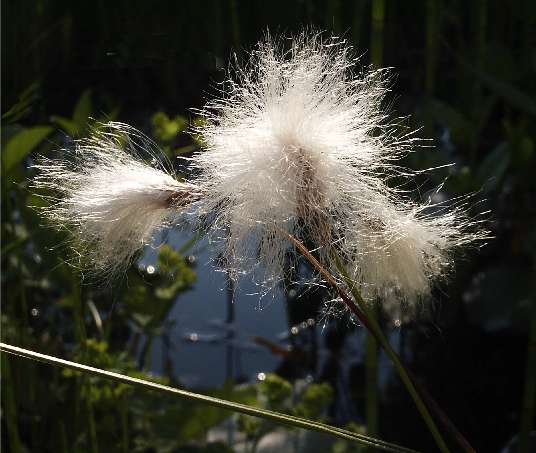
Close-up of fluffy white seed heads of Common Cottongrass (Eriophorum angustifolium) against a dark, out-of-focus background of greenery and water.
Common Cottongrass (Eriophorum angustifolium) seeds in bloom.

Orchideenwiese bei Heintjeshammer Nature Reserve conservation status and protection priorities

Conservation of the Orchideenwiese bei Heintjeshammer is driven by the need to protect a relict of orchid-rich wet and nutrient-poor grassland that has become exceptionally rare on the Bergische Hochfläche. The site's official protection purposes include safeguarding its function as a habitat-connection area of outstanding importance, maintaining the landscape's distinctive character and beauty, and preserving habitats for characteristic and rare wild plant and animal communities associated with these grasslands.

Key protective measures include restrictions on any activity that could alter groundwater levels, since the orchid-rich vegetation depends on the specific hydrology of the slope and the seepage zones fed by the surrounding woodland. The reserve also protects legally defined biotopes such as swamps, reeds, sedge- and rush-rich wet meadows, and species-rich nutrient-poor meadows and pastures. Through its inclusion in the Wermelskirchen landscape plan and its administration by the lower landscape authority of the Rheinisch-Bergischer Kreis, the site functions as both a refuge for declining grassland and mire habitats and a node in the wider regional biotope network.

Orchideenwiese bei Heintjeshammer Nature Reserve cultural meaning and human context

The reserve reflects a long-standing regional tradition of low-intensity meadow use on the Bergische Hochfläche, where small hillside fields once supported a mix of hay-making and grazing that produced species-rich grasslands. Many such meadows disappeared during twentieth-century land-use change, and surviving sites like the Orchideenwiese have taken on a heritage value as living reminders of the agricultural landscapes that shaped the region.

The locality name Heintjeshammer, along with nearby place names in the Eschbach valley, reflects the historic pattern of small hamlets, mills, and craft sites along the brooks of the Bergisches Land. The protected area today is a quiet ecological island within this historically worked valley landscape, valued more for its continuity with old land-use patterns than as a site of distinctive human structures.
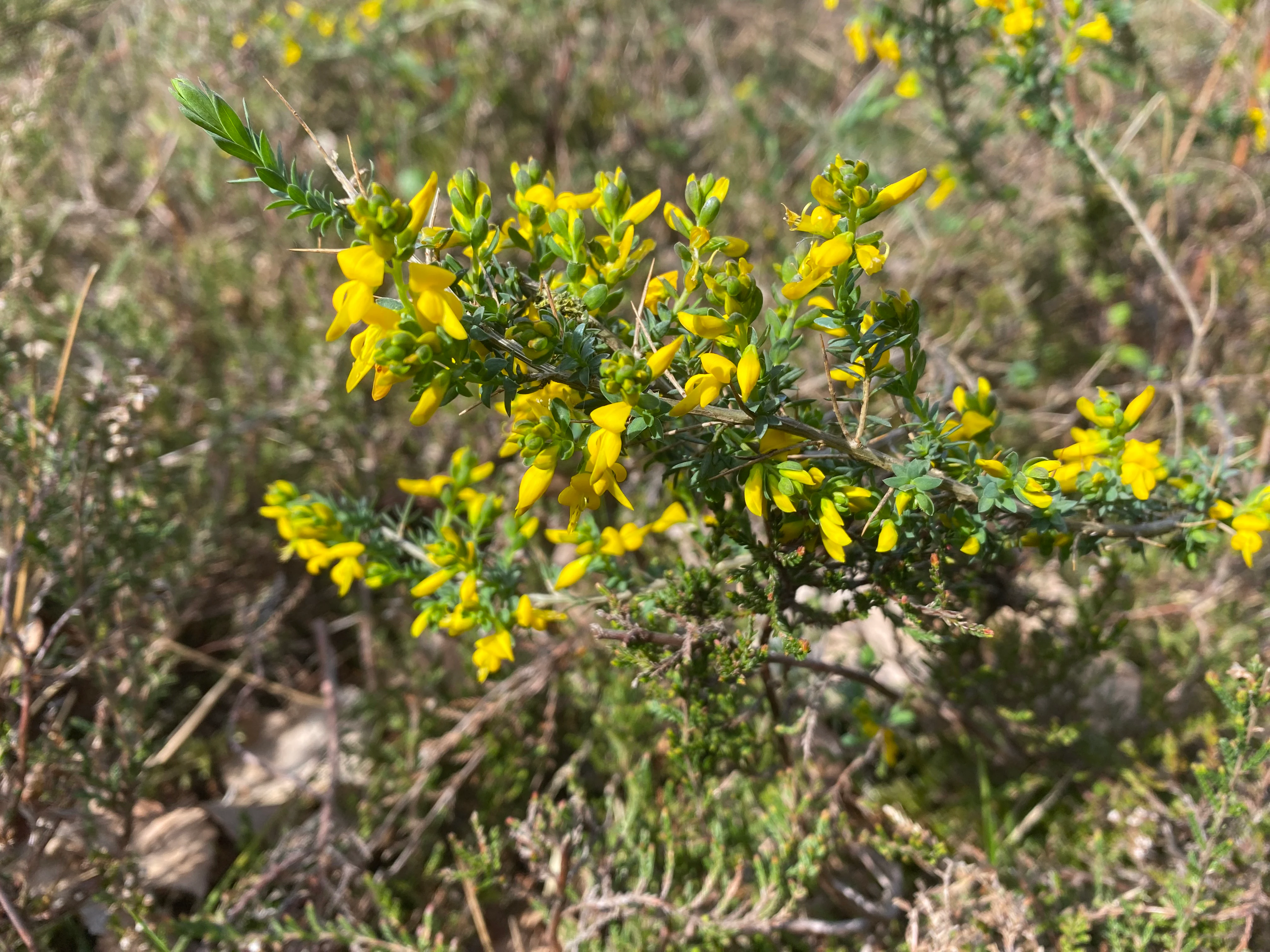
A close-up view of a small petty whin plant with bright yellow flowers and thin green leaves, growing in a grassy field.
Petty whin (Genista anglica) blooming in the grassland habitat of the nature reserve.

Top sights and standout views in Orchideenwiese bei Heintjeshammer Nature Reserve

Among the reserve's most notable qualities are its surviving populations of wild orchids in an otherwise heavily altered landscape, the unusual juxtaposition of wet meadow, mire, and small wooded valley on a single hillside, and its role as a habitat-connection node within the Eschbach valley landscape.

Equally important is its contribution to the conservation of declining seminatural habitats of the Bergische Hochfläche, and the fact that a site of just a few hectares can sustain such a varied flora and invertebrate fauna, including species of regional and national conservation concern such as the forester moth and the broad-leaved marsh orchid.
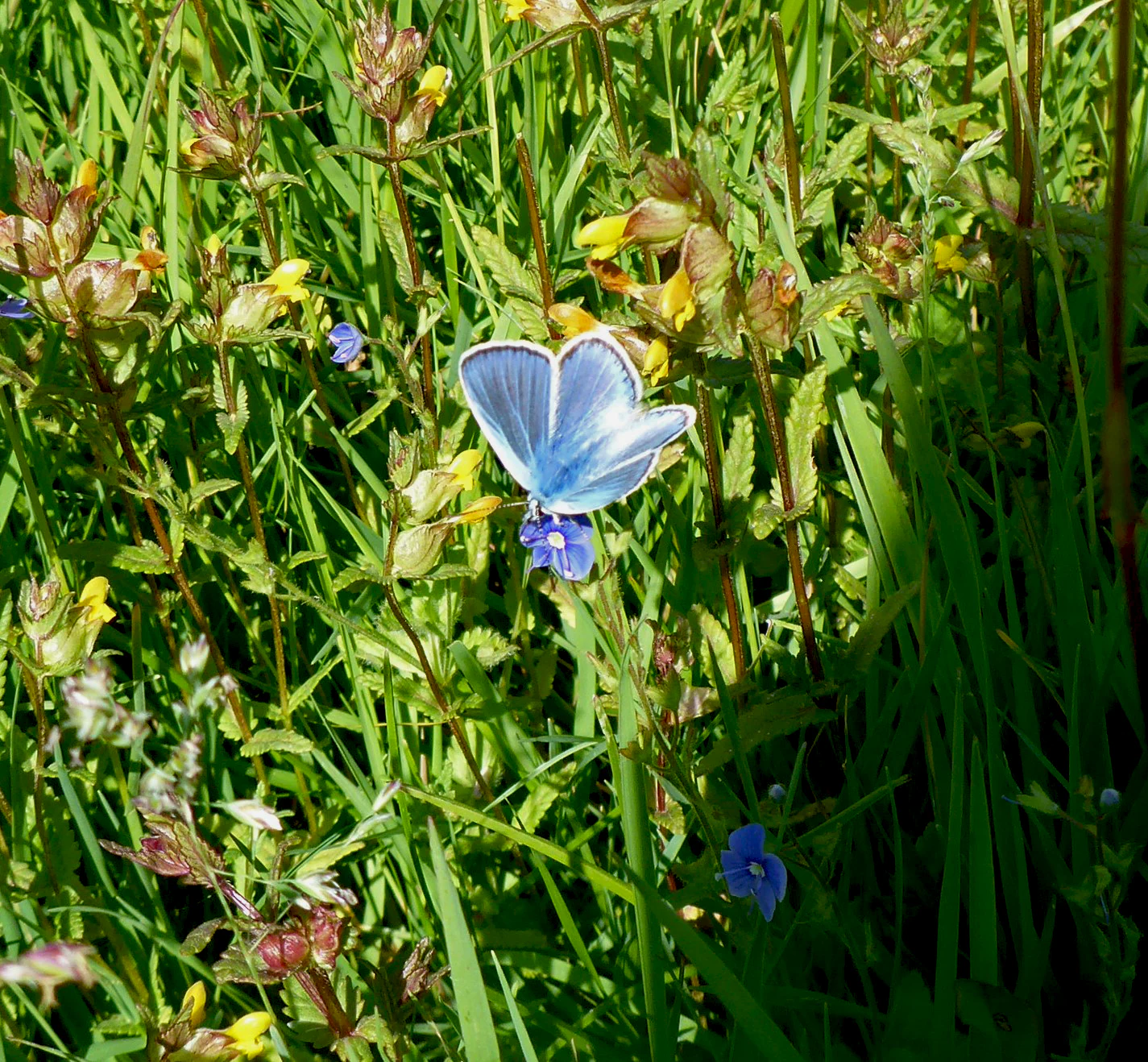
A small blue butterfly, likely a Common Blue, with wings open resting on a small blue wildflower amidst green grass and yellow-tipped stalks.
A Common Blue butterfly perched on a plant in the Orchideenwiese bei Heintjeshammer nature reserve.

Best time to visit Orchideenwiese bei Heintjeshammer Nature Reserve

The reserve is most rewarding in late spring and early summer, when the orchids are in flower and the meadows display their richest mix of colour and structure. Visiting during this period allows observation of the broad-leaved and spotted marsh orchids, cottongrass, and devil's-bit scabious at their peak, along with active butterflies and other pollinators that depend on the open flower-rich sward.

Later in summer, the vegetation grows taller and the floral display fades, while in autumn and winter the wetter areas can become very muddy, making access more difficult. As a small protected nature reserve without formal visitor infrastructure, the site is best appreciated as a quiet seasonal walk through traditional Bergisches countryside rather than as a year-round attraction.

Monthly climate preview

Long-term temperature ranges and monthly precipitation patterns for a representative coordinate

Naturschutzgebiet Orchideenwiese bei Heintjeshammer Climate and Weather Normals

Historical climatology records outline measured baseline temperatures and daily precipitation rates across twelve distinct months at Naturschutzgebiet Orchideenwiese bei Heintjeshammer. Detailed monthly temperature averages and precipitation statistics provide comprehensive context for analyzing long-term environmental patterns.
Annual mean9 °C
0 °C18 °C
Jan
Feb
Mar
Apr
May13°
Jun16°
Jul18°
Aug18°
Sep14°
Oct
Nov
Dec
Warmest month
July

18.3 °C

Coolest month
January

0.3 °C

Wettest month
December

3 mm/day

Driest month
April

1.8 mm/day

Park location guide

Geography guide, regional context, and park location map for Orchideenwiese bei Heintjeshammer Nature Reserve

Orchideenwiese bei Heintjeshammer Nature Reserve park geography, regions, and map view in Germany

Understand where Orchideenwiese bei Heintjeshammer Nature Reserve sits in Germany through a broader geographic reading of the surrounding landscape, nearby location context, and its mapped position within the national park landscape.

How Orchideenwiese bei Heintjeshammer Nature Reserve fits into Germany

Germany is a federal republic in Western and Central Europe with a population of over 83 million across sixteen constituent states. It is Europe's largest economy by nominal GDP and a major global exporter and importer. The capital is Berlin, and the country borders Denmark, Poland, Czech Republic, Austria, Switzerland, France, Luxembourg, Belgium, and the Netherlands.

Wider geography shaping Orchideenwiese bei Heintjeshammer Nature Reserve in Germany

Germany is located in Western and Central Europe, spanning 357,022 km². It borders Denmark to the north, Poland and the Czech Republic to the east, Austria and Switzerland to the south, and France, Luxembourg, Belgium, and the Netherlands to the west. The country has coastlines on the Baltic Sea and North Sea to the north, with the Alps located in the southern region.

Map view of Orchideenwiese bei Heintjeshammer Nature Reserve

Use this park location map to pinpoint Orchideenwiese bei Heintjeshammer Nature Reserve in Germany, understand its exact geographic position, and read its mapped placement within the surrounding landscape more clearly.

Pigeon | © OpenStreetMap contributors

Location context for Orchideenwiese bei Heintjeshammer Nature Reserve

Nordrhein-Westfalen

Visualizing the rare wet grasslands and spring mire habitats of the Bergische Hochfläche

Naturschutzgebiet Orchideenwiese bei Heintjeshammer Photos and Landscapes

Visual documentation captures the unique topography and floral assemblages of Naturschutzgebiet Orchideenwiese bei Heintjeshammer across its protected hillside terrain. Examining these detailed landscape photographs provides clear insight into the fragile meadow ecosystems and moist valley habitats preserved within the region.

A close-up view of bright green, star-shaped Sphagnum moss growing in shallow, clear water.

A single, dark purple Black Rampion flower head on a green stem, centered against a blurred background of green meadow grasses.

A close-up of a small bee resting on a purple-blue globular flower head of a Devil's bit scabious plant, with out-of-focus green grass in the background.

A green meadow in a valley with a tree stump in the foreground and a forested hillside in the background under a partly cloudy sky.

Close-up of fluffy white seed heads of Common Cottongrass (Eriophorum angustifolium) against a dark, out-of-focus background of greenery and water.

A purple, cone-shaped orchid flower standing tall in a patch of bright green grass.

A close-up view of a small petty whin plant with bright yellow flowers and thin green leaves, growing in a grassy field.

A small blue butterfly, likely a Common Blue, with wings open resting on a small blue wildflower amidst green grass and yellow-tipped stalks.

Close up of a yellow rattle wildflower with small yellow blossoms and serrated green leaves surrounded by blades of green grass.

A green, hilly meadow landscape with a wooden fence line stretching into the distance under a blue sky with light clouds, framed by tree branches.

A green spring meadow surrounded by trees and a forested hillside under a blue sky with white clouds.

A wide view of a vibrant green grassy meadow in a German nature reserve, with a small stream, surrounding trees, and a white house on a hill in the background under a blue sky.

A small, iridescent metallic-green moth resting on tall grass stalks.

A brown common frog partially submerged in shallow, dark pond water surrounded by aquatic plants and floating leaves.

A wide view of a grassy, lush green meadow with scattered trees and a forested hillside in the background under a clear blue sky.

A small, narrow stream flows through a transition zone between vibrant green grass and dormant, brownish brush with trees in the background.

Park atlas

Compare regional park geography and connected protected landscapes across the Bergische Hochfläche

Parks Near Naturschutzgebiet Orchideenwiese bei Heintjeshammer and Surrounding Protected Areas

Browse nearby protected areas and neighboring nature reserves sharing similar wetland and valley characteristics with Naturschutzgebiet Orchideenwiese bei Heintjeshammer. Comparing surrounding regional habitats provides deeper geographic context for understanding local conservation networks.
Nature reserveNordrhein-Westfalen
About 3.4 km away#1 closest

Northwest

Wupper und Wupperhänge südlich Müngsten Protected Nature Reserve and River Valley Geography

Mapped river slopes and protected forest landscapes in Nordrhein-Westfalen

This nature reserve protects a 2.8 kilometer stretch of the Wupper valley, defined by steep ravines, rocky slate outcrops, and ancient broadleaf forests. As an important habitat for local river-dependent flora and fauna, the area offers a structured look at low mountain landscape ecology and complex hydraulic stream networks in the Bergisches Land region.

Area
1.443 km²
Established
2003
IUCN
IV
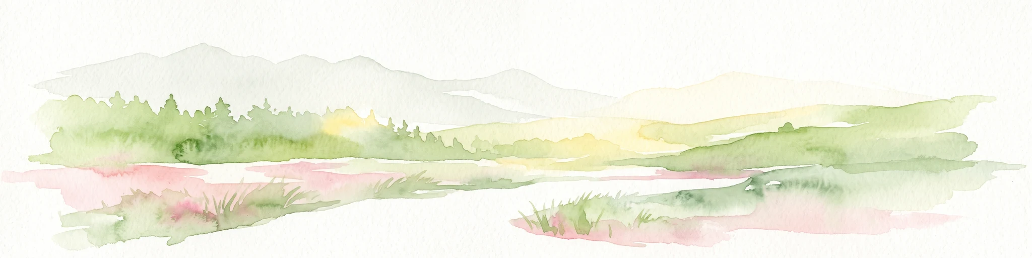
Watercolor painting of a rolling rural landscape with distant purple hills, green meadows, and trees, with a soft yellow sky.
Nature reserveNordrhein-Westfalen
About 5.7 km away#2 closest

North

Naturschutzgebiet Oelingrather und Grunder Bachtal: Regional Valley Conservation Atlas

Deep-dive into the stream networks of Nordrhein-Westfalen

Naturschutzgebiet Oelingrather und Grunder Bachtal is defined by its two parallel V-shaped valleys and diverse aquatic habitats. This reserve preserves a vital mosaic of wet meadows, nutrient-poor grasslands, and deciduous forests that function as an essential stepping-stone within the regional ecological network of the Bergisches Land.

Area
0.222 km²
Established
2003
IUCN
IV
Relief
Upland
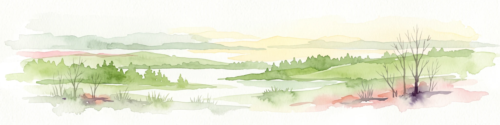
A wide watercolor illustration showing a winding river flowing through a green valley with pink and purple flowers in the foreground and soft yellow hills in the background.
Nature reserveNordrhein-Westfalen
About 5.7 km away#3 closest

North

Leyerbachtal Nature Reserve: A Protected Valley and Industrial Heritage Site in Remscheid

An alluvial landscape and low-mountain stream corridor in Germany

Leyerbachtal serves as a vital protected corridor featuring a meandering brook, expansive gravel banks, and species-rich wet meadows. Located in the heart of the Bergisches Land, this nature reserve integrates high-value ecological habitats with the historic industrial remnants of Remscheid's water-powered past.

Area
0.151 km²
Established
2003
IUCN
IV
Nature reserveNordrhein-Westfalen
About 9.4 km away#4 closest

Northeast

Wilhelmsthaler und Haller Bachtal Nature Reserve: Bergisches Land Landscape and Map

A study of protected stream valleys and habitat mosaics in North Rhine-Westphalia.

Located in Remscheid, the Wilhelmsthaler und Haller Bachtal nature reserve protects a diverse array of interconnected stream-side and grassland habitats. This area demonstrates the ecological value of traditional valley landscapes in the Bergisches Land, providing essential connectivity for rare flora and local stream ecosystems through its unique relief and water corridors.

Area
0.103 km²
Established
2003
IUCN
IV
Relief
Upland
A horizontal watercolor illustration depicting rolling hills, forest patches, and a soft, hazy valley against a white background.
Nature reserveNorth Rhine-Westphalia
About 9.9 km away#5 closest

Southeast

Mausbachtal Nature Reserve in North Rhine-Westphalia: Protected Stream Valley and Forest Landscapes

Regional stream valley network and deciduous forest landscape

This protected area in the Oberbergischer Kreis offers a window into the Bergische Hochflächen topography. The reserve highlights a mosaic of near-natural beech forest, wet meadows, and floodplain woodland, forming an integral link in the regional stream network connected to the Große Dhünn.

Area
0.237 km²
Established
2013
IUCN
IV
Nature reserveOberbergischer Kreis
About 11 km away#6 closest

Northeast

Wupper bei Radevormwald: Protected River Valley and Riparian Woodland Geography

Nature reserve landscape in the Oberbergischer Kreis region

Wupper bei Radevormwald serves as a critical protected area within the Wupper river corridor, featuring a mosaic of beech-oak forests and floodplain alder stands. The reserve highlights the contrast between calm, impounded reaches and energetic, meandering water sections, providing an essential study of river valley morphology and natural recovery in the Bergisches Land.

Area
1.208 km²
Established
2003
IUCN
IV
Relief
Upland
A soft watercolor illustration of a green valley with a central stream or river winding through meadows towards distant hills.
Nature reserveOberbergischer Kreis
About 11 km away#7 closest

East

Leiverbachtal und Talhänge: Protected Stream Valley and Forest Habitat in Oberbergischer Kreis

Examining the geography of a Bergisches Land nature reserve

Leiverbachtal und Talhänge stands as a significant nature reserve within the Oberbergischer Kreis, defined by its near-natural meandering stream and diverse riparian ecosystem. The site offers a detailed look at floodplain meadows, slope forest transitions, and the ongoing shift toward broadleaf woodland within the German Mittelgebirg landscape.

Area
0.92 km²
Established
2006
IUCN
IV
Relief
Upland
Nature reserveNorth Rhine-Westphalia
About 11 km away#8 closest

East

Wupperaue bei Westenbrücke Nature Reserve Landscape and Geographic Mapping

Protected riparian floodplain in the Oberbergischer Kreis

This nature reserve protects a vital 2.3 kilometer segment of the Wupper river valley. Its landscape is characterized by a mosaic of wet meadows, alder and willow stands, and riparian corridors, providing a crucial stepping-stone habitat within the Hückeswagen area of North Rhine-Westphalia.

Area
0.318 km²
Established
2013
IUCN
IV

Common questions about visiting, size, designation, and location context for Orchideenwiese bei Heintjeshammer Nature Reserve

Orchideenwiese bei Heintjeshammer Nature Reserve FAQs for park facts, access, geography, and protected area context

Find quick answers about Orchideenwiese bei Heintjeshammer Nature Reserve, including protected-area facts, park geography, trail and visitor context, and how the park fits into its surrounding country and regional landscape.
MoriAtlas Explorer

Continue Your Protected Areas Search Across the Global Atlas

Deepen your exploration by continuing the structured search for national parks and protected areas worldwide. Utilize the comprehensive filtering capabilities to compare different conservation landscapes and refine your understanding of global park geography. Discover more about the distribution and characteristics of protected natural areas.

Global natural geography