
Mori Atlas logo
Nature reserveNaturschutzgebiet Perlenbach-Fuhrtsbachtal

A detailed geographic study of rare wetland habitats and stream ecosystems in the northern Eifel.

Naturschutzgebiet Perlenbach-Fuhrtsbachtal: Protected Brook Valleys and Landscape Geography

(Naturschutzgebiet Perlenbach-Fuhrtsbachtal-Talsystem)

Naturschutzgebiet Perlenbach-Fuhrtsbachtal comprises a complex of deeply incised stream valleys within the North Rhine-Westphalia region of Germany. This protected landscape is defined by its humid microclimate, supporting extensive wet meadows, relict beech forest fragments, and critical freshwater habitats. The terrain, characterized by narrow, sinuous valleys and quartz-rich slate geology, provides a essential sanctuary for specialized botanical populations and rare freshwater species.

nature reservebrook valleywet meadowfen and bogwild narcissusfreshwater pearl mussel
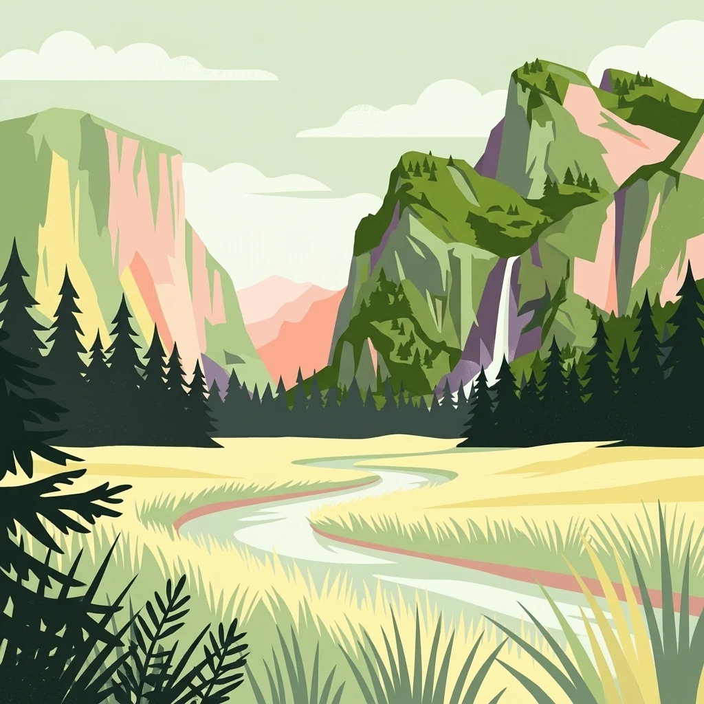
A flat-style digital illustration showing a winding river through a grassy valley, flanked by evergreen forests and steep mountain cliffs with a waterfall.

Naturschutzgebiet Perlenbach-Fuhrtsbachtal

Nature reserve

Park overview

Structured park overview, official facts, and landscape profile for Perlenbach-Fuhrtsbachtal Nature Reserve

Perlenbach-Fuhrtsbachtal Nature Reserve park facts, protected area profile, and essential visitor context

Review the core facts for Perlenbach-Fuhrtsbachtal Nature Reserve, including designation, size, terrain, visitor scale, habitats, and operating context in one park-focused overview.

About Perlenbach-Fuhrtsbachtal Nature Reserve

The Perlenbach-Fuhrtsbachtal-Talsystem is a nature reserve in the northern Eifel that conserves one of the region's most distinctive valley landscapes. It is built around two parallel brook valleys, the Perlenbach and the Fuhrtsbach, which cut narrow, winding courses through an elevated plateau at the western edge of the Monschauer-Hellentaler Waldhochfläche. Although the protected area is modest in size, it packs in a remarkable variety of habitats; spring fens, sedge and reed beds, wet meadows, matgrass and small bent grasslands, fragments of heath, broom-foxtail meadows, and patches of fen woodland all occur within a few kilometers.

What sets the reserve apart is its unusually cool and humid microclimate. Tucked against the Elsenborn military training area, a restricted zone that has effectively shielded the valleys from intensive agriculture, reforestation, and settlement, the brooks course through a continually shaded, ground-water-influenced landscape with annual mean temperatures of just 6 to 6.5 degrees Celsius. These conditions support a flora and fauna that, in much of western Germany, has long since disappeared.

The reserve is also an important cultural-historical landscape. Its meadows were maintained for centuries through a traditional system of brook-fed meadow irrigation, known as Flüxgräben, which fertilized the hay fields with nutrient-rich spring water and allowed a delayed mid-summer hay cut. The collapse of this practice after the introduction of mineral fertilizers, combined with extensive spruce planting, transformed the landscape in the 20th century and eventually triggered large-scale restoration starting in 1980, when conservation workers removed spruce and re-introduced alders along the streams.

Quick facts and research context for Perlenbach-Fuhrtsbachtal Nature Reserve

The Perlenbach-Fuhrtsbachtal Nature Reserve lies within the Städteregion Aachen in North Rhine-Westphalia, near the town of Monschau and east of the village of Kalterherberg. It was designated as a German nature reserve (Naturschutzgebiet) in 1976 and is also classified as a Natura 2000 site under the EU Habitats Directive.

Most of the area sits between roughly 465 and 615 meters above sea level on the Monschau-Hellental forested upland plateau. Two parallel, narrow stream valleys, each about five kilometers long, form the core of the protected landscape. The underlying geology consists of Lower Devonian slates, primarily quartz-bearing clay slates of the Rurberg layers, yielding acidic brown soils that shift into gleyed soils near the streams.

Protection and recognition

Documented terrestrial protection metrics and official conservation data

Naturschutzgebiet Perlenbach-Fuhrtsbachtal Protection Status and Scope

Naturschutzgebiet Perlenbach-Fuhrtsbachtal maintains a registered terrestrial protection scope within international conservation databases. Structured records assemble verified designation parameters and management metadata for geographical analysis.

Protection details

Protection scope
Terrestrial
Transboundary protection
No
WDPA ID
82312
Park context

Deeper park guide and search-rich context for Perlenbach-Fuhrtsbachtal Nature Reserve

Perlenbach-Fuhrtsbachtal Nature Reserve history, landscape, wildlife, and travel context

Explore Perlenbach-Fuhrtsbachtal Nature Reserve through its history, landscape character, ecosystems, wildlife, conservation priorities, cultural context, and seasonal travel timing in a structured park guide built for atlas discovery and search intent.

Why Perlenbach-Fuhrtsbachtal Nature Reserve stands out

The reserve is best known for its annual narcissus bloom, when more than 10 million wild Narcissus pseudonarcissus flower across damp meadows from late March to mid-May. Only the Hunsrück in Germany offers comparable populations of this species, making the valley a focal point of national botanical interest. It is equally renowned for its cold, humid microclimate, which preserves relict populations of ice-age butterflies such as the violet copper and the bog fritillary. The valleys host the only surviving freshwater pearl mussel population in North Rhine-Westphalia, a species that has vanished from most of its former Central European range.
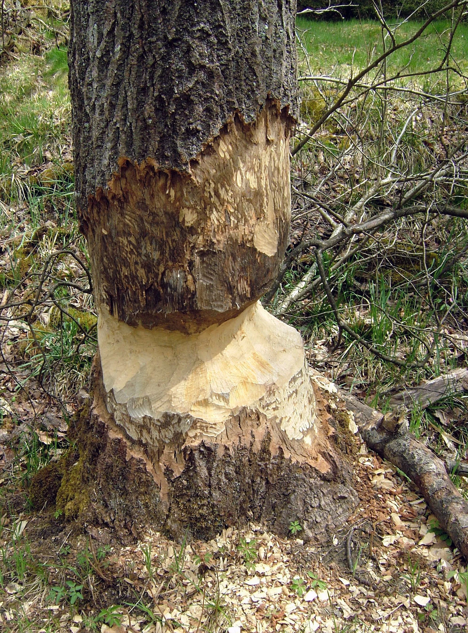
A close up view of a tree trunk showing heavy gnaw marks made by a beaver, with wood chips scattered at the base.
A tree trunk showing distinctive gnaw marks from beaver activity in the Perlenbach Valley.

Perlenbach-Fuhrtsbachtal Nature Reserve history and protected-area timeline

Before any documented human use, the Perlenbach and Fuhrtsbach valleys were covered in beech forest. That forest was likely cleared as early as the 12th century, opening the valley floors to long-term agricultural use that persisted for more than 600 years. Farmers developed an elaborate meadow irrigation network, the Flüxgräben system, which diverted nutrient-rich brook water from the upper catchment across the lower meadows in spring. This technique supported a delayed hay harvest in July and kept much of the valley free from grazing disturbance for most of the year.

The traditional land-use system unraveled after around 1950. The widespread availability of mineral fertilizers made lowland hay production far more efficient than flooded mountain meadows, and farmers abandoned the labor-intensive Flüxgräben regime. Spruce, first planted in pre-war Prussia and again after the Second World War, increasingly colonized the valley. Dense spruce stands shaded out the original vegetation along the brook courses and drove the meadows and their associated wildlife into retreat.

In response, the valleys of the Perlenbach and Fuhrtsbach were formally designated as a nature reserve in 1976. Beginning in 1980, staff from the Nordeifel Nature Park and the NRW-Stiftung Naturschutz, Heimat und Naturpflege began large-scale restoration, clearing spruce from the valley bottoms and replanting alder along the streambeds in an effort to return the brooks to a more natural, open state. These efforts were subsequently reinforced by inclusion of the Perlenbach valley in the European Natura 2000 network.

Perlenbach-Fuhrtsbachtal Nature Reserve landscape and geographic character

The topography of the reserve is shaped by two deeply incised, relatively narrow valleys that descend through the gently undulating forested plateau east of Monschau. The valleys themselves are only about 25 to 100 meters wide but extend in sinuous curves for roughly five kilometers each. Elevations range from about 465 meters near the brooks to roughly 615 meters on the surrounding upland, producing noticeable cold-air pooling and persistent ground moisture even in midsummer.

The geology is uniformly Lower Devonian, dominated by quartz-bearing clay slates of the Middle and Upper Rurberg layers, with occasional sandstone bands. The Fuhrtsbach valley additionally cuts through the dark, almost black slates of the Wüstebach layers. These bedrock types weather into acidic brown soils on the slopes, which transition into gleyed, waterlogged soils close to the streams. The combination of acid substrates, cool air drainage, and continuously seeping groundwater defines the valley's character and strongly influences its vegetation.
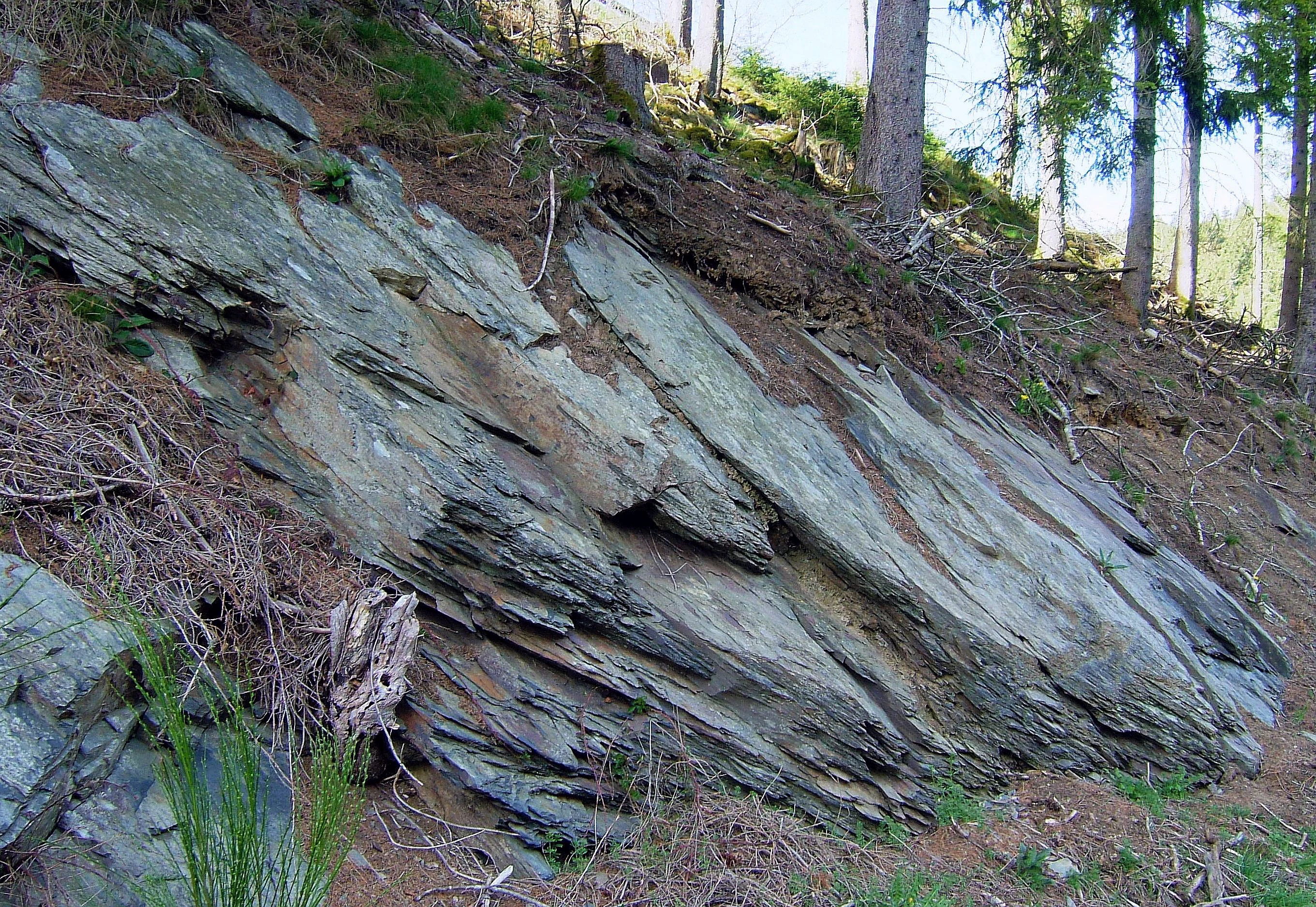
A close view of a layered clay slate rock formation emerging from a forested hillside.
A clay slate rock outcrop exposed on a hillside in the Perlenbach valley.

Perlenbach-Fuhrtsbachtal Nature Reserve ecosystems, habitats, and plant life

Vegetation in the reserve follows the moisture gradient from stream edge to dry slope in tightly nested zones. Directly along the brooks, wet meadows and sedge- and reed-dominated communities prevail, often marked by stands of bistort, the principal host plant for several of the reserve's rarest butterflies.

Further from the streams, the floodplain transitions into montane meadows of the Bärwurzwiesen type, locally distinguished by massive populations of yellow wild narcissus. In drier, nutrient-poor valley sections, matgrass and small bent grasslands appear, and small remnants of upland heath and ryegrass-clover pasture vegetation are still recognizable. On permanently waterlogged depressions, transitional floating mats and raised-bog fragments persist, while isolated pockets of fen woodland occupy the wettest ground. Across the full mosaic, roughly 360 fern and flowering plant species have been recorded, including the high-mountain roll fern, Cryptogramma crispa, which is otherwise rare outside the Alps, and the only known North Rhine-Westphalian population of Vicia orobus.
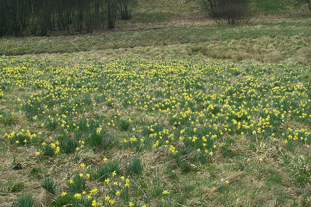
A wide shot of a sloping meadow filled with many small yellow wild daffodils amidst green and dried grasses, with a line of dark trees in the background.
A field of wild yellow daffodils blooming in the Naturschutzgebiet Perlenbach-Fuhrtsbachtal.

Perlenbach-Fuhrtsbachtal Nature Reserve wildlife and species highlights

The Perlenbach-Fuhrtsbachtal system supports an exceptionally rich freshwater fauna centered on the two brooks. The meandering stream channels and gravel beds host at least 45 snail and mussel species, including the freshwater pearl mussel (Margaritifera margaritifera), whose population here is the last surviving in North Rhine-Westphalia, and Dunker's spring snail (Bythinella dunkeri), another highly threatened mollusk. Seven native fish species have been documented, among them European grayling, brook trout, Eurasian minnow, loach, bullhead, and the brook lamprey.

Above the water, butterflies are a particular conservation focus. More than 35 day-flying species have been recorded, including the violet copper (Lycaena helle), the bog fritillary (Boloria eunomia), and the scarce copper (Lycaena hippothoe). Both copper species are regarded as ice-age relicts, tied to the valley's perpetually cool and humid climate and to the presence of their bistort host plants.

Twelve or more dragonfly and damselfly species inhabit the streamside vegetation, including the beautiful demoiselle and the golden-ringed dragonfly. Amphibians and reptiles are represented by at least nine species, including the viviparous lizard. Birds are abundant; 80 breeding or regularly occurring bird species have been recorded, including the white-throated dipper, the European kingfisher, and the willow tit, while more than 40 mammal species are present, ranging from Geoffroy's bat, Natterer's bat, and the brown long-eared bat to wildcat and, since around 2000, the Eurasian beaver.
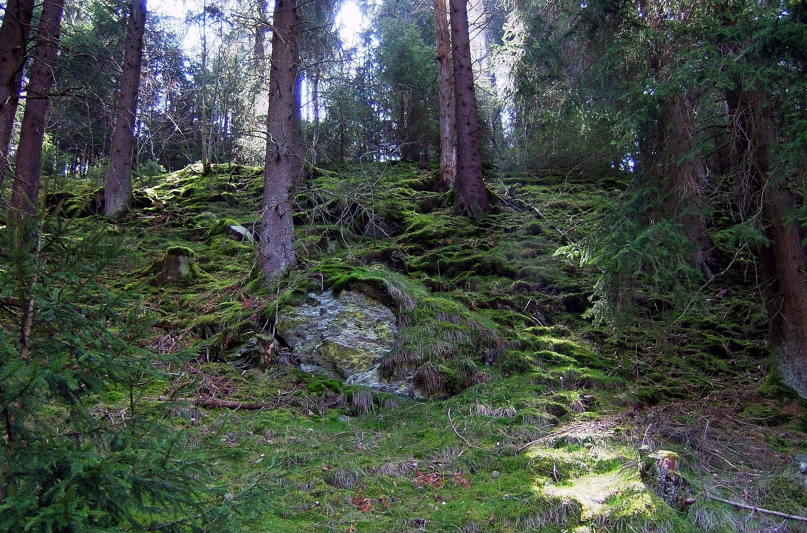
A sloped forest floor covered in green moss with tall coniferous trees and a large exposed rock formation.
A mossy hillside within the Perlenbach valley, characteristic of the protected landscape.

Perlenbach-Fuhrtsbachtal Nature Reserve conservation status and protection priorities

The reserve's primary conservation significance lies in the protection of cool, groundwater-fed valley habitats that have largely vanished from intensively used parts of western Germany. Its status as both a national nature reserve (Naturschutzgebiet) and a Natura 2000 site under the EU Habitats Directive imposes binding protection requirements on habitat types and species listed in the directive's annexes.

Conservation targets explicitly identified include the maintenance and recovery of running waters with submerged vegetation, matgrass grasslands of the low mountain ranges, tall oat-grass and great burnet-sila meadows, mountain hay meadows, transition mires and quaking bogs, siliceous cliff communities with fissure vegetation, and bog woodland. Active restoration measures that began in 1980, particularly the removal of spruce and the reintroduction of alder along the streams, continue to define the reserve's management approach alongside mowing regimes that maintain the open meadow character.

Species-level conservation work focuses on the freshwater pearl mussel, Dunker's spring snail, the violet copper, bog fritillary, wild narcissus, and a small suite of bats and breeding birds. The reserve's isolated location, abutting the restricted Elsenborn military training area, has historically been a key factor in its preservation and remains central to its long-term conservation value.

Perlenbach-Fuhrtsbachtal Nature Reserve cultural meaning and human context

The valley landscape of the Perlenbach and Fuhrtsbach carries a distinct cultural imprint from centuries of small-scale, labor-intensive meadow farming. The traditional Flüxgräben irrigation system, in which brook water was channeled across hay meadows to enrich the soil and delay the hay harvest to midsummer, shaped both the vegetation and the human rhythm of life in the valley for hundreds of years.

In modern times, the reserve's proximity to the Elsenborn military training area has had an equally important cultural impact. Public access to the upper brook sources is restricted during exercises, a fact that has unintentionally reinforced the protection of headwater habitats but also requires careful coordination between conservation, tourism, and military use. Widespread hiking routes and informational signage along the reserve's borders guide visitors safely around the active training zones.

Top sights and standout views in Perlenbach-Fuhrtsbachtal Nature Reserve

The Perlenbach-Fuhrtsbachtal is exceptional in combining three things in a single compact area: an extraordinarily rich brook ecosystem with relict freshwater species, one of Germany's two great wild narcissus meadows, and a sheltered valley microclimate that still supports ice-age relict butterflies. The combination of active restoration since 1980, formal protection since 1976, and the buffer effect of a neighboring military training area has produced a site of disproportionately high biodiversity value for its size.

Equally notable is the reserve's role as a refuge for the freshwater pearl mussel in North Rhine-Westphalia and as a serene springtime destination where visitors can witness one of central Europe's largest wild narcissus displays.

Best time to visit Perlenbach-Fuhrtsbachtal Nature Reserve

The dramatic seasonal highlight of the Perlenbach-Fuhrtsbachtal is the narcissus bloom, which typically runs from late March through mid-May and turns the valleys into an extensive carpet of wild yellow flowers. Visits at this time should follow the marked trails; leaving the paths can damage the meadows and is discouraged. Because the narcissus meadows are the reserve's main drawing card, late spring is by far the busiest period and visitors should expect crowded trailheads.

Outside this window, late spring into early autumn remains rewarding for those interested in the streams themselves, drift moors, woodland margins, and the reserve's rich bird and insect life. Cool, wet days are particularly good for spotting dippers, kingfishers, and dragonflies along the brooks; freezing conditions or military exercises in the adjacent Elsenborn training area can restrict access to some trails.


Monthly climate preview

Long-term representative point measurements for temperature and precipitation rhythm

Naturschutzgebiet Perlenbach-Fuhrtsbachtal Climate Normals and Annual Weather Patterns

Representative coordinate records show measured annual temperature swings alongside steady monthly precipitation averages across the protected site. Reviewing these multi-year climate normals provides essential baseline context before opening the full twelve-month weather profile.
Annual mean8 °C
0 °C17 °C
Jan
Feb
Mar
Apr
May11°
Jun15°
Jul17°
Aug17°
Sep13°
Oct
Nov
Dec
Warmest month
July

17 °C

Coolest month
January

-0 °C

Wettest month
December

3.1 mm/day

Driest month
April

1.9 mm/day

Park location guide

Geography guide, regional context, and park location map for Perlenbach-Fuhrtsbachtal Nature Reserve

Perlenbach-Fuhrtsbachtal Nature Reserve park geography, regions, and map view in Germany

Understand where Perlenbach-Fuhrtsbachtal Nature Reserve sits in Germany through a broader geographic reading of the surrounding landscape, nearby location context, and its mapped position within the national park landscape.

How Perlenbach-Fuhrtsbachtal Nature Reserve fits into Germany

Germany is a federal republic in Western and Central Europe with a population of over 83 million across sixteen constituent states. It is Europe's largest economy by nominal GDP and a major global exporter and importer. The capital is Berlin, and the country borders Denmark, Poland, Czech Republic, Austria, Switzerland, France, Luxembourg, Belgium, and the Netherlands.

Wider geography shaping Perlenbach-Fuhrtsbachtal Nature Reserve in Germany

Germany is located in Western and Central Europe, spanning 357,022 km². It borders Denmark to the north, Poland and the Czech Republic to the east, Austria and Switzerland to the south, and France, Luxembourg, Belgium, and the Netherlands to the west. The country has coastlines on the Baltic Sea and North Sea to the north, with the Alps located in the southern region.

Map view of Perlenbach-Fuhrtsbachtal Nature Reserve

Use this park location map to pinpoint Perlenbach-Fuhrtsbachtal Nature Reserve in Germany, understand its exact geographic position, and read its mapped placement within the surrounding landscape more clearly.

Pigeon | © OpenStreetMap contributors

Location context for Perlenbach-Fuhrtsbachtal Nature Reserve

Nordrhein-Westfalen
Recorded earthquake history

Explore Documented Seismic History Near Naturschutzgebiet Perlenbach-Fuhrtsbachtal

Review the historical collection of recorded earthquake events associated with the geographic boundaries of Naturschutzgebiet Perlenbach-Fuhrtsbachtal. This MoriAtlas dataset provides event parameters such as epicentre location and magnitude to support deeper understanding of the regional seismic record.

Naturschutzgebiet Perlenbach-Fuhrtsbachtal Earthquake History

Catalogued events

52 events

Strongest magnitude

Magnitude 4.8

Most recent event

Nov 25, 2007

This history includes earthquakes recorded inside the park or within 50 km of its borders

Visualizing the protected valley habitats, stream environments, and terrain character

Naturschutzgebiet Perlenbach-Fuhrtsbachtal Photos and Landscape Scenery

Photographic records reveal the intricate terrain, steep valley slopes, and damp meadow habitats defining Naturschutzgebiet Perlenbach-Fuhrtsbachtal. Visualizing these protected ecosystems clarifies the unique microclimate, stream networks, and rare botanical displays shaping the landscape.

A close up view of a tree trunk showing heavy gnaw marks made by a beaver, with wood chips scattered at the base.

A cluster of yellow wild daffodils in bloom growing in a grassy meadow.

A close view of a layered clay slate rock formation emerging from a forested hillside.

A wide shot of a sloping meadow filled with many small yellow wild daffodils amidst green and dried grasses, with a line of dark trees in the background.

A sloped forest floor covered in green moss with tall coniferous trees and a large exposed rock formation.

A small, winding river flowing through a grassy meadow with a dense coniferous forest in the background.

Park atlas

Compare nearby regional nature reserves and connected valley ecosystems across the Eifel uplands

Other Parks Near Naturschutzgebiet Perlenbach-Fuhrtsbachtal and Surrounding Protected Areas

Browse protected areas near Naturschutzgebiet Perlenbach-Fuhrtsbachtal to examine similar low mountain terrain, cool valley microclimates, and regional stream habitats. Comparing adjacent reserves expands geographical context and reveals broader conservation patterns across the surrounding landscape.
Watercolor illustration of rolling green hills and meadows with patches of pink and yellow flowers
National parkNorth Rhine-Westphalia
Park boundaries overlap#1 closest

Northeast

Eifel National Park: North Rhine-Westphalia Protected Area Atlas

Explore mapped boundaries and regional geography.

Gain a structured understanding of Eifel National Park, a key protected area within Germany's North Rhine-Westphalia region. This page focuses on its geographic identity, detailing mapped boundaries and offering context within the state's broader natural landscapes. MoriAtlas enhances your exploration by presenting Eifel National Park as a distinct entity within a larger geographic framework, ideal for atlas-based research and understanding protected land distribution.

Area
107 km²
Established
2004
IUCN
II
Relief
Upland
Protected landscapeBelgium
About 1.1 km away#2 closest

East

Hohes Venn, Eifel Nature Park: A Protected Landscape in Belgium for Geographic Atlas Exploration

Explore mapped natural terrain and protected area details.

The Hohes Venn, Eifel Nature Park in Belgium represents a key protected landscape for atlas and geographic discovery. This entry focuses on the park's specific identity, its geographic setting within Belgium, and the value it holds for users interested in mapped terrain and protected area exploration. Understand the landscape context and the detailed geographic information available for this significant natural area, supporting structured learning about Belgium's conservation efforts.

IUCN
V
A pale, minimalist watercolor painting showing a soft-focus landscape with green trees in the foreground, rolling hills in the background, and hints of pink in the foreground foliage.
Protected areaGermany
About 2 km away#3 closest

Northeast

Holderbachtal, Dürholderbachtal: Protected Area Geography and Landscape Mapping in Germany

Integrated stream valley and wetland habitat analysis

Holderbachtal, Dürholderbachtal covers 187 hectares of diverse terrain in Germany, blending alder swamp forests with species-rich grasslands. This protected area offers deep insight into the valley-bound ecology and hydrological characteristics that define the Eifel region. Explore the connection between the primary stream systems, spring mires, and the surrounding woodland mosaic in this structured geographic overview.

A soft watercolor illustration of a rolling green landscape with flowering trees and distant forested hills, isolated on a white background.
Nature reserveNordrhein-Westfalen
About 2.2 km away#4 closest

North

Kluckbachtal Nature Reserve: Geographic Atlas and Protected Stream Valley Overview

Mapped riparian forest and orchard meadow habitats in Nordrhein-Westfalen

Kluckbachtal protects a distinctive valley segment between Rohren and Höfen, featuring a complex of stream beds, wet grasslands, and old oak and alder woodland. This nature reserve is recognized for its significant role in preserving Red List species and traditional cultural landscapes, offering a detailed look at the ecology of the northern Eifel region through its varied habitats.

Area
1.13 km²
Established
1997
IUCN
IV
Relief
Upland
Nature reserveNordrhein-Westfalen
About 2.9 km away#5 closest

East

Wüstebachtal Nature Reserve: Protected Eifel Valley and Wetland Landscapes

Hydrological geography and upland meadow ecosystems in Nordrhein-Westfalen

Wüstebachtal represents a quintessential Eifel nature reserve where the convergence of flowing stream corridors and species-rich meadows creates a unique habitat for threatened flora. This protected area focuses on the conservation of the Wüstebach valley, maintaining vital connections between alpine-style meadow communities and forest-fringed wetlands within the North Rhine-Westphalia region.

Area
0.834 km²
Established
1997
IUCN
IV
A horizontal watercolor painting showing a soft, stylized landscape with rolling green hills, distant purplish ridges, and grassy foreground elements on a white background.
Nature reserveNordrhein-Westfalen
About 3.8 km away#6 closest

Northeast

Mittleres Rurtal mit den Felsbildungen der Perdsley und Wiselsley Protected Nature Reserve Map

Exploring the Rur valley river dynamics and cliff geology

Investigate the topographical features of the Mittleres Rurtal mit den Felsbildungen der Perdsley und Wiselsley, a critical nature reserve characterized by free flowing river segments and steep ravine forests. This overview outlines the ecological distribution of rock formations and riparian habitats across the Monschau region landscape.

Area
1.33 km²
Established
2003
IUCN
IV
A watercolor painting depicting a soft, panoramic landscape of a meandering stream valley with rolling hills, meadows, and scattered patches of trees.
Nature reserveNordrhein-Westfalen
About 4.1 km away#7 closest

North

Kleines Laufenbachtal Nature Reserve: Geographic Atlas of an Eifel Stream Valley

Protected brook habitats and natural rock landscapes in North Rhine-Westphalia

Investigate the topographical features and habitat diversity of Kleines Laufenbachtal, an established nature reserve in the Eifel. This protected area showcases a dense assembly of wet grasslands, reed banks, and rocky slopes that anchor local ecological corridors within the Monschau landscape.

Area
0.13 km²
Established
1997
IUCN
IV
Watercolor painting of a soft, hazy landscape featuring rolling hills and marshy wetlands in muted green and yellow tones.
Nature reserveNorth Rhine-Westphalia
About 8 km away#8 closest

North

Kalltal Nature Reserve: Protected Stream Valley and Eifel Landscape in North Rhine-Westphalia

Ecological corridor with rare bog habitats and wet meadows.

Kalltal protects a stretch of the Kall stream, creating a haven for moisture-dependent plant species and wildlife within the Monschau municipality. Its terrain is defined by soft wet grasslands, peat-rich depressions, and small forest patches that form an intact ecological refuge within the broader German landscape.

Area
0.545 km²
Established
1998
IUCN
IV

Common questions about visiting, size, designation, and location context for Perlenbach-Fuhrtsbachtal Nature Reserve

Perlenbach-Fuhrtsbachtal Nature Reserve FAQs for park facts, access, geography, and protected area context

Find quick answers about Perlenbach-Fuhrtsbachtal Nature Reserve, including protected-area facts, park geography, trail and visitor context, and how the park fits into its surrounding country and regional landscape.
MoriAtlas Explorer

Continue Your Protected Areas Search Across the Global Atlas

Deepen your exploration by continuing the structured search for national parks and protected areas worldwide. Utilize the comprehensive filtering capabilities to compare different conservation landscapes and refine your understanding of global park geography. Discover more about the distribution and characteristics of protected natural areas.

Global natural geography