
Mori Atlas logo
Nature reserveNaturschutzgebiet Schluchtwald bei Hundesossen

Mapped boundaries and ecological context for a significant forest reserve in Nordrhein-Westfalen

Naturschutzgebiet Schluchtwald bei Hundesossen: A Protected Ravine Forest and Regional Landscape

Naturschutzgebiet Schluchtwald bei Hundesossen represents a critical protected landscape within the Lenne valley of the German uplands. This reserve preserves a structurally complex mosaic of European beech forest and ravine vegetation, situated on steep, rugged slopes near Schmallenberg. Its location within the Natura 2000 network highlights its importance for maintaining rare spring-fed habitats and specialized forest biodiversity across the broader Sauerland region.

ravine forestbeech forestSchluchtwaldNatura 2000FFH sitenature reserve
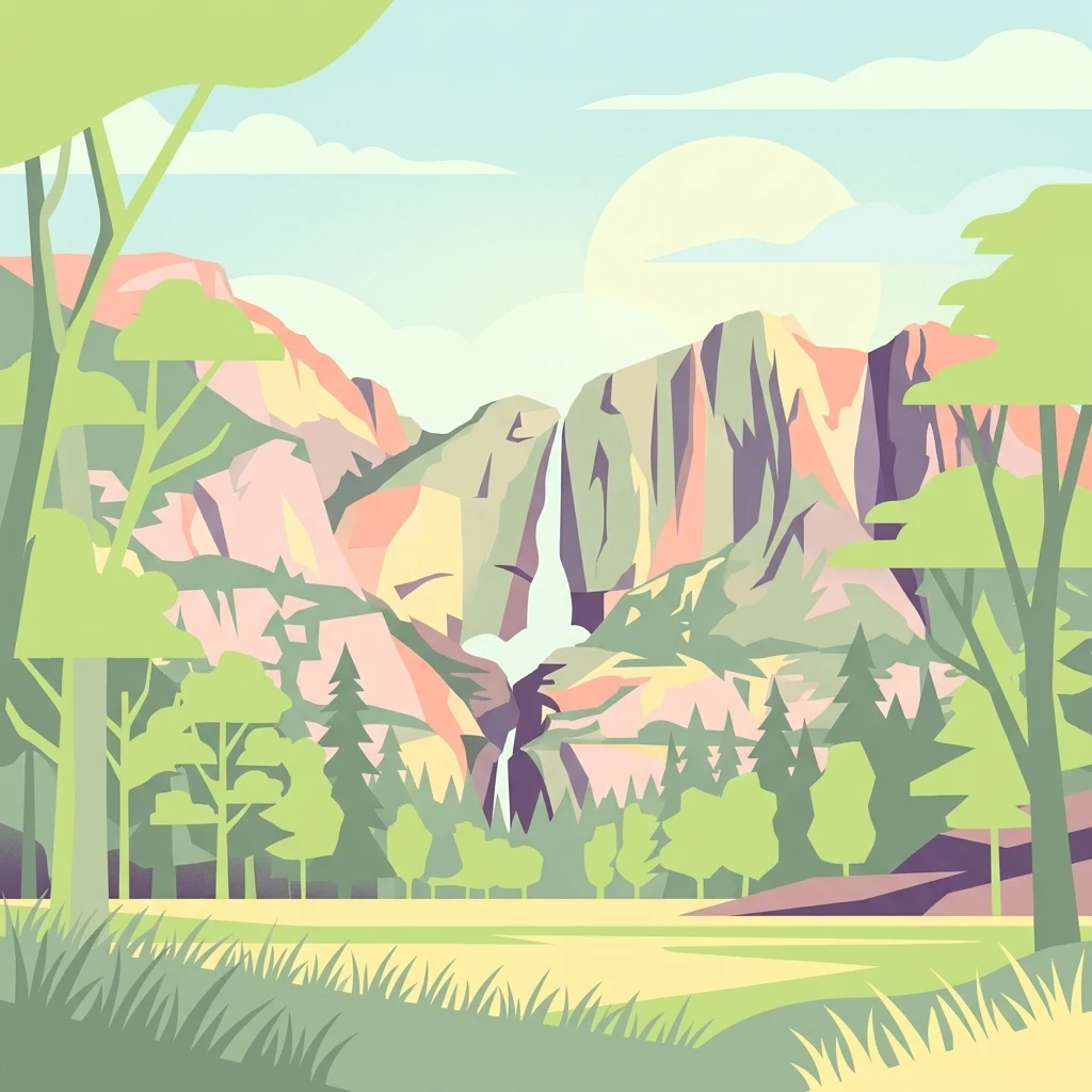
An artistic, flat-style digital illustration showing a valley with a waterfall cascading down steep rocky cliffs, framed by foreground trees and grassy meadows.

Naturschutzgebiet Schluchtwald bei Hundesossen

Nature reserve

Park overview

Structured park overview, official facts, and landscape profile for Schluchtwald bei Hundesossen Nature Reserve

Schluchtwald bei Hundesossen Nature Reserve park facts, protected area profile, and essential visitor context

Review the core facts for Schluchtwald bei Hundesossen Nature Reserve, including designation, size, terrain, visitor scale, habitats, and operating context in one park-focused overview.

About Schluchtwald bei Hundesossen Nature Reserve

The Schluchtwald bei Hundesossen Nature Reserve protects one of the more typical examples of gorge and beech forest remaining in the Rothaargebirge foothills of the Sauerland. Although the area is small, roughly 30 hectares, its ecological character is shaped by the rugged terrain of the Lenne river valley, where steep slopes, narrow ravines, and persistent springs create the cool, humid microclimate that ravine forests require.

Woodland is the overwhelming land cover of the reserve. European beech dominates the canopy, complemented on shaded slopes by the structurally complex, multi-layered stands typical of Schluchtwald. This forest type is defined less by a single tree species than by the way terrain, moisture, and shade combine to support a distinctive community of ferns, mosses, and moisture-loving herbs on the forest floor. The reserve's geography, with its combination of steep forested slopes and small spring channels, sustains exactly these conditions.

Beyond its forest character, the site forms part of the broader Natura 2000 network through the Schluchtwald bei Saalhausen Site of Community Importance, connecting it functionally to wider European conservation efforts for beech-dominated habitats. For visitors, researchers, and conservation managers interested in the heritage forest landscape of the Rothaargebirge, the reserve offers an accessible, well-documented case study of how small protected patches contribute to the preservation of rare forest types across central Europe.

Quick facts and research context for Schluchtwald bei Hundesossen Nature Reserve

The Schluchtwald bei Hundesossen Nature Reserve is a roughly 30-hectare forest reserve in the Sauerland region of western Germany. It is located in the Hochsauerland district of North Rhine-Westphalia, within the municipal area of Schmallenberg, south of the locality of Hundesossen. The reserve was formally designated in 2008 as part of the Schmallenberg Südost landscape plan.

The protected area lies fully inside the Schluchtwald bei Saalhausen Natura 2000 site, covering approximately 35 hectares, making it part of the European Union's Natura 2000 network of habitat-protected areas. The site is catalogued as HSK-530 in the North Rhine-Westphalian nature conservation register and is classified as an IUCN Category IV habitat and species management area. Its dominant vegetation is mixed beech and gorge forest, and it supports rare species associated with springs and shaded woodland environments.

Protection and recognition

Review documented terrestrial protection scope and official administrative records for Naturschutzgebiet Schluchtwald bei Hundesossen.

Naturschutzgebiet Schluchtwald bei Hundesossen Protection Status and Terrestrial Designation Facts

Comprehensive protected area records compile the documented terrestrial protection status and administrative designation details for Naturschutzgebiet Schluchtwald bei Hundesossen. Structured conservation entries examine the formal management scope and verified international recognition sources associated with this protected landscape.

Protection details

Protection scope
Terrestrial
Transboundary protection
No
WDPA ID
389893
Park context

Deeper park guide and search-rich context for Schluchtwald bei Hundesossen Nature Reserve

Schluchtwald bei Hundesossen Nature Reserve history, landscape, wildlife, and travel context

Explore Schluchtwald bei Hundesossen Nature Reserve through its history, landscape character, ecosystems, wildlife, conservation priorities, cultural context, and seasonal travel timing in a structured park guide built for atlas discovery and search intent.

Why Schluchtwald bei Hundesossen Nature Reserve stands out

The reserve is best known for preserving a structurally rich example of Schluchtwald, the steep-slope ravine beech forest characteristic of sheltered valley topography in central European uplands. Its mosaic of mature beech stands, shaded ravine slopes, and spring-fed microhabitats makes it a representative benchmark for this rare forest type in the Sauerland. The site is also recognized for holding a population of the Dunker spring snail (Bythinella dunkeri), a small, narrowly distributed mollusc restricted to clean calcareous and low-pollution spring environments. The presence of this specialist species, alongside characteristic herb-layer plants such as Lunaria rediviva, the perennial honesty, gives the reserve particular botanical and faunistic interest beyond its modest size.
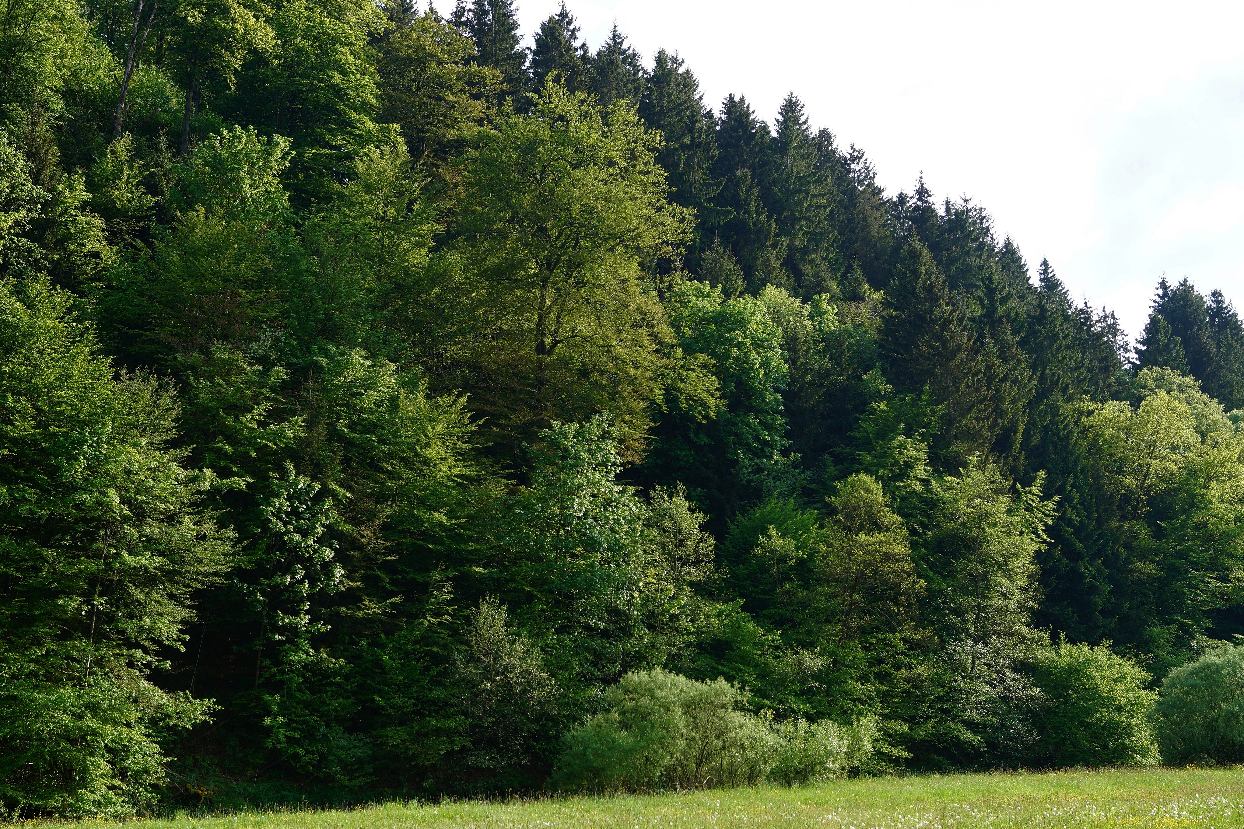
A thick forest with a mix of deciduous and coniferous trees covering a hillside above a grassy meadow.
The dense forest landscape at the Naturschutzgebiet Schluchtwald bei Hundesossen.

Schluchtwald bei Hundesossen Nature Reserve history and protected-area timeline

The Schluchtwald bei Hundesossen Nature Reserve was formally designated in 2008 by the Hochsauerlandkreis, North Rhine-Westphalia's rural district authority, through the Schmallenberg Südost landscape plan, a binding planning instrument that defines protected areas and conservation objectives across the southeastern portion of the Schmallenberg municipal area. Its designation completed a broader pattern of nature reserves in the region aimed at retaining the structurally diverse forests, grasslands, and spring habitats of the Sauerland in the face of changing land use.

The reserve's later integration into the Schluchtwald bei Saalhausen Site of Community Importance, a slightly larger habitat protection zone that overlaps and fully encloses it, extended its conservation framework into the European Natura 2000 network. This means the reserve's protection is grounded both in national landscape planning and in European Union habitat conservation policy under the Habitats Directive.

Management of the area is carried out by the lower landscape authority of the Hochsauerlandkreis under the standard German approach to nature reserve protection, which emphasizes safeguarding rarity, special character, and natural beauty. In practice, the reserve's history since designation has been one of continued forest-focused protection rather than active restoration, reflecting the already high ecological value of the existing beech and gorge forest stands.

Schluchtwald bei Hundesossen Nature Reserve landscape and geographic character

The reserve occupies a steeply dissected section of the Lenne valley south of Hundesossen, in the southern part of the Rothaargebirge uplands. The terrain is shaped by the Lenne river and its small tributary ravines, producing a mosaic of narrow valleys, shaded slopes, rocky outcrops, and small spring seeps. Elevation in the area sits broadly in the mid-upland range, with the protected forest extending across slopes and valley shoulders rather than across flat lowland.

The defining landscape character is the Schluchtwald itself, a German designation for ravine and gorge forest found on steep, often north-facing slopes in central European uplands. These environments are typically dim, humid, and sheltered, with cooler air drainage and persistent soil moisture. Such conditions favour dense canopy cover, deep litter layers, and a luxuriant understorey of moisture-loving ferns and herbs, all of which give the reserve its distinctly enclosed, sheltered forest atmosphere.

The Lenne, a Sauerland tributary that eventually reaches the Ruhr, defines the western edge of the area and has carved the valley within which the reserve sits. Small, steep side ravines cutting back into the slopes contribute additional topographic complexity, supporting the spring systems and moisture gradients that underpin the site's biological interest.

Schluchtwald bei Hundesossen Nature Reserve ecosystems, habitats, and plant life

Ecologically, the reserve is defined by its stands of European beech and associated Schluchtwald communities. Mature beech dominates the canopy, with the understorey and herb layer shaped by the shaded, humid valley conditions. The result is a structurally layered, species-rich woodland more reminiscent of foothill and montane beech forests of central Europe than of the wider, more uniform beech woodlands once common further north.

The herb layer reflects the environmental gradients of the site. In the darker, moister parts of the forest, moisture-loving plants such as Alpine enchanter's nightshade, opposite-leaved golden saxifrage, wood stitchwort, and creeping buttercup dominate, alongside characteristic ferns including mountain male fern and beech fern. In slightly brighter or drier spots, bilberry and grove stigma earthnut contribute to the diversity. Honesty, a tall perennial herb associated with undisturbed beech and mixed montane forests, occurs in places in substantial stands.

Spring habitats add a further ecological layer. Where groundwater emerges along the slopes, specialised plants and animals adapted to clean, cold, oxygen-rich spring water occur. The combination of beech forest, ravine topography, and active springs produces a continuous gradient of humidity and shading that supports many microhabitats within a small area.

Schluchtwald bei Hundesossen Nature Reserve wildlife and species highlights

Wildlife interest in the reserve is closely tied to its spring habitats and humid ravine forest environment. The most notable faunal record is the Dunker spring snail, a small hydrobiid mollusc restricted to unpolluted calcareous or low-nutrient spring seeps. Its presence in the reserve indicates that water quality and hydrological conditions in the area's springs remain favourable, since the species is highly sensitive to disturbance, pollution, and habitat alteration.

Beetles, spring-dwelling invertebrates more broadly, and moisture-dependent forest species such as various ferns, mosses, and liverworts are likely to be the dominant wildlife groups highlighted in standard surveys of this type of habitat. Larger mammal species typical of beech-dominated forests elsewhere in the Rothaargebirge would find suitable habitat in the reserve's mature stands, while amphibians and other moisture-dependent fauna benefit from the cool, shaded spring environments. Detailed species inventories beyond the Dunker spring snail and the broader habitat types are not extensively documented in publicly available sources for this site.

Schluchtwald bei Hundesossen Nature Reserve conservation status and protection priorities

The reserve's conservation value lies in its representation of Schluchtwald, a forest type that has become increasingly scarce across much of central Europe as historical woodland cover has been reduced or altered. By protecting a structurally rich beech and gorge forest on steep valley slopes, the reserve helps safeguard a benchmark example of this habitat, including its associated species assemblages of ferns, moisture-loving herbs, and spring-dwelling fauna like the Dunker spring snail.

Integration into the Schluchtwald bei Saalhausen Site of Community Importance brings additional protections under the European Union's Natura 2000 framework. The Habitats Directive, which underpins the Natura 2000 network, obliges member states to maintain or restore the favourable conservation status of listed habitat types and species. Because the nature reserve lies completely within the larger FFH site, its forest stands and spring habitats benefit from both national protection as a Naturschutzgebiet and the European-level obligations of the Natura 2000 site.

From a regional conservation perspective, the reserve contributes to a wider network of protected forest patches in the Hochsauerlandkreis, including the Altholzinsel im Fredeburger Wald, the Kahler Asten reserve, and the Oberes Lennetal. Together these areas support the long-term survival of beech-dominated forest communities and the rare plant and animal species associated with them in the Sauerland.

Schluchtwald bei Hundesossen Nature Reserve cultural meaning and human context

The reserve sits within a long-established cultural landscape of the Sauerland, where small villages and traditional woodland management have shaped the forested valleys for centuries. The locality of Hundesossen reflects this rural heritage, with the surrounding forest historically used for timber, small-scale grazing, and other everyday land uses typical of the Rothaargebirge.

The modern conservation framework, however, is a product of post-war German nature protection law. The standard protection rationale cited in the reserve's designation, rarity, special character, and natural beauty, is the conventional phrasing used across the country's Naturschutzgebiete and reflects a tradition of landscape-level protection that has been codified in North Rhine-Westphalian and federal nature conservation statutes since the twentieth century. The reserve's place within the landscape plan Schmallenberg Südost places it firmly in that institutional context.

Top sights and standout views in Schluchtwald bei Hundesossen Nature Reserve

Key highlights of the Schluchtwald bei Hundesossen Nature Reserve include its status as a fully embedded component of the larger Schluchtwald bei Saalhausen Natura 2000 Site of Community Importance, its representative stands of Schluchtwald, a rare central European gorge forest type, and its documented populations of the Dunker spring snail, a specialist of clean calcareous and low-pollution springs.

The reserve's location in the Lenne valley south of Hundesossen gives it a compelling combination of steep ravine topography, mature beech canopy, and active spring seeps. Together these features make it a useful, well-protected case study of small but ecologically rich forest reserves in the German uplands, of interest to conservationists, forest ecologists, and visitors exploring the Sauerland's natural heritage.

Best time to visit Schluchtwald bei Hundesossen Nature Reserve

Late spring and early summer are typically the most rewarding periods for experiencing a small forest reserve like Schluchtwald bei Hundesossen, when the herb layer reaches its fullest expression and the forest floor displays the ferns and moisture-loving flowering plants characteristic of Schluchtwald habitats. In these months the canopy is fully leafed, and the shaded, humid character of the ravine forest is at its strongest.

Autumn is also attractive for visitors more interested in the broader forest character and the beech woodland landscape that surrounds the reserve. The mature beech stands produce their characteristic golden canopy and mast, and the contrast between the steep valley topography and the surrounding Sauerland hills becomes visually pronounced. For visitors specifically interested in observing spring-dwelling species like the Dunker spring snail, conditions during and shortly after periods of consistent rainfall are more favourable, since spring flow is then at its highest.

Monthly climate preview

Long term temperature and precipitation patterns derived from representative coordinate sampling

Naturschutzgebiet Schluchtwald bei Hundesossen Climate Normals and Average Temperature

Representative coordinates across Naturschutzgebiet Schluchtwald bei Hundesossen record measured monthly temperature swings from sub zero winter lows to warm summer maximums alongside steady daily precipitation. Detailed twelve month climate normals provide complete statistical context for analyzing long term environmental conditions at this protected location.
Annual mean8 °C
-1 °C17 °C
Jan-1°
Feb
Mar
Apr
May12°
Jun15°
Jul17°
Aug17°
Sep13°
Oct
Nov
Dec
Warmest month
July

17.4 °C

Coolest month
January

-0.7 °C

Wettest month
December

3 mm/day

Driest month
April

1.8 mm/day

Park location guide

Geography guide, regional context, and park location map for Schluchtwald bei Hundesossen Nature Reserve

Schluchtwald bei Hundesossen Nature Reserve park geography, regions, and map view in Germany

Understand where Schluchtwald bei Hundesossen Nature Reserve sits in Germany through a broader geographic reading of the surrounding landscape, nearby location context, and its mapped position within the national park landscape.

How Schluchtwald bei Hundesossen Nature Reserve fits into Germany

Germany is a federal republic in Western and Central Europe with a population of over 83 million across sixteen constituent states. It is Europe's largest economy by nominal GDP and a major global exporter and importer. The capital is Berlin, and the country borders Denmark, Poland, Czech Republic, Austria, Switzerland, France, Luxembourg, Belgium, and the Netherlands.

Wider geography shaping Schluchtwald bei Hundesossen Nature Reserve in Germany

Germany is located in Western and Central Europe, spanning 357,022 km². It borders Denmark to the north, Poland and the Czech Republic to the east, Austria and Switzerland to the south, and France, Luxembourg, Belgium, and the Netherlands to the west. The country has coastlines on the Baltic Sea and North Sea to the north, with the Alps located in the southern region.

Map view of Schluchtwald bei Hundesossen Nature Reserve

Use this park location map to pinpoint Schluchtwald bei Hundesossen Nature Reserve in Germany, understand its exact geographic position, and read its mapped placement within the surrounding landscape more clearly.

Pigeon | © OpenStreetMap contributors

Location context for Schluchtwald bei Hundesossen Nature Reserve

Nordrhein-Westfalen

Visual reference for the ravine forest, beech canopy, and valley terrain

Naturschutzgebiet Schluchtwald bei Hundesossen Photos and Landscapes

Visual documentation captures the steep ravine topography, mature beech stands, and shaded spring habitats characteristic of the Lenne river valley. Examining field photographs helps researchers and visitors understand the protected forest structure and ecological character of the Sauerland uplands.

A thick forest with a mix of deciduous and coniferous trees covering a hillside above a grassy meadow.

Park atlas

Compare adjacent ravine forests and surrounding Sauerland conservation landscapes

Parks near Naturschutzgebiet Schluchtwald bei Hundesossen and Regional Protected Areas

Browse protected areas and connected forest reserves located throughout the surrounding Hochsauerland region. Evaluating nearby natural habitats provides valuable geographic context for understanding regional ravine ecosystems.
A watercolor illustration depicting a winding river flowing through a lush green valley with distant soft hills in the background.
Nature reserveNordrhein-Westfalen
About 8.7 km away#1 closest

South

Naturschutzgebiet Schwarzbachsystem mit Haberg und Krenkeltal: Protected Landscape Geography

A detailed atlas entry for the Sauerland region nature reserve.

This nature reserve protects an intricate network of streams and lowland brooks in the Sauerland, including the Schwarzbach and Meinscheidbach. The area features a distinct mosaic of habitats ranging from bog woodlands and spring-fed mires to nutrient-poor grasslands and juniper heaths, all embedded within a rolling forested landscape that extends into the Rothaargebirge foothills.

Area
3.12 km²
Established
1961
Scope
Terrestrial
Water
Water-dominated
A watercolor painting of a grassy marshland with low hills in the background under a soft light.
Nature reserveNordrhein-Westfalen
About 10 km away#2 closest

East

Naturschutzgebiet Opspring: Mapped Forest Reserve and Stream Valley Geography

A protected nature reserve in the Schmallenberg highlands of Germany

Deeply forested and centered on the headwaters of the Grafschaft stream, Naturschutzgebiet Opspring represents a vital protected link in the Sauerland conservation network. This nature reserve captures unique north-facing slope microclimates, characterized by beech forests and rocky ravine habitats. Our mapping documents the three distinct parcels that form this essential upland catchment, highlighting the site's botanical significance and ecological structure.

Area
0.117 km²
Established
2008
IUCN
IV
Relief
Upland
Nature reserveNordrhein-Westfalen
About 11 km away#3 closest

Northeast

Naturschutzgebiet Schmalenautal: Protected Grassland and Valley Mosaic in North Rhine-Westphalia

Regional geography and protected landscape analysis

Discover the topography and conservation geography of Naturschutzgebiet Schmalenautal, a nature reserve in the Hochsauerlandkreis district. This protected area features a steep-sided valley with distinct Magergrünland meadows, spring-fed brooks, and shrubby slopes that support a rare regional biodiversity mosaic.

Area
0.118 km²
Established
2008
IUCN
IV
Relief
Upland
A soft watercolor painting of a rolling landscape with green hills, a cluster of trees, and a small water body in the foreground.
Nature reserveNordrhein-Westfalen
About 13 km away#4 closest

Northeast

Naturschutzgebiet Quellgebiet der Henne: Exploring the Sauerland Springhead Landscape

A protected forest area in the Rothaargebirge foothills of Germany.

This protected area captures the headwaters of the Henne river, featuring a dense ash-dominated mixed forest in the Sauerland uplands. The terrain consists of narrow, humid valleys that protect the delicate springhead ecosystem, offering a focused study of central European forest hydrology and regional conservation.

Area
0.107 km²
Established
2008
IUCN
IV
Nature reserveKreis Olpe
About 15 km away#5 closest

West

Wunderwäldchen Nature Reserve: Mapping Botanical Biodiversity in the District of Kreis Olpe

A cross-boundary woodland refuge in the Sauerland region

Wunderwäldchen is a protected nature reserve spanning the border of two municipalities in Kreis Olpe. This small beech and oak woodland serves as a critical botanical refuge, sustaining rare plant species on its carbonate-enriched soils. It remains a key example of how even minute, fragmented habitats provide essential ecological value within the densely managed landscapes of the Lenne valley.

Area
0.007 km²
Established
1981
IUCN
IV
Relief
Upland
A horizontal watercolor painting depicting a gentle, light-filled landscape featuring soft green trees, rolling hills, and a small water feature.
Nature reserveNorth Rhine-Westphalia
About 17 km away#6 closest

West

Hohe Ley Nature Reserve: Limestone Cliffs and Forest Geography in North Rhine-Westphalia

Protected calcareous woodland and raptor breeding habitat

This nature reserve in the Sauerland region features a prominent limestone cliff and a complex mosaic of woodruff and wavy hair grass beech forests. As part of a larger European habitat network, the reserve supports rare dry grassland and ravine woodland communities. Its topography provides critical nesting sites for eagle owls and common kestrels, anchoring a valuable ecological corridor within the local landscape.

Area
0.498 km²
Established
1981
A soft watercolor illustration of a landscape featuring green rolling hills, a meandering river or stream, and distant low mountains under a light sky.
Nature reserveNorth Rhine-Westphalia
About 18 km away#7 closest

West

Naturschutzgebiet Ahauser Klippen und Stausee: Protected Area and Limestone Landscape Atlas

A key nature reserve in the Attendorn-Elsper limestone basin of North Rhine-Westphalia.

Naturschutzgebiet Ahauser Klippen und Stausee is a compact yet ecologically rich nature reserve defined by carbonate geology and steep cliff biotopes. The area serves as a core refugial site within the Sauerland, integrating diverse forest stands, rare fissure vegetation, and essential waterbird resting zones at the reservoir edge.

Area
0.239 km²
Established
2003
IUCN
IV
Relief
Upland
Nature reserveNorth Rhine-Westphalia
About 18 km away#8 closest

East

Naturschutzgebiet Oberes Lennetal: Protected Stream Valley and Meadow Ecosystem Atlas

Geographic analysis of the Upper Lenne valley conservation area.

Naturschutzgebiet Oberes Lennetal serves as a cornerstone of habitat protection along the upper Lenne River in North Rhine-Westphalia. The reserve features a unique combination of near-natural stream channels and traditionally managed valley meadows. This atlas entry details the site's role in the regional network of protected lands, emphasizing its hydrological features and diverse mountain grassland character within the Sauerland.

Area
0.256 km²
Established
2008
IUCN
IV

Common questions about visiting, size, designation, and location context for Schluchtwald bei Hundesossen Nature Reserve

Schluchtwald bei Hundesossen Nature Reserve FAQs for park facts, access, geography, and protected area context

Find quick answers about Schluchtwald bei Hundesossen Nature Reserve, including protected-area facts, park geography, trail and visitor context, and how the park fits into its surrounding country and regional landscape.
MoriAtlas Explorer

Continue Your Protected Areas Search Across the Global Atlas

Deepen your exploration by continuing the structured search for national parks and protected areas worldwide. Utilize the comprehensive filtering capabilities to compare different conservation landscapes and refine your understanding of global park geography. Discover more about the distribution and characteristics of protected natural areas.

Global natural geography