
Why Naturschutzgebiet Schomet stands out
Schomet is best known as a reclaimed Blaustein quarry whose abandoned workings have become a refuge for calcareous woodland and orchid flora. The site's defining character is the combination of pale fossil-rich limestone cliffs, water-filled quarry basins, hornbeam and beech regrowth, and a rich spring flora of geophytes and orchids on thin lime-rich soils. The reserve is also recognised for its fossil heritage, particularly the abundant brachiopods preserved in the folded Lower Carboniferous limestone, and for the wetland vegetation that has established itself in the damp bottoms of the former pits. These qualities connect Schomet to a wider regional landscape of disused limestone extractions along the Belgian border.
Naturschutzgebiet Schomet history and protected-area timeline
Human activity in what is now Schomet goes back at least to 1413, when the quarrying of limestone in the area is first documented. The dark Blaustein extracted here was used locally for house building, road construction, and as feed for lime kilns, and the stone can still be seen in older houses across Breinig, Breinigerberg, and into Belgium.
After the construction of Kornelimünster Abbey the use of local resources was reorganised. Documents relating to the Stockumer Lehen of 1502 and the Hof auf den Heiden of 1489 show that the land passed into church ownership. At the turn of the 18th to the 19th century the church sold the area to the state, which in turn sold it on to private entrepreneurs seeking additional income. These owners opened a total of four quarries within Schomet.
During extraction, the rock was found to be rich in fossils, especially brachiopods, the so-called arm-footed shellfish that lived in the Carboniferous sea roughly 290 million years ago. The folded layers visible in some quarry faces reveal the tectonic deformation the limestone has since undergone.
One of the four quarries, the Beritzekull, was backfilled over time and is no longer recognisable. After extraction ended the remaining pits partly filled with groundwater. No formal renaturation was carried out, but nature gradually reclaimed the ground. In 1985 the area was placed under nature protection, and the present Schutzgebietsrahmen was confirmed through the Landschaftsplan Aachen adopted in February 2005.
Naturschutzgebiet Schomet landscape and geographic character
The Schomet reserve lies on a narrow limestone spur at about 288 metres above sea level, forming part of a low ridge that runs from Stolberg westward into Belgium. The terrain is shaped less by natural processes than by centuries of quarrying, giving the site a distinctive stepped morphology of rock faces, ledges, spoil heaps, and deepened basins.
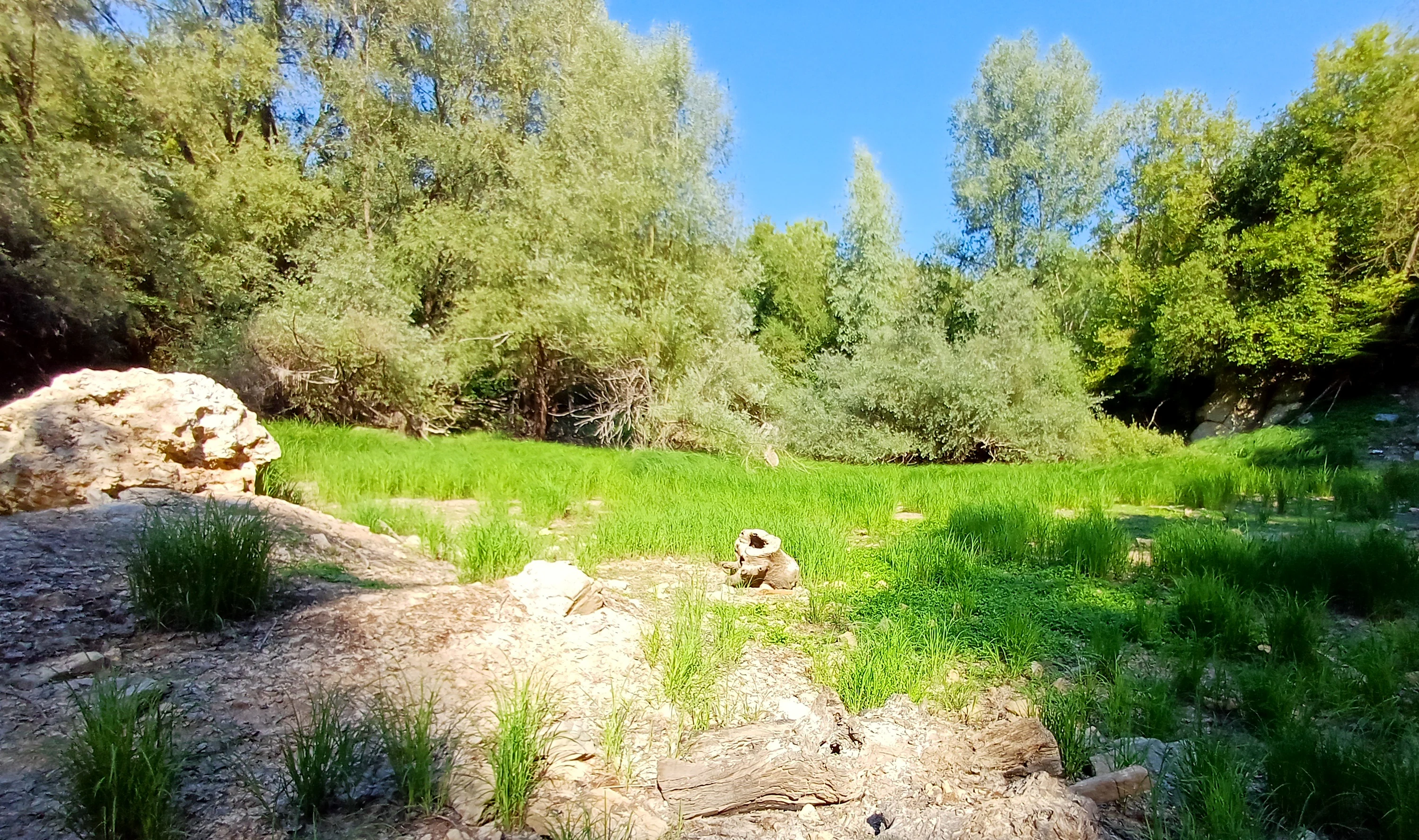
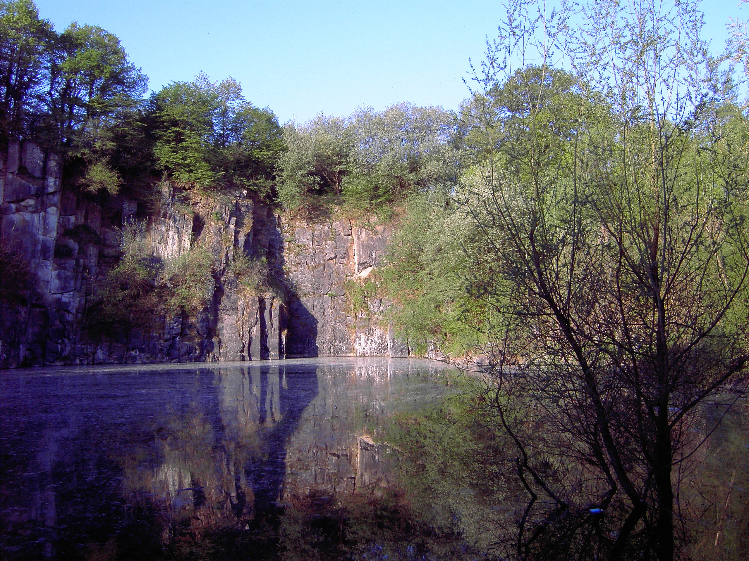
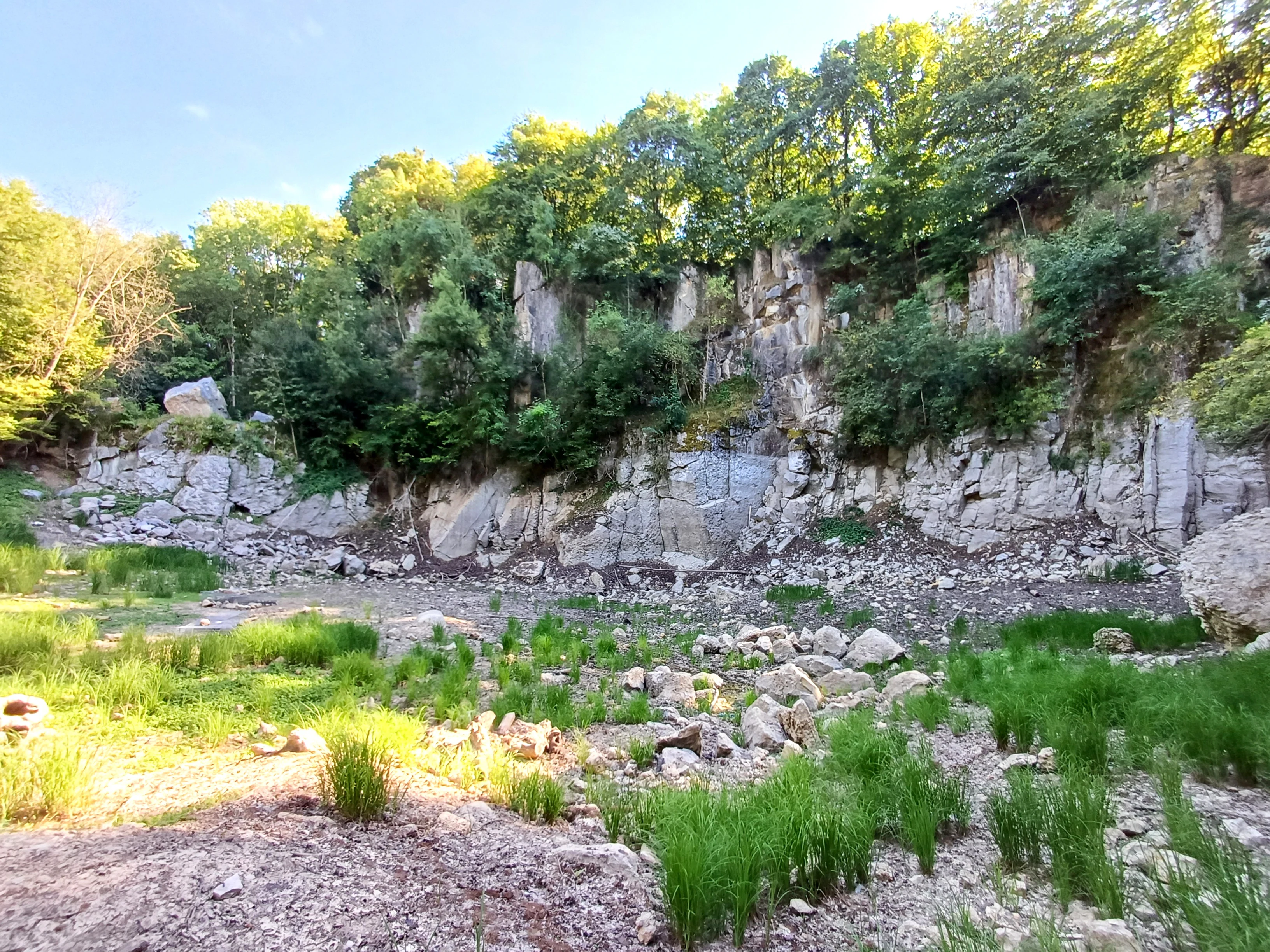
Exposed quarry walls reveal the pale, fine-grained Blaustein in folded layers, with the harder bedding planes standing out against softer, more weathered material. The floors of the former workings are uneven and partly water-filled, and photographs from the reserve show how these basins have gradually dried out in recent decades. Moss-covered cut blocks, still lying where they were left, give parts of the site an almost archaeological atmosphere.
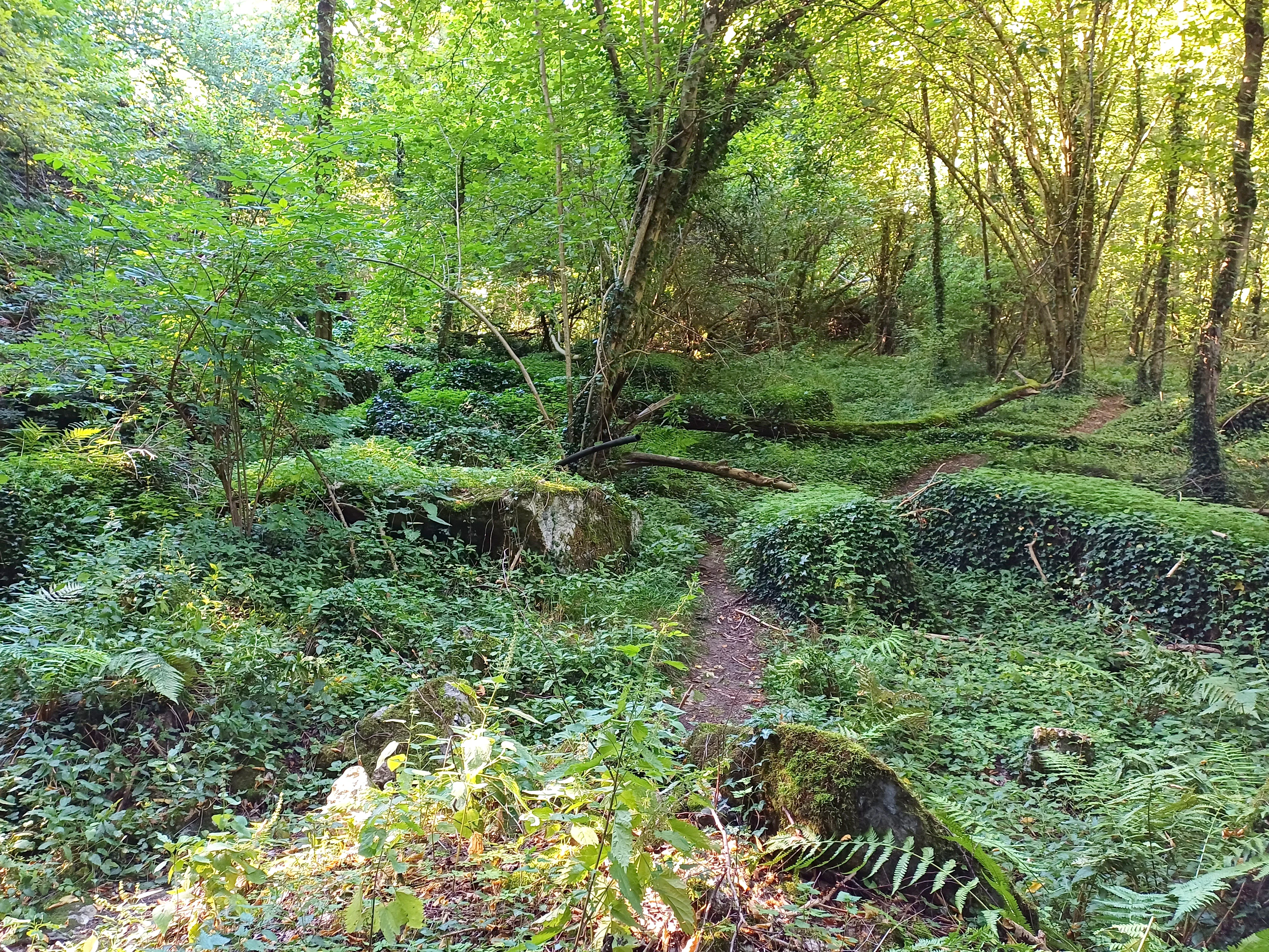
Between the quarries, the ridge carries woodland developed on thin calcareous soils, with hornbeam becoming the dominant tree on parts of the slope. Despite its small size, the reserve contains a clear sequence of micro-landscapes, from dry rock and scree to damp pit floors and shaded forest, all within a few hundred metres of the Breinig settlement edge.
Naturschutzgebiet Schomet ecosystems, habitats, and plant life
The natural character of Schomet is built on a small but ecologically rich mosaic. The thinnest and most calcareous sections carry an orchid-rich beech woodland community, while more developed slopes are clothed in hornbeam forest with a spring layer of geophytes that blooms before the leaf canopy closes.
In the damper hollows of the former quarries, a wetland biotop has developed. Here, tall herbs such as meadowsweet (Filipendula) form dense stands, and the characteristic flora of a moist, mineral-rich substrate is well represented. Even in the small water-filled basins the vegetation reflects the wet, base-rich conditions created by groundwater seeping through the limestone.
A botanical survey in 1987, two years after the area received protection, recorded more than 160 plant species on the site. This diversity reflects both the variety of substrates and the long period of undisturbed development since active quarrying ceased.
Naturschutzgebiet Schomet wildlife and species highlights
The varied habitats within Schomet support a community of butterflies and amphibians that benefit from the combination of damp quarry floors, flowering meadows, and sheltered woodland edge. The presence of meadowsweet and other tall herbs in the wet pits, together with the adjacent woodland, provides both breeding habitat and foraging opportunities for these groups.
The reserve is also important for invertebrates more broadly, since the mosaic of wet and dry calcareous habitats available within a very small area supports a wider range of species than the surrounding agricultural and built-up land. Spring geophyte flowering, in particular, provides an early-season nectar and pollen source for pollinators active before the trees come into full leaf.
Although the original calcareous beech forest was largely cleared during the quarrying period, woodland has returned to a substantial part of the reserve, providing cover and breeding sites for common forest birds typical of the Eifel edge.
Naturschutzgebiet Schomet conservation status and protection priorities
Schomet is classified as an IUCN Category IV Habitat and Species Management Area, a designation reflecting its role in protecting specific habitats and species rather than a large landscape-scale ecosystem. The reserve preserves a particular combination of calcareous woodland, disused quarry habitat, and wetland vegetation that is increasingly rare in this part of North Rhine-Westphalia.
The site has conservation value on several fronts. The thin soils over Carboniferous limestone support an orchid flora that is characteristic of the Eifel edge but vulnerable to woodland shading, scrub overgrowth, or quarrying pressure. The abandoned pits, left to fill naturally with groundwater, have created wetland habitats that are now an important refuge for amphibians and for moisture-loving plants.
Although the reserve is small, its position within a continuous limestone ridge extending into Belgium, and its relationship to the neighbouring reserves Schlangenberg and Bärenstein, gives it added regional significance. The slow, unmanaged recolonisation of the quarry workings is itself a conservation outcome, showing how abandoned extractive sites can develop into ecologically valuable habitat when quarrying stops and protection is put in place.
Naturschutzgebiet Schomet cultural meaning and human context
Quarrying for Blaustein has shaped the surrounding villages for centuries, and older houses in Breinig, Breinigerberg, and across the border into Belgium still display the dark-to-pale weathering pattern of the local stone. The continuity of the quarries with the local building tradition gives Schomet a cultural as well as a geological importance.
The transfer of the area from church ownership through state ownership to private entrepreneurs after the dissolution of the older ecclesiastical estates reflects the broader 18th and 19th century reshaping of resource ownership in the region, particularly around Kornelimünster Abbey. The four small quarries that resulted from this period still structure the landscape of the reserve today.
The area also has a minor palaeontological cultural value. The abundance of brachiopod fossils in the Blaustein, and the visible folding of the rock layers in the quarry walls, make Schomet a local point of reference for the Carboniferous history of the Aachen region.
Top sights and standout views in Naturschutzgebiet Schomet
Standout features of Naturschutzgebiet Schomet include the pale, fossil-rich Blaustein quarry faces with their visible folding, the orchid-rich beech and hornbeam woodland regrowth on calcareous soils, and the wetland vegetation, including meadowsweet stands, that has developed in the damp quarry hollows. The reserve also preserves cut stone blocks still lying in the old workings, evidencing centuries of quarrying that ended before formal renaturation took place.
Best time to visit Naturschutzgebiet Schomet
Spring is the most rewarding season for visiting Schomet at an ecological level, when the woodland floor is carpeted with flowering geophytes before the hornbeam canopy closes, and orchids such as the small wild orchid, bird's-nest orchid, and fly orchid are most easily observed. The damp quarry floors are also at their most floristically active in late spring and early summer.
Late spring and early summer also suit observation of the reserve's butterflies and the wetland vegetation of the former pits. By late summer the geophyte layer has largely died back and the quarry basins may have lost much of their standing water, as happened in the reserve's former pool. For a quieter impression of the landscape itself, autumn light on the pale quarry faces brings out the characteristic contrast between fresh dark Blaustein and weathered pale stone that defines the site's visual identity.