

Mori Atlas logo
Nature reserveNaturschutzgebitt Birelergronn

Discover the hydrological character and historic milling geography of this protected nature reserve.

Naturschutzgebitt Birelergronn: Protected Sandstone Valley and Wetland Landscapes in Luxembourg

Naturschutzgebitt Birelergronn represents a protected natural corridor in central-eastern Luxembourg, stretching across a 270 hectare valley formed by the Bireler Baach. This reserve preserves distinctive Luxembourg Sandstone geology, where spring-fed streams sustain the rare Neimillen wetland and fragments of alluvial forest. The terrain reflects centuries of hydrological evolution, blending human milling heritage with complex marshland ecosystems that serve as vital habitats.

wetlandnature reservesandstone valleyalluvial forestreedbedsstream habitat

Naturschutzgebitt Birelergronn

Nature reserve

Park overview

Structured park overview, official facts, and landscape profile for Naturschutzgebitt Birelergronn

Naturschutzgebitt Birelergronn park facts, protected area profile, and essential visitor context

Review the core facts for Naturschutzgebitt Birelergronn, including designation, size, terrain, visitor scale, habitats, and operating context in one park-focused overview.

About Naturschutzgebitt Birelergronn

Naturschutzgebitt Birelergronn is a Luxembourgish nature reserve embedded in a broader valley landscape known locally as the Bireler Gronn, situated south and east of Luxembourg City. It occupies part of a valley corridor carved by the Bireler Baach through the Luxembourg Sandstone plateau, a Jurassic sedimentary formation around 200 million years old. Because the sandstone above is permeable and rests on impermeable marl below, the area is characterized by abundant springs that feed the stream and sustain the surrounding habitats.

The reserve is administered across three communes: Sandweiler, Schuttrange, and Niederanven. At roughly 272 hectares, it combines a core protected zone of about 11 hectares with a buffer of approximately 260 hectares, ensuring that the ecological processes behind the wetland can continue to function. The site was placed under statutory nature protection on December 12, 1999, marking a formal recognition of its value to the country's natural heritage.

Ecologically, the heart of Birelergronn is the Neimillen wetland. This marshland came into existence after a centuries-old mill pond associated with the Neimillen was gradually drained when the milling operations ceased, leaving behind a rich mosaic of reedbeds, sedge stands, and wet woodland. Today it is one of the most ecologically rewarding wetland habitats in the country, supporting breeding amphibians and characteristic bird species tied to reed and marsh environments.

Culturally, the reserve carries the imprint of at least six historic mills that once lined the Bireler Baach, including the preserved Loumillen, Bannmillen, and Boumillen, and the now-demolished Neimillen, Hentzensmillen, and Berwicksmille. The Neimillen, also called Wollefsmille, was first documented in the 14th century and belonged to the Münster Abbey, with its associated pond once being the largest in the valley. Since these mills stopped operating and the ponds were allowed to evolve naturally, a valuable wetland ecosystem has emerged in their place.

The reserve is also a destination for public engagement. In 1997, a thematic nature trail was developed across the area, divided into the 7-kilometer Quellepad starting at Sandweiler and the 5-kilometer Millepad starting at Schrassig and Neuhäuschen. Together they form an interpretive loop through the wetland, springs, and former mill sites, allowing visitors to experience both the natural and cultural layers of the Bireler Gronn.

Quick facts and research context for Naturschutzgebitt Birelergronn

Naturschutzgebitt Birelergronn lies in central-eastern Luxembourg, between the villages of Sandweiler, Schrassig, and Neuhäuschen, within the communes of Sandweiler, Schuttrange, and Niederanven. It covers about 271 to 272 hectares, including around 11 hectares of core protected wetland and a buffer zone of about 260 hectares. The reserve has been legally protected as a zone of national interest since December 12, 1999, carrying the national code ZH 50.

Protection and recognition

Explore the documented terrestrial conservation status established in 1999.

Naturschutzgebitt Birelergronn Protection Status and Designation History

Naturschutzgebitt Birelergronn maintains a documented terrestrial protection status established in 1999 without transboundary status or imported international recognition sources. Protected area records compile official designation history and management scope for reliable conservation reference.

Protection details

Protection scope
Terrestrial
Designated year
1999
Transboundary protection
No
Core area
0.11 km²
Buffer area
2.6 km²
Park context

Deeper park guide and search-rich context for Naturschutzgebitt Birelergronn

Naturschutzgebitt Birelergronn history, landscape, wildlife, and travel context

Explore Naturschutzgebitt Birelergronn through its history, landscape character, ecosystems, wildlife, conservation priorities, cultural context, and seasonal travel timing in a structured park guide built for atlas discovery and search intent.

Why Naturschutzgebitt Birelergronn stands out

The reserve is best known for the Neimillen wetland, a biologically rich marshland that developed after the draining of a historic mill pond and now supports dense reedbeds, alluvial forest fragments, amphibian breeding habitat, and a notable community of wetland birds. It is also recognized for its setting within the Luxembourg Sandstone, a Jurassic-age formation whose permeable layers feed the many springs that sustain the Bireler Baach and the entire wetland system. Beyond its ecology, Birelergronn stands out for its layered milling heritage. Six former mills once operated along the valley stream, and although most have disappeared, the landscape still preserves the story of how water power shaped human life here for centuries. The combination of spring-fed sandstone landscape, abandoned mill weirs, and recovered wetland gives the reserve one of the most distinctive identities among Luxembourg's protected natural areas.
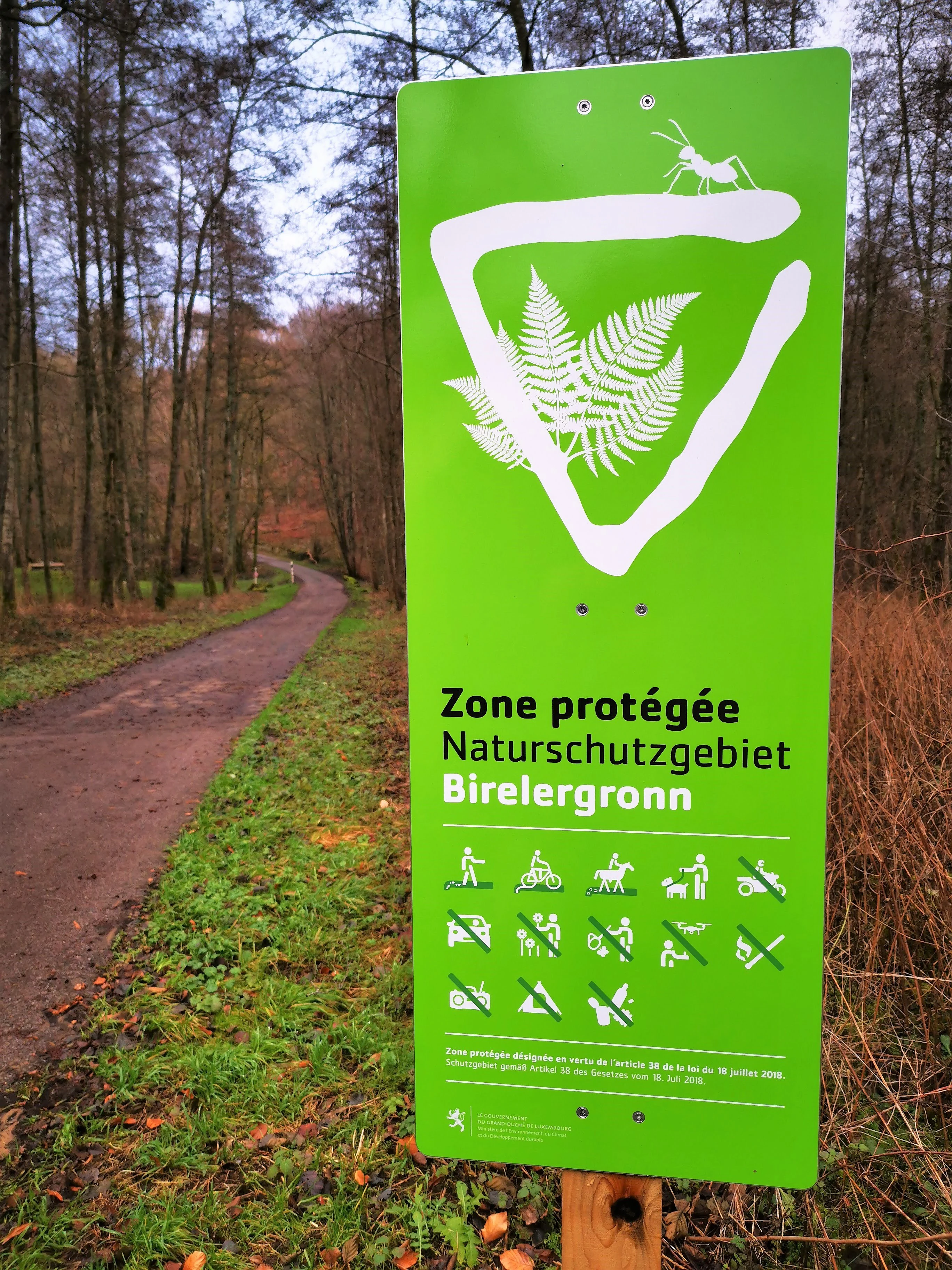
Birelergronn Nature Reserve in Sandweiler
A view of the Birelergronn nature reserve located in Sandweiler.

Naturschutzgebitt Birelergronn history and protected-area timeline

The Bireler Gronn valley has a long history shaped by water. Where the Bireler Baach carved into the Luxembourg Sandstone, six historical mills once harnessed its flow. From the valley mouth upward, these included the Loumillen, Bannmillen, Boumillen, Neimillen, Hentzensmillen, and Berwicksmille. Most of these structures are no longer standing, but the Loumillen, Bannmillen, and Boumillen are still preserved.

The Neimillen, also known as the Wollefsmille, is the historically best-documented mill in the valley. Records about it date back to the 14th century, and it belonged to the Münster Abbey. With its large upstream mill pond, it was the most significant mill in the valley. The pond was eventually drained, and the mill was eventually demolished after the Luxembourg state acquired it in 1981.

The drying-out of the former mill pond during the late 20th century allowed a wetland ecosystem to develop naturally. This created, through ecological recovery rather than deliberate engineering, one of Luxembourg's most valuable marshland habitats, complete with reedbeds and fragments of alluvial forest.

Recognizing the ecological importance of this recovery, the grand-ducal regulation of December 6, 1999 placed roughly 11 hectares of core wetland alongside a 260-hectare buffer zone under formal nature protection, taking effect on December 12, 1999. This regulation formally established the Naturschutzgebitt Birelergronn as a protected area of national interest and gave the Bireler Gronn a durable conservation framework.

In 1997, prior to the formal protection designation, the area was already being used for public education. A thematic nature trail with informational panels about the natural and cultural history of the valley was created, dividing into the Quellepad and the Millepad. These trails remain one of the most visible expressions of the reserve's identity today.

Naturschutzgebitt Birelergronn landscape and geographic character

The landscape of Naturschutzgebitt Birelergronn is shaped by the geology of the Luxembourg Sandstone, a Jurassic formation dating back roughly 200 million years to the Lias period. The sandstone is permeable to water, and the impermeable marl beneath it creates ideal conditions for springs, which are a defining feature of the area. Numerous springs rise within and around the reserve, many of them feeding the Bireler Baach and giving the valley its characteristic sound and hydrological rhythm.

Over time, the Bireler Baach has cut into the sandstone plateau. This slow erosion has produced a varied valley terrain with wet valley floors, gently sloping edges, and rocky sandstone outcrops, where exposed stone and groundwater emerge together. The result is a small-scale but visually distinctive valley landscape in central Luxembourg, dominated by soft slopes, dense vegetation, and reed-covered wet zones.

A second defining landscape feature is the chain of historic mill sites along the stream, including the sites of the Loumillen, Bannmillen, Boumillen, Neimillen, Hentzensmillen, and Berwicksmille. Although most of the structures are gone, their footprint in the landscape remains visible as flat openings along the valley, sometimes still containing ponds or wetland remnants.

In the place of the former Neimillen pond, the landscape has shifted from a barrier pond to an open wetland mosaic. This Neimillen wetland is now the visual centerpiece of the reserve, with reedbeds, herbaceous marsh vegetation, and patches of wet woodland forming a layered scenery that contrasts with the surrounding forests and meadows.
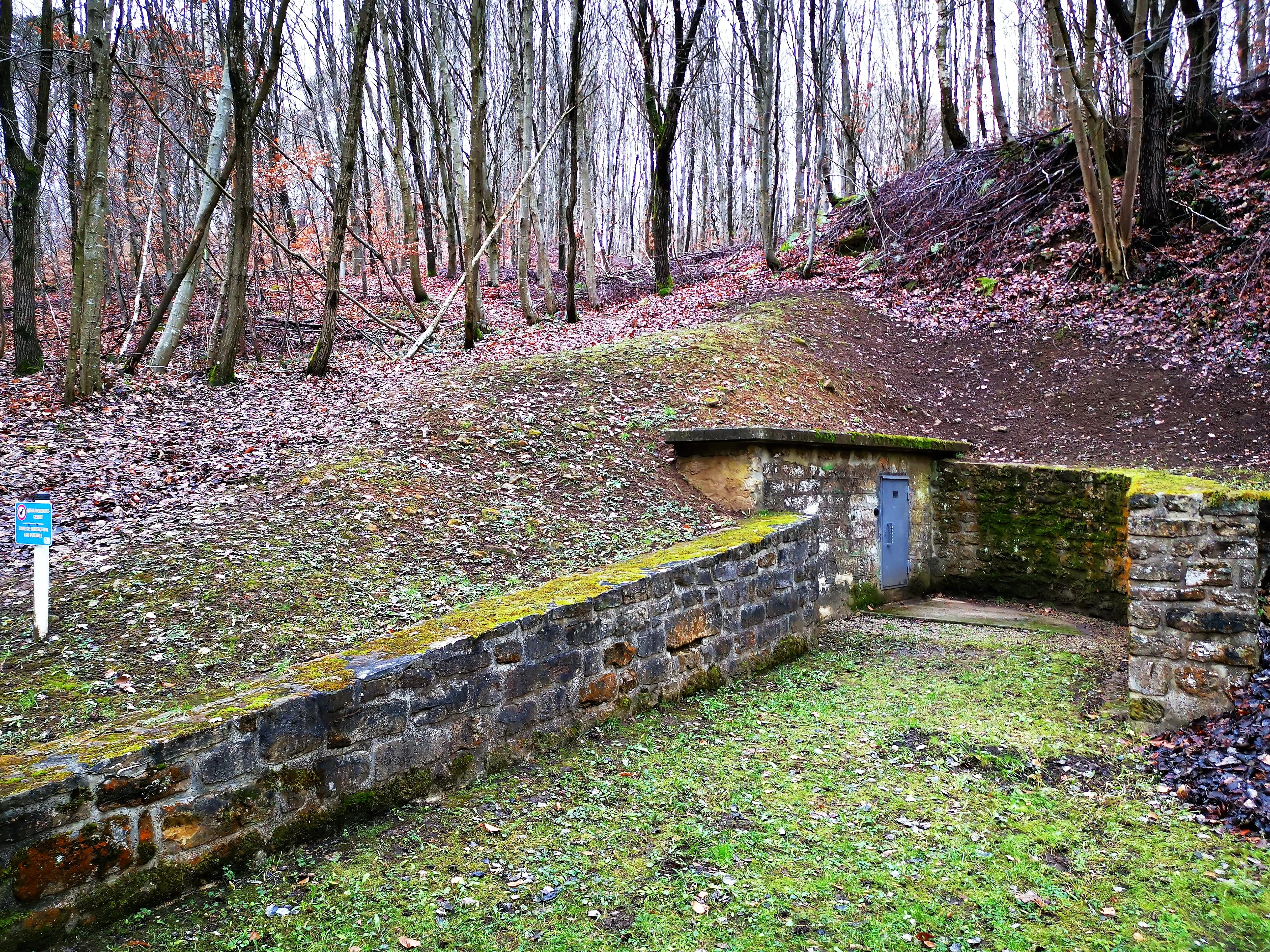
Birelergronn Nature Reserve in Sandweiler
View of the Birelergronn nature reserve located in Sandweiler.

Naturschutzgebitt Birelergronn ecosystems, habitats, and plant life

The nature of the Birelergronn reserve is dominated by wetland and stream-edge ecosystems. The Neimillen wetland has become a richly diverse habitat in the ecological sense. Around the former pond, succession has produced dense beds of reeds, dominated by common reed, with broadleaf cattail and other rushes adding structural diversity. These tall reedbeds are central to the reserve's character and play a major role in supporting breeding birds and amphibians.

Along the Bireler Baach upstream from the Neimillen, fragments of alluvial forest still survive. These are characterized by alder as the dominant tree species, supported by periodically flooded soils that alder prefers. Over time, accumulating organic matter in the wetter zones allows the wetland to develop further toward a natural alluvial forest state if left undisturbed, a process that is already visible in some areas of the reserve.

Outside the wetland and alluvial forest, the surrounding slopes and plateau host mixed deciduous woodland of the type typically found on Luxembourg Sandstone terrain. The mosaic of wet valley floor, alluvial woodland, and dry forest creates a strong ecological gradient across a relatively small area, supporting a wide range of species within the 272-hectare reserve.
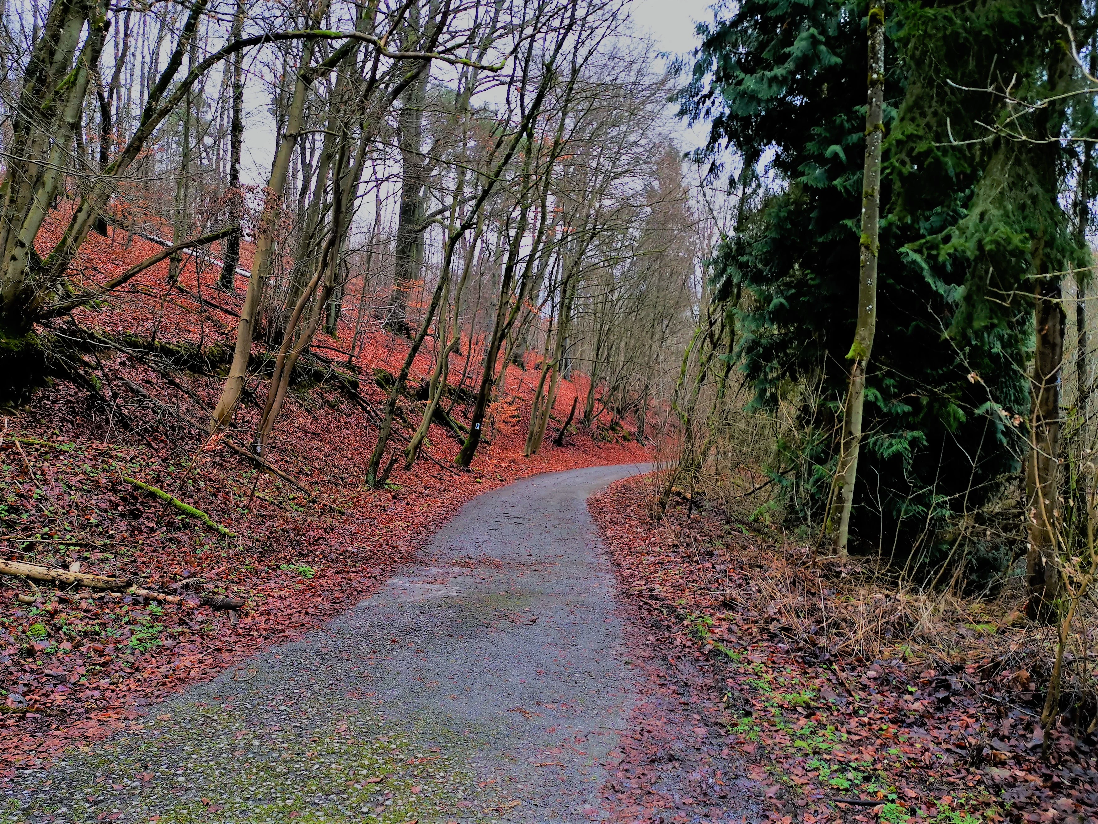
Birelergronn Nature Reserve in Sandweiler
A view of the Birelergronn nature reserve located in Sandweiler, Luxembourg.

Naturschutzgebitt Birelergronn wildlife and species highlights

Wildlife in Naturschutzgebitt Birelergronn is closely tied to the wetland, reedbeds, and alluvial forest habitats. The Neimillen wetland supports a notable community of wetland birds. The common reed warbler breeds in the dense reedbeds where its specific habitat requirements are met, while the water rail finds sheltered conditions among the tall reeds, sedge stands, and dense vegetation along the water's edge. The reed bunting is also present in the area, contributing to the reserve's characteristic songbird assemblage.

Amphibians are another important component of the wildlife. In spring, common toads and other amphibian species use the wetland as a spawning site, taking advantage of the open shallow water and slow-flowing conditions along the Bireler Baach. This seasonal use of the reserve by amphibians is one of the key reasons the wetland is considered ecologically significant.

Fish in the Bireler Baach also benefit from the root systems of alder trees along the banks. The split, deep root structures of alder help stabilize the banks while providing shelter for fish and other aquatic life. The alder-associated habitat is therefore ecologically important not only for birds and amphibians but for the broader aquatic food web in the stream.

In the surrounding forests and meadows, the wildlife character reflects typical central Luxembourg habitats, with small mammals, common forest birds, and insects typical of sandy and wetland environments. The reserve's overall importance lies less in rare individual species than in its role as a coherent wetland-forest-stream system that operates on a meaningful spatial scale within Luxembourg's protected-area network.
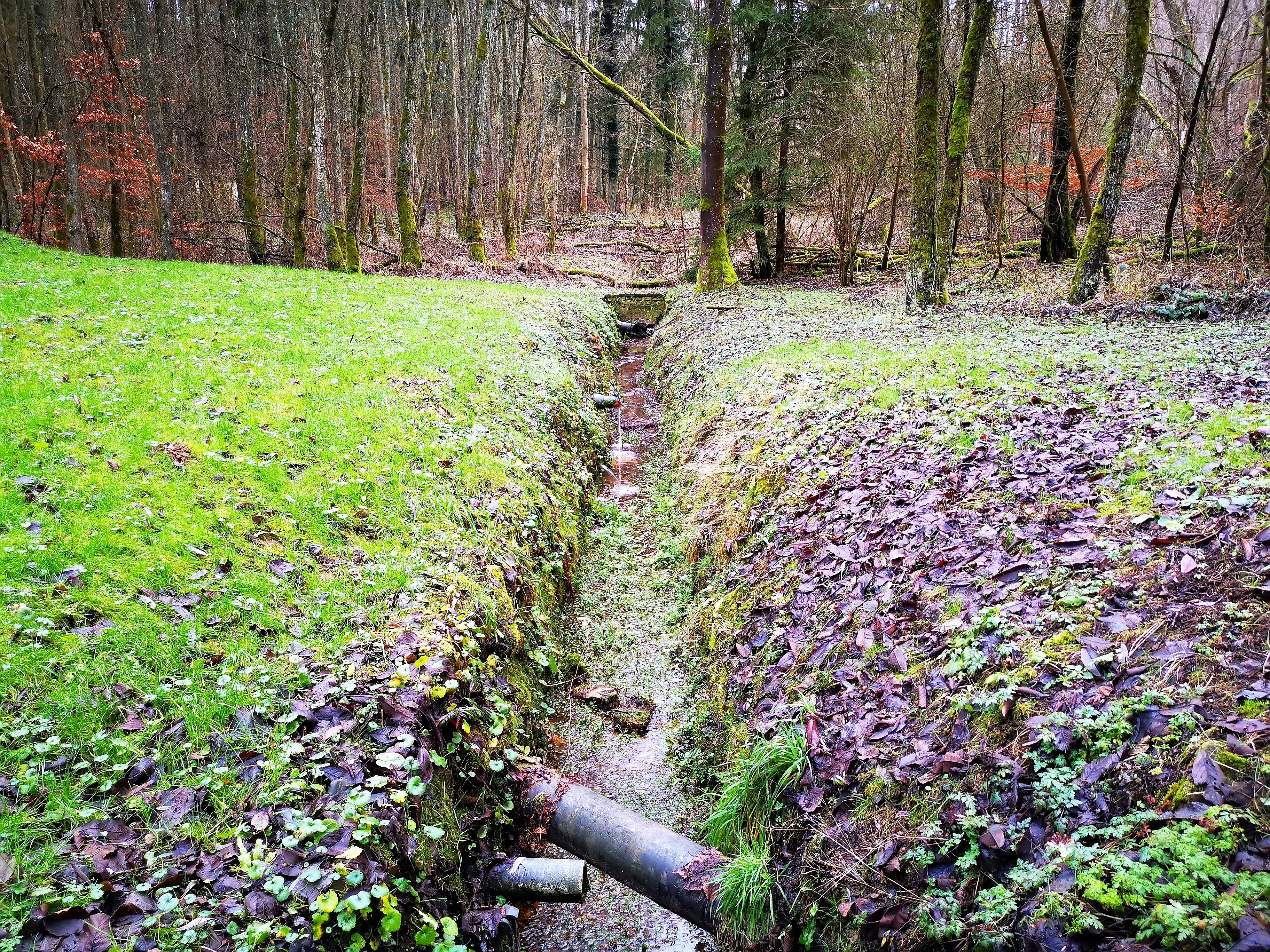
Birelergronn Nature Reserve in Sandweiler
A view of the Birelergronn nature reserve located in Sandweiler, Luxembourg.

Naturschutzgebitt Birelergronn conservation status and protection priorities

Naturschutzgebitt Birelergronn has formal conservation status as a protected zone of national interest, supported by the grand-ducal regulation of December 6, 1999, which entered into force on December 12, 1999, with the national code ZH 50. The designation reflects the recognition of both the 11-hectare wetland core and the broader 260-hectare buffer zone as ecologically significant.

The conservation importance of the reserve rests on three pillars. First, the wetland ecosystem that emerged naturally from a former mill pond now represents one of the most valuable marshland complexes in the country, supporting breeding wetland birds, amphibians, and successional ecological processes that would not occur without protection.

Second, the reserve includes surviving fragments of alluvial forest along the Bireler Baach, a habitat type that has been heavily reduced across Europe due to drainage, agricultural conversion, and river engineering. Protecting these fragments ensures that the natural hydrological processes and characteristic alder-dominated woodland can continue to develop.

Third, the protection framework buffers the wetland from surrounding land uses, including the former meadows on the valley slopes that were historically maintained without artificial fertilizer. This buffer is essential because wetland habitats of this kind are vulnerable to hydrological disturbance, nutrient enrichment, and invasive species, all of which are minimized by the reserve's protected status.

Naturschutzgebitt Birelergronn cultural meaning and human context

The cultural context of the Birelergronn is inseparable from water and milling. For centuries, the Bireler Baach powered the local economy through a chain of at least six mills that processed grain along the valley. These mills were not only economic centers but also social ones, anchoring settlement and infrastructure in the surrounding communes.

The Neimillen, or Wollefsmille, held particular historical importance. First mentioned in the 14th century, it belonged to the Münster Abbey and was the most significant mill in the valley thanks to its large mill pond. This monastic ownership reflects the medieval ecclesiastical influence on rural land use in the region, which is characteristic of much of central Luxembourg.

The cultural layer of the valley continues to be visible today. Three of the historic mills remain standing, and the names of the disappeared mills still appear on local maps and interpretive materials. The 1997 nature trail, with its thematic stations on natural and cultural history, explicitly integrates this milling heritage into the visitor experience, presenting the reserve as a place where ecology and human history have shaped one another over many generations.

Top sights and standout views in Naturschutzgebitt Birelergronn

Birelergronn's defining highlight is the Neimillen wetland, a marshland ecosystem that emerged after a centuries-old mill pond was drained, now hosting dense reedbeds, amphibian breeding grounds, and characteristic wetland birds.

Equally important is the reserve's setting within the Luxembourg Sandstone, whose permeable geology feeds abundant springs and underpins the entire hydrological system of the Bireler Baach. Together with surviving fragments of alluvial forest along the stream, this gives the reserve an unusually coherent landscape structure for its relatively modest size.

A third highlight is the valley's milling heritage, visible through both the preserved mills and the interpretive nature trail, which has helped establish Birelergronn as one of Luxembourg's most accessible and educational nature reserves.

Best time to visit Naturschutzgebitt Birelergronn

Spring is one of the most rewarding periods to experience Birelergronn. As amphibian species migrate to the wetland, the shallow waters and reedbeds come alive with breeding activity. Wetland birds also become more vocal and visible during this season, and the surrounding deciduous vegetation begins to leaf out, softening the valley scenery.

Summer brings warm weather and full foliage, when the reedbeds reach their greatest density and the wetland mosaic is visually most striking. Bird activity continues, particularly among reed-dwelling species, and the two themed trails, the Quellepad and the Millepad, are most comfortable to walk in this period.

Autumn and winter are quieter but can offer good views of the wetland structure and clearer observation of the geology along the stream, when deciduous trees are bare. Because the area's interest lies primarily in ecology and cultural landscape rather than in remote wilderness scenery, each season offers a different lens on the same underlying transformation of valley, water, and wetland.


Monthly climate preview

Long-term representative monthly temperature and precipitation patterns across the protected landscape

Naturschutzgebitt Birelergronn Climate Normals and Annual Temperature Rhythm

Representative coordinates document monthly temperature variation and precipitation averages from 1991 through 2020 at a 277-meter elevation. Full monthly records and extended climatological metrics remain available for complete comparative analysis.
Annual mean9 °C
0 °C19 °C
Jan
Feb
Mar
Apr
May13°
Jun17°
Jul19°
Aug19°
Sep14°
Oct
Nov
Dec
Warmest month
July

19.1 °C

Coolest month
January

0.4 °C

Wettest month
December

2.7 mm/day

Driest month
April

1.6 mm/day

Park location guide

Geography guide, regional context, and park location map for Naturschutzgebitt Birelergronn

Naturschutzgebitt Birelergronn park geography, regions, and map view in Luxembourg

Understand where Naturschutzgebitt Birelergronn sits in Luxembourg through a broader geographic reading of the surrounding landscape, nearby location context, and its mapped position within the national park landscape.

How Naturschutzgebitt Birelergronn fits into Luxembourg

Luxembourg is a small landlocked nation in Western Europe and the world's only grand duchy. It borders Belgium, Germany, and France, with Luxembourg City as its capital and largest city. The country has one of the highest GDP per capita figures globally and hosts several EU institutions, notably the Court of Justice. Its population of nearly 700,000 is multinational, with Luxembourgish as the national language and French and German as administrative languages.

Wider geography shaping Naturschutzgebitt Birelergronn in Luxembourg

Luxembourg is located in Western Europe, landlocked between Belgium to the west and north, Germany to the east, and France to the south. The terrain consists largely of forested uplands and plains in the Oesling region to the north, with the Gutland region in the south featuring more fertile land. The country covers 2,586 square kilometres, making it Europe's seventh-smallest nation.

Map view of Naturschutzgebitt Birelergronn

Use this park location map to pinpoint Naturschutzgebitt Birelergronn in Luxembourg, understand its exact geographic position, and read its mapped placement within the surrounding landscape more clearly.

Pigeon | © OpenStreetMap contributors

Location context for Naturschutzgebitt Birelergronn

Sandweiler

Visual exploration of sandstone valley terrain, wetlands, and protected habitats

Naturschutzgebitt Birelergronn Photos and Landscape Scenery

Photographic records reveal the distinct valley terrain, spring-fed stream habitats, and recovered wetlands that define the protected landscape of Naturschutzgebitt Birelergronn. Visual documentation provides deeper insight into the ecological character, alluvial forest fragments, and historic milling environments of central Luxembourg.

Birelergronn Nature Reserve in Sandweiler

Birelerbaach stream

Birelergronn Nature Reserve in Sandweiler

Birelergronn Nature Reserve in Sandweiler

Birelergronn Nature Reserve in Sandweiler

Park atlas

Compare valley terrain, spring-fed sandstone landscapes, and regional nature reserves

Explore Protected Areas and Other Parks Near Naturschutzgebitt Birelergronn

Compare Naturschutzgebitt Birelergronn with other protected areas across the surrounding regional landscape. Evaluating connected valley terrain and wetland habitats deepens geographic understanding of central Luxembourg conservation areas.
Nature reserveLuxembourg
About 5.4 km away#1 closest

North

Cornelysmillen-Schucklai Nature Reserve: Geographic and Protected Area Overview

Wetland ecosystems on the Luxembourg plateau

Cornelysmillen-Schucklai serves as a key protected area of national interest, encompassing a mosaic of marshland, meadows, and deciduous woodland. This reserve acts as a vital corridor for moisture-dependent plant communities and threatened bird populations, defining the hydrological character of the plateau region with its intricate stream systems and restored pond basins.

Area
1.437 km²
Established
2023
Relief
Upland
Climate
Temperate
Nature reserveLuxembourg
About 5.4 km away#2 closest

North

Naturschutzgebitt Aarnescht Nature Reserve; Geographic Atlas and Protected Area Profile

Exploring calcareous dry grasslands and ecological mosaic habitats in Luxembourg

Discover the geographic composition of Naturschutzgebitt Aarnescht, a premier nature reserve in Luxembourg. This profile details the site's unique Keuper sediments, extensive orchid populations, and varied terrain, including traditional orchards and oak low-forests that form a vital protected landscape.

Area
0.752 km²
Established
1988
Relief
Upland
Climate
Temperate
Nature reserveLuxembourg
About 14 km away#3 closest

Southwest

Beetebuerger Bësch: Nature Reserve and Protected Woodland Mapping in Luxembourg

A crucial reference site for forest ecology in southern Luxembourg

Beetebuerger Bësch stands as a designated nature reserve within the communes of Bettembourg, Leudelange, and Roeser. This protected forest landscape is managed to allow natural woodland development, providing researchers and visitors with a view of old growth dynamics, saproxylic invertebrate habitats, and restored riparian zones along the Koleschgriecht stream.

Area
2.373 km²
Established
2005
Relief
Lowland
Climate
Temperate
Nature reserveSchengen
About 14 km away#4 closest

Southeast

Haff Réimech Nature Reserve: Wetland Geography and Protected Landscape in Schengen

Reclaimed industrial wetlands in the Moselle river valley

Haff Réimech is a protected wetland sanctuary located in the Moselle valley near Schengen. The reserve features approximately forty shallow lakes created from former sand and gravel pits, now surrounded by reedbeds and riparian woodland. This mosaic landscape serves as a key site for migratory bird species, demonstrating a unique transition from industrial extraction to a managed, ecologically rich floodplain environment.

Area
1.008 km²
Established
1998
Relief
Lowland
Climate
Temperate
Nature reserveLuxembourg
About 14 km away#5 closest

East

Naturschutzgebitt Kelsbaach Nature Reserve: A Geographical Overview of Luxembourg Landscapes

Dolomite rock formations and protected dry grassland ecosystems

Naturschutzgebitt Kelsbaach preserves a distinctive environmental gradient across the Moselle valley hillsides in Luxembourg. From exposed dolomite cliffs and arid plateau grasslands to the shaded Kelsbaach stream gorge, the reserve illustrates the complex interplay of regional geology and microclimate. This protected area offers a precise look at local biodiversity habitats and the lasting impact of historical land use on the natural terrain.

Area
0.755 km²
Established
1998
Relief
Upland
Climate
Temperate
Nature reserveRheinland-Pfalz
About 16 km away#6 closest

East

Langheck bei Nittel Nature Reserve: A Detailed Atlas of Protected Moselle Landscapes

Ecological geography and calcareous grassland habitat in Rheinland-Pfalz

Langheck bei Nittel is a significant nature reserve located in the Upper Moselle valley of Germany. The site protects a rare mosaic of calcareous dry grasslands, shrubbery, and forest edges that host a high concentration of orchid species. As a critical component of the regional biotope network, it offers insight into the conservation of warm-loving flora and the management of stony, nutrient-poor landscapes.

Area
0.42 km²
Established
1998
Nature reserveLuxembourg
About 17 km away#7 closest

Southwest

Naturschutzgebitt Däerebësch-Waal-Hellengerbësch: Protected Forest and Transboundary Geography

Nature reserve profile and regional landscape connectivity

Spanning 222 hectares across Bettembourg, Dudelange, and Frisange, this nature reserve preserves a contiguous forest landscape essential to the Natura 2000 network. The site is defined by its role as a cross-border ecological corridor, connecting Luxembourgish woodlands with the Forêt domaniale de Zoufftgen in France through a sophisticated wildlife bridge.

Area
2.223 km²
Established
2023
Relief
Upland
Climate
Temperate
Nature reserveLuxembourg
About 20 km away#8 closest

Southwest

Naturschutzgebitt Haard: Exploring Luxembourg's Largest Reclaimed Nature Reserve

Geography of a transformed iron-mining industrial landscape

Naturschutzgebitt Haard encompasses vast quarry faces and pioneer meadows, serving as a critical biodiversity hub within southern Luxembourg. The area offers an intricate landscape mosaic of calcareous grassland, recovering forest, and dramatic mining cliffs, providing a window into how post-industrial ground evolves into a protected refuge for specialized orchid and butterfly species.

Area
5.943 km²
Established
1994
Relief
Upland
Climate
Temperate

Common questions about visiting, size, designation, and location context for Naturschutzgebitt Birelergronn

Naturschutzgebitt Birelergronn FAQs for park facts, access, geography, and protected area context

Find quick answers about Naturschutzgebitt Birelergronn, including protected-area facts, park geography, trail and visitor context, and how the park fits into its surrounding country and regional landscape.
MoriAtlas Explorer

Continue Your Protected Areas Search Across the Global Atlas

Deepen your exploration by continuing the structured search for national parks and protected areas worldwide. Utilize the comprehensive filtering capabilities to compare different conservation landscapes and refine your understanding of global park geography. Discover more about the distribution and characteristics of protected natural areas.

Global natural geography