
Why Naturschutzgebitt Haard stands out
The Haard is best known for its dramatic man-made cliff walls, considered among the longest and most impressive steep rock faces of their kind in Europe. These former open-pit mining slopes have become a unique habitat for cliff-dwelling reptiles, nesting eagle owls, and a specialised flora adapted to thin, nutrient-poor, sun-exposed substrates. Equally distinctive is the reserve's biodiversity on reclaimed land: more than 500 butterfly species, including roughly 240 on Luxembourg's protected list, and about 20 orchid species, some rare, growing on the calcareous soils and pioneer grasslands. Traditional conservation grazing with Moorschnucken sheep has been used since 1999 to maintain these open habitats.
Naturschutzgebitt Haard history and protected-area timeline
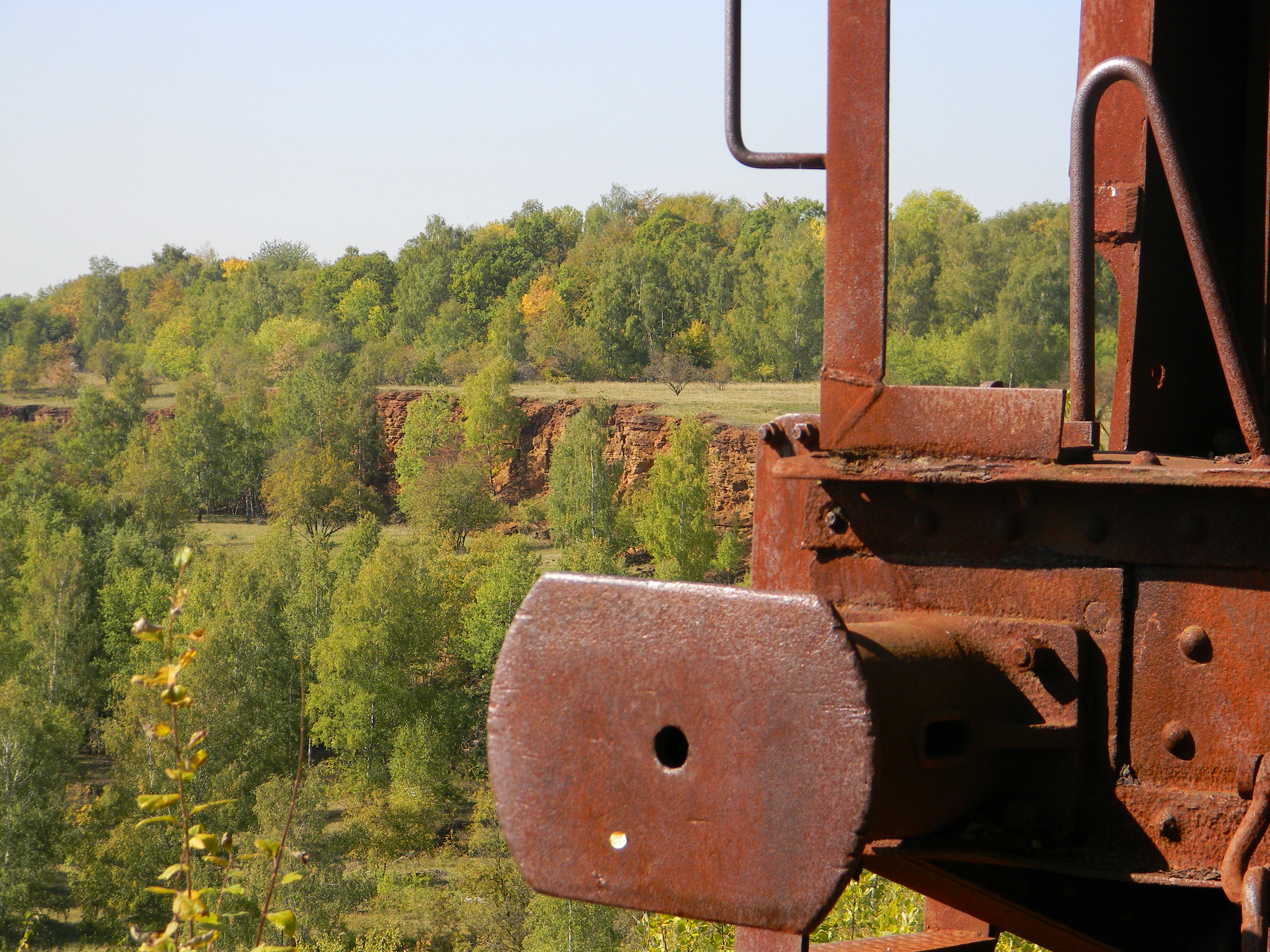
The contemporary Haard reserve exists because of an earlier industrial era centred on Luxembourg's iron ore, or minette. The Bajocian limestone and Aalenian iron-bearing rocks that form the local scarp were mined both underground in galleries and in open pits for a long period, leaving behind a patchwork of bare ground, spoil tips, quarry walls, and altered land surfaces once extraction ended.
After mining stopped in the open pits, the site was largely abandoned. Across the following decades, vegetation returned through a slow process of ecological succession: lichens, mosses, and algae colonised the bare rock, then pioneer and dry grasslands, and eventually pioneer trees such as birch and hazel, with calcareous beech forest gradually reasserting itself as the natural end stage. This transformation, from an industrial scar to a diverse living landscape, was the catalyst for formal protection.
The turning point came with the grand-ducal regulation of 30 July 1994, which designated roughly 594 hectares as the Naturschutzgebitt Haard and classified an additional 157 hectares as Naturbësch, natural forest. Three years later, in 1997, the Environment Ministry and the Forestry Administration, working with the communes of Dudelange, Kayl, and Rumelange, created a 17-station nature and culture trail to present the area's natural and historical significance to visitors. Since autumn 1999, a flock of Moorschnucken sheep, herded with dogs, has been used to graze the open areas extensively, preventing woodland regeneration from suppressing the rare species of dry grassland.
Naturschutzgebitt Haard landscape and geographic character
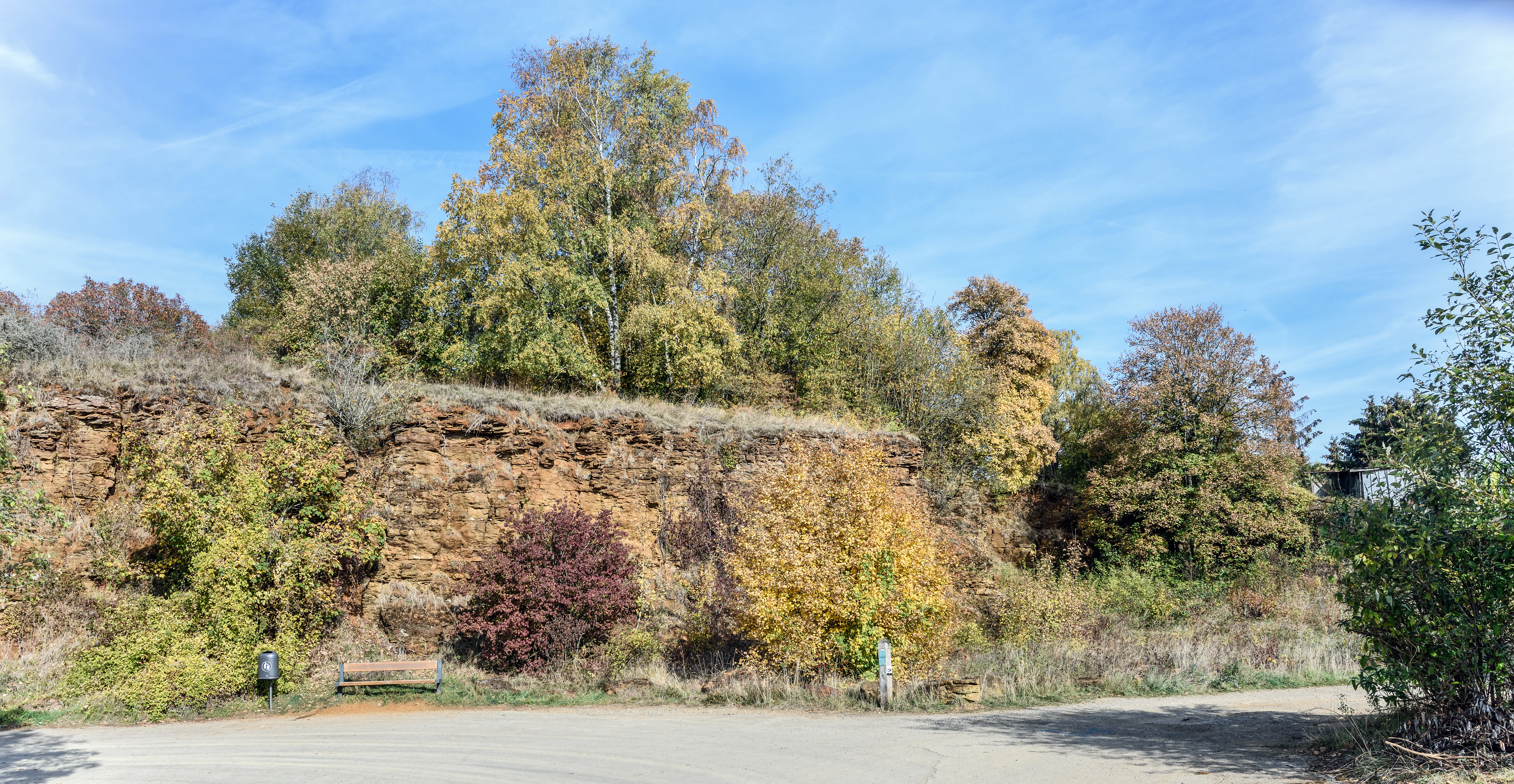
The Haard landscape is defined by the abrupt transition between flat plateau and deep workings. Long, near-vertical former quarry faces cut into the Dogger scarp form the most visually striking element of the reserve, recognised as among the longest and most impressive man-made cliff lines of this type in Europe. Below the cliffs sit the gentler slopes of the Lias foothills and the valley toward the Gehaansbierg.
Above and around these walls the terrain is a mosaic of exposed calcareous rock, spoil tips, pioneer ground, and surviving older woodland. The Dogger scarp itself is made up of Bajocian limestone capped by Aalenian iron-bearing minette; the underlying softer Lias layers have weathered into rolling lower ground. This geological setting gives the Haard its sharp contrasts, with bright exposures of pale limestone, rust-toned iron-mined ground, dark areas of slag, and the green of returning forest.
Streams such as the Frankelach, the area around the Cloos quarry near Dudelange, the localities of Téiteng, Laangertegronn, and Wuederten near Rumelange all shape the access to the landscape and provide entry points to the trail network. The result is a terrain that reads, both on a map and on the ground, as a landscape of edges, between plateau and wall, between forest and open, between the old mining surface and the new biological one.
Naturschutzgebitt Haard ecosystems, habitats, and plant life
Ecologically, the Haard is a textbook example of how biodiversity can arise from industrial disruption. The reserve preserves not just one habitat but a whole succession gradient, from bare stone and pioneer crust, through dry and ruderal grasslands, to pioneer shrub and young woodland, and on to the original calcareous beech forest that once covered these slopes.
The most ecologically distinctive habitats are the dry grasslands on calcareous substrate, which support roughly twenty orchid species, including rare ones such as Himantoglossum hircinum, the lizard orchid, and Aceras anthropophorum, the man orchid. Slag tips from the old Dudelange smelter provide warm, sunny conditions sought by thermophilic species. The beech forest itself, on deeper calcareous soils, and the rock faces on the cliffs together host a layered vegetation of weak, sun-loving specialists adapted to thin soils and high temperature swings.
The cliff system and the surrounding larger forest complexes together form habitats of regional and European interest, in part because natural cliff habitats are scarce in Luxembourg. The biodiversity values of the Haard depend on keeping the open habitats open, which is why active management is built into the reserve's story.
Naturschutzgebitt Haard wildlife and species highlights
The Haard supports an unusually rich butterfly fauna, with roughly 525 larger butterfly species recorded, of which around 243 appear on Luxembourg's protected Red List. This richness is driven by the diversity of open habitats, from pioneer grasslands on disturbed ground through dry calcareous meadows to the warm microclimates of the slag heaps.
Birds are strongly tied to the reserve's rocky terrain. The eagle owl, one of Europe's largest owls, nests in the niches of the cliff walls. Other avian species of note include the woodlark, which prefers the warm, dry slopes, and the wheatear, which uses the open ground. The black woodpecker is characteristic of the older calcareous beech forest.
Reptiles and small mammals are prominent on the cliffs and rocky slopes. Wall lizards, sand lizards, and slow worms sun themselves on the warm rock faces during summer. The wildcat, which favours larger forest areas with rocky terrain, lives in the calcareous beech sections alongside other forest mammals such as the European badger. The smooth snake (Coronella austriaca) is also recorded, taking advantage of the dry, warm conditions at the base of the walls. Together these species give the Haard one of the most species-rich faunas of any reserve in Luxembourg.
Naturschutzgebitt Haard conservation status and protection priorities
The reserve's main conservation significance lies in preserving a complete ecological succession sequence on a former industrial substrate, along with the rare species that depend on it. The dry calcareous grasslands and the cliff habitats are particularly important because equivalent natural habitats are scarce in Luxembourg, and the warm, nutrient-poor conditions they provide cannot easily be recreated elsewhere.
Formally, the protection dates to the grand-ducal regulation of 30 July 1994, which designated the 594-hectare core area and added a 157-hectare natural forest classification. Active management is central to the reserve's strategy: without intervention, the open habitats would gradually be lost as birch, hazel, and other pioneer trees reclaim the slopes. Since 1999, a flock of Moorschnucken sheep, herded with dogs, has been used for extensive grazing to keep the grasslands open and to maintain the rare orchids, butterflies, and other light-dependent species.
The reserve also documents how a working mining landscape can be rehabilitated into an area of high biodiversity through a combination of legal protection, ecological monitoring, and low-intensity management. Studies of the area's wild bees and wasps, as well as forest-structure surveys of the Haard, have helped refine that management and have made the reserve a reference site for post-industrial restoration in the region.
Naturschutzgebitt Haard cultural meaning and human context
The Haard carries a strong cultural memory tied to Luxembourg's iron-mining identity. The minette ores extracted here were central to the country's industrial history, supplying the smelters that made the southern region known as the Minett. The slag heaps near the plateau still bear witness to the waste from the Dudelange smelter, and the names Hesselsbierg and Stäbierg preserve the human geography of those earlier workings.
Three communes, Dudelange, Kayl, and Rumelange, share stewardship of the reserve, reflecting the long-standing local connection to this landscape. The 1997 nature and culture trail was explicitly designed to weave the natural and the industrial stories together, with thematic stations that read both as ecological interpretation and as a record of the mining past.
In this way the Haard is more than a withdrawal of land from human use; it is a place where the country's industrial past and its biodiversity objectives are read together, and where the communities that once worked the mines now steward a nature reserve.
Top sights and standout views in Naturschutzgebitt Haard
The most distinctive features of the Haard are its long, near-vertical former mining cliffs, considered among the most impressive steep rock faces of their type in Europe. These walls host nesting eagle owls, basking reptiles, and a thin specialised flora on calcareous rock.
Alongside the cliffs, the reserve's network of dry calcareous grasslands, pioneer meadows, and recovering beech forest supports an exceptional concentration of biodiversity, including around 20 orchid species, roughly 525 butterfly species of which about 243 are protected, and mammal populations that include the wildcat. A 17-station nature and culture trail links the natural and mining heritage of the area through an 8.6-kilometre red loop and a 5.8-kilometre blue loop.
Best time to visit Naturschutzgebitt Haard
The Haard is best experienced in late spring and summer, when the dry grasslands come into bloom with orchids, butterflies are most active on the warm slopes, and reptiles are commonly seen basking on the cliff faces and slag tips. Late spring is the peak time for orchids such as the lizard orchid and the man orchid, while midsummer brings the highest butterfly activity and the strongest display of warmth-loving species on the south-facing rock walls.
Autumn offers quieter conditions, softer light across the forested slopes, and an attractive seasonal character as the leaves change, while winter visits give the clearest views of the cliff structure and forest composition, though much of the flora is dormant. Hiking on the marked trail network is generally pleasant across these seasons, with the protected status ensuring that the landscape is managed for biodiversity rather than intensive recreational use.