
Mori Atlas logo
Nature reserveNaturwald Wolfsruhe

Examining the ecological boundaries and forest dynamics of this preserved Bavarian woodland

Naturwald Wolfsruhe: A Protected Forest Reserve in the Northern Keuper Escarpment Landscape

Naturwald Wolfsruhe represents a significant protected forest area located within the Bruderwald landscape of Oberfranken, Germany. This site preserves a historic coppice-with-standards woodland dominated by pedunculate oak, providing a crucial reference for natural forest development in the northern Keuper escarpment region. The geography of the reserve reflects a complex transition of substrates, including Fireletten clays and Upper Burgsandstein, which influence the mosaic of native forest communities.

protected forestBavariaUpper FranconiaBambergnatural forest reservedeciduous forest
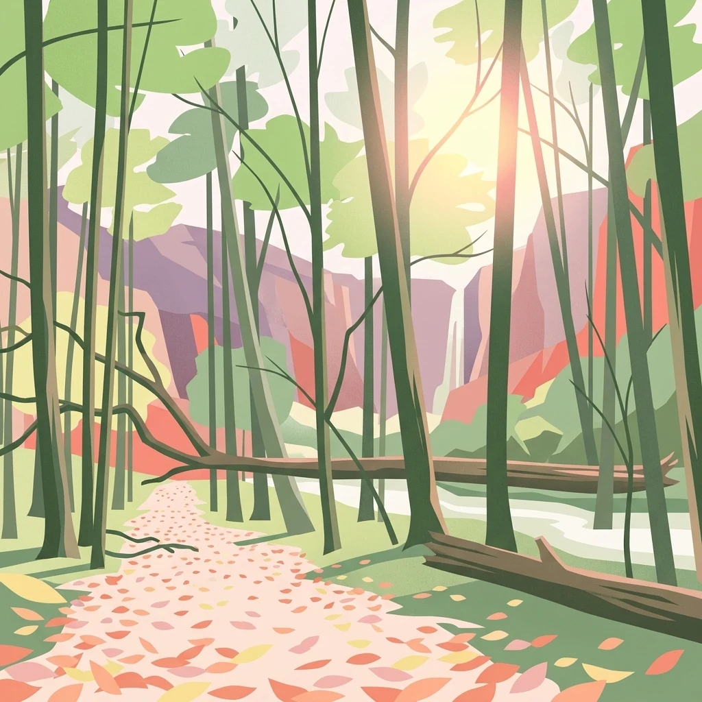
Stylized digital illustration of a forest path covered in fallen leaves leading toward a distant waterfall amidst trees, with a sunlit sky and vibrant color palette.

Naturwald Wolfsruhe

Nature reserve

Park overview

Structured park overview, official facts, and landscape profile for Naturwald Wolfsruhe

Naturwald Wolfsruhe park facts, protected area profile, and essential visitor context

Review the core facts for Naturwald Wolfsruhe, including designation, size, terrain, visitor scale, habitats, and operating context in one park-focused overview.

About Naturwald Wolfsruhe

Naturwald Wolfsruhe is a protected forest area situated on the southern fringe of the city of Bamberg in the administrative district of Upper Franconia, in the northern part of Bavaria. Covering approximately 47 hectares, the reserve sits within the larger Bruderwald, a regionally significant woodland that functions as an important local recreational area for the city of Bamberg. Despite this proximity to urban infrastructure, Wolfsruhe is managed as a strict nature protection zone, with no timber harvesting or active forestry permitted other than necessary forest protection or traffic safety measures.

The reserve originated through historical coppice-with-standards (Mittelwald) woodland management, a traditional Central European forest use pattern in which trees are cut on rotation to produce smaller wood while a scatter of larger standards is left standing. The forest communities that developed through this history today resemble natural conditions in many respects, particularly in the broadleaved sections. In the canopy layer, pedunculate oak dominates, supported by hornbeam and small-leaved lime, with occasional birch, beech, and wild service tree. In some zones, stands of pine, larch, and hornbeam occur, while the southern part of the reserve holds a younger mixture of spruce and pine, and the northeast contains a younger pine stand.

Wolfsruhe is part of the broader Natura 2000 network as a component of the Habitats Directive site Bruderwald mit Naturwaldreservat Wolfsruhe, and it carries IUCN Category IV designation. It is owned and administered by the Bayerische Staatsforsten under Article 12a of the Bavarian Forest Act, which provides the legal basis for Bavarian nature forest reserves and natural forest areas. The site forms part of an expanding network of strictly protected forests in the region: alongside the nearby Naturwald Brand to the east and Naturwald Wasserwand, also to the east, Wolfsruhe is part of a cluster of natural forest areas in the northern Keuper escarpment landscape that together offer some of the most ecologically significant protected woodland in Upper Franconia.

Quick facts and research context for Naturwald Wolfsruhe

Naturwald Wolfsruhe lies in the southern part of the city of Bamberg in the district of Upper Franconia, Bavaria, and covers about 46.49 hectares within the Bruderwald forest. It holds IUCN Category IV status as a Habitat/Species Management Area and forms part of the Natura 2000 site Bruderwald mit Naturwaldreservat Wolfsruhe. The area was established as a Naturwaldreservat in 1978 and re-designated as a Naturwald in 2020, and is managed under Article 12a of the Bavarian Forest Act by the Bayerische Staatsforsten as a strictly protected, unmanaged forest.

Protection and recognition

Terrestrial conservation framework, establishment year, and administrative scope.

Naturwald Wolfsruhe Protection Status and Designated Area History

Naturwald Wolfsruhe maintains a documented terrestrial protection status established in the year 2020. Official records compile the recorded management scope and designation history for geographic evaluation.

Protection details

Protection scope
Terrestrial
Designated year
2020
Park context

Deeper park guide and search-rich context for Naturwald Wolfsruhe

Naturwald Wolfsruhe history, landscape, wildlife, and travel context

Explore Naturwald Wolfsruhe through its history, landscape character, ecosystems, wildlife, conservation priorities, cultural context, and seasonal travel timing in a structured park guide built for atlas discovery and search intent.

Why Naturwald Wolfsruhe stands out

Naturwald Wolfsruhe is best known for being one of the most important forest protected areas in Upper Franconia and for its preserved former coppice-with-standards forest dominated by pedunculate oak. The reserve is valued for its largely natural tree species composition, its characteristic Franconian Keuper-Lias forest communities, and its role as a strictly managed no-intervention reference site within the Bavarian nature forest network south of Bamberg.
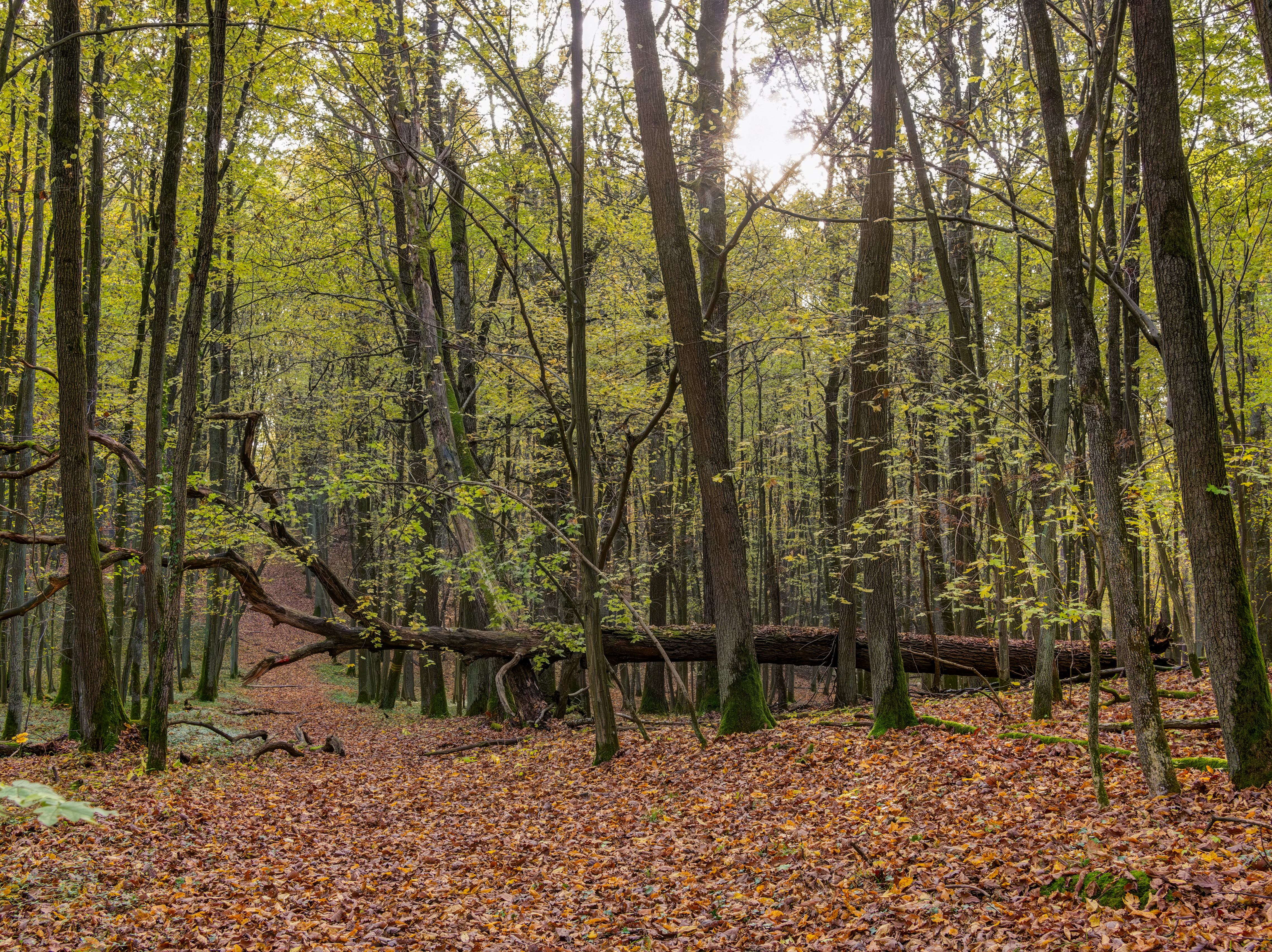
A view through a deciduous forest in autumn showing a large tree trunk fallen across the frame and a carpet of fallen leaves on the ground.
A fallen tree trunk resting in the dense deciduous woodland of Naturwald Wolfsruhe.

Naturwald Wolfsruhe history and protected-area timeline

Naturwaldreservat Wolfsruhe was formally designated in 1978 as one of the early Bavarian nature forest reserves, reflecting the Free State of Bavaria's commitment to setting aside dedicated tracts of forest for ecological research and biodiversity protection. As a state-owned forest, the area was incorporated into the official Bavarian nature forest reserve network from the outset and was placed under a dedicated Nature Forest Ordinance (Naturwaldverordnung) that limits intervention to essential forest protection and traffic safety work.

In 2020 the area was reclassified and expanded as a Naturwald under Article 12a of the Bavarian Forest Act, consolidating its protected status while aligning it with the broader system of Naturwälder now established across the Free State. This reclassification coincided with the establishment of additional strictly protected natural forests in the immediate vicinity, including the Naturwald Brand and Naturwald Wasserwand to the east, strengthening Wolfsruhe's role within an expanding cluster of no-intervention forest reference sites in the Bamberg area.

Naturwald Wolfsruhe landscape and geographic character

The Wolfsruhe reserve occupies a gently undulating section of the northern Keuper escarpment (Nördliche Keuperabdachung) just south of Bamberg, within the larger Bruderwald landscape. Its topography is shaped by the underlying geological transitions between three substrates: the colorful Fireletten (Feuerletten) clays that dominate most of the reserve, a strip of Rhätolias in the north and east, and a narrow band of Upper Burgsandstein in the northwest. These substrate differences produce a mosaic of soil types, including brown earth (Braunerde) on the sandy substrates and, on the Feuerletten, a spectrum ranging from mesotrophic para-brown earths through brown earth and brown earth pelosols to pelosols and brown earth pseudogleys where drainage is limited.

This geological and pedological variety gives the Wolfsruhe landscape a subtle but ecologically meaningful diversity, shaping where oak, hornbeam, and lime can dominate and where pine, spruce, and larch stands have developed. The reserve blends into the surrounding managed Bruderwald forest and the agricultural landscapes of the villages of Bug, Pettstadt, Strullendorf, Waizendorf, and Höfen, creating a transitional zone from protected natural forest to inhabited countryside.

Naturwald Wolfsruhe ecosystems, habitats, and plant life

The ecological identity of Naturwald Wolfsruhe centers on its forest communities, which are considered characteristic of the Franconian Keuper-Lias region. The broadleaved canopy is dominated by pedunculate oak (Stieleiche), with hornbeam (Hainbuche) and small-leaved lime (Winterlinde) as important associated species. The tree species composition of the main canopy layer broadly reflects natural site conditions, with the exception of a few smaller conifer stands. Older broadleaved sections of the reserve still bear the structural signature of centuries of Mittelwald management, while younger zones of pine, larch, spruce, and hornbeam reflect more recent successional states.

This combination of natural broadleaved forest communities, successional conifer patches, and varied soils creates a habitat mosaic that supports forest biodiversity in a region where most woodlands remain actively managed for timber production. As part of the Natura 2000 Habitats Directive site Bruderwald mit Naturwaldreservat Wolfsruhe, the area contributes to the European network of protected forest habitats and to the conservation of forest types characteristic of central Franconia.

Naturwald Wolfsruhe wildlife and species highlights

The source material does not provide detailed species inventories for Naturwald Wolfsruhe. As an old woodland with a high proportion of native broadleaves, mature oak, and structurally varied stands, the reserve functions as habitat for forest-dependent fauna typical of central German deciduous and mixed forests, including woodland bird assemblages, saproxylic invertebrates associated with old oak and lime, and small mammals reliant on mature forest cover. Because the site is strictly unmanaged, its value for wildlife is closely tied to the continuity of dead wood, veteran trees, and undisturbed microhabitats rather than to any single flagship species.

Naturwald Wolfsruhe conservation status and protection priorities

Naturwald Wolfsruhe is significant from a conservation perspective primarily as a strictly protected, unmanaged reference forest within the Bavarian natural forest network. Within the reserve, no timber harvest or active silvicultural management takes place, allowing the forest to develop according to natural dynamics and providing a baseline against which the biodiversity and structural development of managed forests in Upper Franconia can be compared.

Its integration into the Natura 2000 network through the Habitats Directive site Bruderwald mit Naturwaldreservat Wolfsruhe gives the area additional European conservation significance, linking it to broader efforts to protect representative forest habitat types across the EU. Its IUCN Category IV designation underscores its role in targeted habitat and species management. Together with the nearby Naturwald Brand and Naturwald Wasserwand, Wolfsruhe contributes to a strengthening cluster of no-intervention forest reserves in the Bamberg area, increasing the overall connectivity and ecological value of protected woodland on the northern Keuper escarpment.

Naturwald Wolfsruhe cultural meaning and human context

The cultural dimension of Wolfsruhe lies primarily in its long history of historical forest use. The stand originated under Mittelwald, or coppice-with-standards, management, a traditional Central European system of wood production in which underwood was cut on rotation while selected standards were retained. This long-standing human interaction has shaped the present structure and species composition of the forest, even though the area now lies in a regime of strict ecological protection. The reserve also sits within the Bruderwald, a forest that serves as a local recreation area for the historic city of Bamberg, linking the site's ecological function to the everyday cultural life of the surrounding urban population.

Top sights and standout views in Naturwald Wolfsruhe

Naturwald Wolfsruhe stands out for its preserved former Mittelwald forest dominated by pedunculate oak, its characteristic Franconian Keuper-Lias forest communities, and its status as one of the most important forest protected areas in Upper Franconia. The reserve combines long legal continuity as a Bavarian nature forest reserve with a high level of strict protection under both Article 12a of the Bavarian Forest Act and the EU Habitats Directive, and forms part of an expanding cluster of natural forests in the Bamberg area alongside the nearby Brand and Wasserwand reserves.

Best time to visit Naturwald Wolfsruhe

The source material does not provide seasonal visitation guidance specific to Wolfsruhe. As a small forest reserve bordering the city of Bamberg, it functions primarily as a quiet local nature area within the Bruderwald. Spring and early summer offer the fresh green character of broadleaved woodland with active birdlife, while autumn brings the most visually distinct seasonal change in the oak-and-lime-dominated canopy. Visitors seeking the atmospheric quality of mature broadleaved forest and undisturbed woodland walks may prefer the milder months, when forest paths are more comfortable, although the reserve itself remains an ecological rather than visitor-focused site.

Monthly climate preview

Long-term representative point measurements for monthly temperature and precipitation in Oberfranken

Naturwald Wolfsruhe Climate Normals and Annual Temperature Rhythm

Naturwald Wolfsruhe exhibits a measured annual temperature and precipitation rhythm derived from long-term representative point records in Oberfranken. Examining the complete monthly climate normals reveals detailed baseline variations across the representative coordinate.
Annual mean9 °C
-1 °C19 °C
Jan-1°
Feb
Mar
Apr
May13°
Jun17°
Jul19°
Aug19°
Sep14°
Oct
Nov
Dec
Warmest month
July

19.4 °C

Coolest month
January

-1.2 °C

Wettest month
July

2.5 mm/day

Driest month
April

1.3 mm/day

Park location guide

Geography guide, regional context, and park location map for Naturwald Wolfsruhe

Naturwald Wolfsruhe park geography, regions, and map view in Germany

Understand where Naturwald Wolfsruhe sits in Germany through a broader geographic reading of the surrounding landscape, nearby location context, and its mapped position within the national park landscape.

How Naturwald Wolfsruhe fits into Germany

Germany is a federal republic in Western and Central Europe with a population of over 83 million across sixteen constituent states. It is Europe's largest economy by nominal GDP and a major global exporter and importer. The capital is Berlin, and the country borders Denmark, Poland, Czech Republic, Austria, Switzerland, France, Luxembourg, Belgium, and the Netherlands.

Wider geography shaping Naturwald Wolfsruhe in Germany

Germany is located in Western and Central Europe, spanning 357,022 km². It borders Denmark to the north, Poland and the Czech Republic to the east, Austria and Switzerland to the south, and France, Luxembourg, Belgium, and the Netherlands to the west. The country has coastlines on the Baltic Sea and North Sea to the north, with the Alps located in the southern region.

Map view of Naturwald Wolfsruhe

Use this park location map to pinpoint Naturwald Wolfsruhe in Germany, understand its exact geographic position, and read its mapped placement within the surrounding landscape more clearly.

Pigeon | © OpenStreetMap contributors

Location context for Naturwald Wolfsruhe

Oberfranken

Visualizing protected forest terrain and woodland habitats in Upper Franconia

Naturwald Wolfsruhe Photos and Landscape Scenery

Examine detailed photographs of Naturwald Wolfsruhe to understand its unique canopy structure, soil mosaic, and protected forest environment. Visual documentation reveals the distinct character of this Franconian reserve and its surrounding Keuper escarpment landscapes.

A view through a deciduous forest in autumn showing a large tree trunk fallen across the frame and a carpet of fallen leaves on the ground.

Park atlas

Compare surrounding forest reserves and regional woodland habitats across Franconia

Other Protected Areas and Parks Near Naturwald Wolfsruhe

Browse neighboring protected areas and forest reserves situated around the northern Keuper escarpment near Bamberg. Expanding the geographic comparison helps place regional oak woodlands and natural forest ecosystems into a wider protected landscape context.
A horizontal watercolor painting showing a soft, abstract landscape with rolling green fields, a winding pale river, and a light-filled line of trees in the distance.
Nature reserveBayern
About 1.3 km away#1 closest

East

Naturwald Wasserwand Nature Reserve: Mapped Protected Forests of Upper Franconia, Bayern

An undisturbed oak and beech woodland within the Bruderwald forest plateau.

Naturwald Wasserwand represents a core node in the protected forest network surrounding Bamberg, Bayern. This nature reserve, spanning 30 hectares, focuses on preserving near-natural forest processes through the exclusion of active timber management. The site provides a unique opportunity to study the development of mature broadleaf stands in a transitional zone between suburban expansion and the rural Franconian countryside.

Area
0.291 km²
Established
2022
IUCN
IV
Relief
Lowland
A soft watercolor painting of a winding river flowing through green rolling hills and meadows under a hazy, bright sky.
Protected landscapeBavaria
About 7.9 km away#2 closest

East

Naturpark Fränkische Schweiz, Frankenjura: An Atlas of Bavarian Karst and Forested Landscapes

Protected landscape geography within the northern Franconian Jura.

Naturpark Fränkische Schweiz, Frankenjura is a landmark protected area covering over 2,300 square kilometers across Bavaria. Its terrain is defined by a rhythmic sequence of limestone plateaux, winding river valleys, and dolomite formations, balanced by the quieter, pine-dominated reaches of the Veldensteiner Forst. This atlas entry details the park's geological complexity and its significant role in regional conservation.

Area
2,335.44 km²
Established
1968
Relief
Upland
Climate
Temperate
Nature reserveLandkreis Haßberge
About 23 km away#3 closest

West

Schulterbachtal Nature Reserve: Mapped Geography and Protected Wetland Landscapes in Bavaria

A focused analysis of the Steigerwald wetland and brook habitats

Schulterbachtal occupies a protected valley floor within the Haßberge district, characterized by its near-natural stream, extensive wet meadow communities, and characteristic alder-ash woodland belts. As a key segment of the northern Steigerwald ecosystem, this site demonstrates the ecological significance of managed cultural landscapes and provides a detailed view of its hydrological and vegetative terrain.

Area
0.341 km²
Established
1990
IUCN
IV
A watercolor painting showing a panoramic landscape with light green hills, tall slender trees in the foreground, and soft washes of color depicting a natural forest scene.
Nature reserveBavaria
About 25 km away#4 closest

Southwest

Naturwald Schlag Nature Reserve: Geographic Atlas and Protected Forest Context in Bavaria

A dedicated site for natural forest development and regional conservation mapping

Naturwald Schlag serves as a vital case study for non-intervention forestry in the Steigerwald region of Upper Franconia. Located near the locality of Heuchelheim, this reserve protects a mature stand of pine, beech, and oak. MoriAtlas provides a clear view of its formal designation and geographic position within the broader Bavarian natural forest network.

Area
0.008 km²
Established
2021
Relief
Upland
Climate
Temperate
Nature reserveLandkreis Haßberge
About 28 km away#5 closest

West

Naturwald Wotansborn: A Protected Old-Growth Beech Reserve in the Heart of the Steigerwald

Ancient forest geography within the Haßberge district

Naturwald Wotansborn is a protected woodland enclave that preserves centuries-old beech trees and high concentrations of deadwood habitat. Located in the Steigerwald of Landkreis Haßberge, this reserve offers a window into natural forest cycles, housing the historic Wotansborn spring and a vital corridor for amphibian life along the Erlesbach stream.

Area
0.033 km²
Established
2020
IUCN
IV
Relief
Upland
A soft watercolor painting of a rolling forested landscape with green hills and trees on a white background.
Nature reserveBayern
About 30 km away#6 closest

West

Naturwald Knetzberge-Böhlgrund Nature Reserve and Steigerwald Forest Geography

A mapped overview of protected broadleaf forests in Lower Franconia.

Spanning over 800 hectares, Naturwald Knetzberge-Böhlgrund is a major protected forest entity in the Steigerwald that integrates mature stands, deadwood habitats, and steep valley topographies. This area offers a unique perspective on natural forest succession and ecological preservation within the German landscape, marked by its distinct sandstone ridges and high biodiversity.

Area
8.474 km²
Established
2020
Relief
Mountain
Climate
Temperate
A horizontal watercolor painting showing soft, light-colored rolling hills and distant mountain ridgelines, with clusters of green trees in the foreground.
Nature reserveBavaria
About 31 km away#7 closest

Northeast

Naturwald Vierzehnheiligen Protected Area and Bavarian Forest Geography

Nature reserve featuring old-growth deciduous stands and limestone slope terrain

Naturwald Vierzehnheiligen comprises a vast, strictly protected forest in Upper Franconia, Germany. Spanning the foothills of the northern Franconian Jura, this reserve is defined by its structurally diverse canopy, moist ravine habitats, and limestone geological formations. It provides a essential study in non-intervention woodland management, serving as a critical refuge for broadleaved-forest species within the regional Bavarian landscape.

Area
5.413 km²
Established
2020
Relief
Upland
Climate
Temperate
Watercolor painting of a forest landscape with a grassy clearing and distant hills, rendered in soft green and pink tones.
Nature reserveGermany
About 31 km away#8 closest

West

Naturwald Waldhaus: Geographic Mapping of an Ancient Beech Reserve in Steigerwald, Bavaria

Protected natural woodland and forest biodiversity in northern Germany.

Naturwald Waldhaus stands as a prime example of a protected forest in the Steigerwald, recognized for its exceptionally old beech stands and documented saproxylic beetle populations. This nature reserve provides essential ecological continuity within the Bamberg district, representing a rare, undisturbed woodland landscape that serves as a cornerstone for forest research in southern Germany.

Area
1.062 km²
Established
1978
Relief
Upland
Climate
Temperate

Common questions about visiting, size, designation, and location context for Naturwald Wolfsruhe

Naturwald Wolfsruhe FAQs for park facts, access, geography, and protected area context

Find quick answers about Naturwald Wolfsruhe, including protected-area facts, park geography, trail and visitor context, and how the park fits into its surrounding country and regional landscape.
MoriAtlas Explorer

Continue Your Protected Areas Search Across the Global Atlas

Deepen your exploration by continuing the structured search for national parks and protected areas worldwide. Utilize the comprehensive filtering capabilities to compare different conservation landscapes and refine your understanding of global park geography. Discover more about the distribution and characteristics of protected natural areas.

Global natural geography