
Mori Atlas logo
Wildlife reserveNdumo Game Reserve

Examining the confluence of the Pongola and Great Usutu rivers within a rare Maputaland mosaic

Ndumo Game Reserve: A Critical Protected Wetland Landscape in Northeastern KwaZulu-Natal

Ndumo Game Reserve sits at the far northeastern corner of KwaZulu-Natal, serving as a vital ecological anchor within the Maputaland region at the border of Mozambique. This wildlife reserve features an intricate mosaic of sand forests, riverine woodlands, reed beds, and expansive alluvial floodplains shaped by the seasonal pulses of the Pongola and Great Usutu river systems. Recognized for its status as a Ramsar Wetland of International Importance, the reserve provides a critical sanctuary for diverse aquatic species and remains a significant focal point for understanding the intersection of regional geography, biodiversity, and conservation history.

wetlandsRamsar sitebirdwatchingMaputalandfloodplainriverine forest
A flat, stylized illustration showing a savanna landscape with various trees, bushes, and a water body containing small pink birds in the foreground.

Ndumo Game Reserve

Wildlife reserve

Park overview

Structured park overview, official facts, and landscape profile for Ndumo Game Reserve

Ndumo Game Reserve park facts, protected area profile, and essential visitor context

Review the core facts for Ndumo Game Reserve, including designation, size, terrain, visitor scale, habitats, and operating context in one park-focused overview.

About Ndumo Game Reserve

Ndumo Game Reserve sits at the very edge of South Africa, where the country's northeastern boundary with Mozambique is traced by the slow convergence of the Pongola and Great Usutu rivers. Occupying roughly 11,000 hectares of the Maputaland lowveld, this comparatively small reserve is unusually rich in ecological character because of the meeting of two major floodplain systems in a transitional zone between tropical and subtropical Africa.

The reserve's defining feature is the sheer concentration of habitats squeezed into its borders. Sand forest, dense riverine forest, open floodplains, alluvial plains, reed beds, grasslands, broad-leaved woodlands, acacia woodlands, and extraordinarily dense thornveld all coexist here, shaped by seasonal flooding and the meandering behavior of the two rivers. Pans, channels, and backwaters further break up the terrain, creating a wetland mosaic that is unusually productive for wildlife.

Ndumo's wetlands are not only ecologically rich but also internationally recognized. The reserve was designated a Ramsar Wetland of International Importance in January 1997, acknowledging the global significance of its floodplain, riverine, and pan systems. It is adjacent to Tembe Elephant Park, and the two reserves together with their Mozambican counterparts are conceptualized as part of a future Usuthu-Tembe-Futi Transfrontier Conservation Area.

Despite its small footprint, Ndumo carries an outsized identity in South African conservation. It is famous above all for birdwatching, having recorded more than 430 bird species including residents and seasonal migrants. Many of those species are of particular interest because Maputaland lies at the southern limit of distributions that otherwise extend through eastern and northeastern Africa. The reserve has also long been recognized as one of South Africa's final strongholds for Nile crocodiles, with a particularly storied history of conservation research conducted in its floodplains.

Access to Ndumo is part of its character. The reserve lies more than 400 kilometers from Durban and about 110 kilometers from the nearest town of Mkuze, giving it a remote, unhurried atmosphere. Ezemvelo KZN Wildlife operates a campsite and hutted camp, supported by several hides, picnic areas, and a four-wheel-drive track, with guided drives and walks available for visitors seeking orientation in a landscape where habitats and wildlife shift rapidly across short distances.

Quick facts and research context for Ndumo Game Reserve

Ndumo Game Reserve lies in the Maputaland district of far northeastern KwaZulu-Natal, South Africa, sitting on the international border with Mozambique where the Pongola and Great Usutu rivers meet. Established as a provincial game reserve in 1924, it has been managed by Ezemvelo KZN Wildlife and designated a Ramsar Wetland of International Importance since 1997, reflecting its globally recognized wetland values.

The reserve covers roughly 11,000 hectares of extremely varied terrain for its size, including sand forest, riverine forest, floodplains, alluvial plains, reed beds, grassland, and thornveld. It is famous for birdwatching, with more than 430 species recorded, and for harboring one of South Africa's last sanctuaries of Nile crocodiles.

Protection and recognition

Documented terrestrial designation history and Ramsar wetland status

Ndumo Game Reserve Protection Status and International Recognition

Ndumo Game Reserve maintains a documented terrestrial protection status established in 1997 alongside official Ramsar wetland recognition. Verified administrative records outline the official designation history and international recognition sources associated with the protected area.

International recognition

Protection details

Protection scope
Terrestrial
Designated year
1997
Transboundary protection
No
Park context

Deeper park guide and search-rich context for Ndumo Game Reserve

Ndumo Game Reserve history, landscape, wildlife, and travel context

Explore Ndumo Game Reserve through its history, landscape character, ecosystems, wildlife, conservation priorities, cultural context, and seasonal travel timing in a structured park guide built for atlas discovery and search intent.

Why Ndumo Game Reserve stands out

Ndumo is most celebrated as a birding destination, thanks to a recorded bird list exceeding 430 species within a very small area. This richness reflects both the reserve's habitat diversity and its geographic position in Maputaland, where many east and north-central African bird species reach the southern edge of their range. The reserve is also a key stronghold for Nile crocodiles in South Africa and an important refuge for hippopotamus populations in the Pongola and Usuthu floodplains. Beyond fauna, Ndumo is known among conservationists for its Ramsar status and for the unusually visible social and ecological tensions playing out within its boundaries, including its 1924 origins as a hippopotamus sanctuary, its mid-twentieth-century forced evictions, and its more recent struggles with illegal fishing, grazing, and cultivation.
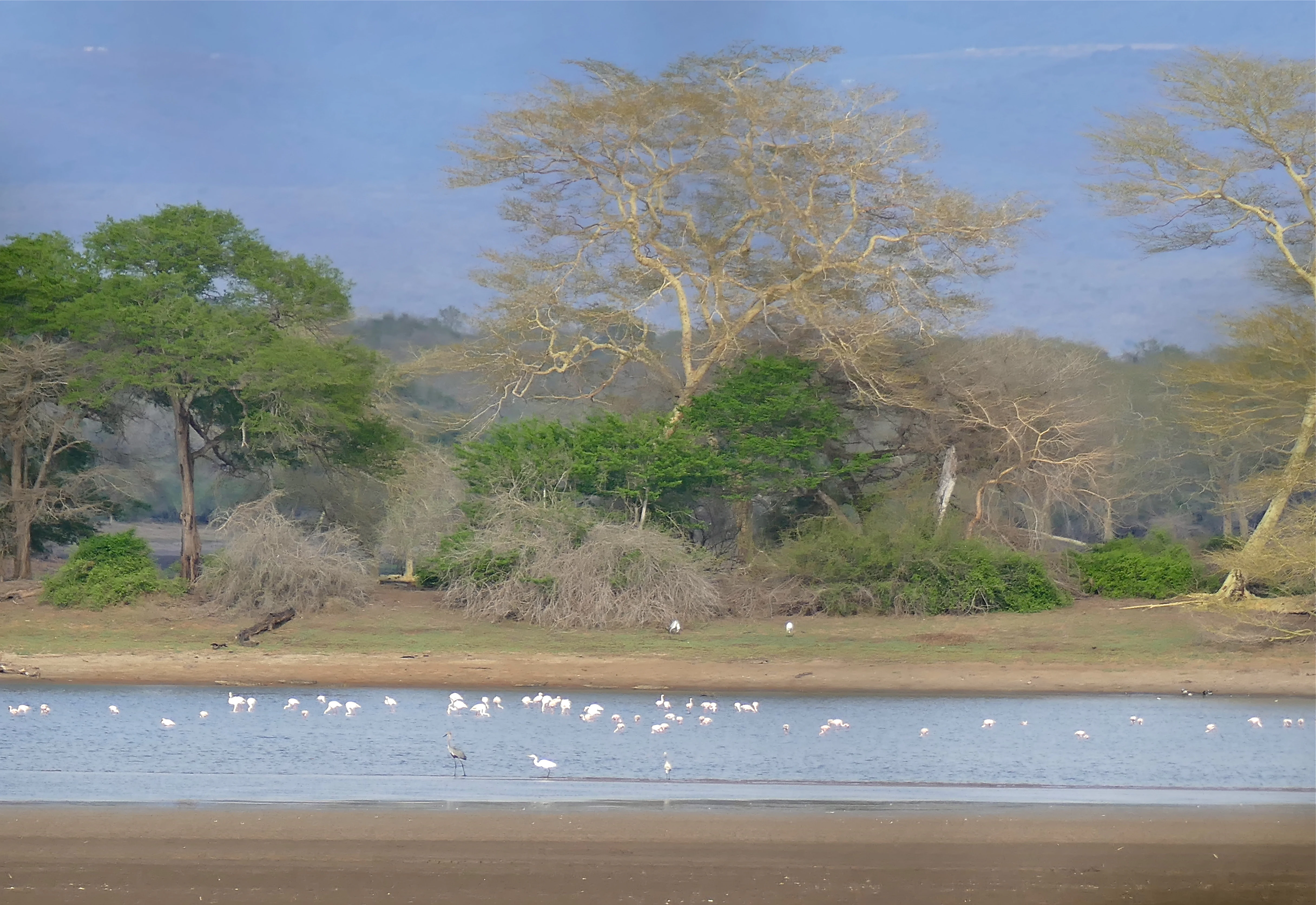
A wide view of a calm body of water at Nyamithi Pan with a group of white water birds wading in the shallows, backed by a treeline of acacias and dense coastal forest vegetation under a soft sky.
A view of the wetlands at Nyamithi Pan in Ndumo Game Reserve, showcasing the local birdlife and riparian vegetation.

Ndumo Game Reserve history and protected-area timeline

Ndumo Game Reserve was formally established as a protected provincial game reserve in 1924. The original purpose was practical and wildlife-focused: protecting hippopotamus living in the reserve's pans and along stretches of the Usuthu and Pongola rivers, at a time when hippo populations across southern Africa were under heavy pressure.

During the 1950s and 1960s, however, the reserve's history took a darker turn. Long-established local inhabitants were systematically and forcibly evicted from their homesteads and fields within the reserve boundaries, which were also fenced during this period. The justification offered by authorities was that the resident community, their cultivated fields, burning practices, dogs, and livestock were incompatible with the reserve's conservation function. Families were removed as and when conservation regulations were broken and convictions upheld, a process completed in 1966.

Those communities pursued legal recourse, and their land claim was eventually settled in their favor in 2000. Yet they were denied the right to physically resettle on the land, instead receiving financial compensation and, in principle, a consultative role in reserve management. The unresolved nature of this dispute, combined with broader tensions around Community Based Natural Resource Management in KwaZulu-Natal and ongoing unemployment, has contributed to a difficult conservation era for Ndumo.

A parallel scientific history also runs through the reserve. In the 1960s and 1970s, Tony Pooley conducted pioneering research on Nile crocodiles in Ndumo, working from an Experimental Crocodile Restocking Station he established on the Phongolo floodplain below the rest camp. This work gave Ndumo an important place in South Africa's crocodile conservation history.

The reserve's centenary in 2024 received only modest public attention, though it was marked by a special issue of the African Journal of Wildlife Research, published in early 2025, which gathered scientific papers on the reserve's management history and future prospects. At the same time, conservationists have worked since 2021 to have Ndumo listed as a threatened Ramsar site, citing illegal use of the Phongolo floodplain within the reserve since 2010 as a serious risk to its hippo, crocodile, and wetland values.

Ndumo Game Reserve landscape and geographic character

The landscape of Ndumo Game Reserve is shaped by water. Two major rivers, the Pongola and the Great Usutu, meet within or beside the reserve, and the land between and around them is built from the sediments, flood pulses, and slow drainage that these rivers bring. The result is a mosaic of floodplains, alluvial plains, pans, reed beds, and backwater channels interspersed with patches of higher, drier woodland.

Ndumo Game Reserve ecosystems, habitats, and plant life

Ecologically, Ndumo is defined less by a single dominant biome than by an unusually compressed layering of habitats. Sand forest patches, dense riverine corridors along the rivers, open floodplains, broad-leaved woodlands, acacia woodland, and exceptionally dense thornveld all coexist within the reserve's borders.

The wetlands themselves are the core of Ndumo's ecological identity. Pans, floodplains, reed beds, and slow-moving stretches of the Pongola and Usuthu rivers create habitat for aquatic mammals, fish, amphibians, reptiles, and an enormous variety of birds. The high annual rainfall of the Maputaland region also helps sustain productivity through drier periods and supports the lush vegetation characteristic of the area.

Ndumo sits in a transitional zone where tropical and subtropical African faunas meet more temperate southern African biota, an ecological position that strongly shapes its birdlife and contributes to its botanical and herpetological richness.

Ndumo Game Reserve wildlife and species highlights

Ndumo's wildlife profile is dominated by its birdlife, but the reserve also supports significant mammal, reptile, and amphibian populations that reflect its mosaic of habitats. More than 430 bird species have been recorded here, including both residents and seasonal migrants, drawn from forest, wetland, savanna, and riverine environments.

Among birds, Ndumo hosts species of particular interest to birders because of Maputaland's southern location relative to many east and northeast African ranges. Sought-after species recorded in the reserve include Pel's fishing owl, Narina trogon, African broadbill, eastern nicator, and African cuckoo-hawk. The combination of floodplains, pans, reed beds, and forest patches supports forest birds, waterbirds, raptors, and migrants in unusually close proximity.

Large mammals at Ndumo include nyala, hippopotamus, impala, giraffe, and Cape buffalo. Hippopotamus are ecologically central, having been the original focus of the reserve's protection when it was proclaimed in 1924. Elephants, while not resident in Ndumo itself, are common in the adjacent Tembe Elephant Park. Big cats are notably absent from Ndumo.

The reserve is also one of South Africa's last remaining sanctuaries for Nile crocodiles. Ndumo has been a focal site for crocodile research and conservation, most famously through Tony Pooley's work at the Experimental Crocodile Restocking Station on the Phongolo floodplain in the 1960s and 1970s. The reserve is also rich in frogs and other herpetofauna, reflecting the importance of its wetland habitats for reptiles and amphibians.

Ndumo Game Reserve conservation status and protection priorities

Ndumo Game Reserve holds formal recognition as a Ramsar Wetland of International Importance, designated in January 1997 in acknowledgment of the global value of its floodplain and riverine wetland systems. It has been managed as a protected area by Ezemvelo KZN Wildlife since its proclamation as a provincial game reserve in 1924, originally to protect hippopotamus in its pans and along its rivers.

The reserve has also been identified as a core area within the proposed Usuthu-Tembe-Futi Transfrontier Conservation Area, a cross-border landscape concept that would link Ndumo with Tembe Elephant Park and adjacent protected areas in Mozambique. This makes Ndumo potentially important not only as a standalone Ramsar site but as a node in a larger regional conservation network.

Conservation at Ndumo is, however, marked by serious and ongoing challenges. Forced evictions of resident communities during the 1950s and 1960s, followed by a 2000 land claim ruling in favor of those communities but denying resettlement, have left an unresolved social dimension to the reserve. Since 2010, the eastern part of the reserve has experienced illegal fishing, grazing, and cultivation, including the conversion of indigenous vegetation and wildlife habitat to farmland. These pressures are endangering hippopotamus habitat, traditional winter grazing grounds, and the crocodile nesting areas of the Phongolo floodplain.

Efforts since 2021 to have the Ramsar Secretariat list Ndumo as a threatened Ramsar site have highlighted the complexity of governance, with multiple national and provincial agencies involved. In 2025, Ramsar SA agreed the site was threatened, but broader intervention has remained slow. As of mid-2025, authorities were awaiting a final report from Ezemvelo KZN Wildlife before submitting a long overdue national Ramsar update on Ndumo, leaving the practical steps to restore and protect this wetland reserve still to be determined.

Ndumo Game Reserve cultural meaning and human context

Ndumo Game Reserve carries a deep and unresolved cultural and social history. Before the mid-twentieth-century evictions, the reserve's land was home to communities who cultivated sweet potatoes, bananas, madumbe, cassava, and pumpkins, drew water from the Usuthu River, and coexisted with the surrounding wildlife. Their forced removal, justified at the time as necessary for conservation, is now widely recognized as a defining and contested chapter in the reserve's history.

Although a 2000 land claim was settled in favor of the displaced communities, the legal victory did not return the land itself, only financial compensation and a theoretical consultative role in management. This unresolved status, combined with broader frustrations about unemployment and unfulfilled development promises, has shaped the social dynamics around the reserve ever since and continues to influence how the land is used today.

Ndumo also sits within the broader cultural geography of Maputaland, a region known for its distinctive natural heritage, including more southerly extensions of tropical African ecosystems. The reserve is part of a wider cultural-ecological landscape that includes the adjacent Tembe Elephant Park and the cross-border communities of the Lebombo and Maputaland region.

Top sights and standout views in Ndumo Game Reserve

Ndumo Game Reserve's standout features are its wetland systems at the meeting of the Pongola and Great Usutu rivers, its bird list of more than 430 species, and its standing as one of South Africa's last strongholds of Nile crocodiles. A small but globally recognized Ramsar site, it combines floodplains, pans, reed beds, sand forest, and dense thornveld in an unusually compact setting.

Equally distinctive is its layered history: a 1924 declaration originally aimed at protecting hippopotamus, mid-century forced evictions of resident communities, pioneering 1960s and 1970s crocodile research, and an ongoing struggle over land use and conservation authority that continues to shape the reserve's future.

Best time to visit Ndumo Game Reserve

Ndumo's character shifts with the wet and dry seasons typical of the Maputaland lowveld. The area receives high annual rainfall, and seasonal flooding plays a major role in shaping wetland visibility, bird activity, and overall accessibility. Visiting during drier periods generally offers firmer road conditions and more reliable access to the reserve's four-wheel-drive tracks, hides, and picnic areas, while wetter periods tend to produce more dramatic floodplain scenery and richer waterbird activity.

Birdwatchers often target periods when both residents and seasonal migrants are present, when pans and floodplains are full, and when forest, riverine, and wetland species can be observed in close succession. As with the wider Maputaland region, malaria is endemic, and visitors are advised to take appropriate precautions when planning a visit.
Monthly climate preview

Measured monthly temperature and precipitation averages for Ndumo Game Reserve

Ndumo Game Reserve Climate Normals and Long Term Temperature Rhythms

Long term data for Ndumo Game Reserve reveals a pronounced annual rhythm of warm temperatures and shifting monthly precipitation rates. Analyzing the complete twelve month climate profile provides deeper insight into representative temperature and rainfall patterns across the landscape.
Annual mean23 °C
18 °C26 °C
Jan26°
Feb26°
Mar25°
Apr23°
May21°
Jun19°
Jul18°
Aug20°
Sep22°
Oct23°
Nov24°
Dec25°
Warmest month
February

25.7 °C

Coolest month
July

18.3 °C

Wettest month
January

5 mm/day

Driest month
July

0.5 mm/day

Park location guide

Geography guide, regional context, and park location map for Ndumo Game Reserve

Ndumo Game Reserve park geography, regions, and map view in South Africa

Understand where Ndumo Game Reserve sits in South Africa through a broader geographic reading of the surrounding landscape, nearby location context, and its mapped position within the national park landscape.

How Ndumo Game Reserve fits into South Africa

South Africa is the southernmost country in Africa, spanning 1.22 million km² with a population of over 63 million. The country operates with three capital cities, Pretoria (executive), Cape Town (legislative), and Bloemfontein (judicial), and is renowned for its biodiversity, national parks, and multicultural society.

Wider geography shaping Ndumo Game Reserve in South Africa

South Africa occupies the southernmost region of Africa, with coastline along both the Atlantic Ocean to the west and the Indian Ocean to the east. The interior features elevated plateaus including the Highveld, with the Drakensberg escarpment marking the eastern highlands. The country shares borders with Namibia, Botswana, Zimbabwe, Mozambique, Eswatini, and Lesotho.

Map view of Ndumo Game Reserve

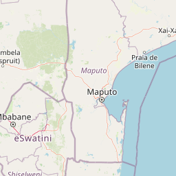
Use this park location map to pinpoint Ndumo Game Reserve in South Africa, understand its exact geographic position, and read its mapped placement within the surrounding landscape more clearly.

Pigeon | © OpenStreetMap contributors

Location context for Ndumo Game Reserve

KwaZulu-Natal

Visualizing floodplain habitats, riverine woodlands, and protected wildlife environments

Ndumo Game Reserve Photos and Landscape Scenery

Visual records capture the complex terrain, river confluences, and dense habitat mosaics that define Ndumo Game Reserve. Examining protected area photography provides clear geographic context for understanding regional wetlands and wildlife refuges.

A wide view of a calm body of water at Nyamithi Pan with a group of white water birds wading in the shallows, backed by a treeline of acacias and dense coastal forest vegetation under a soft sky.

Park atlas

Compare regional protected areas and connected Maputaland conservation terrain.

Exploring Parks Near Ndumo Game Reserve and Surrounding Protected Landscapes

Browse other parks near Ndumo Game Reserve to examine contiguous wetland habitats and regional riverine ecosystems. Comparing adjacent protected landscapes reveals broader patterns of biodiversity across the surrounding Maputaland terrain.
A soft watercolor painting of a serene lakeside landscape with green rolling hills and calm water.
Protected areaKwaZulu-Natal
43 km away#1 closest

East

Kosi Bay Protected Area: Mapped Geography and Coastal Lake Systems in KwaZulu-Natal

Coastal lake geography and protected wetland boundaries

Kosi Bay forms a complex wetland chain in KwaZulu-Natal, characterized by four linked lakes and a clear estuary mouth. The terrain transitions from coastal dunes and sandy beaches to mangrove-lined channels and Maputaland forest, providing a rich study of regional water systems and protected land boundaries.

Established
1991
Water
Water-dominated
Season
Year-round
Protected areaKwaZulu-Natal
48 km away#2 closest

Southeast

Lake Sibaya Protected Area: Mapping the Freshwater Heart of the KwaZulu-Natal Coast

Freshwater wetlands and coastal dune forest topography

Lake Sibaya encompasses the largest freshwater basin in South Africa, defined by its position near the Maputaland coast. The landscape represents a significant freshwater interface between coastal dune forests and the Indian Ocean, serving as an important protected study site for catchment ecosystems, water-bird habitats, and regional hydrological diversity.

Area
64 km²
Established
1991
Relief
Lowland
Climate
Subtropical
Nature reserveKwaZulu-Natal
About 57 km away#3 closest

Southwest

Phongolo Nature Reserve: Mapped Protected Landscapes of Northern KwaZulu-Natal

Historic reserve terrain at the Lebombo escarpment

Spanning over 10,000 hectares, Phongolo Nature Reserve represents a critical geographic unit defined by the Pongolapoort Dam and the surrounding Lebombo range. Its terrain transitions from clay-rich lowveld plains to dramatic high-altitude rocky escarpments, forming a complex protected environment within the KwaZulu-Natal borderlands. Explore the mapped extent and structural biodiversity of this long-standing South African conservation site.

Area
104.85 km²
Established
1894
IUCN
IV
Relief
Mountain
National parkEswatini
About 73 km away#4 closest

Northwest

Hlane Royal National Park: Eswatini's Vast Protected Savanna Woodland Landscape

Mapped geography and protected area context in northeastern Eswatini.

Delve into Hlane Royal National Park, Eswatini's most extensive protected territory, a prime example of lowland bushveld savanna. This national park is defined by its expansive woodland terrain, dotted with ancient trees and seasonal water pans, creating a dynamic landscape. It is an essential component for understanding the regional geography and the distribution of protected areas within Southern Africa, offering significant opportunities for landscape exploration.

Area
300 km²
IUCN
VI
Relief
Lowland
Climate
Subtropical
Wildlife reserveKwaZulu-Natal
About 108 km away#5 closest

Southwest

Ithala Game Reserve: Mapping the Protected Landscape and Ancient Geology of KwaZulu-Natal

A rugged wilderness reserve defined by dramatic escarpment and river valley topography.

Ithala Game Reserve represents a critical protected area in South Africa where deep river valleys meet the high-altitude grasslands of the Ngotshe Mountains. Its topography provides a unique study in vertical relief, featuring exposed sandstone cliffs and dolerite spires. The reserve serves as a prime example of ecological diversity within the region, combining ancient geological formations with a successfully reestablished mosaic of bushveld, savanna, and forest habitats.

Area
296.53 km²
Established
1973
IUCN
IV
Relief
Mountain
Nature reserveKwaZulu-Natal
About 147 km away#6 closest

South

Hluhluwe, Imfolozi Park Nature Reserve: Detailed Protected Area and Regional Geography

Explore mapped boundaries and landscape context in KwaZulu-Natal.

Hluhluwe, Imfolozi Park, designated as a nature reserve, offers a distinct protected landscape within KwaZulu-Natal, South Africa. This entity page provides an atlas-focused view, emphasizing the park's mapped boundaries and its contribution to the region's protected area network. Understand its geographic setting and unique landscape character through structured data, essential for any explorer keen on mapping protected lands.

Area
960 km²
Established
1895
Relief
Mountain
Climate
Subtropical
National parkSouth Africa
156 km away#7 closest

North

Kruger National Park: South Africa's Iconic National Park for Geographic Discovery

Explore savanna landscapes and mapped protected area boundaries.

Kruger National Park serves as a paramount example of a protected landscape, offering a rich tapestry of savanna ecosystems and varied terrain across South Africa's Lowveld. This canonical entry details its vast geographic scope, approximately 19,623 square kilometres, and its status as the nation's first national park. Understand the park's environmental context, from the Lebombo Mountains to the Limpopo River, and its integral role within larger transfrontier conservation initiatives, providing critical insight for atlas-based geographic exploration.

Area
19,623 km²
Established
1926
IUCN
II
Visitors
1.7M annual
Protected areaMpumalanga
About 162 km away#8 closest

Northwest

Makhonjwa Mountains: Geologically Ancient Protected Landscape in Eastern South Africa

Atlas mapping of the Barberton Greenstone Belt and Mpumalanga terrain

Spanning 120 by 60 kilometres, the Makhonjwa Mountains represent a vital scientific archive of Paleoarchean history. This protected area offers a deep look into volcanic komatiite rocks, ancient meteor impact evidence, and complex highland ecosystems that define the geography of the Mpumalanga border region.

Established
2018
Relief
Mountain
Scope
Terrestrial
Water
Minor water

Common questions about visiting, size, designation, and location context for Ndumo Game Reserve

Ndumo Game Reserve FAQs for park facts, access, geography, and protected area context

Find quick answers about Ndumo Game Reserve, including protected-area facts, park geography, trail and visitor context, and how the park fits into its surrounding country and regional landscape.
MoriAtlas Explorer

Continue Your Protected Areas Search Across the Global Atlas

Deepen your exploration by continuing the structured search for national parks and protected areas worldwide. Utilize the comprehensive filtering capabilities to compare different conservation landscapes and refine your understanding of global park geography. Discover more about the distribution and characteristics of protected natural areas.

Global natural geography