
Mori Atlas logo
Protected landscapeNebraska National Forest

Tracing the mapped boundaries and landscape contrasts of this dual-district protected area.

Nebraska National Forest: A Geographic Atlas of Planted Forests and Native Pine Woodland

Nebraska National Forest occupies a distinct geographic position in the United States, managing two contrasting landscapes that serve as important ecological anchors. The Bessey Ranger District features a historic man-made forest within the vast, grass-stabilized sand dunes of the central Sandhills. Conversely, the Pine Ridge Ranger District in the northwest protects native ponderosa pine woodlands across rugged canyons and high escarpments, representing a critical bridge between the Great Plains and western mountain geography.

national forestGreat PlainsSandhillsPine Ridgeponderosa pineplanted forest
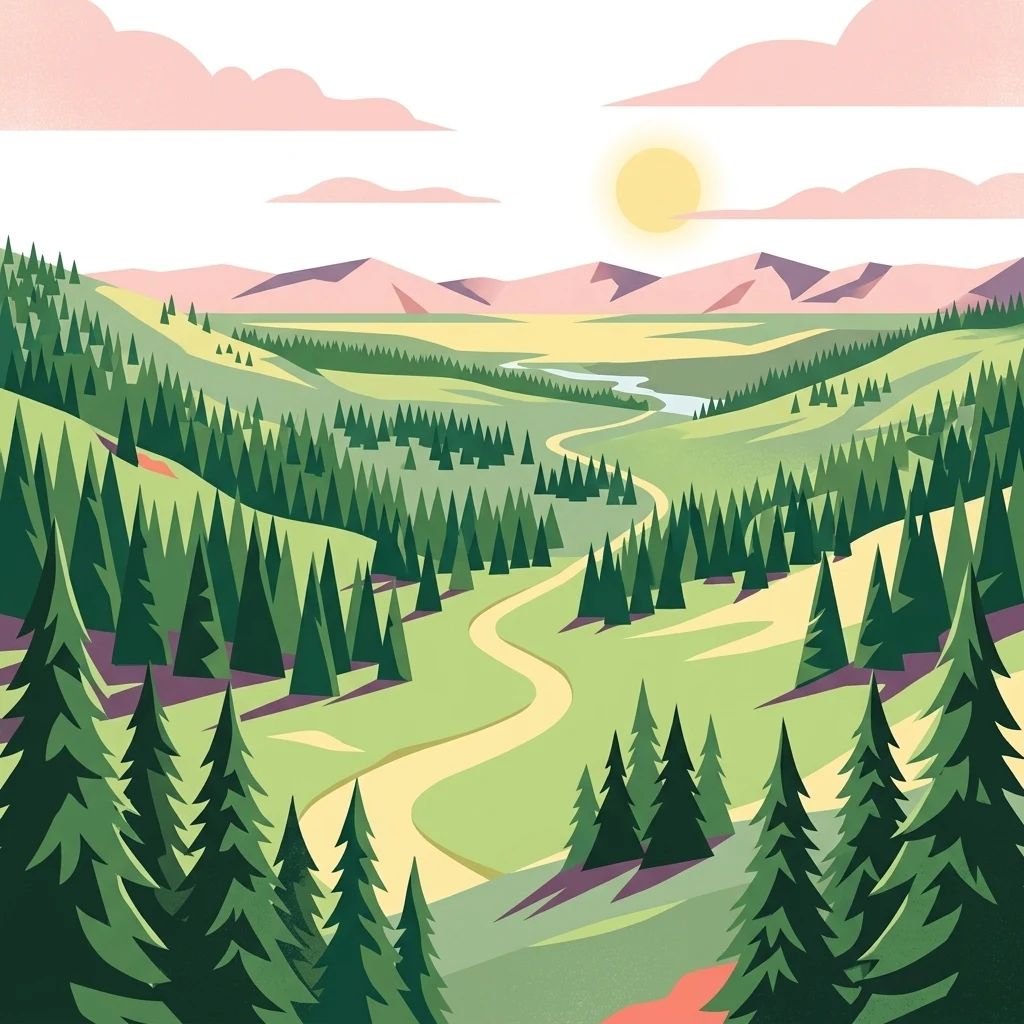
A flat, vector-style digital illustration depicting a winding path through a green, coniferous forest, with distant mountains and a setting sun under a soft sky.

Nebraska National Forest

Protected landscape

Park overview

Structured park overview, official facts, and landscape profile for Nebraska National Forest

Nebraska National Forest park facts, protected area profile, and essential visitor context

Review the core facts for Nebraska National Forest, including designation, size, terrain, visitor scale, habitats, and operating context in one park-focused overview.

About Nebraska National Forest

Nebraska National Forest is a U.S. national forest in western and central Nebraska, notable because it protects not one but two very different forested landscapes under a single administrative umbrella. Its combined area is roughly 141,864 acres, divided between the Bessey Ranger District in the Sandhills and the Pine Ridge Ranger District in the northwestern part of the state. The forest is managed from Chadron by the Nebraska National Forests and Grasslands Supervisor's Office, an office that also administers several surrounding national grasslands and a neighboring national forest, giving the larger Nebraska Forests and Grasslands complex a sweeping arc across the western plains.

The Bessey Ranger District is the more famous half of the forest. Set in the Sandhills near Halsey, in Thomas and Blaine counties, it grew out of an early 20th-century conviction that trees might once again thrive on the Great Plains if given a chance. Over time, those plantings matured into the largest human-planted forest in the United States, a wooded island in a sea of grass that has altered local ecology and created new habitat for wildlife species that would otherwise be absent from the region. The district's Bessey Tree Nursery, itself listed on the National Register of Historic Places, continues to play an active role in tree culture, producing millions of seedlings per year.

The Pine Ridge Ranger District, in Dawes and Sioux counties, tells a complementary story. Here the forest consists largely of native ponderosa pine, set against the broken country of the Pine Ridge escarpment. This part of the system expanded into federal management in the 1950s and includes the Soldier Creek Wilderness and the Pine Ridge National Recreation Area, both of which add significant recreational and ecological value. The combination of a man-made forest in the central plains and a piece of native western pine forest in the Panhandle makes Nebraska National Forest a distinctive outlier among national forests of the western United States.

Quick facts and research context for Nebraska National Forest

Nebraska National Forest covers about 141,864 acres across Thomas, Dawes, Blaine, and Sioux counties in western and central Nebraska. It is administered from Chadron by the U.S. Forest Service under the Nebraska National Forests and Grasslands Supervisor's Office, which also oversees surrounding national grasslands and the Samuel R. McKelvie National Forest.

The forest is split between the Bessey Ranger District in the central Sandhills (about 64 percent of the area, near Halsey) and the Pine Ridge Ranger District in the northwest (about 36 percent of the area, near Chadron). The Bessey district is largely a human-created forest and includes a historic nursery still producing millions of seedlings each year, while the Pine Ridge district protects native ponderosa pine, the Soldier Creek Wilderness, and the Pine Ridge National Recreation Area.

Protection and recognition

Documented protection scope and recognized conservation boundaries

Nebraska National Forest Protection Status and Terrestrial Conservation Data

Terrestrial conservation records for Nebraska National Forest outline the documented protection status and management scope for this protected area. Official registry data tracks the established boundaries and administrative context without additional international designations.

Protection details

Protection scope
Terrestrial
Transboundary protection
No
Park context

Deeper park guide and search-rich context for Nebraska National Forest

Nebraska National Forest history, landscape, wildlife, and travel context

Explore Nebraska National Forest through its history, landscape character, ecosystems, wildlife, conservation priorities, cultural context, and seasonal travel timing in a structured park guide built for atlas discovery and search intent.

Why Nebraska National Forest stands out

Nebraska National Forest is best known for being one of the great tree-planting experiments of the American conservation era, executed first in the Sandhills and later anchored by genuine pine forest in the Pine Ridge. The Bessey Ranger District grew out of a deliberate early 20th-century attempt to recreate forest cover across the Great Plains, an effort that produced what was at the time the largest hand-planted forest in the United States and a working nursery that still supplies millions of seedlings annually. In the northwest, the Pine Ridge Ranger District represents an entirely different identity: native ponderosa pine woodland draped over a rugged escarpment, complete with a designated wilderness area and a national recreation area. The forest's distinctive reputation comes from that contrast: a working forestry and tree-culture legacy in the central plains paired with a slice of western pine country in the Panhandle.
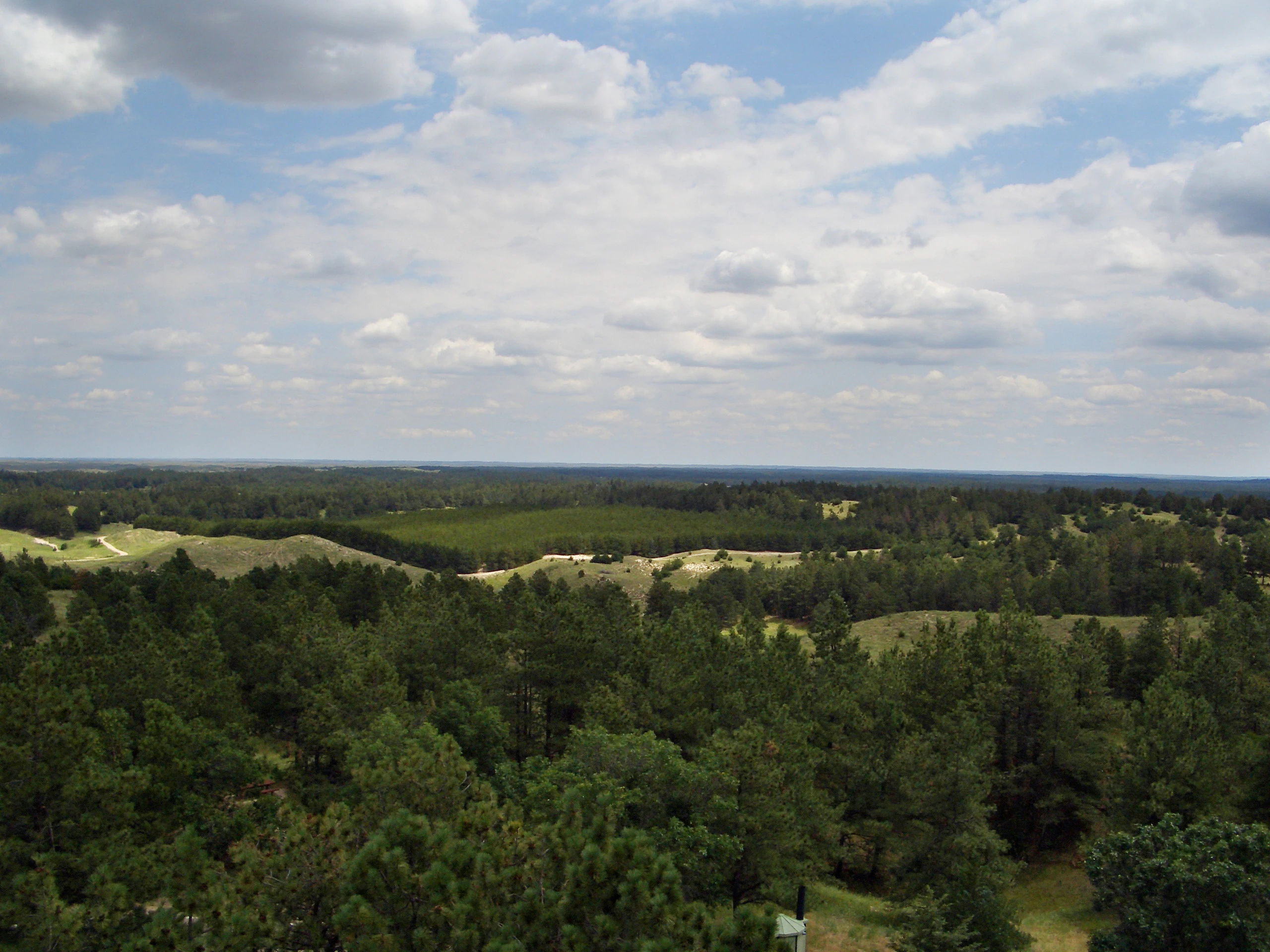
A wide, elevated landscape view overlooking a vast expanse of pine forest interspersed with rolling grassy hills under a partially cloudy blue sky.
A panoramic view of the forest landscape in the Bessey Ranger District of the Nebraska National Forest.

Nebraska National Forest history and protected-area timeline

The history of Nebraska National Forest begins in 1902, when University of Nebraska botany professor Charles Edwin Bessey, working with Gifford Pinchot, the first U.S. Forest Service Chief, persuaded President Theodore Roosevelt to set aside two treeless Sandhills tracts as forest reserves. Bessey's motivation was a combination of scientific curiosity and practical concern: he believed the Sandhills had once supported natural forest, and he wanted to test whether trees could be reestablished on the Great Plains, partly to offset fears of a national timber shortage caused by fire, unregulated harvest, and rising wood demand.

Nebraska National Forest was formally established on July 1, 1908, through the consolidation of three smaller national forests: the Dismal River, Niobrara, and North Platte National Forests. The Niobrara portion eventually became the separate Samuel R. McKelvie National Forest. The Bessey Ranger District grew through decades of active planting into a substantial artificial forest, one that for a time ranked as the largest man-made forest in the world.

In the 1950s, the native ponderosa pine woodlands of the Pine Ridge were brought into the National Forest System, broadening the forest's ecological identity to include true wild pine country. Today the forest sits within a much larger administrative unit that also encompasses national grasslands and additional forest lands in Nebraska and southwestern South Dakota.

Nebraska National Forest landscape and geographic character

Nebraska National Forest spans two sharply contrasting landscapes. The bulk of it lies in the Sandhills of central Nebraska, a vast region of grass-stabilized sand dunes that is one of the largest sand dune formations in the Western Hemisphere. The Bessey Ranger District sits within this dune and grassland sea, and the forest exists as a green island of planted pines, hardwoods, and other species rising out of an otherwise largely treeless setting.

The Pine Ridge Ranger District occupies a very different landform in the northwest: the Pine Ridge, a long, broken escarpment marking the edge of the High Plains. Here rolling grasslands give way to canyons, ridges, and exposed buttes, with native ponderosa pine clinging to slopes and benches. The contrast between soft Sandhills dunes and rugged pine-covered canyons, all under one administrative roof, defines the forest's physical identity.

Nebraska National Forest ecosystems, habitats, and plant life

The forest's ecology is defined by the unusual pairing of an artificial forest embedded in Sandhills prairie with natural pine woodland on the Pine Ridge escarpment. The Bessey Ranger District is essentially a human-built habitat, with stands of planted conifers and hardwoods sitting amid native prairie. Even though it is cultivated in origin, the resulting forest cover has matured into functioning woodland habitat that supports a community of species otherwise rare or absent in the central Great Plains.

The Pine Ridge Ranger District, by contrast, is a natural pine ecosystem. Ponderosa pine dominates the upper slopes, with associated woodland and grassland communities filling the surrounding terrain. The district also contains designated wilderness in the form of the Soldier Creek Wilderness, a relatively undisturbed piece of the Pine Ridge landscape. Together these two ecological characters give the forest a kind of split personality: managed plantation in the middle of the state, preserved wildland along its northwestern edge.

Nebraska National Forest wildlife and species highlights

The wildlife profile of Nebraska National Forest reflects the unusual mix of habitats present. In the Bessey Ranger District, the surprising presence of closed-canopy forest in the plains has drawn in woodland birds that would not normally occur in this part of Nebraska, including species such as the red-breasted nuthatch and the pine siskin. The planted forest functions as a habitat island, benefiting both resident and migratory birdlife.

The Pine Ridge Ranger District supports a more characteristic western fauna associated with ponderosa pine woodland, canyon country, and adjoining grasslands. The combination of woodland and rough terrain in the Pine Ridge offers habitat for species typical of the northern High Plains border country, although the source material does not detail a specific species inventory beyond the birdlife noted in the Bessey district.

Nebraska National Forest conservation status and protection priorities

Nebraska National Forest matters for conservation in two complementary ways. In central Nebraska, the Bessey Ranger District demonstrates how deliberate reforestation can re-create woodland cover in a region where trees are not naturally dominant, and how that cover can, over time, become ecologically meaningful habitat for wildlife that would not otherwise persist in the Sandhills. The district's longstanding nursery also makes the forest an important center for ongoing tree-culture and restoration work.

In northwestern Nebraska, the Pine Ridge Ranger District preserves a piece of native ponderosa pine forest at the eastern edge of this woodland type's range. The presence of the Soldier Creek Wilderness and the Pine Ridge National Recreation Area adds layers of formal protection beyond ordinary national-forest status. As part of the larger Nebraska National Forests and Grasslands complex, the forest is also integrated with surrounding national grasslands managed for soil, water, and prairie habitat, broadening its conservation footprint across the western plains.

Nebraska National Forest cultural meaning and human context

The forest's cultural roots are tied closely to the early American conservation movement. Charles Edwin Bessey's tree-planting experiment, encouraged by Gifford Pinchot and authorized by President Theodore Roosevelt, marked one of the first deliberate attempts to test large-scale forest restoration on the Great Plains. The Bessey Tree Nursery, listed on the National Register of Historic Places, reflects that heritage and remains an active part of how the forest is understood locally.

The forest also sits within ranching and agricultural country, with nearby communities such as Halsey and Chadron serving as practical gateways. The Pine Ridge country carries its own long history of use by Indigenous peoples and later settlers, although the source material does not detail specific cultural sites, and so this historical dimension is best treated as light context rather than a developed theme.

Top sights and standout views in Nebraska National Forest

Nebraska National Forest's most distinctive features are its two contrasting ranger districts: the planted forest and nursery complex of the Bessey Ranger District in the Sandhills, and the native ponderosa pine landscape of the Pine Ridge Ranger District in the northwest. The Bessey district includes the historic Bessey Tree Nursery, still producing millions of seedlings each year, while the Pine Ridge district includes the Soldier Creek Wilderness and the Pine Ridge National Recreation Area.

The forest's broader administrative context is also notable: its supervisor's office in Chadron also oversees surrounding national grasslands and a neighboring national forest, making Nebraska National Forest part of one of the more spatially scattered national-forest systems in the country. The combination of man-made and native forest under one roof is rare among U.S. national forests.

Best time to visit Nebraska National Forest

Because the forest spans two very different landscapes, the best feel for the place often comes from visiting more than once. Late spring and early summer bring vivid green-up to the planted Bessey district, when the contrast with surrounding Sandhills prairie is most visible and woodland bird activity in the canopy tends to peak. Cooler months also work well, as summer heat across the open plains can be intense.

In the Pine Ridge district, late spring through fall is generally favorable for exploring the ponderosa country, with summer offering the classic pine-scented, dry-ground character of the High Plains edge. Winter can bring snow to the ridges and a quieter, more introspective atmosphere, while the canyons and the wilderness remain accessible to those prepared for cold-weather conditions.
Monthly climate preview

Track monthly precipitation averages and measured temperature rhythms across the protected landscape

Nebraska National Forest Climate Normals and Long Term Temperature Records

Representative coordinate records show measured long term temperature swings and monthly precipitation patterns across Nebraska National Forest. Reviewing the complete twelve month profile provides detailed climate normals for deeper geographic comparison.
Annual mean10 °C
-2 °C24 °C
Jan-2°
Feb-1°
Mar
Apr
May14°
Jun20°
Jul24°
Aug23°
Sep17°
Oct
Nov
Dec-2°
Warmest month
July

24.3 °C

Coolest month
January

-2.4 °C

Wettest month
May

2.5 mm/day

Driest month
January

0.3 mm/day

Park location guide

Geography guide, regional context, and park location map for Nebraska National Forest

Nebraska National Forest park geography, regions, and map view in United States of America

Understand where Nebraska National Forest sits in United States of America through a broader geographic reading of the surrounding landscape, nearby location context, and its mapped position within the national park landscape.

How Nebraska National Forest fits into United States of America

The United States of America is a federal presidential republic and one of the world's largest countries by area and population. It consists of 50 states across a vast territory spanning multiple time zones, with its capital in Washington, D.C. and largest city in New York City. The nation has a diverse economy, influential political system, and significant cultural and military presence globally.

Wider geography shaping Nebraska National Forest in United States of America

The United States occupies a vast territory in North America, bordered by Canada to the north and Mexico to the south. The 48 contiguous states stretch from the Atlantic to the Pacific Ocean, while Alaska occupies the northwestern region and Hawaii is an archipelago in the Pacific. The country encompasses diverse terrain including the Rocky Mountains, Appalachian Mountains, Great Plains, and extensive river systems.

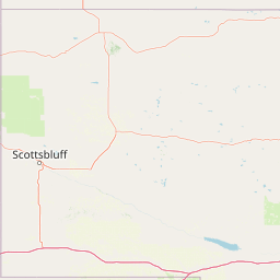
Map view of Nebraska National Forest

Use this park location map to pinpoint Nebraska National Forest in United States of America, understand its exact geographic position, and read its mapped placement within the surrounding landscape more clearly.

Pigeon | © OpenStreetMap contributors

Location context for Nebraska National Forest

Nebraska

Explore visual records of Sandhills plantations and Pine Ridge canyons.

Nebraska National Forest Photos and Scenery: Visualizing the Landscape

Visual documentation reveals the stark ecological contrast defining Nebraska National Forest across its scattered ranger districts. Examining these protected habitats clarifies how planted woodlands and native pine escarpments shape the regional environment.

A wide, elevated landscape view overlooking a vast expanse of pine forest interspersed with rolling grassy hills under a partially cloudy blue sky.

A panoramic landscape view from an elevated viewpoint showing a patchwork of coniferous forest and light brown, sandy hills under a wide sky.

Park atlas

Compare regional conservation areas and adjacent High Plains habitats.

Parks Near Nebraska National Forest and Surrounding Protected Landscapes

Browse other national forests, grasslands, and protected reserves situated across the surrounding regional terrain. Continuing the geographic comparison reveals how administrative ties connect disparate habitats throughout the central plains and western Panhandle.
Watercolor painting of a wide, rolling grassy plain leading to distant low hills or badlands against a pale sky.
Protected landscapeNebraska
About 39 km away#1 closest

West

Oglala National Grassland: Geological Terrain and Protected Landscape Map in Nebraska

Regional geography of prairie rangelands and eroded badlands

Situated in the northwest corner of Nebraska, Oglala National Grassland covers nearly 95,000 acres of shortgrass prairie and badlands. This protected landscape is defined by the unique exposure of Pierre Shale, creating a terrain characterized by deep gullies, banded sedimentary rock, and hoodoo formations that provide essential habitat and a deep record of natural history.

Area
382.5 km²
Relief
Upland
Climate
Arid
Access
Easy access
National parkSouth Dakota
About 82 km away#2 closest

North

Badlands National Park: South Dakota's Premier National Park for Atlas Exploration

Explore mapped terrain and protected landscape boundaries.

Badlands National Park stands as a key protected area within the geography of South Dakota, offering a distinct natural landscape for detailed atlas exploration. This National Park's unique terrain and mapped boundaries provide crucial context for understanding regional geography and conservation landscapes. Engage with structured information that highlights the park's geographic identity, making it an essential destination for those seeking to map and comprehend protected natural areas.

Area
982.4 km²
Established
1939
IUCN
II
Visitors
1M annual
A pale, minimalist watercolor illustration of a wide, open grassy landscape with soft rolling hills in the background and light green vegetation in the foreground.
Protected landscapeSouth Dakota
About 84 km away#3 closest

North

Buffalo Gap National Grassland: Regional Geography and Protected Prairie Boundaries

Mapping the vast grasslands of southwestern South Dakota

Spanning across four counties in southwestern South Dakota, Buffalo Gap National Grassland serves as a premier example of a working Great Plains landscape. The region is defined by its immense scale, where undulating mixed-grass prairie transitions into striking, chalky badlands. This area is recognized for its vital conservation role, including successful species recovery programs, and stands as a foundational feature of the regional geological and ecological map.

Area
2,410.77 km²
Established
1960
Relief
Upland
Climate
Temperate
National parkCuster County
About 97 km away#4 closest

Northwest

Wind Cave National Park: A National Park with Distinct Protected Landscape and Geographic Identity

Explore the mapped terrain and regional context of this US protected area.

Wind Cave National Park represents a key protected area within Custer County, offering users a deep dive into its unique geography and landscape characteristics. As a designated national park in the United States, its mapped boundaries provide crucial context for understanding its ecological and geological significance. This MoriAtlas entry facilitates detailed exploration, focusing on the protected land's identity and its role within the wider regional geography and natural landscape.

Area
136.97 km²
Established
1903
IUCN
II
Visitors
489.4K annual
National parkCherry County
About 132 km away#5 closest

East

Samuel R. McKelvie National Forest: Mapping Nebraska's Sandhills Protected Landscape

An atlas view of rolling dune grasslands and forest mosaics in Cherry County.

Located in the heart of Cherry County, Samuel R. McKelvie National Forest presents a distinct landscape where prairie grasses meet planted pine islands. This overview examines the forest's placement within the Sandhills region, highlighting its role as a protected grassland unit near the shores of Merritt Reservoir and the Snake River corridor.

Area
469.76 km²
Established
1971
Relief
Upland
Climate
Temperate
Protected landscapeWyoming
About 148 km away#6 closest

Northwest

Thunder Basin National Grassland: A Protected Landscape in the Wyoming Powder River Basin

Mapping the prairie and sagebrush mosaic of northeastern Wyoming

Thunder Basin National Grassland is a sprawling, federally protected territory in northeastern Wyoming that functions as a critical ecotone between the Great Plains and the Rocky Mountain region. Its landscape is characterized by wide-open vistas, intricate sedimentary bluffs, and diverse habitats shaped by natural disturbance patterns and ongoing grassland management. This record outlines the geography, terrain features, and protected boundaries that define this essential segment of the American West.

Area
2,215.65 km²
Established
1960
Relief
Upland
Climate
Arid
A soft watercolor painting of a wide, rolling grassy landscape with a pale sky and hints of a treeline in the distance.
Protected landscapeColorado
About 206 km away#7 closest

Southwest

Pawnee National Grassland: Protected Landscape and Great Plains Atlas

Shortgrass prairie and geologic remnants in Colorado.

Pawnee National Grassland represents a significant protected area within northeastern Colorado, spanning vast semiarid plains and striking erosional formations known as the Pawnee Buttes. This atlas overview details the park boundaries, regional drainage systems of the South Platte River basin, and the ecological value of these native grass communities and scarp woodlands.

Area
781.3 km²
Established
1960
Relief
Upland
Climate
Arid
Protected areaSouth Dakota
About 243 km away#8 closest

Northeast

Fort Pierre National Grassland: An Atlas of South Dakota Mixed-Grass Prairie Ecosystems

Exploration of central Great Plains protected terrain and boundaries

Focusing on the authentic mixed-grass prairie of South Dakota, Fort Pierre National Grassland serves as a critical example of northern Plains conservation. Its landscape, marked by sweeping vistas and seasonal wetlands, provides a deep look into the spatial character and ecological heritage of the interior United States. Gain a precise understanding of its boundaries and the surrounding geographic features that define this expansive public land.

Area
469 km²
Relief
Upland
Access
Access unknown
Scope
Terrestrial

Common questions about visiting, size, designation, and location context for Nebraska National Forest

Nebraska National Forest FAQs for park facts, access, geography, and protected area context

Find quick answers about Nebraska National Forest, including protected-area facts, park geography, trail and visitor context, and how the park fits into its surrounding country and regional landscape.
MoriAtlas Explorer

Continue Your Protected Areas Search Across the Global Atlas

Deepen your exploration by continuing the structured search for national parks and protected areas worldwide. Utilize the comprehensive filtering capabilities to compare different conservation landscapes and refine your understanding of global park geography. Discover more about the distribution and characteristics of protected natural areas.

Global natural geography